
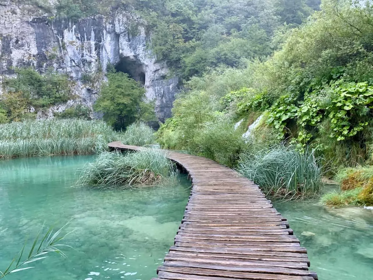
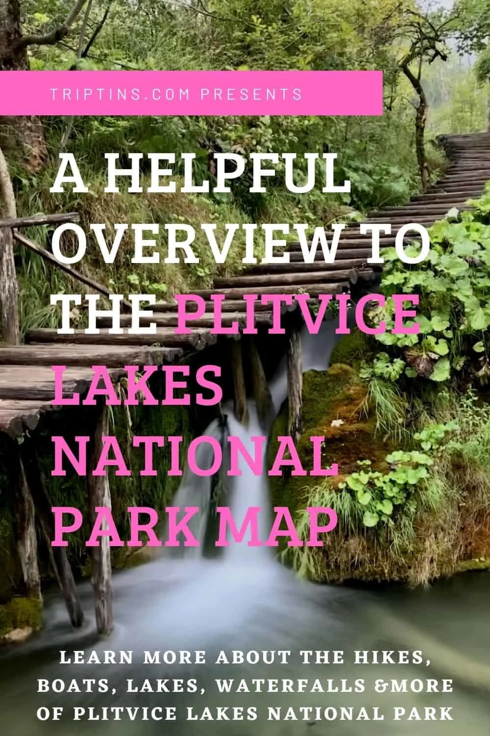
Plitvice Lakes National Park has a whole lot of variety including walking trails, lakes, waterfalls, shuttle busses, boats, and more.
I thought it would be a good idea to put together a guide that focuses on the Plitvice Lakes National Park map so you will have a better understanding on how the park is laid out.
Read on to learn more about Plitvice and all the important spots throughout the beautiful national park.
* Affiliate Disclosure: This post may contain affiliate links, which means I may receive a commission if you make a purchase through the links provided, at no additional cost to you. Thanks for supporting the work I put into TripTins!
1) Plitvice Lakes National Park Map
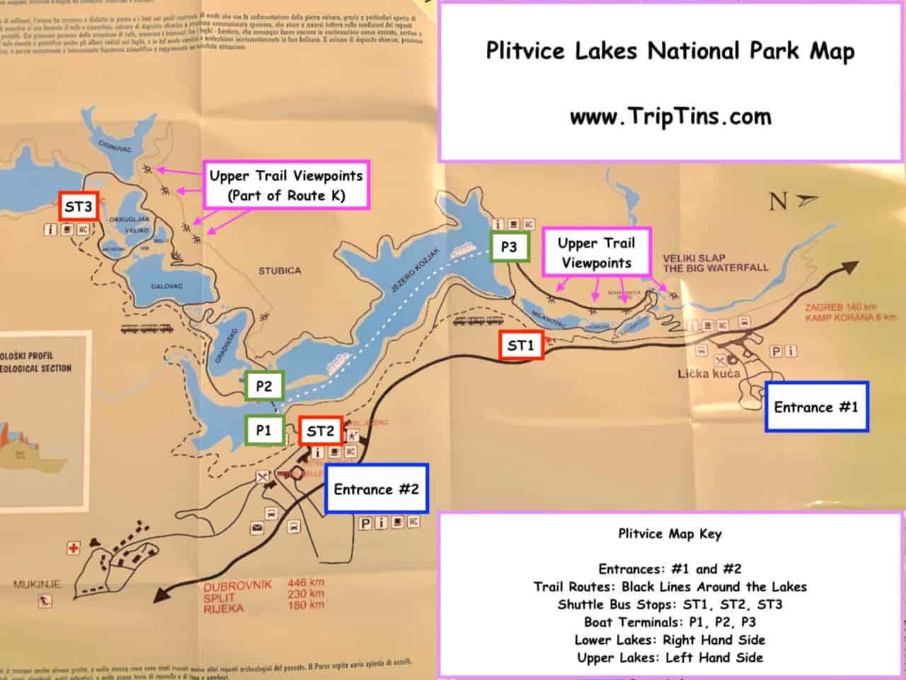
At the Plitvice Lakes gift shop, they sell a fantastic map that not only shows the park as a whole but it breaks down all the different trail options that are offered throughout Plitvice.
This is a photo I took of the main map, and then from there I added some notes so you can better understand when everything is in the park.
You can refer to this map as I walk through the rest of the guide explaining the different aspects of Plitvice and how to get yourself around.
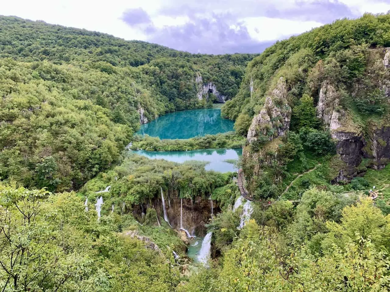
As a reference, Plitvice is broken up into two main areas – the Lower Lakes (right hand side of the map) and the Upper Lakes (left hand side of the map).
Between the two areas you will find the main Jezero Kozjak Lake that breaks up the Lower and Upper Lake sections.

2) Park Entrances
There are two main entrances to Plitvice Lakes National Park – Entrance #1 and Entrance #2. Entrance 1 is situated closer to the Lower Lakes section while Entrance 2 is near the Upper Lakes section. Below are some more details about each one.
↔ If you are renting a car in Croatia, be sure to check out Rentalcars.com, which will have a variety of rental options to choose from for your trip.
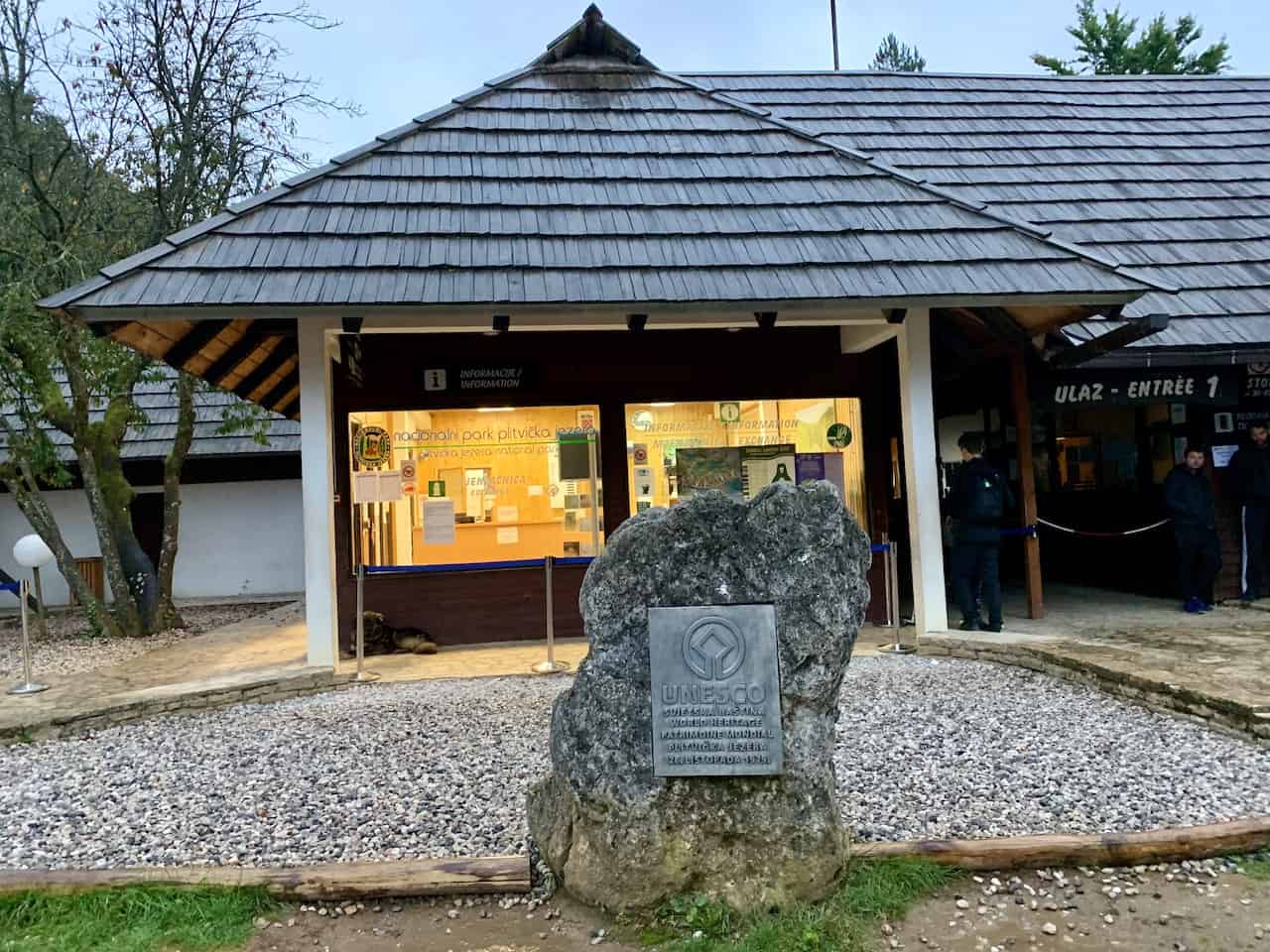
Entrance #1
Entrance #1 is on the right hand side of the map and is the main starting point when exploring the Lower Lakes section of Plitvice Lakes National Park.
At this entrance you will find a parking lot, ticket booth, information booth, gift shop, café, restrooms, and even a luggage holding area.
Just outside the parking lot area, you will find the entrance 1 inter city bus stops, where busses pick up and drop off passengers visiting from other places throughout Croatia.
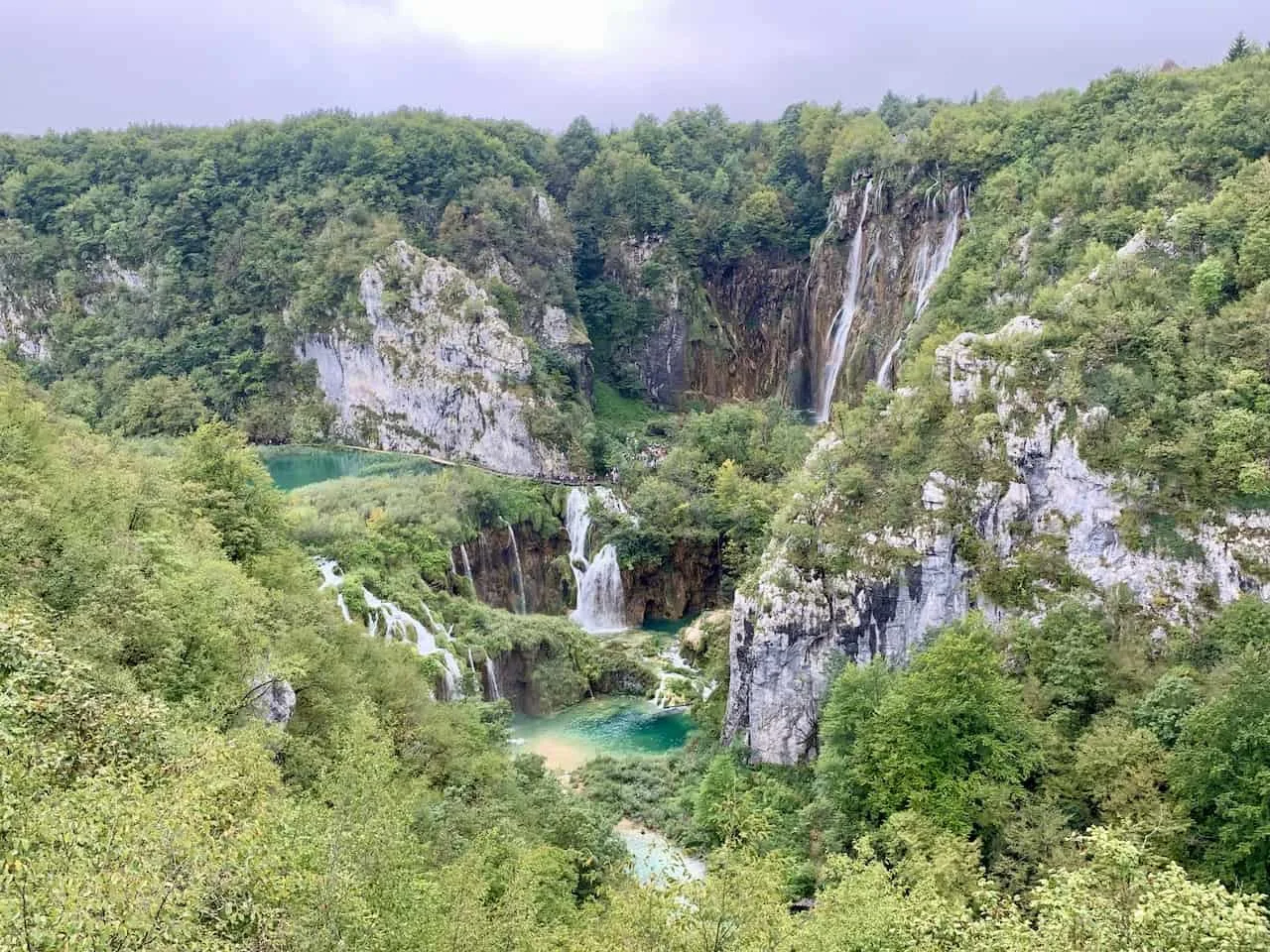
After going through entrance 1, you will be welcomed to a lookout platform with a beautiful view of the Lower Lakes from above. From the viewing platform you will need to take a winding path to get down to the base of the Lower Lakes.


Entrance #2
Entrance #2 can be found of the left hand side of the map, and is the main starting point for the Upper Lakes section of Plitvice.
Here you will find similar offerings to Entrance 1 such as a parking lot, ticket booth, information booth, gift shop, café, and restrooms. You will also find another inter city bus stop here if coming from other regions around Croatia.
On top of that though you can find a few hotels that are directly outside the entry point.
These three hotels – Hotel Bellevue, Hotel Plitvice, and Hotel Jezero are great options to choose from if you are looking to stay overnight near the national park (check out the end of the guide for more accommodation options!).
There are also additional areas to stay in (both by entrance 1 and 2), but these will require a longer walk to reach the park.
From entrance 2, it is just a short walk down until you reach the P1 boat terminal, which is the main starting point to visit the Upper Lakes section.
3) Plitvice Walking Routes
Since there are 7 various overlapping walking routes that make their way around the Lower and Upper Lakes, it is difficult to show them all on one map.
For that reason, I put together a separate guide that solely focuses on the walking routes of Plitvice Lakes National Park.
» You can take a look at the Plitvice Lakes National Park Routes Guide to learn more.
Essentially, the black lines near the lakes that can be seen on the map above are the walking routes. If you wanted to see the breakdown of those black lines, then be sure to take a look at the guide that goes into detail about each and every one of those routes.
Some of these walking routes focus solely on the Lower Lakes, some just the Upper Lakes and others combine the two.
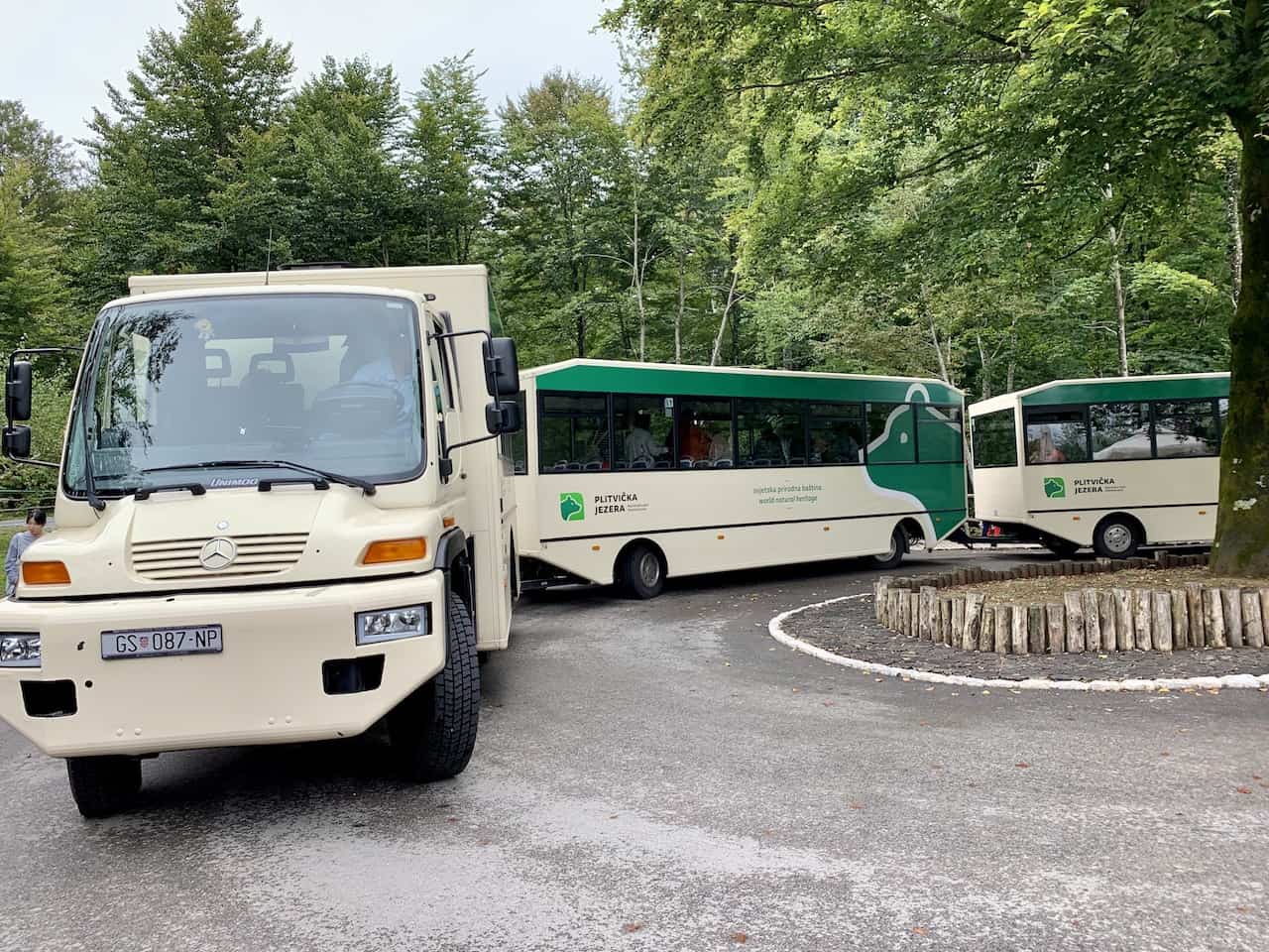
You will also find that some of the walking routes will require certain forms of transportation around the park – the shuttle bus and boat ride, while other routes will require none at all.
Plitvice Lakes Route A
Entrance: #1
Duration: 2-3 Hours
Length: 3.5 km / 2.2 miles
Lakes: Lower Lakes
Boat Ride: None
Shuttle Bus: None
Plitvice Lakes Route B
Entrance: #1
Duration: 3-4 hours
Length: 4.0 km / 2.5 miles
Lakes: Lower Lakes
Boat Ride: Long Ride (P3 » P1)
Shuttle Bus: ST2 » ST1
Plitvice Lakes Route C
Entrance: #1
Duration: 4-6 hours
Length: 8.0 km / 5.0 miles
Lakes: Lower Lakes + Upper Lakes
Boat Ride: Long Ride (P3 » P1) & Short Ride (P1 » P2)
Shuttle Bus: ST3 » ST1
Plitvice Lakes Route E
Entrance: #2
Duration: 2-3 hours
Length: 4.3 km / 2.7 miles
Lakes: Upper Lakes
Boat Ride: Short Ride (P1 » P2)
Shuttle Bus: ST3 » ST2
Plitvice Lakes Route F
Entrance: #2
Duration: 3-4 hours
Length: 4.6 km / 2.9 miles
Lakes: Lower Lakes
Boat Ride: Long Ride (P1 » P3)
Shuttle Bus: ST1 » ST2
Plitvice Lakes Route H
Entrance: #2
Duration: 4-6 hours
Length: 8.9 km / 5.5 miles
Lakes: Upper Lakes + Lower Lakes
Boat Ride: Short Ride (P2 » P1) & Long Ride (P1 » P3)
Shuttle Bus: ST2 » ST3 & ST1 » ST2
Plitvice Lakes Route K
Entrance: #1 or #2
Duration: 6-8 hours
Length: 18.3 km / 11.4 miles
Lakes: Lower Lakes + Upper Lakes
Boat Ride: Short Ride (P2 » P1)
Shuttle Bus: None

4) Shuttle Bus Stops
Within Plitvice Lakes National Park you will find three shuttle bus stops – ST1, ST2, and ST3.
These shuttle busses run consistently throughout the day, helping visitors more easily make their way between the various spots in the park.
As an example, if you started by entrance 2, explored the Upper Lakes, and don’t want to walk back to P2, you can simply hop on the shuttle bus at ST3 that will take you right back to entrance 2.
Depending on which trail routes you decide to explore, you may end up taking a couple shuttle busses or none at all.
ST1
ST1 is the closest shuttle bus stop to entrance #1 of the national park. However, the stop is not directly at entrance #1.
Instead you will need to walk along a 10-15-minute path that overlooks the Lower Lakes, to get between the shuttle bus stop and the entrance.
ST2
ST2 is located directly outside entrance #2 of the national park. So, whether you are starting your day by entrance #2 and want to get to the Lower Lakes, or you need to get back to entrance #2 at the end of the day, ST2 will have you covered.
ST3
ST3 is located way out at the furthermost point of the Upper Lakes.
When exploring those Upper Lakes, you can either decide to hop on the shuttle at ST3 (to head back to ST2 or ST1), or you can decide to walk back through the Upper Lakes to the P2 boat terminal.
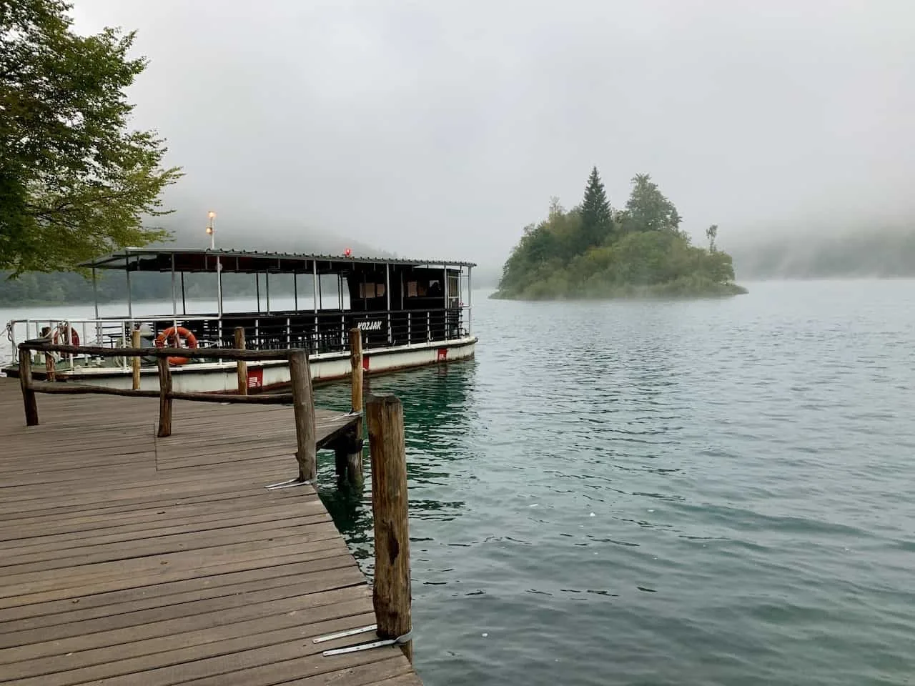
5) Boat Terminals
While walking the boardwalks will have you seeing the most beautiful parks of Plitvice, you will also get the chance to take a boat ride or two on the main Jezero Kozjak lake.
There are two boat trips that you can take during a visit – the first is just a short 5 minute ride between P1 and P2, and the second is a longer 30 minute ride between P1 and P3.
P1
The P1 boat terminal is located right next to the entry point at entrance #2.
From the P1 boat terminal you can either take a boat to P2 to see the Upper Lakes, or you can opt for a boat ride to P3, which will take you closer to the Lower Lakes.
Both of these boat rides can also be done in the reverse direction depending on what route you decide to take when visiting Plitvice.
P2
The P2 boat terminal is the starting/ending point for many people who decide to visit the Upper Lakes. It is just a short ride between P2 and P1, as you get to enjoy a little time out on the water.
It is also good to note that you can only go to P1 from P2 (and vice versa). If you want to go to P3, you first must go to P1.

P3
The final boat terminal here is P3. After many people explore the Lower Lakes, they will end up here at P3.
From there you can either take the 30 minute boat ride across to P1 or you can opt to continue the walk around the lake (part of route K), to the Upper Lakes section.
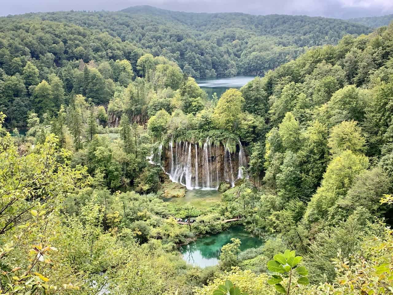
6) Upper Trail Viewpoints
You will also see on the map that I have highlighted two sections of upper trail viewpoints.
While all the boardwalks, waterfalls, and lakes are down below, these viewpoints give you a chance to enjoy the landscape from up above.
Lower Lakes Viewpoints
The upper trail viewpoints of the Lower Lakes are not part of any of the 7 walking routes of Plitvice. Instead, once you reach P3, you can head up the hill to the main road and visit the viewpoints along the way.
These are some of the best views to enjoy from above so I would highly recommend you adding them into your Plitvice walking route.
Once done with the viewpoints from above, you will want to backtrack down the same way you came and back to P3, where you can continue on with your day.
Note: there is also a staircase near the Veliki Slap Waterfall that takes you up to the main road, however it was blocked off during my visit.

Upper Lakes Viewpoints
The upper trail viewpoints of the Upper Lakes are part of one of the official walking routes.
The trail up top is part of Route K, and these viewpoints can be reached from either direction.
Much of the hike here is done in the forest and from time to time you will have openings where the lakes and waterfalls will come into view. If you have the time and want to see some of the Upper Lakes from above, then this section of Route K is a great option.

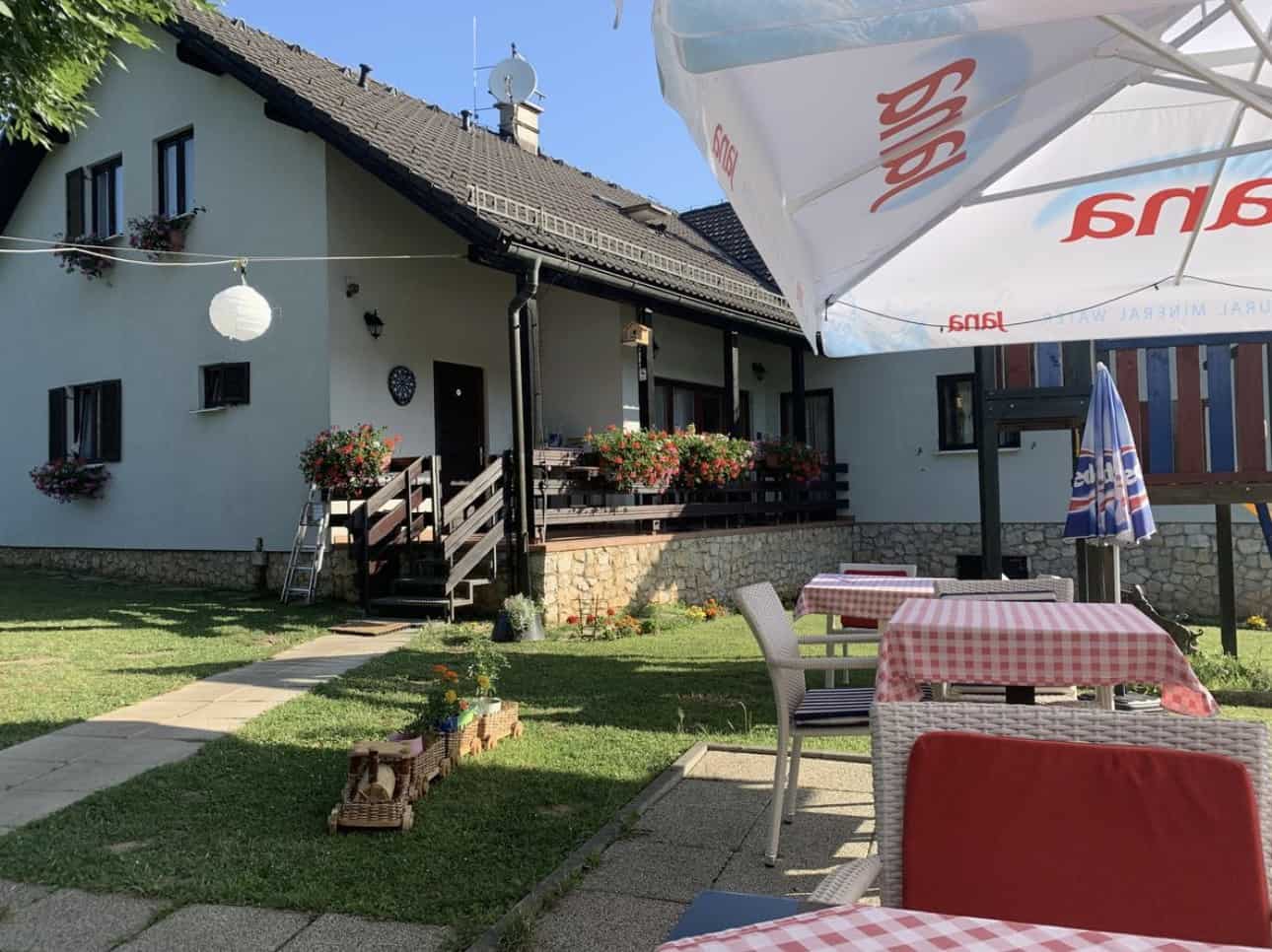
7) Where to Stay Near Plitvice
Staying within walking distance (or short drive away if you have a car), of Plitvice Lakes National Park would be my recommendation when visiting the area.
You can arrive the night before and get yourself all prepared for an early morning wakeup. You can then spend all day exploring the park and leave later in the evening time.
If you have more time to spare, then a second day in Plitvice could also be an option for you.
You can spend some time on the lesser walked routes, head up to the viewpoint areas, or just spend some time just sitting by some of the lakes.
If you are looking for hotel options then you can find a couple right next to entrance 2, with several guesthouses nearby too.
Entrance 1 has a ton of guesthouses to choose from in the nearby village of Rastovaca (15 or so minute walk). Below are some highly rated options to choose from:
Entrance 1: Pansion Danica | House Flora | Guest House Ljubo & Ana
Entrance 2: Hotel Plitvice | Hotel Jezero | Hotel Bellevue | Natura Plitvice Lakes
I hope that this Plitvice Lakes National Park map has given you more clarity on exactly how the park is laid out and how to get yourself around.
If you have any additional questions or comments, feel free to add them in below.
Also don’t forget to check out the other Croatia itineraries and guides up on the site. Have fun out there and safe travels!


Michael clyne
Sunday 7th of June 2026
Hi there, my wife and I are staying in Plitvice for a week in September 2026. Im worried we've made the wrong choice as from what i can gather we can do the hanging lakes in a day . We were expecting several days of walking options. I have since discovered a few options immediately north + east of the lakes..... what im not sure about now is if we need to book park tickets to access those trails. Do you have any advice on day hikes in the area but not within the ticketed area of the park. Thanks
Kennix
Monday 26th of July 2021
Hello, thank you for your blog. It's very informative and resourceful. May I ask in the park, are there any signs to guide you to the viewpoints which you marked on the map? Thank you.
Charles
Tuesday 27th of July 2021
Hi Kennix - I browsed through some of my photos and notes, and I do not believe there are sign postings in the park for the viewpoints. The Upper Lakes viewpoints would be on route K, so the route itself is signposted. For the Lower Lakes viewpoints, once you are at P3 boat terminal, you should see a path that takes you up and out of the park -> I would download an app like Maps.me that shows you exactly where the viewpoints are if you would like to better prepare for your visit.
Hope that helps!