
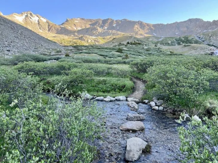
The Cohutta Wilderness is the largest federally designated wilderness in the national forests east of the Mississippi, and it belongs on any serious list of secret trails and rivers in the USA.
Most hikers outside Georgia have never heard of it. Some routes carry no blazes, every river crossing is unbridged, and the canopy runs dense enough to swallow a GPS signal.
Two Rivers, Two Sides of the Wilderness
Everything in the Cohutta organizes around water. Two river drainages split the wilderness in half, and every trail you walk will eventually lead you to one of them.
The Conasauga and Jacks River Drainages
The Conasauga River drainage covers the eastern side. The Jacks River drainage cuts through the western half. The drainage you enter determines the crossings you will face, the terrain’s steepness, and whether you are hiking alongside a river or standing in one.
The Conasauga side runs more calmly and is more contained. The Jacks River side is wilder, wider, and far more demanding on your legs and your judgment. Understanding how terrain logic shapes long-distance travel matters here, because the rivers dictate your route rather than a maintained path.
How the Cohutta Feels Different
Most trail systems in the southern Appalachians come with signage, maintained bridges, and a cell tower on the ridge. The Cohutta has almost none of that.
Hardwood cove forests and rhododendron tunnels line the lower stretches. Higher up, oak and hickory take over with drier footing. If your frame of reference is the Smokies or Pisgah, the Cohutta will feel noticeably emptier. That is its best quality.
The Jacks River Trail and Its 40-Plus Fords
This is the trail that put the Cohutta on the map. Roughly 16 miles of river valley hiking with over 40 unbridged crossings will either thrill you or send you home early.
What the Fords Look Like
These are not stepping-stone crossings. The fords range from ankle-deep gravel bars in late summer to thigh-deep channels after rain. You will get wet. That is not a maybe. Plan your footwear and pack contents around that certainty, and you will enjoy the trail far more than the hikers who show up in cotton socks.
Seasonal Windows and Water Levels
Late summer through early fall offers the lowest, most manageable water. Spring runoff turns several crossings into genuinely hazardous conditions, particularly after consecutive days of rain.
Before you commit to a date, check USGS water data for Georgia’s Jacks River gauge or call the Conasauga Ranger District. A phone call takes two minutes and can save you from a very frustrating weekend.
Jacks River Falls
The payoff. Roughly 5.5 miles in from the Beech Bottom trailhead, Jacks River Falls drops about 80 feet into a wide pool surrounded by rock slabs perfect for sitting and regretting that you did not bring a second lunch.
A full end-to-end traverse is not a casual day hike. Most first-timers treat it as an out-and-back to the falls or a two-day backpacking trip.
Conasauga River Trail: Hiking in the Riverbed
If the Jacks River Trail is the Cohutta’s headliner, the Conasauga River Trail is the one locals keep to themselves. Shorter, quieter, and stranger in the best possible way.
What “Hiking in the River” Means
Sections of this trail do not run alongside the river. They run through it. The riverbed becomes the trail, and you pick your line between submerged rocks while current pushes against your shins.
Water shoes or quick-drain boots are mandatory. Trekking poles help enormously, and a dry bag for anything you would rather not fish out of a stream is worth its weight in gold. The shorter distance makes this a realistic strong day hike.
The Water and the Quiet
The Conasauga runs a shade of green that looks almost artificial in photographs. It is not. The color comes from the watershed’s geology and near-zero upstream development.
Midweek visits in shoulder season can feel genuinely solitary. Just you, the water, and the occasional kingfisher.
Day Hike vs. Multi-Day: Picking the Right Format
Not every trip to the Cohutta requires a tent and a bear canister. The wilderness rewards both formats, but choosing wrong will take the fun out of it fast.
Day Hike Options
Three routes work well as single-day outings. The Jacks River Falls out-and-back covers roughly 11 miles from Beech Bottom. The Conasauga River Trail works as a shorter option for the in-river experience. And the Tearbritches Trail offers ridgeline views without river crossings.
Multi-Day Format
The classic overnight is the Jacks River end-to-end with a camp near the falls. For a loop, linking the Jacks River, Penitentiary Branch, and Rice Camp trails creates a two-to-three-day circuit.
One honest note: there are no facilities in the backcountry. No shelters, no privies, no water spigots. If you have experience camping in the wild, you know the drill. Water filtration is required, and bear canisters are strongly recommended.
Access Points, Trailheads, and Permits
The trails are the easy part to plan. Getting to them is where the Cohutta asks you to pay attention.
Primary Trailheads and Road Conditions
Three trailheads handle most traffic: Beech Bottom for the Jacks River Trail, the Conasauga River trailhead off Forest Service Road 68, and Three Forks Mountain for connector trails and loops.
Most access roads are gravel, some steep and rutted after rain. High-clearance vehicles are recommended on the Jacks River side. Do not trust your GPS app’s estimated arrival.
Permits and Logistics
No wilderness permit is currently required to hike or camp in the Cohutta. A parking pass or day-use fee may apply at certain trailheads, so confirm with the Conasauga Ranger District through the Cohutta Wilderness Trailheads page before you head out.
Cell service drops off sharply once you leave the main highways. Download your maps and save your GPX tracks before you go.
Why a Fixed Base Beats Backcountry for a First Visit
The Cohutta’s trailheads are spread wide, and exploring more than one drainage over a long weekend means driving between access points. From Ellijay, most trailheads sit 45 to 60 minutes north.
A fixed base lets you day-hike one drainage, drive back to a hot shower, and hit a different trail the next morning. Scenic Ellijay cabins near hiking, vineyards, and rivers make that approach easy. For a first visit, comfort and flexibility win.
What to Bring Before You Go
The Cohutta is not the place to discover gaps in your gear list. If you need a refresher on essential gear for exploring the outdoors, sort that before you leave cell range.
Water shoes or quick-drain boots for the fords, plus dry socks for camp. Trekking poles for river crossings. A printed map or downloaded GPX tracks, since phone signal is nonexistent in the wilderness. Water filtration for every drink. And a tick plan from May through September.
Fall is the sweet spot: lower water, cooler temps, and color on the ridges worth stopping for.
Follow the Water In
The Cohutta does not promote itself. No entrance arches, no visitor centers, no gift shops. Just a version of the southern Appalachians that most hikers never see. Start with one river. Walk until the trail disappears into the water. Keep going.