One of my favorite hiking trails in Bavaria is the one that starts up on Alpspitze mountain and makes its way into the Höllentalklamm valley down below.
The official route on hiking maps shows it as the trail starting from Osterfelderkopf near the top of the Alpspitze cable car, then down the Rinderscharte route into the valley, and finally through the Höllentalklamm Gorge, ending in the town of Hammersbach.
This guide will walk you through the hike and how to best prepare for the trail.
* Affiliate Disclosure: This post may contain affiliate links, which means I may receive a commission if you make a purchase through the links provided, at no additional cost to you. Thanks for supporting the work I put into TripTins!
1) Trail Overview
After taking the Alpspitzbahn cable car up the mountain, you will be welcomed to the AlpspiX viewing platform, restaurant, and seating deck.
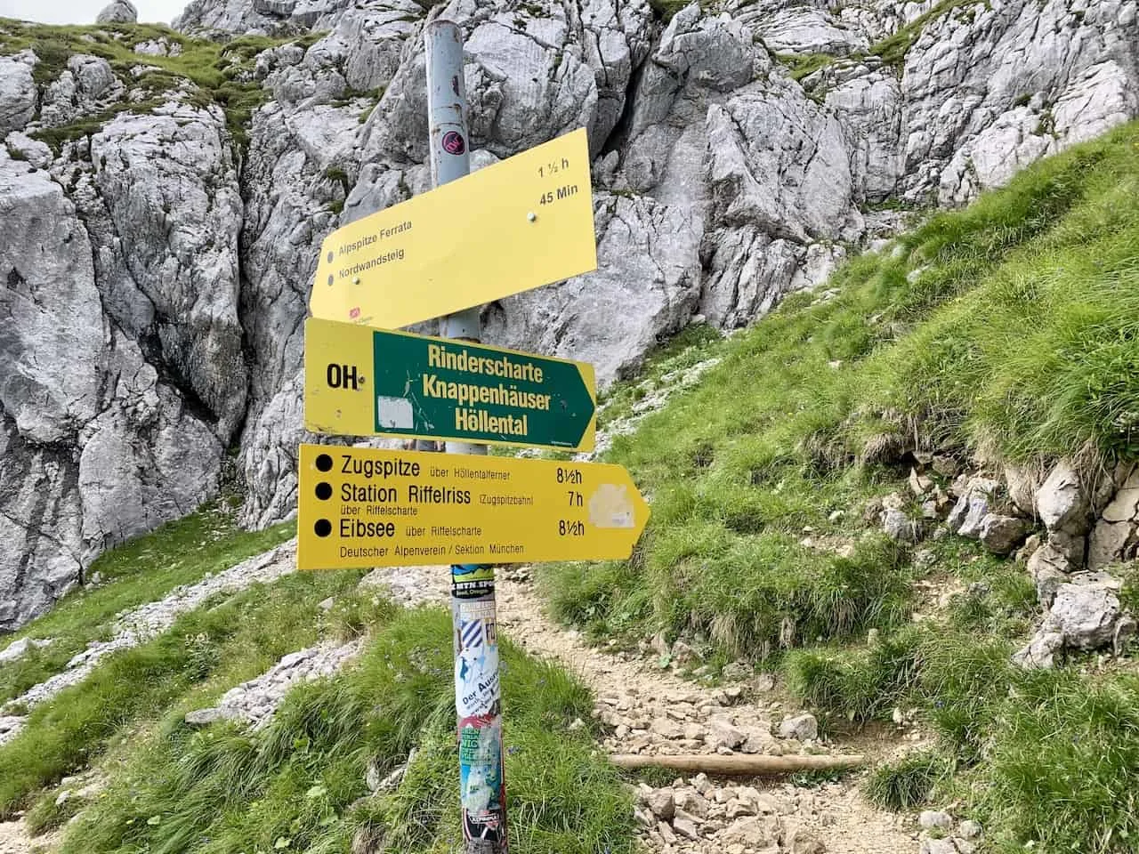
From there you will just need to walk about 20 minutes past the Osterfelderkopf before catching the zig zagging Rinderscharte trail down into the valley below.
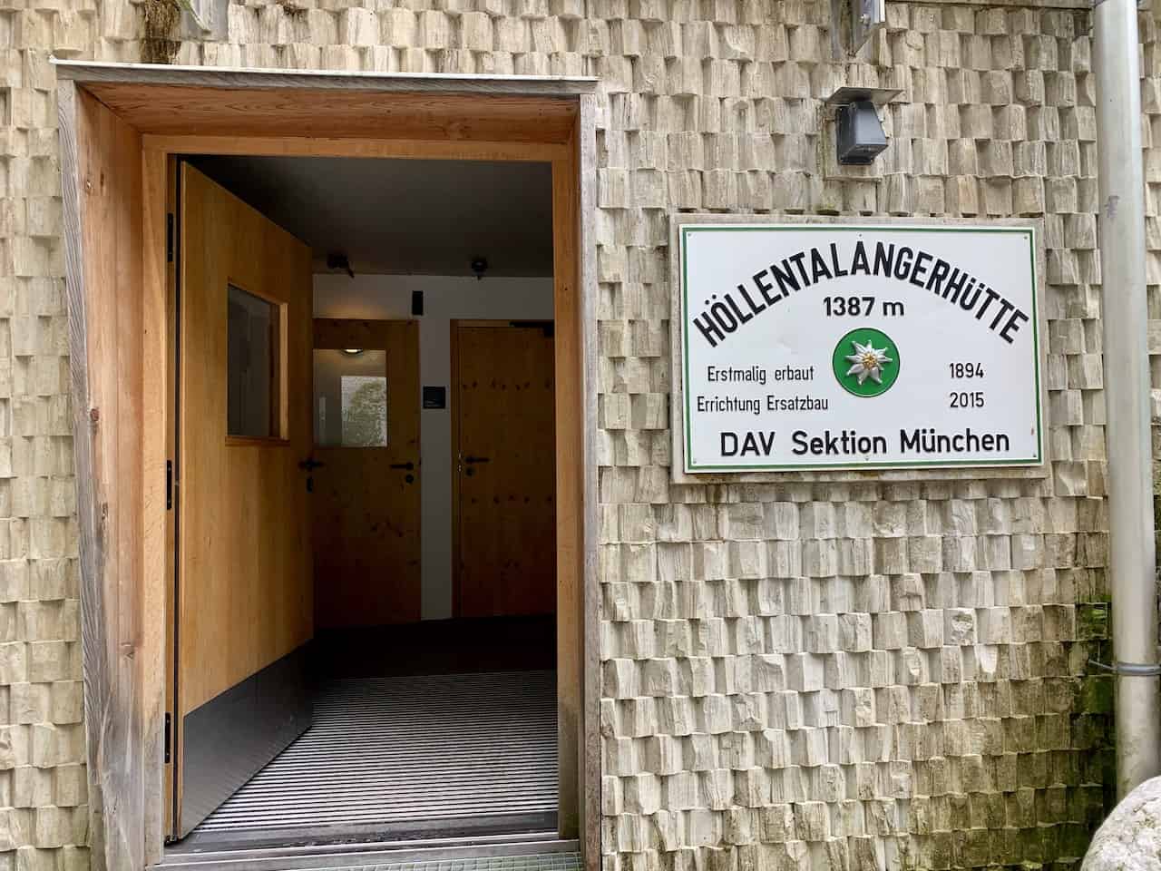
Once at the bottom of the valley, you will be welcomed at the Höllentalangerhütte before continuing towards the Höllentalklamm Gorge and onto the village of Hammersbach to end the hike.
A couple things to note about hiking the area around Alpspitze:
- This route can also be done in the opposite direction – starting in Hammersbach and ending up at the top of the Alspsitze cable car. Such a route would require more time and a high level of fitness as it would gain +1,600 meters / +5,200 feet in elevation.
- I should also note that the top of the Alpspitzbahn is not the summit of Alpspitze. If you would like to head up to the summit, you can take part of the Alpspitze Via Ferrata or hiking trail that takes you the final distance to the top of the mountain. Once complete, you could continue on your day with the hike down to Hammersbach.
Below are some of the main stats of the trail so you will have a better idea of what to expect:
- Starting Point: Alpspitzbahn / Osterfelderkopf
- Ending Point: Hammersbach
- Distance: 9.6 km / 6.0 miles
- Duration: 4 hours
- Elevation Gain: 380 meters / 1,247 feet
- Elevation Loss: 1,602 meters / 5,256 feet
- Difficulty: Moderate
As you can see, there will be a lot of downhill hiking during this route (unless of course you opt for the opposite). If you are not comfortable physically with such an elevation profile I would opt against doing this hike.
Hiking Resources & Checklist
Before heading out for the trails, be sure to read up on some of the hiking resources up on the site. These are here to better prepare you for all types of outdoor adventure.
- Gear: Hiking Packing List
- Weather: How to Prepare for Hiking Weather
- Navigation: Hiking GPS & Navigation
- Tips: 20+ Hiking Tips & Tricks for the Trail
- Accommodation: Book Your Hotel Today
- Rental Car: Book Your Car Rental Today
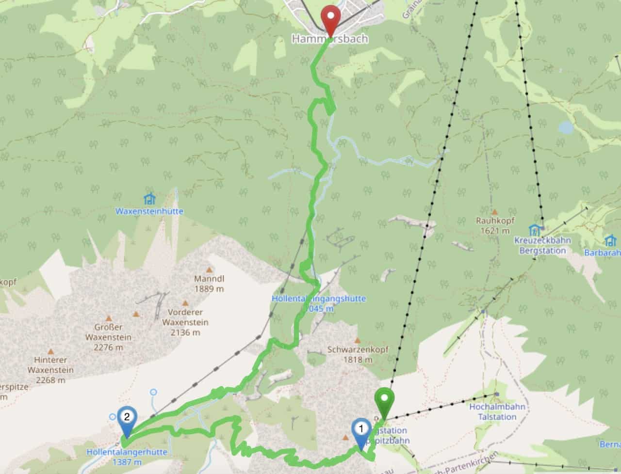
2) Map & Route
Below you can find the map of the Alpspitze hiking trail and the route down to Hammersbach.
The trail starts at the green marker (Alpspitzbahn) and continues down to the valley floor along the Rinderscharte route to the Höllentalangerhütte.
Once at the Höllentalangerhütte, it is straight down the valley past the Höllentalklamm Gorge and onto Hammersbach.
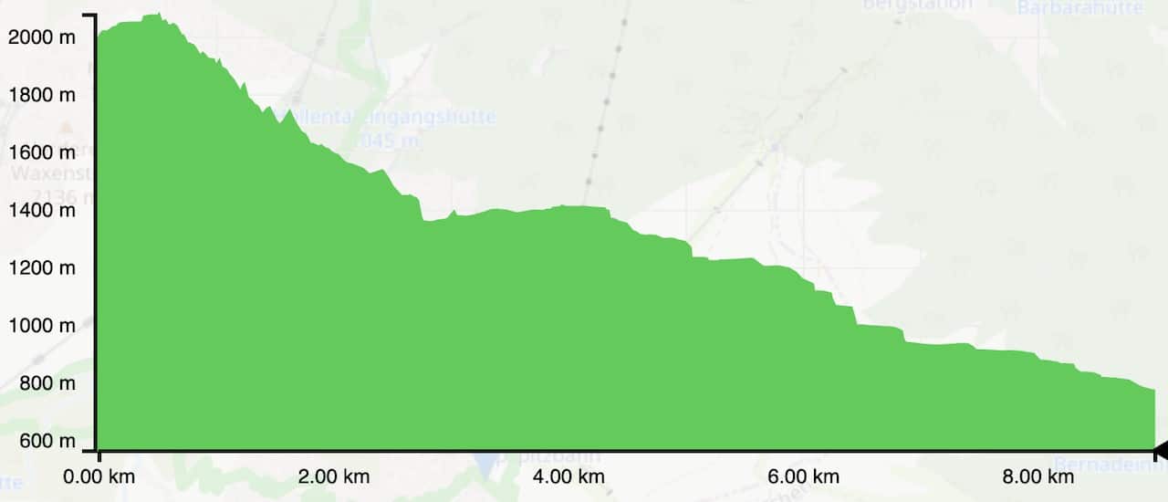
3) Elevation Profile
I also wanted to lay out the elevation profile for the trail. As you can see it is nearly all downhill with a few short uphill sections throughout.
4) How to Get to the Starting Point
While you can make the hike up to the starting point of the hike from ground level, that will require an additional 1,000+ meters of elevation gain. Instead just head on over the Alpspitzbahn Cable Car Station.
But be careful here, as there are actually two different cable cars that go up Alpspitze – the Alpspitzbahn and Kreuzeckbahn.
The Kreuzeckbahn takes you only about 75% of the way up while the Alpspitzbahn takes you to the main viewing platform, where you can begin the hike from. These two cable cars are right next to each other so just be certain when going on.
Once you get off at the top station of the Alpspitzbahn, you will now be ready to hit the hiking trail!
» Note: there is another mountain also called Alpspitze, which also has an Alpspitzbahn. The map below though has the correct points of interest for you to follow when planning your trip.
Rent a Car: When it comes to renting a car, I would highly recommend checking out Rentalcars.com for potential options. By going through Rentalcars.com, you will have the chance to compare car prices among a variety of rental companies, and choose the best option for you.

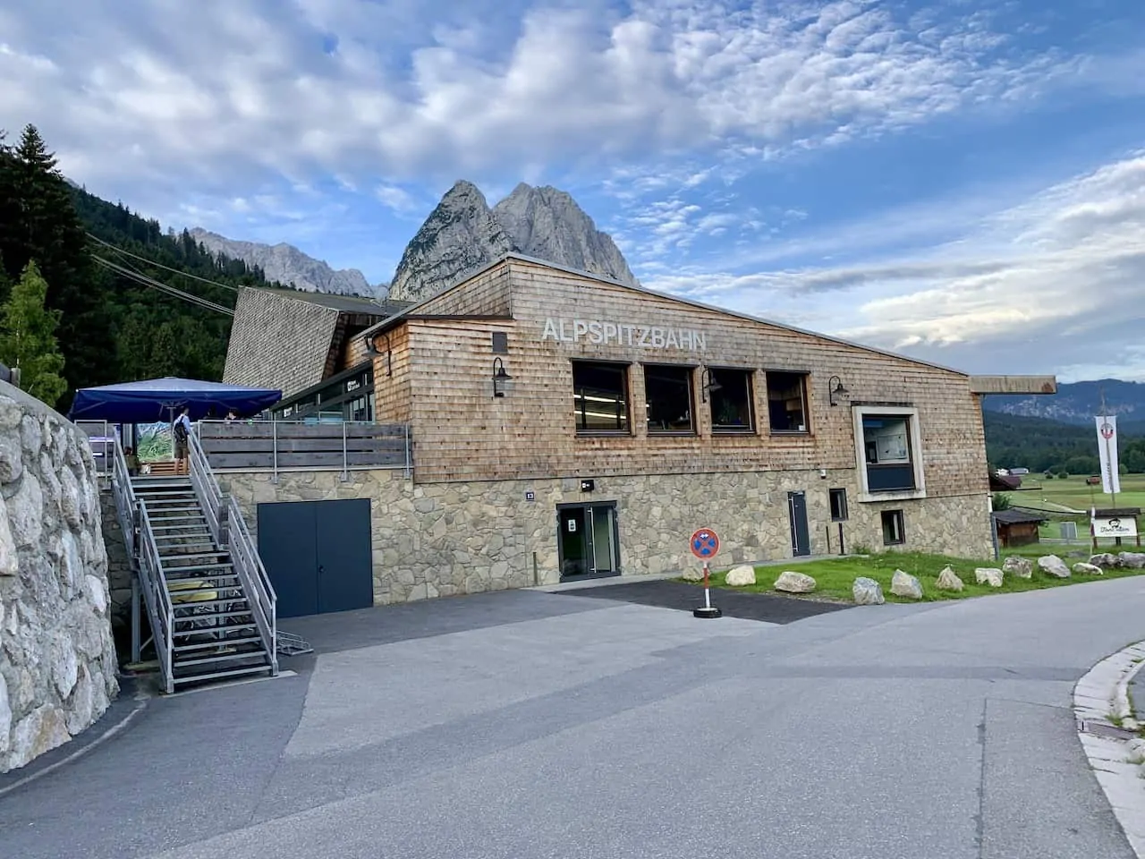
Operating Hours
Below are the hours of the Alpspitzbahn. Note that the last ascent is 30 minutes prior to closing.
- November to February: 8:30AM – 4:30PM
- March to April: 8:30AM – 4:45PM
- May to June: 8:30AM – 5:00PM
- July to September: 8:00AM – 5:30PM
- October: 8:30AM – 5:00PM
- March to June: 8:30AM – 4:30PM | 5:00PM
- July to September: 8:00AM | 5:00PM | 5:30PM
- October to February: 8:30AM | 4:00PM | 4:30PM
Ticket Cost
Since you will be hiking back down from the top of the cable car, only a one way up ticket is required.
You can purchase a one way ticket which costs 20.50 Euro round trip for adults, 16.50 Euro for ages 16-18, and 10.50 Euro for ages 6-15.
Alpspitze Map
5) What to Bring on the Hike
Whenever heading off on longer day hikes, I always recommend being adequately prepared when it comes to the type of gear to bring along.
Check out the below packing list for this hike and other hikes in Austria.
Hiking Packing List
In general when it comes to hiking, there are a few main aspects to consider. These includes clothing layers, hiking shoes, hydration & fuel, electronics, and other essentials.
Below in a breakdown of some of the top items, but be sure to check out the Hiking Packing List for a more comprehensive view.
Clothing Layers
Layering is going to be a top consideration when hiking. You will want to be prepared for all sorts of weather so you can be comfortable in different situations. Some items may include:
→ Hiking Shorts
→ Hiking Pants
→ Short Sleeve Shirt
→ Long Sleeve Shirt / Sun Hoodie
→ Mid Layer Fleece
→ Puff Jacket (not always needed)
→ Packable Rain Jacket (Columbia Watertight II)Note that your layers should be made of moisture wicking material as they are breathable and quick drying.
Footwear
Having appropriate footwear will also be very important. You will want to have shoes with the necessary grip and support to keep you safe on the trail.
→ Hiking Shoes (Keen Targhee)
→ Hiking Socks (Darn Tough)Other Essentials
Whether it is hiking gear, electronics, or just some miscellaneous items, here are some other essentials to bring along on hikes.
→ Hiking Backpack (Osprey Talon 22) & Rain Cover (Joy Walker Cover)
→ Hiking Poles (Black Diamond Trekking Poles)
→ Water Bottle (CamelBak Chute or Katadyn Filter Bottle)
→ Portable Charger (Anker PowerCore 5000mAh)
→ Action Camera (GoPro Hero)
→ Energy Bars & Snacks
→ Hat & Sunglasses
→ Sunscreen & Bug Spray
6) An Alpspitze Hiking Experience
Now that you have a better background of the hike, below are some more details of what to expect on the hike itself.
Once you get off the cable car at the top Alpspitzbahn station, you can take in the views from the AlpspiX viewing platform and be on your way from there.
Bavaria Itinerary: Take part of an Alpspitze hiking experience during this Bavaria Road Trip
A) Alpspitzbahn / Osterfelderkopf to Rinderscharte
The first portion of trail is pretty short as you make the 20 minute walk from the cable car station to the route down the valley.
The Osterfelderkopf is actually the name of the mountain peak where the cable car station ends up. There is a small trail that can take you to the true summit of Osterfelderkopf at 2,060 meters.
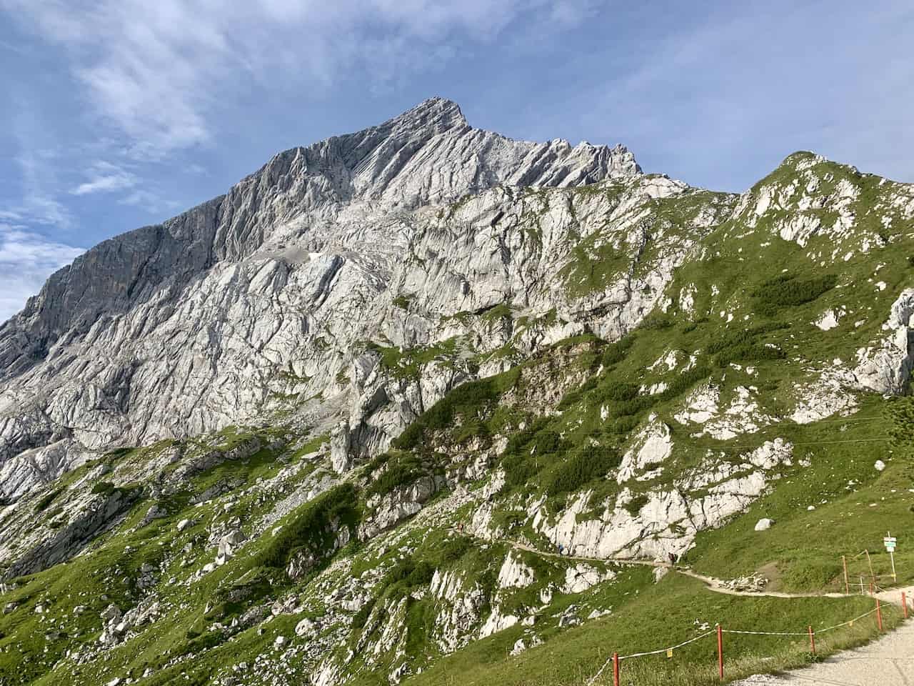
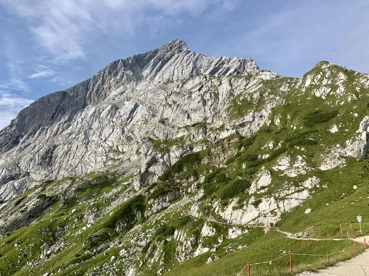
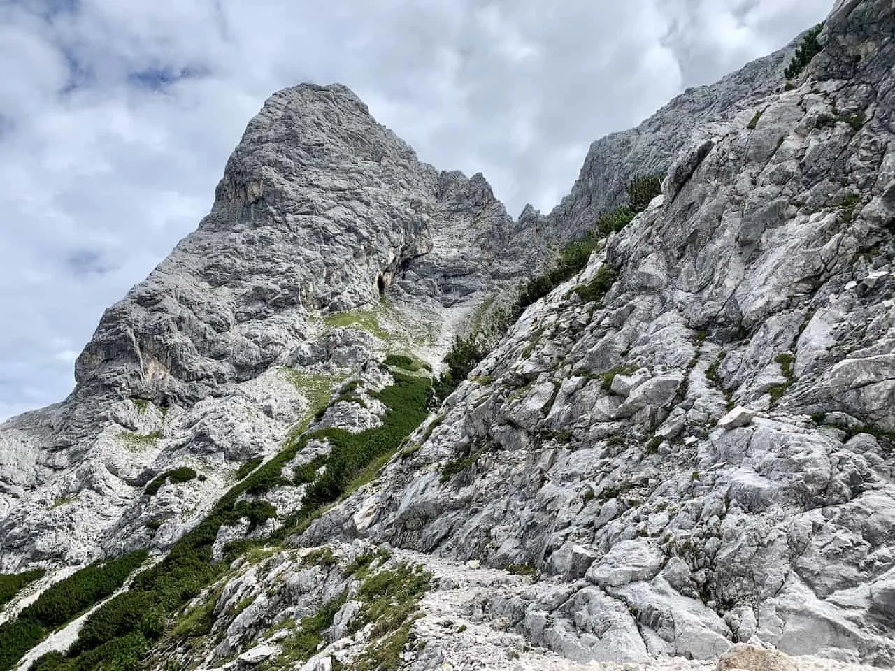
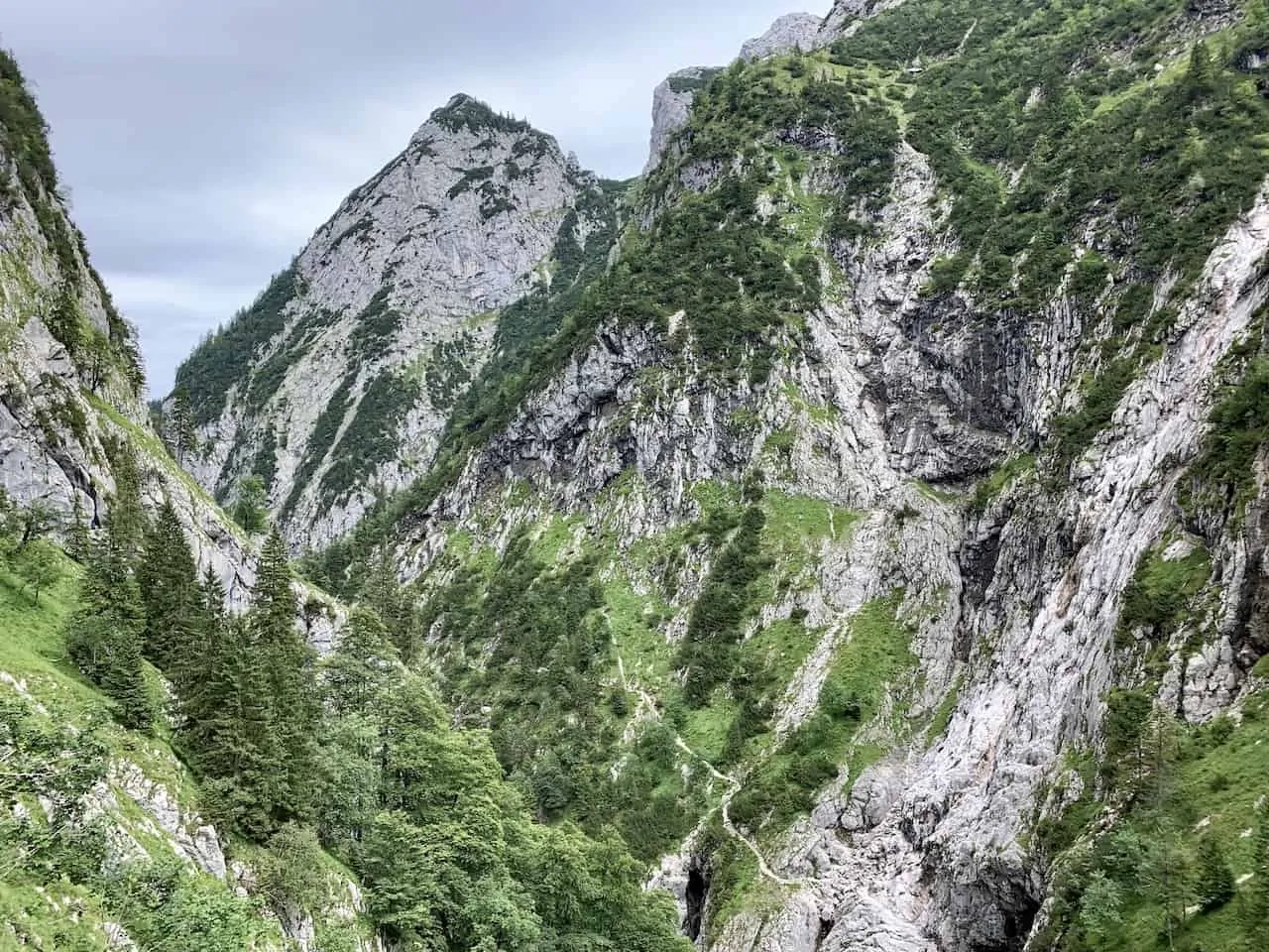
Whether you head on the short trail or not, next up will be continuing the walk away from the cable car station and towards Alpspitze mountain. If you take a look up top, you will actually be able to see the cross that sits up on the summit of Alpspitze.
As you continue on this easy trail, you will see signs pointing you to the right hand side down to Rinderscharte and Hollental. Once you make this turn to the right, you will begin the incredibly beautiful hike down to the valley floor.
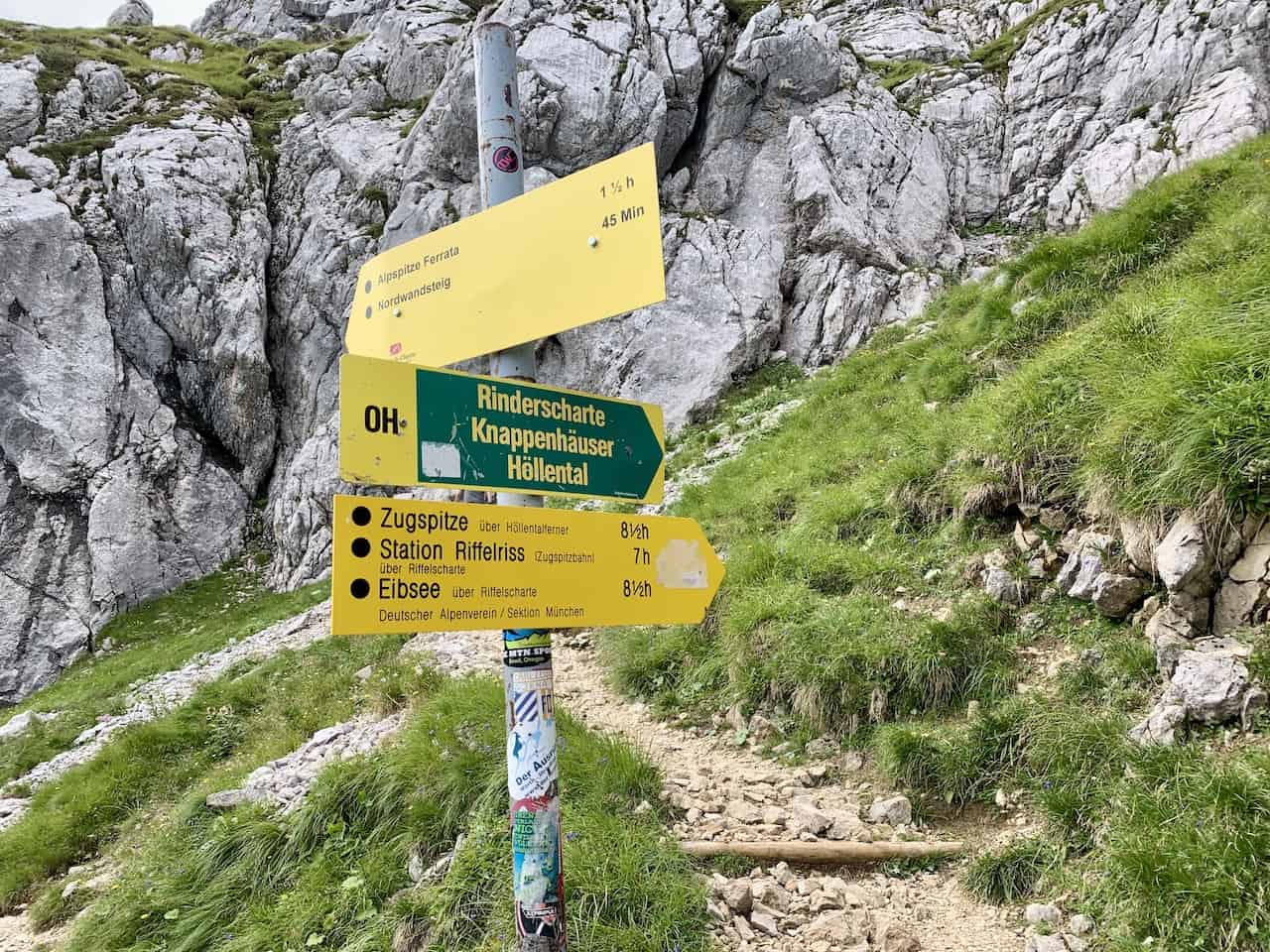
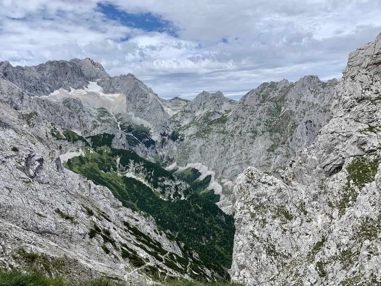
B) Rinderscharte to the Höllentalangerhütte
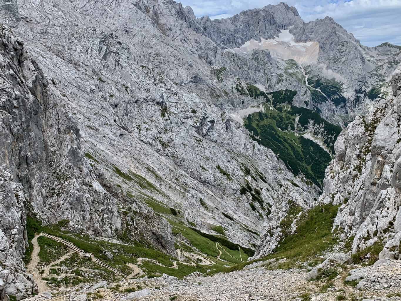
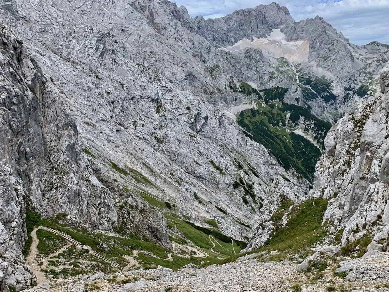
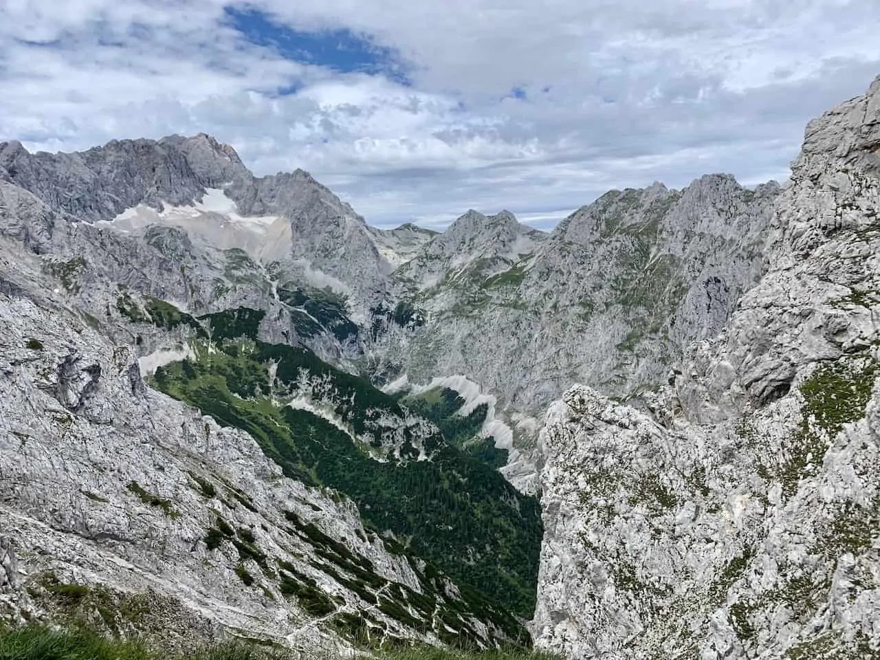
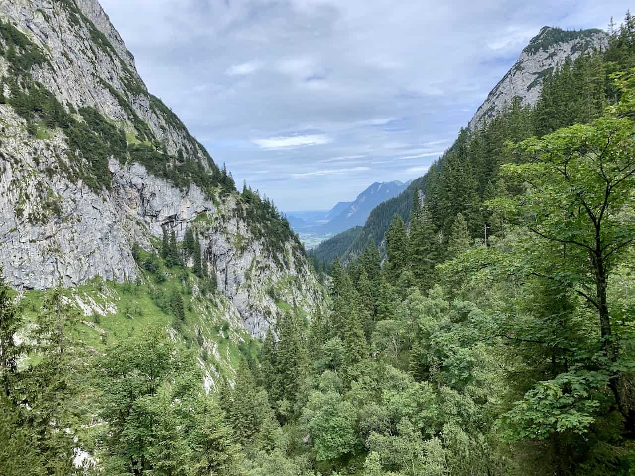
Just after making that right hand turn, you will now be on the Rinderscharte route down to the Höllentalangerhütte. Now comes the big time elevation loss as you will begin to slowly zig zag your way down the mountain.
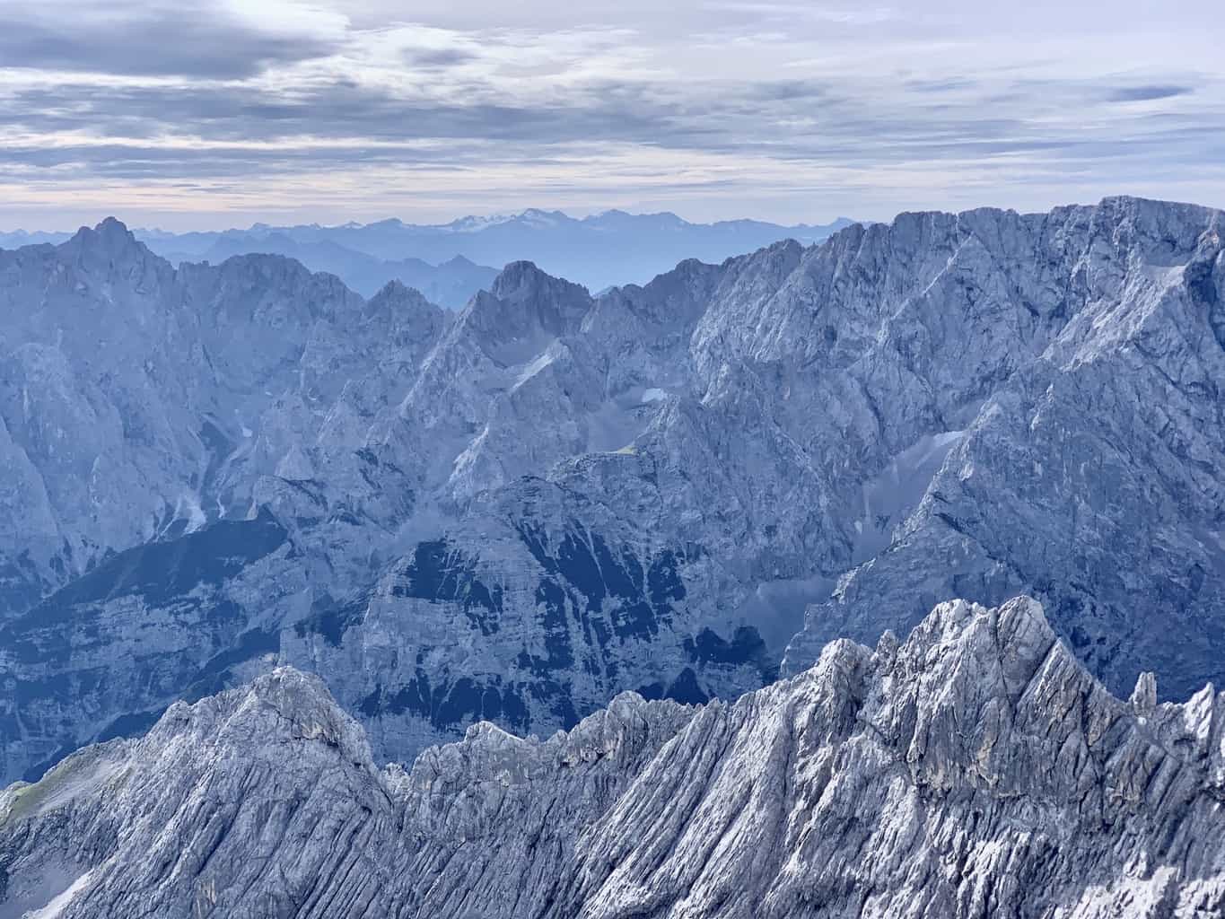
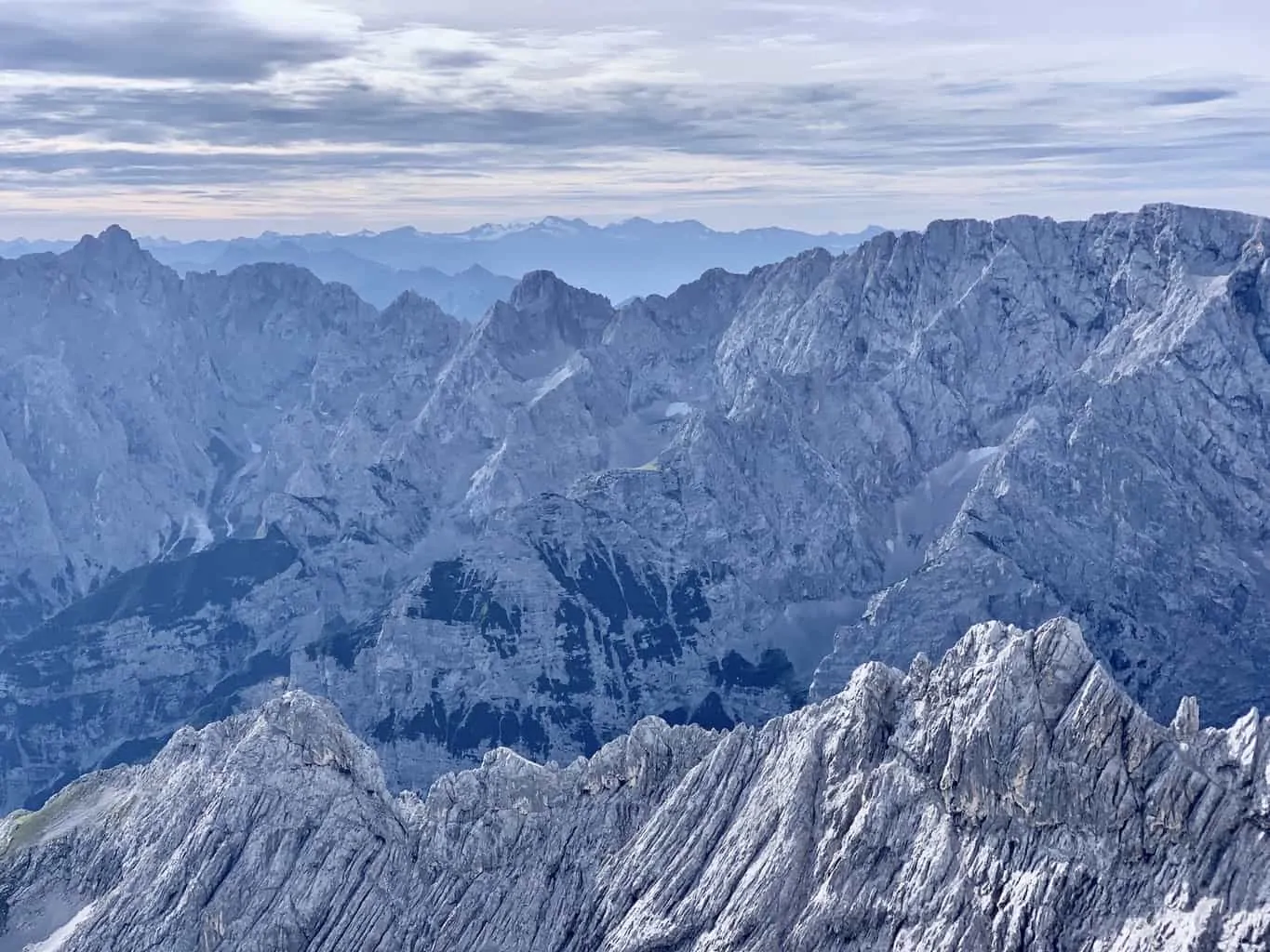
Although this portion is purely a downhill hike, the views out in front of you will be some of the best you will ever come across in Bavaria.
Down below you will be able to see the never ending winding trail surrounded by the beautiful mountain stone in every which direction.
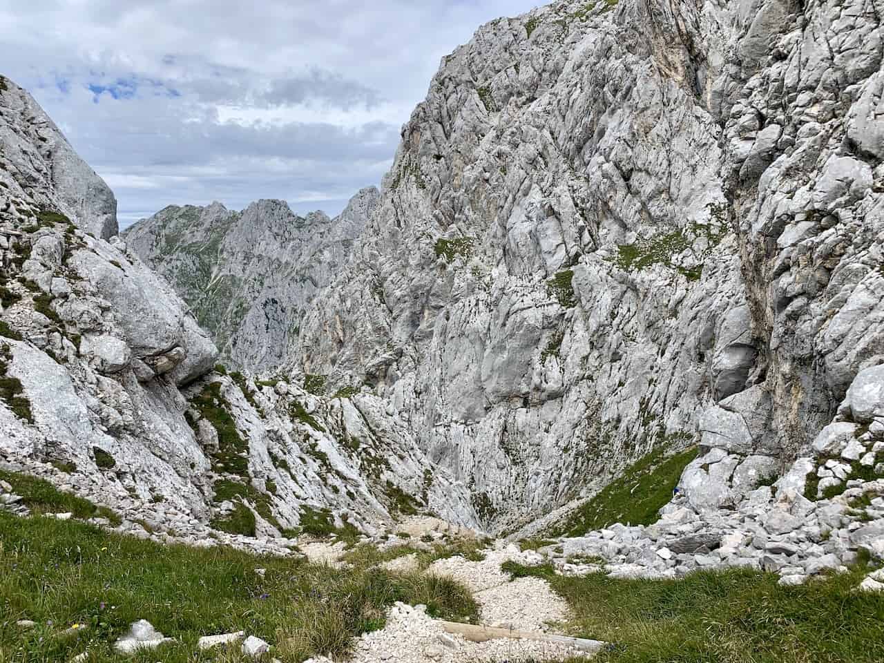
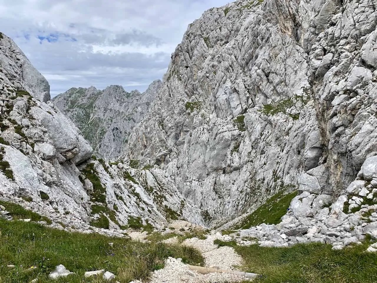
The stairs here are made up of wooden logs as their base with small rocks as the steps themselves. While most of the route will be made up of these stairs, you will also have some flat sections throughout.
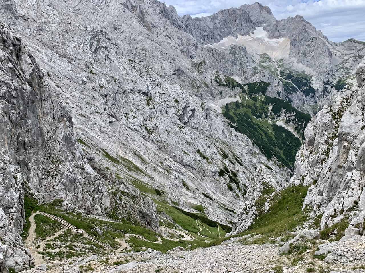
As you continue down, you will slowly be able to see some new angles of the landscape out in front of you. Zugspitze mountain, the highest in Germany, will be also be out in the distance with its glacier route just below the summit.
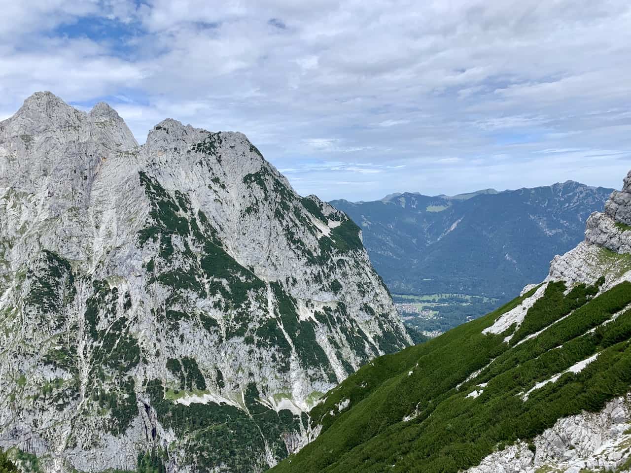
To your right you will be able to see all the way through the valley to the town of Hammersbach – your final destination of the hike.

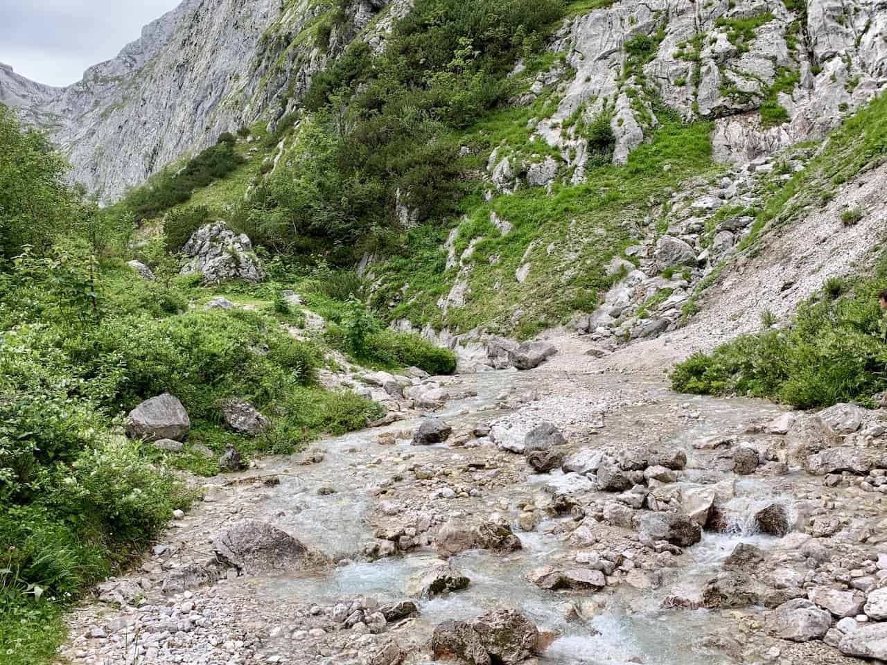
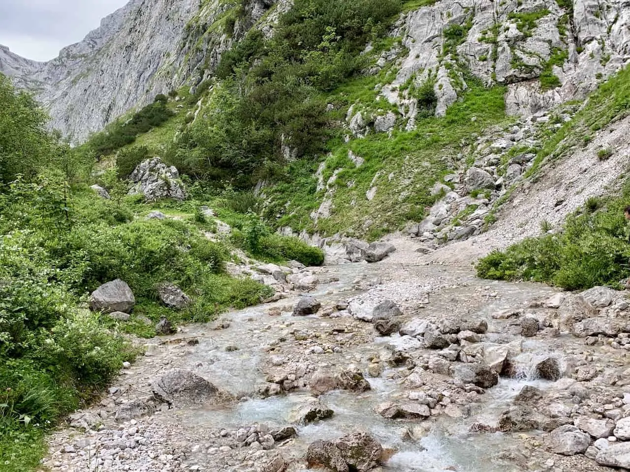
Eventually the stairs will end and you will be more so hiking on just a small rocky pathway as you make your way around the mountain and then into the forest down below.
Follow the signs to the Höllentalangerhütte, your next destination for the day.


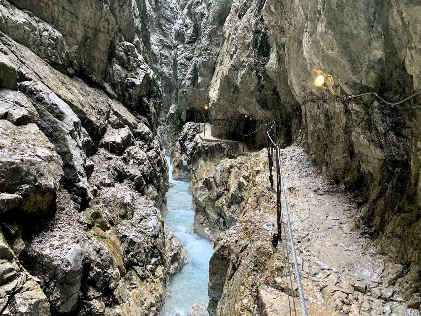
C) Höllentalangerhütte to Höllentalklamm Gorge
Now that you have reached the bottom of the valley, things will start to get a bit easier on those knees.
Behind you will be the route up to Zugspitze at the back of the valley wall while out in front of you will be the exit through the gorge and out of the valley.
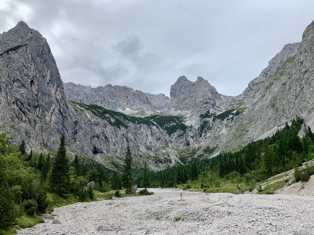
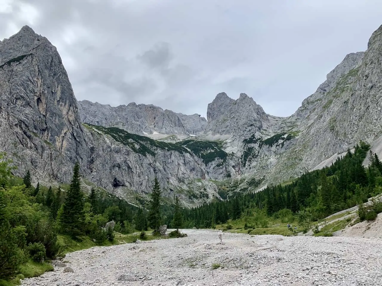
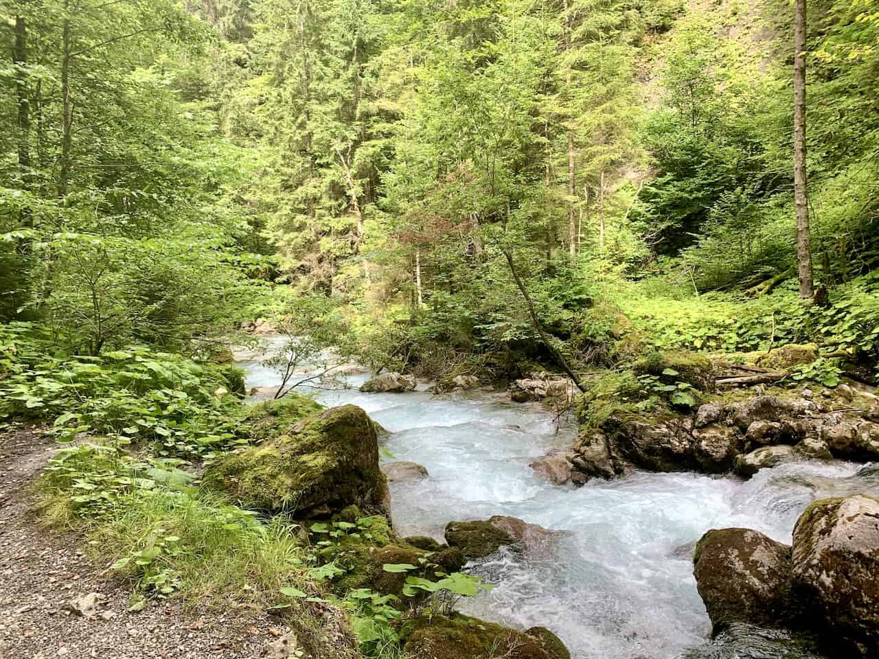
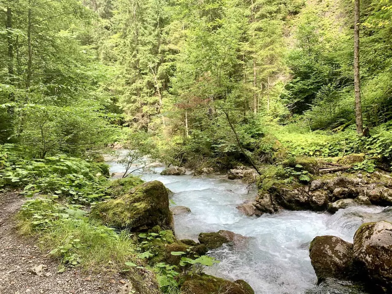
You will simply follow the 30-minute path through the valley until you reach the gorge itself. It is a beautiful route as you walk alongside the turquoise river with the valley walls on either side of you.

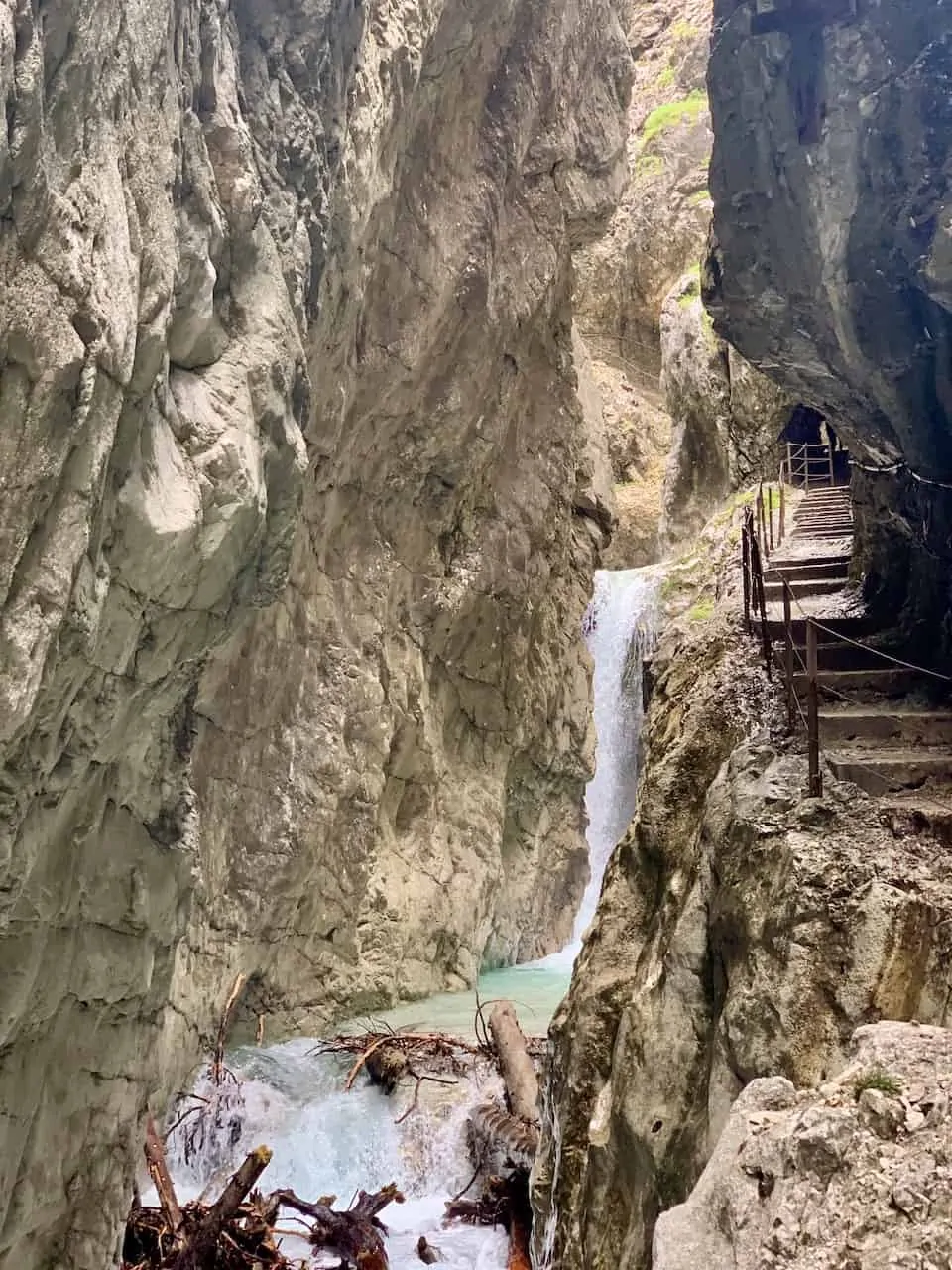
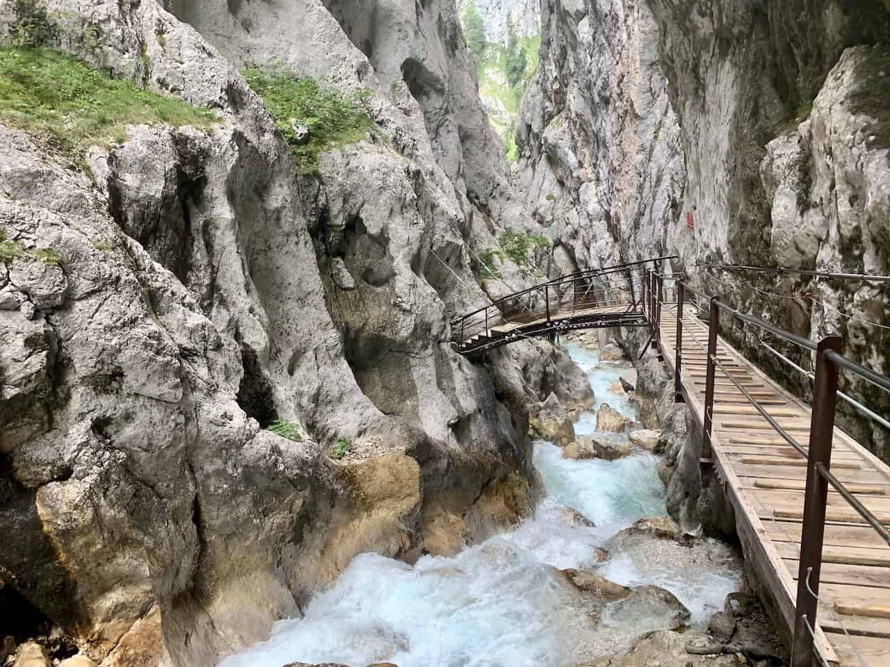
Once you get to the gorge, the walls will be much narrower as you walk along the pathway and staircases etched into the gorge’s walls. The water will be rushing through down below as you continue the path to the main entrance of the gorge.
During this section of trail, you can expect there to be water dripping down from the walls and you can certainly get wet at one point or another as well. You are sure to pass through some tunnels built into the stone as you make your way from one section to the next.
After about 30-40 minutes of walking in the gorge, you will reach the entrance hut. Since you will coming in from the backside, you wouldn’t have paid an entrance fee just yet. But on your way out, you will need to pay the 5 Euro fee.
» Learn more about this section of trail in the Höllentalklamm Gorge Guide up on the site

D) Höllentalklamm Gorge to Hammersbach
The last portion of trail takes you from the gorge entrance to the village of Hammersbach. The trail will be mostly downhill as you walk along the river and through the forest.
It is a well maintained trail and easy to follow for another 30-45 minutes until you exit the greenery and reach the village.
Once you arrive at the village of Hammersbach, the trail has officially been complete. However, if you parked your car at the Alpspitzbahn, you will need to walk another 20 minutes down the road to reach the Alpspitzbahn parking lot.
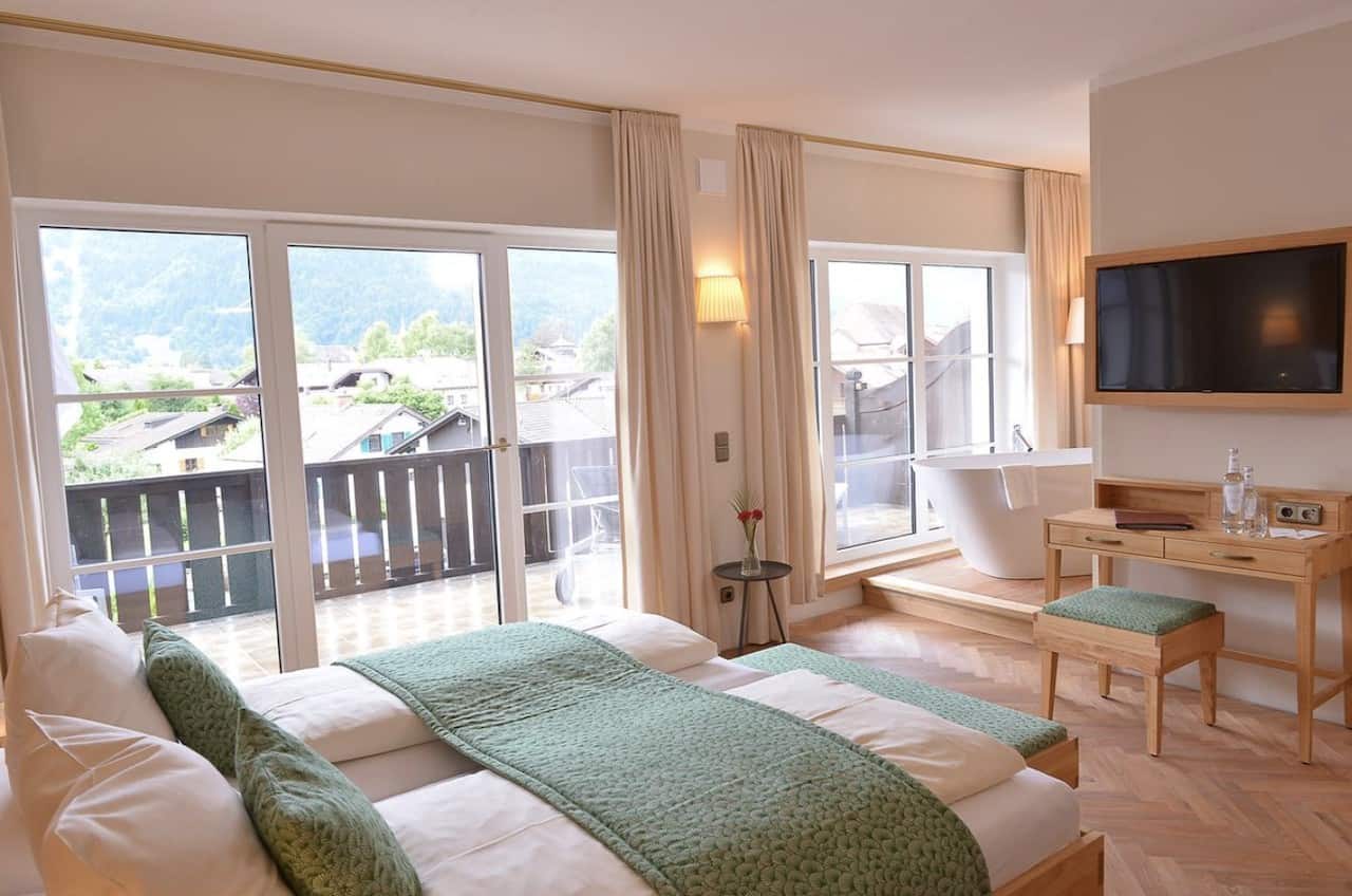
7) Where to Stay in GP
The town of Garmisch Partenkirchen is full of hotels and guesthouses that are frequented both in the winter months for skiing and the summer months for hiking.
Below are some highly rated options that you can choose from when visiting Alpspitze:
- Luxury: Obermühle 4*S Boutique Resort | Hotel Zugspitze
- Mid Range: Hotel Vier Jahreszeiten | Biohotel Garmischer Hof
- Budget: Hostel der Athleten | moun10 Jugendherberge
→ Be sure to also check out some of the other things to do in Garmisch Partenkirchen during a visit

That about does it for an Alpspitze hiking trail from up top to down below. If you have any questions about the route, feel free to add them in below. Don’t forget to check out some other Germany itineraries and guides up on the site.
Have fun out there and safe travels!

Joe
Tuesday 3rd of October 2023
Is the hike down easy, moderate etc? And what makes it that level.
Charles
Wednesday 4th of October 2023
Hey Joe - it is quite a bit of elevation loss so you will need to be very comfortable with downhill hiking. There are many steps all the way through, as well as a more rocky/dirt path. Once you make it down to the valley, then it begins to get much less steep. I would consider this is a moderate hike down altogether. Hope you enjoy
Oleksandr
Sunday 14th of May 2023
thanks a lot for your work!!
Adam
Sunday 11th of September 2022
How do you recommend getting back to the starting from the ending point? The ending point is a 1 hour drive from starting point. Are there car services that can get you back and forth?
Charles
Monday 12th of September 2022
Hey Adam - the ending point in Hammersbach is just a 20 minute walk to the Alpspitzbahn parking lot. In the guide you can find the map that shows the starting/ending points and how close they are to one another. Hope that helps!