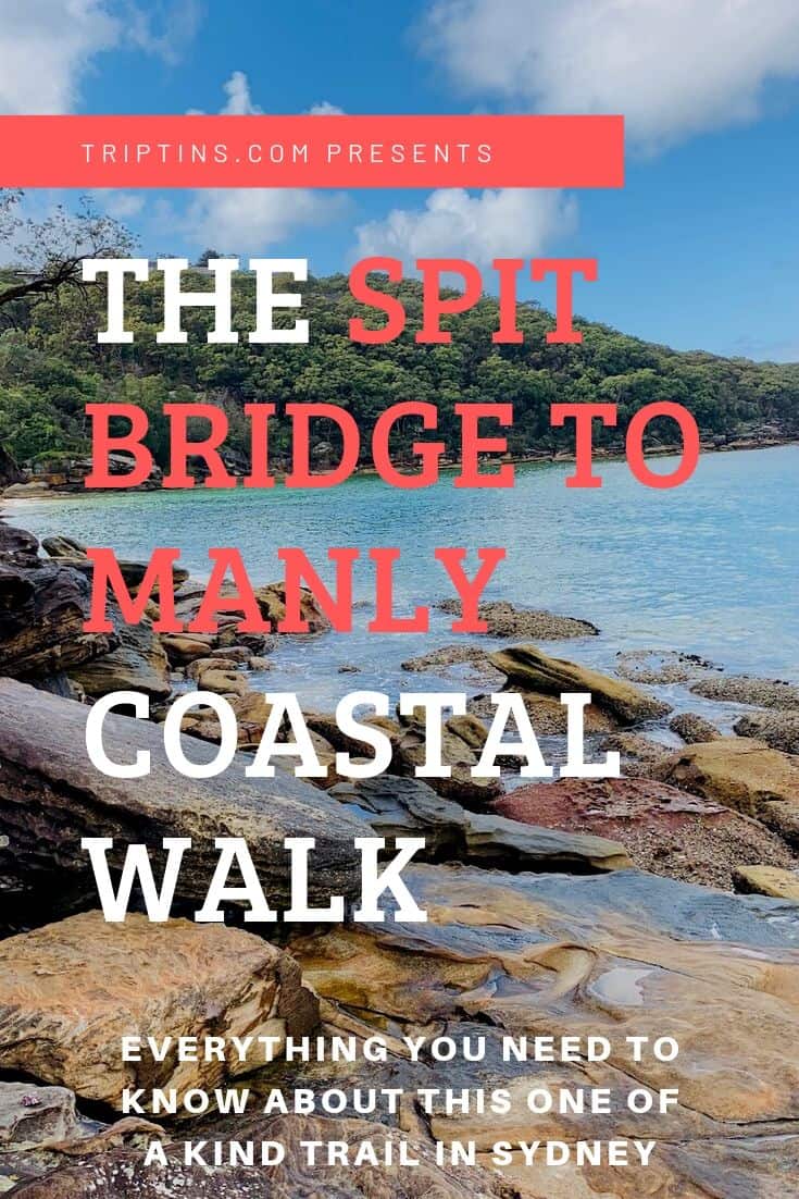

If there is one thing Sydney has no shortage of, it is the number of coastal walks that can be found all throughout the city and its suburbs.
One of the most well known and beautiful coastal tracks is the Spit Bridge to Manly Walk.
During this trail, you will pass by beaches, bays, and plenty of views over Sydney. This guide will go over what you need to know to take part of the walk and what to expect along the way. So let’s get into it!
* Affiliate Disclosure: This post may contain affiliate links, which means I may receive a commission if you make a purchase through the links provided, at no additional cost to you. Thanks for supporting the work I put into TripTins!
1) Spit Bridge to Manly Walk Fast Facts
To give you a high level background about the Spit Bridge to Manly walk, below are some fast facts about the walk.
Throughout the remainder of this guide I will be diving into more detail about logistics and what to expect on the walk itself.
- Starting Point: Spit Bridge (more info on the starting in the next section)
- Ending Point: Manly
- Length: 10 KM / 6 Miles
- Time: ~3 Hours Walking (+ time relaxing)
- Track: Dirt, Steps, Rock, Walkway
- Difficulty: Easy with a few medium sections
As you can see, this is a one way type of walk, starting by the Spit Bridge and ending in Manly. Since it is one way, you will need to figure out some logistics.
In the next few sections I will lay out exactly how to get yourself to the starting point and back from the ending point.

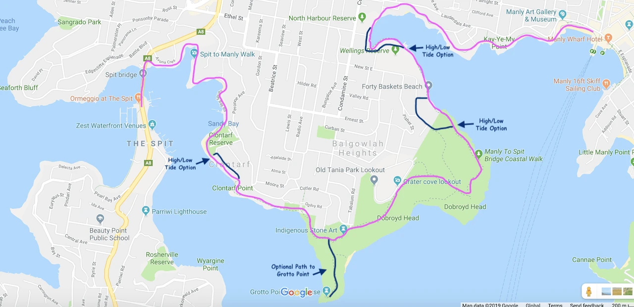
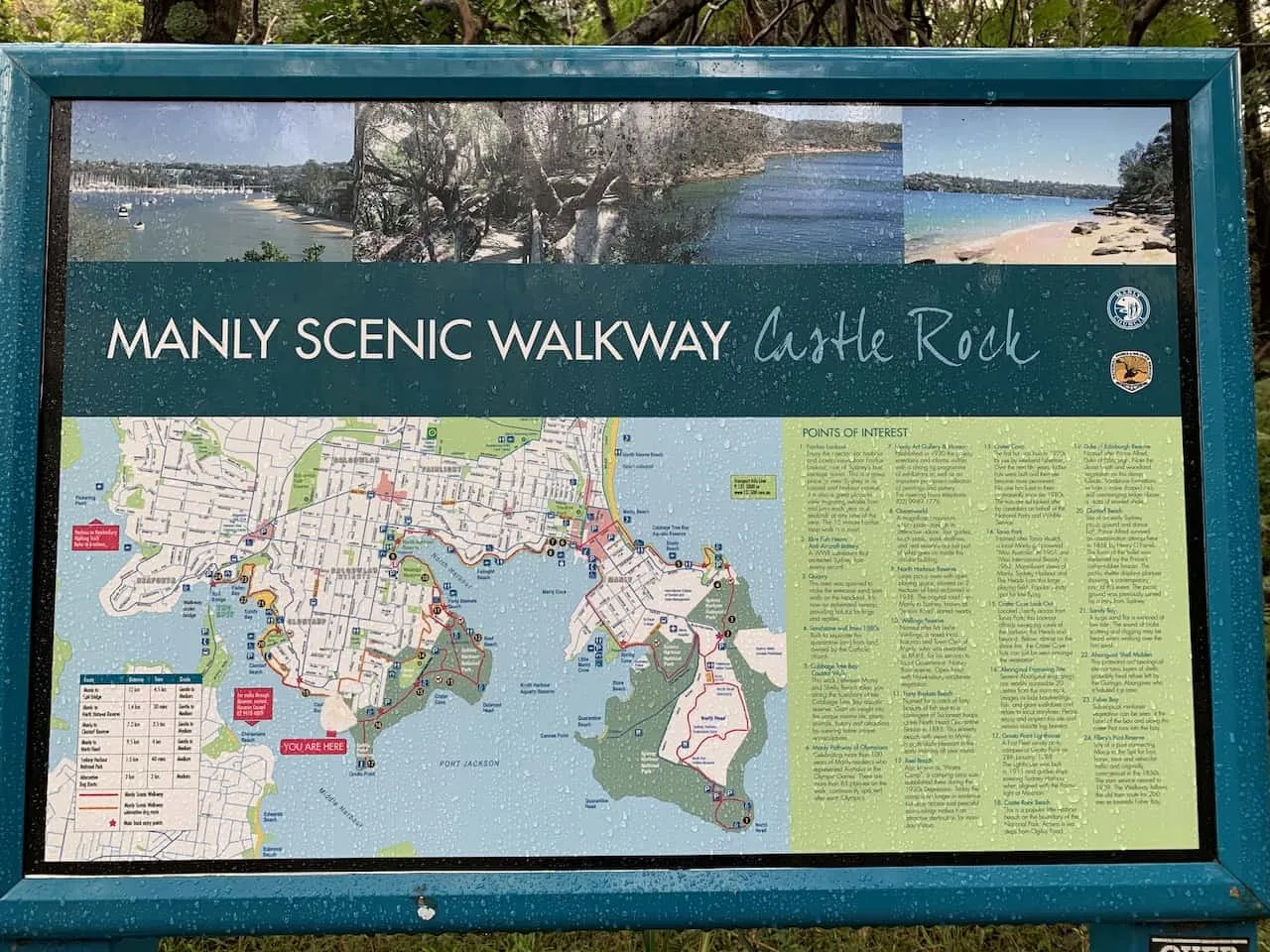
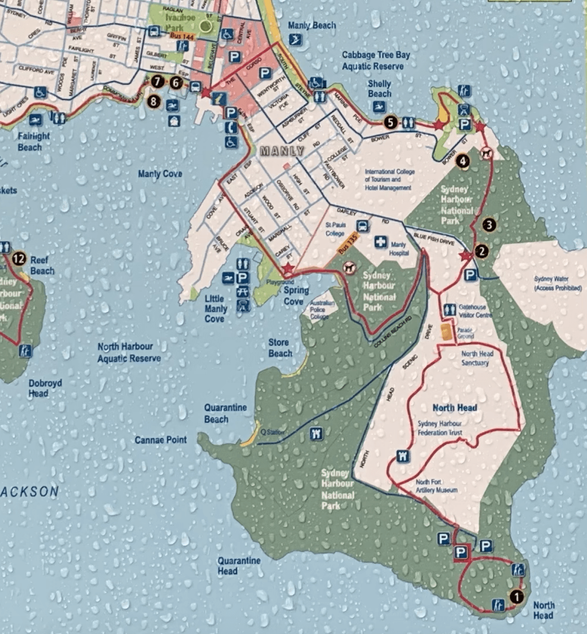
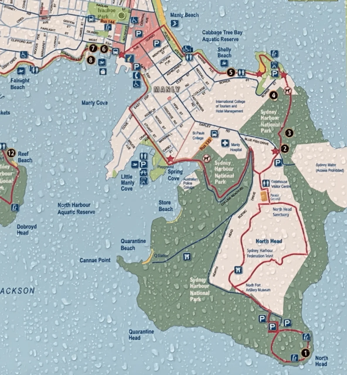
2) Spit Bridge to Manly Map
In order to better visualize the hike, below is a useful map that you can reference throughout the remainder of the guide.
You can see the main route highlighted in pink, starting on the left hand side on the Spit Bridge.
The trail then hugs the coastline, passing by coves, beaches, viewpoints, and more.
It then ends up right in Manly, where you can spend some time relaxing before making your way back to your accommodation.
The route also has some high tide vs low tide options, as pointed out by the black lines on the map.
During high tide, some of the main route will be impassable. But no worries, as there are alternate routes that bypass these sections. As I talk through the route, I will be sure to mention these instances.

Track Notes
1) You can do this walk in the opposite direction (from Manly to the Spit Bridge). In my opinion though, it is much nicer ending the walk in Manly, where you can explore the town and head on off to the beach at the end of the walk.
2) As mentioned, from time to time you should see signs pointing you towards a low tide route or a high tide route alternative. Since some of the walk is done very close to the water, during high tide these parts may not be passable.
If this is the case you will need to take the high tide option further away from the water’s edge. Check the latest Sydney tide tables before you go.
3) Getting to the Spit Bridge
This was one part that got a bit confusing for me so I will try and make it clear for you. When I took part of the walk, I simply saw that Google Maps had a pin down for the “Spit to Manly Walk” and followed the public transportation directions to there.
Unfortunately, it told me to get off a bit farther away from the starting point, which ended up with me missing the first small section of the walk. I am hoping this can help you out a bit so you don’t make the same mistake as me.
Below is my recommendation to getting yourself to the true starting point:
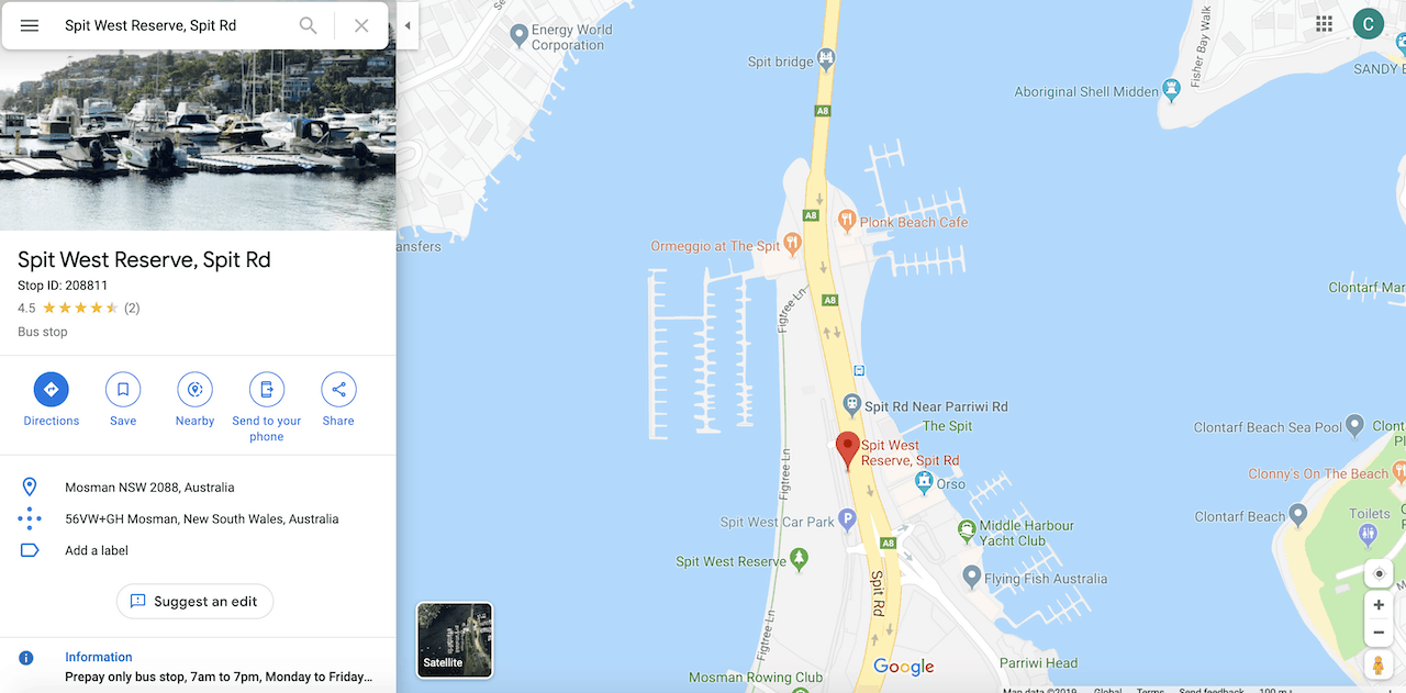
If taking public transportation, which would be a cheap ($2-$3 AUD) and convenient option, hop on a bus towards the Spit Bridge and get off at the “Spit West Reserve, Spit Rd” stop.
The stop is BEFORE the bridge, not the stop after (which is what Google Maps initially told me to do).
There are several busses that stop there including the 178, 180, E68, among many others.
My advice would be to put that exact bus stop into Google Maps and follow its guidance from where you will be coming from. Below is a screenshot of the Google Maps view of the bus stop.
Note that you will need to buy a ticket before you get on the bus – I recommend getting an OPAL Card for your time in Sydney (basically a reloadable transit card).

Once off the bus, you will be on the left hand side of the road prior to the Spit Bridge. All you need to do is continue on the walkway and cross the bridge from there.
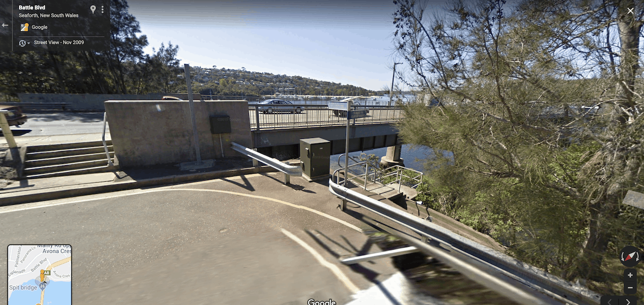
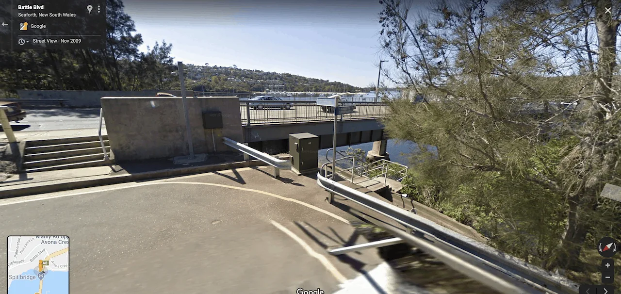
Immediately after you cross the bridge, you will see on your left hand side a staircase that will take you underneath the bridge and onto the official starting point of the Spit Bridge to Manly walk.
⇒ Note that the Spit Bridge is a drawbridge and does open up several times a day to let boats pass underneath. If you want to avoid getting stuck during these times check out the latest bridge opening timetable.
Below is a Google Maps street view of the staircase to keep an eye out for:
4) The Spit Bridge to Manly Walk
Now that you have a bit more insight on the logistics of how to get to the trail, let’s talk a bit more about the trail itself.
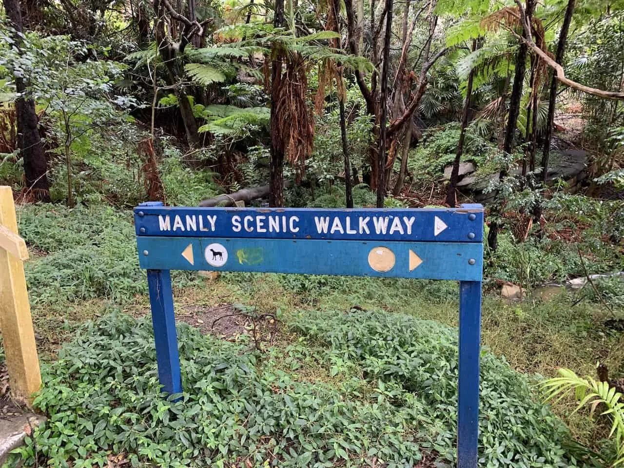
Overall, you should have very little trouble getting yourself to Manly as there are many signs pointing you in the right direction.
As mentioned earlier though, there are some sections of the walk that can only be passed in low tide (during high tide you will need to take the path around), and I will go into a bit more detail about those parts soon.

Below are some details of the main portions of the track that you will pass by throughout your time on the trail along with some pictures to give you a better sense of what to expect.
A) Spit Bridge to Sandy Bay
Like I mentioned before, my starting point got a bit mixed up so I did not start at the “official” starting point.
But once you take those stairs under the bridge, you will continue on the first part of the trail on the Fisher Bay Walk that will take you around Shell Cove.
After Shell Cove, continue the walk around until you reach Sandy Bay (where I ended up starting the walk from).

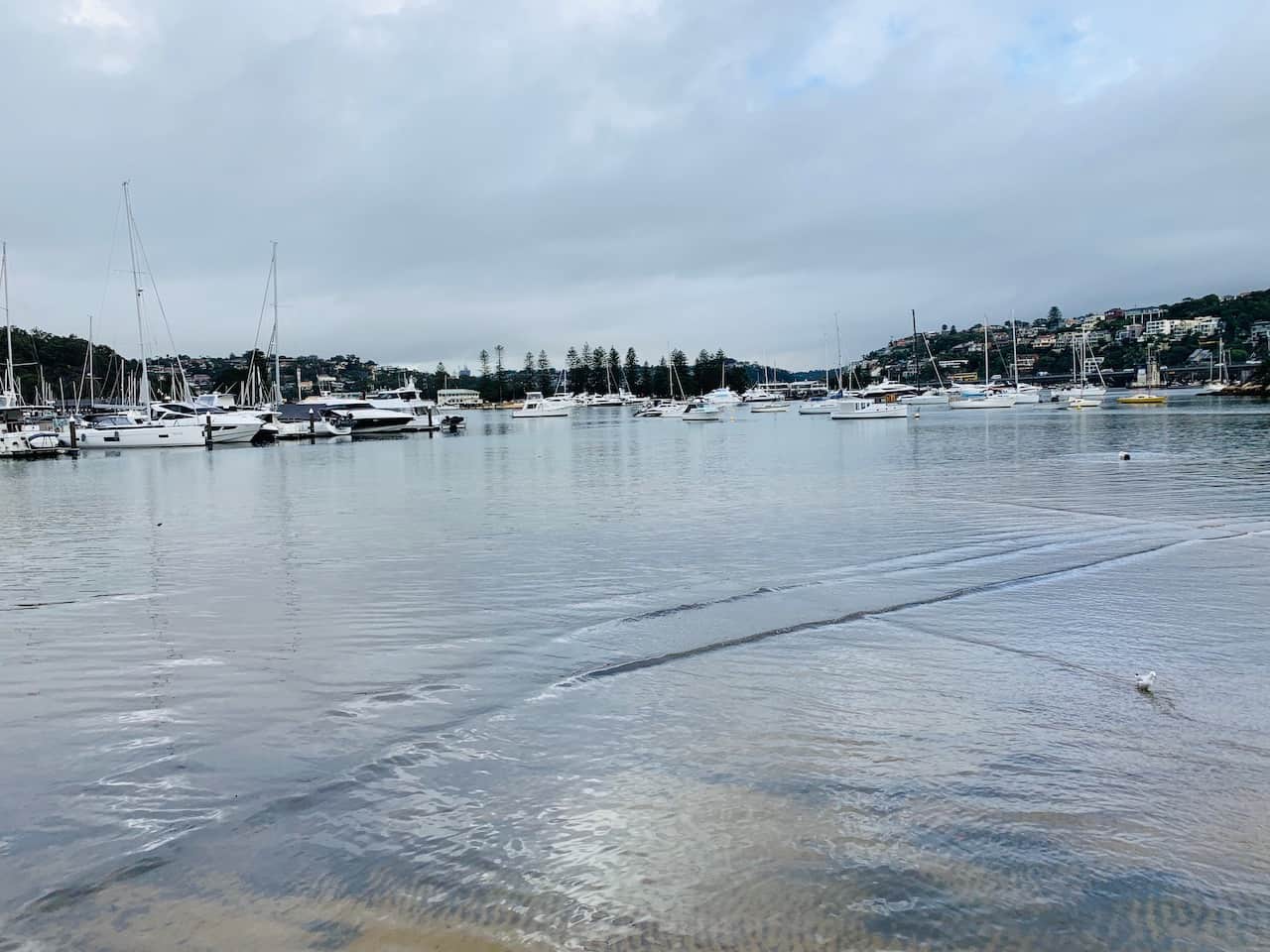
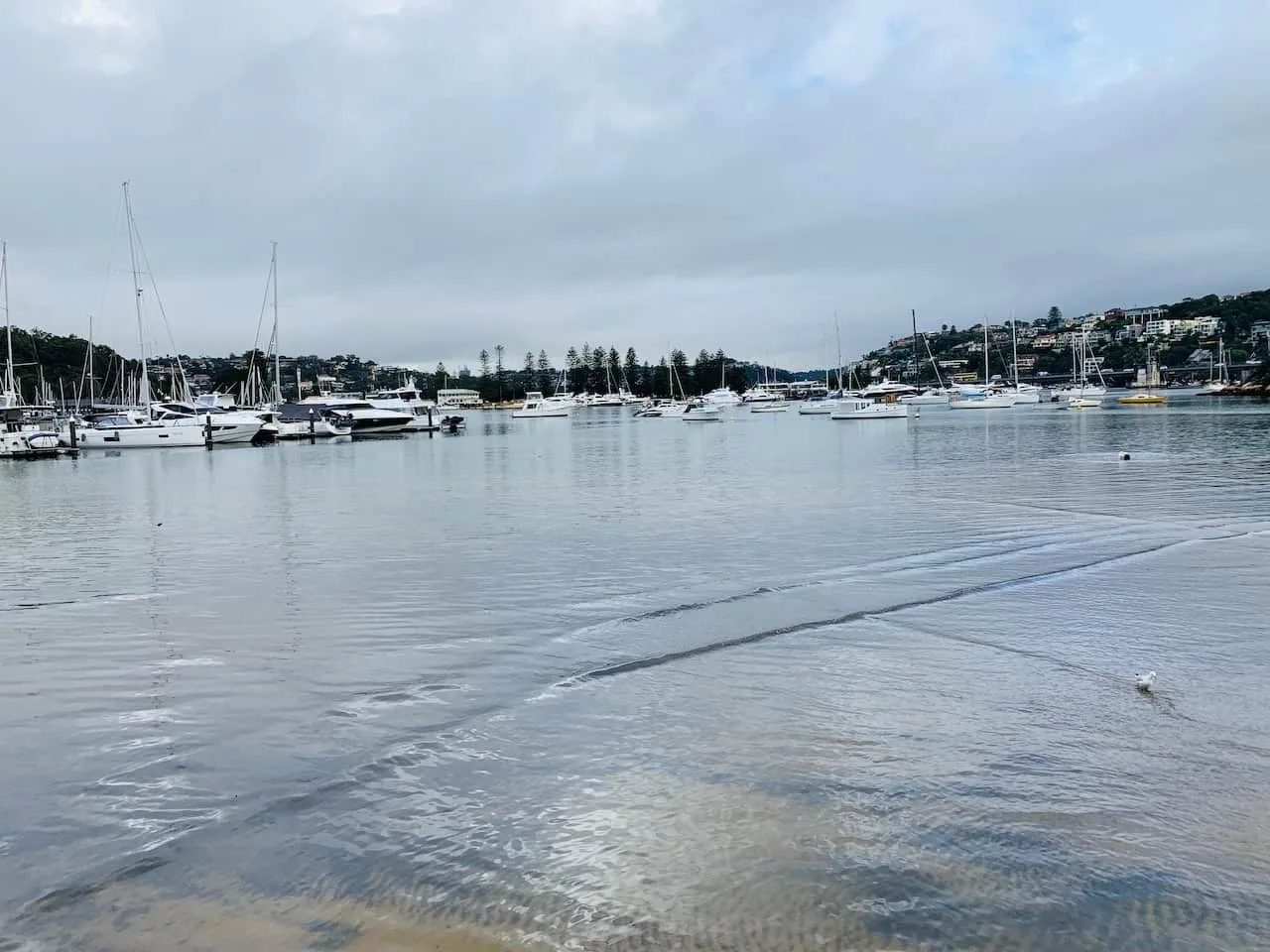
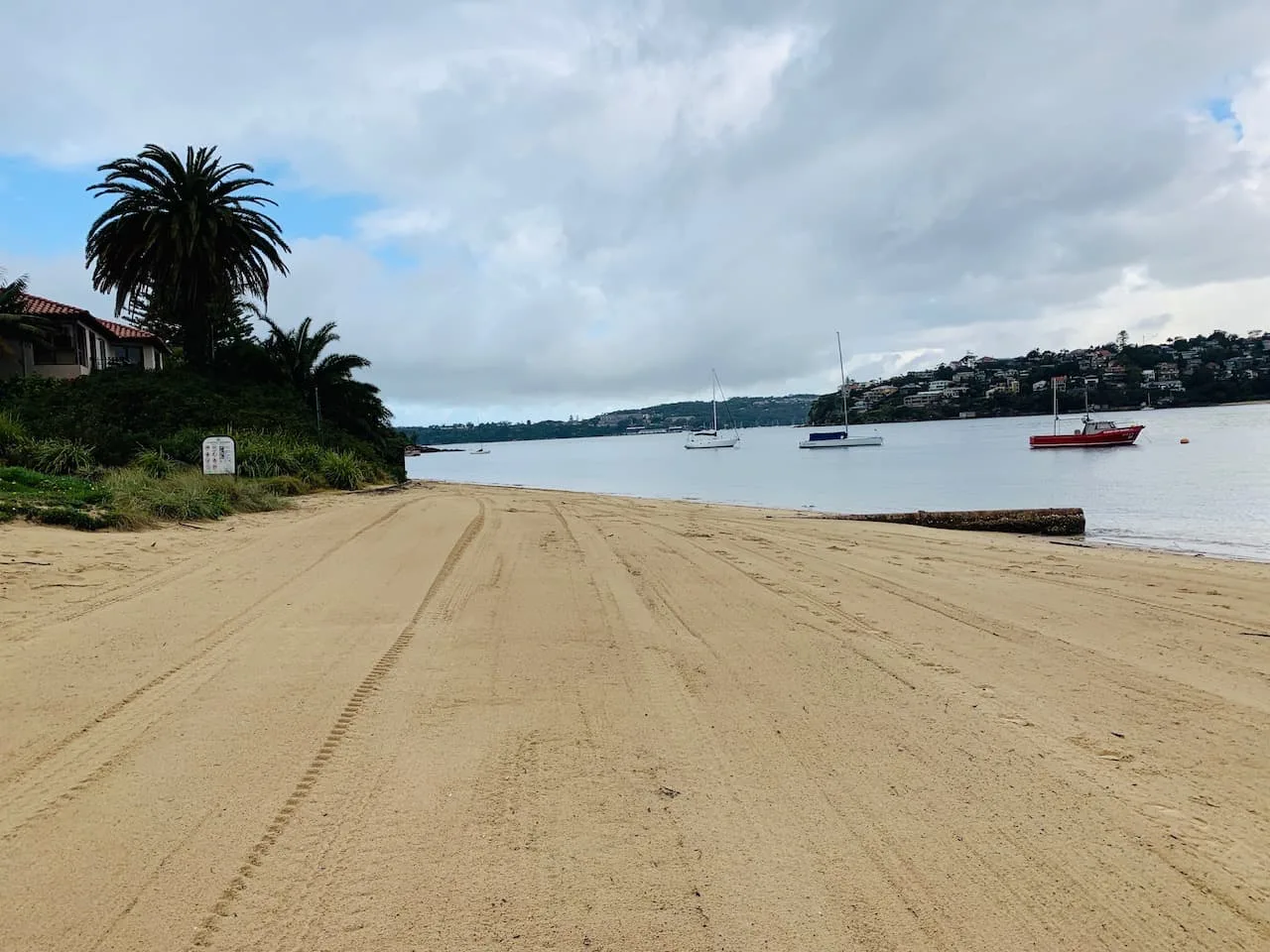
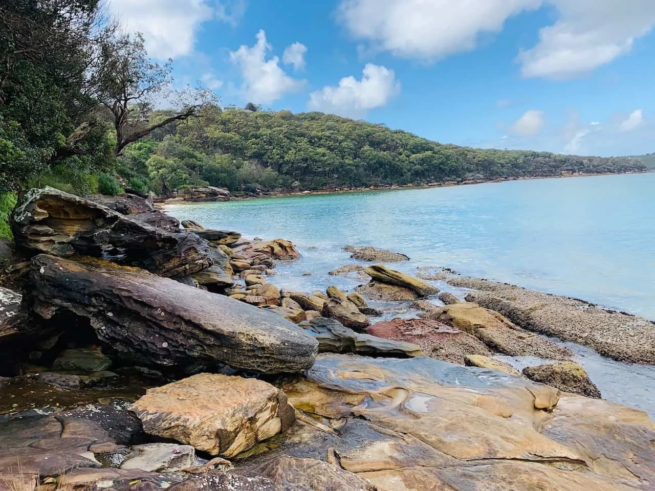
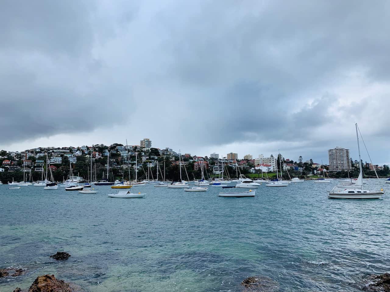
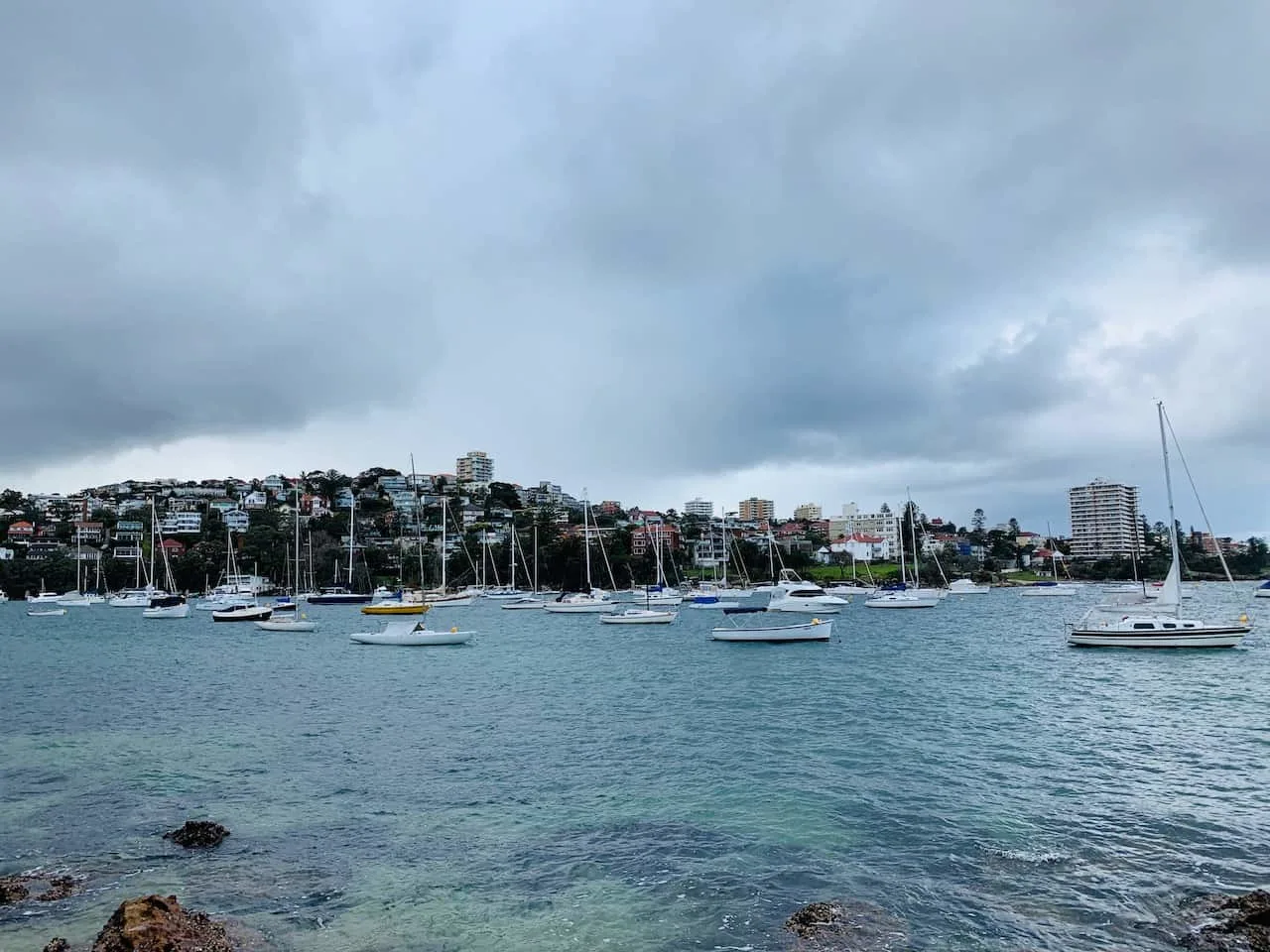
B) Sandy Bay to Castle Rock
After Sandy Bay you will make your way into the Clontarf Reserve, where you will find a marina area surrounded by a local park.
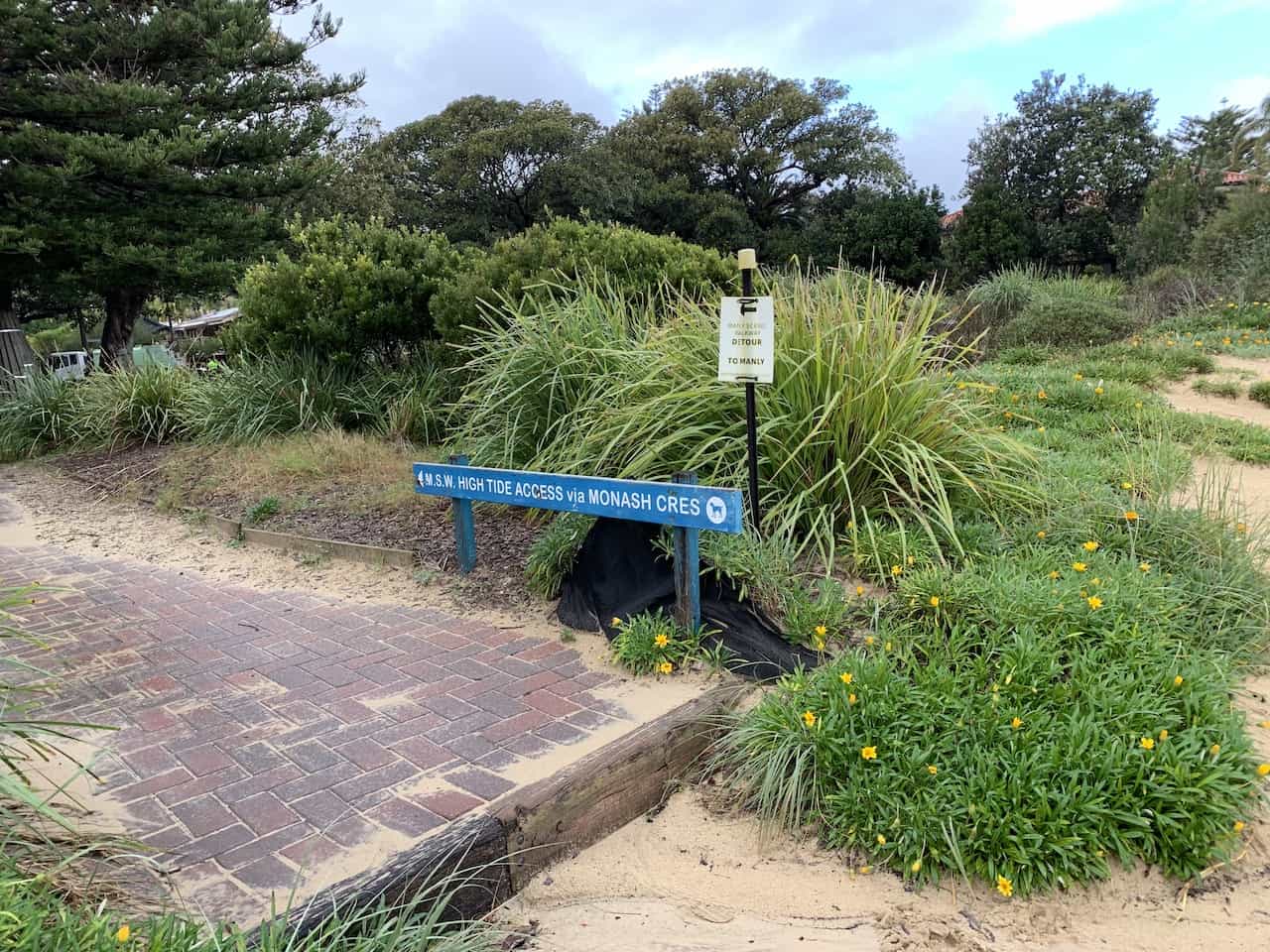
As you are walking along the beachfront, you will come to a point where there will be a low/high tide route option.
If it is low tide, you should be able to walk right along the beach up until Clontarf Point. If it is high tide you will need to follow the road along Monash Cres until you meet back up near Clontarf Point.

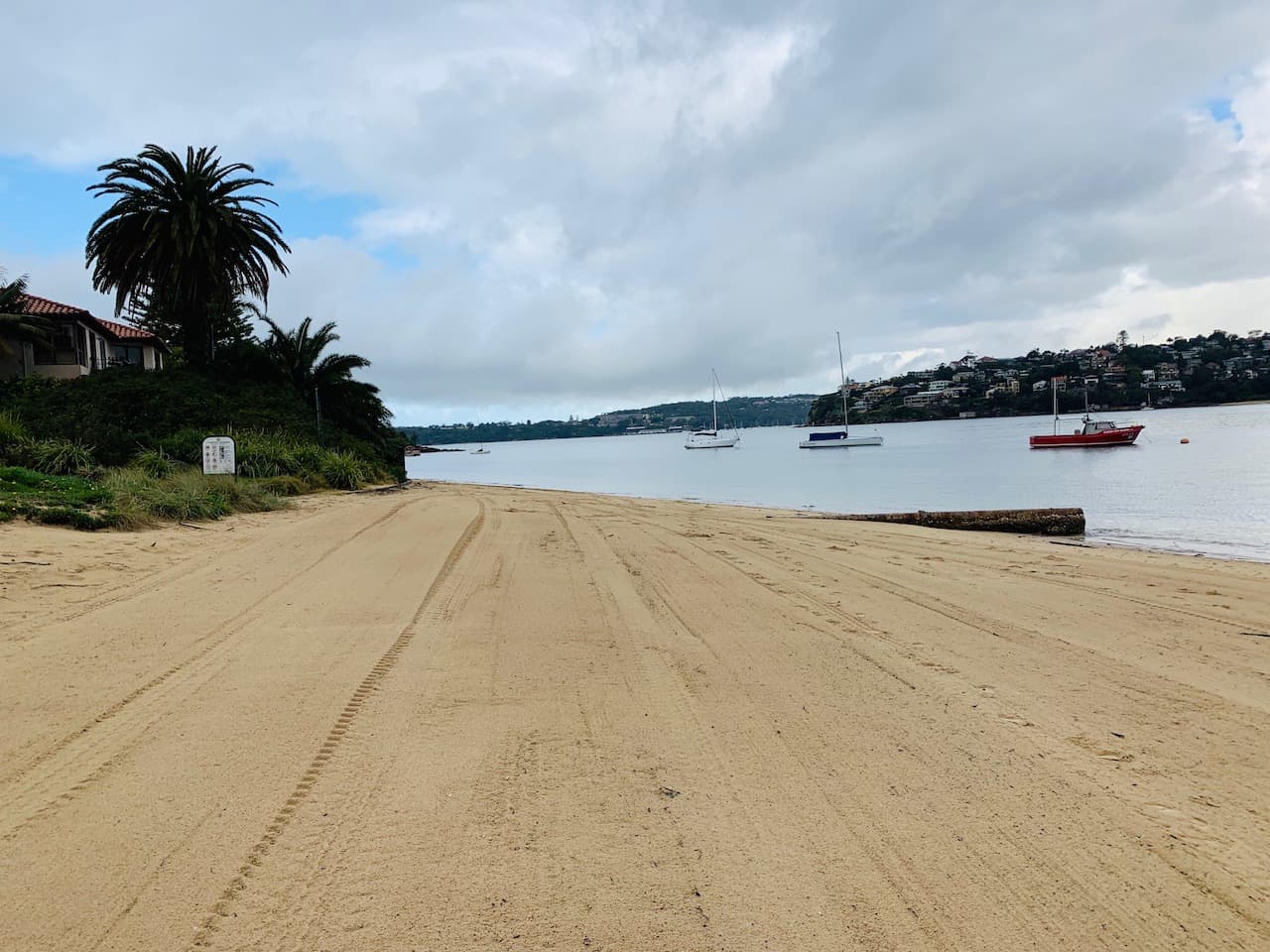

You will then be directed further up onto a higher track as you take in some views from above.
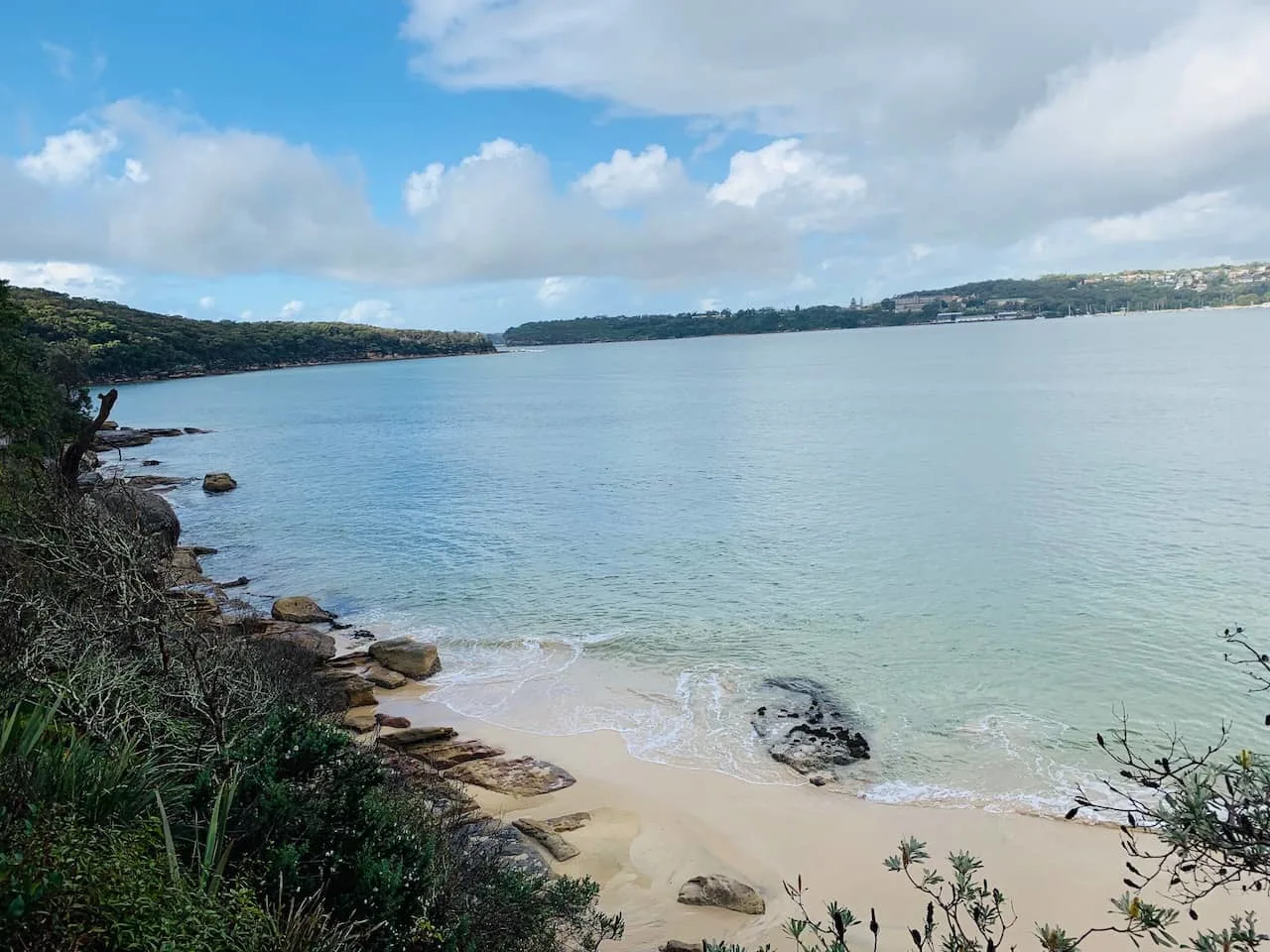
Down below you will get a great look at some small beaches, where you can opt for a quick swim or just take some time to enjoy the sand.


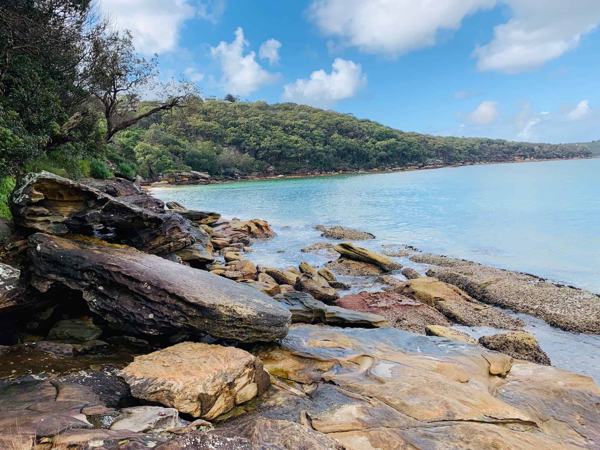
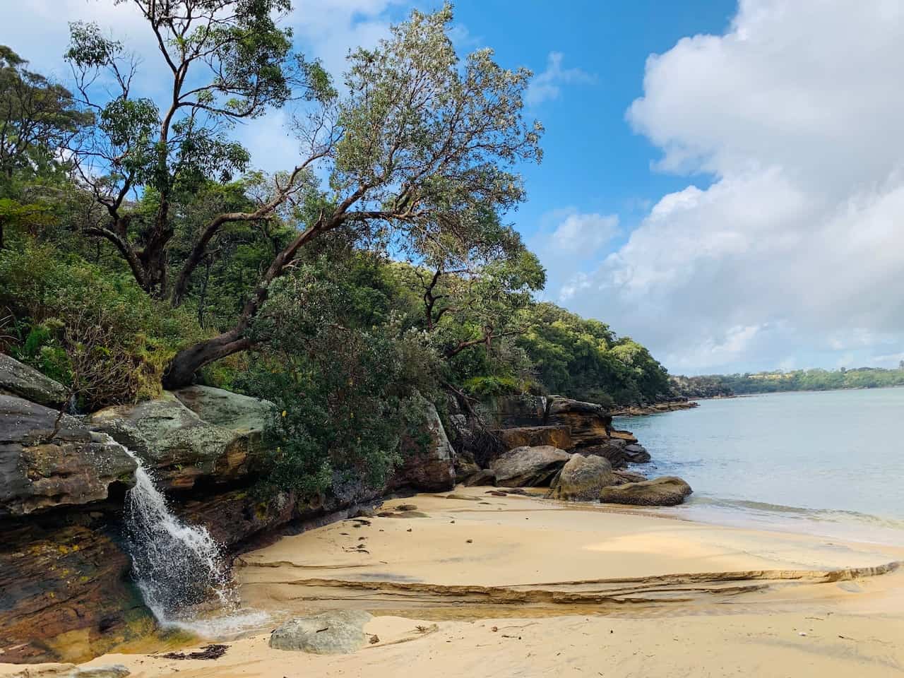
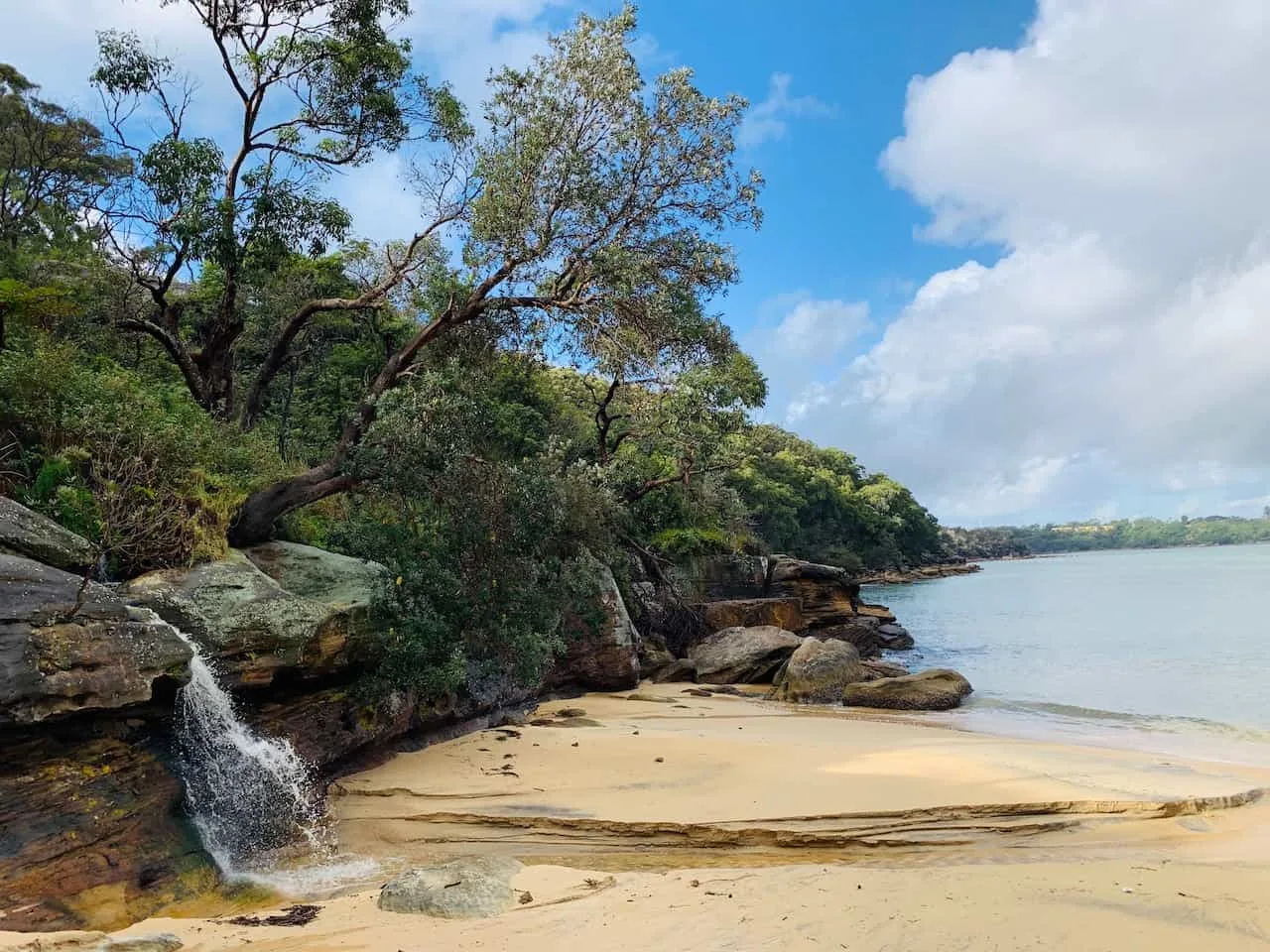
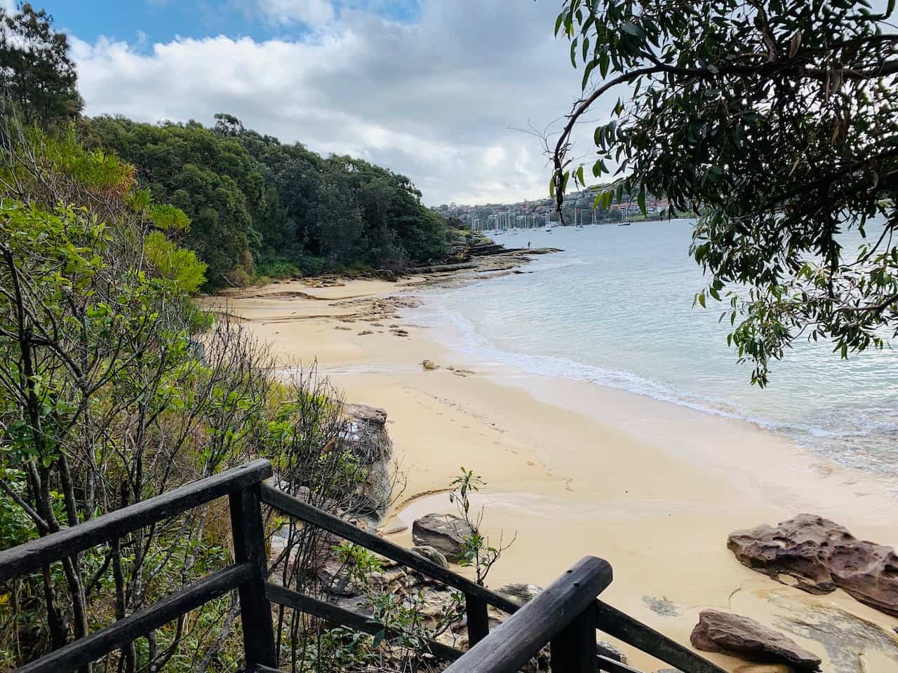
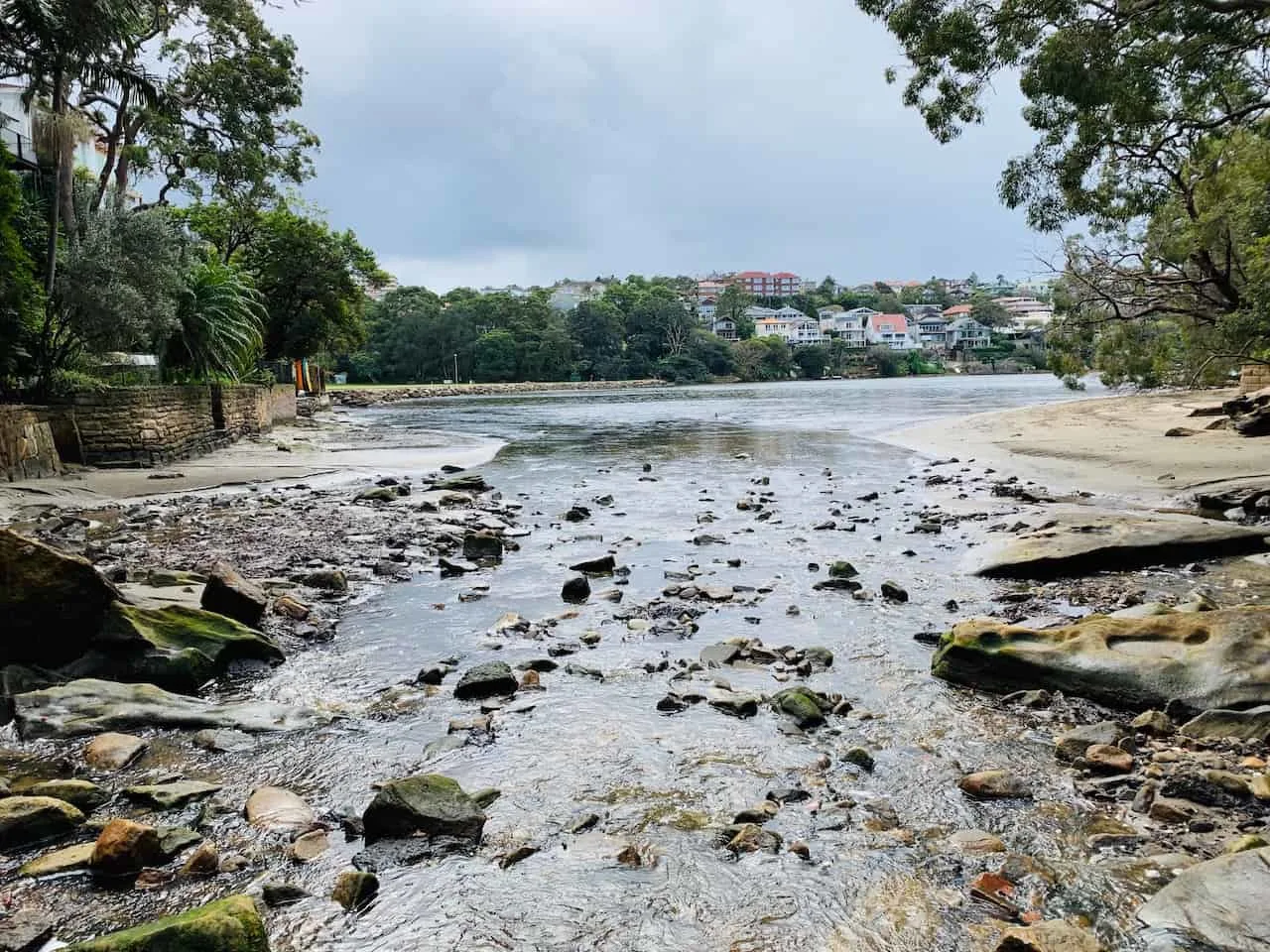
As you follow the path, the last small beach – Castle Rock – will come into view where you can enjoy the beach and its small waterfall flowing into the water.
C) Castle Rock to Reef Bay
Once you pass by Castle Rock Beach you will head into Dobroyd Head area. You will soon have the option to head to the Grotto Point Lighthouse at the end of the peninsula (it is a one way, there and back path).
Whether you head to the lighthouse or not, you will then pass by some indigenous rock art – these aboriginal carvings are thought to date back 1,000+ years.
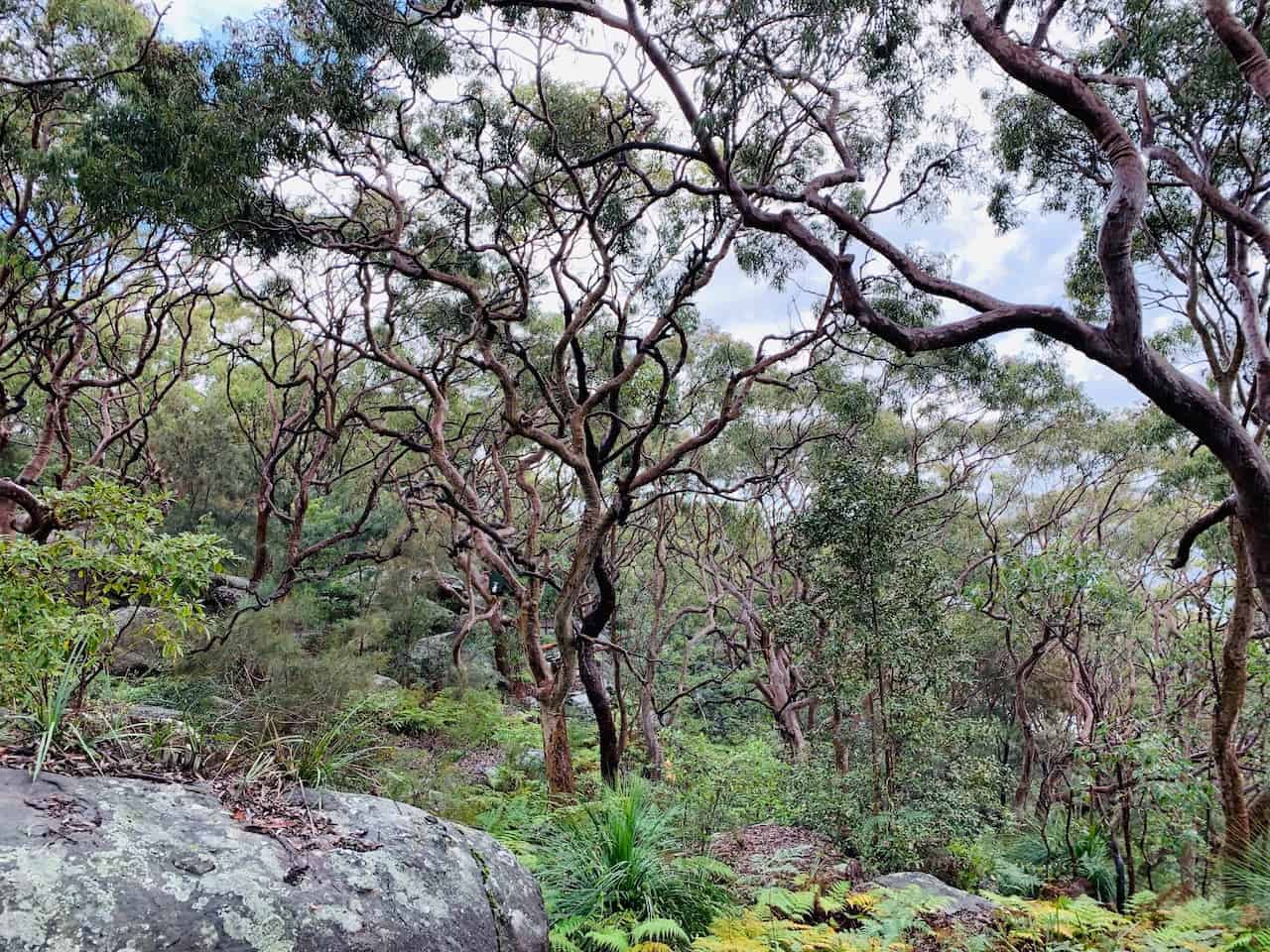
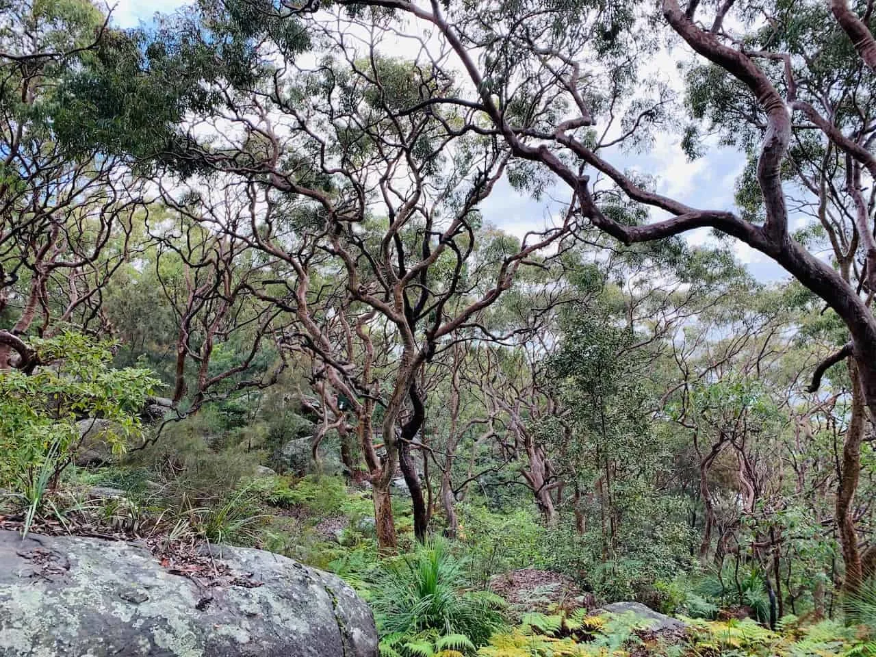

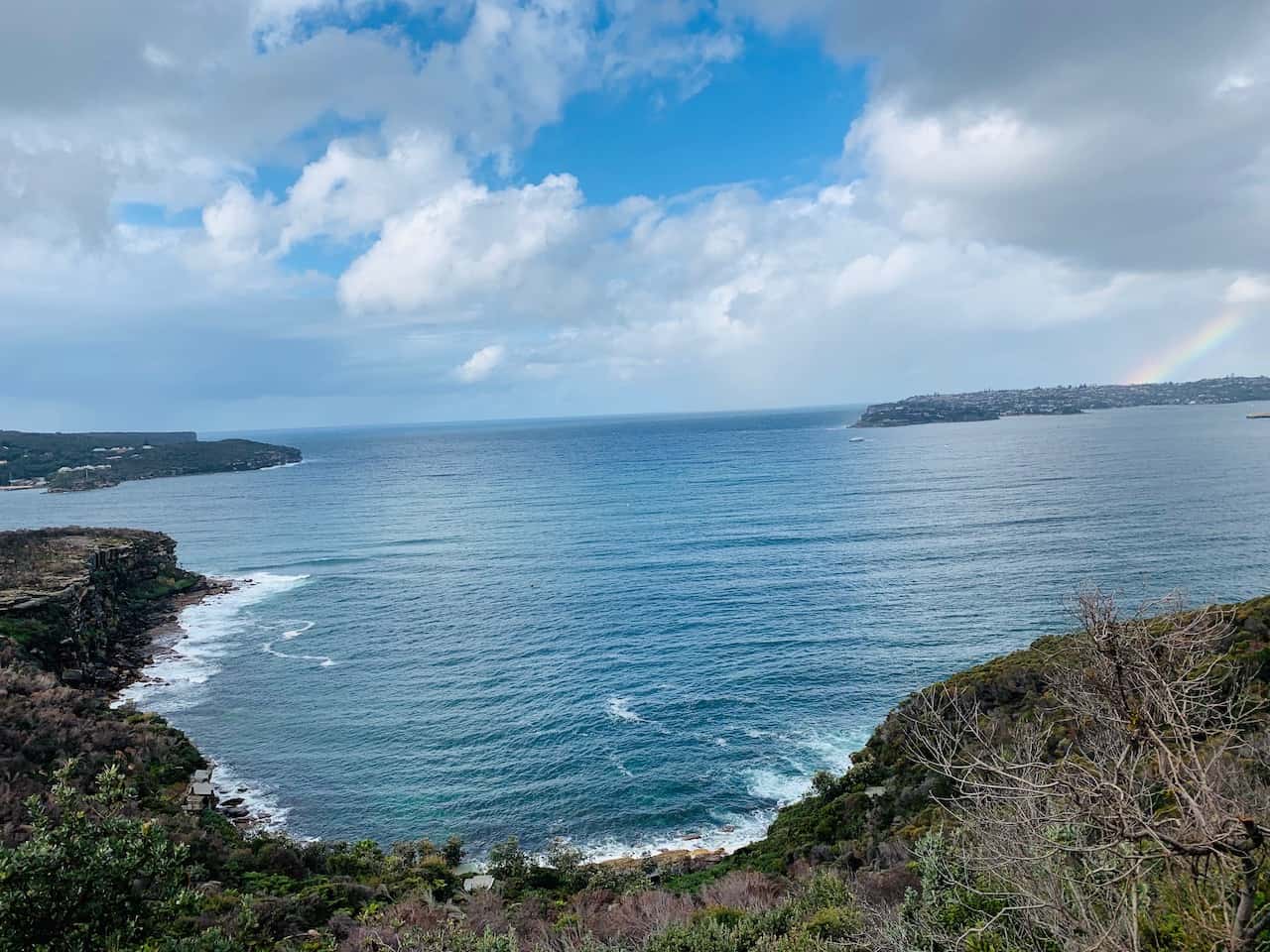
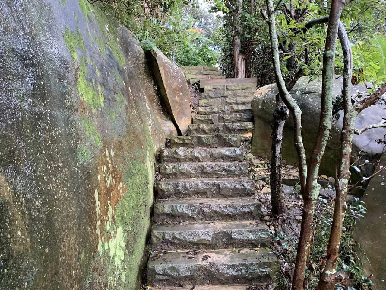
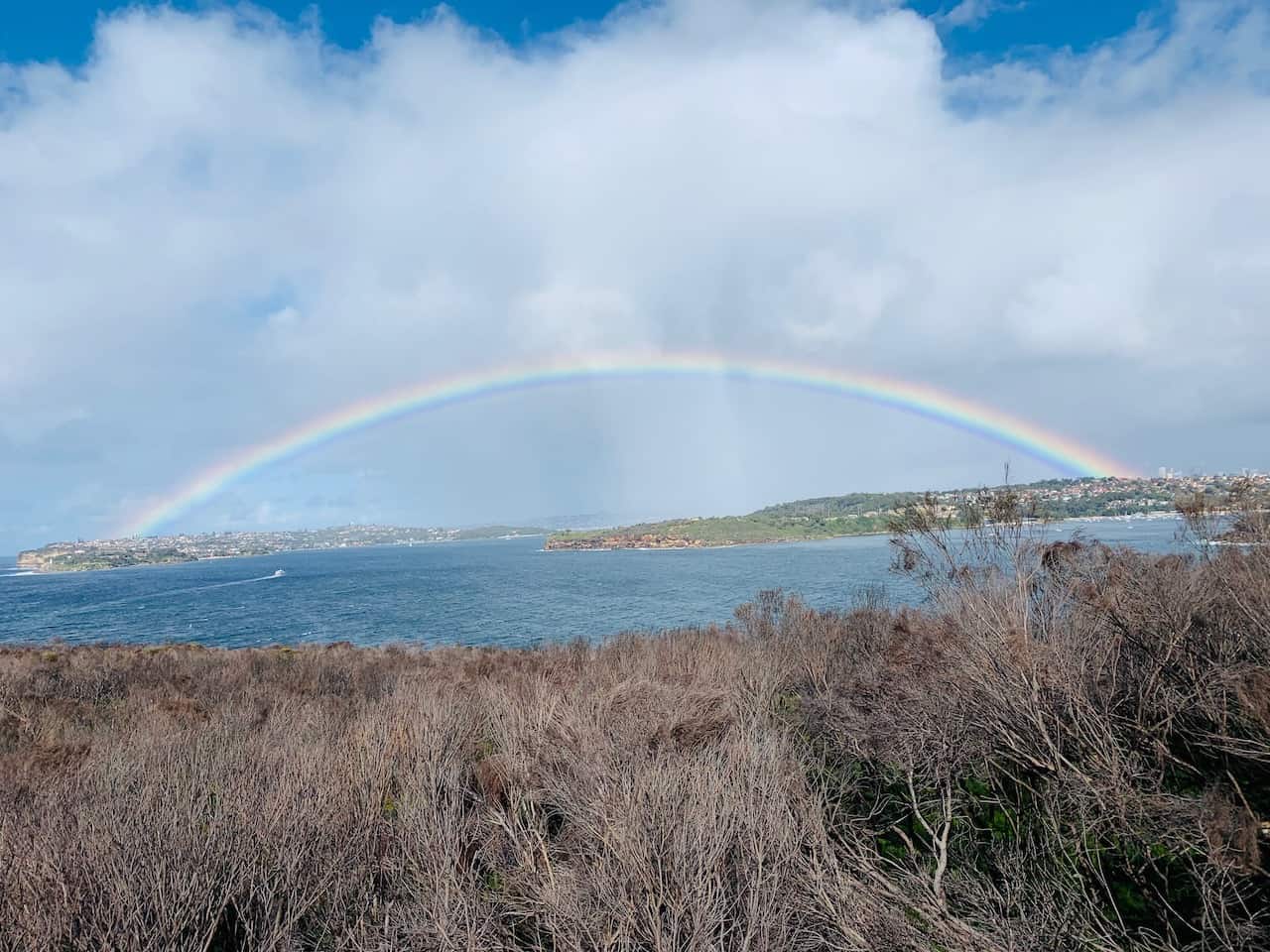
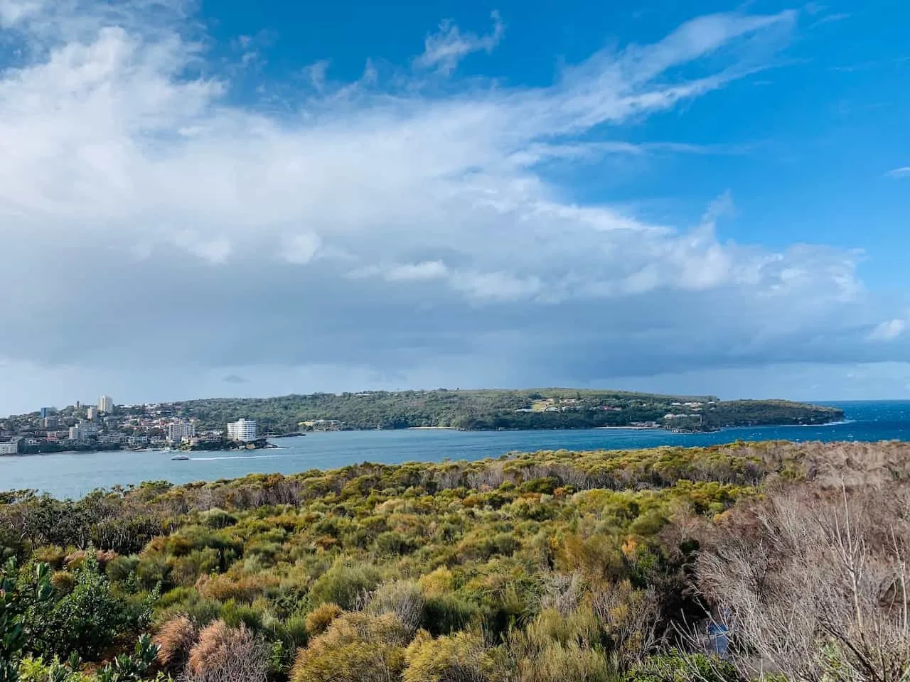
Continue up along on the stairs and boardwalk, until you reach a great lookout spot called Crater Cove, where you will take in the view from above.
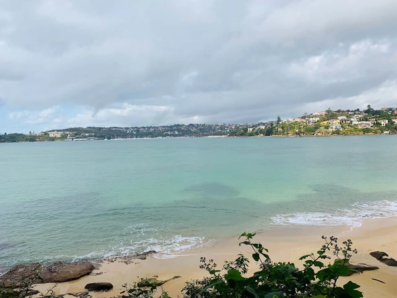
You will then be directed back down as you get closer to the water and have some more great views of the Manly area out in the distance.
During this section, there was an incredible full rainbow that appeared over downtown Sydney.


Your next destination and resting point from here is Reef Bay, another small beach where you can opt in for a swim and a rest.

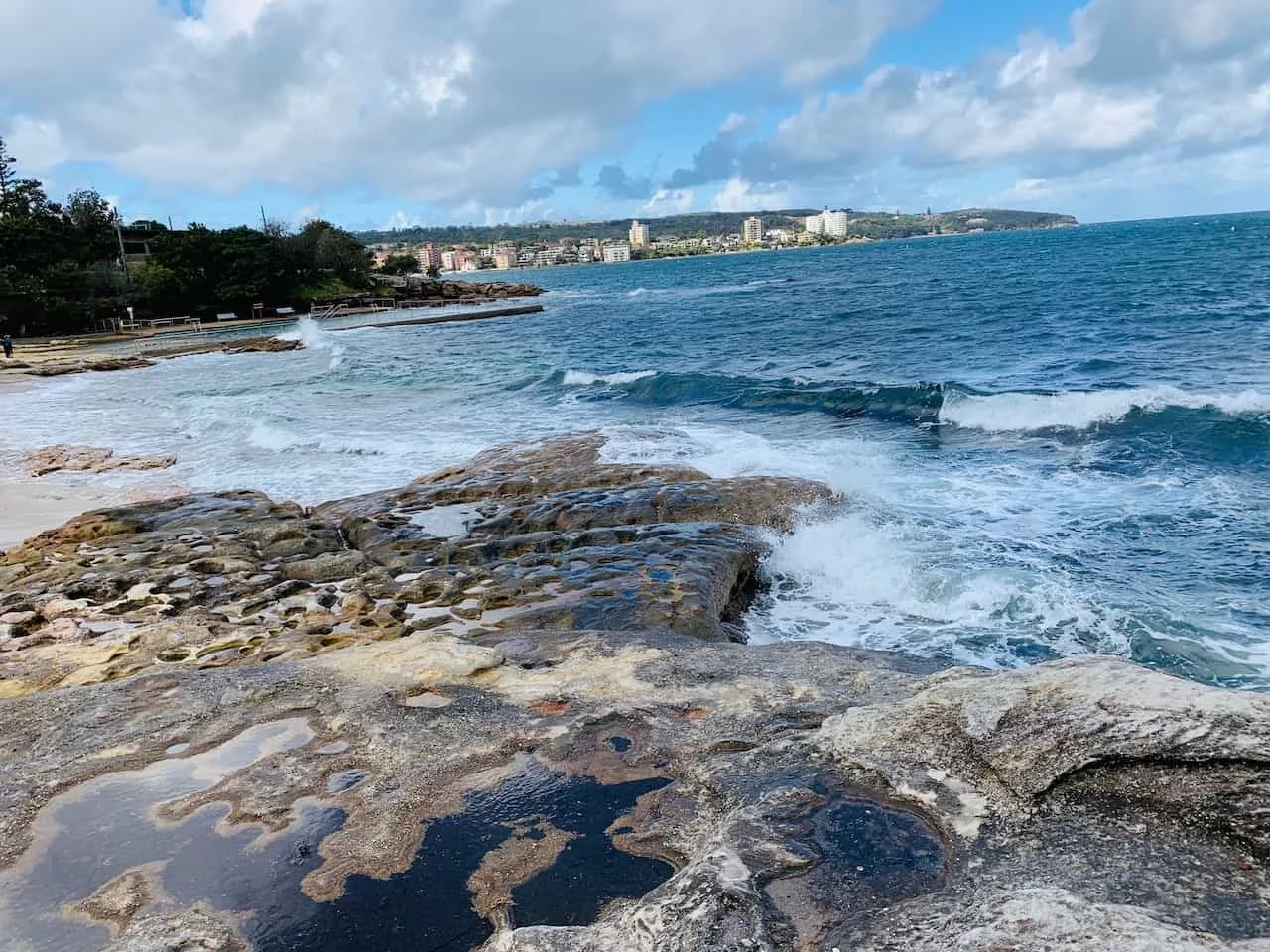
D) Reef Bay to Manly
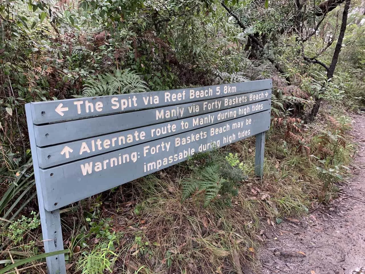
The final part of the Spit Bridge to Manly walk, will take you all along the coastline until you hit Manly itself. Shortly after Reef Bay, you will come across another low/high tide route near Forty Baskets Beach.
During this stretch during low tide you have the option to head right up on the coastal rocks as you pass by the Forty Baskets Beach area and towards Davis Marina.
If it is high tide you will need to head on up to the street level to get around this coastal section and down to the beach.

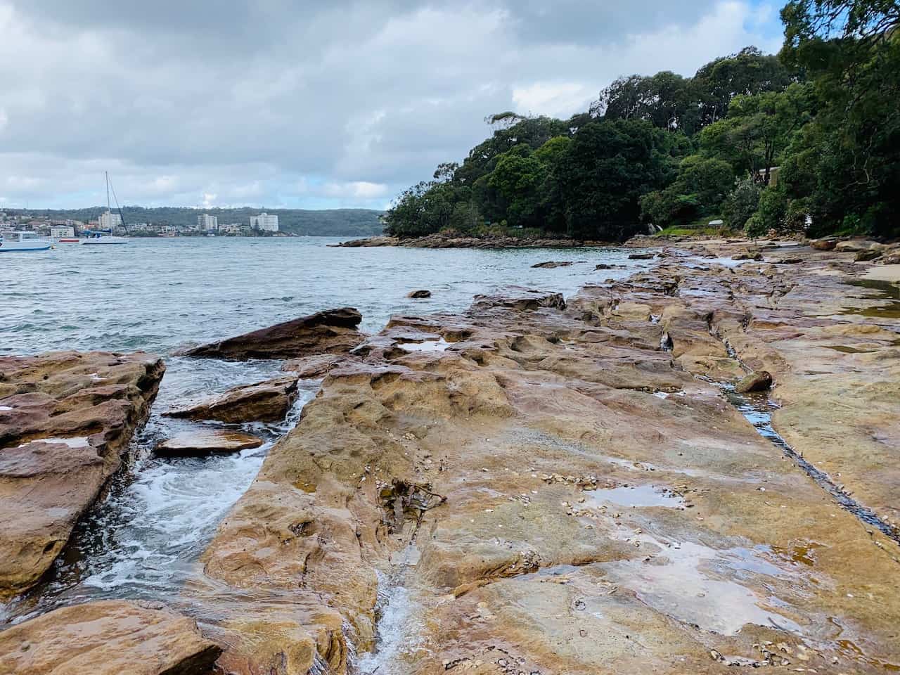
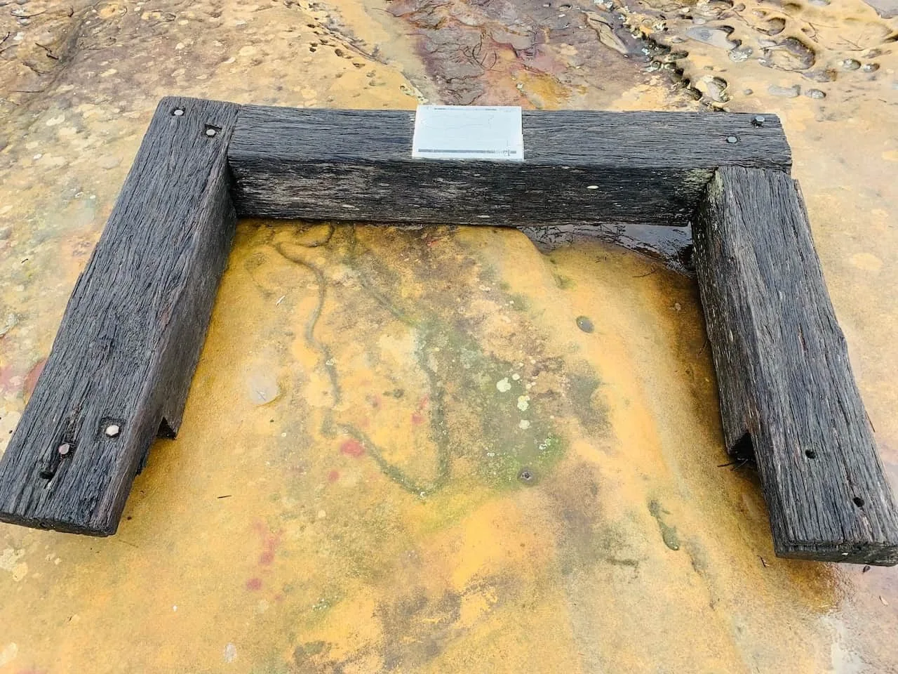
At Davis Marina, there is yet another low/high tide option and this one needs very low tide to fully get around. If it is low tide, you can walk your way along the sliver of beach and back onto the coastal rocks.
Continue around the coastline until you reach the North Harbour Reserve. The high tide route will take you up Gourlay Avenue, where you can meet back up at North Harbour Reserve to continue the walk.

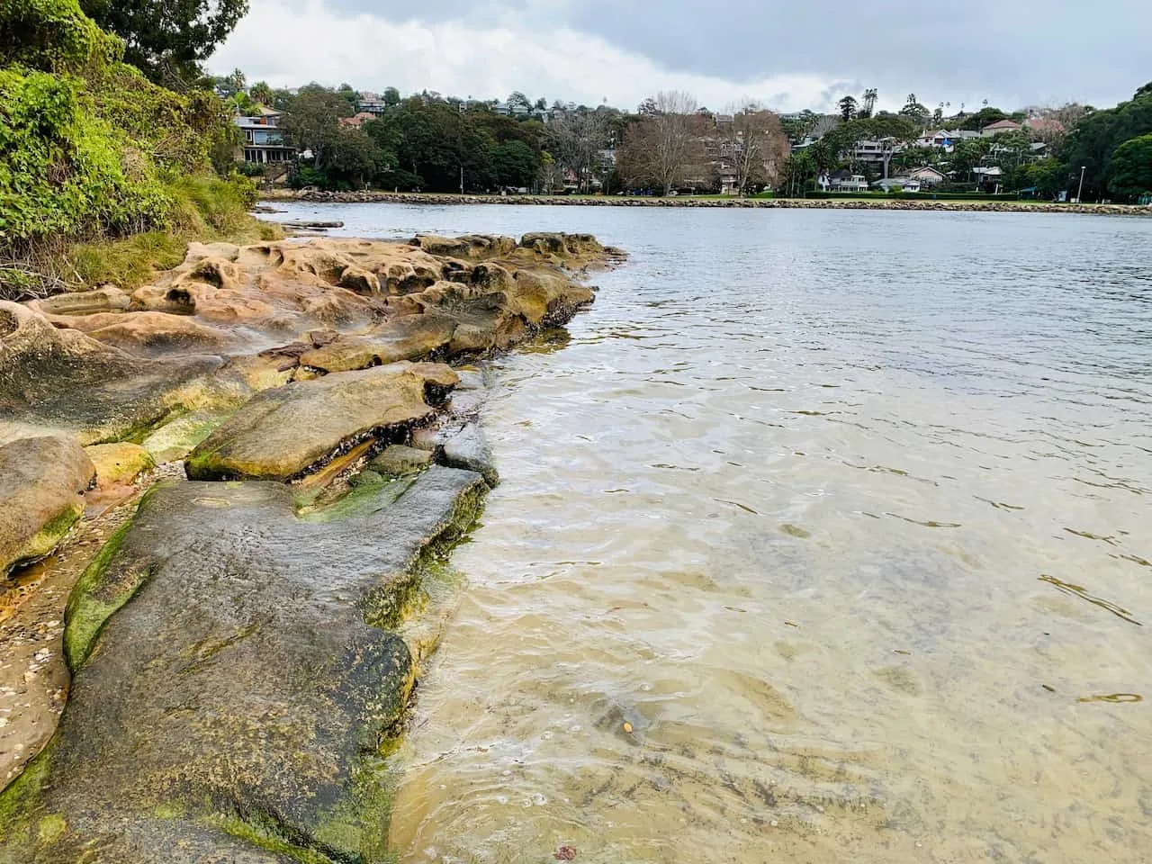
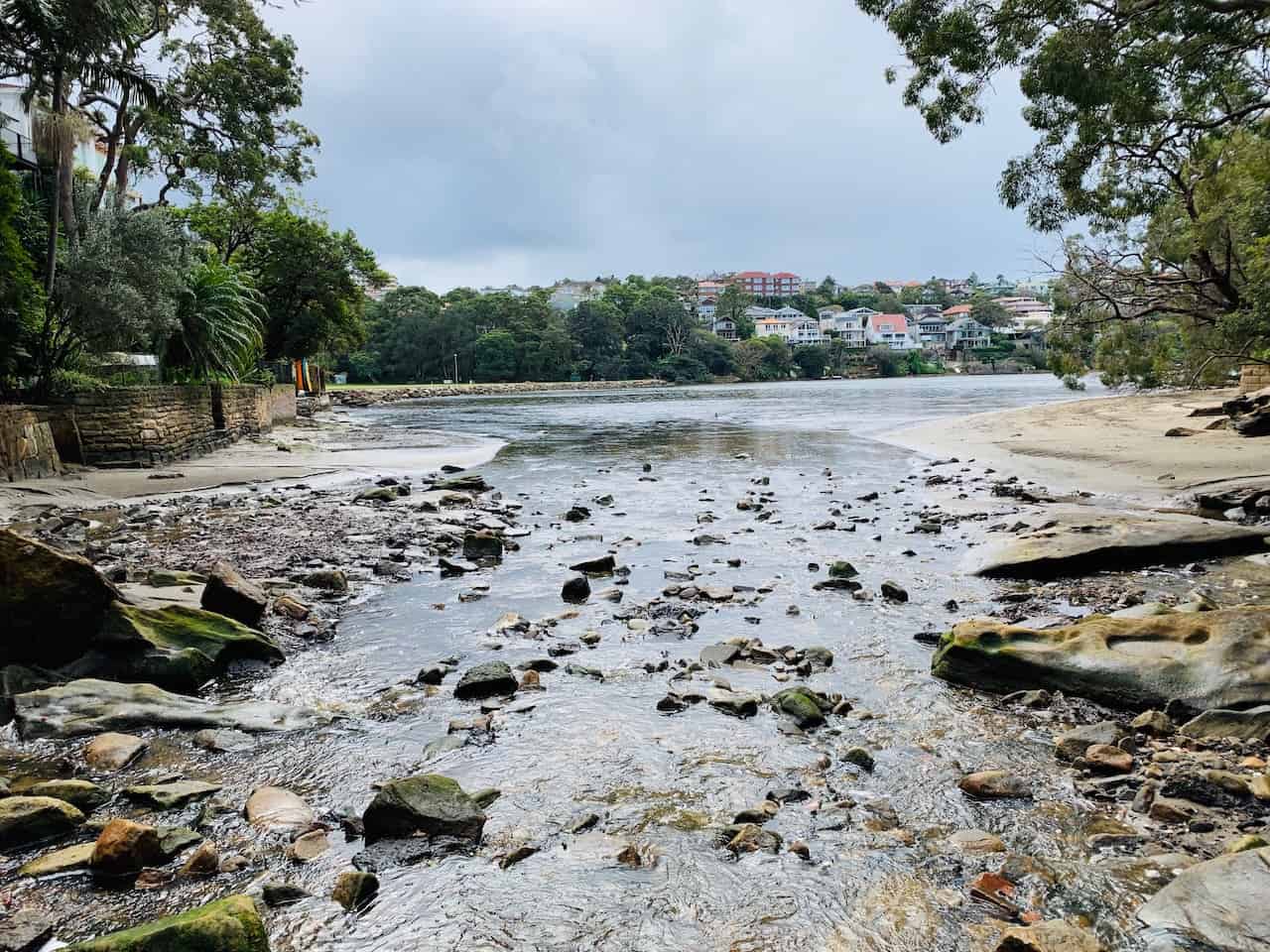
Note: while I did do the walk during low tide, the very end of this section near the North Harbour Reserve was just barely passable (the picture right above), so do be aware. Either way, if you come to a point where it is not passable, simply turn back around and head on the high tide route.
After making your way through the reserve, you will end up on the street, where you can continue shortly after on the North Harbour Walk (the pathway closest to the water).
The rest of the walk is pretty straight forward as you head towards Manly. The route ends up going right along the waterfront as you enjoy the final portion of the Spit Bridge to Manly walk.

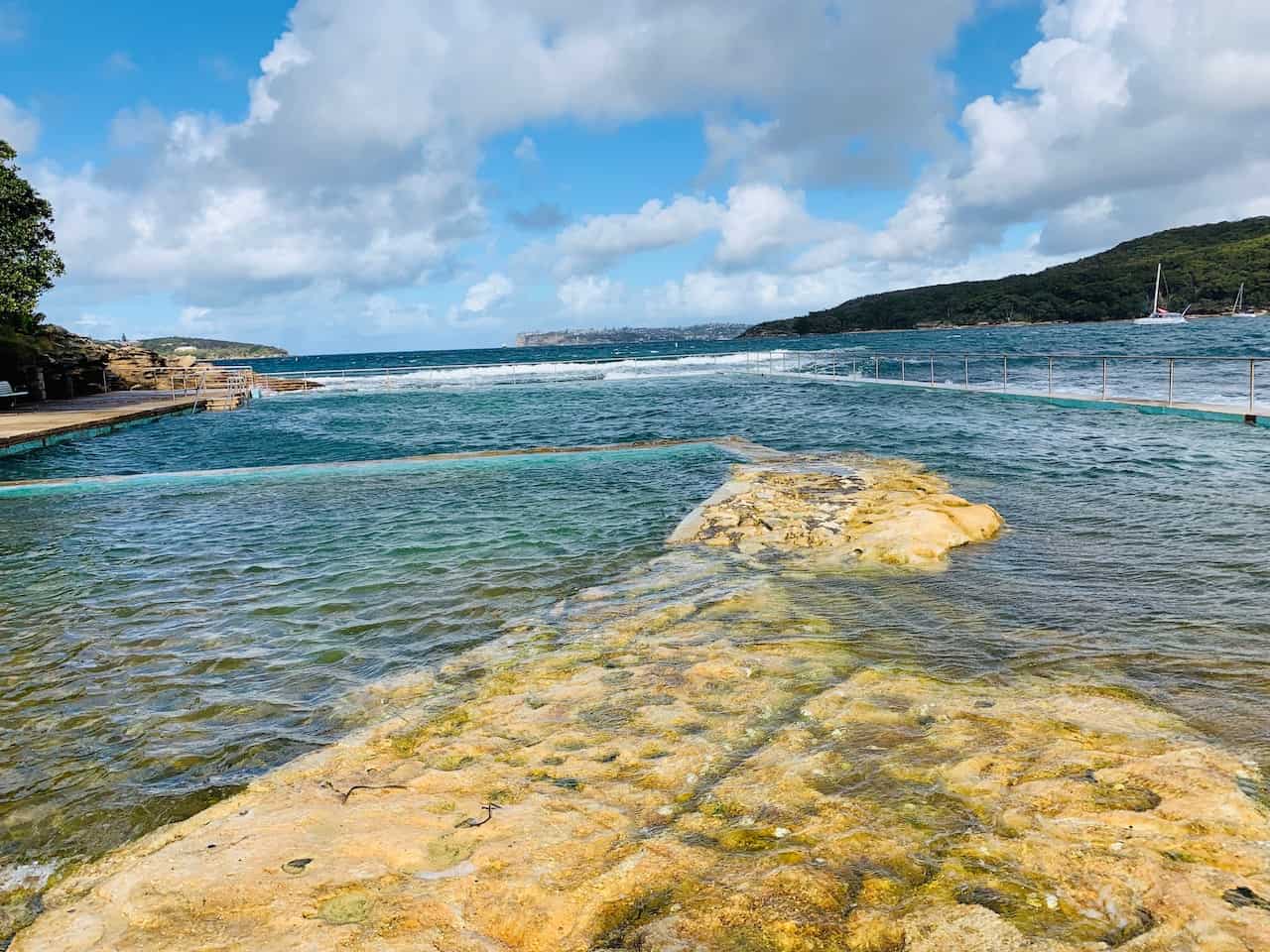
The Fairlight Tidal Swimming Pool is another highlight of this portion of the walk if you want to get in some pool swimming right up in the water.
After the swimming pool are just another couple beaches – Delwood Beach and Manly Cove – until you reach the end of the walk right at the Manly ferry terminal.

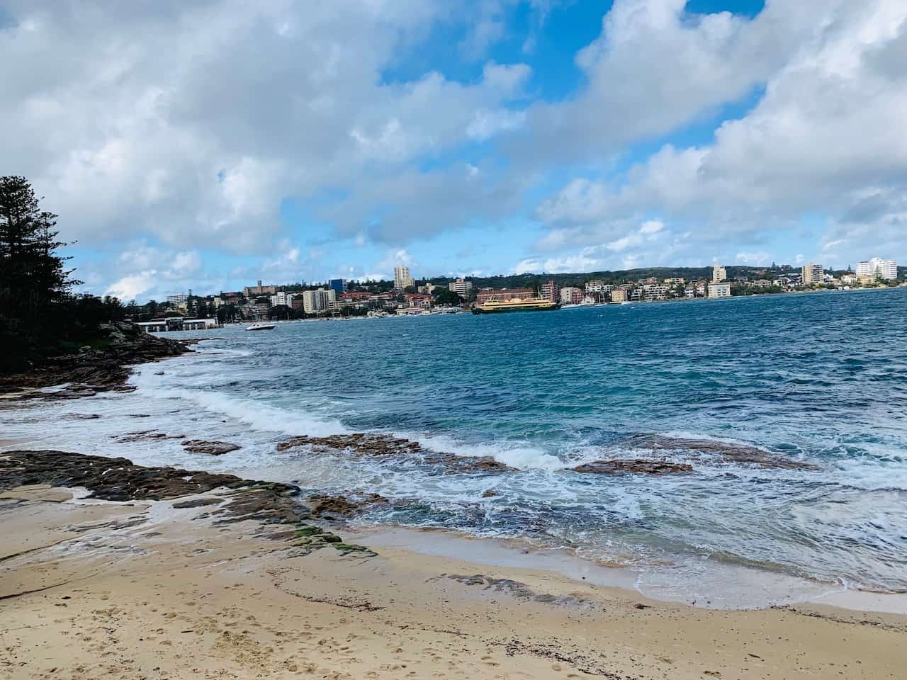

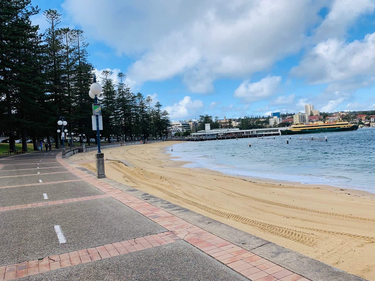

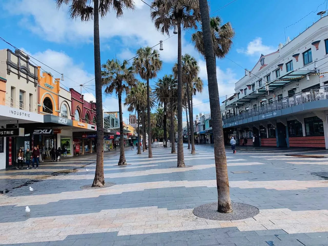
E) Manly
Once in Manly, you can take some time to explore the town for a bit. This was just one reason why I thought it was best to go from Spit Bridge to Manly and not vice versa.
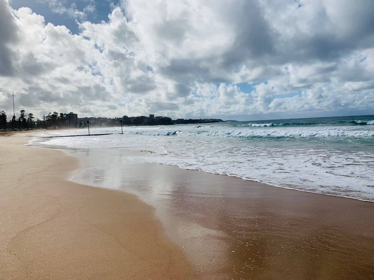
After walking the town and grabbing some food, head on over to Manly Beach to end your day on one of Sydney’s best coastal walks.


5) Continue the Trail
While the Spit Bridge to Manly walk is the main attraction here, there actually is a continuation of the trail once in Manly.
An additional 10KM / 6 Miles route takes you all around the North Head area, where you can make a big loop ending back in Manly.
Now to do this all in one day may be a stretch. But if you have some extra time around the area, this can be a great addition to your itinerary.
6) Getting back from Manly
Once all finished up in the Manly area, it is time to head to the Manly Wharf ferry terminal, where you can hop on a 20 minute ferry directly back to Circular Quay.
The one way ticket for the ferry costs $9.80 AUD and runs every 20-30 minutes, so no need to worry too much about catching the boat back.
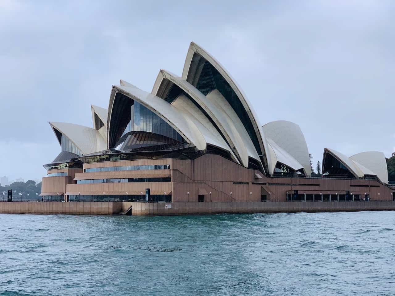
Along the way to Circular Quay you will get some great views of downtown Sydney and the Opera House.
→ Add the Spit to Manly walk as part of your longer Australia itinerary. Check it out to learn more!


7) Where to Stay in Sydney
There are a variety of different options to choose from when deciding where to stay in Sydney. One of the most popular options is to just stay within the Sydney Harbour / CBD / Downtown Area.
There you will find plenty of restaurants and bars, easy public transportation access and of course be close by to some of Sydney’s best attractions.
Below are some accommodation choices at different price points to better help you make your pick.
Mid Tier
Luxury
Budget
That about wraps up your guide to the Spit Bridge to Manly Walk. If you want more helpful info about the country, take a look at the other Australia itineraries and guides up on the site.
If you have time in a couple other walks around Sydney, definitely check out the Coogee to Bondi Walk and the Coogee to Maroubra Walk.
You can take part of them all during your 3 day Sydney itinerary. And don’t forget to add on a day trip to the Blue Mountains while you are at it!
Feel free to leave any questions or comments below! Have fun out there and safe travels!