
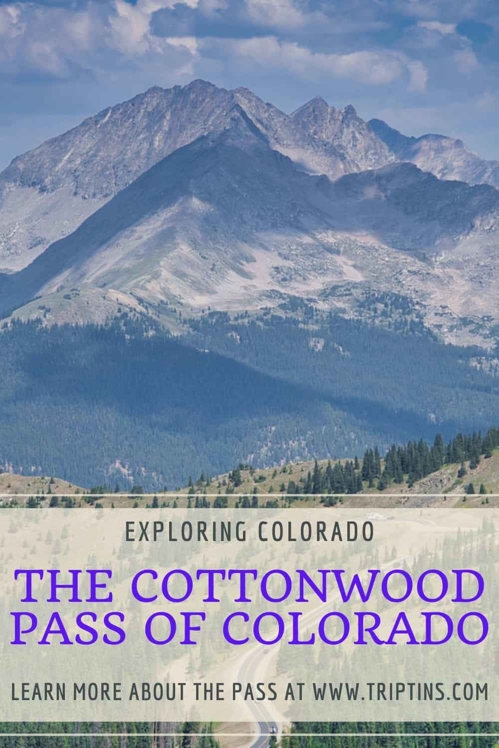
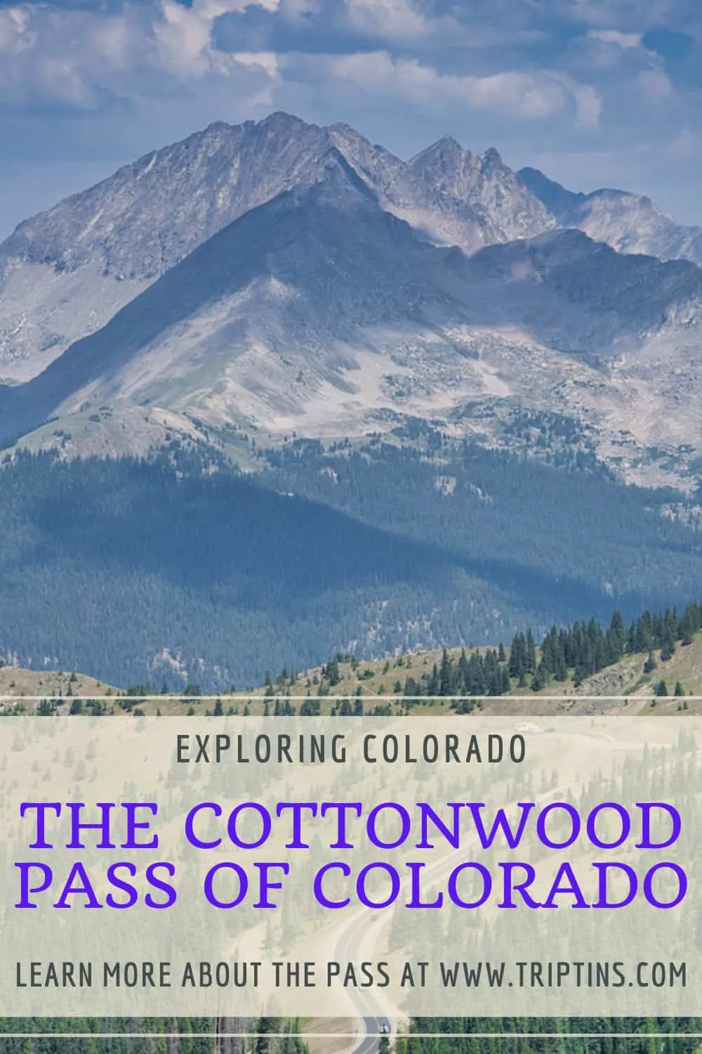
The Cottonwood Pass of Colorado connects the town of Buena Vista in the east to the town of Almont in the west. Along this beautiful 49-mile route, there is plenty to see and do as you make your way through.
Whether you are looking for viewpoints, lake hikes, 14er climbs, or hot springs, the Cottonwood Pass has it all for you.
This guide is here to walk you through what to expect along the Cottonwood Pass and how to go about a trip visiting one of the highest roads in Colorado.
* Affiliate Disclosure: This post may contain affiliate links, which means I may receive a commission if you make a purchase through the links provided, at no additional cost to you. Thanks for supporting the work I put into TripTins!
1) Overview & Background
To start, let’s go over an overview of the Cottonwood Pass along with some helpful details:
Name: Cottonwood Pass
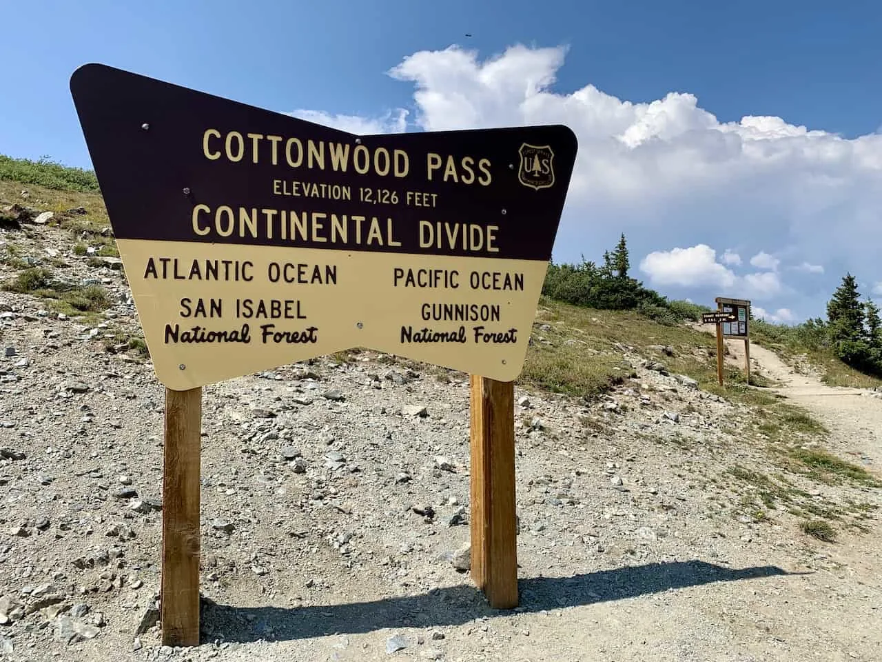
At the saddle of the Cottonwood Pass in Colorado marks the Continental Divide. The Divide is essentially a continuous set of mountain ranges in the Americas that divides the continent’s drainage eastwards and westward.
At the top of the pass lays the Continental Divide Trail (a 3,100 mile trail that runs all along the divide. A portion of this can be hiked here, which I will talk about later.
Note: there is a second pass with the same name in Eagle County (further north). The purpose of this guide though, is to talk through the Continental Divide pass.

Connecting Towns: Buena Vista (east) & Almont (west)
On either side of the Pass are the towns of Buena Vista to the east and Almont to the west. The pass is also the meeting point of the two neighboring forests – San Isabel National Forest (east) and Gunnison National Forest (west).
Length: 49 miles
The length of 49 miles represents the distance between the towns of Buena Vista and Almont. However, the actual Cottonwood Pass road would be slightly shorter than that since it wouldn’t go all the way into these towns.
Cottonwood Pass Elevation: 12,126 Feet
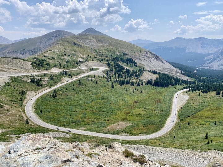
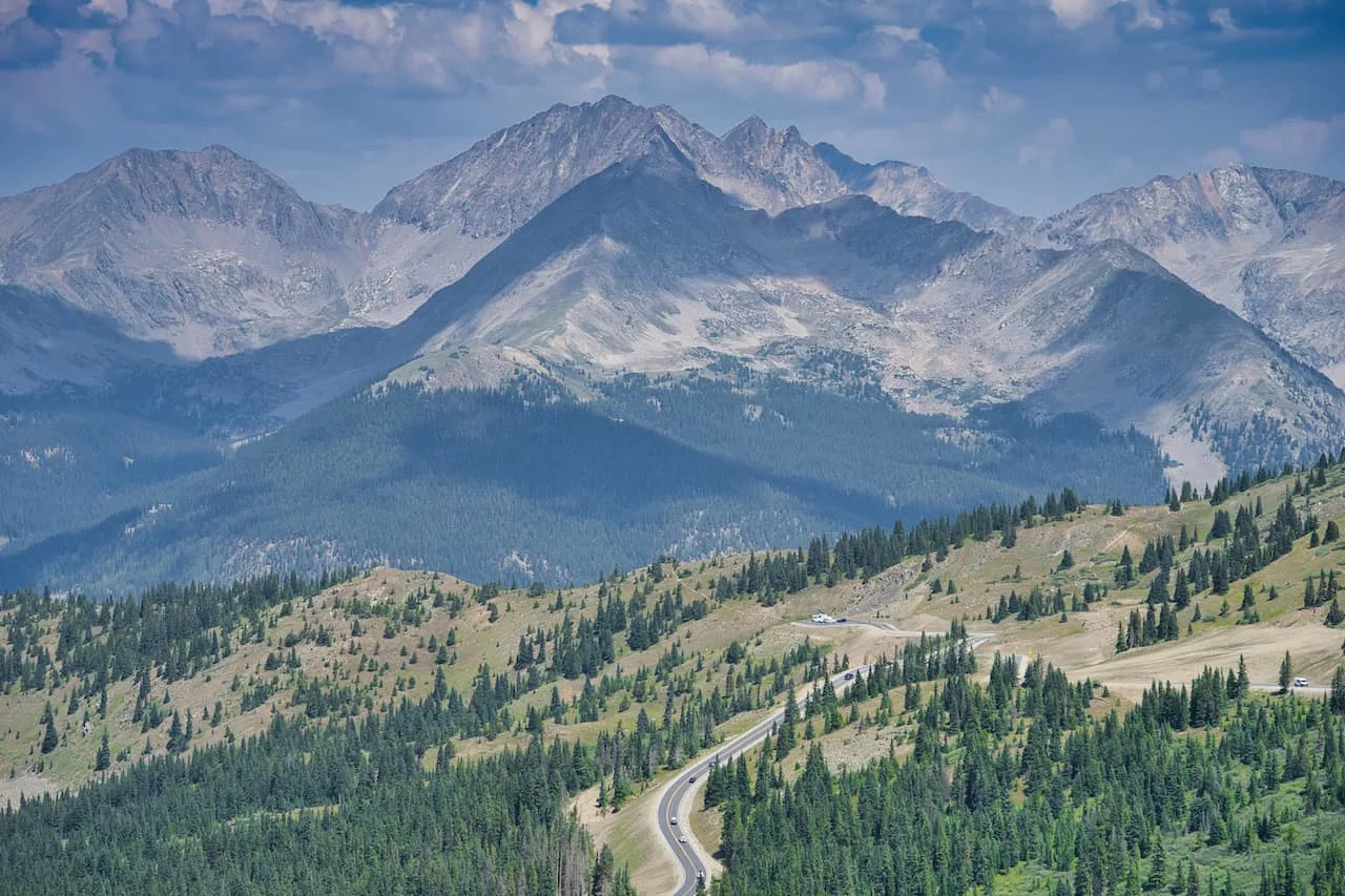
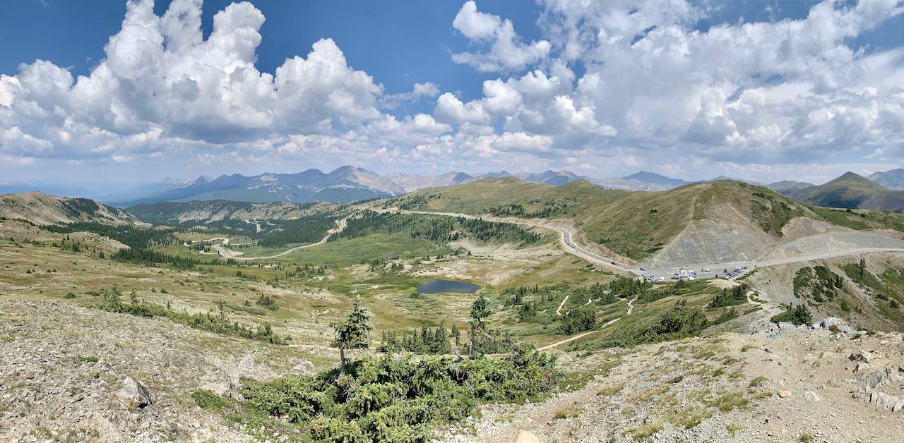
The highpoint of the Pass is 12,126 feet, which also marks one of the highest paved roads in all of Colorado. At the highpoint, there is a viewing area, which I will talk about later on.

Cottonwood Pass Open: ~June to ~October
Cottonwood Pass is a high mountain, curvy road which can experience heavy snowfall in the winter months. Due to this, portions of the road are closed when it becomes too dangerous to drive. This usually starts sometime in October and lasts until May.
Cottonwood Pass Road Conditions → also note that the entirety of the Cottonwood Pass is paved, so there is no need to worry about bumpy gravel roads along the way.
2) Cottonwood Pass Map & Directions
Below you can find an interactive Cottonwood Pass map that highlights many of the top places to visit during a visit.
It includes viewpoints, camping spots, trailheads, and more. Throughout this guide I will be going to more detail about several of these spots.
You can also find the route between Buena Vista and Almont. The route starts on Chaffee County Road 306 in the east before turning into Gunnison County Road 209 to the west towards Taylor Park Reservoir.
→ Renting a car in Colorado? Be sure to check out Rentalcars.com to browse through a variety of car rental options for your trip
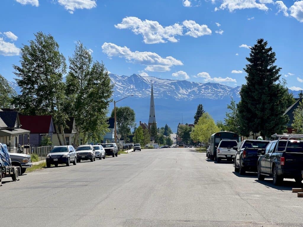
3) Where to Stay in Buena Vista
While there are many places you can choose to base yourself around the area, I would recommend staying in either Buena Vista (right at the start of the pass) or Leadville (60 minute drive).
These are great places to stay if you are looking to not only visit the Pass but also many 14ers and other hikes around the area. Below are a few highly recommended places to stay in each of them.
Buena Vista
- Surf Hotel & Chateau
- Best Western Vista Inn
- Mount Princeton Hot Springs Resort (just outside town)
Leadville

4) Cottonwood Pass Viewpoints
Along the Pass, there will be a few spots, where you can park your car and take in a nice view of the surrounding landscape. I pinpointed three of these spots on the map above:
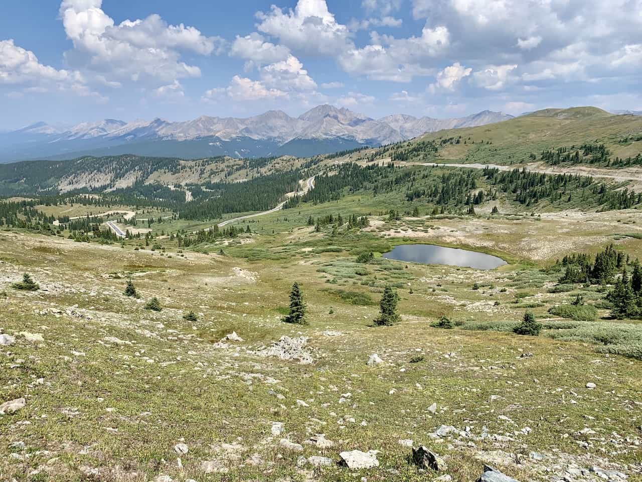
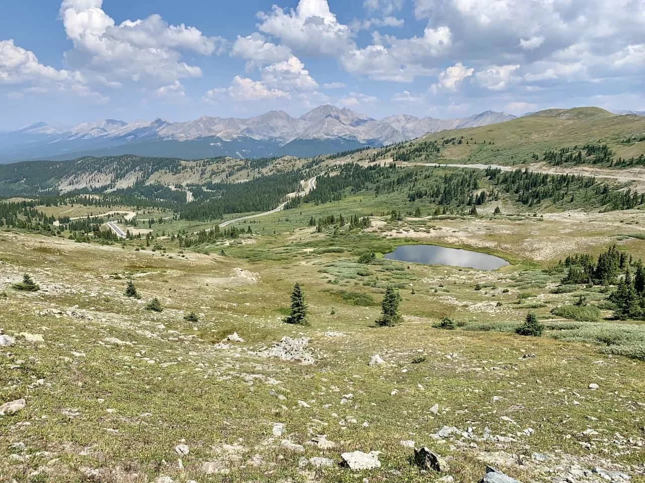
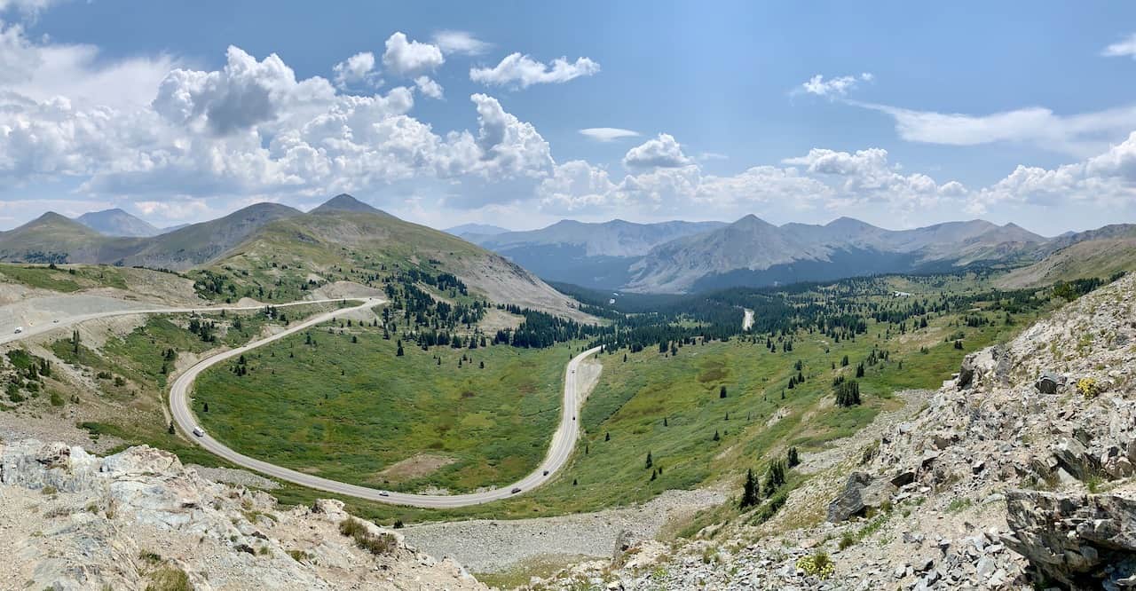
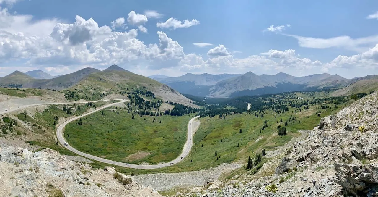
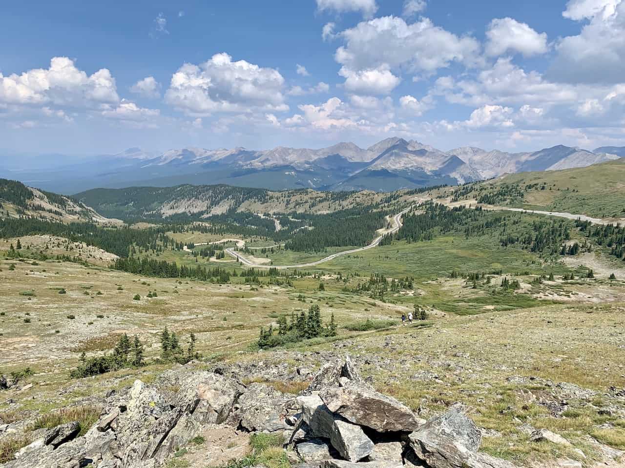
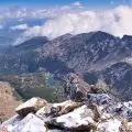
Cottonwood Pass View: at the highpoint of the Cottonwood Pass, there is a parking area off to the side of the road. From the parking area, it is a short trail to a viewing spot (0.2 mile walk). Here you can get some beautiful views in all directions of the winding road and natural beauty all around.
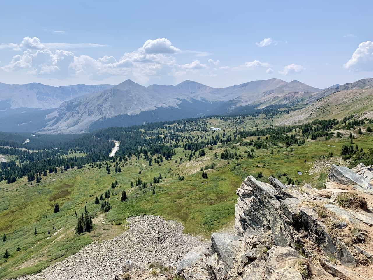
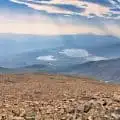
Cottonwood Pass View #2: I also pinpointed a second viewpoint area that is just a bit further down the road from the high point. Here you can get some alternate views of Cottonwood Pass from above with the Taylor Park Reservoir out in the distance.
Taylor Park Reservoir: the last viewpoint here is not from above, but rather from the shores of the Taylor Park Reservoir. The view from the shore gives you the chance to take in the vastness of the reservoir with all the mountain peaks hovering out in the distance.

5) Cottonwood Pass Campground & Camping
The roads that make up the Cottonwood Pass (Chaffee County Road 306 and Gunnison County Road 209) has many different campsites all along it. Some of the main campsites include:
→ Collegiate Peaks Campground
→ Hughes Meadow Campground
→ Rivers End Campground
→ Lakeview Gunnison Campground
You can find these trailheads marked on the map above. Some are going to be closer to the Buena Vista area while others closer to the Almont area.
6) Cottonwood Pass Trails
Not only are there viewpoints to enjoy along Cottonwood Pass but there are also many hiking opportunities just off the road.
Some of these are shorter lake hikes while others are full on 14er climbs. Below are some of the top options to consider along the way:
Cottonwood Pass Peak
At the main viewing area, there is an option to just walk the 5-10 minutes to the standard viewpoint or you can opt to hike up to the Cottonwood Pass Peak, and a portion of the Continental Divide Trail.
The round-trip hike from the parking area is about 1.2 miles in length and gains around 425 feet. So, if you want to get a bit higher than the main viewing area and take in some better views, then continuing the hike up is well worth the effort.

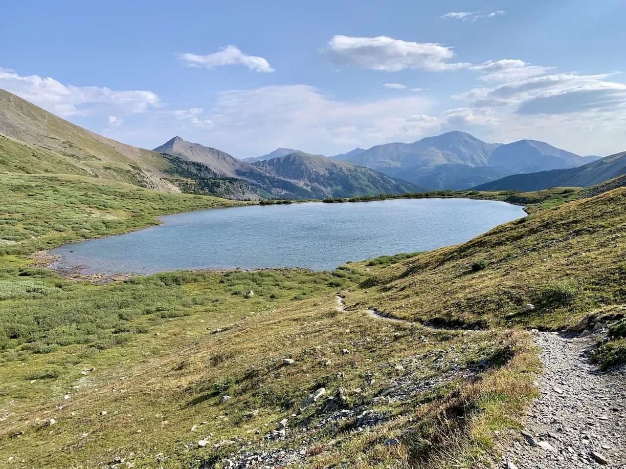
Ptarmigan Lake Trail
A beautiful lake that lays just off of the main road here is Ptarmigan Lake. The round-trip hike to Ptarmigan from the roadside trailhead is 6.5 miles and gains about 1,430 feet of elevation.
Not only does the hike visit the main Ptarmigan Lake but the route also passes by several other lakes along the way.
This is certainly a longer hiking option but it can be paired perfectly with a visit to the Cottonwood Pass.
→ Learn more about the hike in the Ptarmigan Lake trail guide up on the site

Lost Lake Trail
Another great lake hiking option is the one to Lost Lake. The lake itself is very unique as you will find a small island within the lake itself. The round-trip distance is about 2.5 miles with about 450 feet of elevation gain.
If you are not up for the longer hike to Ptarmigan, then Lost Lake can be a great option. Note that there is not a set parking area here. Rather, just pull over to the side of the road near the trailhead and begin from there.
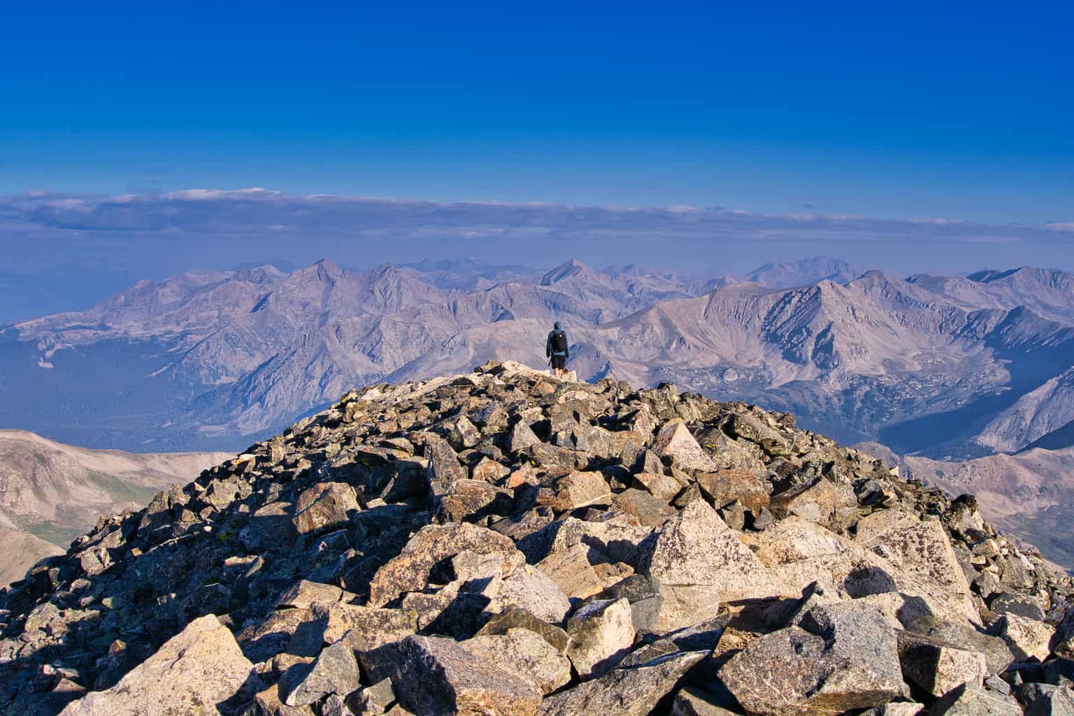
Mount Yale 14er
If the previous hiking options don’t sound tough enough for you, then why not add a 14er to the day – Mount Yale at 14,196 feet.
The Mount Yale trailhead is located at the Denny Creek parking lot. From here the route heads up into the forest, before opening up above the tree line.
Once above the trees, the trail ascends towards the ridge and then along the class 2 terrain towards the summit.
Expect a full day out on the trail as the round-trip hike is 9.5 miles and 4,300 feet of elevation gain. You surely can still add the Pass viewing area to the day once complete with the hike.
→ Learn more about the hike in the Mount Yale trail guide up on the site

7) Cottonwood Pass Hot Springs
What better way to end the day exploring the pass, than visiting a natural hot spring. Just a 10-minute drive from Buena Vista is the Cottonwood Hot Springs Inn & Spa.
You can either stay in the inn itself or opt for a day pass session.
The hot springs don’t close until midnight and costs between $20-$24 depending on day of the week.
8) Frequently Asked Questions
Below are a few of the most frequently asked questions regarding the Pass, along with some helpful answers to prepare you for the trip.
Is Cottonwood Pass Open?
Cottonwood Pass is only open at certain times of the year. According to the Chaffee Country website, the pass is opened from June 15 to October 31.
However, depending on snowfall and safety, it is possible that the road is opened prior and post those dates. Check out the Chaffee County road and bridge site for more up to date details and contact information.
Is Cottonwood Pass Paved Now?
Yes, fortunately the entirety of the Cottonwood Pass road is paved. So, there is no need to worry about taking your car on a dirt or bumpy road.
How Long Does It Take to Get Over Cottonwood Pass?
It takes around 1.5 hours to get over Cottonwood Pass from Buena Vista to Almont. However, that is the time without any stops between the two.
Since you may want to stop at viewpoints, the hot springs, and take part of a hike, plan on a full day along the Cottonwood Pass.
What Highway is Cottonwood Pass?
The main stretch of the Cottonwood Pass is made up of Chaffee County Road 306 in the east before turning into Gunnison County Road 209 to the west of the pass.

That about wraps up a guide to the Cottonwood Pass of Colorado. If you have any questions or comments, feel free to add them in below.
Also, don’t forget to check out the remaining Colorado guides up on the site like the Missouri Lakes & Fancy Pass Loop, and the hike up Huron Peak.
Have fun out there and safe travels!


Jennifer
Saturday 26th of November 2022
Hello,
Is Cottonwood Pass a gentle climb? Does it have any/many sheer drop-offs (like 550 south out of Ouray, CO)?
Thanks!
Charles
Sunday 27th of November 2022
Hi Jennifer - I would consider it a gentle climb in general. I dont recall sheer dropoffs or anything like that. There are a few hairpin turns but overall a comfortable drive (at least from the Buena Vista side). Enjoy!