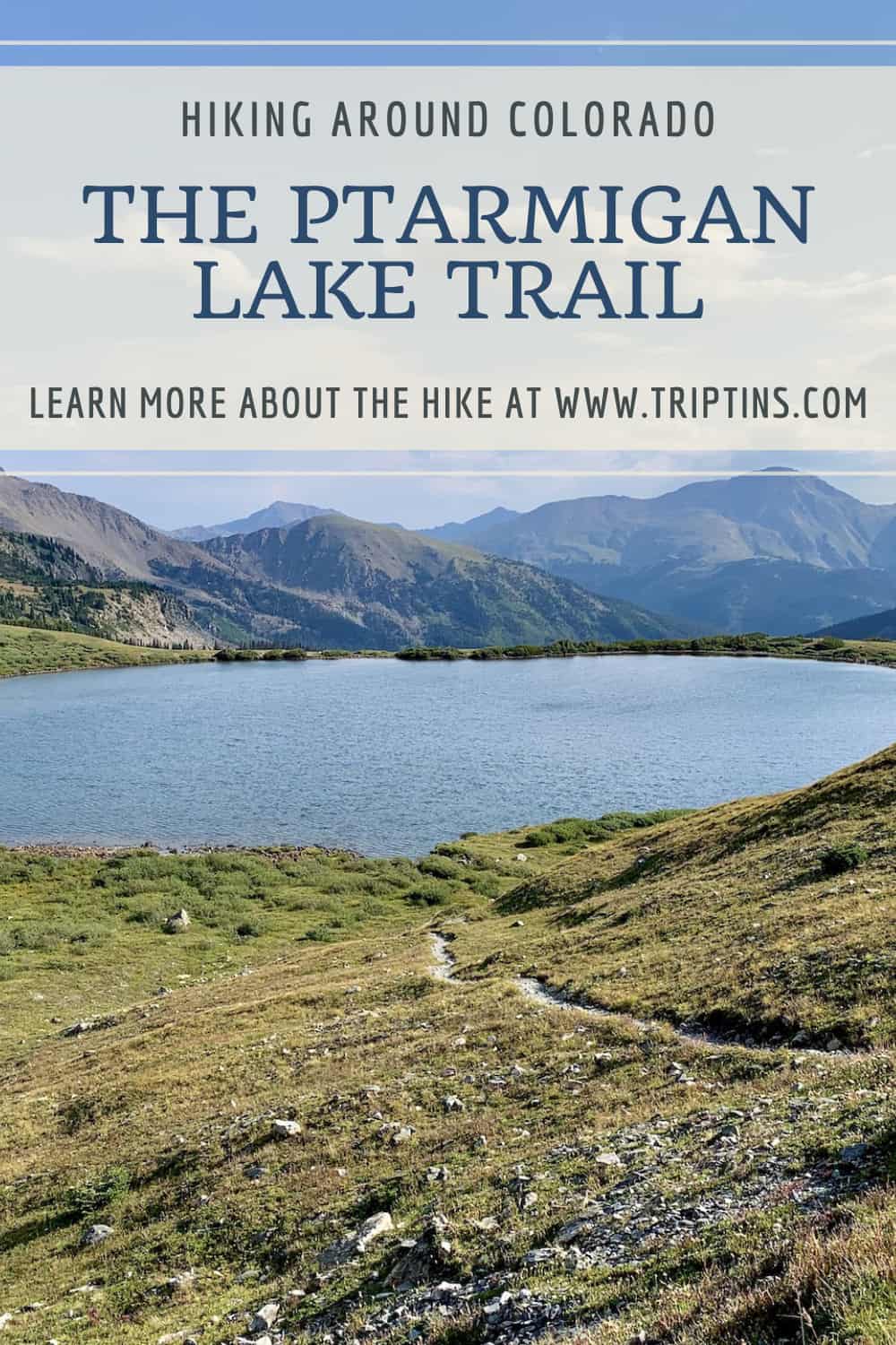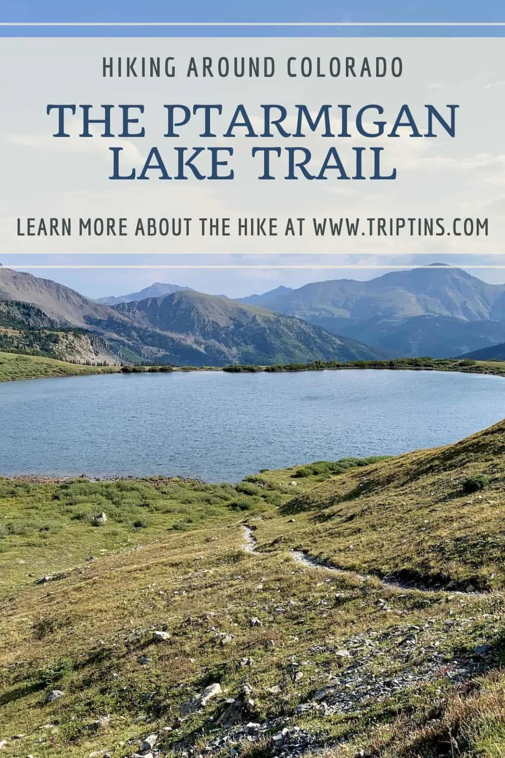
Are you looking for a scenic lake hike in the Colorado Rockies? Well, look no further than the hike along the Ptarmigan Lake Trail.
This 6.5-mile round trip hike takes visitors from the trailhead, through the forest, alongside lakes, and finally to the majestic Ptarmigan Lake itself.
Read on to learn everything you need to know about this great hiking trail. From hiking logistics and trailhead info to trail maps and a walkthrough of the hike itself, this guide will have it all.
* Affiliate Disclosure: This post may contain affiliate links, which means I may receive a commission if you make a purchase through the links provided, at no additional cost to you. Thanks for supporting the work I put into TripTins!
1) Hiking Details
Below are a few helpful details regarding the Ptarmigan Lake trail to get you oriented with what the hike entails.
I will soon be diving deeper into the hike and how to go about it throughout the remainder of the hiking guide.
- Trail Name: Ptarmigan Lake
- Starting & Ending Point: (10,670 feet)
- Mid Point: Ptarmigan Lake (12,100 feet)
- Distance: 6.5 miles (round trip)
- Elevation Gain: 1,430 Feet
- Duration: 3-5 hours
The hike to Ptarmigan Lake from the trailhead runs along an easy to follow pathway for just around 3.25 miles.
Once you reach the lake itself, you can enjoy some beautiful views from all different angles and even take a walk around the lake itself.
Once all done at the lake, it is then the same route back towards the trailhead and parking lot to end a successful day out on the trail.
→ Note that the distance and duration of the trail can be a bit longer if you decide to do a bit more exploring once you reach the lake area.

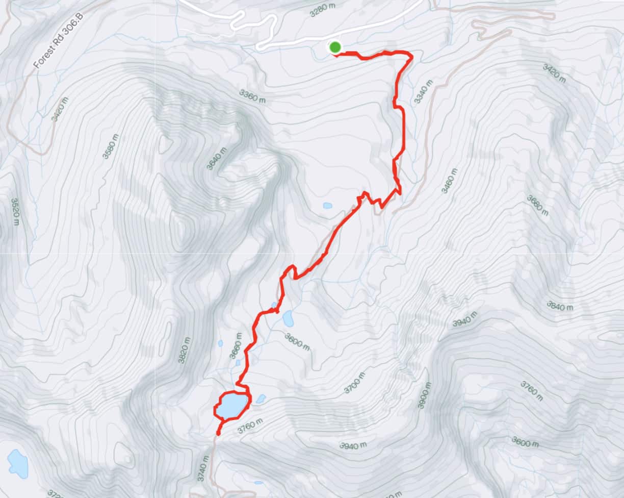
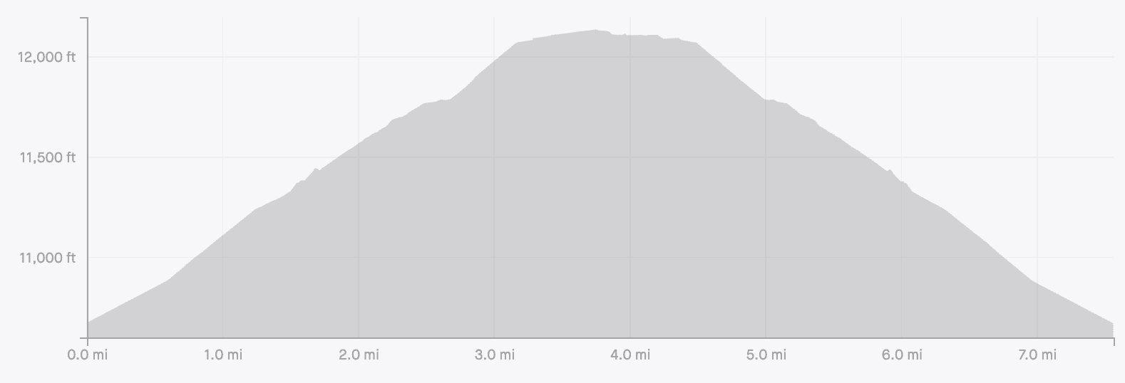
2) Ptarmigan Lake Map & Elevation Gain Profile
Below you can find both the Ptarmigan Lake trail hiking map alongside the elevation gain profile for the day.
The trail begins from a roadside parking lot and heads into the forest for the first 2.5 miles of the hike.
Once out of the forest you will be met with the smaller Lower Ptarmigan Lake before heading along a steeper pathway for the next 0.75 miles towards Ptarmigan Lake.
You can also see the route around the lake I took as well as the short turnoff to get a great elevated view of the lake (more on that later).
» Note the reason the elevation gain profile is longer than 6.5 miles is because I took some additional walks around the lake.

3) Where is Ptarmigan Lake
Ptarmigan Lake is located around 15 miles west of Buena Vista. The trailhead of the lake is just off the side of the State Highway 306, which turns into Cottonwood Pass.
Directions are pretty simple altogether. If coming from the east, you will want to make your way to US 24. Once you hit Buena Vista, turn onto Main Street, which then soon turns into the 306 after a mile or so.
Continue to follow State Highway 306 for 14 miles until you see the trailhead parking lot on the left hand side of the road. The main parking lot here can fit around 10 cars but you can also find some overflow parking as well.
From the trailhead it is just another 3.25 miles of hiking until you reach the lake itself.
Below is a map that shows the directions from Buena Vista to the Ptarmigan Lake trailhead parking lot.
Colorado Car Rental: Looking for a rental car in Colorado? Check out Rentalcars.com for a variety of options that can work well on your trip.
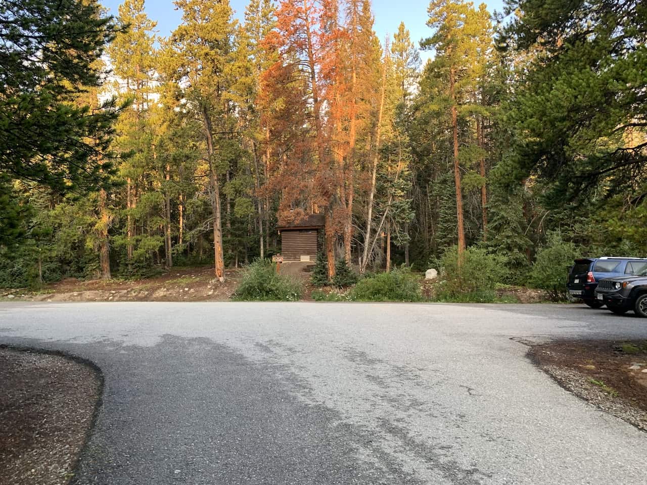
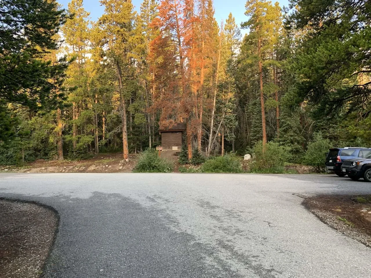
4) Ptarmigan Lake Trailhead
The trailhead here is simply called the Ptarmigan Lake Trailhead, which can be found on Google Maps or whatever other navigation device you may be using.
As you are making the drive along 306/Cottonwood Pass, be on the lookout for the trailhead sign towards the parking lot area.
Follow this short road for a few seconds that will soon turn into a larger parking lot area. Once at the parking lot, head to far end of it to find the start of the trail.
At the trailhead parking lot, you can find restroom facilities, however there are no camping sites at the trailhead itself. You can camp at some spots along the trail or at one of the nearby camping sites.
5) Ptarmigan Lake Weather
The weather is probably the most important thing to consider when going about a hike up to Ptarmigan lake.
Hiking in Colorado (especially at elevations like this) can get quite dangerous when the weather turns for the worst.
Before heading out for the hike be sure to check the mountain forecast for the day. It is very important to check the mountain weather and not the weather for the nearest town. The weather in the mountains can be much different than the weather on the ground.
For Colorado hikes, I like to check a few different sources to get the most up to date and accurate forecasts:
- » Mountain-Forecast
- » NOAA
- » Meteoblue
If you are hiking in the summer months, be on the lookout for those afternoon thunderstorms. While the day can start nice and clear, the weather can turn quickly.
The last thing you want is to be caught above the tree line during a thunderstorm. Always be sure to understand the forecasts and get an earlier start to the day just in case.
Hiking Resources & Checklist
Before heading out for the trails, be sure to read up on some of the hiking resources up on the site. These are here to better prepare you for all types of outdoor adventure.
- Gear: Hiking Packing List
- Weather: How to Prepare for Hiking Weather
- Navigation: Hiking GPS & Navigation
- Tips: 20+ Hiking Tips & Tricks for the Trail
- Accommodation: Book Your Hotel Today
- Rental Car: Book Your Car Rental Today
6) The Ptarmigan Lake Trail
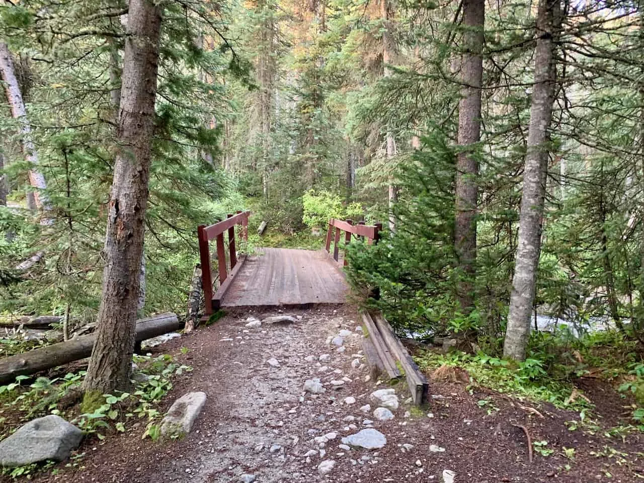
After getting yourself to the parking lot, make your way to the far end of it, where you will find the trailhead starting point.
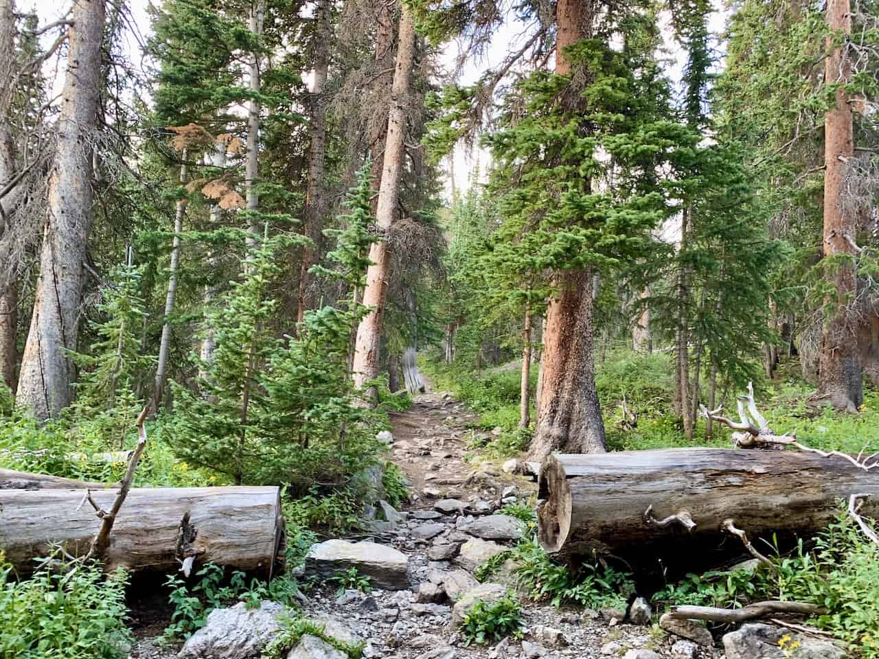
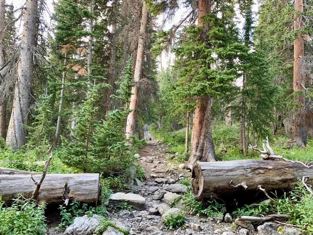
You will be greeted by a short bridge to cross and from there it is into the forest you go. The trail does have a pretty steady incline all the way through the forest. However, it is nothing technical and you should have no issues following along the trail.

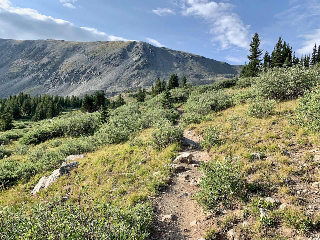
The forest portion is quite long, making up around 2.5 miles of the way up. While it is mostly forest during this portion of trail, expect to have a few instances where the trail does open up a bit more.
During these portions of trail, you will be greeted to a nice rock field to walk through with mountain views further out in the distance.

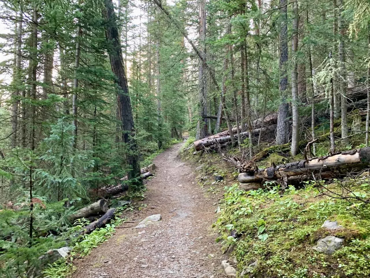

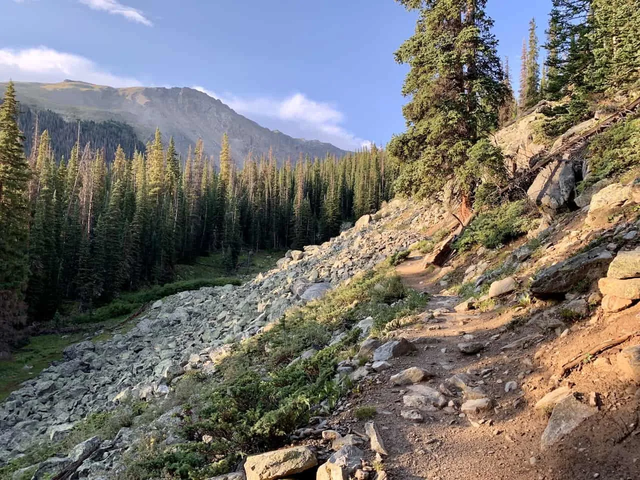
Continue the hike through the forest, following along on the trail and enjoying the serene nature setting all around you.
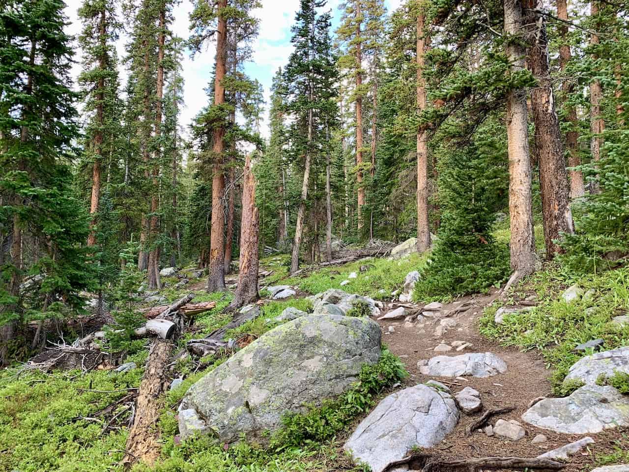

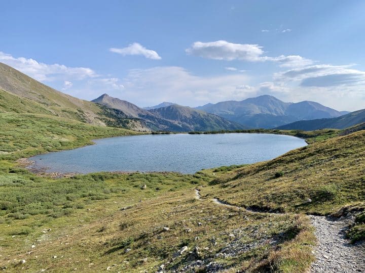
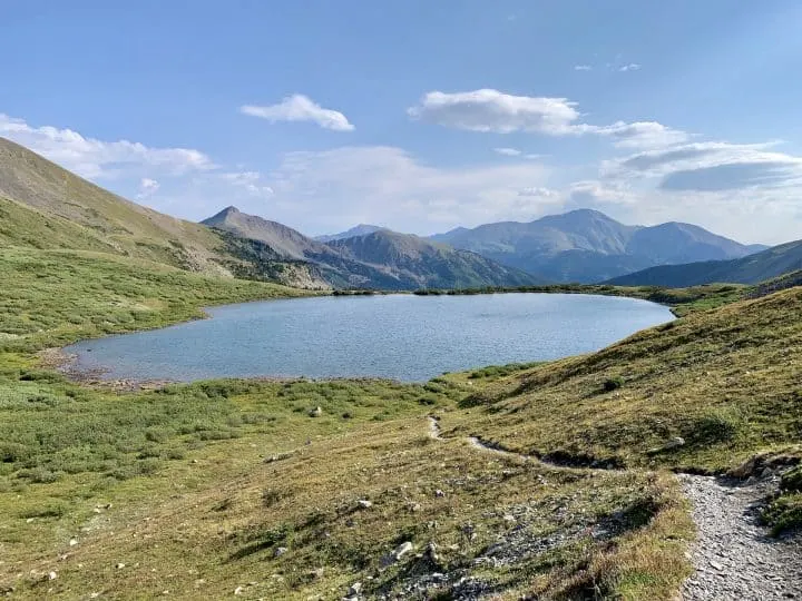
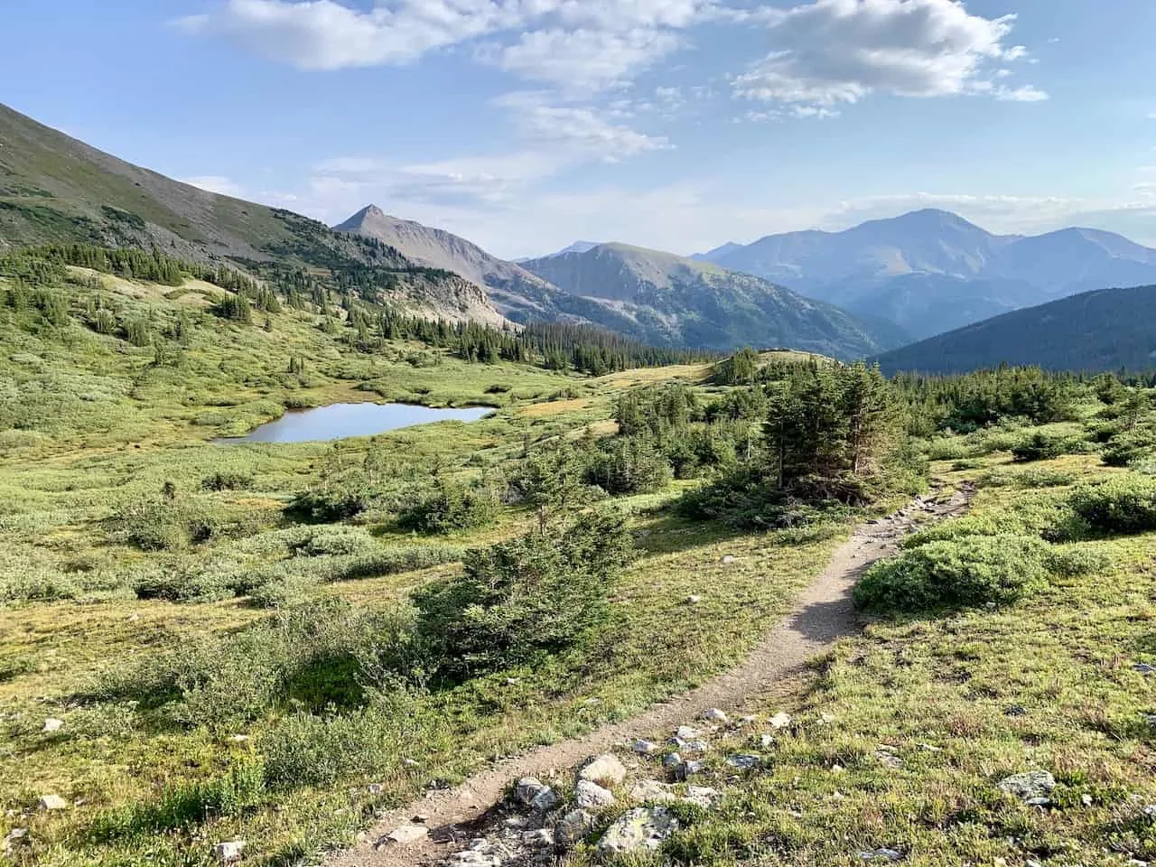
After a couple miles of hiking the landscape will begin to open up more and more. You will come across greenery, lakes, and mountain views all around.
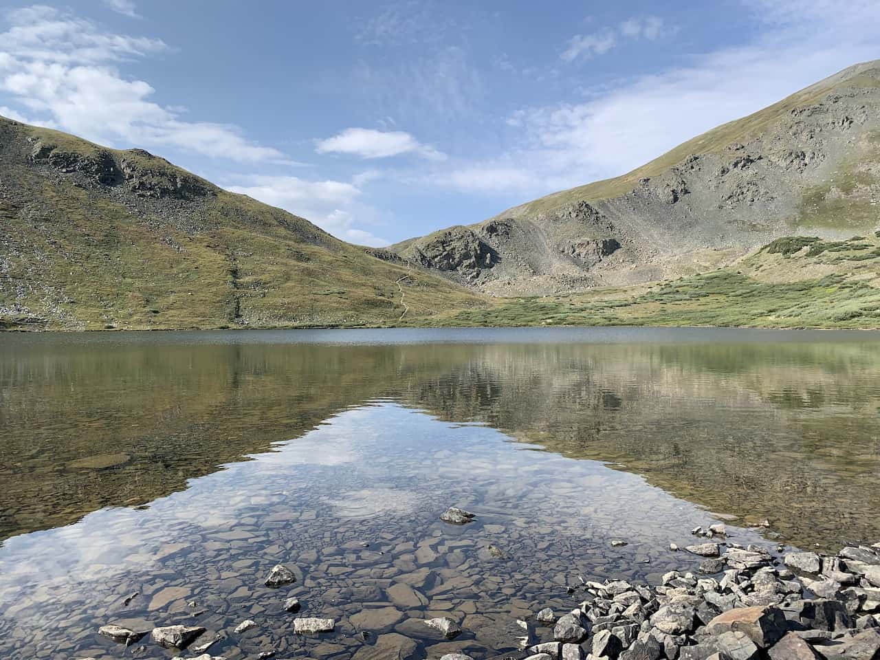
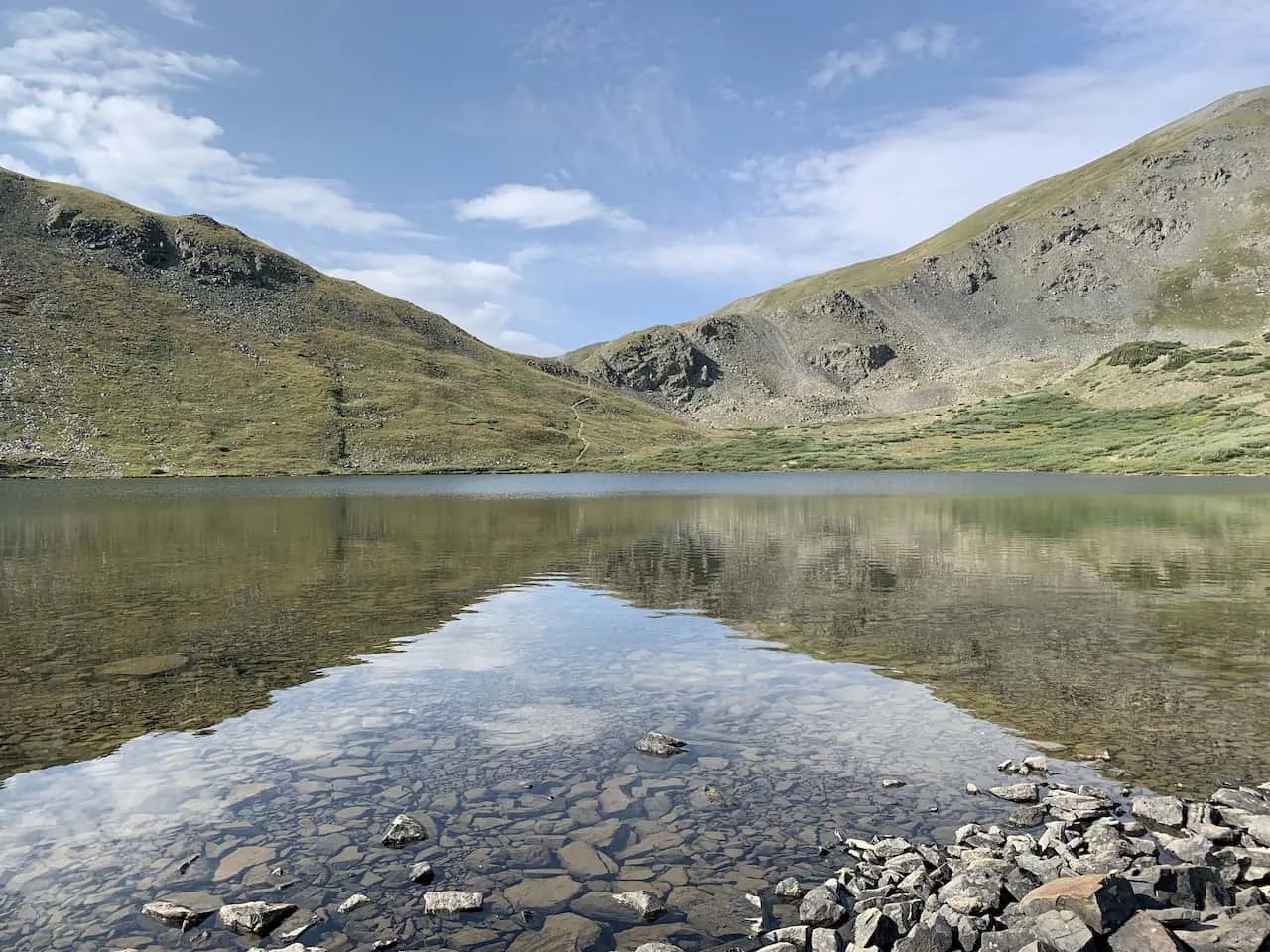
Not too far after getting out of the forest you will come across the Lower Ptarmigan Lake, down below on your left hand side. While not the main lake, it is a beautiful site to take in from afar.

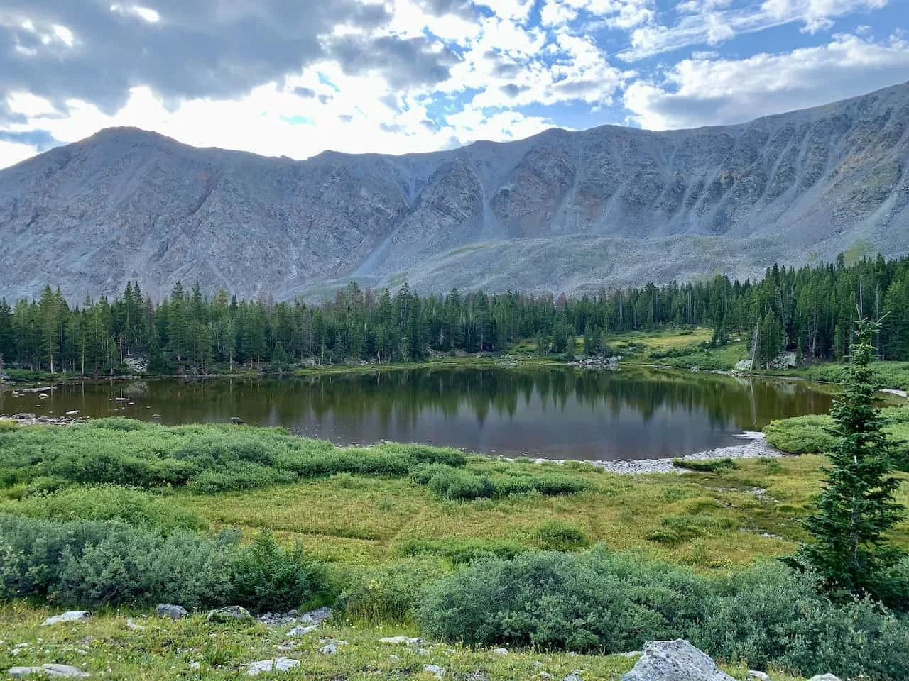
From the lower lake, continue to pathway upwards, where you will begin to see some more smaller lakes off to the side.
It is then a steeper climb up to reach the main Ptarmigan Lake. While the this portion of the climb can be steep, it does not last for too long and is not really technical.
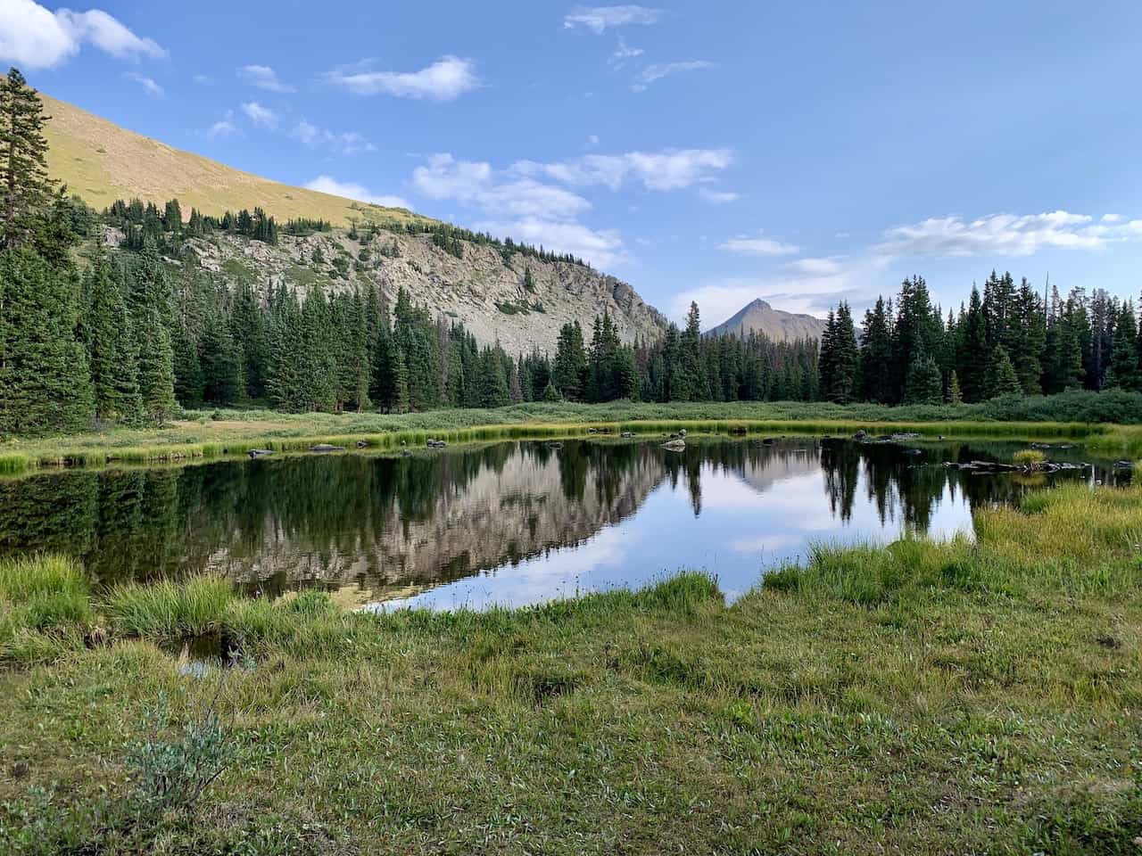


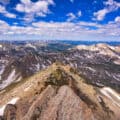
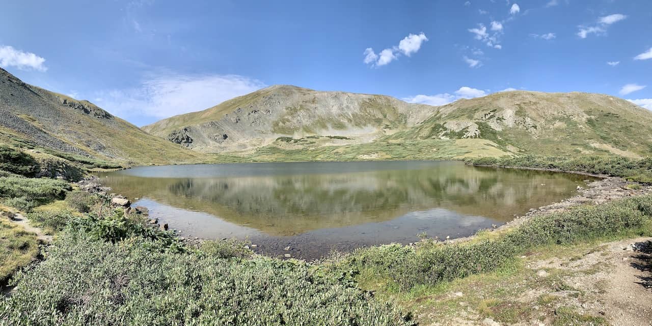
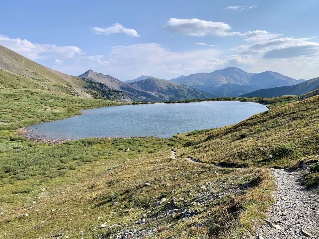
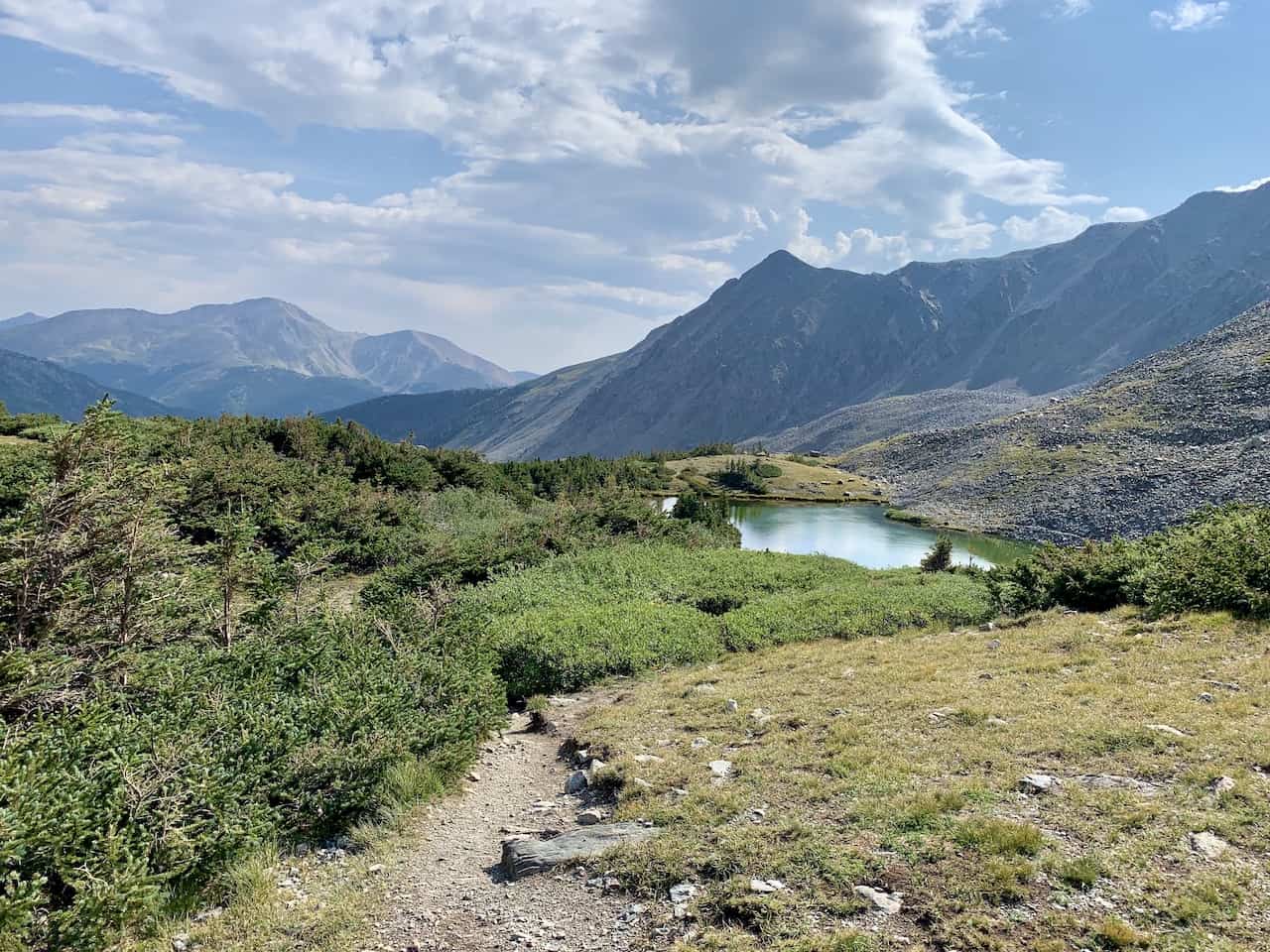
Soon enough, you will reach Ptarmigan Lake. The lake is surrounding my several mountains in each direction including Jones Mountain out back, and you will have some beautiful views to take in and enjoy.
Feel free to hang out by the shores of the lake and then take a nice stroll around as well.
You will begin to get some new angles of the surrounding landscape with the lake in the foreground and the mountains out back (including Mount Yale).
» Need a water refill? Take a look at some of the best water filter bottles out there for your trip!

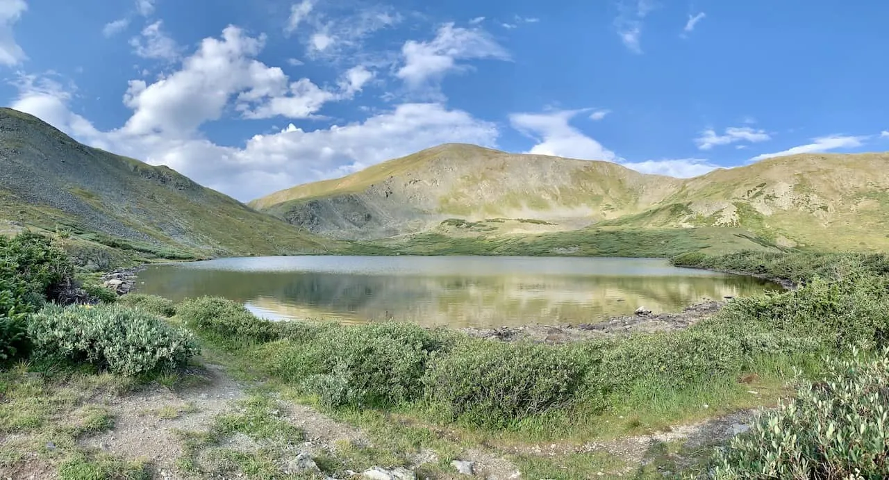
I would highly recommend following the path up on the southern end of the lake, so you can get some views from a higher angle.
You don’t need to head all the way up or anything, but just following the trail for a few minutes and you will get views like this:

After circling the lake, enjoying the views, and just hanging out at the lakeside, it is time to begin the hike all the way back to the trailhead.
It is the same way down as the way up as you are essentially just heading downhill throughout the descent.
During this first portion of the hike down, you will be welcomed to some beautiful views of the forest, lakes, and mountains. Take your time to sit back and enjoy the landscape as you slowly continue your way back to the forest.
Once you hit the forest, the views will disappear (for the most part), as you hike the 2+ miles through the trees and back to the parking lot.

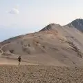
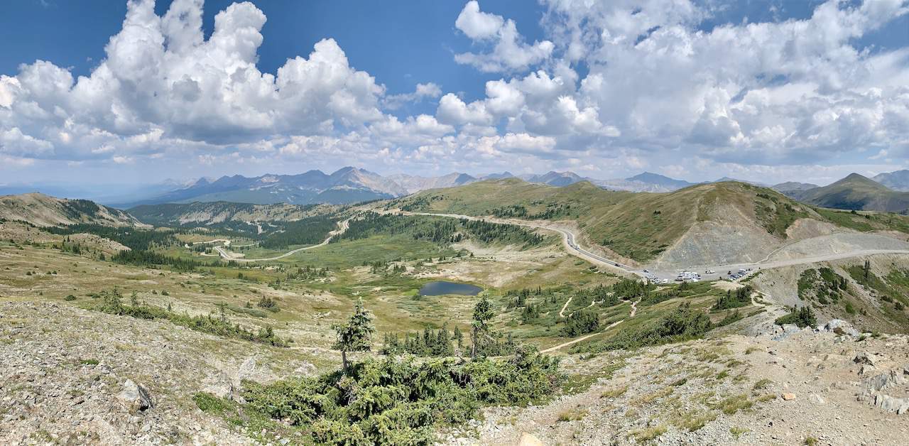
7) Cottonwood Pass
After reaching the parking lot, head into your car and towards the Cottonwood Pass. It is just a 10 minute curvy drive until you reach the roadside parking lot.
From here, head up to the viewpoint, where you will get some great views in all directions.
You can even continue up higher to Cottonwood Pass Peak if you are up for it. But the view from the lower viewpoint area is a pretty nice one to take in too.
» Learn more in the Cottonwood Pass guide up on the site

8) Where to Stay in Buena Vista
While there are many places you can choose to base yourself around the area, I would recommend staying in either Buena Vista (20 minute drive) or Leadville (60 minute drive).
Leadville is north of the turnoff from US 24 and Buena Vista is right alongside of it.
These are great places to stay if you are looking to not only hike Ptarmigan Lake but also many of the 14ers around the area. Below are a few highly recommended places to stay in each of them.
Buena Vista
- Surf Hotel & Chateau
- Best Western Vista Inn
- Mount Princeton Hot Springs Resort (just outside town)
Leadville
That about does it for a hiking guide of the Ptarmigan Lake trail of Colorado. If you have any questions or comments about the hike, be sure to add them in below.
Also don’t forget to check out the remaining Colorado hiking guides up on the site like like Huron Peak, La Plata Peak, and Mount Elbert.
Have fun out there and safe travels!