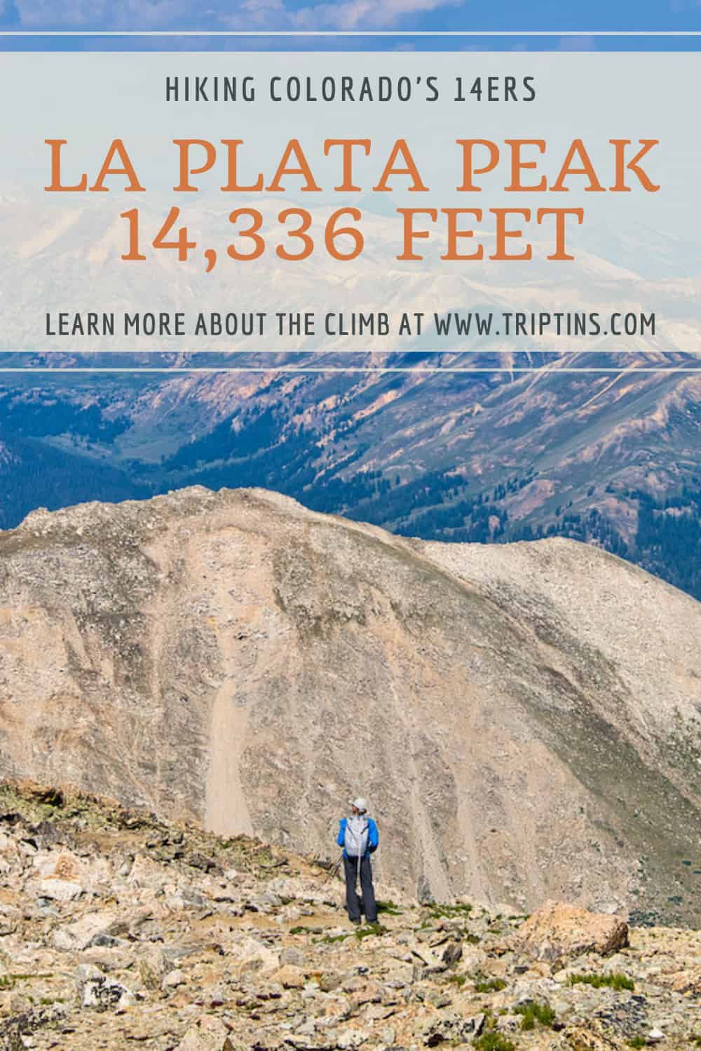

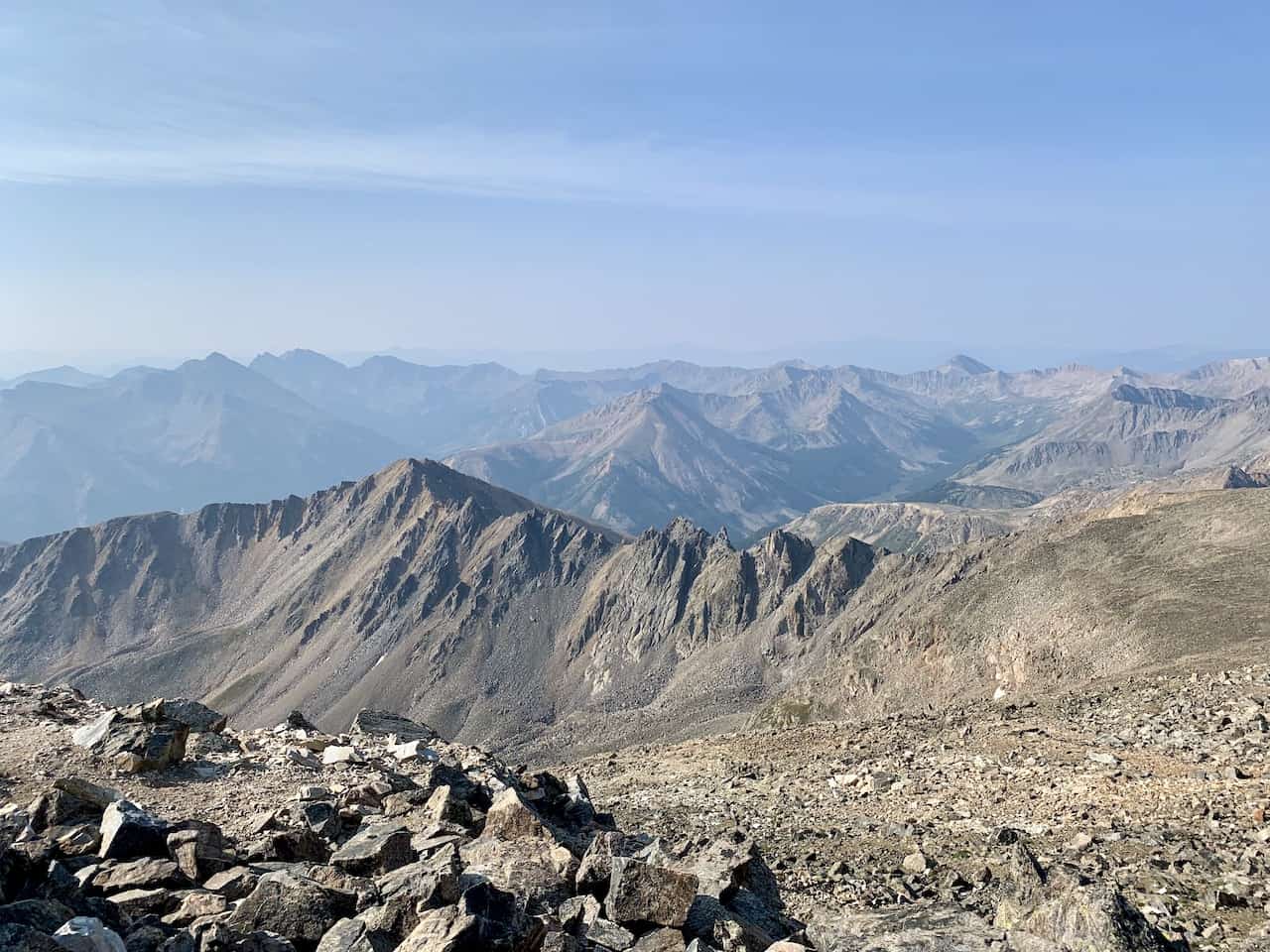
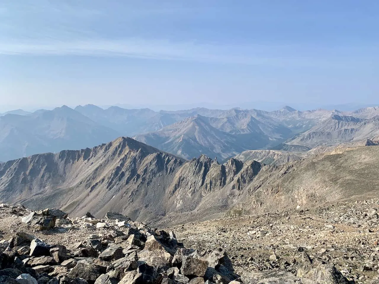
At 14,336 feet in elevation, La Plata Peak stands as one of the tallest 14ers out there. Not only is it one of the tallest, but it also offers some of the best views you can ask for during a climb.
From hiking through the forest to taking on some never-ending switchbacks, La Plata offers a little bit of everything on the climb. But once you reach the top, it will all be worth it as you enjoy the stunning Colorado landscape all around you.
This guide will go into detail about what to expect during a La Plata Peak ascent and how to best prepare for your day out in the mountains.
* Affiliate Disclosure: This post may contain affiliate links, which means I may receive a commission if you make a purchase through the links provided, at no additional cost to you. Thanks for supporting the work I put into TripTins!
1) La Plata Peak Overview & Stats
Before diving into the climb up La Plata, I wanted to lay out some important things to know regarding the mountain itself.
- Mountain Name: La Plata Peak
- Mountain Range: Sawatch Range
- La Plata Peak Elevation: 14,336 feet (5th highest point in Colorado)
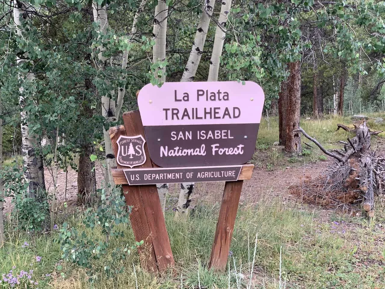
- Trailhead: La Plata Gulch Trailhead
- Parking Coordinates: 39°04’04.4″N 106°30’17.8″W
- La Plata Peak Class: Class 2
- Distance: 9.5 miles (round trip)
- Elevation Gain: +4,500 feet
Starting from the roadside trailhead, the standard Northwest Ridge hike starts up through the forest, hits some switchbacks, and is followed by a tricky class 2 ridge up to the summit.
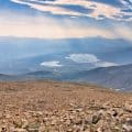
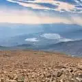
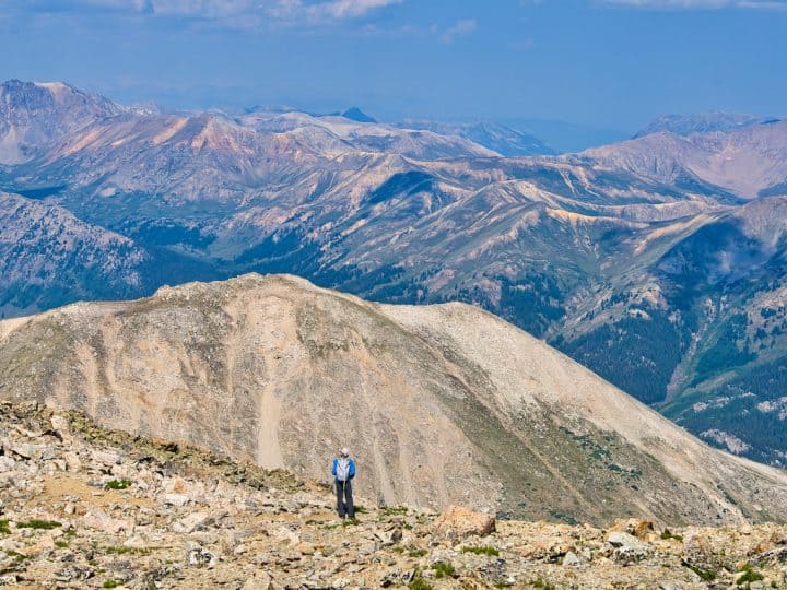
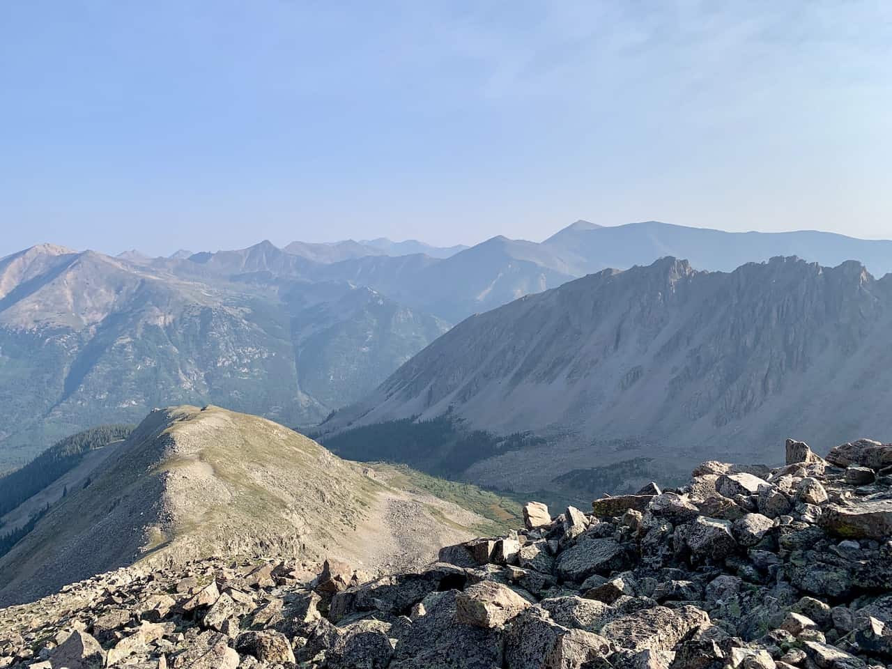
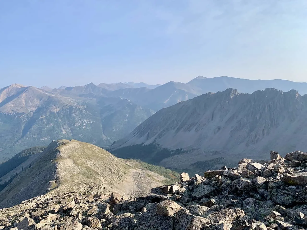
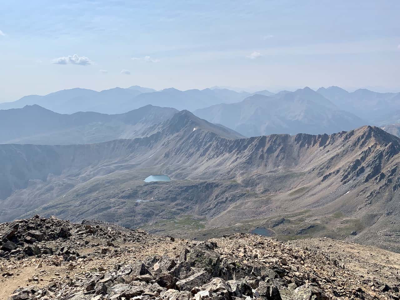
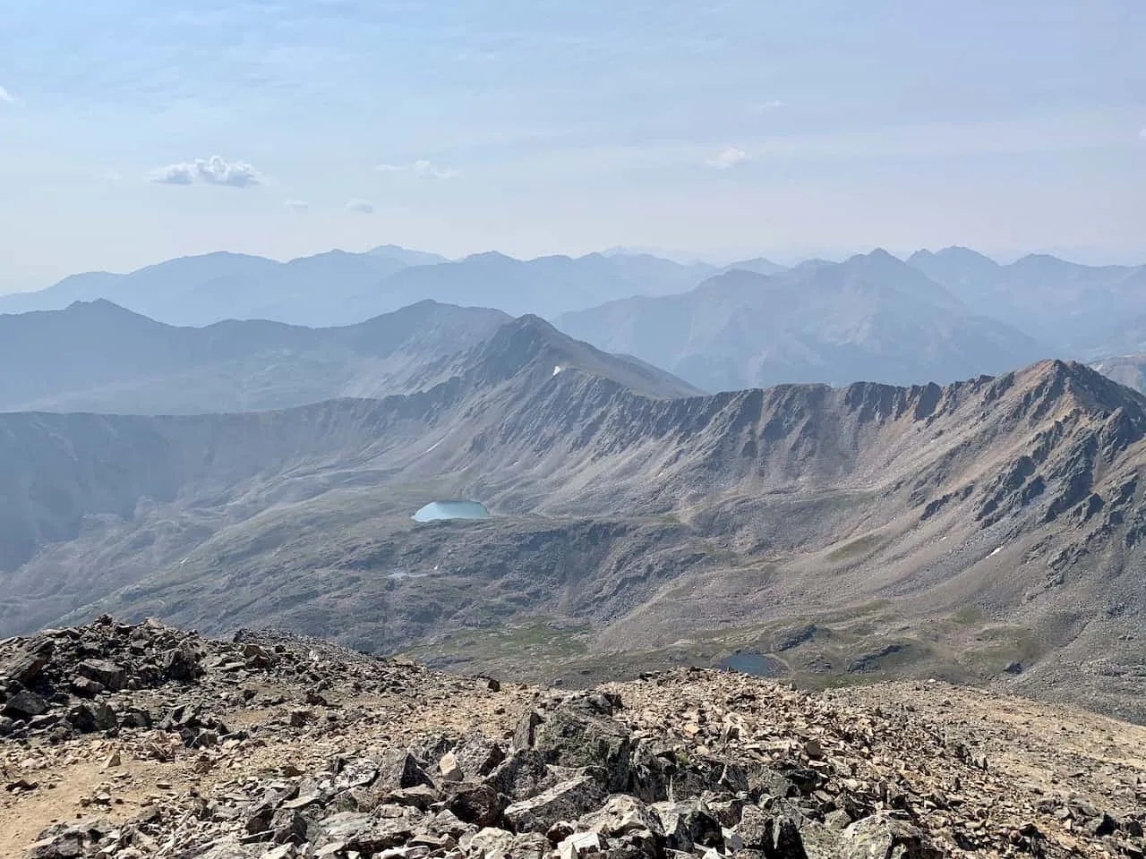
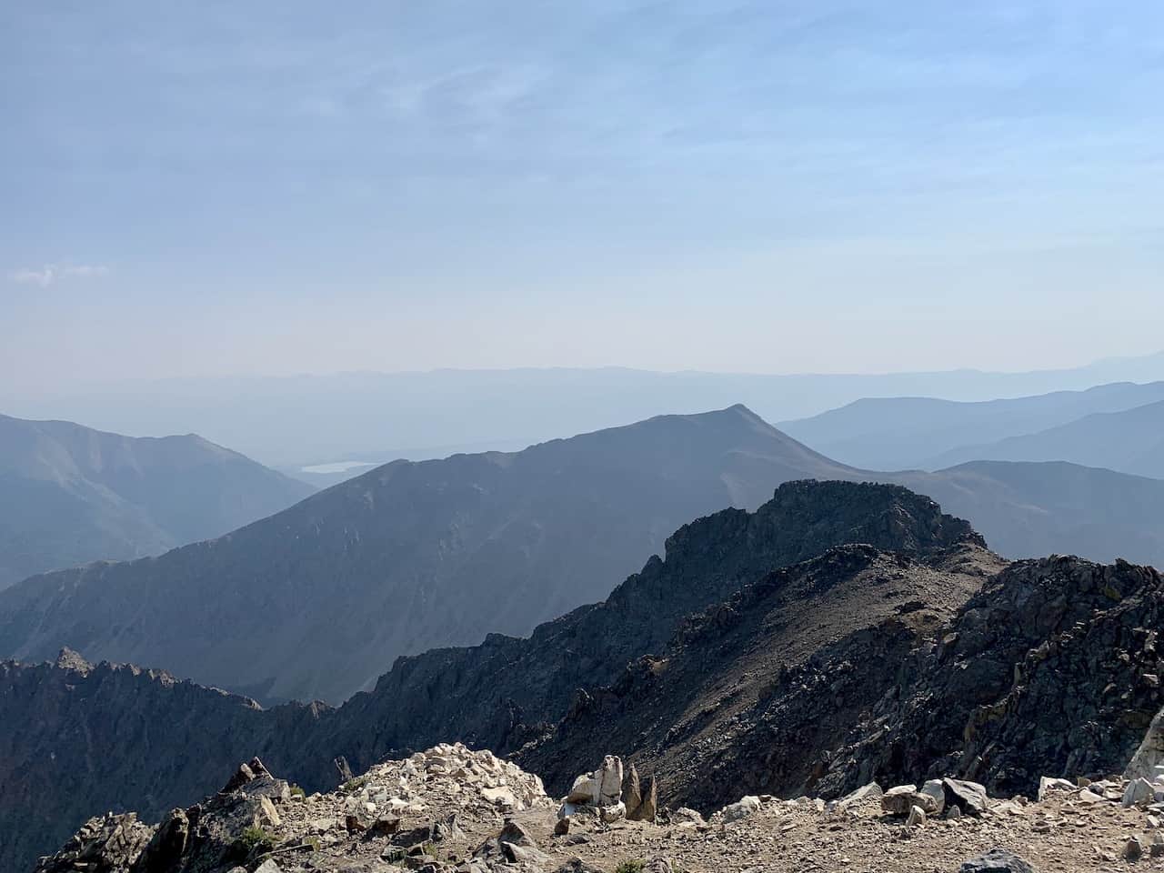
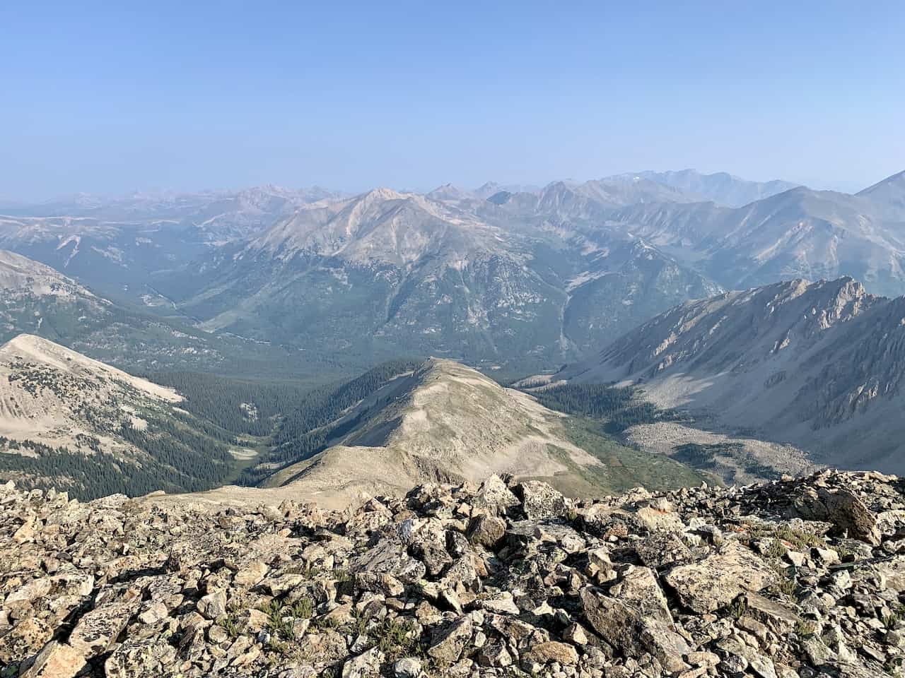
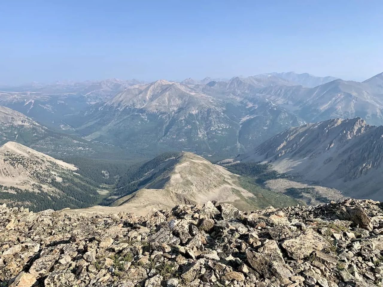
Along the way up you will get some continuous views of the surrounding mountains, lakes, and valleys all around.

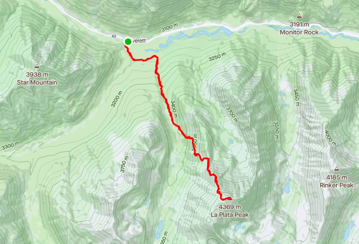
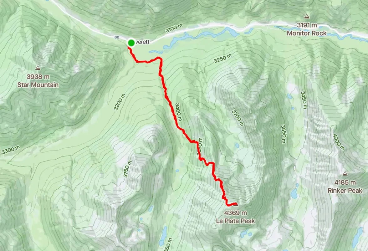
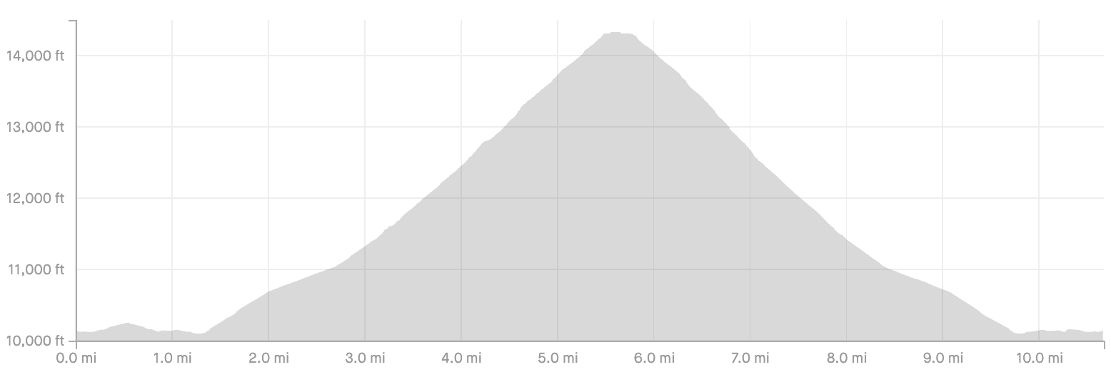
2) La Plata Peak Map & Elevation Profile
Below you can find the La Plata Peak hiking map, along with the elevation profile of the route. While the first and last miles of the hike are nice and flat, the remainder will be a continuous uphill and downhill climb on La Plata.
The trail will start through the forest with an easier 10%-20% grade, followed by a more intense 20%-30% once you get further up the mountain.

3) La Plata Peak Trailhead & Directions
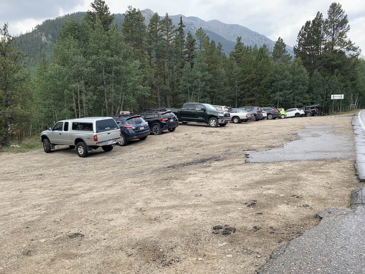
Getting to the La Plata Peak trailhead is one of the easiest trailheads to get to in general. While many trailheads are at the end of dirt roads (some of which require 4WD), the La Plata Peak trailhead is just off the side of a main paved road (Highway 82).
The GPS coordinates of the parking lot are 39°04’04.4″N 106°30’17.8″W. Here you will find a parking lot off to the side of the road that can fit around 25 cars or so.
The trailhead/parking lot is located on Colorado State Highway 82 and is along the Independence Pass.
Depending on snowfall, portions of the road may not be open in the winter. So be sure to check the latest reports on the road conditions if you are looking to head there in the wintertime.
Colorado Car Rental: Looking for a rental car in Colorado? Check out Rentalcars.com for a variety of options that can work well on your trip.
Directions to the trailhead are pretty easy. Unless coming from the Aspen area, odds are you will be coming up or down Route 24.
As you arrive at the Twin Lakes area, you will make the turn onto Highway 82 (signs pointing to Independence Pass).
Once on Highway 82, it is about a 15 mile drive to the parking lot, located on the left hand side of the road.
Below is a map that pin point the parking lot and the route from the turnoff point.
4) La Plata Peak Weather
The weather is probably the most important thing to consider when going about a hike up La Plata Peak.
Hiking in Colorado (especially at elevations like this) can get quite dangerous when the weather turns for the worst.
Before heading out for the hike be sure to check the mountain forecast for the day. It is very important to check the mountain weather and not the weather for the nearest town. The weather in the mountains can be much different than the weather on the ground.
For Colorado 14ers, I like to check a few different sources to get the most up to date and accurate forecasts:
If you are hiking in the summer months, be on the lookout for those afternoon thunderstorms. While the day can start nice and clear, the weather can turn quickly.
The last thing you want is to be caught above the tree line during a thunderstorm.
Always be sure to understand the forecasts and get an earlier start to the day just in case.
» If you enjoy this hike, check out the Missouri Lakes & Fancy Pass loop trail for another great trail
Hiking Resources & Checklist
Before heading out for the trails, be sure to read up on some of the hiking resources up on the site. These are here to better prepare you for all types of outdoor adventure.
- Gear: Hiking Packing List
- Weather: How to Prepare for Hiking Weather
- Navigation: Hiking GPS & Navigation
- Tips: 20+ Hiking Tips & Tricks for the Trail
- Accommodation: Book Your Hotel Today
- Rental Car: Book Your Car Rental Today
5) Colorado Hiking Tips
Before taking on hikes in Colorado, feel free to read up on some helpful tips when it comes to the trails.
Be aware of the elevation: hiking at altitude is no joke and you need to ease your way into the trails. Before taking on hikes from the start, give yourself a day or so to acclimatize.
Stay hydrated: to help with the altitude and the hiking itself, stay consistently hydrated. Take plenty of water and consider a Katadyn Filter Water Bottle for the trail.
Bring bug spray: the bugs can be out in full force on many trails. Put on some bug spray to keep yourself protected while hiking.
Apply sunscreen: the sun can be very strong in the mountains. Applying sunscreen (and wearing a hat / sunglasses), will be very important when it comes to protecting yourself.
Keep an eye on the forecast: the weather can turn suddenly out on the trails. Be sure to check the weather forecasts beforehand to avoid rain & thunderstorms. Afternoon storms can be more prominent in the summer months (so start early!).
Download offline maps: to keep yourself on track, download offline maps for the trail. This can be done by using navigation apps such as AllTrails, Maps.me, and Gaia. You should also download offline Google Maps, as cell service does not always work closer to the trailheads.
Check trail conditions: before committing to a trail, I would recommend looking at the latest trip reports on AllTrails (or 14ers.com for 14er hikes). This is more so important as the summer season starts & ends, as you can get a better idea of trail conditions & snow coverage.
6) The La Plata Peak Hike
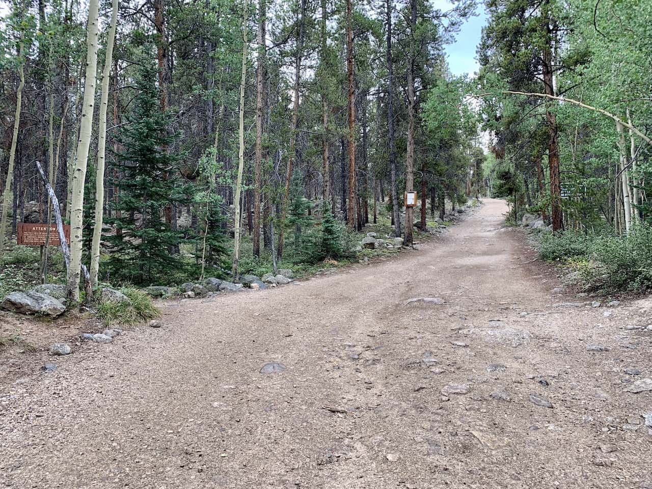
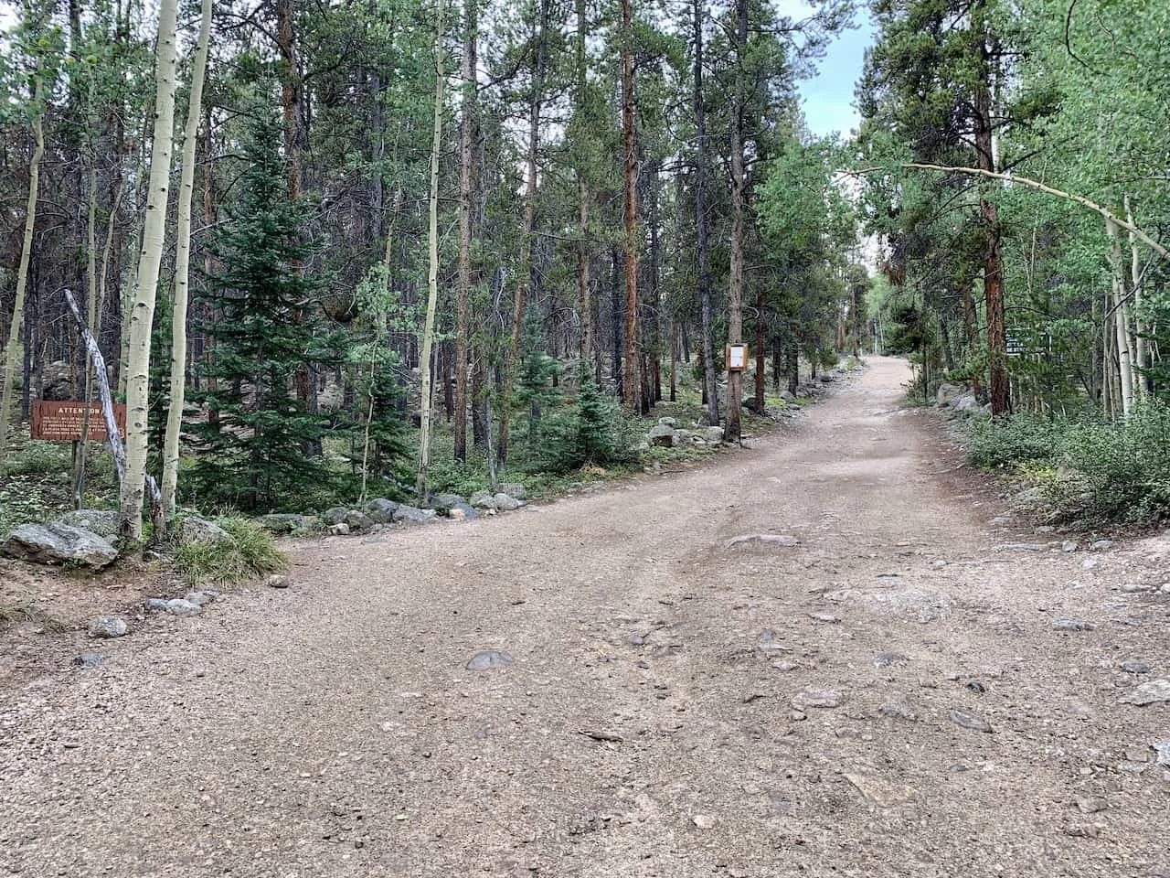
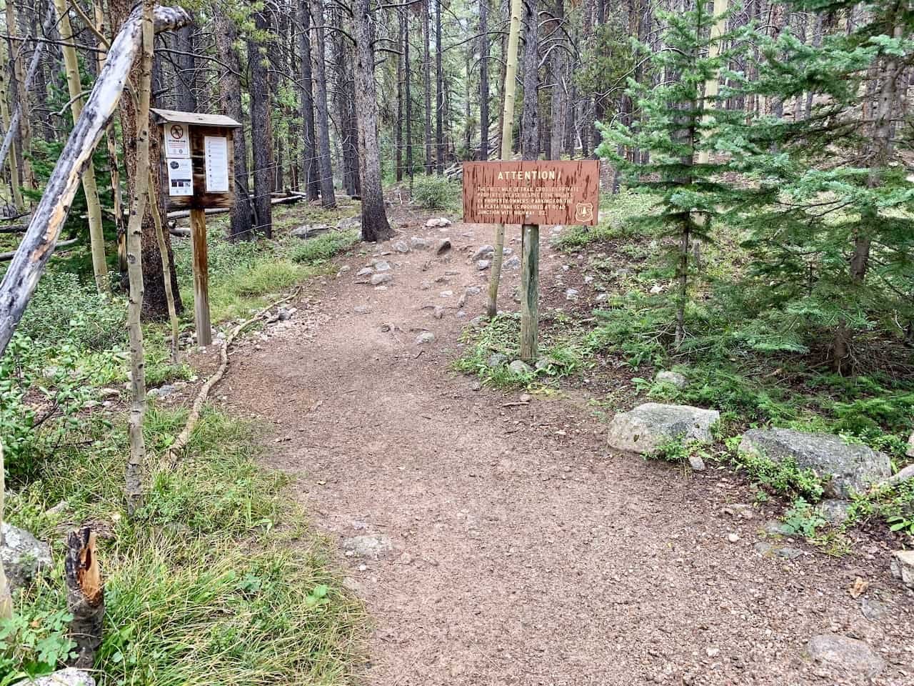
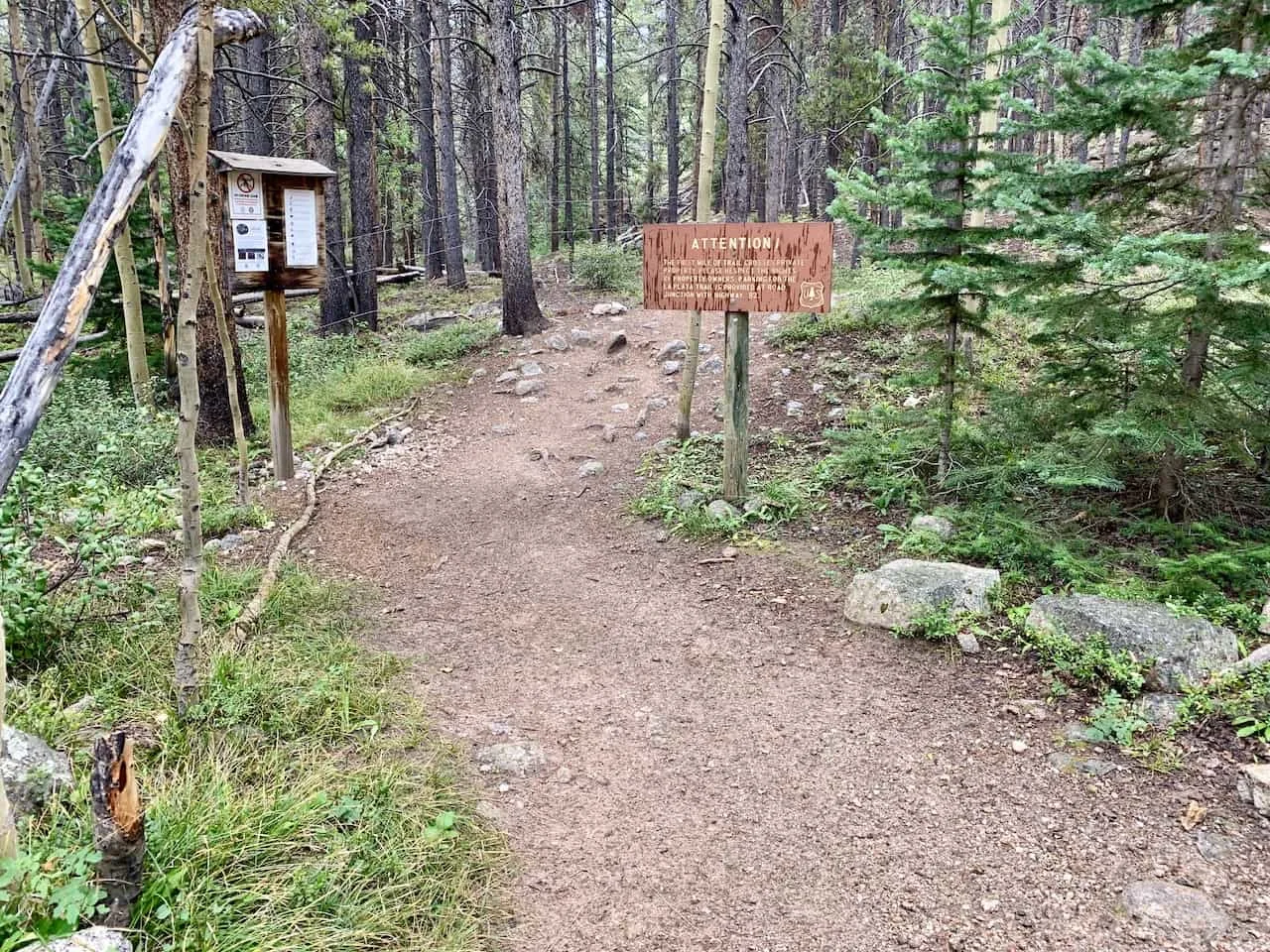
After making it to the trailhead and parking your car in the lot, it is time to begin the hike up to La Plata Peak. The trail begins up a private road just to the left of the parking lot.
Continue on this path for about 0.3 miles until you see a turnoff into the forest on your left hand side.
I cannot stress this enough -> it is such an important turnoff to pay attention to! If you miss this turnoff, you may think all is fine as you continue along the road, thinking it is the correct trail. But in reality this dirt road goes on for miles in the wrong direction.
I met a couple of guys who missed the turn off and ending up adding another 5+ miles to their day. This turnoff can be VERY easy to miss in the dark if starting before sunrise. And honestly, if you are not paying attention, it can also be very easy to miss in the daylight too.
Just note you should not be hiking for more than 10 minutes before you make the turn into the forest. The easiest way to avoid this is to simply have a navigation app open like Maps.me or AllTrails.
Below are a couple photos of the turnoff point from the private road to give you a better idea:
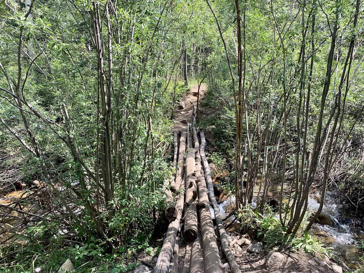
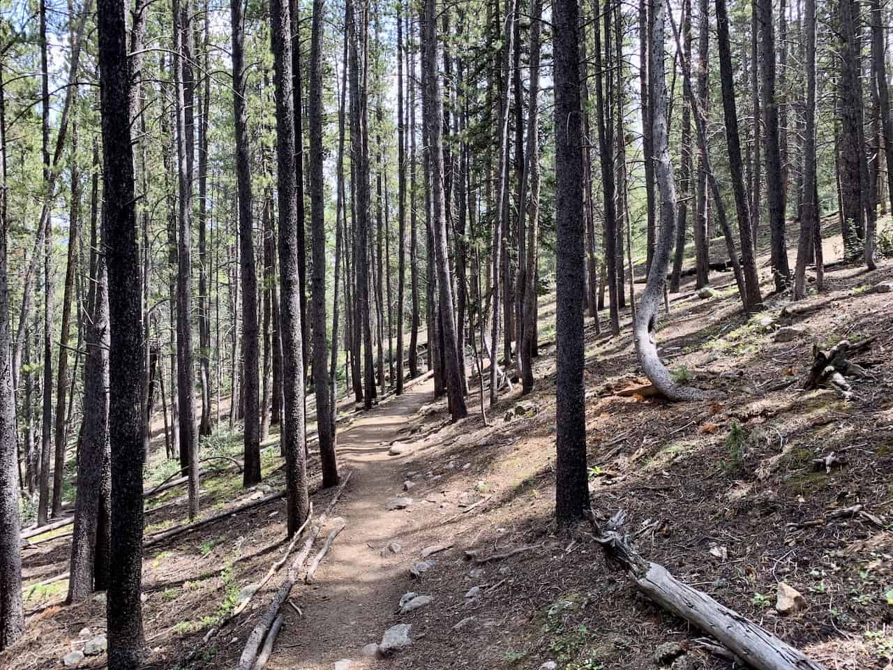
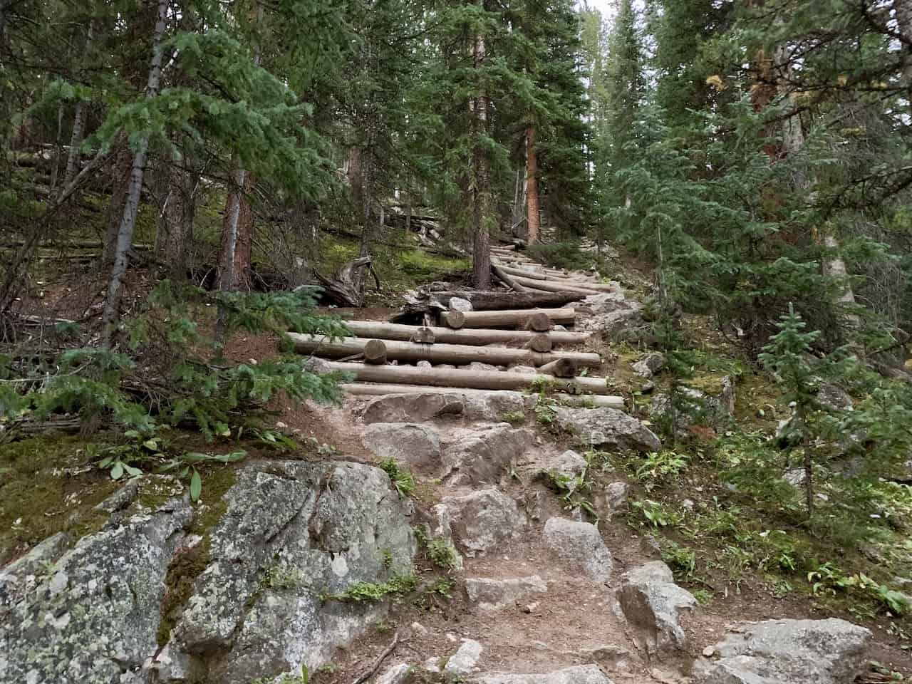
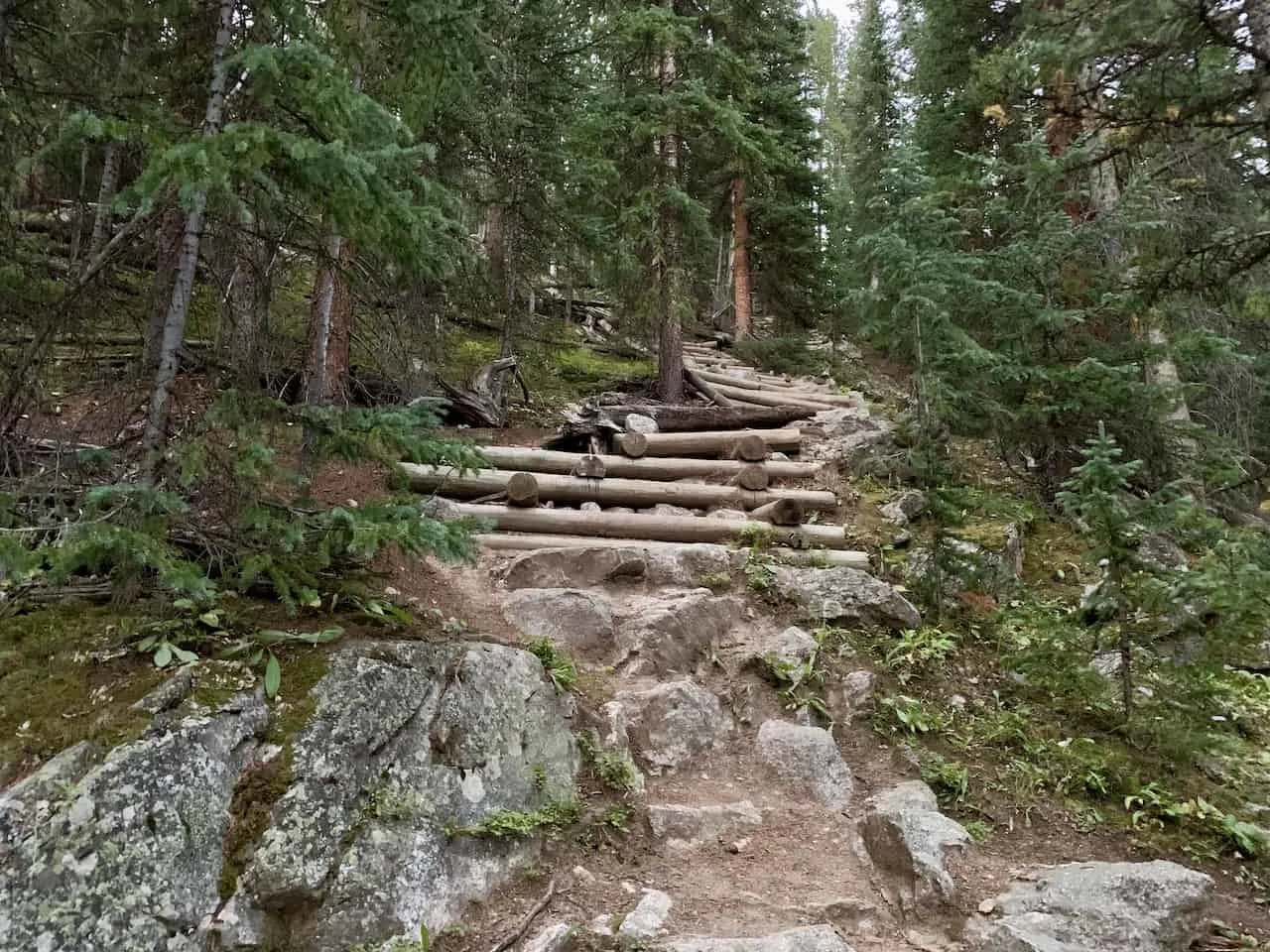
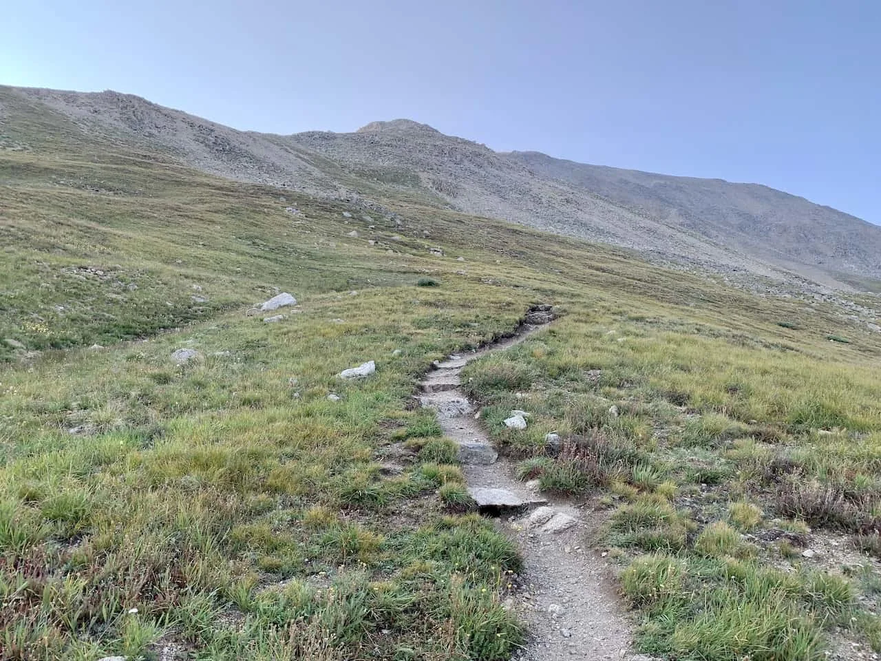
Once in the forest, you will cross over a bridge and walk on a relatively flat path for about 0.5 miles. Then the climb up through the trees begins as you follow a pretty much continuous uphill path through the forest.
The forest portion of the hike is around 2 miles long as you gain around 1,000 feet or so of elevation.
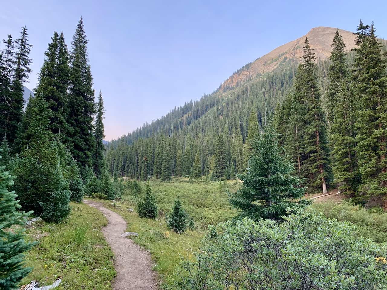
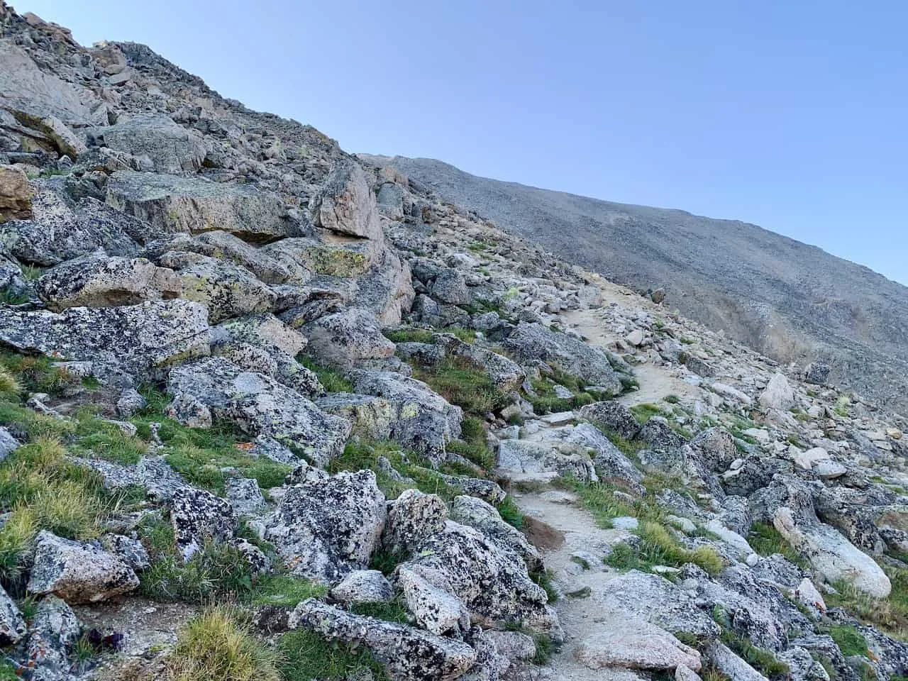
Then things begin to open up a bit more. While you won’t be fully above the treeline just yet, you will be able to take in some great views of the surrounding mountains up above.


You will soon reach a point where you will be welcomed to a maze of short switchbacks.
Before, during and after the switchback section I would recommend taking some breaks. This section is quite demanding and repetitive to say the least.
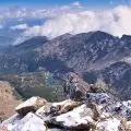
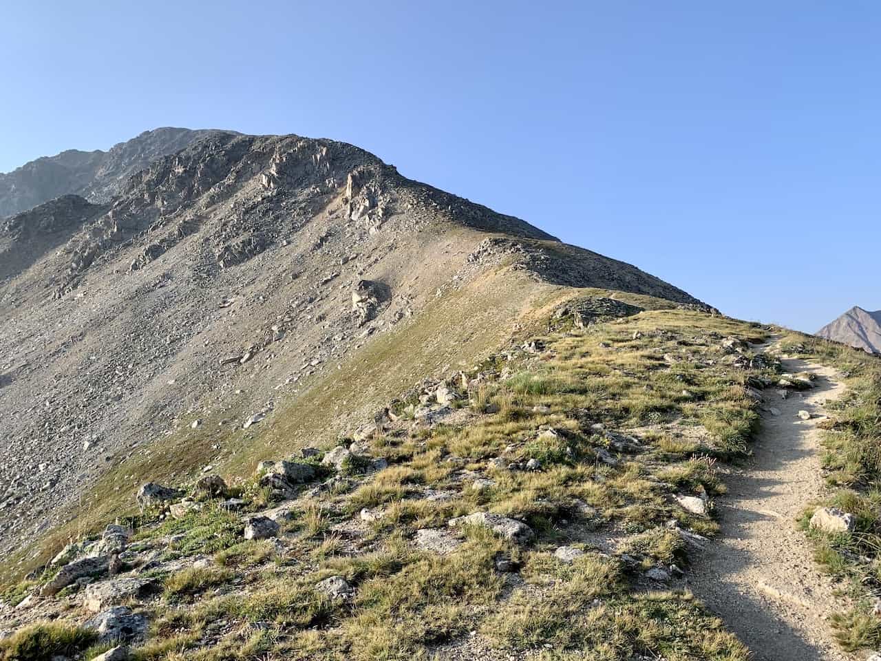
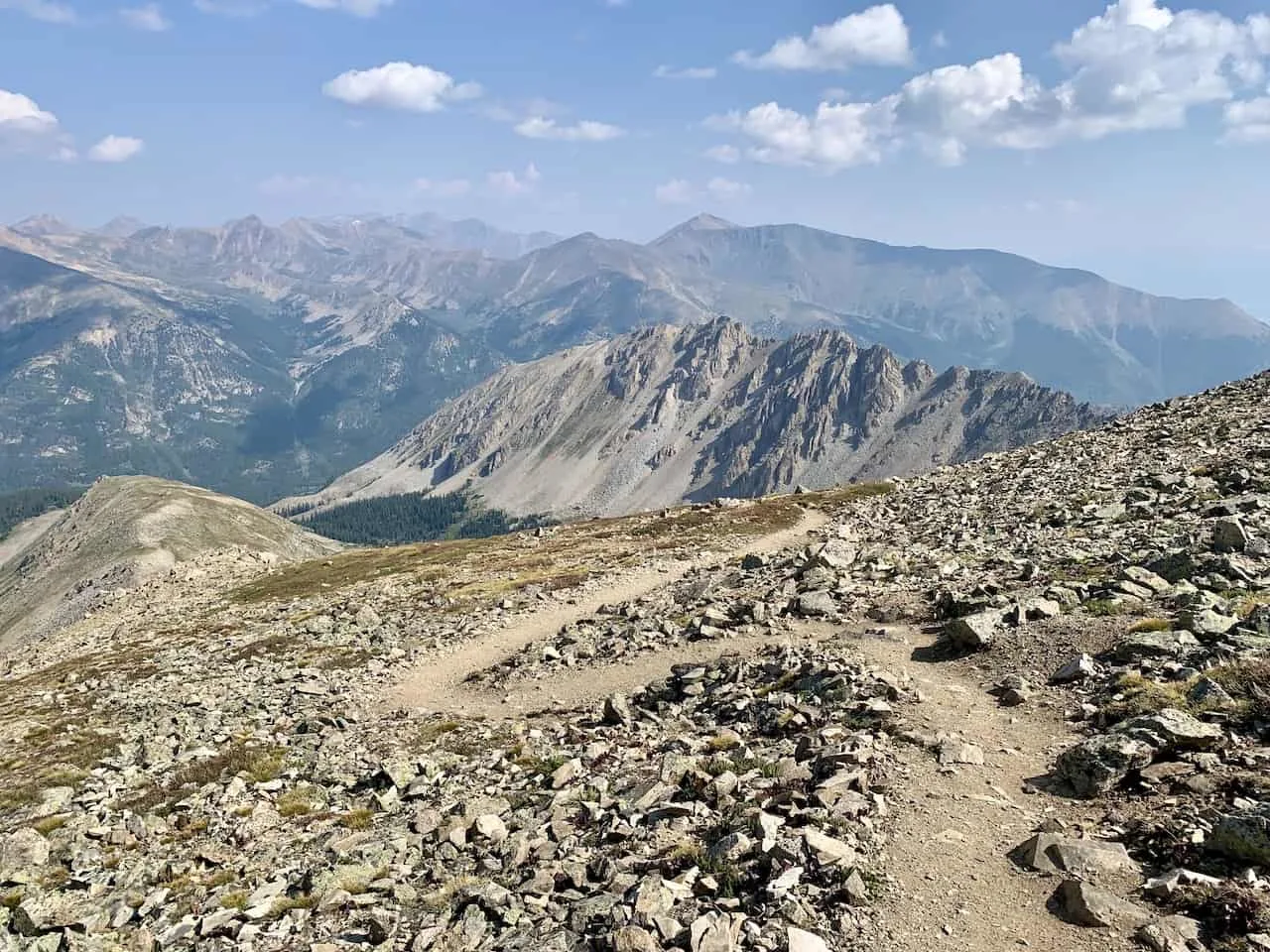
After the switchbacks, things flatten out a bit more as you then head into a few longer switchbacks. By now you should be above the treeline with better and better views as you continue your way up.

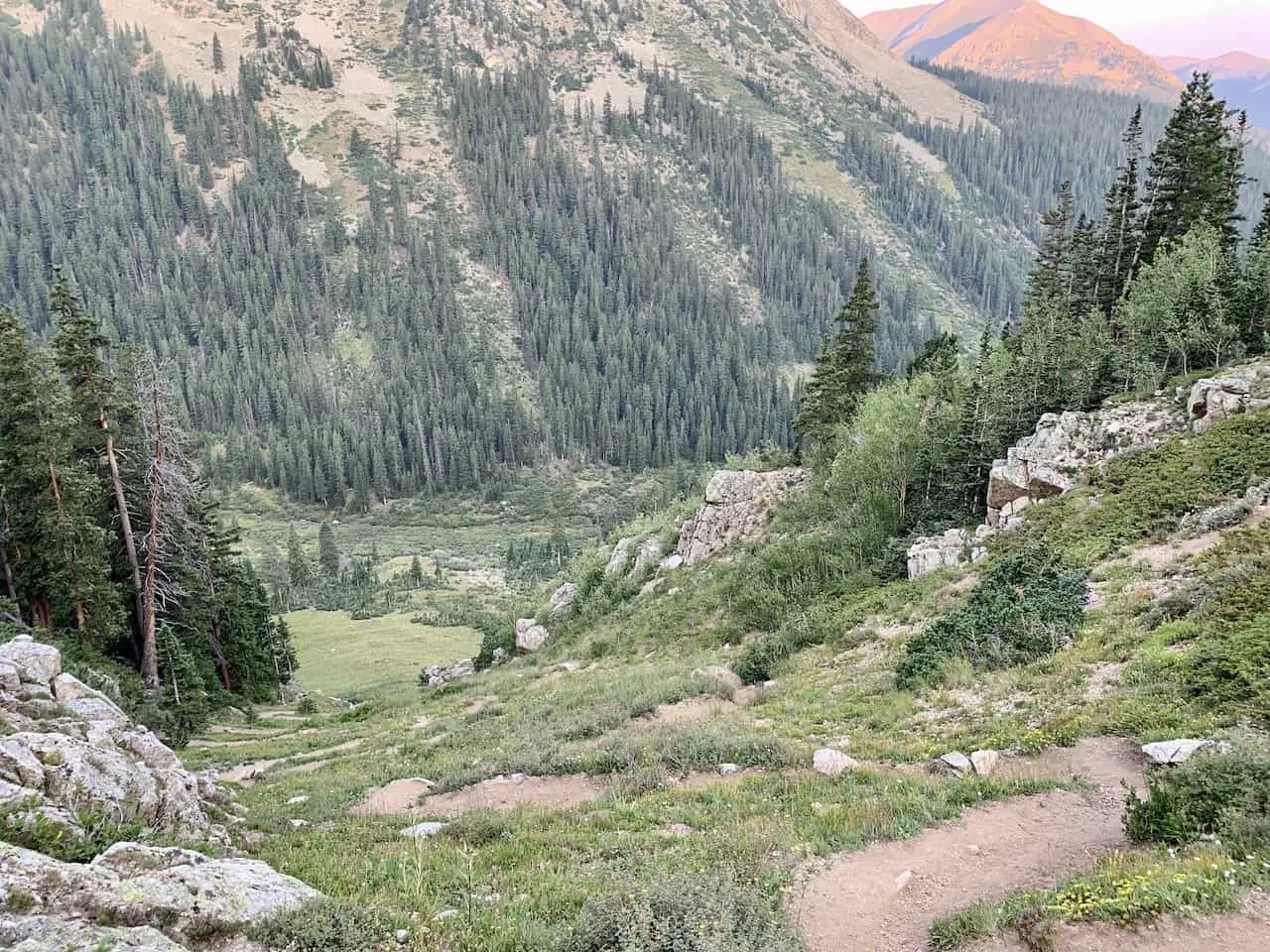
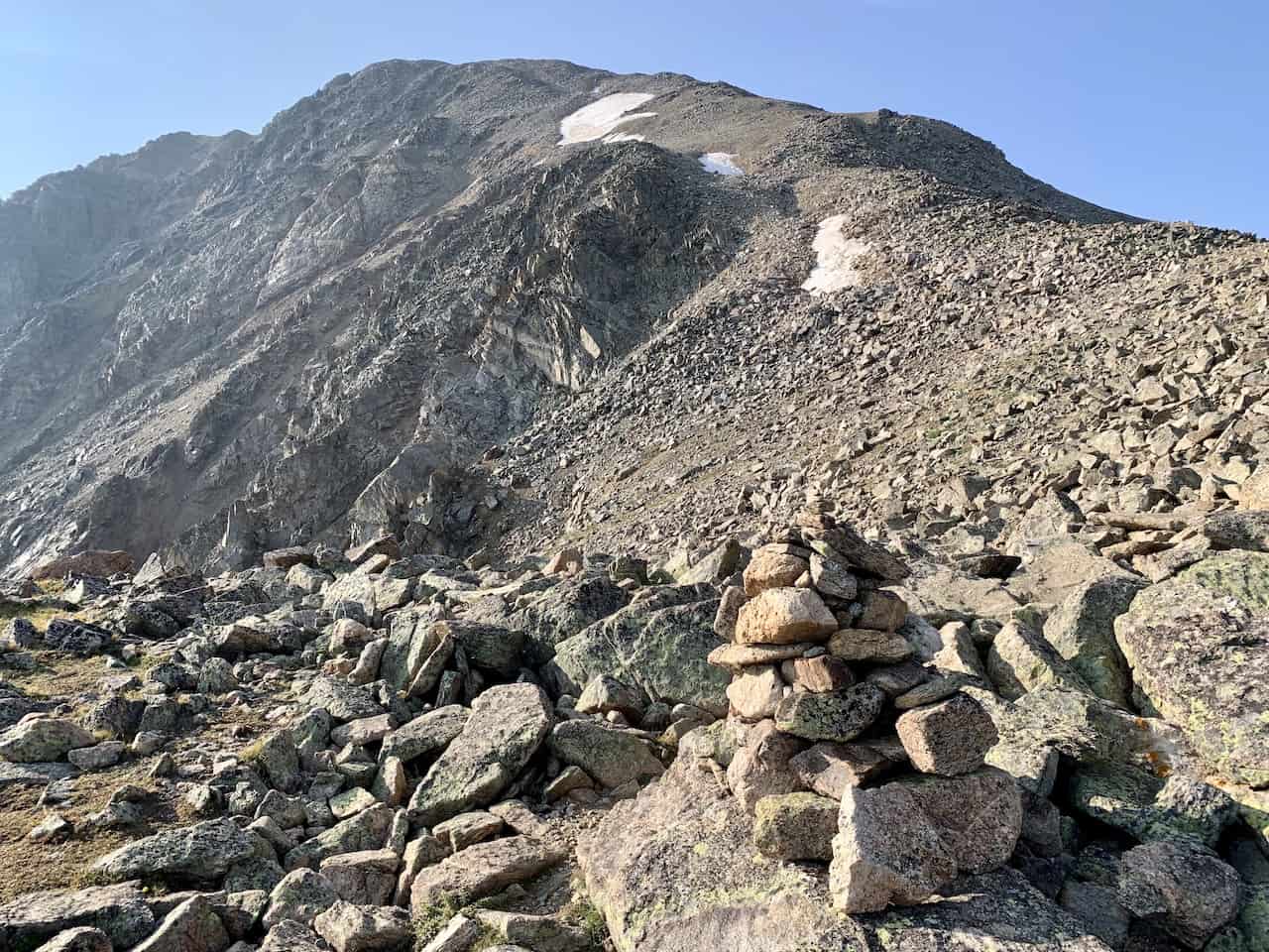
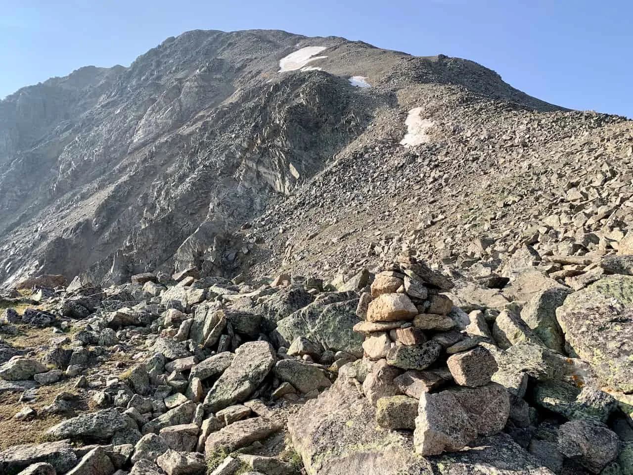
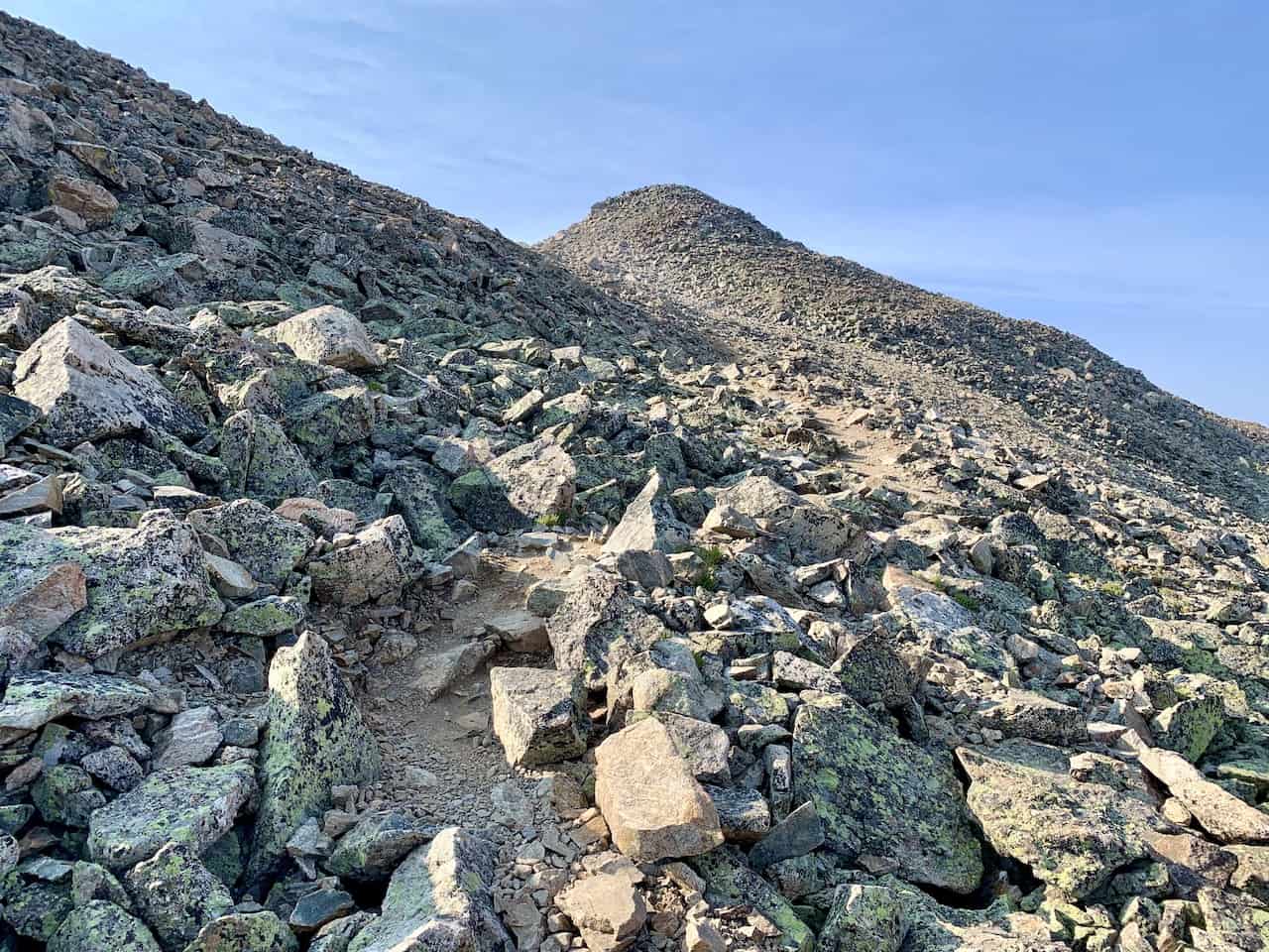
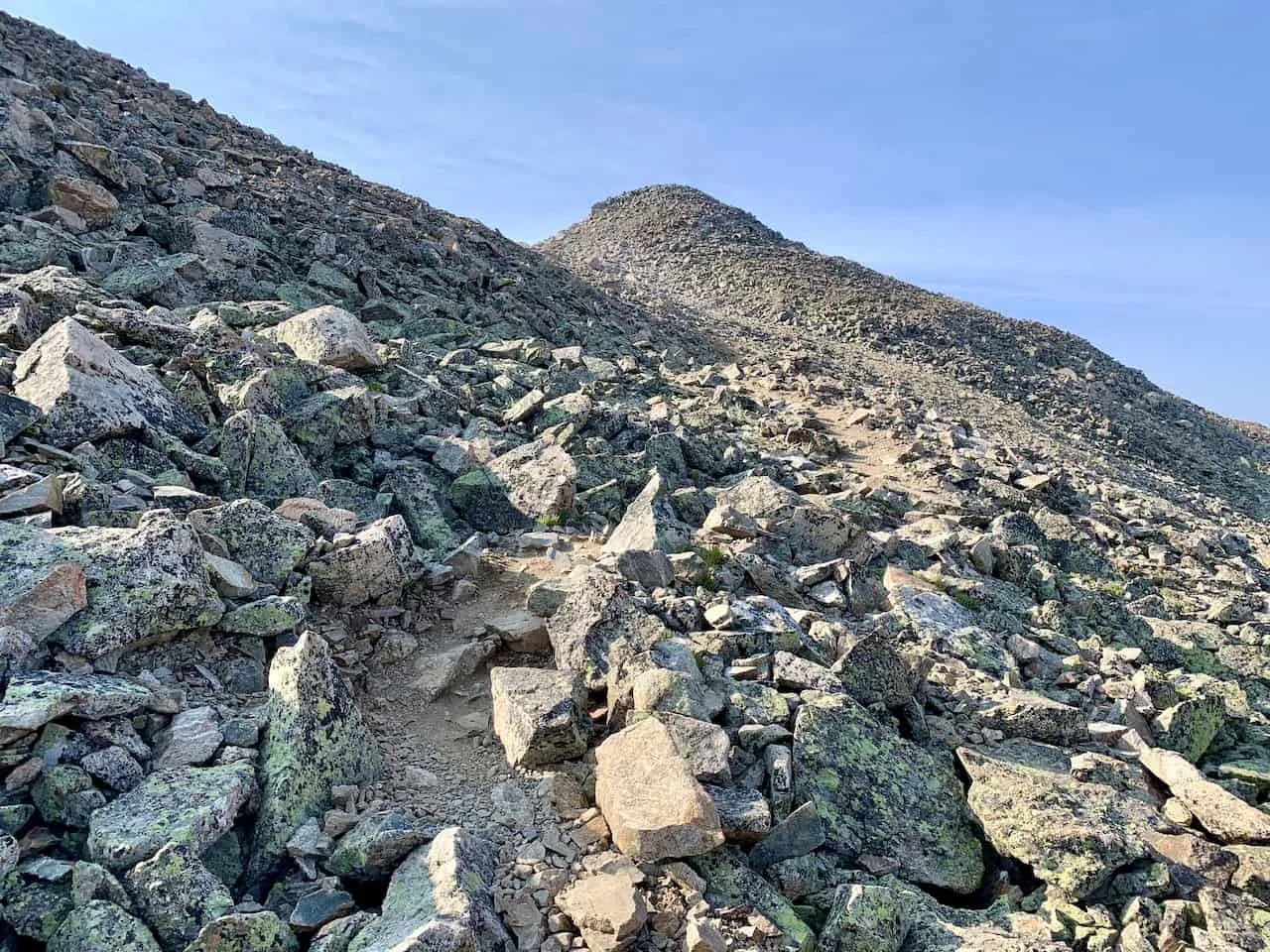
A rockier section comes up next as you maneuver your way around them and up towards the saddle of La Plata Peak.
From here, you should get a pretty good sense of the layout for the rest of the hike up as you see the northwest ridge out in front of you.


From here on out, you will want to follow the rock cairns (small/big piles of rocks) up towards the summit. It is important to note that there may be more than one route up the mountain here.
I did come across instance where there were routes heading up in parallel with one another. As long as you follow these rock piles and keep an eye on the next one as you continue up the mountain, you should be in a good spot.
You may also find yourself choosing between a rocky route vs a sandy route for certain portions. I found it easier to climb the rocks than the sand but that will be up to you depending on what you find easiest. I just found the sandy portions of the route to be a bit more slippery.


This is a long way up to the summit, so be sure to take those breaks, and enjoy those views along the way.
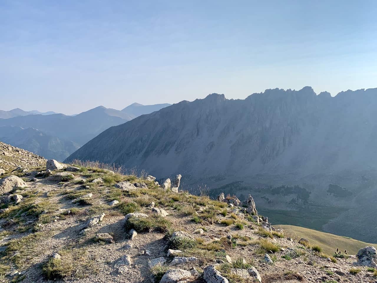
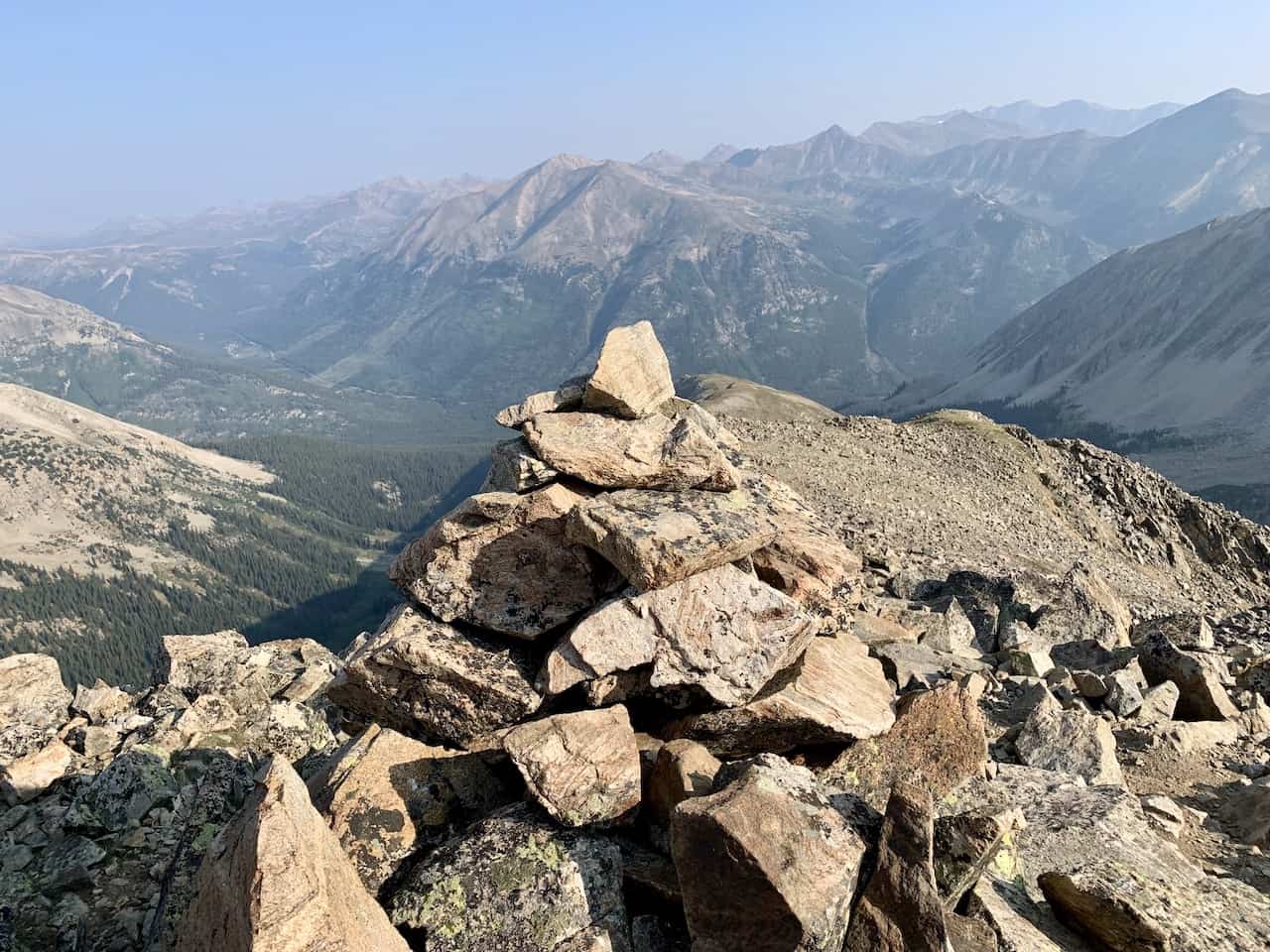
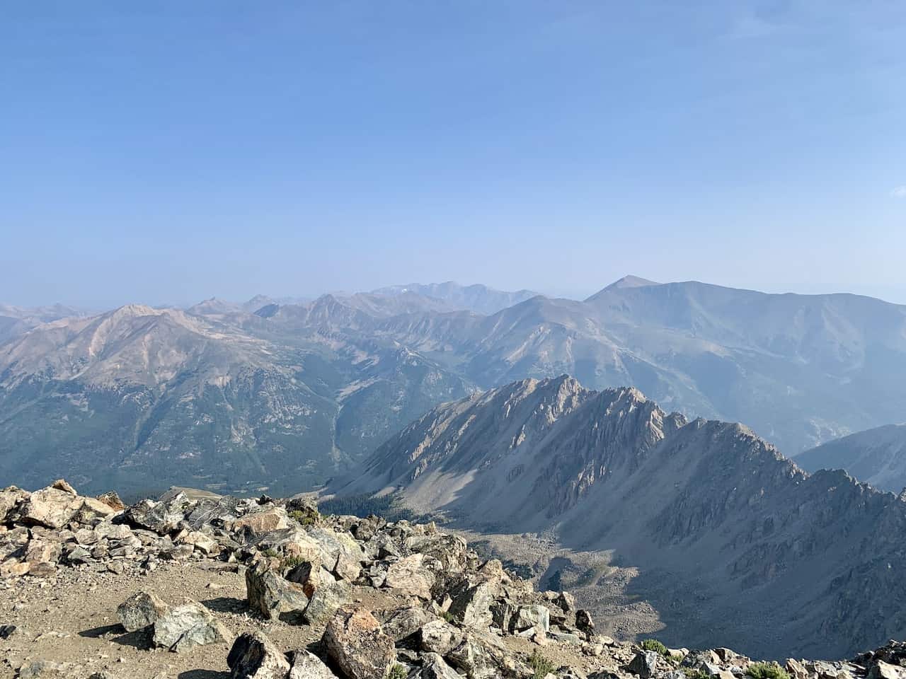
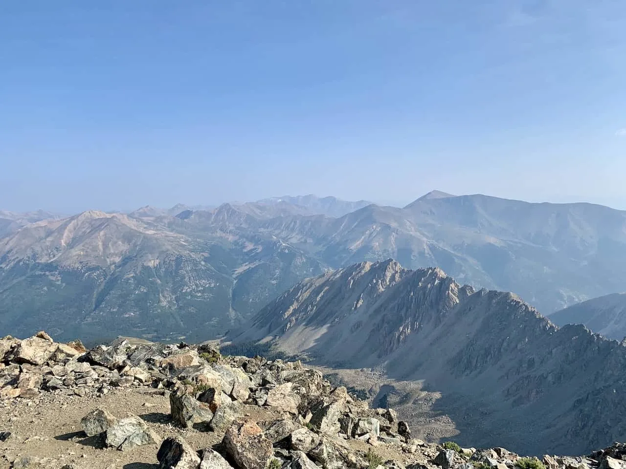
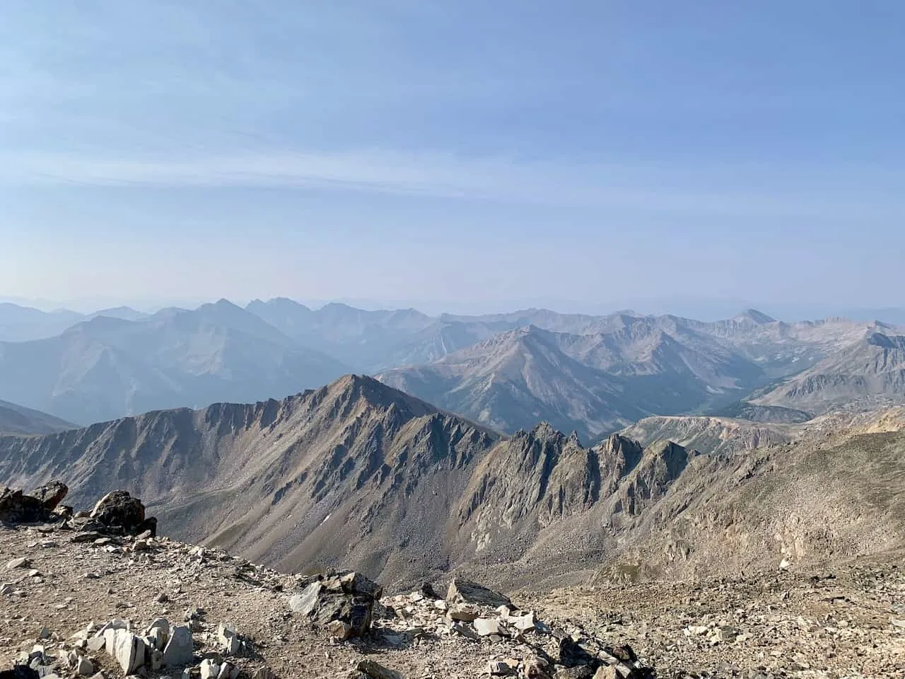
After 5 miles of hiking through the forest, up the switchbacks, and all along the ridge, you will reach the summit of La Plata Peak.
The views are never ending in every which direction as you get to take in the surrounding mountains and lakes all around you.

Once you had enough time at the summit, simply follow the same path you came up on back to the parking lot.
Be very careful on the initial section from the summit down to the saddle. There are a lot of rocks, slippery paths, and steeper terrain. Do take your time and watch your step as you continue downwards.
Once you reach the saddle, things should start to become much easier in terms of the terrain as you head back down the switchbacks and then through the forest to the parking lot.

7) Frequently Asked Questions
Below are just a few of the most frequently asked questions regarding La Plata Peak with some helpful answers.
How Difficult is La Plata Peak?
I would consider La Plata Peak as a moderately difficult mountain to climb. We are talking 10 miles and +4,500 feet of elevation gain with much of it on uneven and tricky terrain.
While the first few portions of the hike are not too technical is any way, it is still quite a bit of elevation gain. Once you reach that saddle and head up to the summit, we are talking elevation gain & class 2 terrain all in one.
What Class is La Plata Peak?
As just mentioned, La Plata Peak is a Class 2 climb. While the first four miles are pretty much class 1 for the most part, it is really that last 1 mile climb to the summit where the class 2 terrain picks up.
So, all said and done, out of the 10 miles of hiking, just around 2 miles will be on that harder to maneuver terrain vs. the rest of the hike.
How Long Does it Take to Hike La Plata Peak?
On the shorter end it should take around 5-6 hours to climb, however I would imagine most average hikers will be in that 7-8 hour range. This is going to be a longer 14er to hike so plan accordingly!

8) Where to Stay
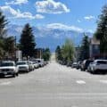
While there are many places you can choose to base yourself around the area, I would recommend staying in either Leadville or Buena Vista.
Both of them are about 45 minutes or so to trailhead with Leadville north of of the Highway 82 turnoff and Buena Vista south of it.
These are great places to stay if you are looking to not only hike La Plata Peak but also many of the other 14ers around the area. Below are a few highly recommended places to stay in each of them.
Leadville
Buena Vista
- Surf Hotel & Chateau
- Best Western Vista Inn
- Mount Princeton Hot Springs Resort (just outside town)
That about does it for a guide to the hike up La Plata Peak. If you have any additional questions or comments, be sure to add them in below.
Looking for More 14ers? Check out some more hiking guides for nearby peaks in the area including:
– Mount Elbert
– Huron Peak
– Mount Yale
– Mount Harvard
– Mount of the Holy Cross
– The Decalibron
– Quandary Peak
– Mount Massive
Have fun out there and safe travels!