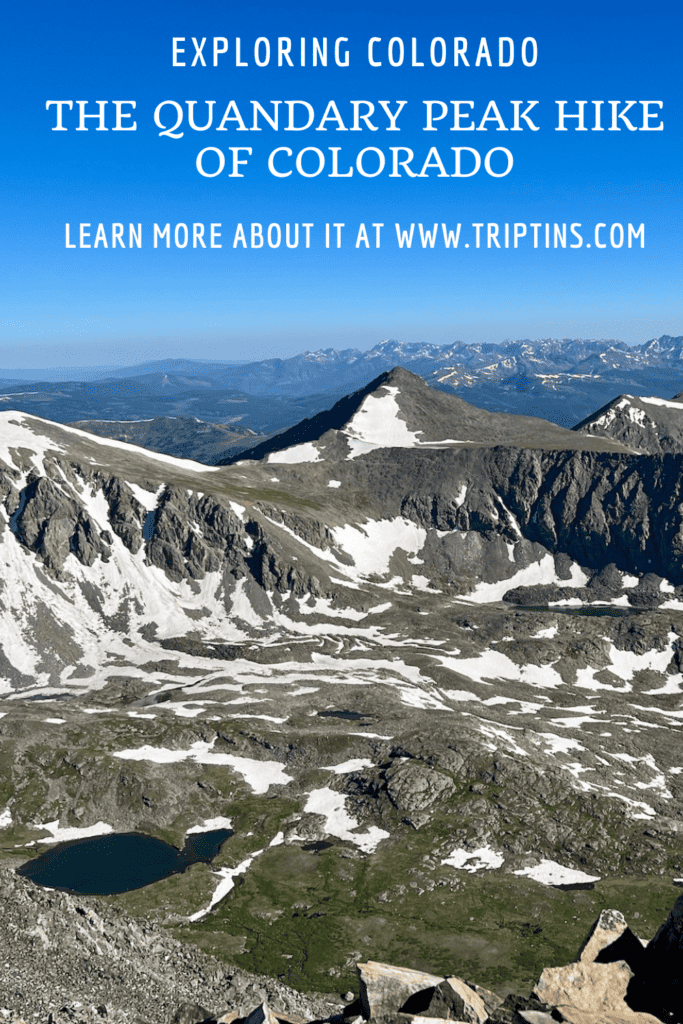
One of the most beautiful and popular 14ers in Colorado is Quandary Peak, located just outside of Breckenridge in the White River National Forest.
Quandary is considered as one of the easier 14ers out there, making it the perfect option for those that want to try and tackle a 14,000+ foot peak for themselves.
Read on to learn more about Quandary Peak and how to take part of the hike for yourself!
* Affiliate Disclosure: This post may contain affiliate links, which means I may receive a commission if you make a purchase through the links provided, at no additional cost to you. Thanks for supporting the work I put into TripTins!
1) Hiking Overview
To start off, below are some helpful trail stats for the hike up Quandary Peak. All of these stats reflect the round-trip hike along the standard East Ridge route.
- Distance: 7.4 miles
- Elevation Gain: +3,450 feet
- Duration: 4 – 6 hours
- Class: 1
- Quandary Peak Elevation: 14,265 feet
- Mountain Range: Tenmile Range
The standard Class 1 East Ridge route up Quandary Peak starts at the parking lot trailhead (more on that next), and gains 3,450 feet of elevation along ~3.7 miles of trail to the summit.
It tops at 14,265 feet in elevation, making it the 11th highest peak in Colorado and the only 14er in the Tenmile Range.
After taking in the beautiful views from the summit, it is then retracing your steps another 3.7 miles back to the trailhead to end a successful day out in the mountains.
Fun Fact: the name “Quandary Peak” came about in the 1860s, when a group of miners discovered an unknown mineral at the time. They were literally in a “quandary” (definition: a state of uncertainty) over what the mineral could be, and the name Quandary Peak came to be.
2) Quandary Peak Trailhead
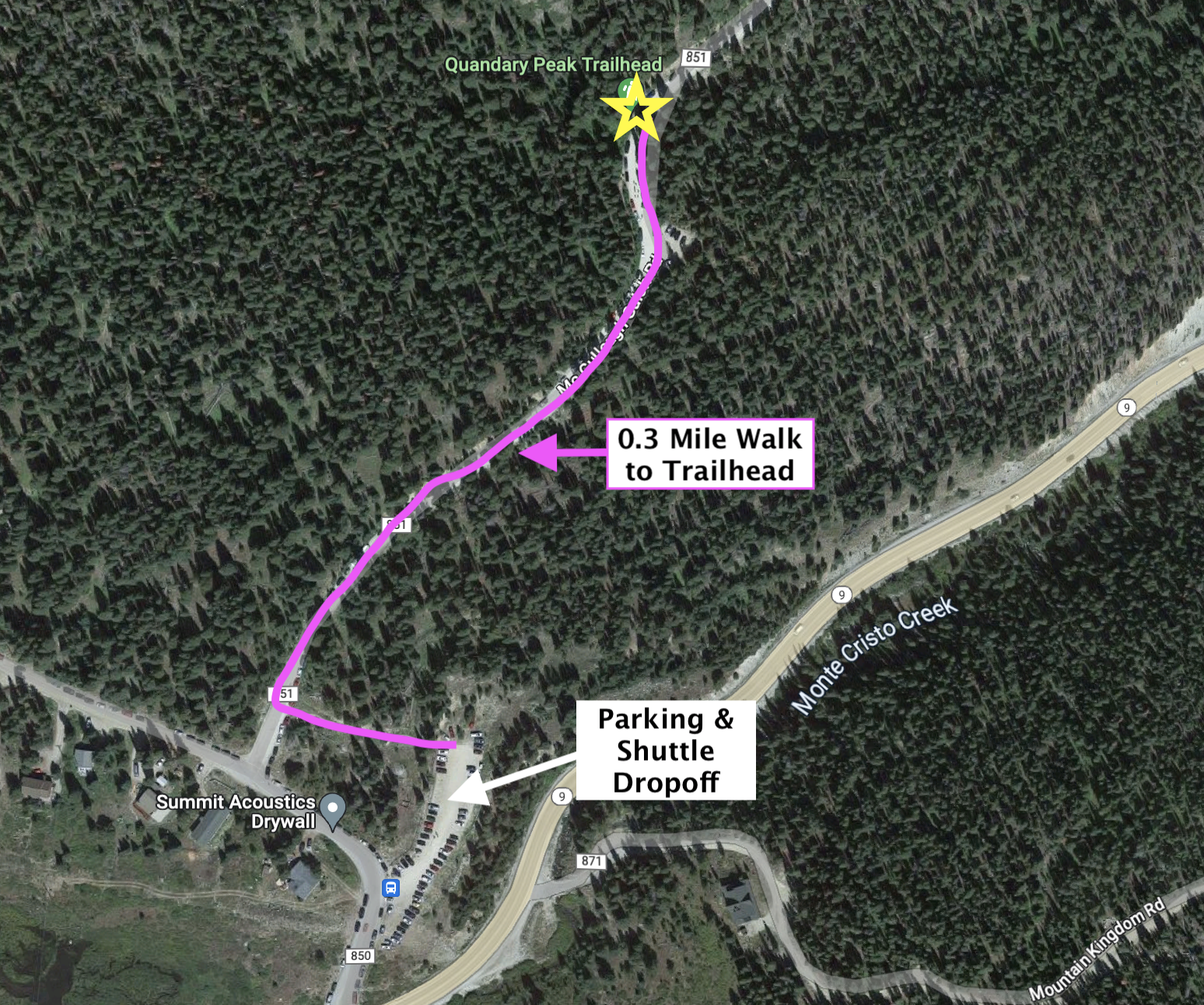
The Quandary Peak trailhead is located just off of McCullough Gulch Road. To get there simply make your way along CO-9, turn onto Blue Lakes Road, and you will be around the corner from the trailhead.
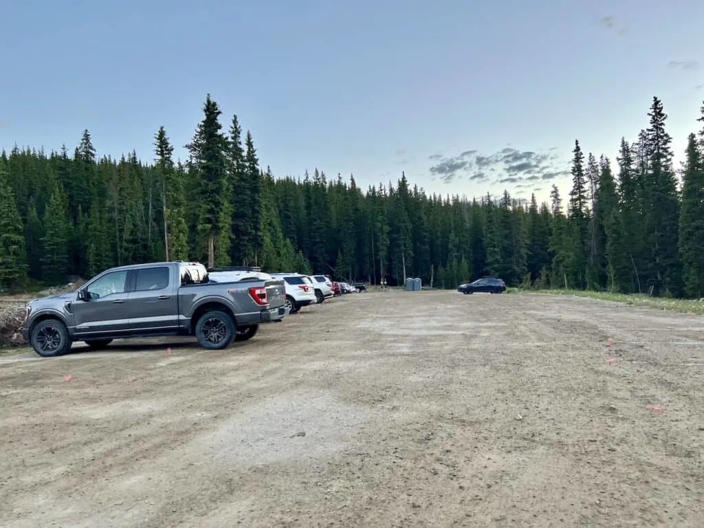
Over the last few years though, Quandary Peak became the most popular 14ers in the state. Due to this, the overflow of parking at the trailhead became just too dangerous.
In response to the situation, a new parking & shuttle reservation system was introduced (which I will cover in more detail in the following section).
When it comes to the trailhead though, you no longer can park directly next to it. Instead the official parking lot and shuttle drop off point is located on Blue Lakes Road, which is 0.3 miles away from the hiking starting point (included in the trail stats above).
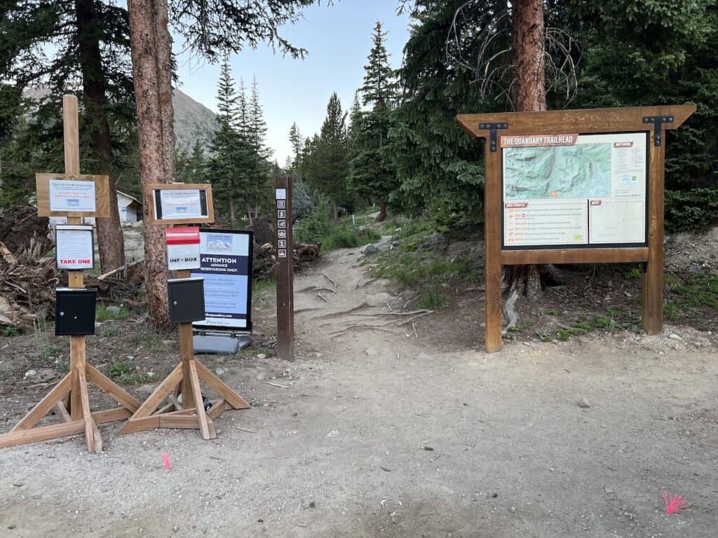

To better explain the parking / trailhead situation, see the screenshot below that lays it out:

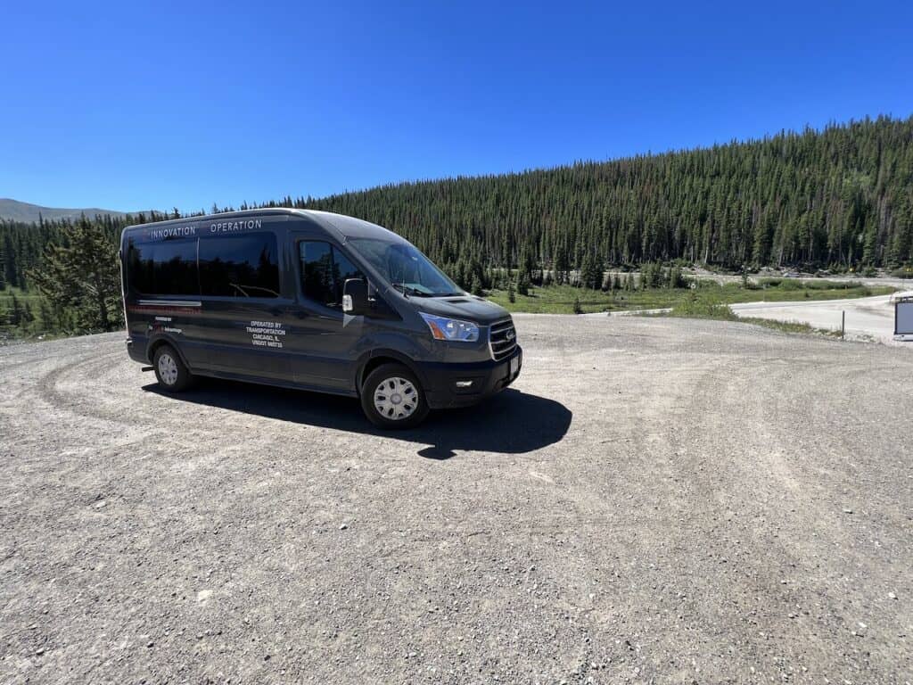
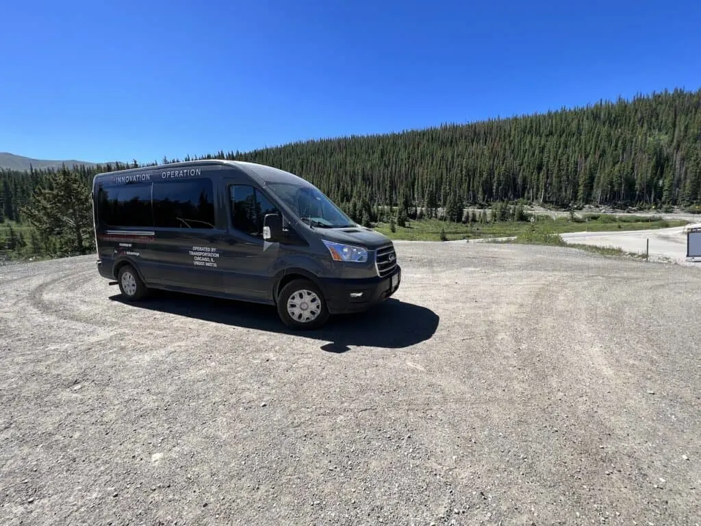
3) Parking Reservations & Shuttle
As I just mentioned, this is not one of those hikes where you can just show up and be on your way (unless you are simply dropped off by someone).
Instead, you must have a parking or shuttle reservation purchased ahead of time if you are hiking between June 17 2023 and September 17 2023.
A parking reservation will give you access to park in the main parking lot that has room for approximately 40 cars.
With a shuttle reservation, you can park your car in Breckenridge and then be driven the final 20 minutes to the parking lot by a shuttle.
These can both be booked through the official HikeQuandary website.
Below is some more information regarding each of these options:
Quandary Peak Parking
For those hiking up Quandary Peak, you will want to make a “full day” reservation from 5:00AM – 3:00PM.
The cost of parking is $30 from Monday to Thursday (excluding holidays), and $55 from Friday to Sunday (and holidays).
One exception to the parking reservation is if you arrive after 3:00PM. From then it is first come first serve and free of charge.
For navigation purposes, these GPS coordinates will take you directly to the main Quandary Peak parking lot: 39°22’56.7″N 106°03’46.6″W.
Colorado Car Rental: Looking for a rental car in Colorado? Check out Rentalcars.com for a variety of options that can work well on your trip.

Quandary Peak Shuttle
Since the parking reservation can be on the more expensive side (especially on weekends), many people opt to simply take the 20-minute shuttle from Breckenridge instead.
The shuttle costs just $7 round trip (free for Summit County residents), and operates from 5:00AM – 5:00PM daily (last shuttle back is at 4:30PM).
When making a reservation for the shuttle, you simply need to pick which day you will be taking it. You do not need to reserve specific time slots – these will be on a first come, first serve basis.
The shuttle pickup location is located at the Breckenridge South Gondola Parking Structure (80 North Park Avenue). For those driving to the shuttle pickup point, you will receive a one-time code that will give you free parking at the structure.
Once wrapped up with the hike, you simply just need to wait for the shuttle to arrive at the Quandary parking lot, and make your way back from there.
4) Quandary Peak Map
To better understand the locations of everything mentioned above, in addition to the trail itself, here is a map that lays it all out.
5) Weather Forecasts
When it comes to hiking up Quandary Peak, it will be very important to pay attention to the weather forecast. Since much of the hike is done above the tree line, you have to be cautious for those afternoon thunderstorms that are common in the summer months.
In addition, the views are just so much better without those low lying or thick clouds. Saving this hike for a nice weather day is your best bet.
I would recommend checking out a few different weather forecasts prior to taking on the hike:
Hiking Resources & Checklist
Before heading out for the trails, be sure to read up on some of the hiking resources up on the site. These are here to better prepare you for all types of outdoor adventure.
- Gear: Hiking Packing List
- Weather: How to Prepare for Hiking Weather
- Navigation: Hiking GPS & Navigation
- Tips: 20+ Hiking Tips & Tricks for the Trail
- Accommodation: Book Your Hotel Today
- Rental Car: Book Your Car Rental Today
6) Where to Stay in Breckenridge
Breckenridge is just 20 minutes away from the trailhead and makes for the perfect base. You not only can take advantage of this hiking trail but also many other nearby ones as well.
One of my favorites is the Mohawk Lakes trail. It is a great hike for those that want to acclimatize before taking on some higher elevation trails.
There are a few top spots to choose from around town. Below are three highly rated hotel options to consider during your time in the area.
Marriott’s Mountain Valley Lodge: when it comes to hotels in Breckenridge, it does not get much better than the Mountain Valley Lodge. Whether it is the location, rooms, pool, lake, or just overall facilities, you will be taken care of at the lodge.
Gravity Haus: this is another centrally located hotel with a very stylish design. The interior is chic & modern, and there are plenty of room choices available for different party sizes.
Residence Inn: another nearby Marriott property is the Residence Inn. The layout looks more like condos than a hotel. And that is the case because most of the rooms are studios & suites that include kitchenettes and larger layouts.

7) Colorado Hiking Tips
Whether you are hiking 14ers or just hiking down by some lakes, below are some helpful hiking tips when it comes to taking on some trails in Colorado.
Be aware of the elevation: hiking at altitude is no joke and you need to ease your way into the trails. Before taking on hikes from the start, give yourself a day or so to acclimatize.
Stay hydrated: to help with the altitude and the hiking itself, stay consistently hydrated. Take plenty of water and consider a Katadyn Filter Water Bottle for the trail.
Bring bug spray: the bugs can be out in full force on many trails. Put on some bug spray to keep yourself protected while hiking.
Apply sunscreen: the sun can be very strong in the mountains. Applying sunscreen (and wearing a hat / sunglasses), will be very important when it comes to protecting yourself.
Keep an eye on the forecast: the weather can turn suddenly out on the trails. Be sure to check the weather forecasts beforehand to avoid rain & thunderstorms. Afternoon storms can be more prominent in the summer months (so start early!).
Download offline maps: to keep yourself on track, download offline maps for the trail. This can be done by using navigation apps such as AllTrails, Maps.me, and Gaia. You should also download offline Google Maps, as cell service does not always work closer to the trailheads.
Check trail conditions: before committing to a trail, I would recommend looking at the latest trip reports on AllTrails (or 14ers.com for 14er hikes). This is more so important as the summer season starts & ends, as you can get a better idea of trail conditions & snow coverage.

Looking for More 14ers? Check out some other hiking guides for nearby peaks in the area including:
– Huron Peak
– La Plata Peak
– Mount Yale
– Mount of the Holy Cross
– The Decalibron
– Mount Massive
– Mount Elbert
– Mount Harvard
8) The Quandary Peak Hike
Let’s now get into some more details and photos about the Quandary Peak hike and what it entails.
Trailhead to Tree Line (1.5 miles)
For the most part, the first 1.5 miles of the hike will take place among the trees. After getting yourself to the parking lot (either with your own car or by shuttle), simply follow the pathway pointing you towards the trailhead.
The first 0.3 miles of the hike takes you along a dirt pathway and dirt road until you reach the “official” trailhead on the left hand side.
Head up onto the trail and begin the gradual ascent through the trees!
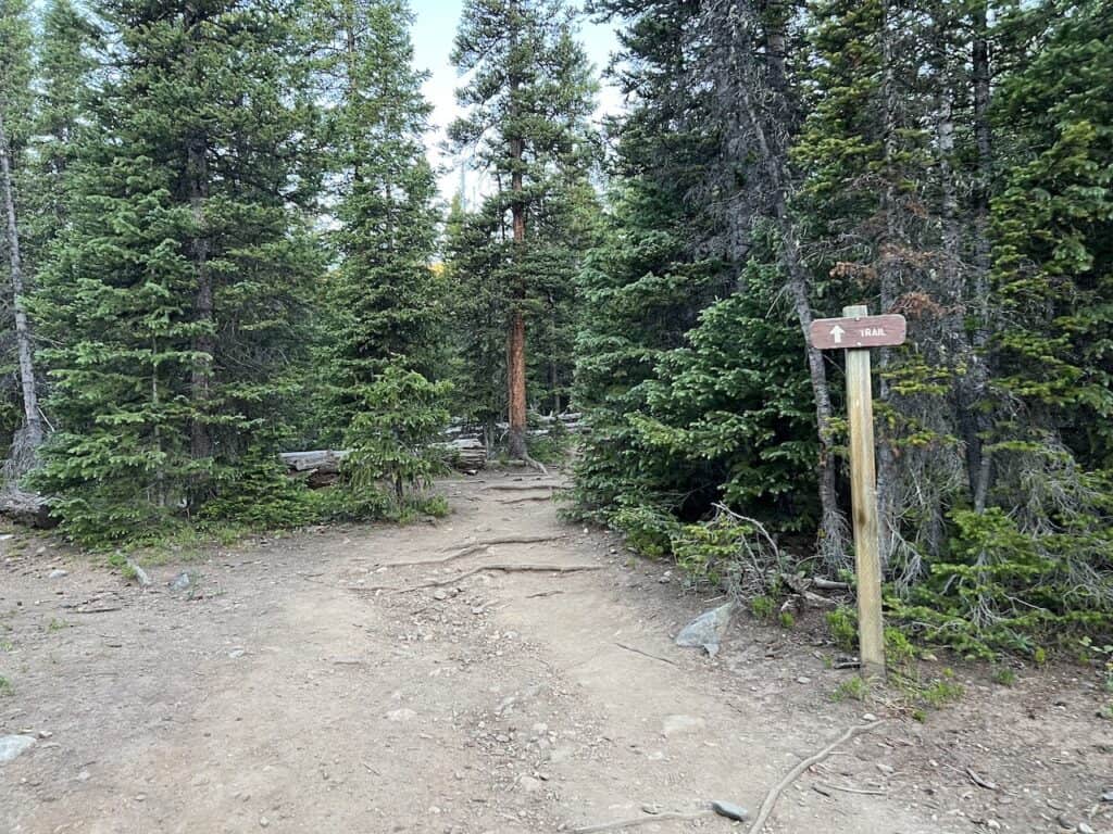
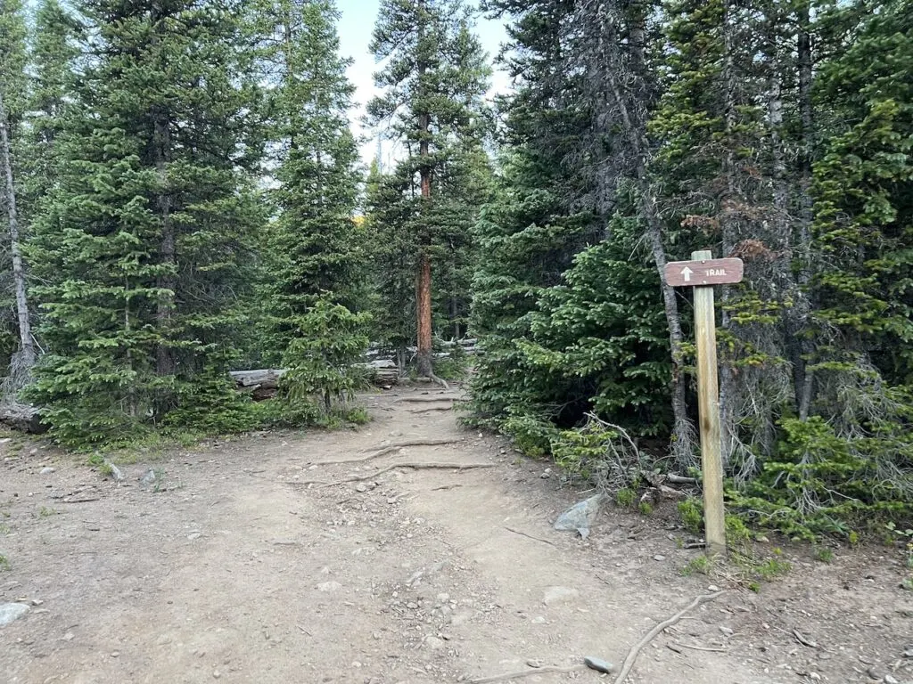

This section of trail in general is very well maintained. The pathway is obvious and there are several manmade steps to help get you higher along the forest.
While the trail does gain elevation all the way through, you will find it to be more gradual and a good way to ease yourself into the hike.
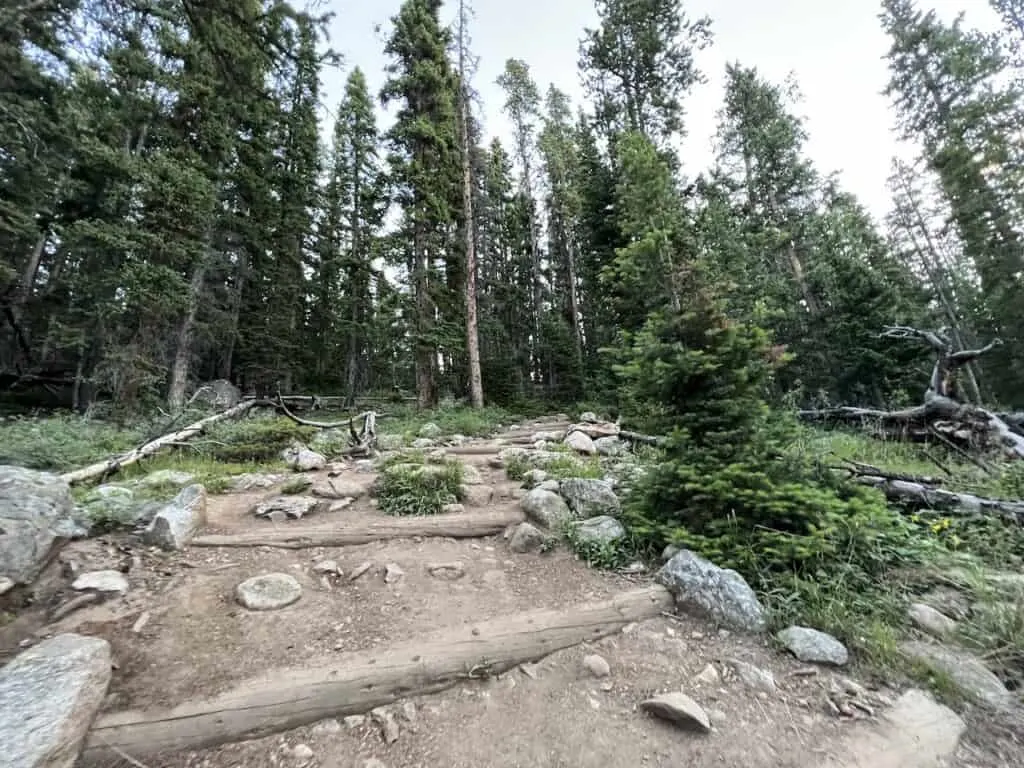
After some hiking, the trees will start to get dispersed. Soon, more and more views will begin to open up all around you as you get past the tree line and to the next portion of trail.
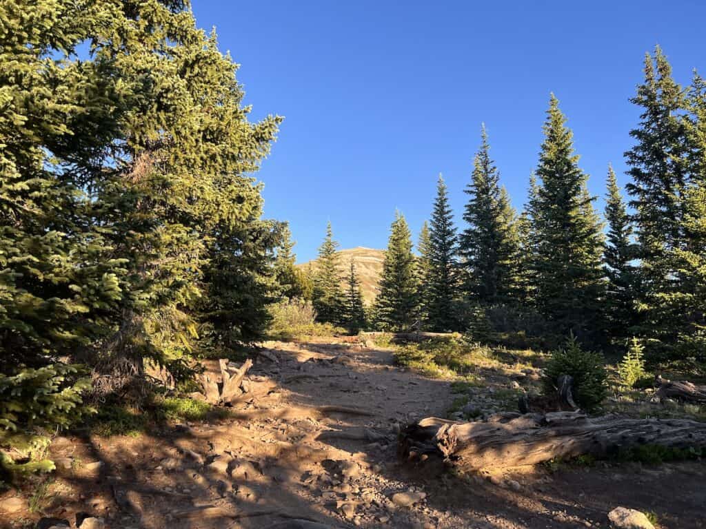

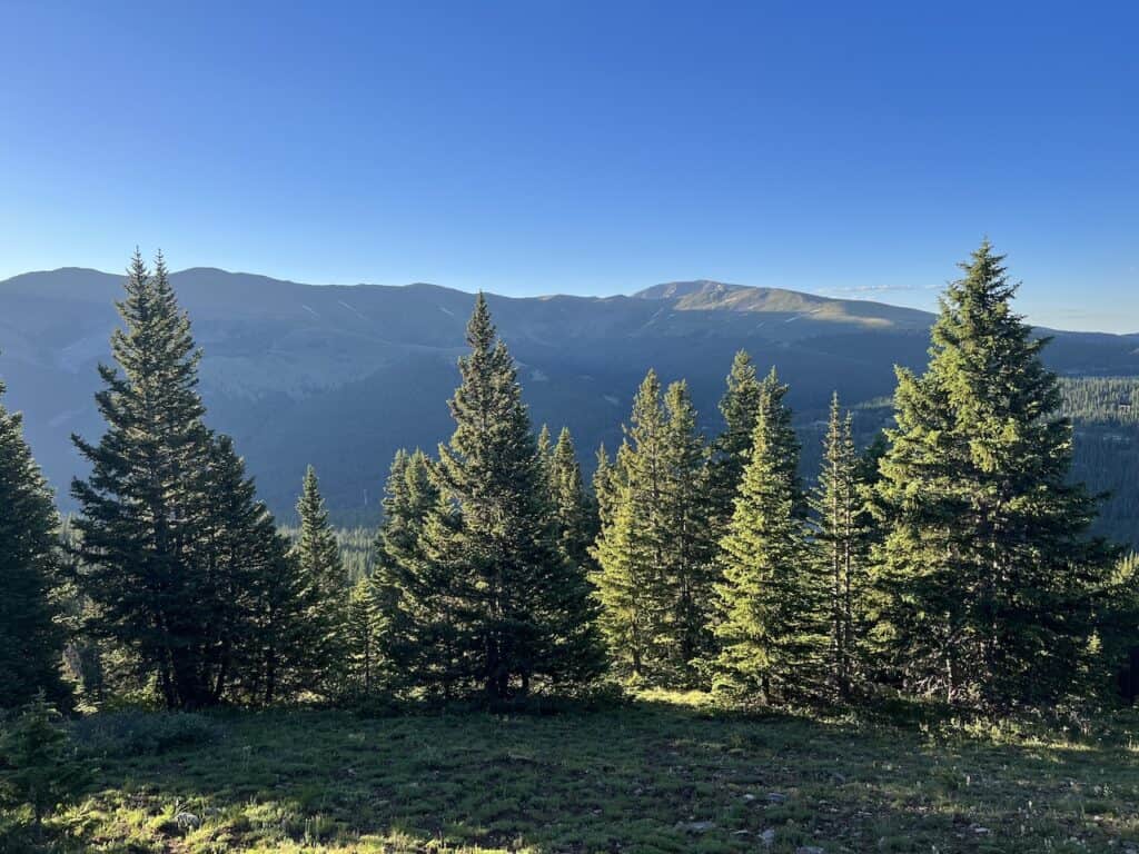
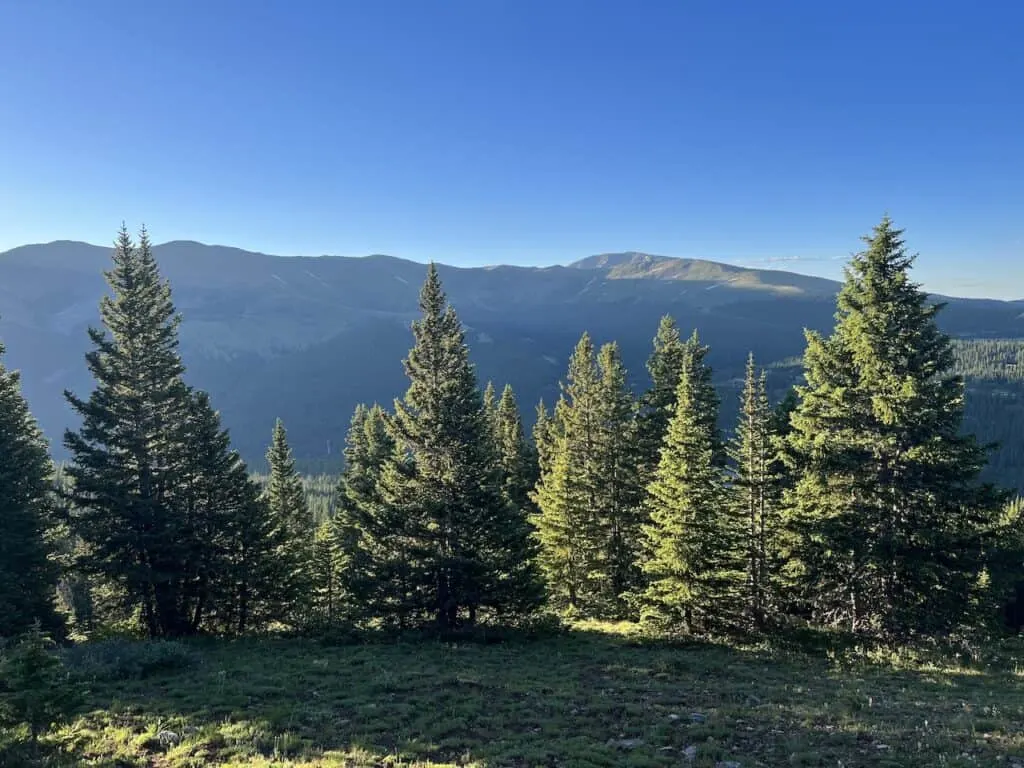
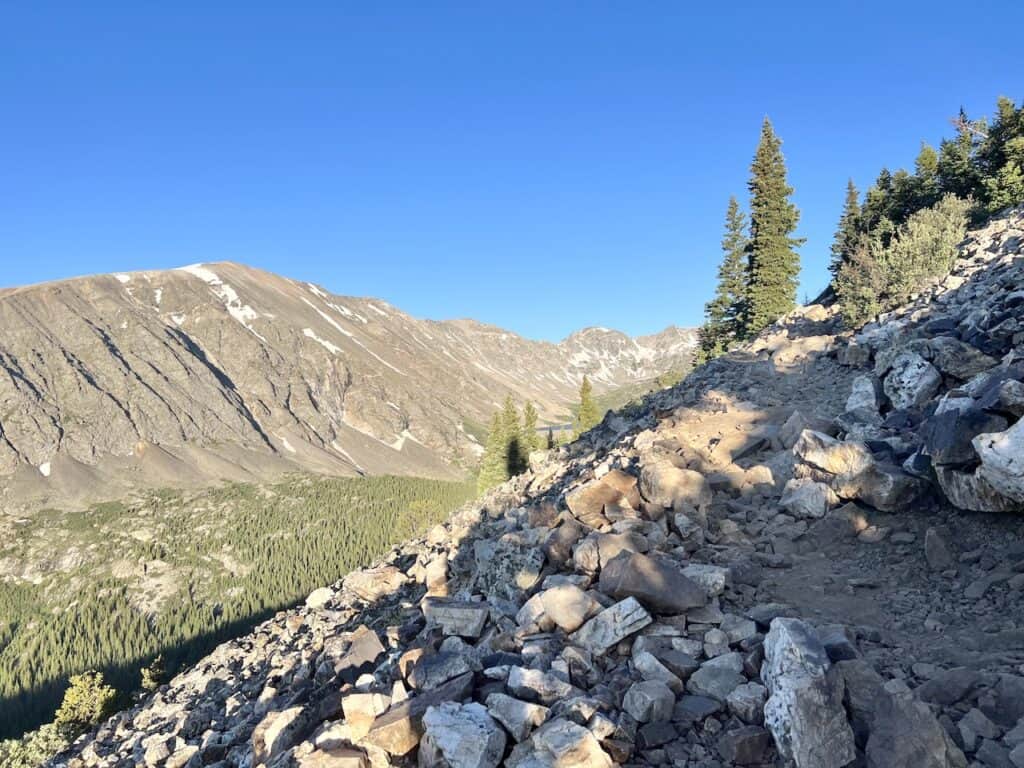
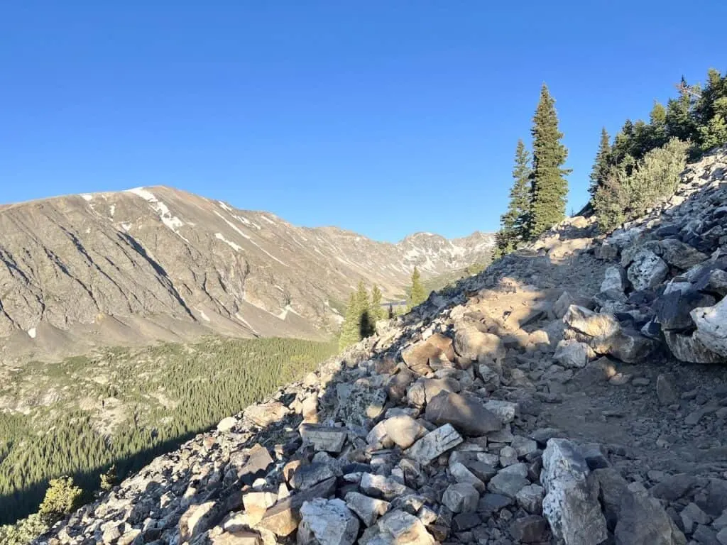
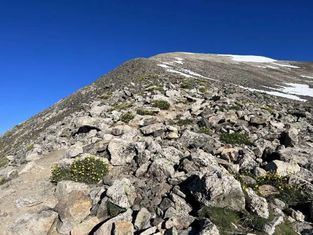
Tree Line to Ridge (1.3 mile)
As soon as you exit the trees, you will begin to get views of Quandary Peak out in the distance. For the next mile or so, the trail continues to gain elevation until a relatively flat portion (that is where the final ascent begins from).
To get there though, continue to follow the dirt trail, which will also turn rockier throughout as well.
Again, the trail is easy to follow, so you should not have much issue. However, it is a continuous amount of elevation gain along the way. While it will not feel crazy steep, there is over 1,200 feet of elevation gain that is happening during these 1.3 miles.
Be sure to take breaks as needed and enjoy some of the views that will begin to appear.
Soon the trail will begin to flatten out for a very short section. Here is where the final push to the summit begins.
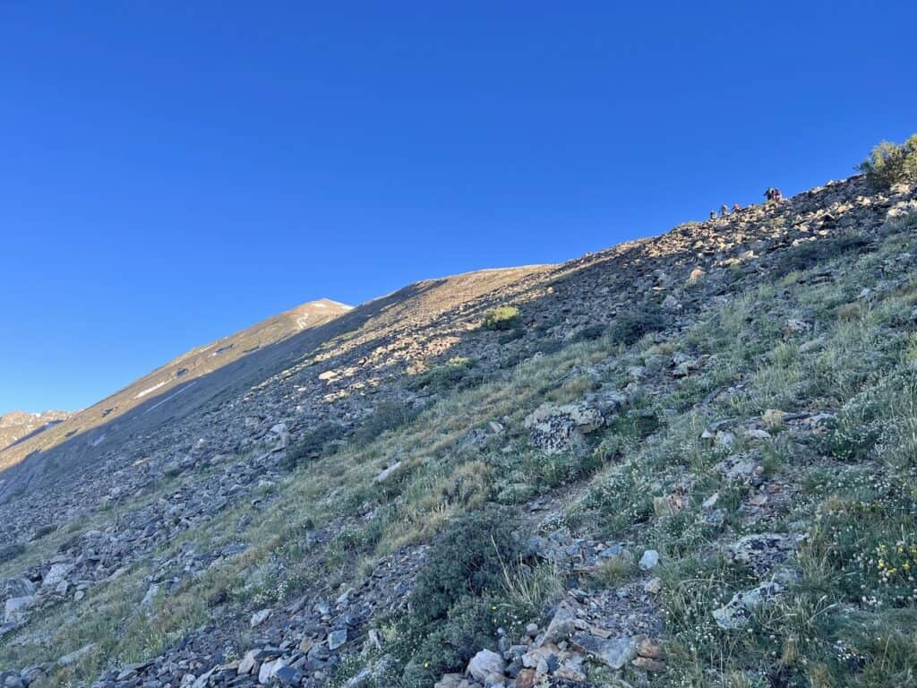
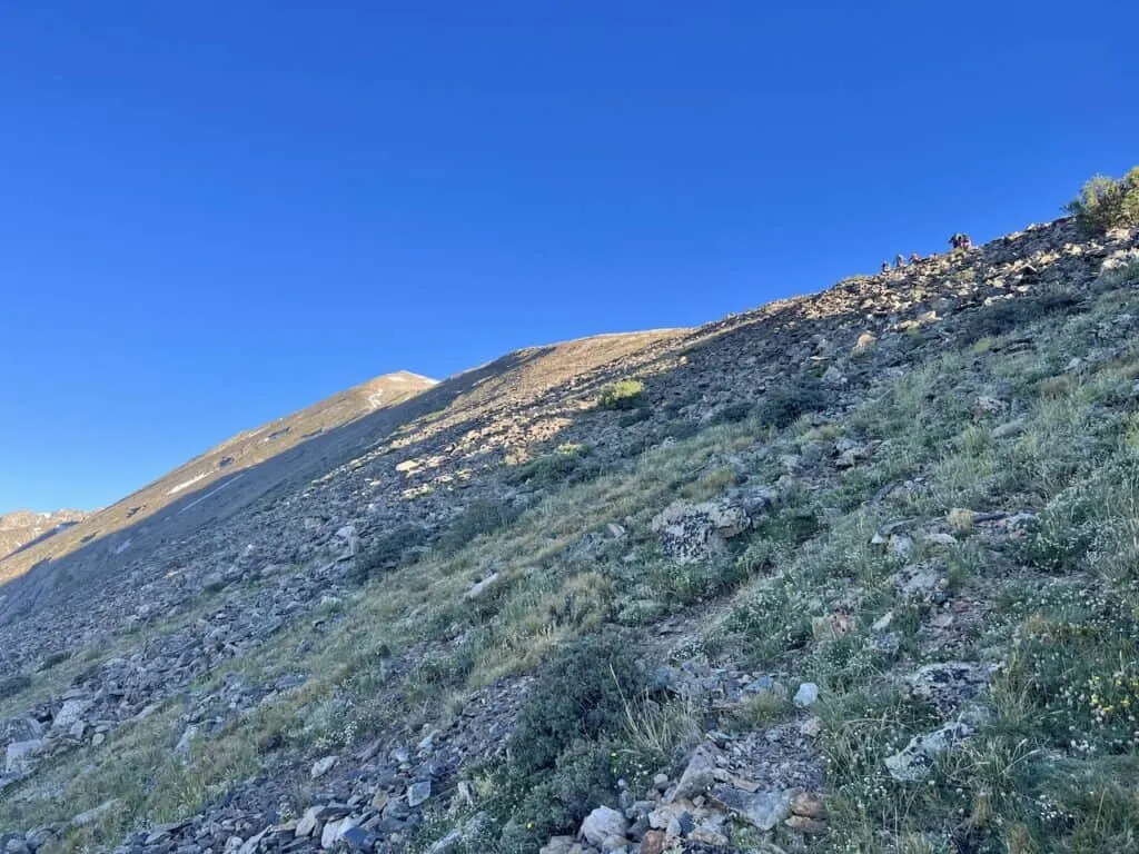
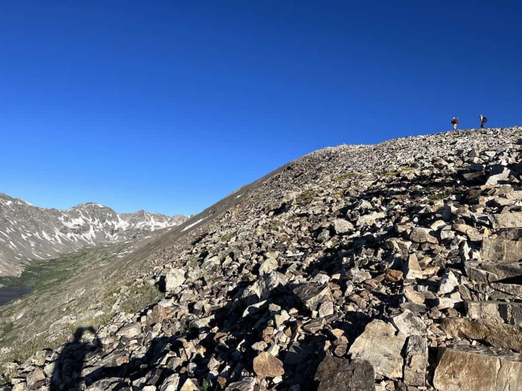

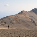
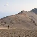
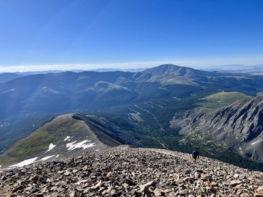
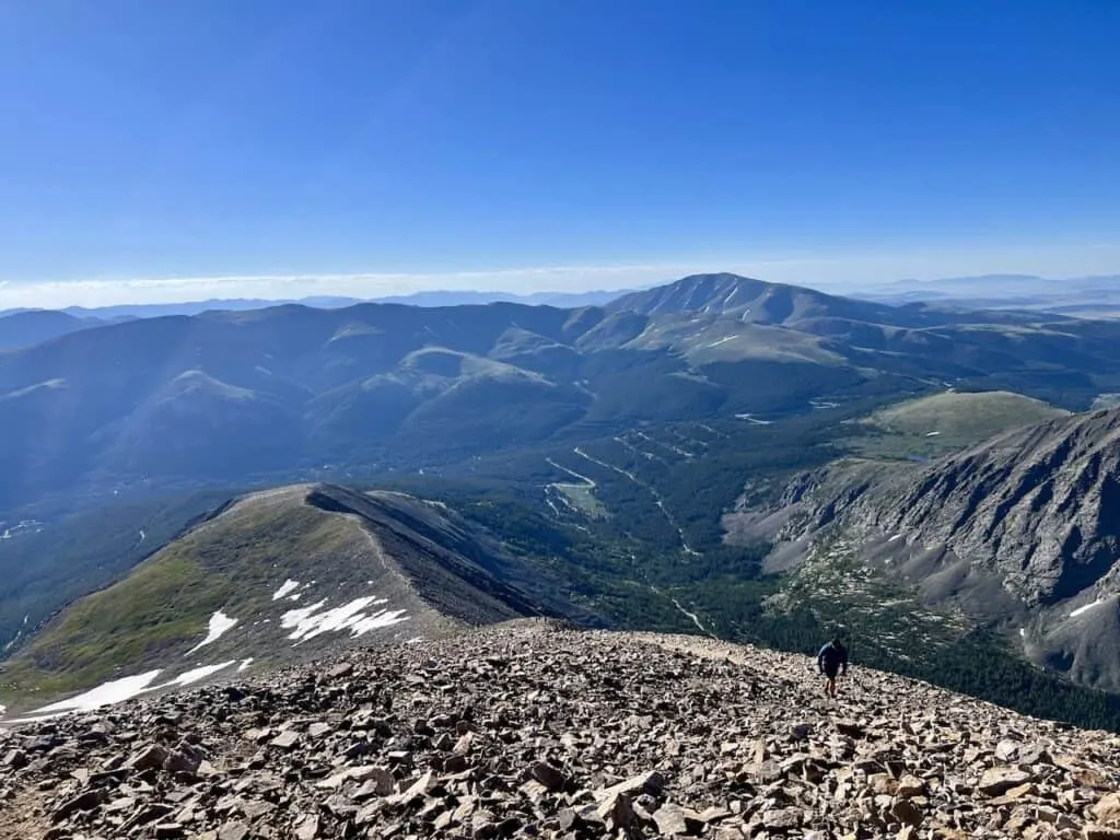
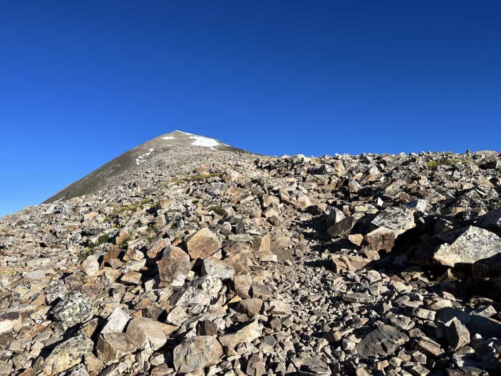
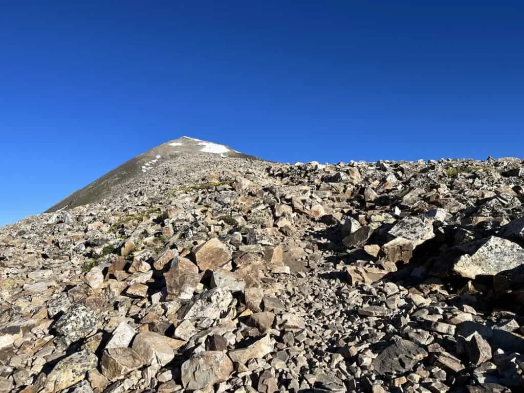
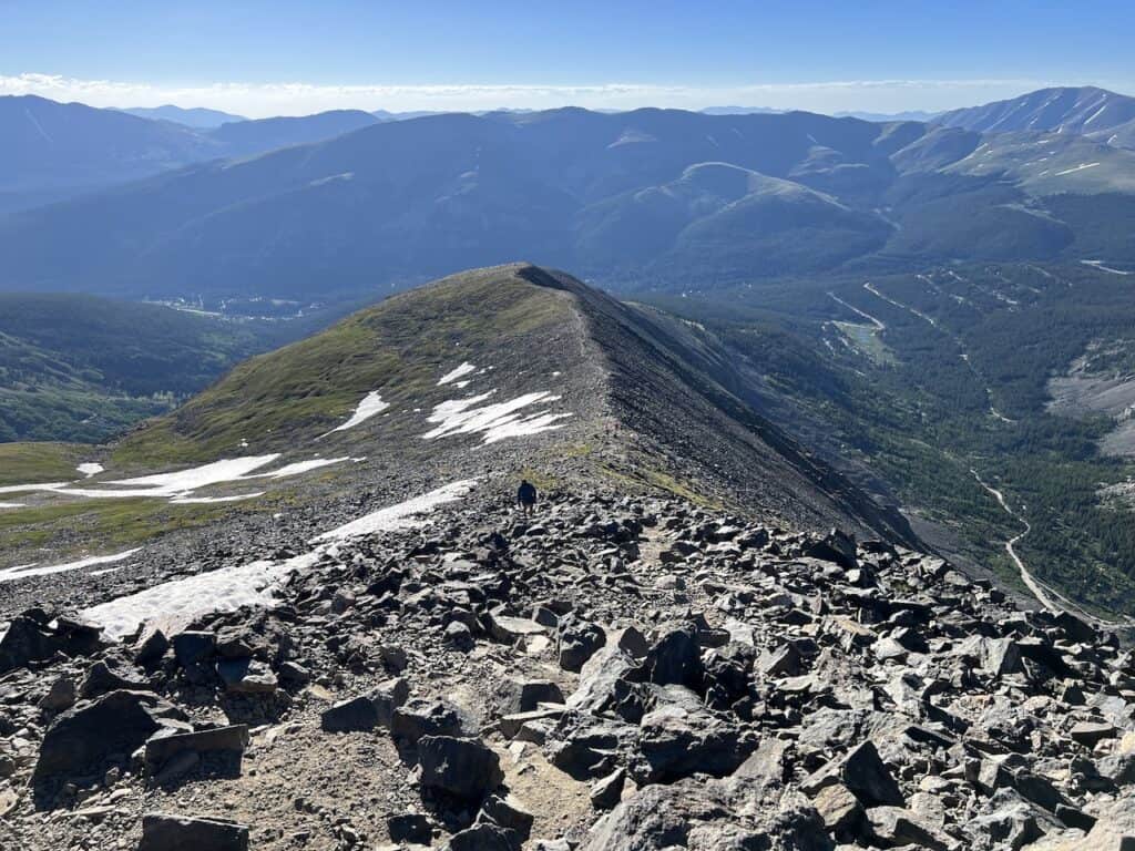
Ridge to Summit (1 mile)
The final mile or so is where things start to feel harder on your body. By now, plenty of elevation gain will be made, however it is still another ~1,100 feet to the summit.

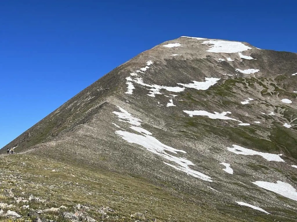
As you continue up, the trail grade will increase and the terrain will get rockier along the way. You may find yourself second guessing on where the trail is as more and more rocks surround you.
Continue to take it slow here and enjoy some breaks as needed. The views will continue to get better as you head further up the mountainside, and I am sure you will see a line of people slowly inching their way along the trail down below.


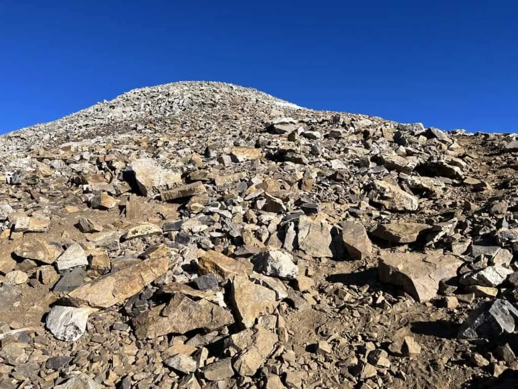
While the terrain did get a little more confusing up here at points, I did find one more obvious trail for 95% of the way. However, there was one instance, where I got myself turned around. Just be careful as you head up and always eye the trail out in front of you.
Although I hiked in mid July, there was still some residual snow near the summit. This is usually gone by the end of June on a normal year (however it did snow quite a bit the winter prior).
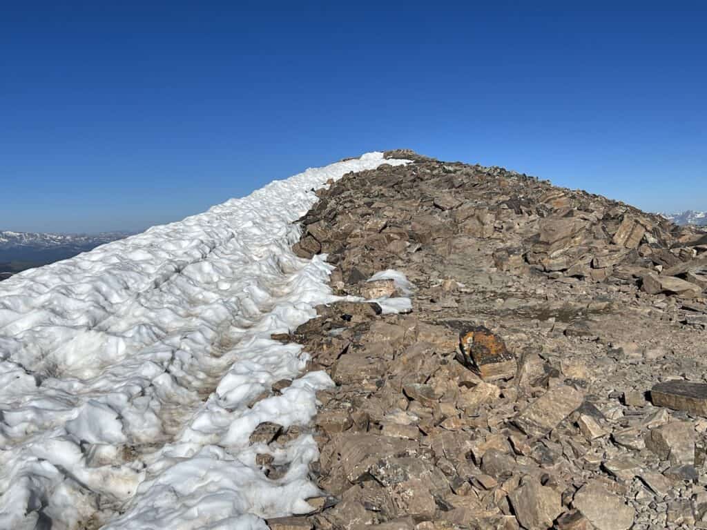

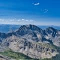
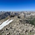
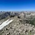
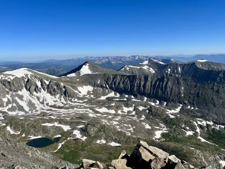
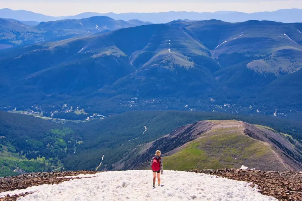
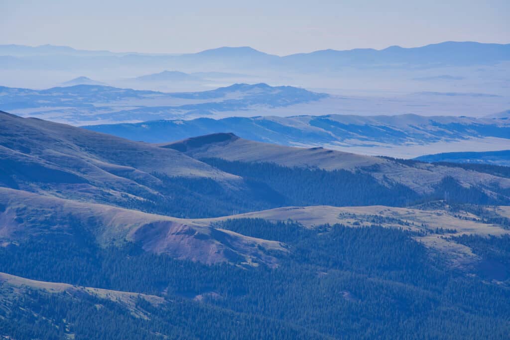
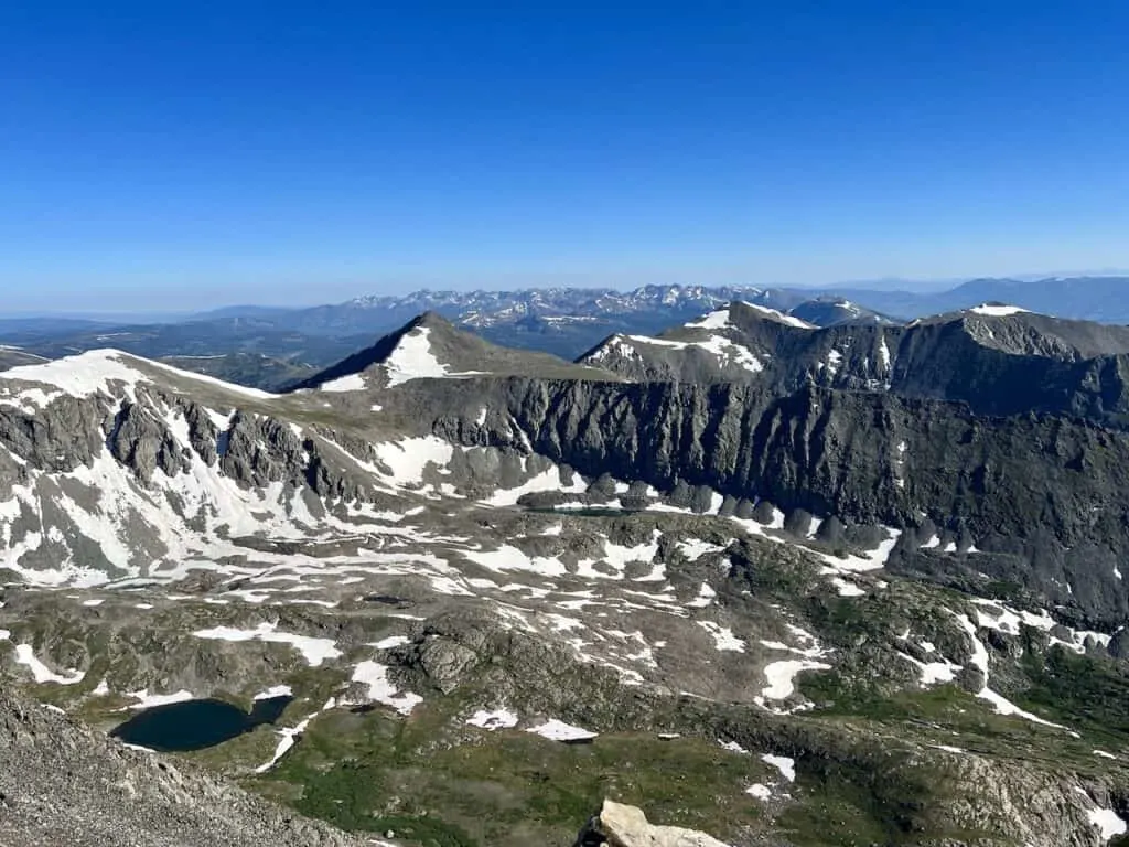
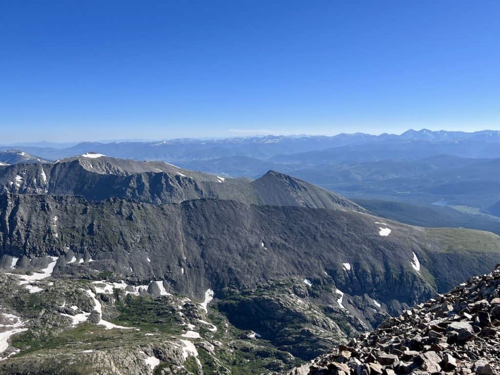
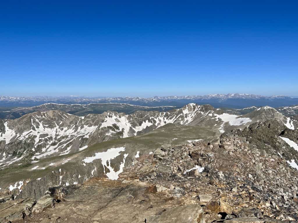
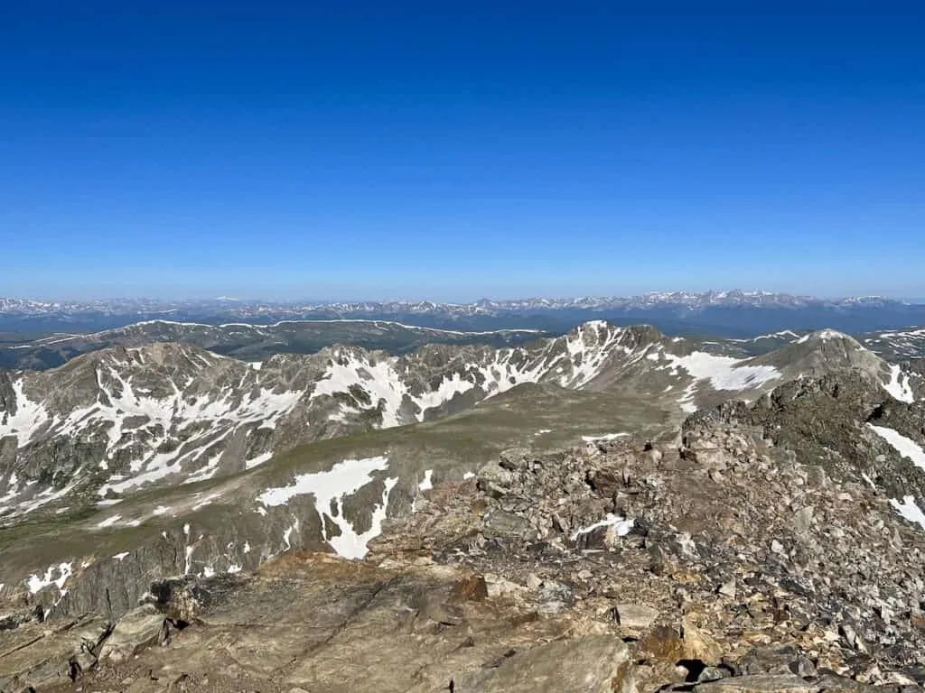
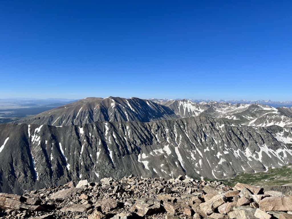
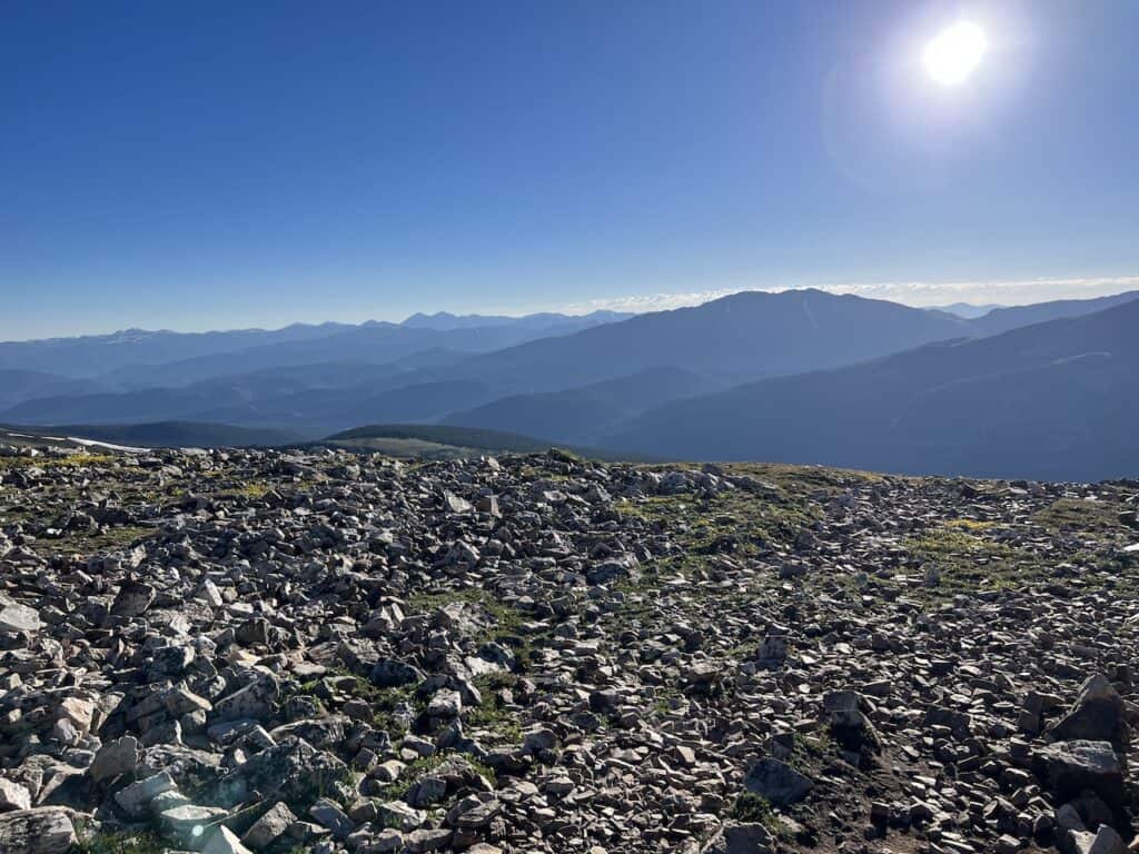
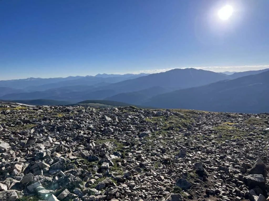
Quandary Peak Summit
After hiking along this final stretch, the summit finally comes into view. From up top there are 360 degree views to fully enjoy.
Other 14ers will be out in front including the famous Decalibron – Democrat, Cameron, Lincoln, and Bross. In addition, you will be able to see all the way out to many other peaks and mountain ranges on a clear day.
Find a nice spot to relax and soak it all in. Below are some summit photos I took during my time up top:


Hiking Back Down
The hike back down will follow the same path that you came up on. But this time, it should be a less strenuous effort as you follow the trail downwards to the parking lot.
During the descent, you will be able to take in some more views out in front of you. It is easy to miss them on the way up, but the way down should be more enjoyable.
Once back at the trailhead parking lot, either hop back into your car or wait for the next shuttle that will get you back to Breckenridge.

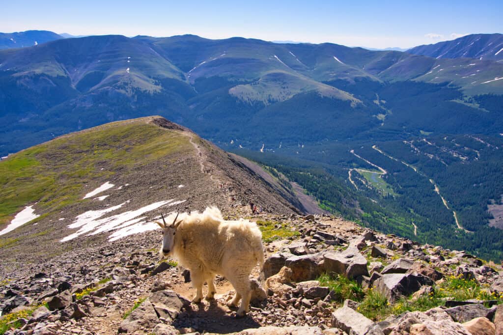
Mountain Goats
Before wrapping up this hiking overview, I just had to mention the mountain goats that call Quandary Peak home.
While mountain goats can be found on many mountains throughout Colorado, there is a high likelihood you pass them by on Quandary.
During my descent, there was a pack of three goats that were slowly making their way down just alongside the trail.
These goats usually mind their own business and get out of the way for hikers. But do not be overly aggressive and purposely try to get too close to them. Just let them be and capture some photos from a distance.

That about does it for the Quandary Peak hike of Colorado. If you have any questions or comments, be sure to add them in below.
Also, don’t forget to check out some of the other Colorado hiking guides up on the site.
Have fun out there and safe travels!