
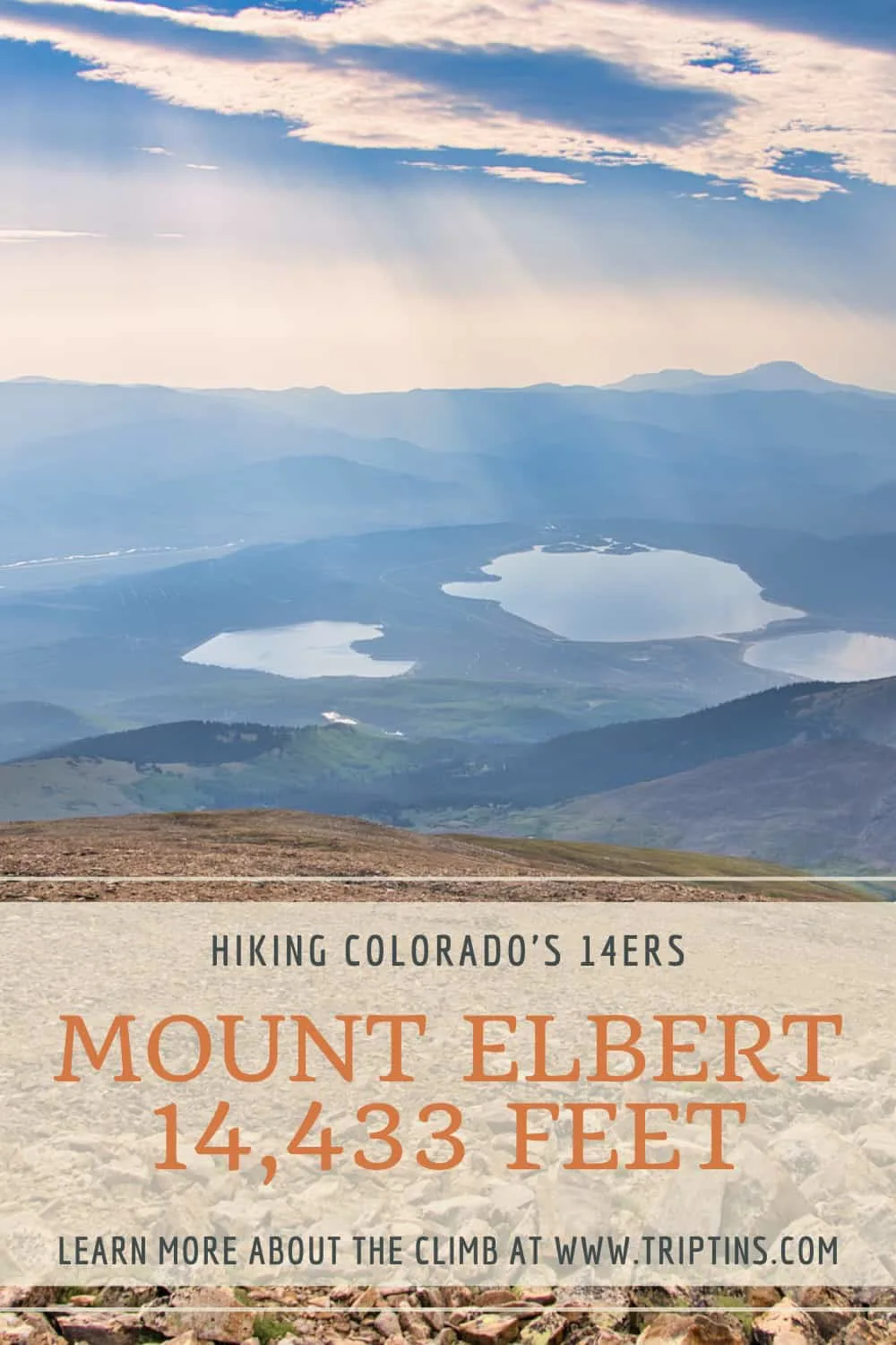
At 14,433 feet in elevation, Mt Elbert stands as the highest point in all of Colorado. While this hike does gain around 4,700 feet of elevation and makes up a 10 mile round trip hike, the standard Northeast Ridge route itself is considered a Class 1 climb.
So, whether you are more of a novice hiker or you have hiked many other 14ers before, this is a climb that allows a little bit of everyone to take part.
This guide will go over all the details you need to know in order to take part of the hike for yourself. From trailhead location to hiking maps to the route itself, read on to learn about it all and more.
* Affiliate Disclosure: This post may contain affiliate links, which means I may receive a commission if you make a purchase through the links provided, at no additional cost to you. Thanks for supporting the work I put into TripTins!
1) Overview & Details
Here are some of the most useful things to know regarding a Mt Elbert climb. I will then dive into some of these aspects in more detail throughout the guide
Mountain Name
Mount Elbert -> the mountain was named after Samuel Hitt Elbert, a Colorado statesman. He was the territorial governor of Colorado in 1873.
Mount Elbert Routes
There are 3 main routes up Mount Elbert -> Northeast Ridge, East Ridge, and Southeast Ridge. The Northeast and East routes are considered class 1 while the Southeast is class 2. The “standard” route up Elbert is the Northeast Ridge.
Mountain Range
Elbert is located within the Sawatch Range in Central Colorado. There are many other 14ers in the range including Massive, La Plata, Yale, Huron, among others.
Mount Elbert Height
Elbert rises 14,433 feet / 4,399 meters above sea level. It is the highest point in Colorado and the second highest point in the contiguous United States (Mt Whitney in California being the only one higher).
Mt Elbert Trailhead
Since there are three different routes up the mountain, there would be three different trailheads. Below are the GPS coordinates for each one:
- Northeast Ridge: 39°09’06.7″N 106°24’44.1″W
- East Ridge: 39°05’56.9″N 106°22’02.0″W
- Southeast Ridge: 39°04’08.1″N 106°26’01.4″W
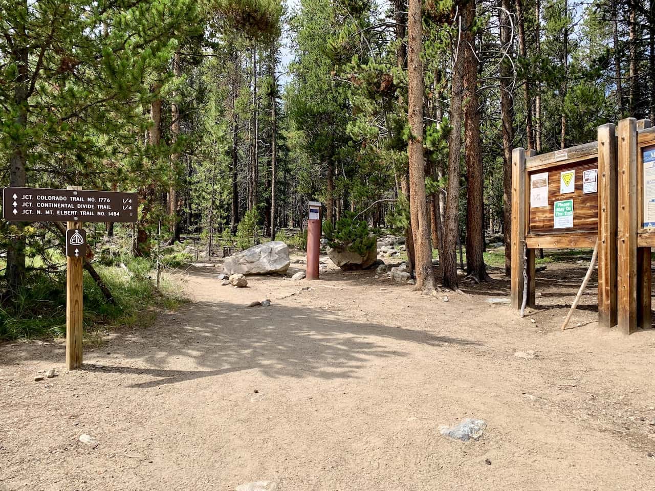
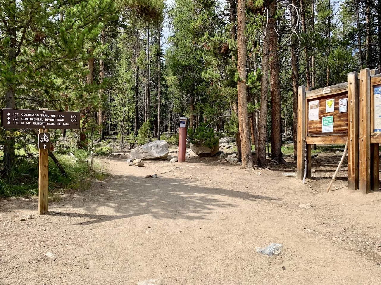
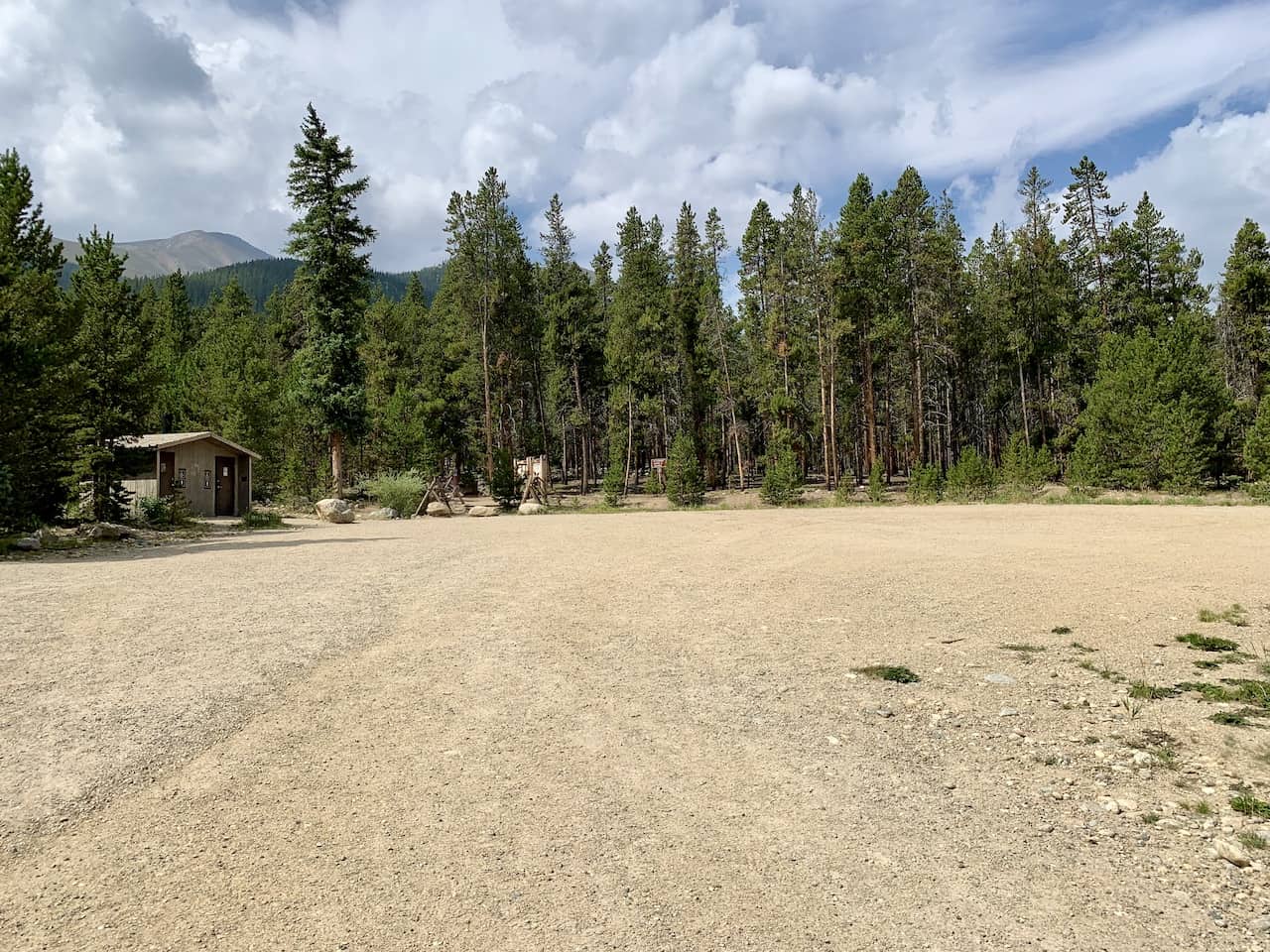
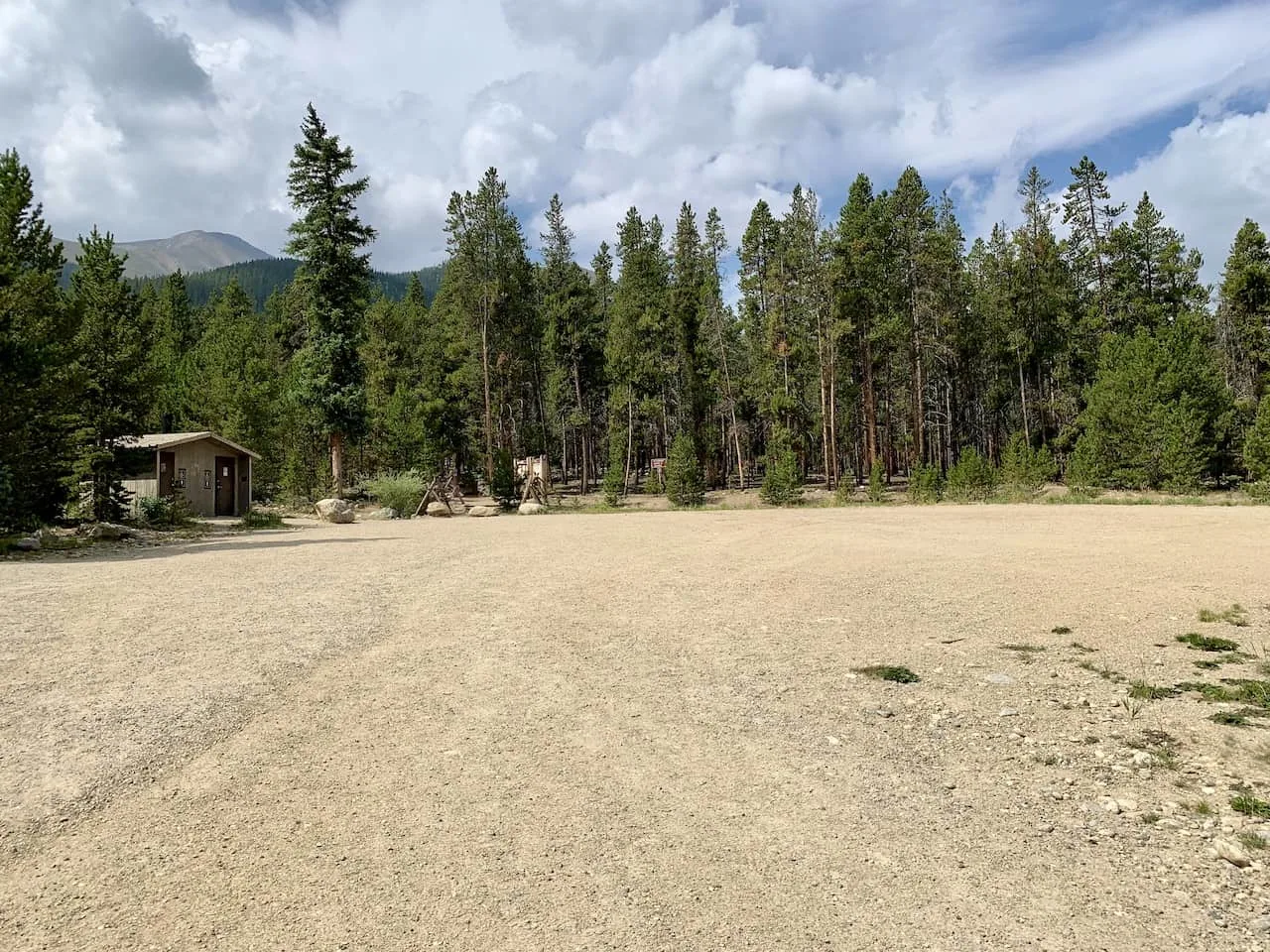
This guide will be going over the Northeast Ridge route, so much of the remainder of the post will be based on that route. At the Northeast Ridge trailhead you will find a large parking lot, campground, and toilet facilities.
Mount Elbert Hike Time
While not technically demanding, the hike up and down the Northeast Ridge of Mount Elbert is long with plenty of elevation gain. Expect the route to take at least 7 hours for the average hiker with 5 hours on the fast end and 9 hours on the longer end.
Distance & Elevation Gain
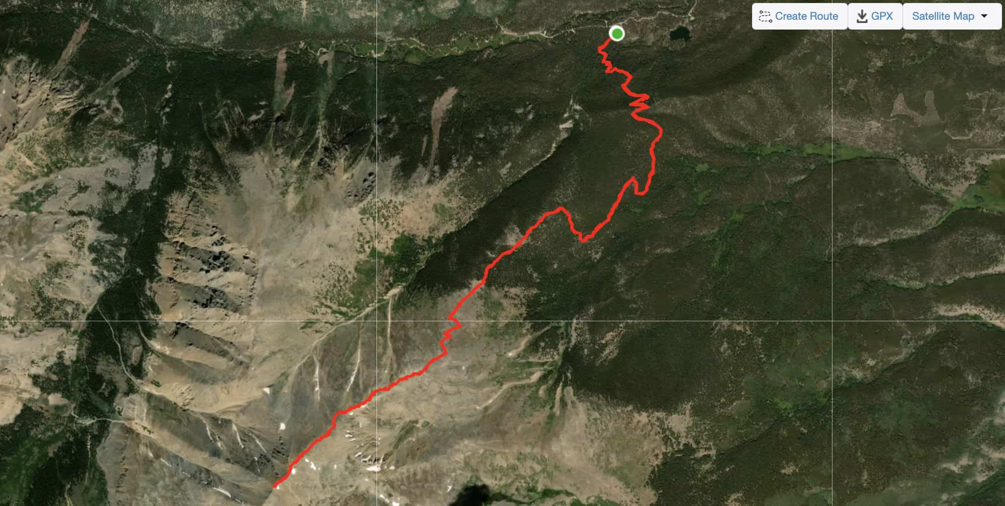
The round-trip hike from the Northeast trailhead is a 9.5-mile round trip route with +4,700 feet of elevation gain.
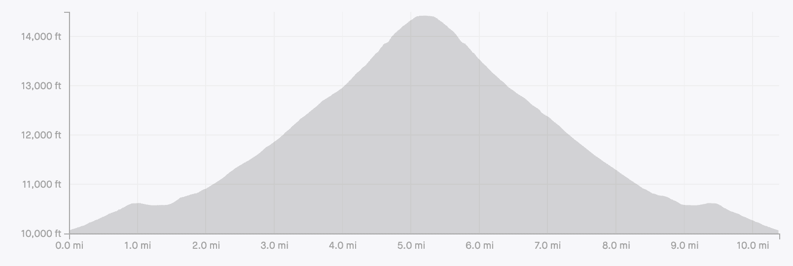
2) Mount Elbert Map and Elevation Gain Profile
Below you can find a Mount Elbert map with the hiking path outlined as well as a helpful elevation gain profile of the route.
Not surprisingly, this is a hike with an essentially constant uphill to the summit followed by a constant downhill back to the parking lot.
While there are some flat sections of trail, most notably for 0.5 miles at the 1-mile mark, the remainder of the hike with be on a 10%-30% elevation grade.


3) Mt Elbert Trailhead & Directions
As mentioned there are really three trailheads for the three different routes. However, the main Northeast Ridge trailhead is what we will focus on here.
The trailhead for the Northeast Ridge route is simply called “Mt Elbert Trailhead Parking Lot” on Google Maps.
The exact GPS coordinates are 39°09’06.7″N 106°24’44.1″W to ensure you are heading to the correct trailhead.
At the trailhead you will find a parking lot area, nearby camping ground and toilet facilities. If parking is full at the trailhead, there are also some other lots that you pass by on the way up.
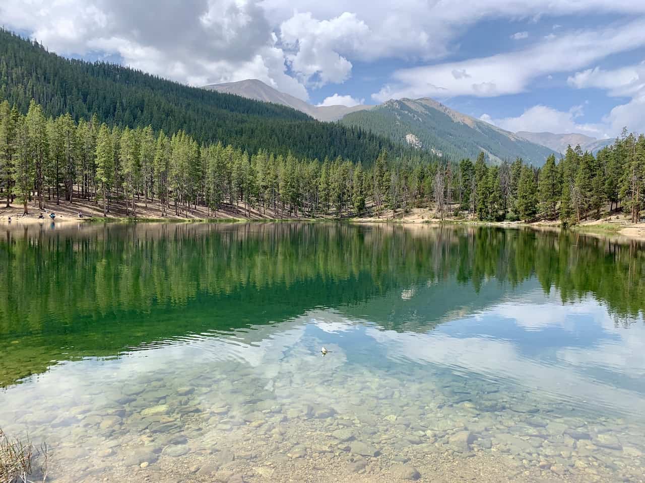
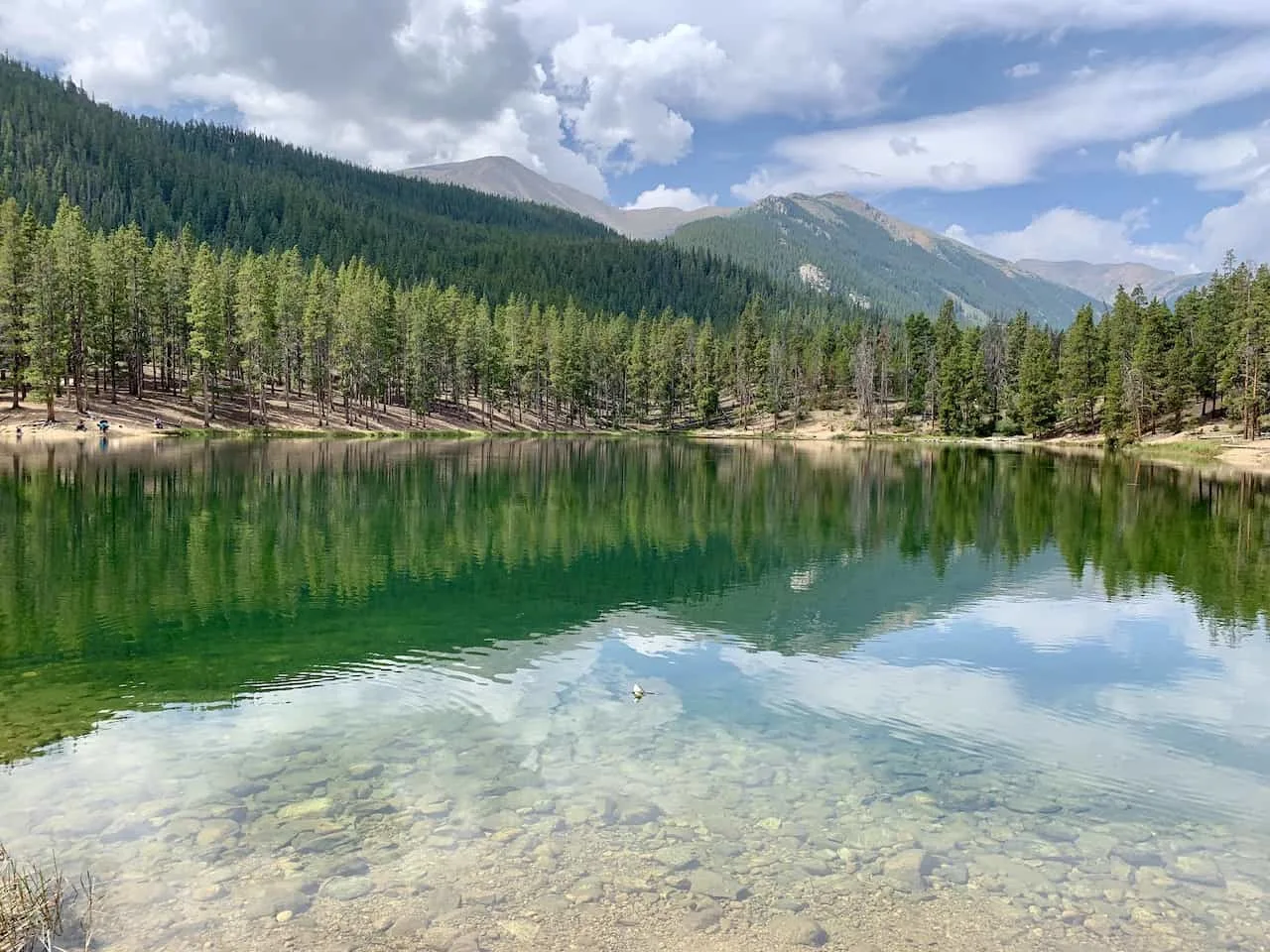
As you make the drive to the trailhead, you will also pass the Halfmoon East Campground, Halfmoon West Campground and the Emerald Lake Picnic Area (heading to Emerald Lake after the hike is a great way to cool down).
Colorado Car Rental: Looking for a rental car in Colorado? Check out Rentalcars.com for a variety of options that can work well on your trip.
Getting to the trailhead itself is pretty straightforward and can be accessed by all vehicles.
Whether you are coming from the north or south, you will be making your way on US 24. Once you arrive just south of Leadville you will take a turn onto Colorado 300 followed by a quick left hand turn onto County Road 11, also known as Halfmoon Rd.
From here you will follow Halfmoon Rd for about 5 miles until you reach the trailhead parking lot on the left hand side of the road. Note that Halfmoon Rd is not paved but is just fine for all types of vehicles.
Below is a Google Maps view of the route from Leadville to the Mt Elbert trailhead parking lot:
4) Mount Elbert Camping
There are three great camping areas just nearby the Mount Elbert trailhead – Elbert Creek Campground, Halfmoon East Campground, and Halfmoon West Campground.
Elbert Creek is the closest to the trailhead as it is just across the street. The other two are about a mile prior to the parking area.
These are all first come, first serve campgrounds and will fill up during weekends in peak season.
5) Mount Elbert Weather
The weather is probably the most important thing to consider when going about a hike up Mount Elbert.
Hiking in Colorado (especially at elevations like this) can get quite dangerous when the weather turns for the worst.
Before heading out for the hike be sure to check the mountain forecast for the day. It is very important to check the mountain weather and not the weather for the nearest town. The weather in the mountains can be much different than the weather on the ground.
For Colorado 14ers, I like to check a few different sources to get the most up to date and accurate forecasts:
- » Mountain-Forecast
- » NOAA
- » Meteoblue
If you are hiking in the summer months, be on the lookout for those afternoon thunderstorms. While the day can start nice and clear, the weather can turn quickly. The last thing you want is to be caught above the tree line during a thunderstorm.
Always be sure to understand the forecasts and get an earlier start to the day just in case.
Hiking Resources & Checklist
Before heading out for the trails, be sure to read up on some of the hiking resources up on the site. These are here to better prepare you for all types of outdoor adventure.
- Gear: Hiking Packing List
- Weather: How to Prepare for Hiking Weather
- Navigation: Hiking GPS & Navigation
- Tips: 20+ Hiking Tips & Tricks for the Trail
- Accommodation: Book Your Hotel Today
- Rental Car: Book Your Car Rental Today
6) Colorado Hiking Tips
Before taking on Mt Elbert, be sure to read through some helpful Colorado hiking tips to better prepare yourself for the hike.
Be aware of the elevation: hiking at altitude is no joke and you need to ease your way into the trails. Before taking on hikes from the start, give yourself a day or so to acclimatize.
Stay hydrated: to help with the altitude and the hiking itself, stay consistently hydrated. Take plenty of water and consider a Katadyn Filter Water Bottle for the trail.
Bring bug spray: the bugs can be out in full force on many trails. Put on some bug spray to keep yourself protected while hiking.
Apply sunscreen: the sun can be very strong in the mountains. Applying sunscreen (and wearing a hat / sunglasses), will be very important when it comes to protecting yourself.
Keep an eye on the forecast: the weather can turn suddenly out on the trails. Be sure to check the weather forecasts beforehand to avoid rain & thunderstorms. Afternoon storms can be more prominent in the summer months (so start early!).
Download offline maps: to keep yourself on track, download offline maps for the trail. This can be done by using navigation apps such as AllTrails, Maps.me, and Gaia. You should also download offline Google Maps, as cell service does not always work closer to the trailheads.
Check trail conditions: before committing to a trail, I would recommend looking at the latest trip reports on AllTrails (or 14ers.com for 14er hikes). This is more so important as the summer season starts & ends, as you can get a better idea of trail conditions & snow coverage.
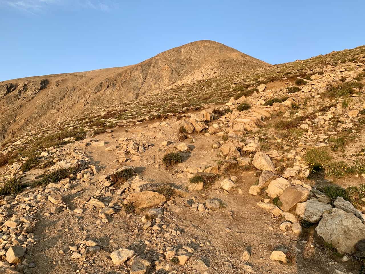
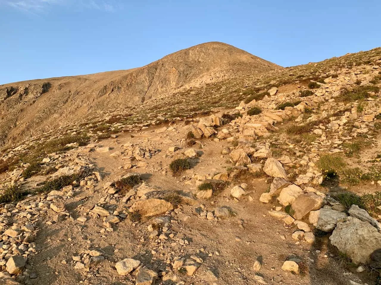
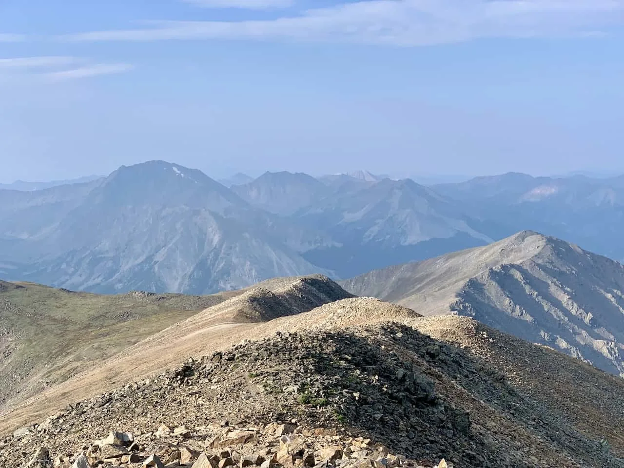
7) Mt Elbert False Summits
There are a couple of times during the climb up Mt Elbert, where you may believe you are looking up at the top of the mountain. Unfortunately, that is probably not the case.
There are two main false summits on the Northeast Ridge hike on Elbert so don’t get your hopes up too much as you climb up the mountain.
Once you reach the top of that second main false summit, you will be welcomed to the true summit just a bit further out in the distance.
8) The Mt Elbert Hike
Now that you have all the background you need to know about the hike and getting yourself to the starting point, let’s talk about the hike itself. Remember, this will be regarding the most standard Northeast Ridge route.
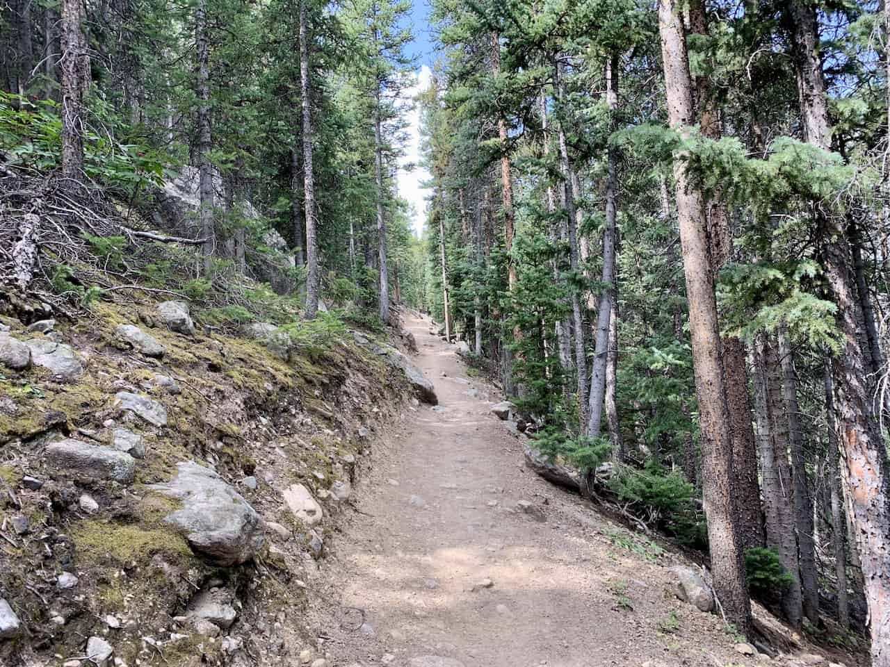
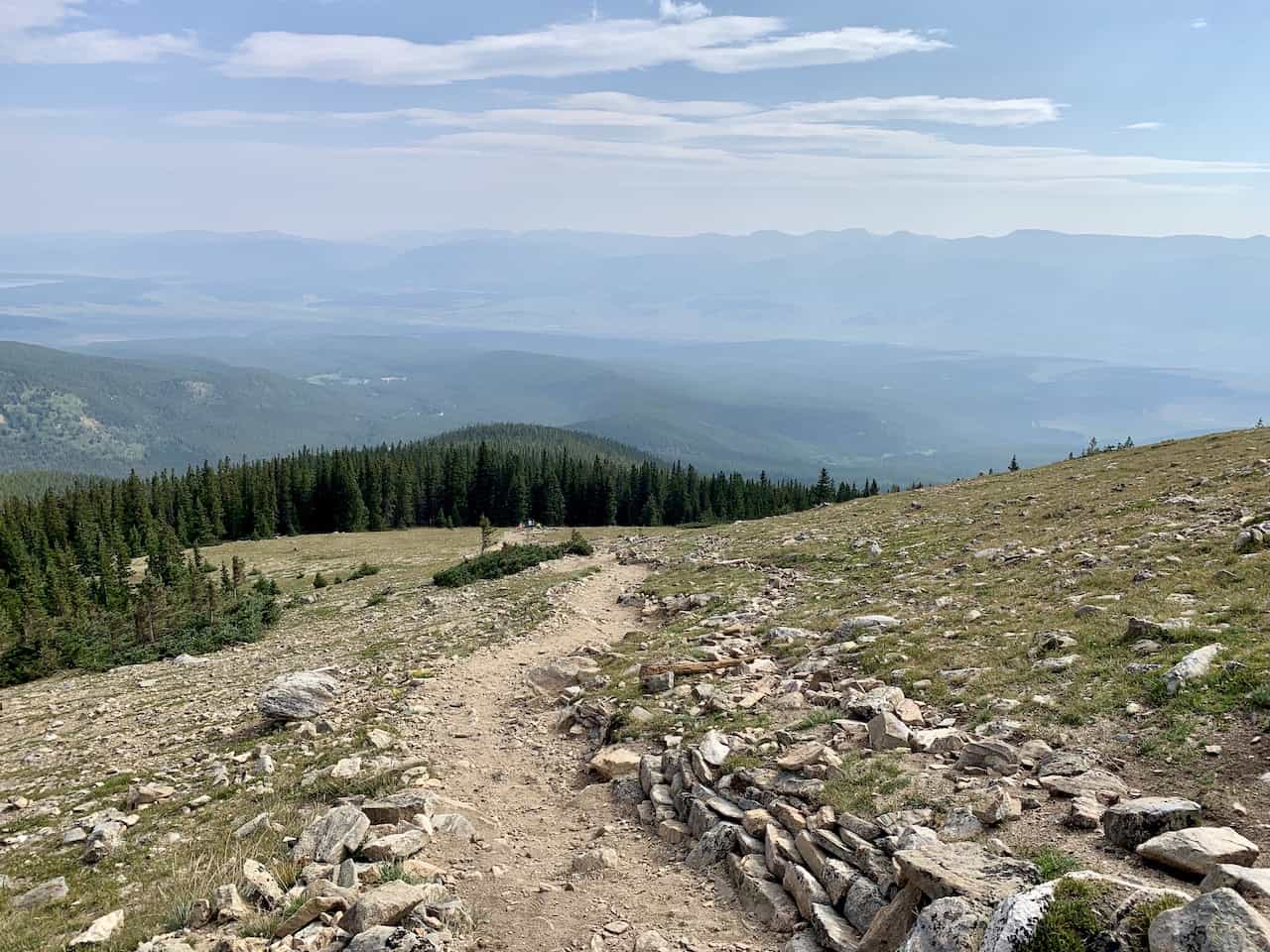
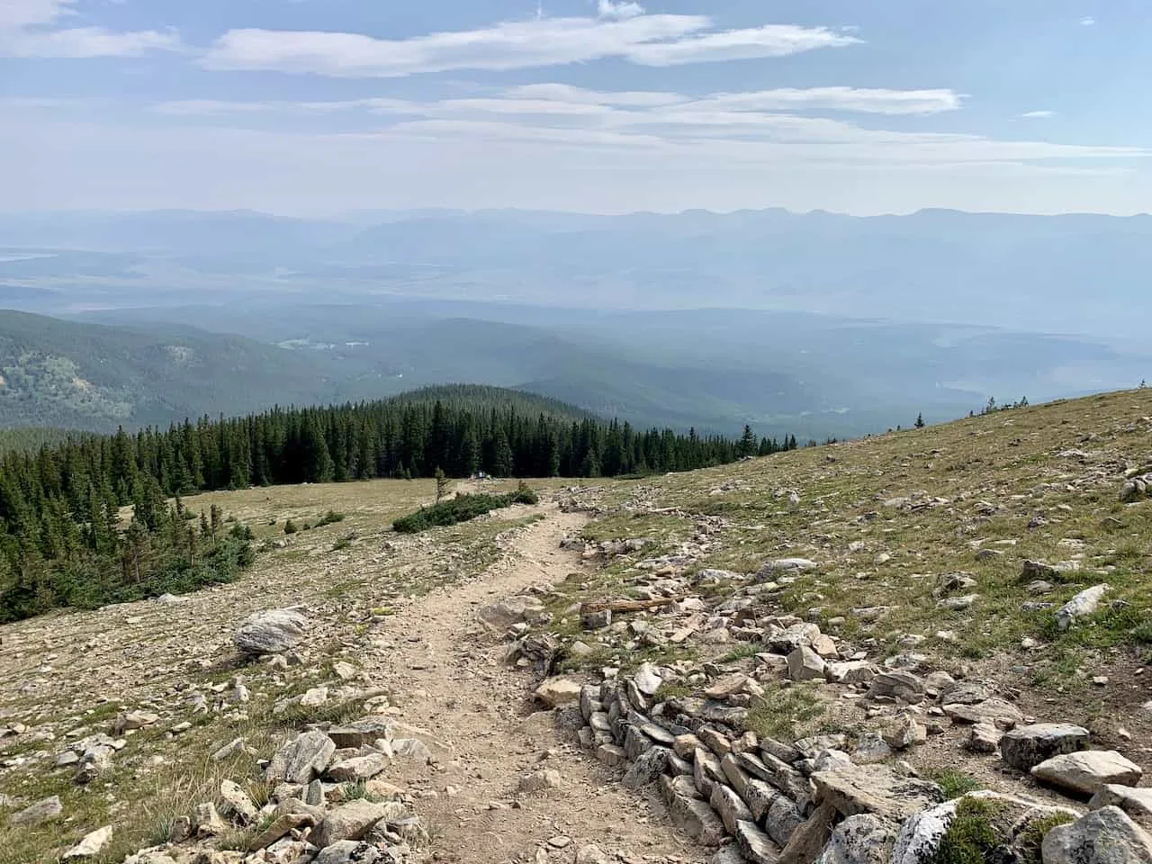
After getting yourself to the trailhead and parking your car, it is time to begin the hike to the summit of Colorado. The trail begins just next to the restroom facilities as you head up into the forest.
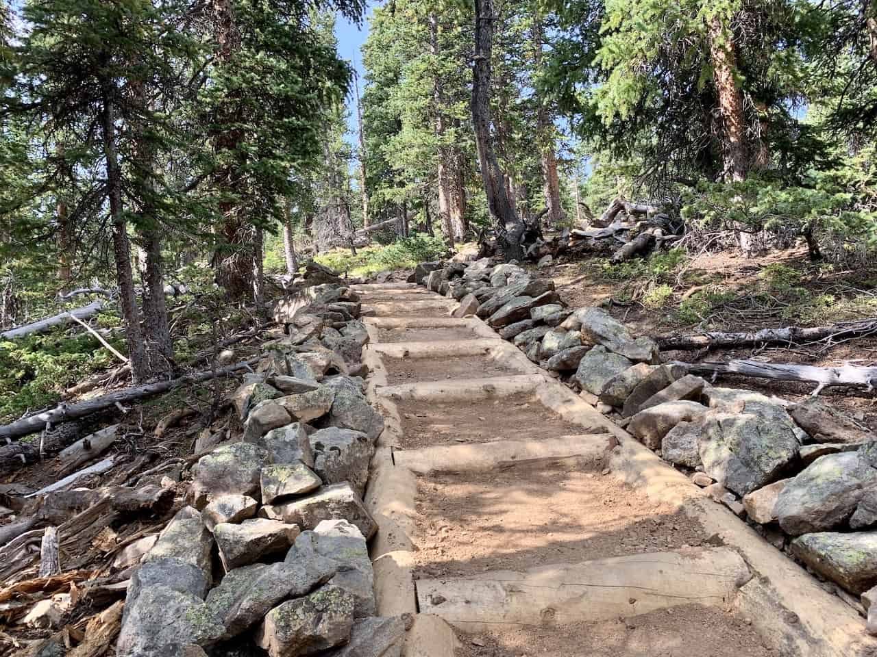
The trail is well maintained and you will find some sections with manmade stairs and bridges helping you get safely up the mountain.
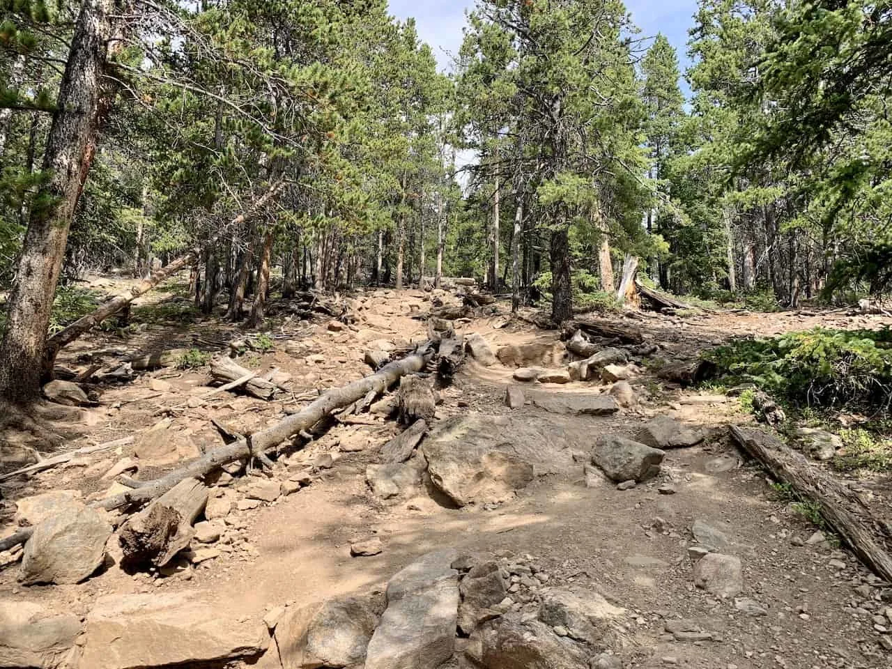
The forest section is going to be quite long as you slowly gain your elevation. Some of it will be steep while other parts will be on a less obvious incline.
You will come across some switchback sections here and there and a few of those helpful staircases.
The forest section takes up the first 3 miles of the trail, which is over half of the total distance up the mountain. During those first 3 miles you will gain right around 2,000 feet of elevation.
So while the forest does take you up a couple thousand feet, there is still over 2,500 feet of elevation gain to go.


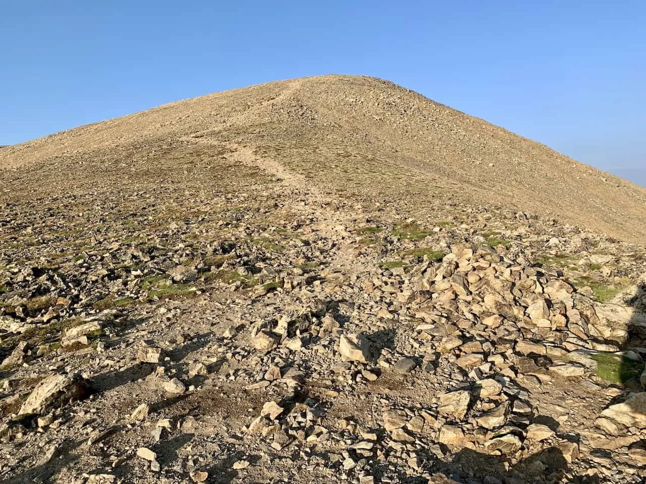
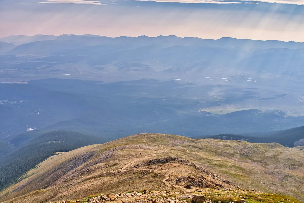
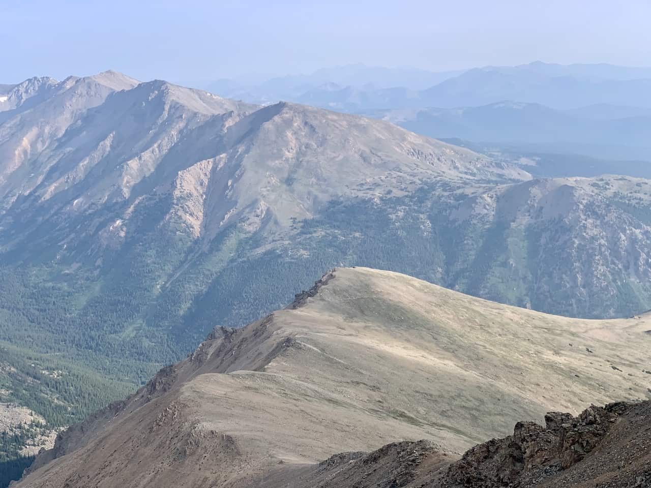
As you exit the trees, things will begin to open up more for you. The sandy dirt trail maneuvers its way around and up the mountain. Be aware though – the mountain peak you see directly out in front of you is not the summit!
As mentioned earlier on there are some Mount Elbert false summits that will seem promising. So, while you may think you see the top of the mountain, in reality you still have a way to go.
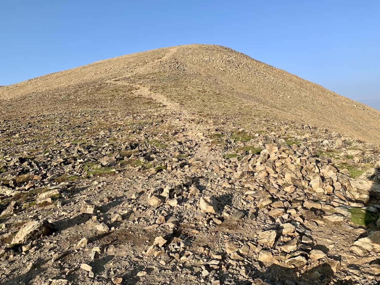
The trail zig zags up and then flattens out a bit as you approach the bottom of the false summit. The terrain itself begins to get a bit rockier as you continue up the false summit so do pay attention to your step.
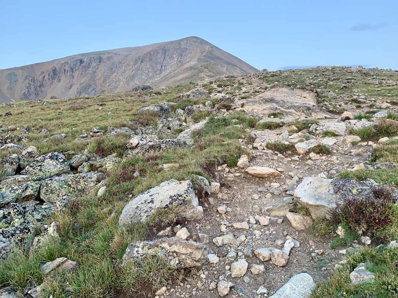
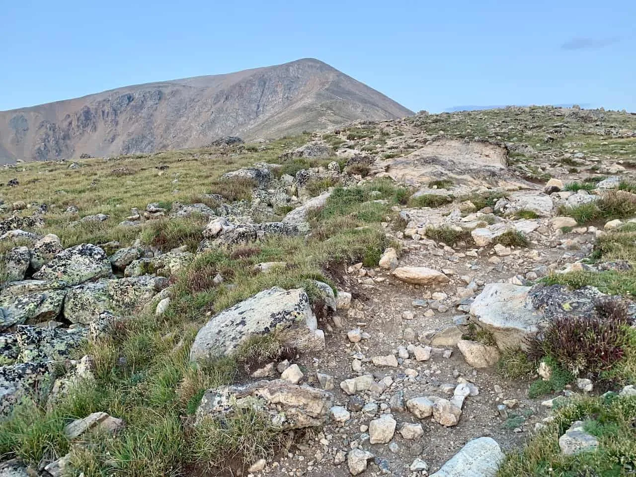
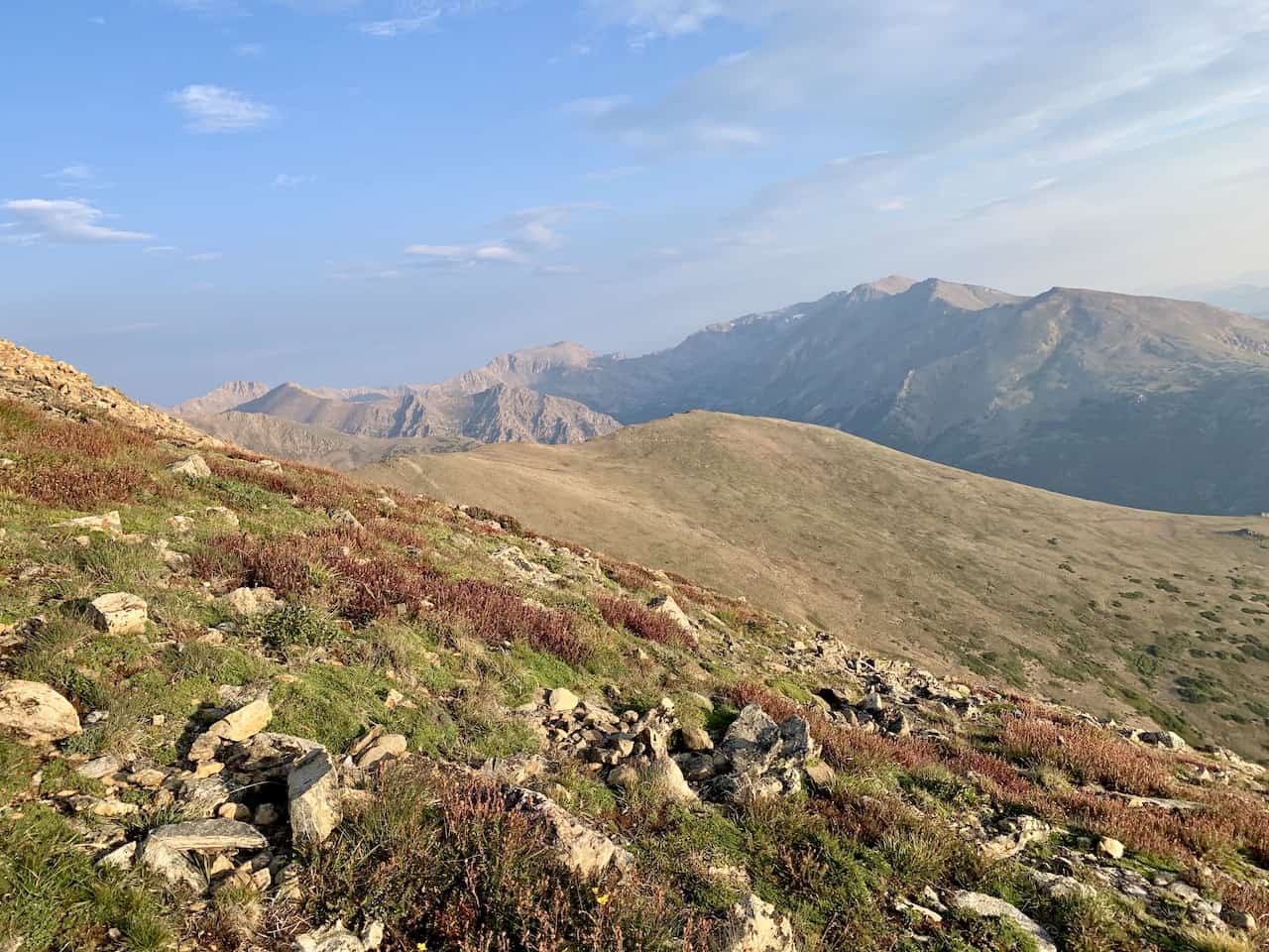

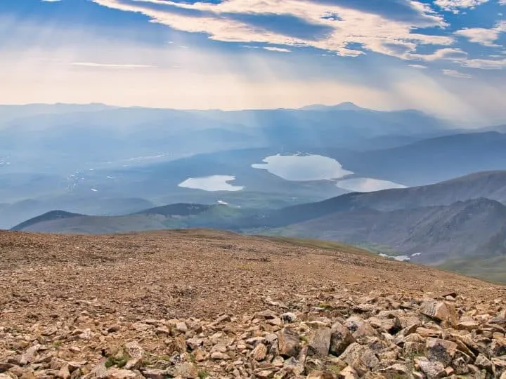
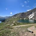
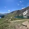
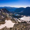
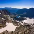
More views come into play here as you get to see some lakes and new angles of the surrounding landscape. Once on top of the false summit, be aware that another one lays right ahead as well.
The same deal is here too. The dirt path etched between all the rocks will zig zag its way up this false summit. At this second false summit you will be greeted to a large rock cairns pile.

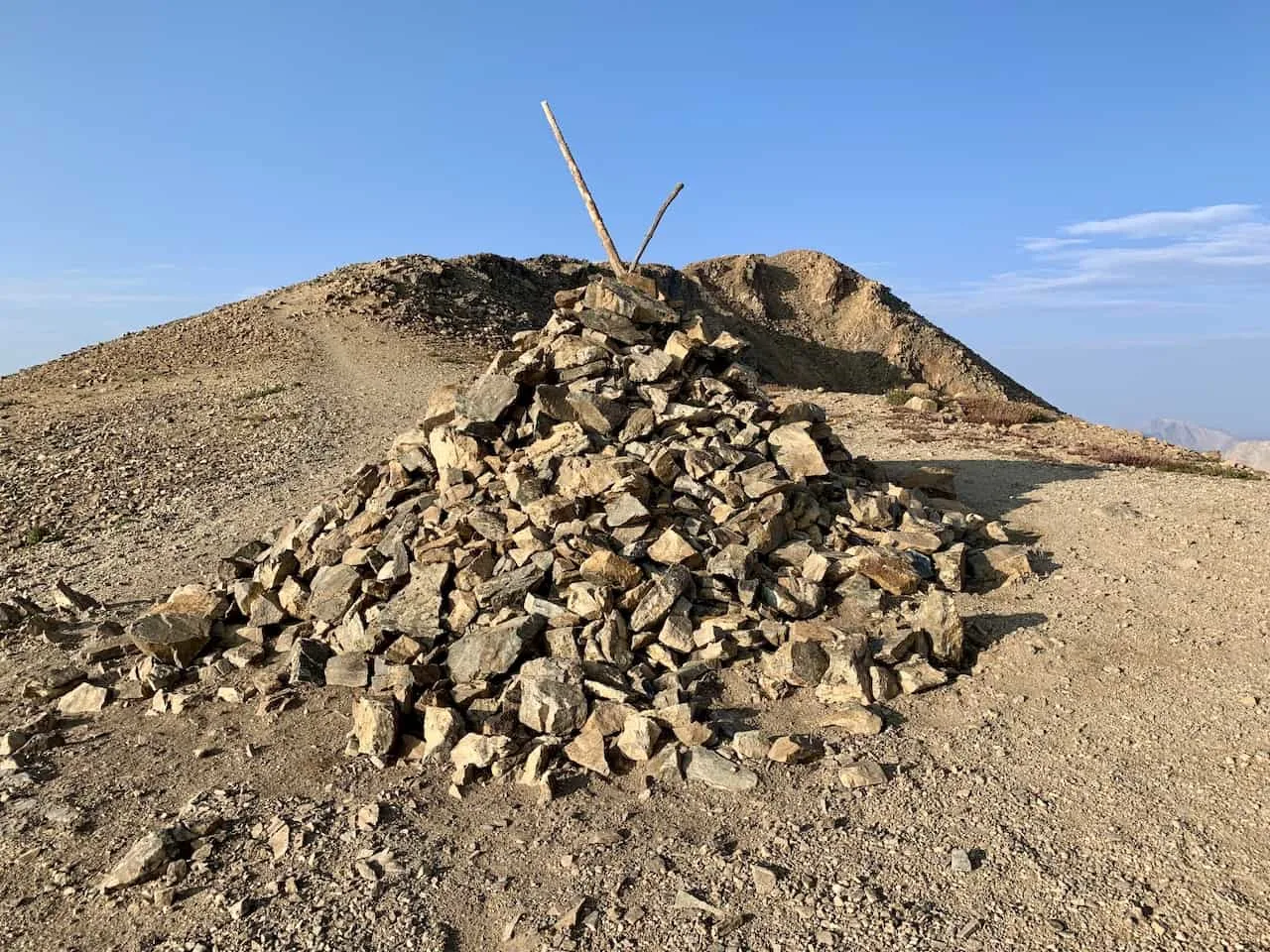
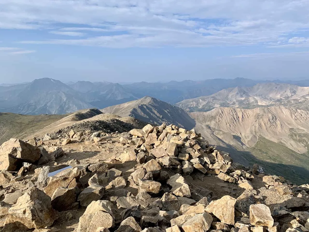
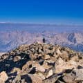
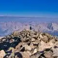
Good news though! The peak you see just a further out in the distance is the true Mt Elbert summit!
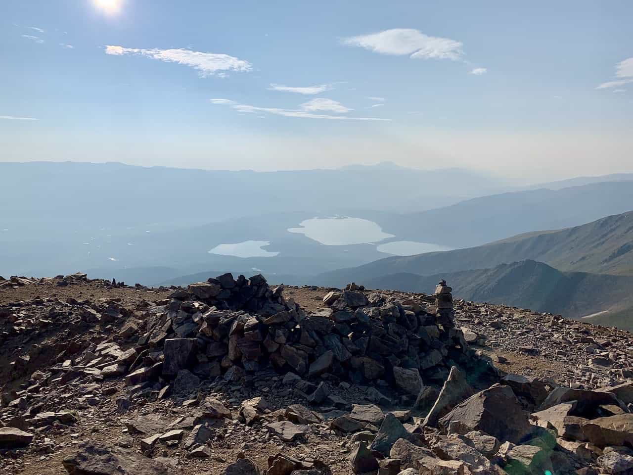
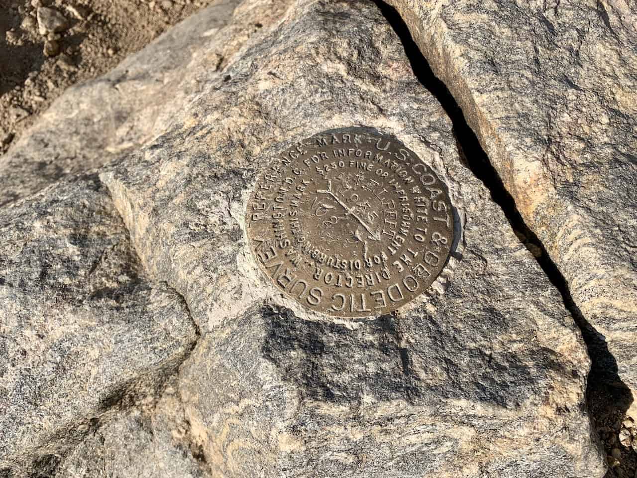
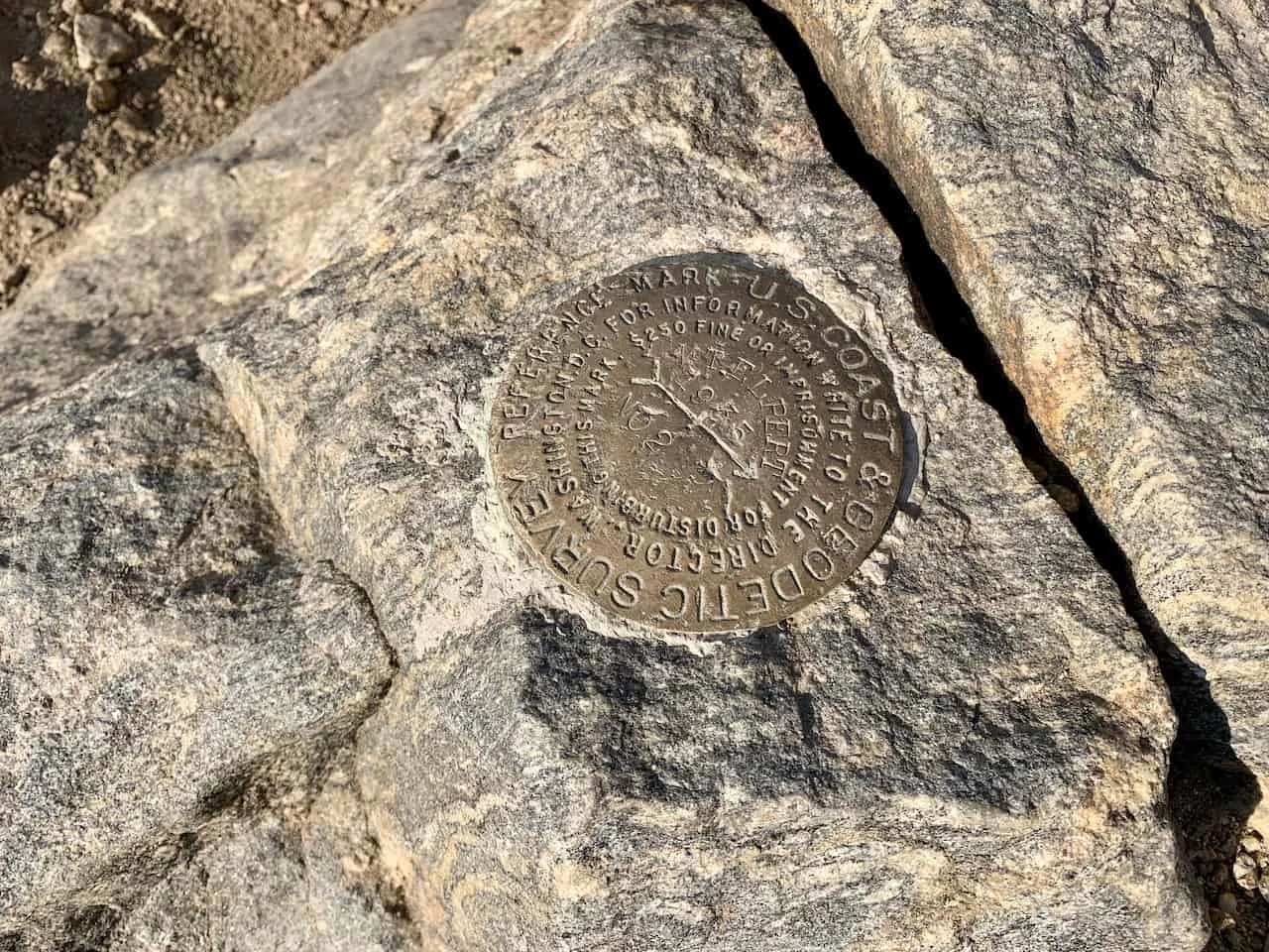
Continue to follow the path up the ridge line as you slowly approach the summit itself. You will find a few rock cairns here, with the one a bit further away being the true summit. There you will see the official Mt Elbert marker etched into the mountain.
Enjoy the views and take it all in as you enjoy the tallest mountain in Colorado!
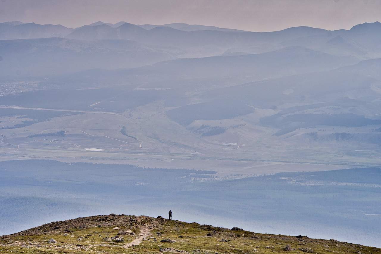
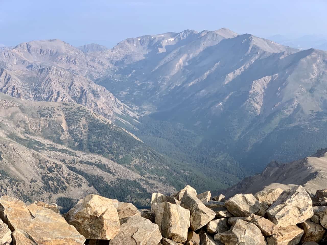
9) Mount Elbert Summit
The views are expansive in every way you look. North, south, east and west will offer never ending mountain, lake, and valley views.
You should be able to see plenty other 14ers including the nearby Mt Massive as well as the famous Twin Lakes in the opposite direction.
Take your time up top to just sit back and enjoy the view before heading back down to the trailhead.


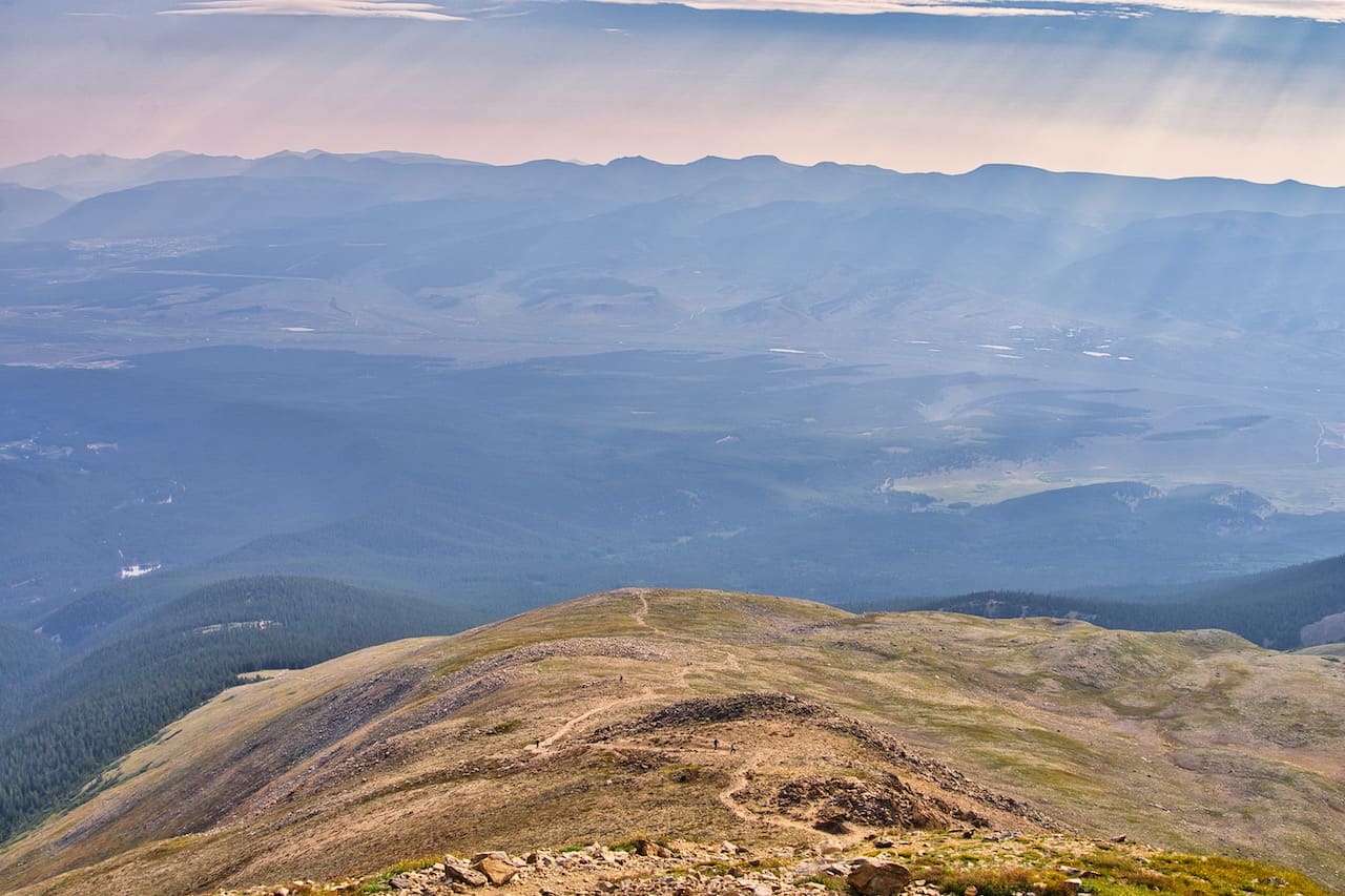
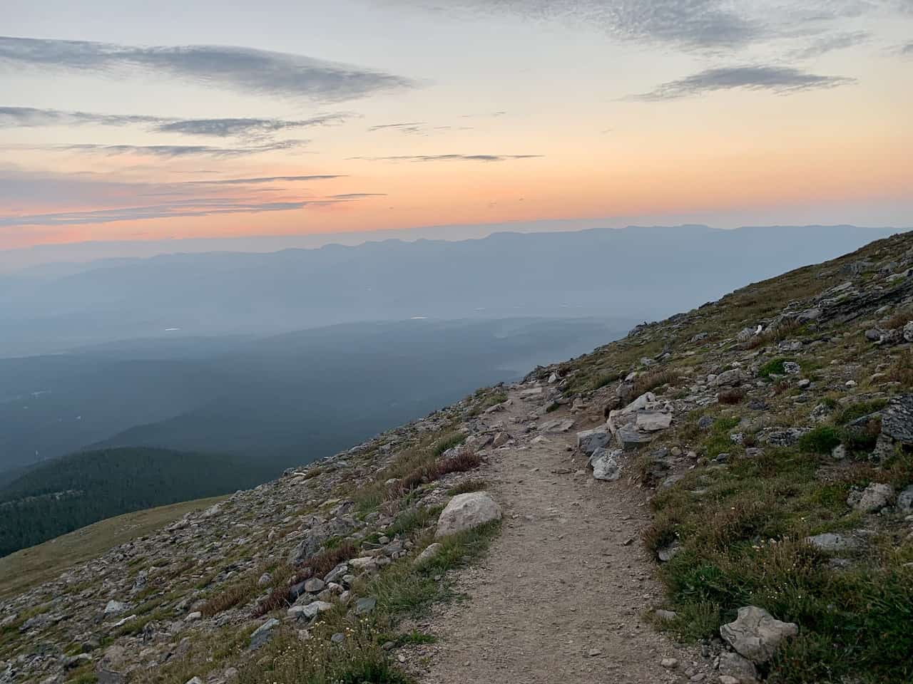
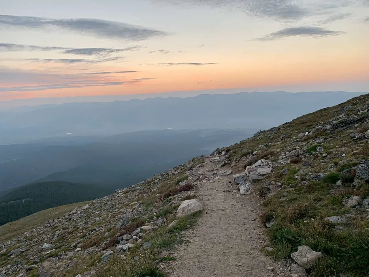
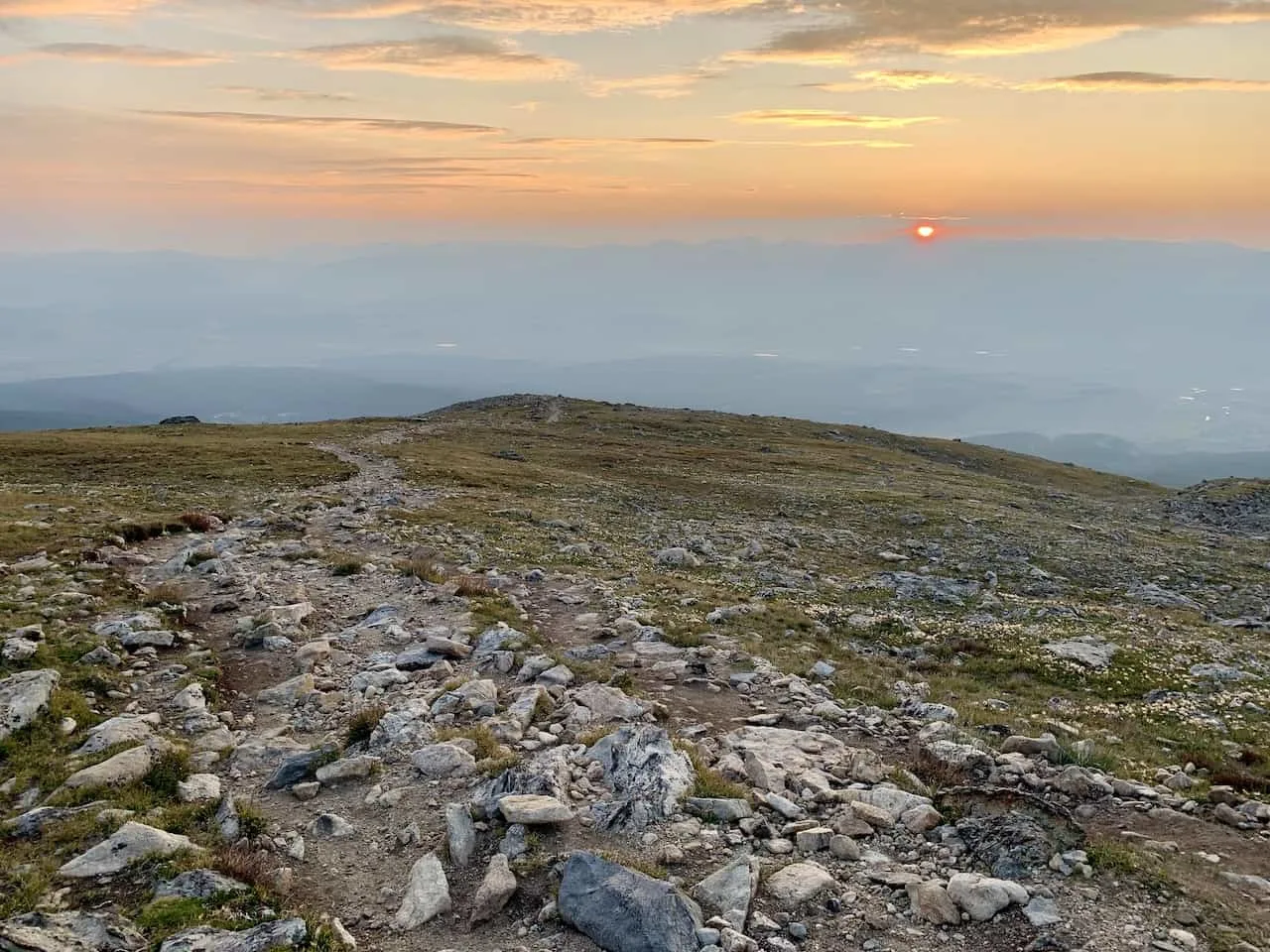
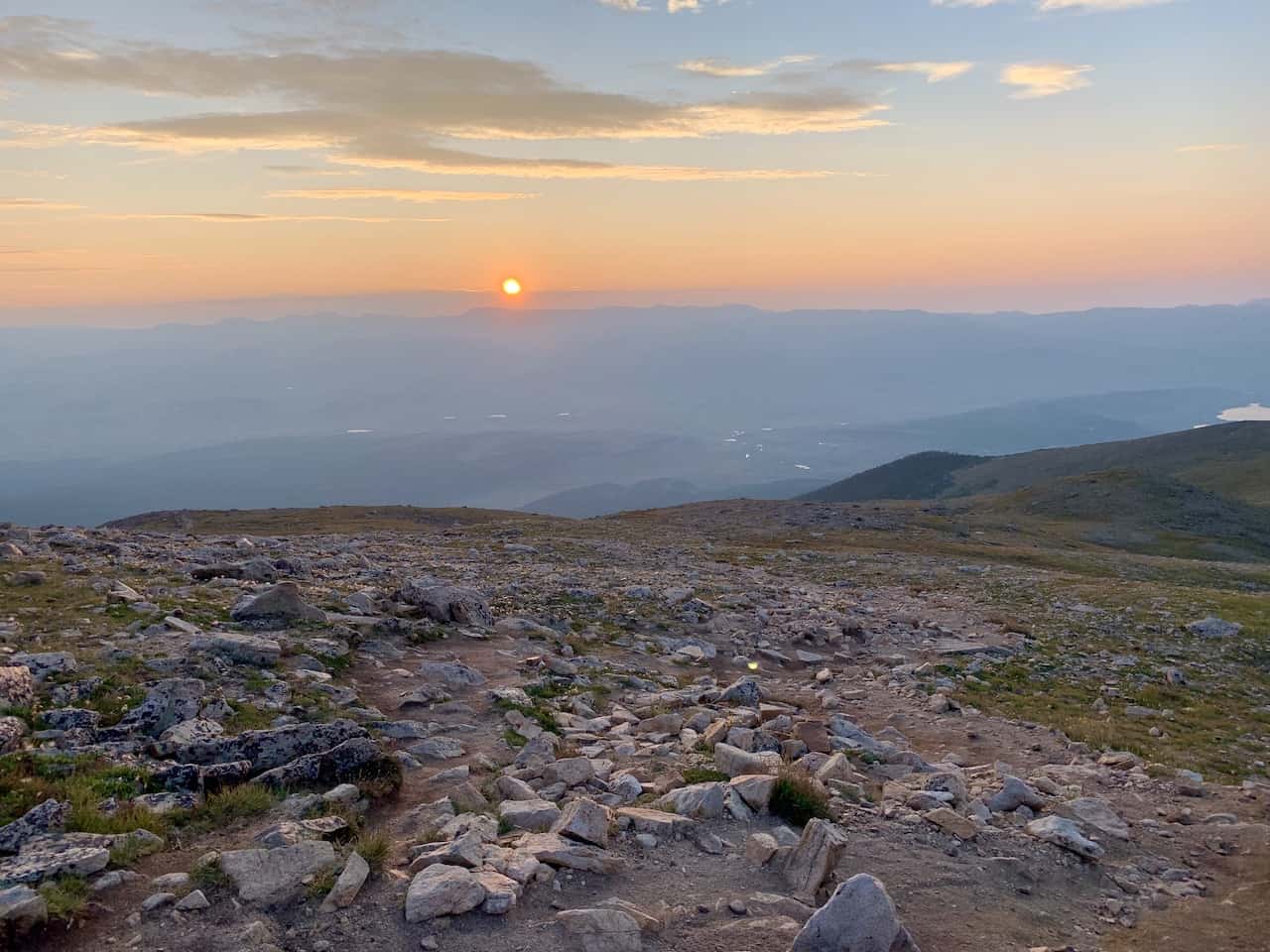
10) Mt Elbert Sunrise
Whether you are looking to beat the crowds or if you just want to get a view of Colorado at first light, taking part of a Mt Elbert sunrise experience could be for you.
While I did not summit Elbert by sunrise, I did begin my hike up in the darkness. Just as I was getting above the tree line, the sun was making its way above the horizon.
Below are a few photos from the slopes of Mt Elbert during sunrise.


11) Frequently Asked Questions
Here are some of the most frequently asked questions regarding a Mt Elbert climb with some helpful answers to go along.
How Long Does it Take to Climb Elbert?
This will really all depend on an individual’s physical ability. On average the round trip should take between 7-8 hours with a more broad range of 5-10 hours.
How Difficult is Mount Elbert?
From a technical standpoint, Mount Elbert is not a difficult mountain to climb. The entirety of the trail is well maintained with one obvious path to follow all the way through.
However, from a physical standpoint, the Elbert climb is not an easy one. We are still talking about 10 miles round trip with 4,700 feet of elevation gain. That is a long and demanding hike for most people.
If you haven’t been introduced to that type of elevation before, be prepared for a long day up in the mountains.
Do You Need a Permit to Climb Mt Elbert?
No, you do not need a permit to climb Mt Elbert. Anyone who has the willpower to go for the climb is able to do so. Simply show up to the trailhead and be on your way.
Can a Beginner Hike Mt Elbert?
Although this is the highest mountain in Colorado, I am inclined to say that a beginner can hike Mt Elbert. With that said though, you still must be comfortable being on your feet for what could be nearly a 10 hour day.
It will be a long and slow climb up for those with little experience, but it is doable for sure.
How Many People Climb Mt Elbert Each Year?
It is believed that upwards of 20,000 people climb Mt Elbert each year making it one of the most popular 14ers in Colorado.
Whether it is well experienced climbers or just beginners, the mountain is for everyone so that does bring a fair share of people to the mountain.
Couple that with the fact that it is the highest in Colorado, makes Elbert even that much more desirable.

12) Where Do You Stay to Hike Mt Elbert
While there are many places you can choose to base yourself around the area, I would recommend staying in either Leadville (30 minute drive) or Buena Vista (1 hour drive).
Leadville is just north of the turnoff from US 24 and Buena Vista south of it.
These are great places to stay if you are looking to not only hike Mt Elbert but also many of the other 14ers around the area. Below are a few highly recommended places to stay in each of them.
Leadville
Buena Vista
- Surf Hotel & Chateau
- Best Western Vista Inn
- Mount Princeton Hot Springs Resort (just outside town)
That about does it for a guide to the hike up Mt Elbert. If you have any additional questions or comments, be sure to add them in below.
Looking for More 14ers? Check out some more Colorado hiking guides for nearby peaks in the area including:
– Huron Peak
– La Plata Peak
– Mount Yale
– Mount Harvard
– Mount of the Holy Cross
– The Decalibron
– Quandary Peak
– Mount Massive
Have fun out there and safe travels!

CJ
Tuesday 21st of May 2024
Can you camp on Mt. Elbert as your hiking? Not just at the base?
DMZ
Sunday 26th of October 2025
@CJ, yes, as long as you: 1)Stay at least 200 feet away from the trail or any water source, and 2) Leave no trace when you break camp. Best practice is to try to find a spot that someone else has used, but the 'leave no trace' principle makes that quite a challenge.
One thing that Mt. Elbert (and all Colorado 14ers) have in abundance is: ROCKS. One of those backpacker cots that puts you off the ground is worth its weight in gold.
And you can never carry too much water, within your personal carrying weight limits.
sheetal
Monday 11th of September 2023
Is the trails rocky like Mt. Marcy or more a dusty road up a mountain?
sheetal
Tuesday 2nd of January 2024
@Charles, Thank you Charles. steep is possible it was climbing the rocks that killed my knees. I appreciate the input.
Charles
Tuesday 12th of September 2023
Hi Sheetal - I have not done Mt Marcy, but I can say it is a mixture of rocky/dirt terrain all the way through. It will also be steeper than Mt Marcy by the looks of it. Hoping you enjoy either way!