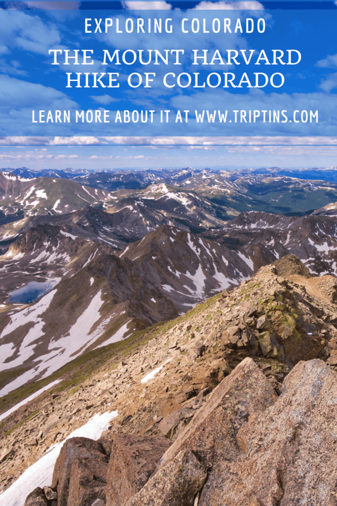

If you are looking to hike up a 14er in the Collegiate Peaks Wilderness of Colorado, add Mount Harvard to the list.
Standing at 14,420 feet in elevation, Mt Harvard is the third highest peak in the state, and is a great all-around trail to take part of.
Read on to learn more about the Mount Harvard hike and how to take it on during your trip.
* Affiliate Disclosure: This post may contain affiliate links, which means I may receive a commission if you make a purchase through the links provided, at no additional cost to you. Thanks for supporting the work I put into TripTins!
1) Mount Harvard Overview
To get a better idea what the trail is all about, below are some helpful hiking stats when it comes to the Mount Harvard hike.
Where is Mt Harvard?
Mt Harvard is located in the Collegiate Peaks Wilderness of San Isabel National Forest. It is part of the larger Sawatch Range, which includes many other 14ers.
The mountain comes in at 14,420 feet in elevation, making it the third tallest 14er in Colorado (behind Elbert & Massive).
Mount Harvard Route
There is one main hiking route that heads up Mount Harvard called the South Slopes trail. This route makes its way through the Horn Fork Basin, so you may see that name mentioned as well.
Since Mount Columbia is right nearby and is connected by a ridge, another option is to combo the routes together. The Harvard – Columbia traverse is a longer and more strenuous hike, but it is possible for those up for it. I will cover that option a bit later on.

How Long is the Mount Harvard Trail?
The Mount Harvard round trip hike up & down the South Slopes comes in at 14 miles (7 miles up & 7 miles down).
It is one of the longer routes, but the effort is certainly worth it.
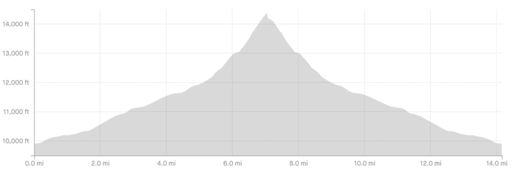
Mount Harvard Elevation Gain
Another important consideration is the elevation gain of the hike. The route has approximately 4,600 feet of elevation gain from the trailhead to the summit.
The elevation gain starts out mild and really gears up closer to the summit (see screenshot).

How Long Does it Take to Climb Mount Harvard?
Expect to spend somewhere around 7 – 10 hours up on the mountain. This includes the time hiking, in addition to having some rest breaks along the way & at the summit.
During my hike on the mountain, the total time came out to 8 hours, with 2 of those hours being non-moving (mostly on the summit).
Mount Harvard Class
Mount Harvard is classified as a Class 2 climb, with the most technical portions coming within the last mile or so towards the summit.
How Hard is Mount Harvard?
For the most part, the Mount Harvard trail is not a difficult hike. While it is a long hike, the technical aspects of the hike are not overwhelming.
As you approach the last 1-2 miles to the summit though, the incline gets steeper and the difficulty gets harder.
If you take your time, include breaks, and don’t overexert yourself, you will find the hike to be manageable (of course this depends person to person).

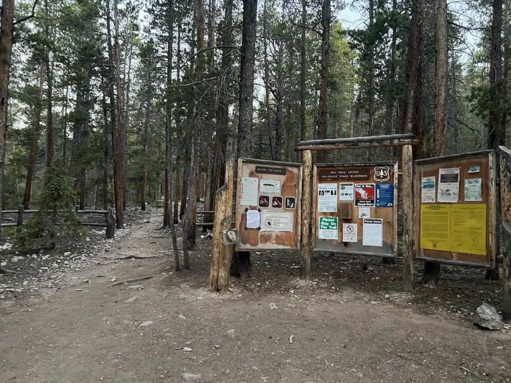
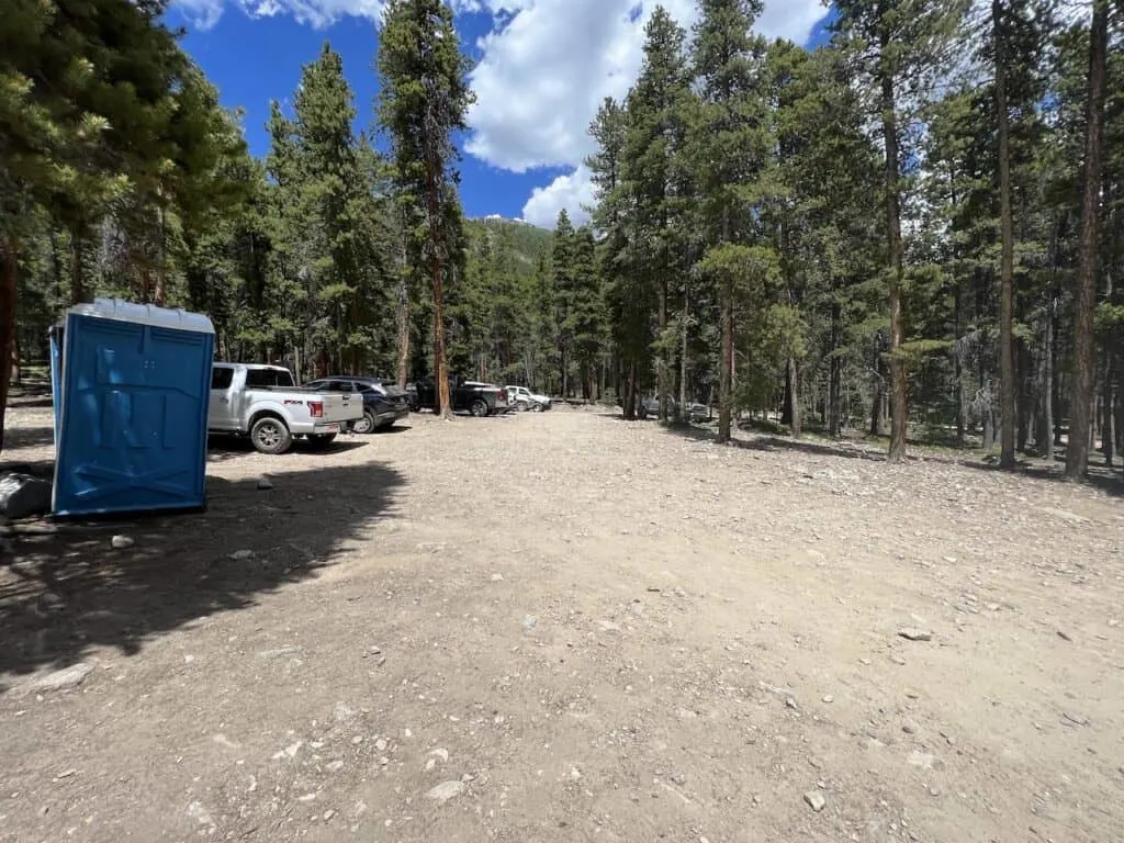
2) Mt Harvard Trailhead
The Mt Harvard Trailhead is located at North Cottonwood Creek (around 9 miles west of Buena Vista).
The North Cottonwood Creek trailhead is also the start for the Mount Columbia climb, as well as some other lake trails in the area.
From Buena Vista, it is just getting yourself onto Colorado Road 365 and continuing west from there. The final ~4 miles along the road to the trailhead can be a bumpy ride but should be fine for 2WD vehicles during the summer season.
At the trailhead parking lot, there are spaces for about 25-30 cars, but I can see even more vehicles fitting in with some ingenuity.
Note: there are other trails & parking lots that will pop up prior to the North Cottonwood Creek trailhead. Just continue driving on past them until you reach it.
Colorado Car Rental: Looking for a rental car in Colorado? Check out Rentalcars.com for a variety of options that can work well on your trip.

Camping Options
While you can find a spot at the trailhead to camp overnight, I would recommend actually splitting up the hike a bit. That way you don’t need to do the full 14 miles in a day.
I did see various campsites set up along the Horn Fork Basin, however the campsites by Bear Lake seemed to be the most scenic of options. It is just off the main route, but should be worth it.
Mount Harvard Map
Check out the map below that lays out the trailhead location and the route itself up to the summit.
3) Weather Forecasts
When it comes to hiking up Mount Harvard, it will be very important to pay attention to the weather forecast. Since much of the hike is done above the tree line, you have to be cautious for those afternoon thunderstorms that are common in the summer months.
In addition, the views are just so much better without those low lying or thick clouds. Saving this hike for a nice weather day is your best bet.
I would recommend checking out a few different weather forecasts prior to taking on the hike:
Hiking Resources & Checklist
Before heading out for the trails, be sure to read up on some of the hiking resources up on the site. These are here to better prepare you for all types of outdoor adventure.
- Gear: Hiking Packing List
- Weather: How to Prepare for Hiking Weather
- Navigation: Hiking GPS & Navigation
- Tips: 20+ Hiking Tips & Tricks for the Trail
- Accommodation: Book Your Hotel Today
- Rental Car: Book Your Car Rental Today
4) Colorado Hiking Tips
Before jumping into the hike itself, I did want to mention some important tips when it comes to hiking in Colorado:
Be aware of the elevation: hiking at altitude is no joke and you need to ease your way into the trails. Before taking on hikes from the start, give yourself a day or so to acclimatize.
Stay hydrated: to help with the altitude and the hiking itself, stay consistently hydrated. Take plenty of water and consider a Katadyn Filter Water Bottle for the trail.
Bring bug spray: the bugs can be out in full force on many trails. Put on some bug spray to keep yourself protected while hiking.
Apply sunscreen: the sun can be very strong in the mountains. Applying sunscreen (and wearing a hat / sunglasses), will be very important when it comes to protecting yourself.
Keep an eye on the forecast: the weather can turn suddenly out on the trails. Be sure to check the weather forecasts beforehand to avoid rain & thunderstorms. Afternoon storms can be more prominent in the summer months (so start early!).
Download offline maps: to keep yourself on track, download offline maps for the trail. This can be done by using navigation apps such as AllTrails, Maps.me, and Gaia. You should also download offline Google Maps, as cell service does not always work closer to the trailheads.
Check trail conditions: before committing to a trail, I would recommend looking at the latest trip reports on AllTrails (or 14ers.com for 14er hikes). This is more so important as the summer season starts & ends, as you can get a better idea of trail conditions & snow coverage.

5) Where to Stay Nearby
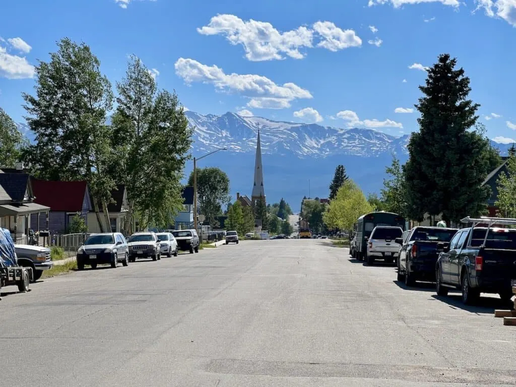
While there are many places you can choose to base yourself around the area, I would recommend staying in either Buena Vista (30 minute drive) or Leadville (1 hour drive).
These are great places to stay if you are looking to not only hike Mount Harvard but also many of the other 14ers around the area. Below are a few highly recommended places to stay in each of them.
Leadville
Buena Vista
- Surf Hotel & Chateau
- Best Western Vista Inn
- Mount Princeton Hot Springs Resort (just outside town)

Looking for More 14ers? Check out some other hiking guides for nearby peaks in the area including:
– Huron Peak
– La Plata Peak
– Mount Yale
– Mount of the Holy Cross
– The Decalibron
– Mount Massive
– Mount Elbert
6) Mount Harvard Hike
Once you have made it out to the trailhead, it is time to begin the hike up to the Mount Harvard summit.
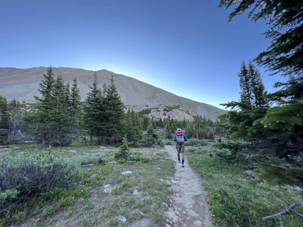
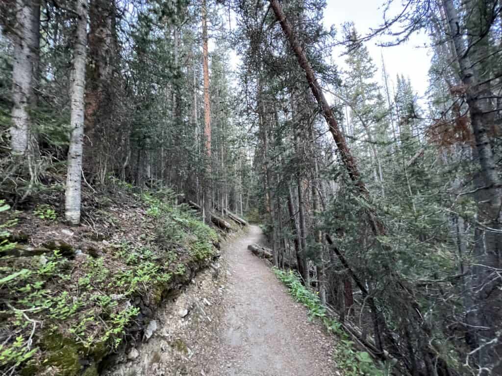
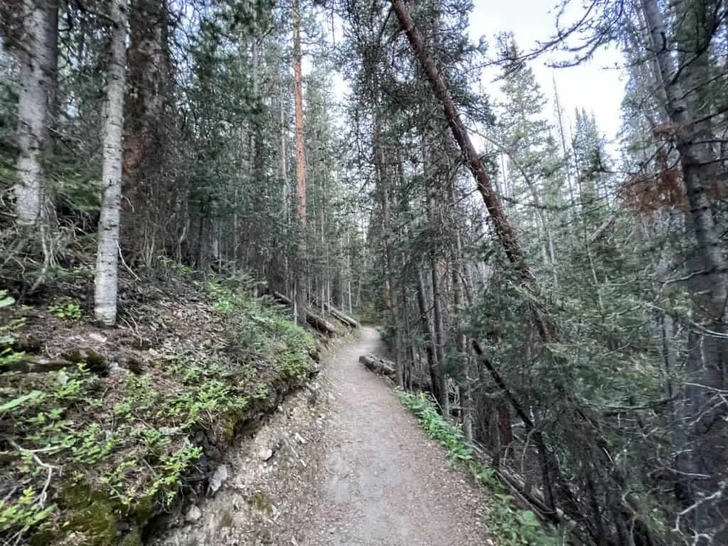
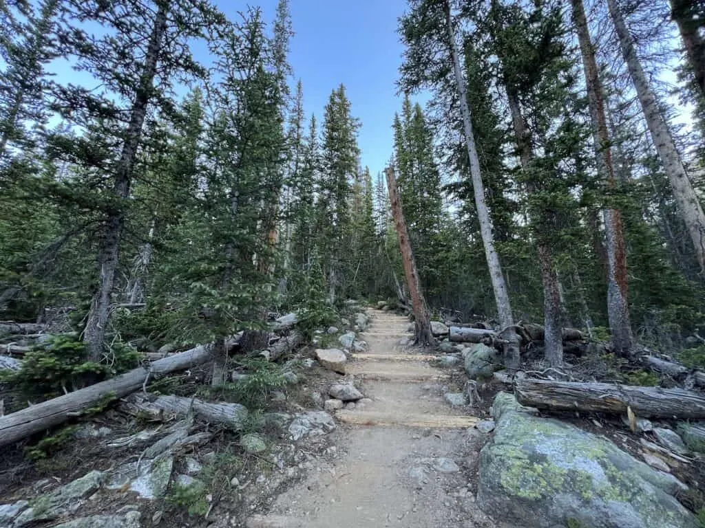
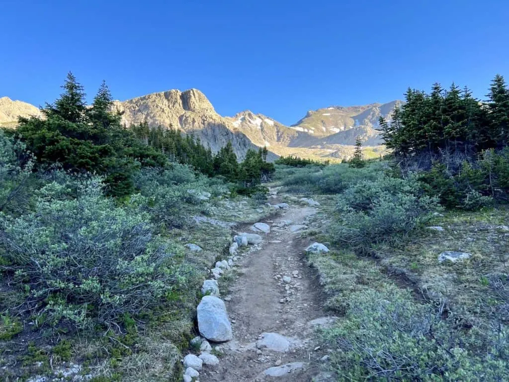
Trailhead to Tree Line (3.8 miles)
The first ~4 or so miles of this hike will be done within the trees as you slowly make your way further into the Horn Fork Basin.
While the hike will gain elevation all the way through the forest, it will all be on a very mild incline. This is a great way to get yourself warmed up for the hike (although it is a long warm up).
Within the trees, there will be several times where you will walk along or across some creeks and rivers. Filling up water from here or there will be a good idea as you get closer to the tree line.

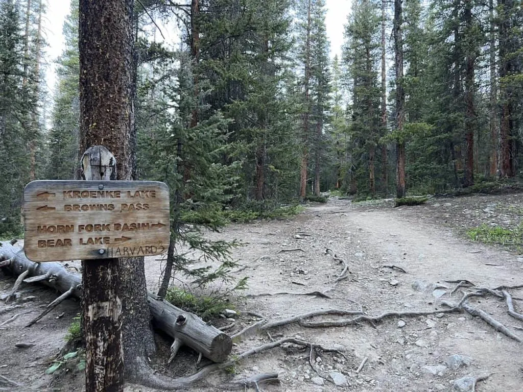
Also within this section are two intersections (both well marked). The first intersection splits the trail between Kroenke Lake/Browns Pass & Horn Fork Basin. The second intersection is where you will find the turn off towards the standard Mount Columbia route.
Overall though, the tree portion of the trail should not give you much issue as you then make your way in the more open basin area with Harvard way out in the distance.
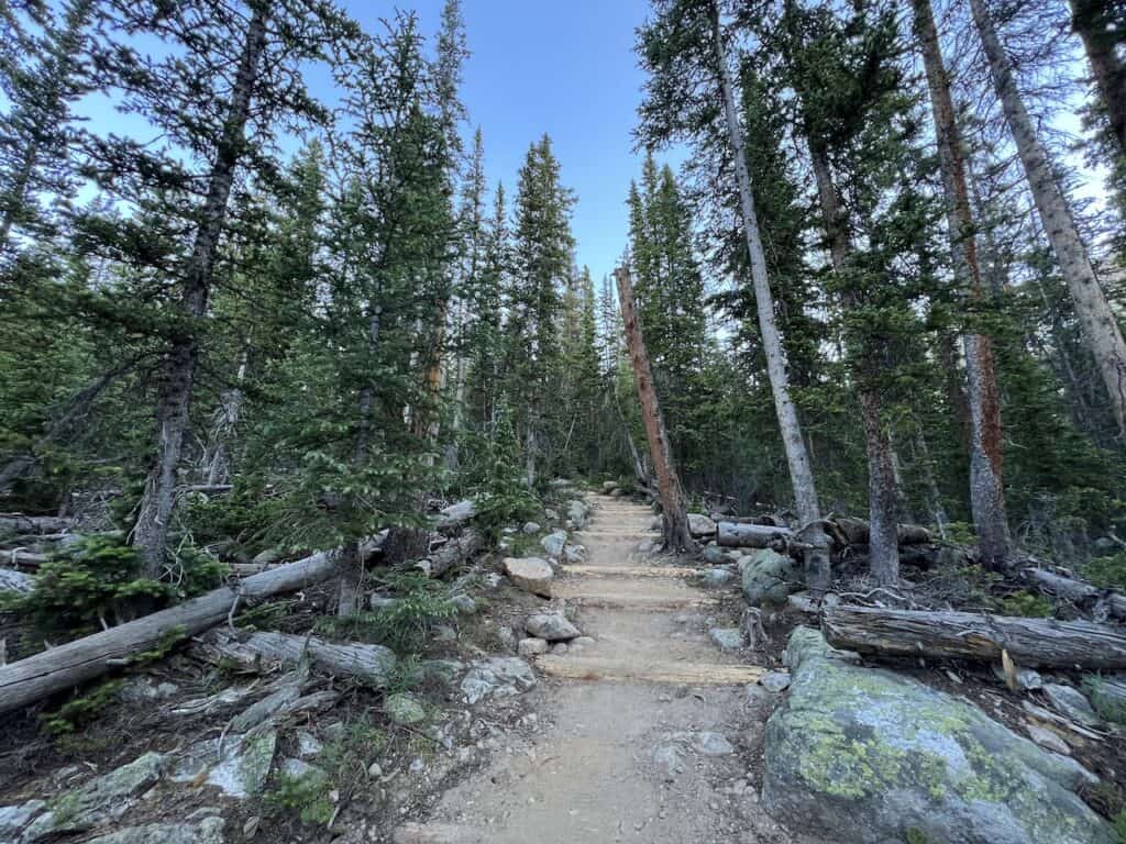
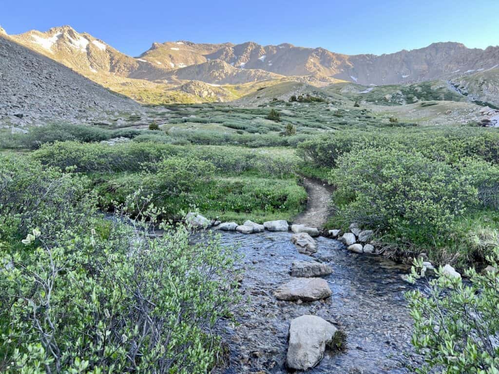
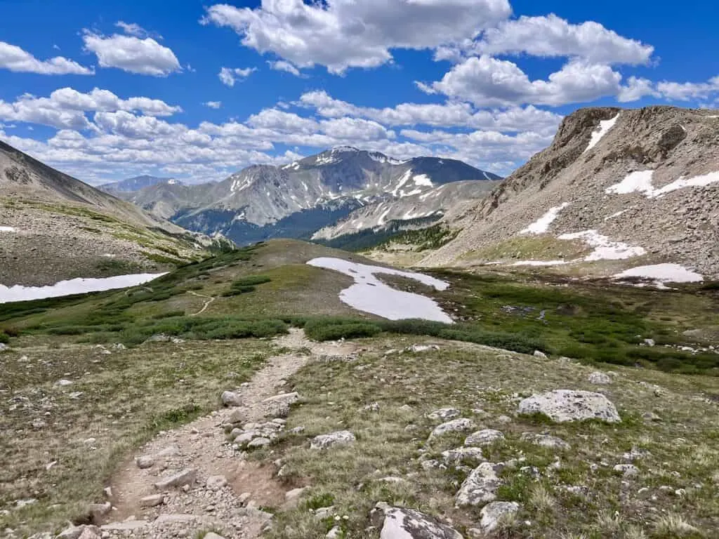
Tree Line to Bear Lake Turnoff (1.7 miles)
Once out of the trees, the elevation grade will slightly get steeper and steeper. But instead of just having the forest surrounding you, there will be some beautiful mountains all around.
Throughout this portion of the hike, you will be able to see Mount Harvard’s summit out back.
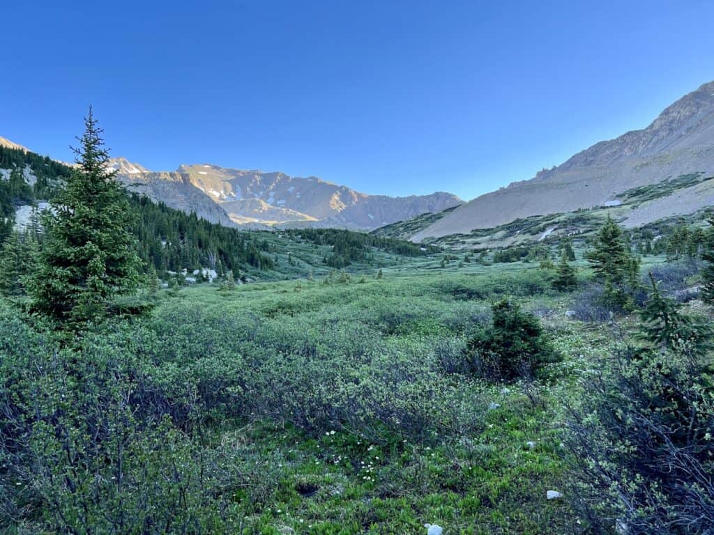
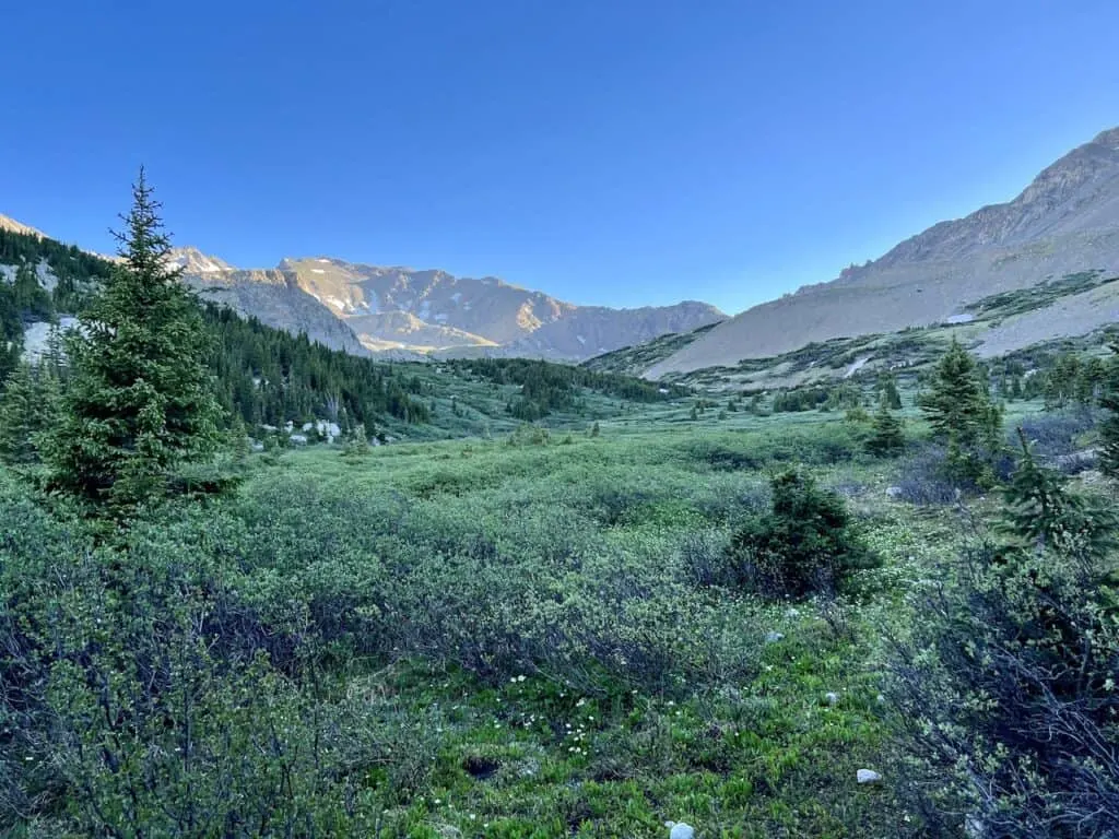
It is an enjoyable portion of trail, as you hop across some river crossings, walk along the dirt pathway, and be surrounded by plants & other flora.
Be aware that during the late spring and early summer, there are portions of the route here that can get muddy from all the snow melt.
In addition, one of the river crossings can get quite high. Although there are rocks to keep your balance, having a trekking pole can be very useful during this portion if need be.
While the turnoff to Bear Lake is easy to miss, you will know once you pass it as the real elevation gain is just about to begin.

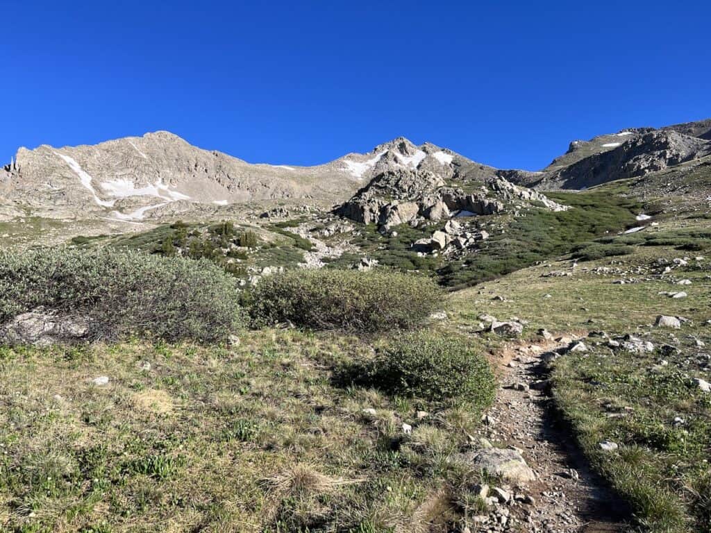

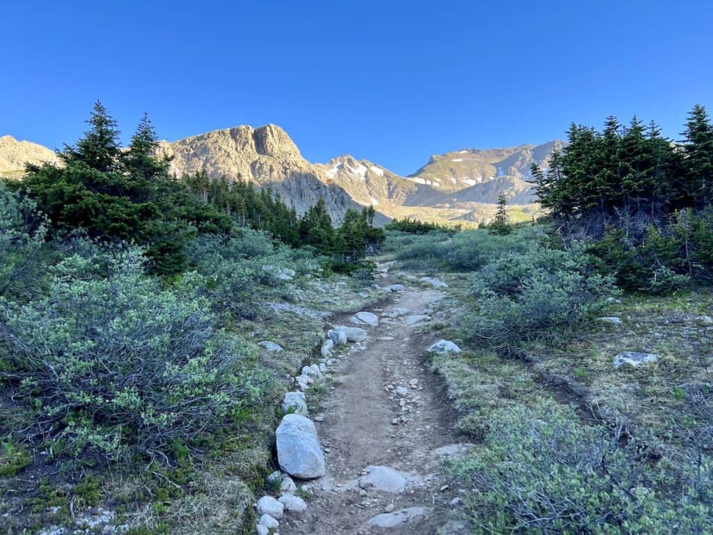
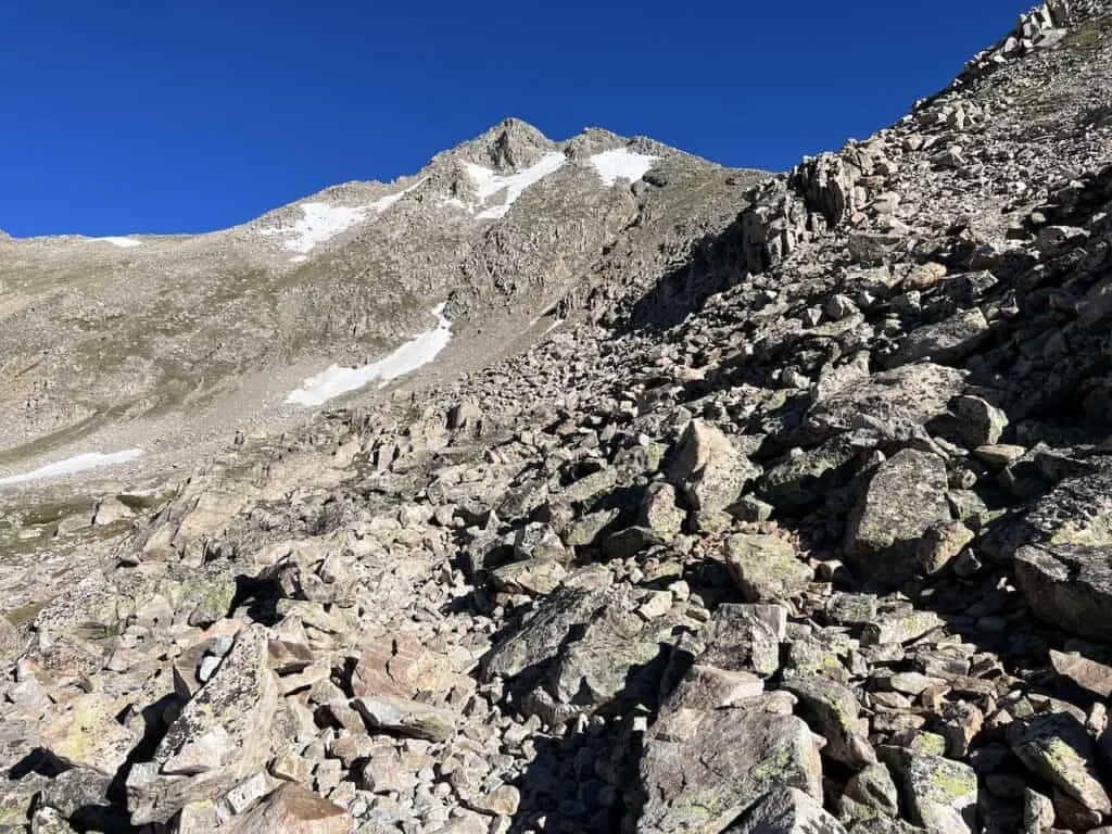
Bear Lake Turnoff to Summit (1.5 miles)
During the final 1.5 miles to the summit, the trail gains around 1,900 feet of elevation. The grade of the terrain makes its way up into the 30%+ range, as things get tougher from here on out.
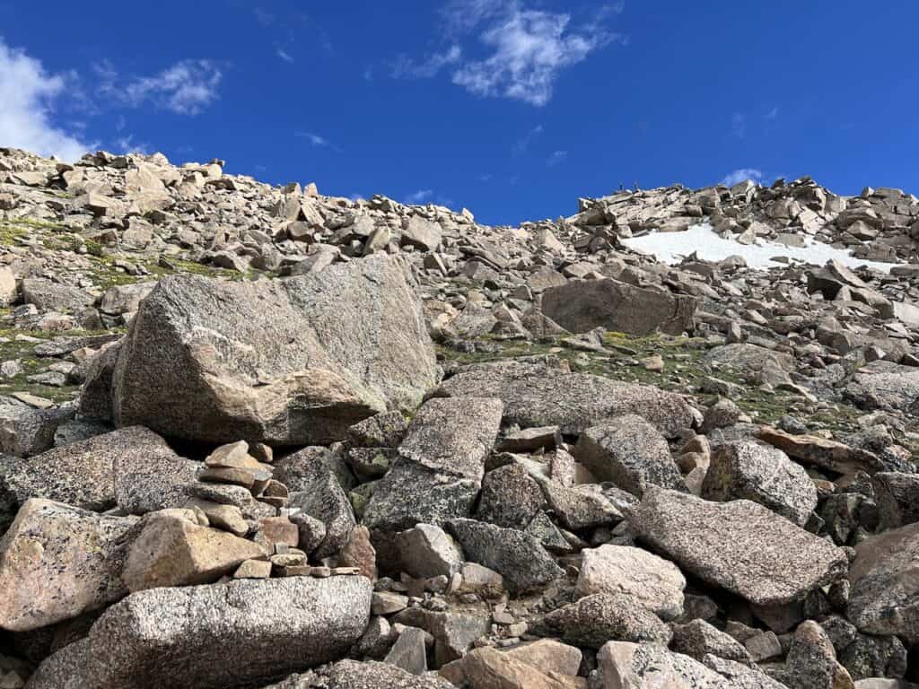
Shortly after making it past the turnoff, the trail begins to get rockier for a section with more technical terrain. As you continue up, just be sure to take breaks as needed so you don’t overexert yourself during the climb.
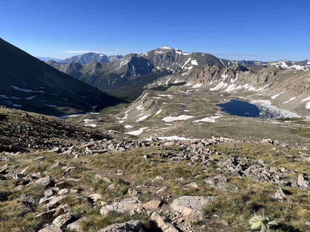
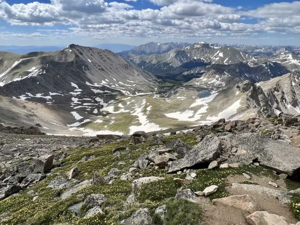
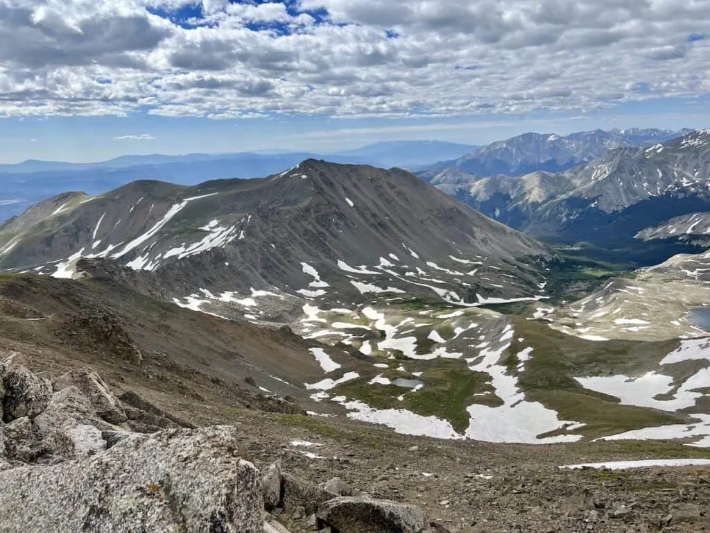
Take in the views out behind you, as you now get higher over the Horn Fork Basin and Bear Lake down below.
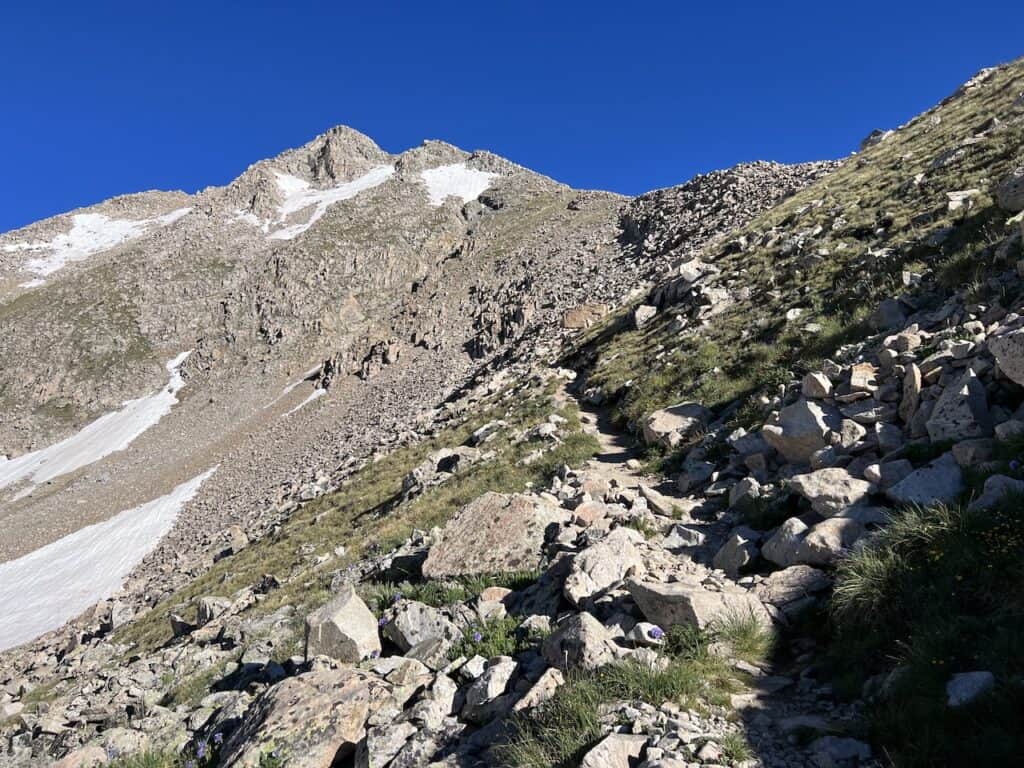


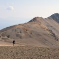
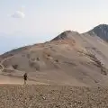
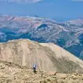
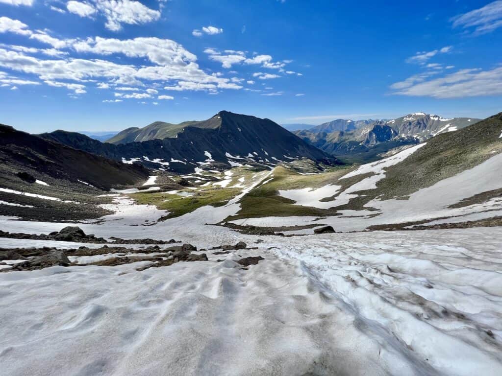
During my hike, there were a few snow crossing sections. These should not be there in a normal year past the beginning of July. However, due to the large snowfall the prior winter, it did stick around another few weeks.
You can see some photos below of the snow portion, which is usually just a dirt trail.

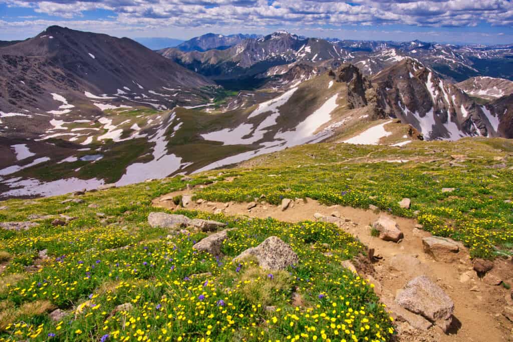
As the trail gets higher up, there are some switchback sections, which can just fill up with wildflowers during the early summer time. I really enjoyed walking this portion of trail on the way down.
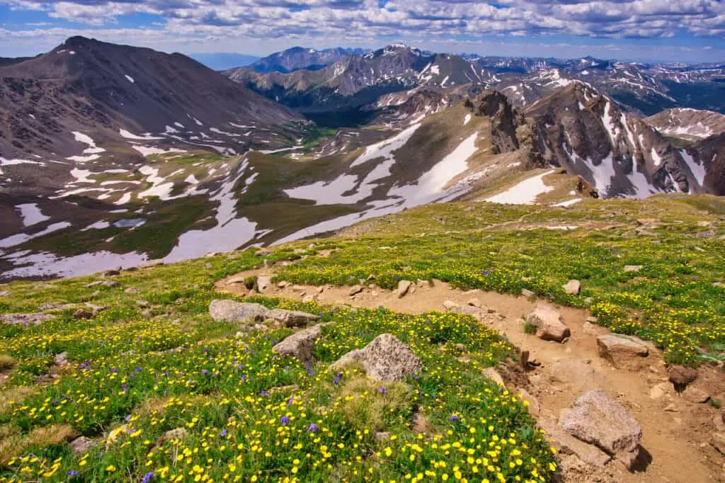
It is then the final push towards the summit. Here the terrain gets rockier and you will want to follow the rock cairns (piles of rocks), as you make your way along the ridge.

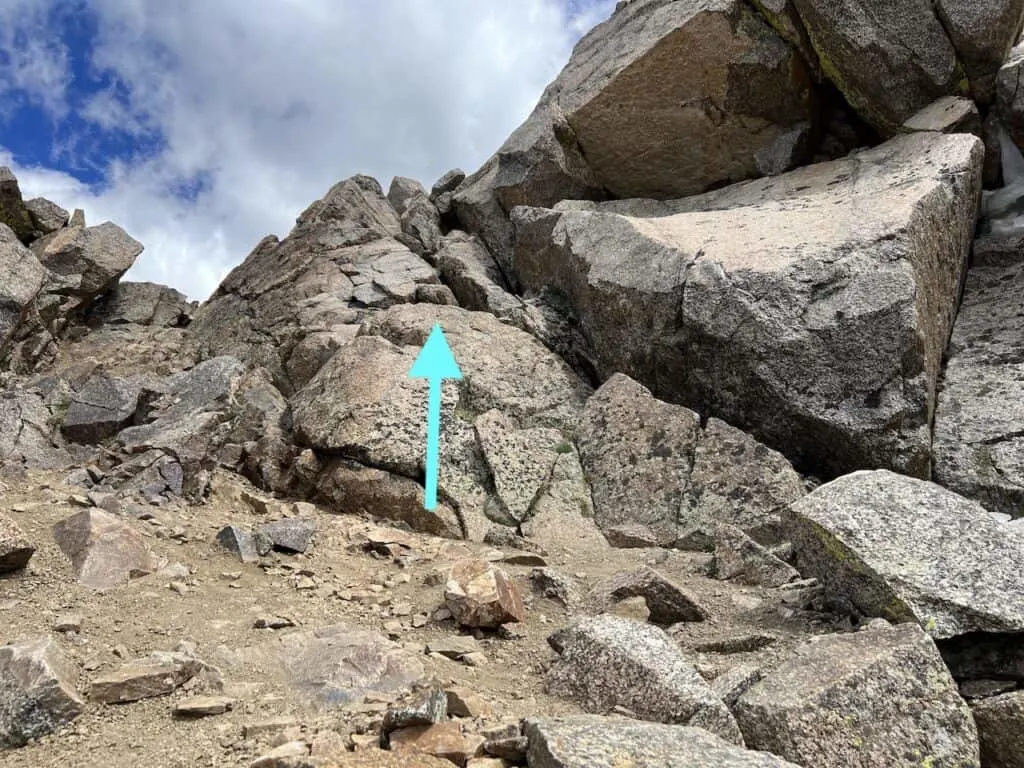
Now, while you may see some people out on the summit in front of you, the final obstacle to get there is a bit tricky. I found myself second guessing myself on what the correct route was to the summit.
While there can be various ways to get up this final portion, I went with the route shown below. Using your hands and balance will be needed as you make the last push towards 14,420 feet.

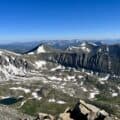
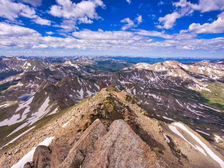
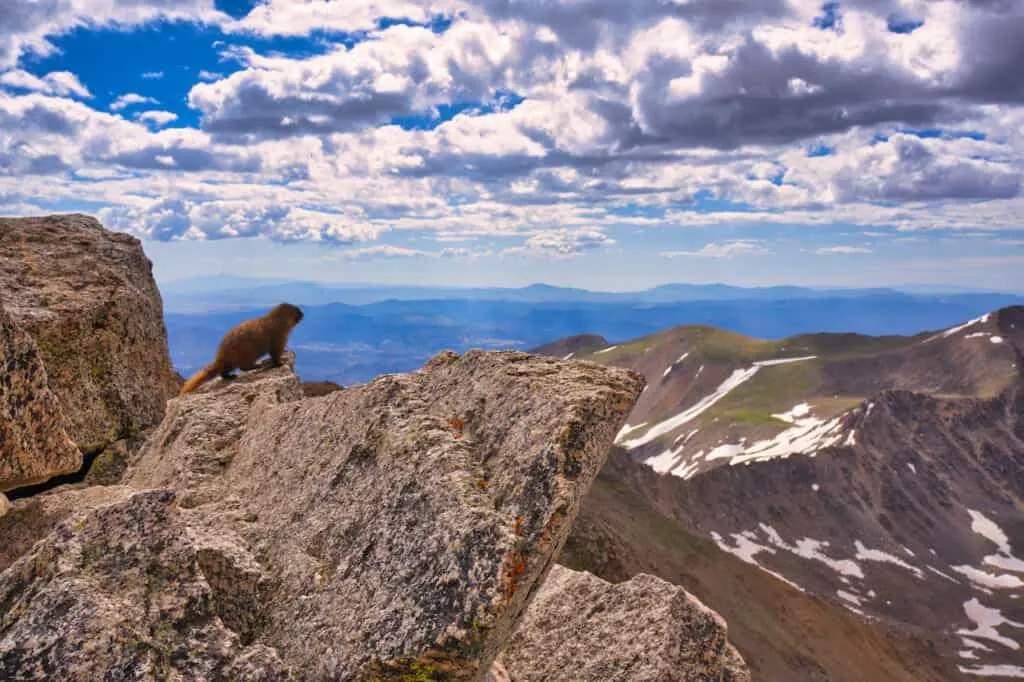
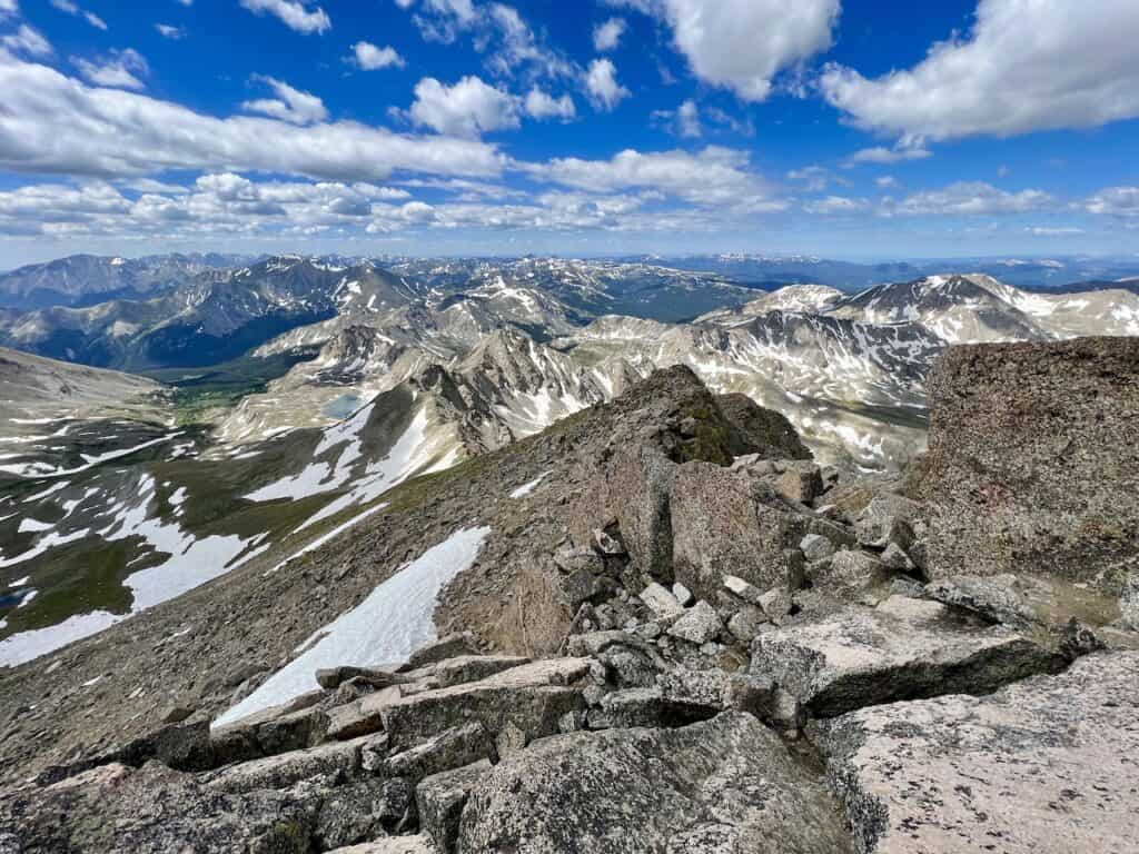
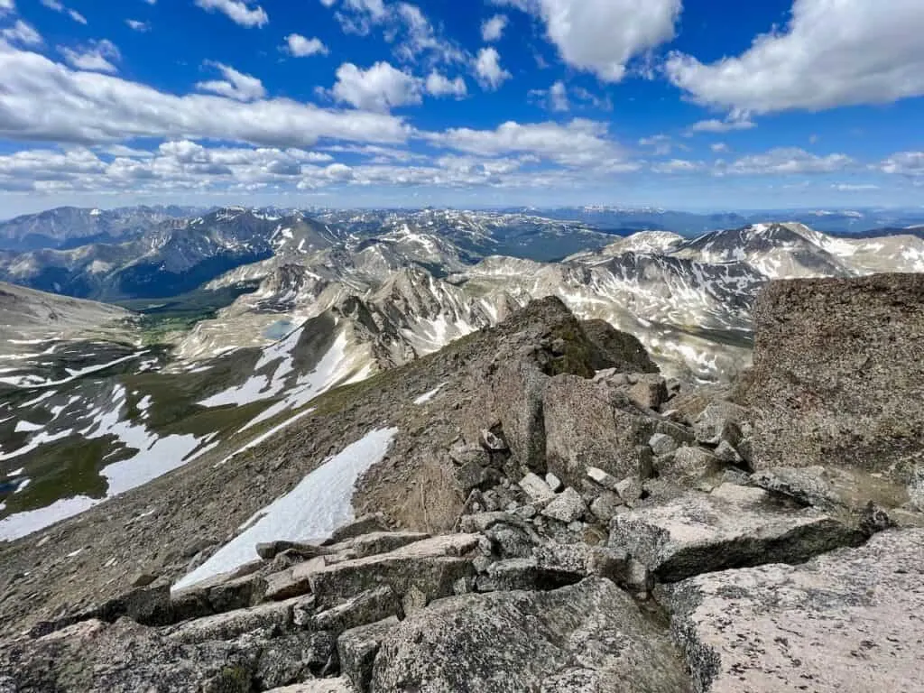
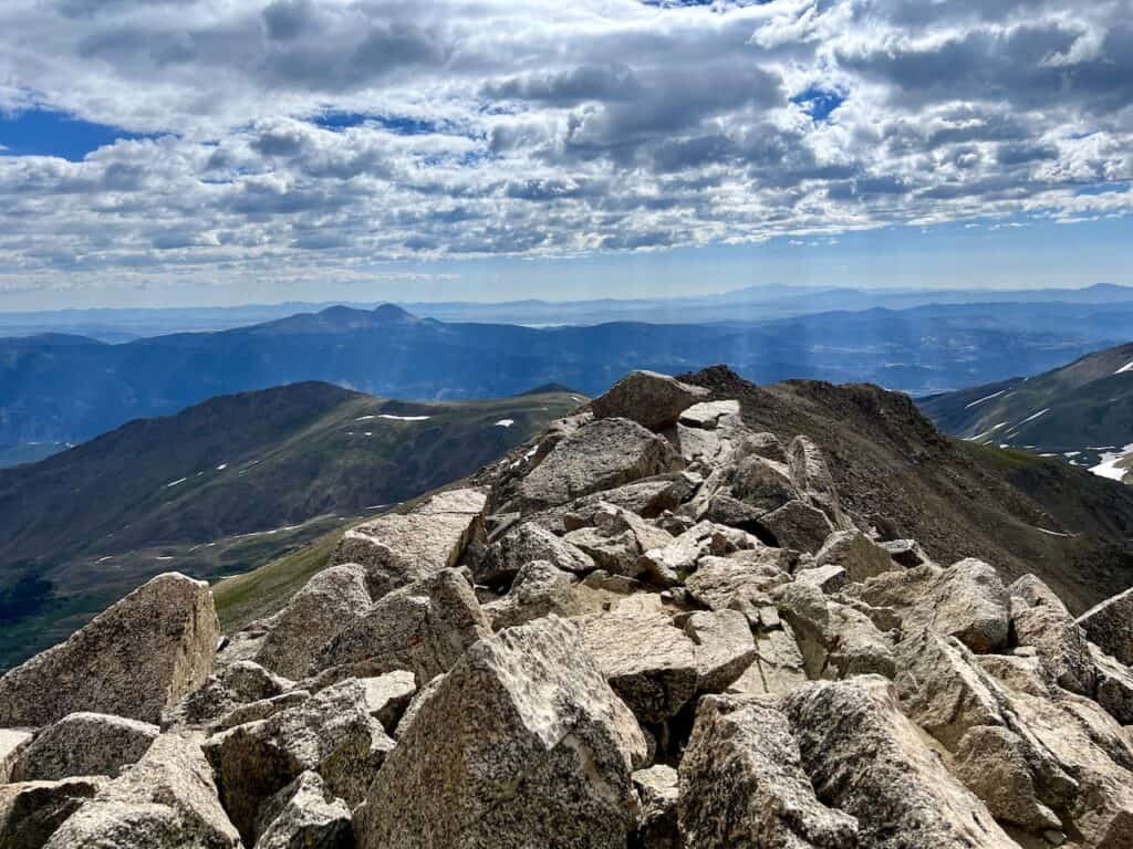
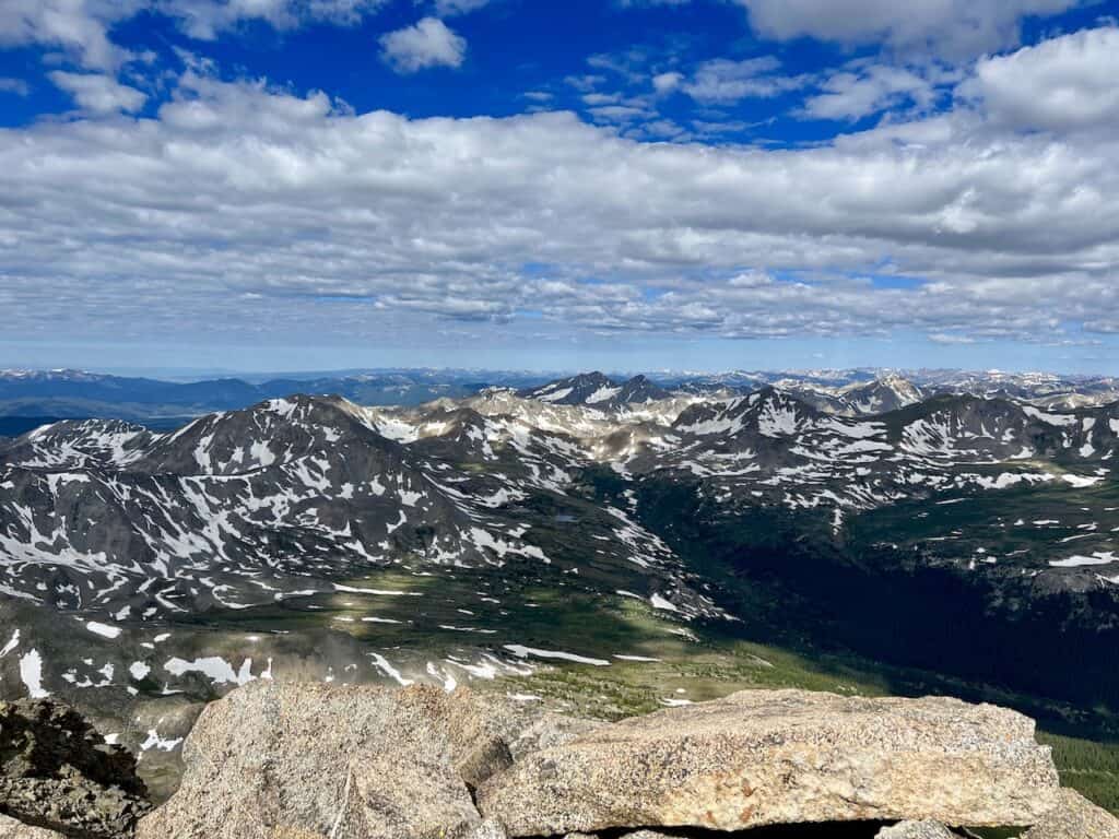
Mount Harvard Summit
Once up top, you will be just surrounded with views from all angles. There will be an endless array of mountains along with valleys, lakes, ridge lines, and plenty more.
Find a comfortable spot to sit back, enjoy the view, and take it all in.
Here are just a few photos I captured from the Mt Harvard summit:


Back to the Trailhead
Everything that comes up, must come down. But don’t worry, the hard part is over. It is only 7 miles of retracing your steps back to the North Cottonwood Creek trailhead.
The first couple miles of descent is actually quite enjoyable as the views will still be out in front of you. Just be careful on those rockier portions of terrain and watch your step along the way.

Once you made it down closer to Bear Lake, things will start to speed up for you. While it is still a long distance back to the trailhead, each mile will just go quicker & quicker.
After 14 miles of round-trip hiking, the Mount Harvard trail will officially be complete. Hop back in your car, make the drive out on the dirt road, and then back to your accommodation for the night.

7) Harvard – Columbia Traverse
Coming in at 15 miles and just over 6,000 feet of elevation gain is the Mount Harvard – Mount Columbia traverse.
This traverse is no joke as you combine two 14ers into one big hike. Most people take on the trail in the clockwise direction. Starting at the trailhead, and then heading up Harvard (just as this trail guide lays out),
Once at the peak, the traverse follows the ridge line to the Mount Columbia summit. The trail will lose upwards of 1,500 feet of elevation, before gaining most of it back to the Columbia summit.
After summiting Columbia, the trail wraps back down into the Horn Fork Basin, and meets up with the Harvard trail just around the tree line.

That about does it for a trail guide to Mount Harvard. If you have any questions or comments about the hike, be sure to add them in below.
Also, don’t forget to check out the other Colorado hiking guides up on the site.
Have fun out there and safe travels!