As the second highest 14er in Colorado at 14,429 feet, Mount Massive offers some of the best hiking experiences you can ask for.
With two main routes to choose from, Massive is a perfect option for those that want to take on a tougher peak and get to enjoy some of the top views in the Sawatch mountain range.
Read on to learn more about the Mount Massive hike and how to take part of the trail for yourself!
* Affiliate Disclosure: This post may contain affiliate links, which means I may receive a commission if you make a purchase through the links provided, at no additional cost to you. Thanks for supporting the work I put into TripTins!
1) Mount Massive Overview
To start, below are some helpful pieces of information regarding Mount Massive itself:
Mount Massive Height: Mount Massive stands at 14,429 feet above sea level. This makes it the second highest peak in Colorado, just a handful of feet shorter than nearby Mt Elbert.
Name: The reason it is called Mount “Massive”, is simply due to the fact that it is indeed massive. Believe it or not, there are five summits above 14,000 feet along the 3 mile ridge line. This makes it the mountain with the most area above 14,000 feet in the lower 48 states.
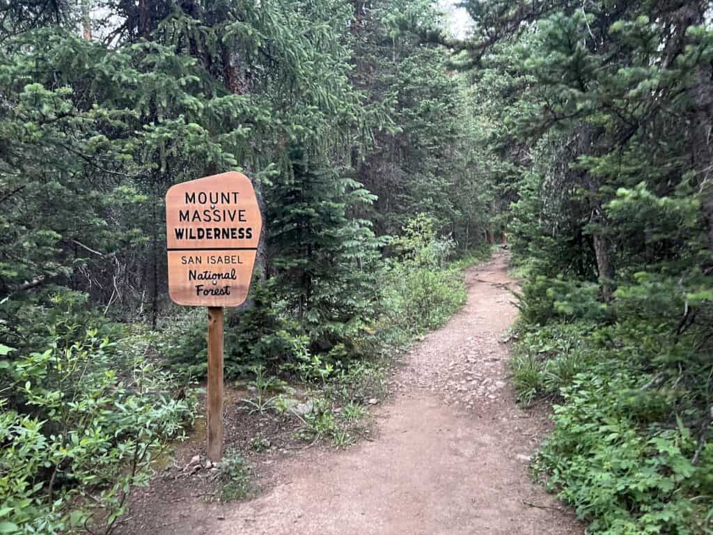
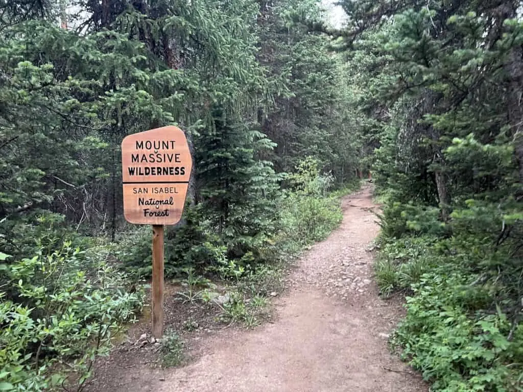
Location: You can find Massive in the Mount Massive Wilderness of San Isabel National Forest, as part of the larger Sawatch Range. The main trailhead is located just 25 minutes west of Leadville.
Routes: There are two main routes that head up to the summit – the longer but easier East Slopes route, and the shorter but harder Southwest Slopes route.
Class: Both of these routes are considered Class 2 difficulty levels making it accessible for many aspiring hikers.
2) Route Statistics
As mentioned, there are two main routes to consider when taking on Mount Massive. There is the standard route that heads up the East Slopes, and the secondary route that heads up the Southwest Slopes.
While the East Slopes route is longer by several miles (around 2.5 miles each way), it is on a much more gradual incline. The Southwest Slopes may be shorter but it can be the much more difficult option for many people due to the sheer amount of elevation gain in a shorter distance.
To give you a better understanding of this, here is the high level math:
- East Slopes: gains 4,500 feet over 6.5 miles = ~700 feet of gain per mile (pretty evenly spread out)
- Southwest Slopes: gains 3,900 feet over 3.7 miles = ~1,050 feet of gain per mile. HOWEVER, during the final 2.2 miles to the summit, the route gains +3,200 feet (1,450 feet of gain per mile).
The main reason why the Southwest Slopes route is recommended is due to the more scenic views along the trail. This is especially true on the way down, as you have peaks out in front of you for a good portion of the hike.
Getting to not only enjoy the views from the summit but also on the way down, makes the Southwest Slopes my recommendation for those that are up for it.
Below are some condensed round trip stats when it comes to both route options:
Standard East Slopes Route
- Distance: 13 miles
- Elevation Gain: +4,500 feet
- Duration: 7 – 9 hours
Southwest Slopes
- Distance: 7.5 miles
- Elevation Gain: +3,900 feet
- Duration: 5 – 7 hours
What is the Easiest Route up Mount Massive: although it is the longer route, the Standard East Slopes route is the known as the easier route.
ROUTE NOTE: my time out on Mount Massive was spent on the Southwest Slopes. Most of this overview will focus on that route. However, I will touch upon the standard East Slopes route as well.

3) Mount Massive Trailhead
Before you make a decision whether to hike the East Slopes vs Southwest Slopes, you will also need to consider the trailhead situation.
These two routes do not start at the same trailhead, however hey do meet up with one another closer to the summit. The trailheads themselves are located 2.5 miles away from one another.
Colorado Car Rental: Looking for a rental car in Colorado? Check out Rentalcars.com for a variety of options that can work well on your trip.
East Slopes Trailhead
The standard East Slopes route trailhead is located along Halfmoon Road, just pass the main Mount Elbert parking lot. Typing in “Mount Massive Trailhead Parking Lot” into Google Maps should get you there.
While the final portion of road is not paved, no car should have a problem getting to the parking lot.

Southwest Slopes Trailhead
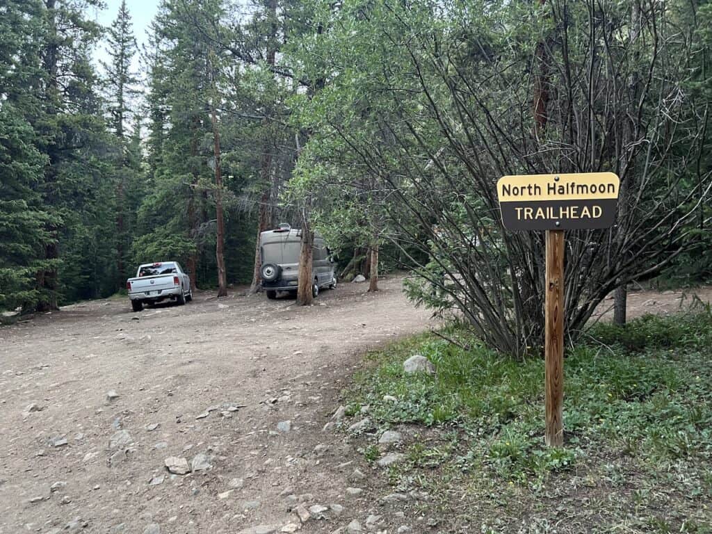
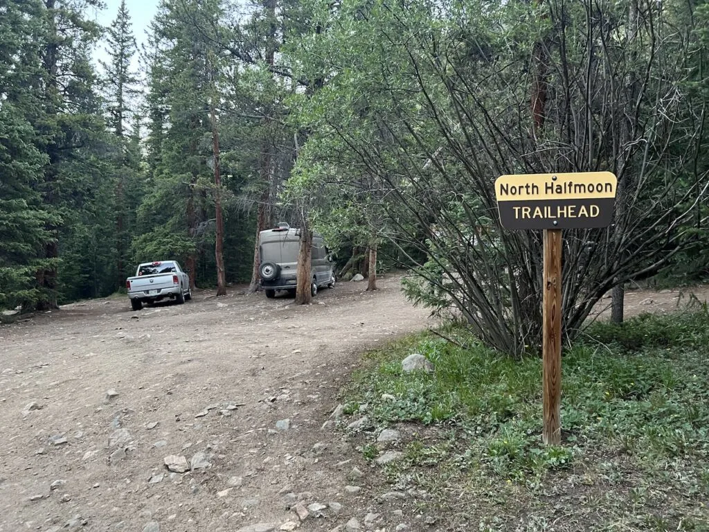
Here is where things get a little more interesting. The Southwest Slopes trailhead is called “North Halfmoon Creek Trailhead”, and is located 2.5 miles further west along Halfmoon Road.
However, not all cars can make it down this road. As you pass by the East Slopes parking lot, you will see a sign that indicates only high clearance vehicles should continue on.
These final 2.5 miles can be bumpy, narrow, and filled with rock protrusions throughout the drive. Expect to take things very slowly here, as these couple of miles can take 15-20 minutes to complete.
If you do not have the appropriate car, the Southwest Slopes are out of the question unless you want to walk or hitchhike the rest of the way from the East Slopes parking lot (+5 miles round trip).
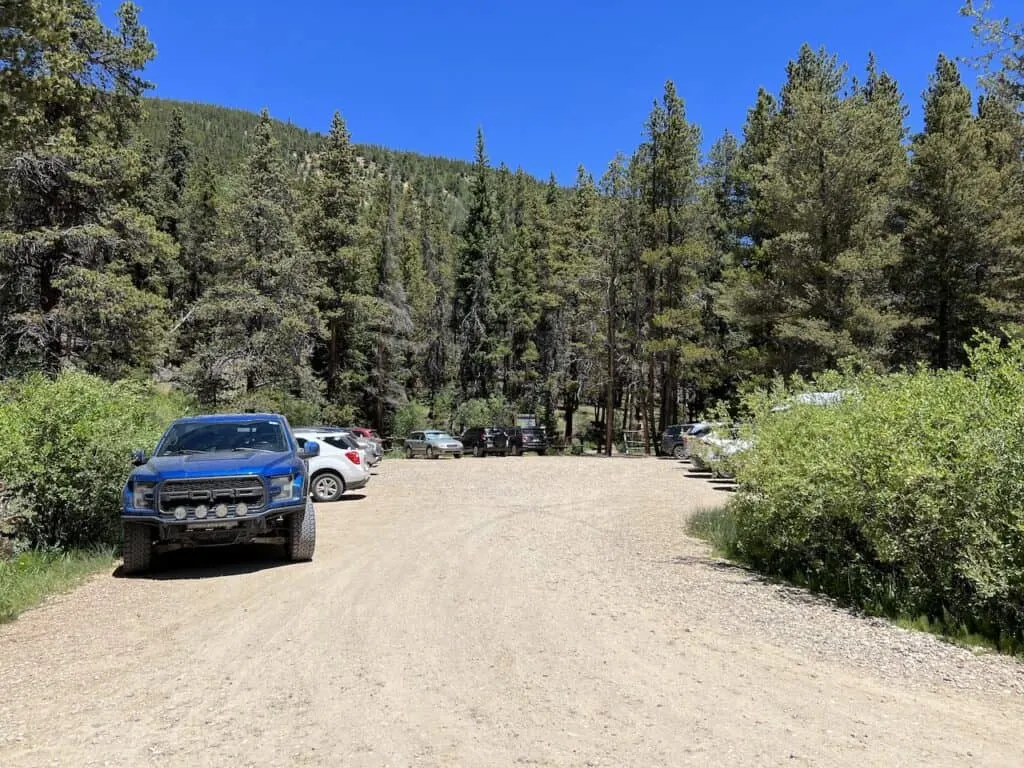
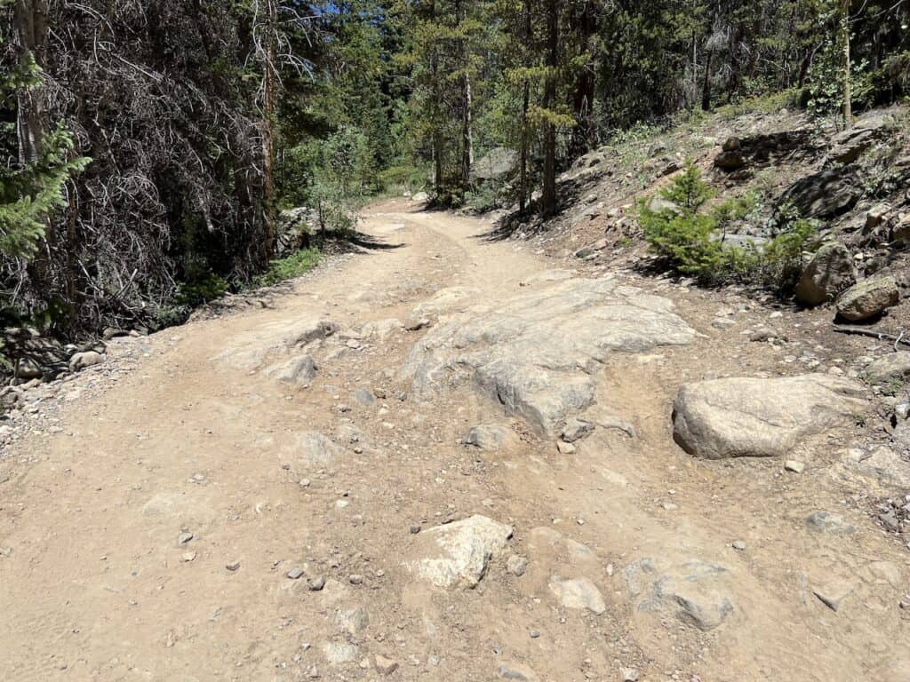
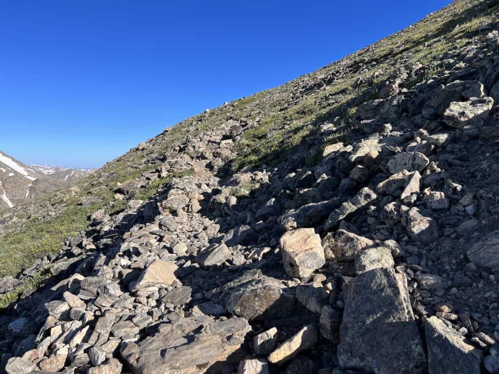
Another important note is that the final 0.5 miles to the North Halfmoon Creek Trailhead is even more dicey with several very large rocks & road obstacles (first image below).
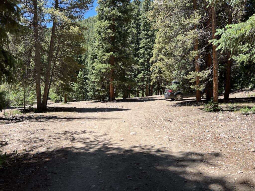
Due to this, many people simply park in an area located 0.5 miles from the trailhead, and then walk along the dirt road to the trailhead. This adds 1 mile of round trip hiking altogether.
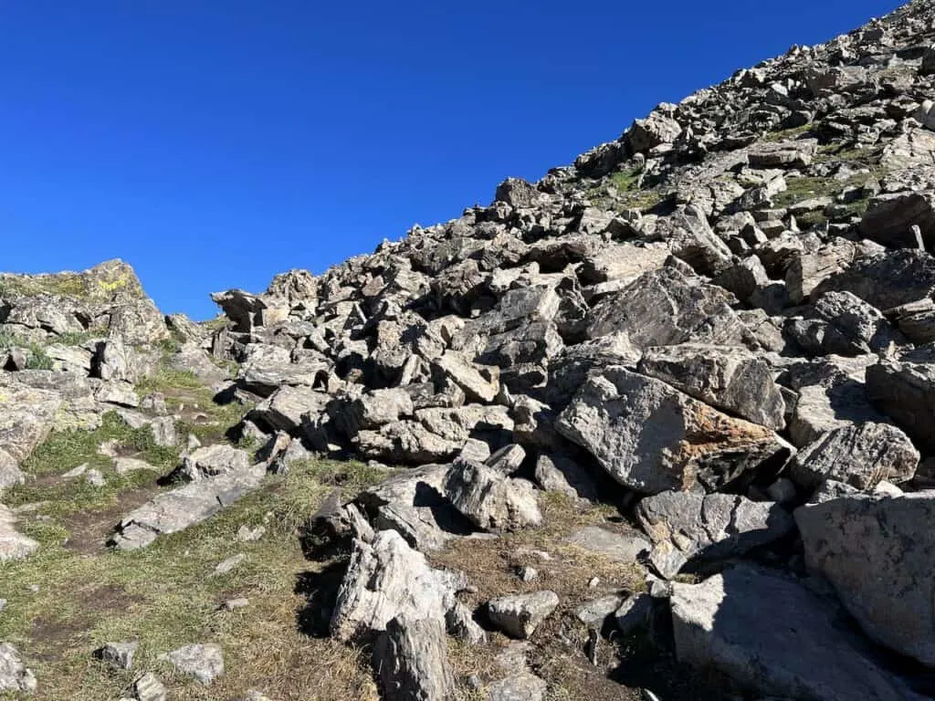
There is somewhat of a larger open parking area here on the left-hand side of the road (see second image below).


See the map in the following section for routes, trailheads, and parking situations. If there are any questions or clarifications needed, please comment down at the end of the article.
4) Mount Massive Map
Here is a Mount Massive map that lays out the following:
- East Slopes Route: Red
- Southwest Slopes Route: Blue
- First 2 Miles 4WD Route Between Trailheads: Yellow
- Secondary Parking for Southwest Slopes: Black
- Final 0.5 Mile Drive to Southwest Slopes: Purple
5) Weather Forecasts
When it comes to hiking up Mount Massive, it will be very important to pay attention to the weather forecast. Since much of the hike is done above the tree line, you have to be cautious for those afternoon thunderstorms that are common in the summer months.
In addition, the views are just so much better without those low lying or thick clouds. Saving this hike for a nice weather day is your best bet.
I would recommend checking out a few different weather forecasts prior to taking on the hike:
Hiking Resources & Checklist
Before heading out for the trails, be sure to read up on some of the hiking resources up on the site. These are here to better prepare you for all types of outdoor adventure.
- Gear: Hiking Packing List
- Weather: How to Prepare for Hiking Weather
- Navigation: Hiking GPS & Navigation
- Tips: 20+ Hiking Tips & Tricks for the Trail
- Accommodation: Book Your Hotel Today
- Rental Car: Book Your Car Rental Today
6) Where to Stay
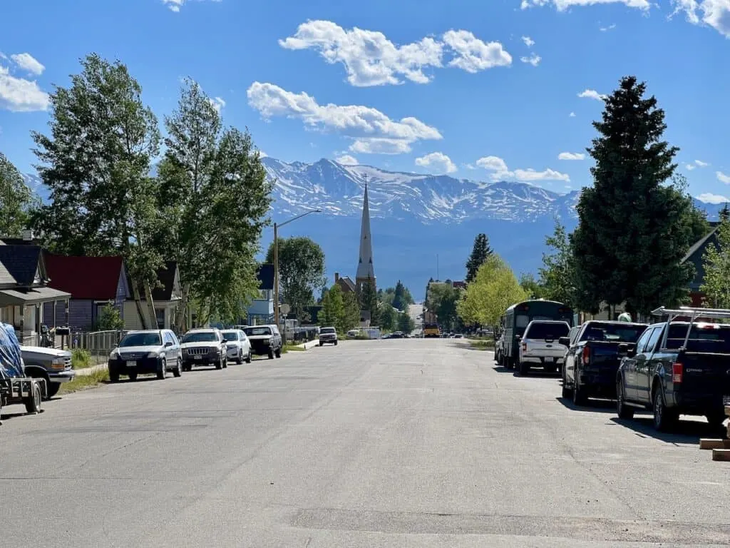
While there are many places you can choose to base yourself around the area, I would recommend staying in either Leadville (30 minute drive) or Buena Vista (1 hour drive).
Leadville is just north of the turnoff from US 24 and Buena Vista south of it.
These are great places to stay if you are looking to not only hike Mount Massive but also many of the other 14ers around the area. Below are a few highly recommended places to stay in each of them.
Leadville
Buena Vista
- Surf Hotel & Chateau
- Best Western Vista Inn
- Mount Princeton Hot Springs Resort (just outside town)

Looking for More 14ers? Check out some more hiking guides for nearby peaks in the area including:
– Mount Elbert
– Huron Peak
– La Plata Peak
– Mount Yale
– Mount Harvard
– Mount of the Holy Cross
– The Decalibron
– Quandary Peak
7) Colorado Hiking Tips
Take a look at some helpful hiking tips when it comes to taking on the trails in Colorado:
Be aware of the elevation: hiking at altitude is no joke and you need to ease your way into the trails. Before taking on hikes from the start, give yourself a day or so to acclimatize.
Stay hydrated: to help with the altitude and the hiking itself, stay consistently hydrated. Take plenty of water and consider a Katadyn Filter Water Bottle for the trail.
Bring bug spray: the bugs can be out in full force on many trails. Put on some bug spray to keep yourself protected while hiking.
Apply sunscreen: the sun can be very strong in the mountains. Applying sunscreen (and wearing a hat / sunglasses), will be very important when it comes to protecting yourself.
Keep an eye on the forecast: the weather can turn suddenly out on the trails. Be sure to check the weather forecasts beforehand to avoid rain & thunderstorms. Afternoon storms can be more prominent in the summer months (so start early!).
Download offline maps: to keep yourself on track, download offline maps for the trail. This can be done by using navigation apps such as AllTrails, Maps.me, and Gaia. You should also download offline Google Maps, as cell service does not always work closer to the trailheads.
Check trail conditions: before committing to a trail, I would recommend looking at the latest trip reports on AllTrails (or 14ers.com for 14er hikes). This is more so important as the summer season starts & ends, as you can get a better idea of trail conditions & snow coverage.
8) Mount Massive Hike
Now that you have some background on the trail, let’s dive into some details and photos of the hike itself.
The following will focus on the Southwest Slopes route. I will then talk through a short high-level description of what to expect on the East Slopes route.
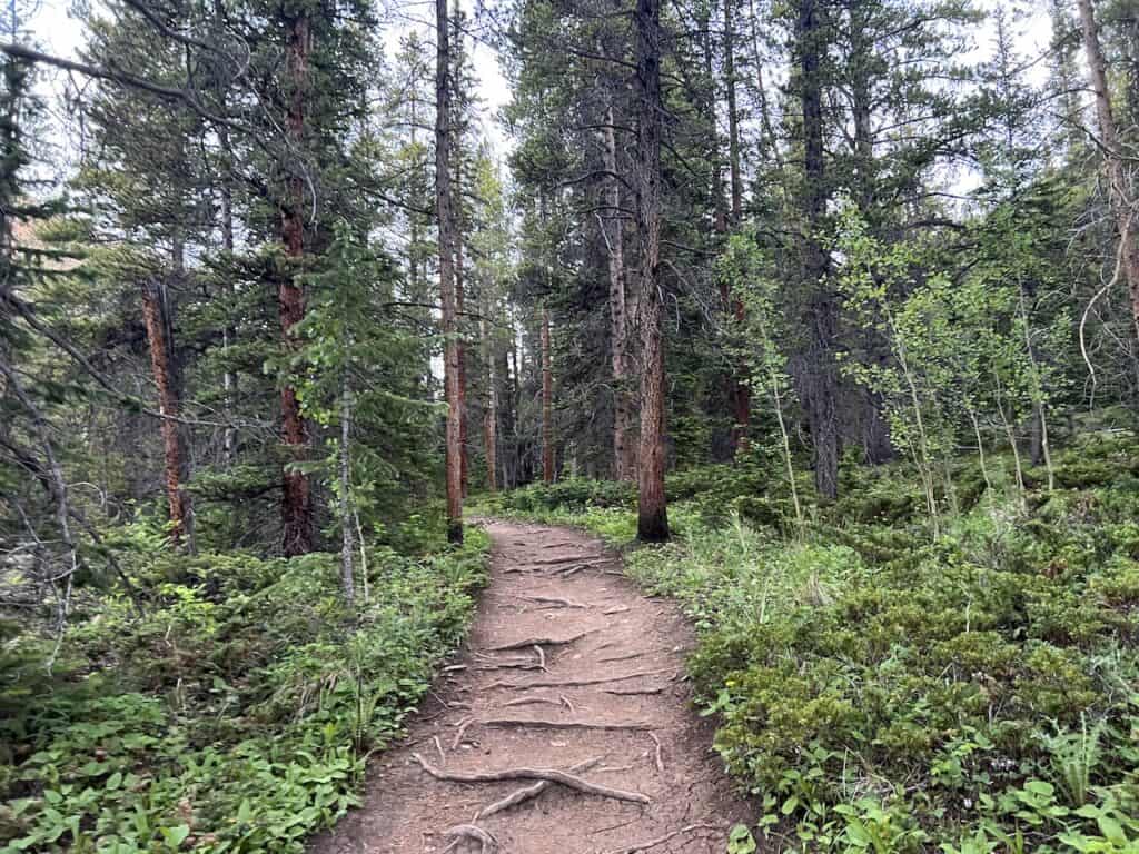
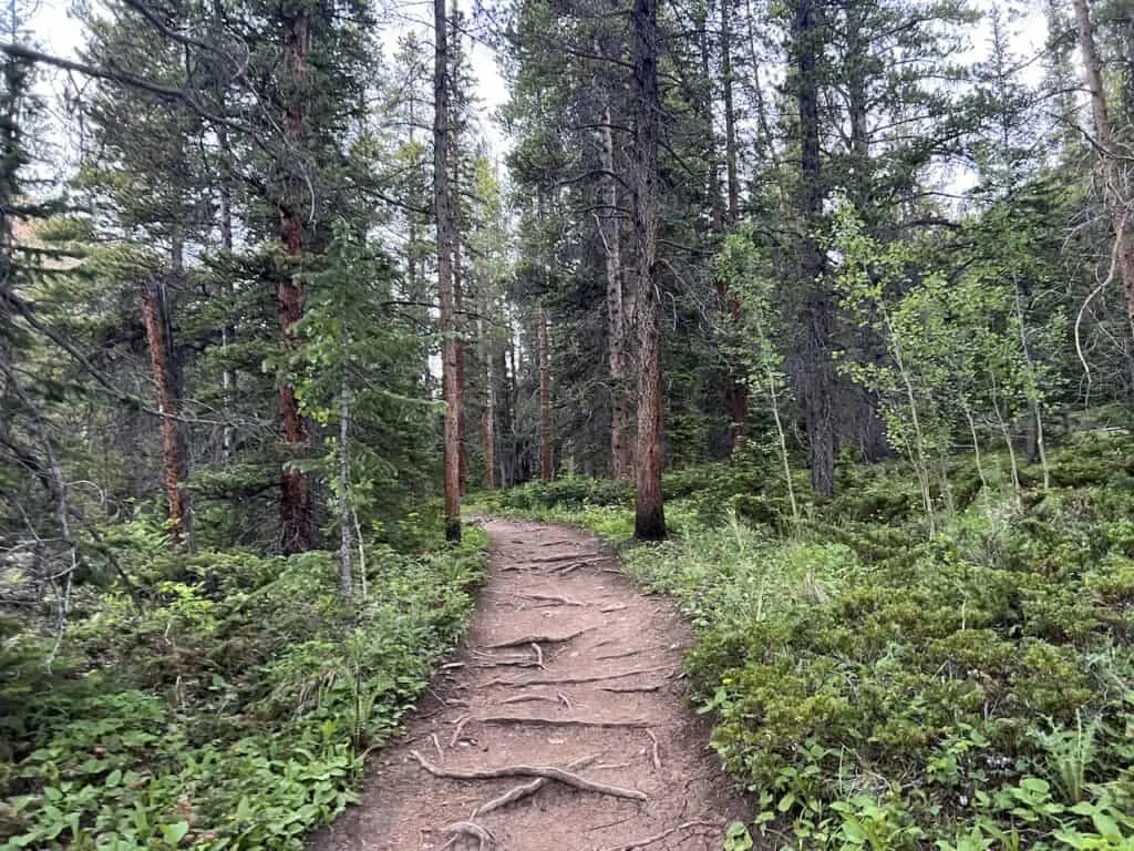
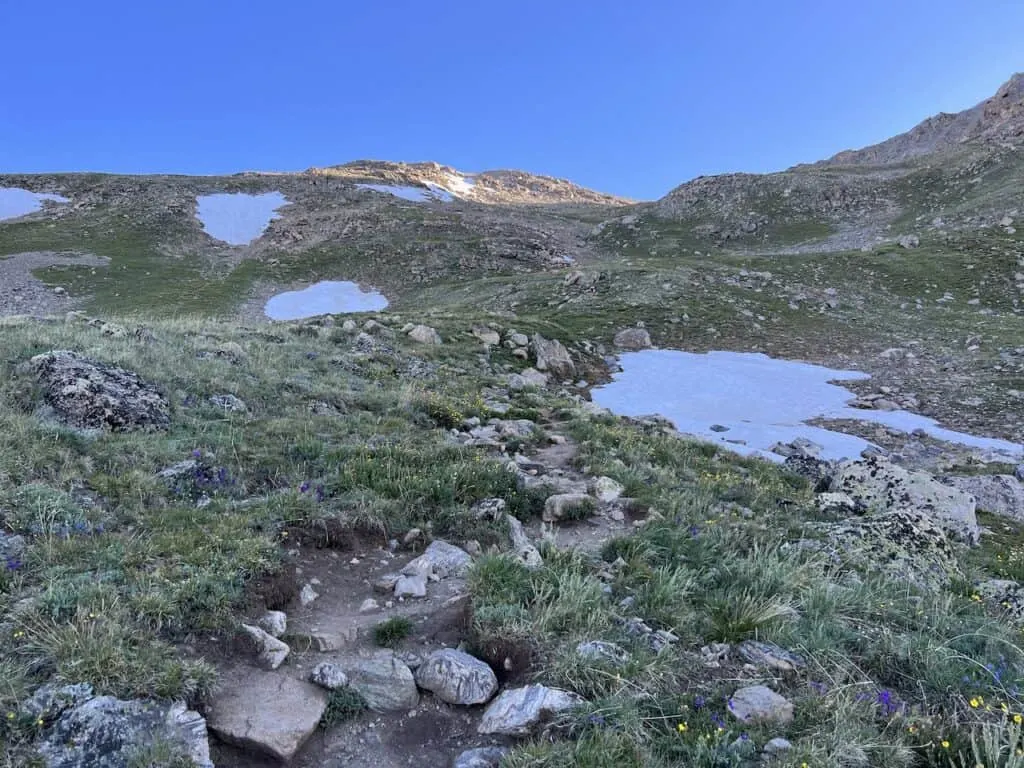
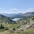
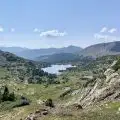
Trailhead to Lakes Intersection (1.5 miles)
Whether you drove all the way to the trailhead, or walked the final 0.5 miles from the alternative parking area, the hike will officially begin at the North Halfmoon Creek Trailhead.
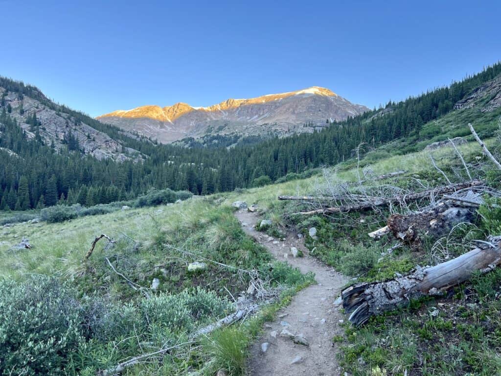
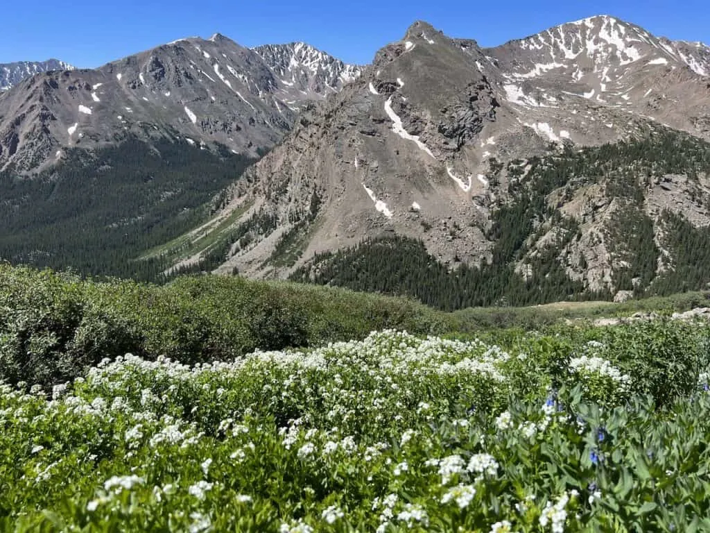
The first portion of the trail will take you through the forest for just over a mile. During this section there will be mild elevation gain but nothing too steep or technical.
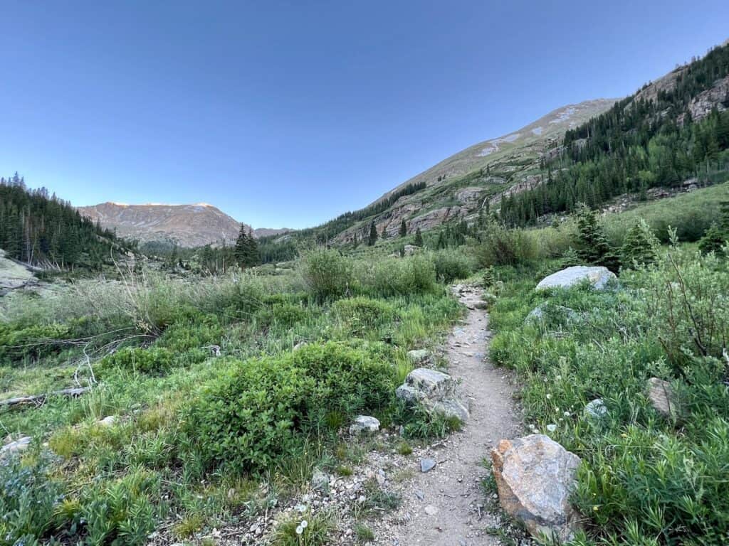
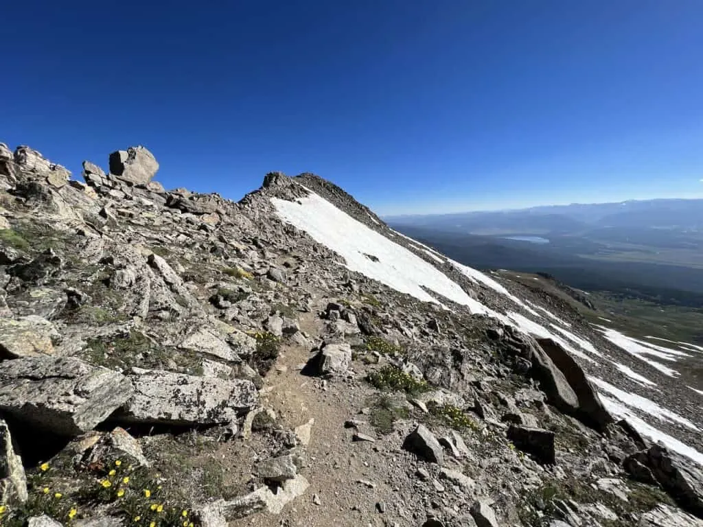
After exiting the forest, you will begin to see the Mount Massive slopes out on your right hand side along with some more mountains out in the distance.
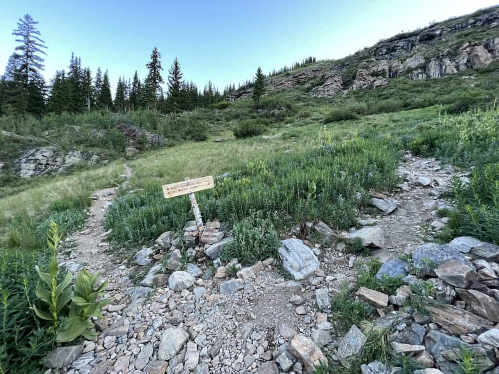
The trail will begin to get a bit rockier in some spots as you continue along until you reach the North Halfmoon Lakes Trail intersection.
When you reach the intersection, you will want to make a right hand turn following the signs up to Mount Massive. While it will be just another 2.2 miles to the summit, these few miles will take some time.


Boulder Fields & Rocky Terrain (0.4 miles)
Once past the intersection, the real hike will begin. Just a few minutes after making the turn at the intersection, you will reach the first of two large boulder field areas.
These sections of trails are just filled with thousands of rocks all over. The key here is to follow the rock cairns (small piles of rocks) that are stacked out in front of you.

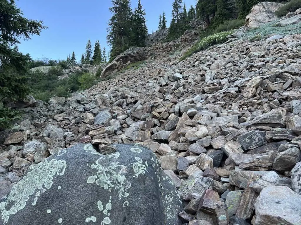

Be extremely careful as you make your way through this rocky terrain. All these rocks can be very unstable and you will need to be cautious with your steps as you head up.
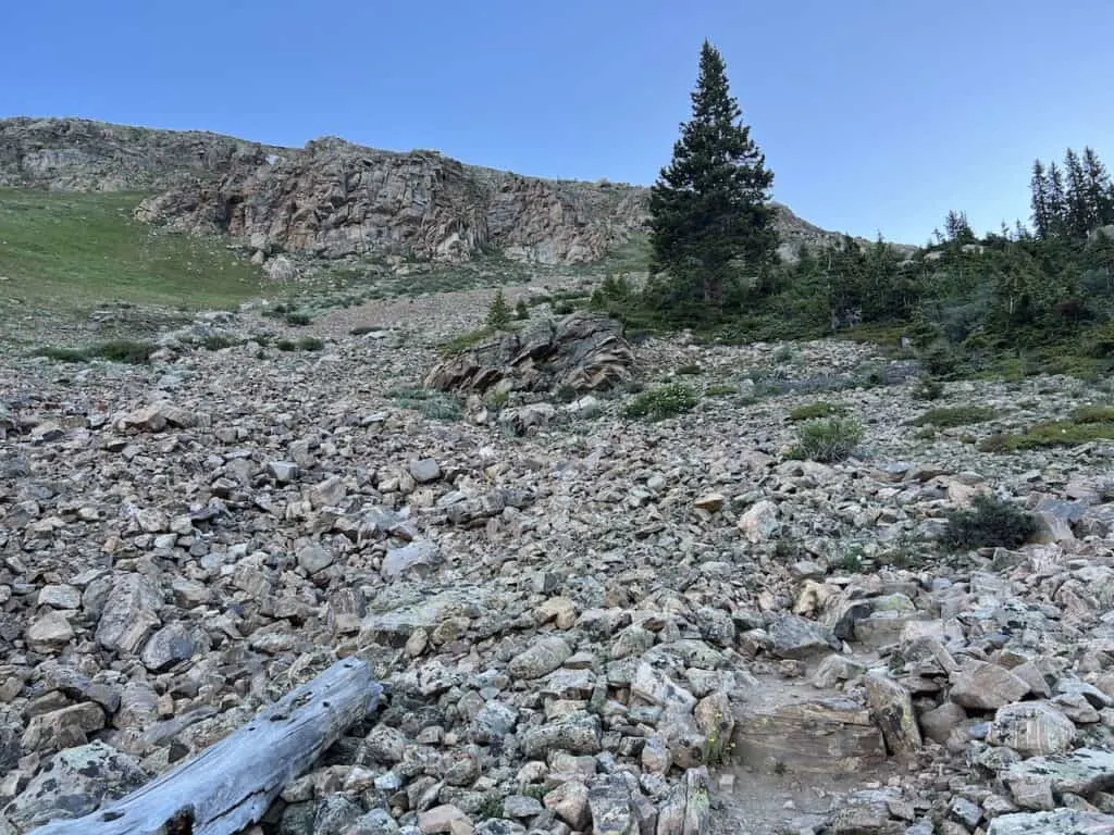
After finishing up the first section, there is a short pathway that will lead to a second section of rocks. Continue your way up as you carefully head along the route until you reach a more defined dirt path.
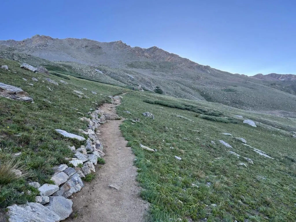
Continue Upwards (0.8 miles)
Once past the boulder field and rocky portion, the trail will be easier to follow for the next 0.8 miles.
While this portion will mostly be a dirt pathway (with some rocks jutting out around here and there), it is going to be gaining a lot of elevation in a short distance.
The switchbacks will start to take you further up the mountainside in a short period of time. Be sure to take breaks as needed and enjoy the views out behind you during your rest stops.


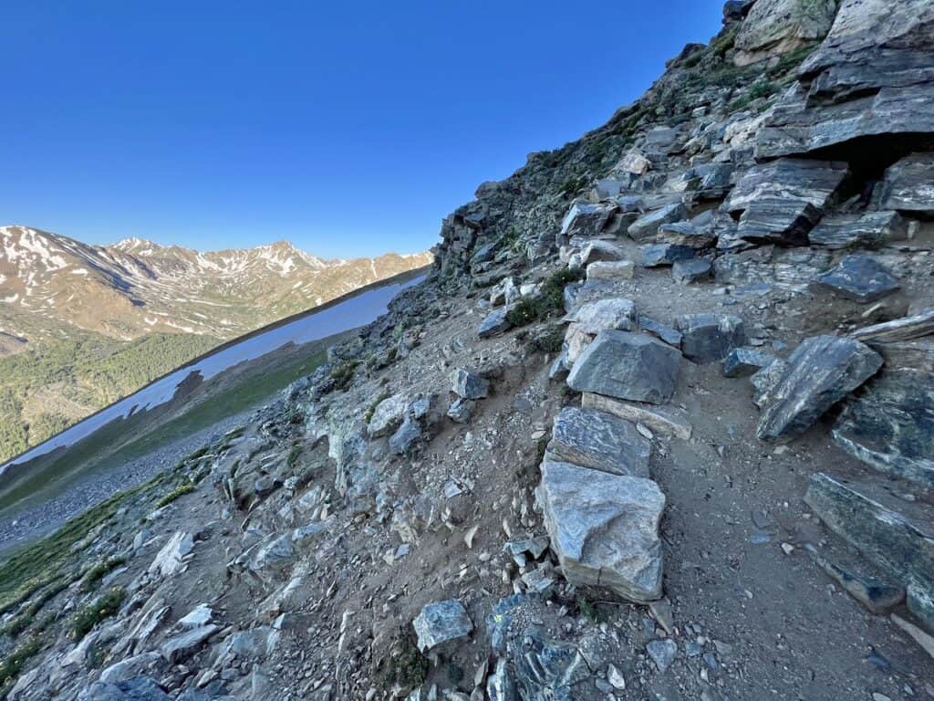
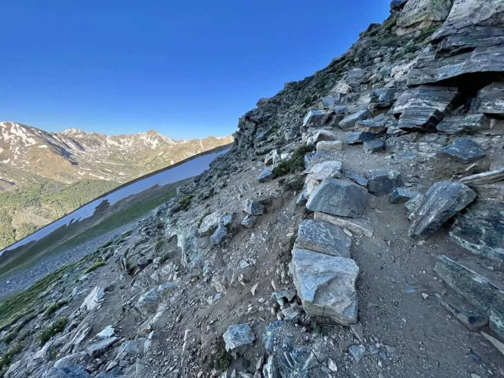
To the Summit (1 mile)
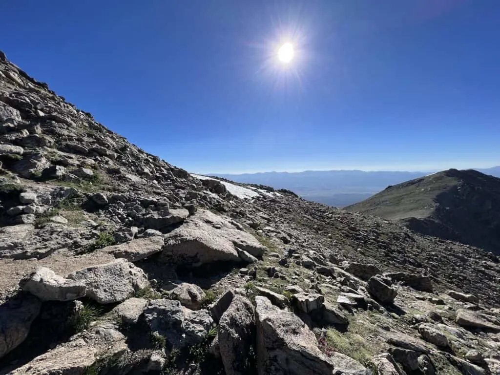
As you get further up the mountain, the rocky terrain will become more prominent. While it will not be like the boulder fields from earlier, you will be dealing with more rocks underneath your feet compared to the easier dirt path.
Similarly, as before, expect some more switchbacks as you gain the final amounts of elevation closer to the summit.


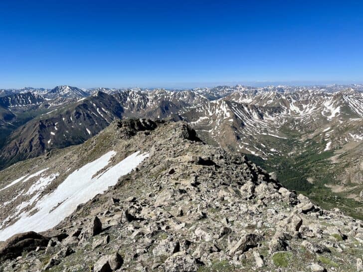
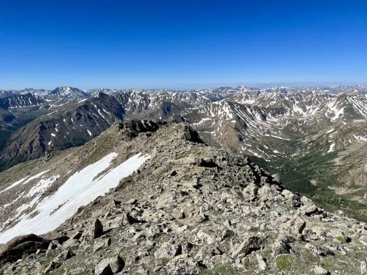
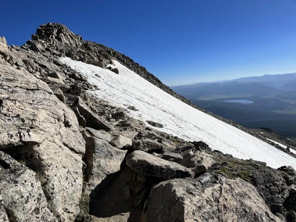
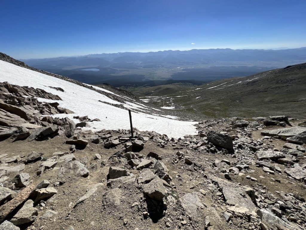
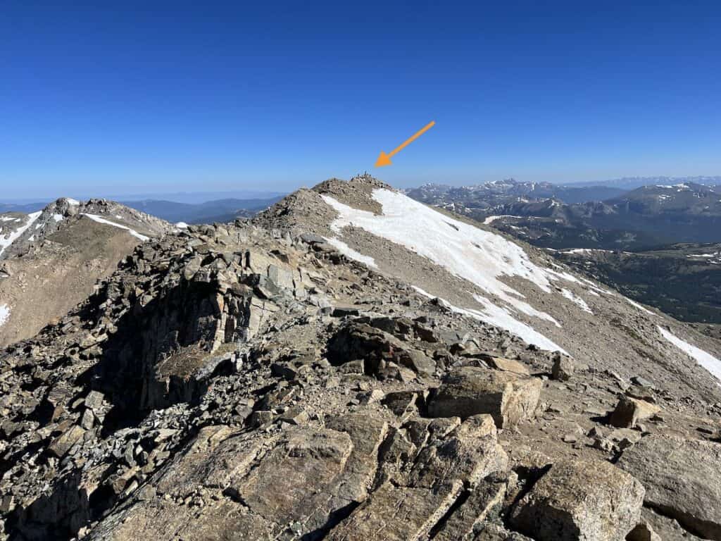
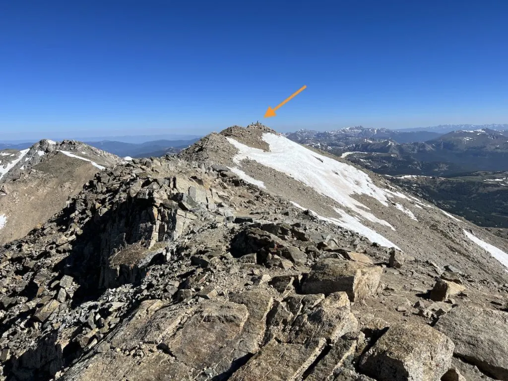
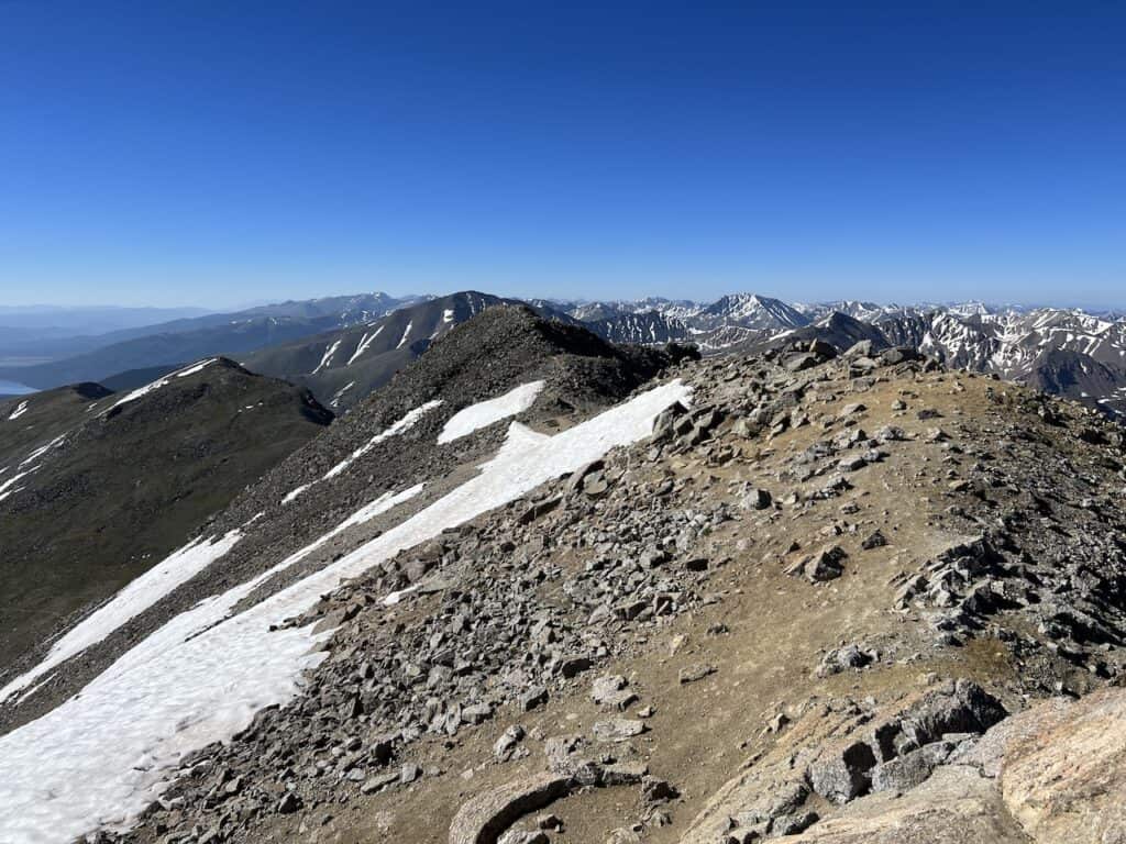
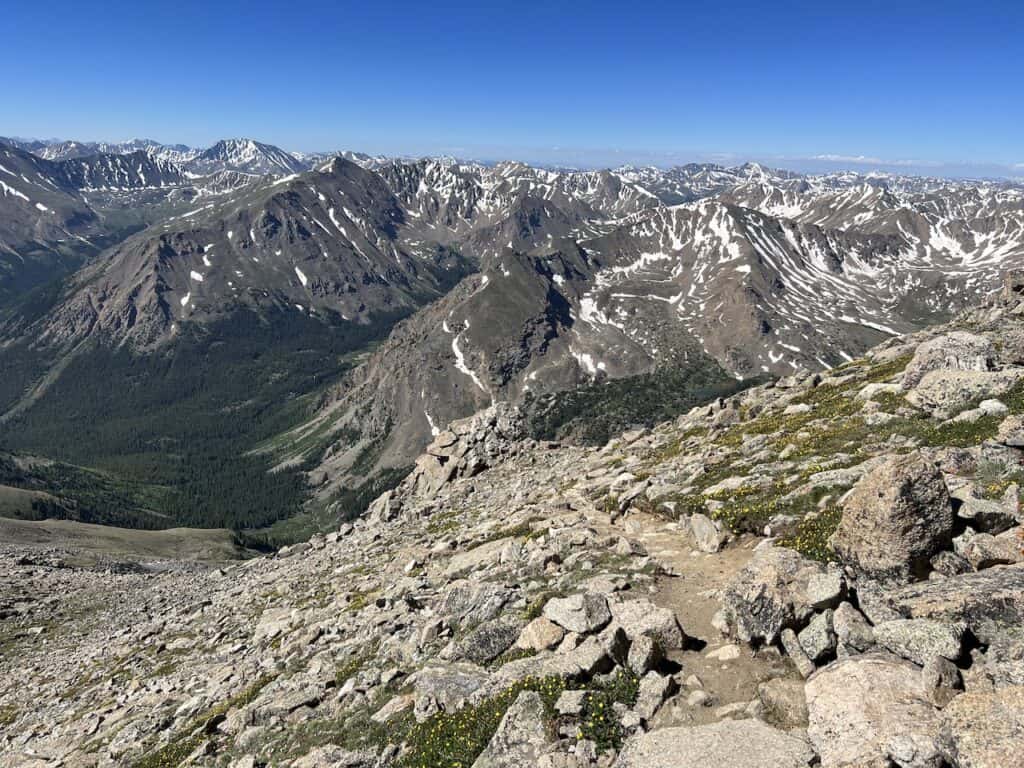
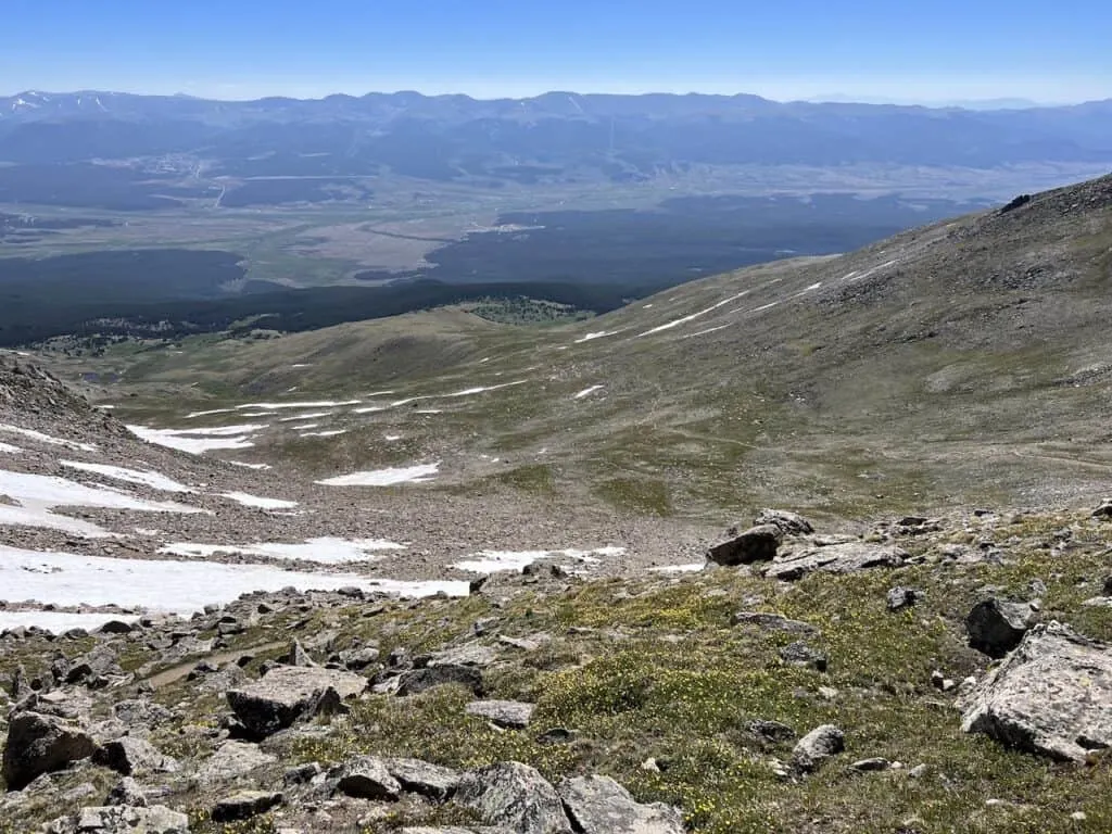
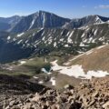
Soon enough, the trail reaches the ridge line. However, it is still almost a half a mile to the true summit. The views will begin to be out in front of you, with the summit almost in reach.
On your right hand side, the East Slopes trail will meet up with the Southwest Slopes trail. A large wooden stick marks this intersection. Be sure to look out for it on the way back so you don’t miss the turn.


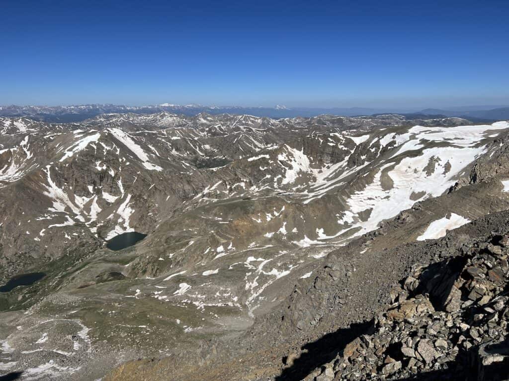
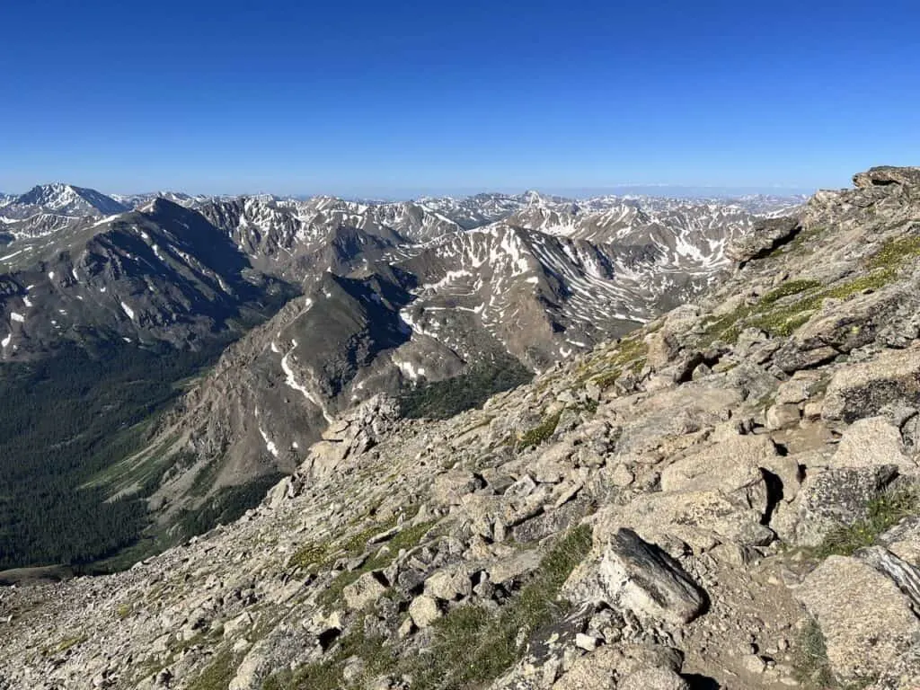
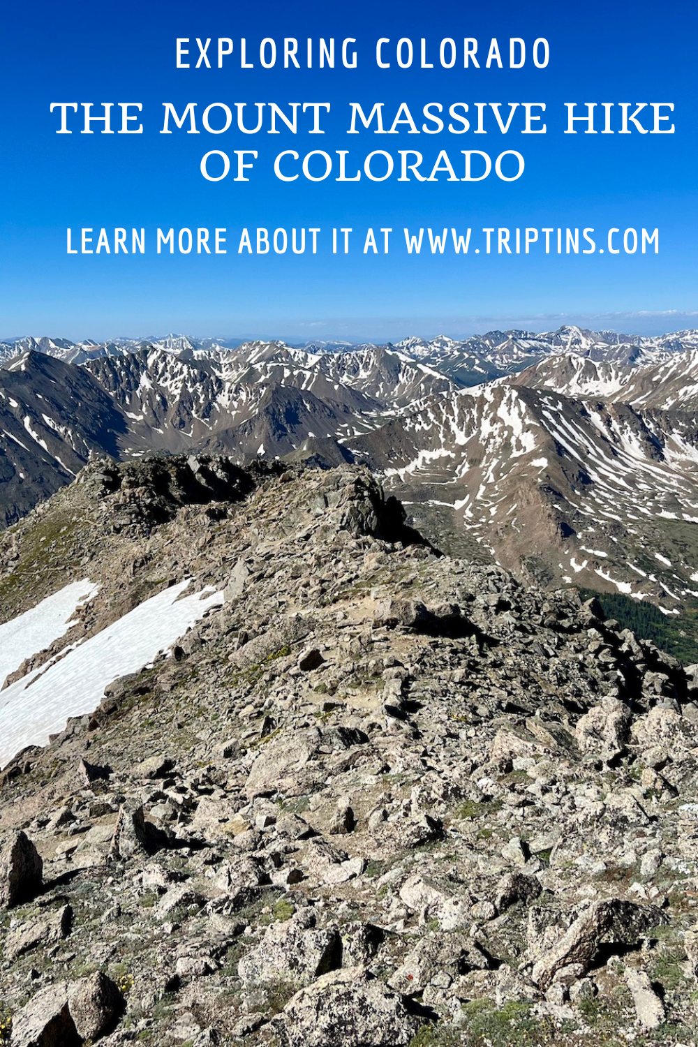
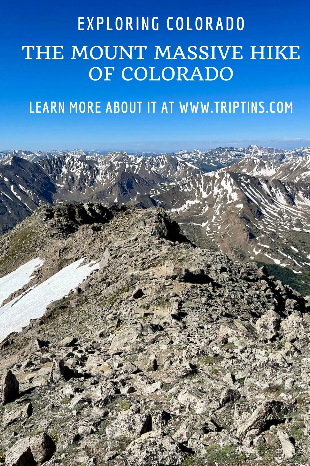
Once on the summit ridge, continue onwards to the farther summit peak. Remember, there are multiple summits here, but only one true summit. You can see in the photo below, the true summit to look out for in the distance.
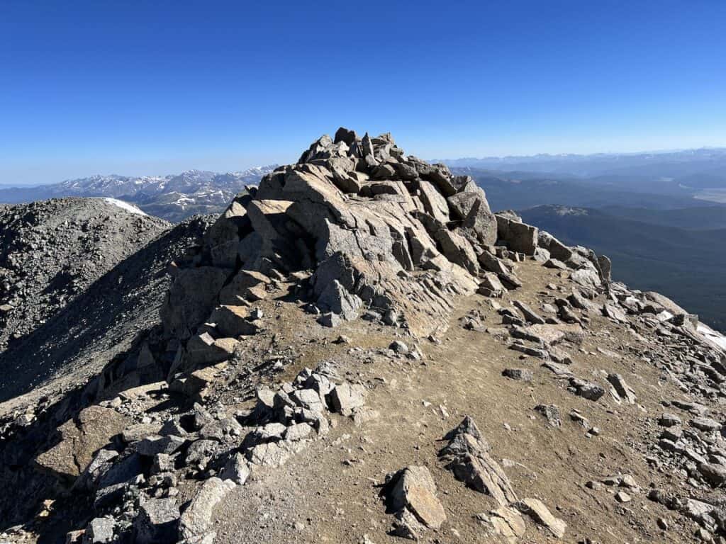
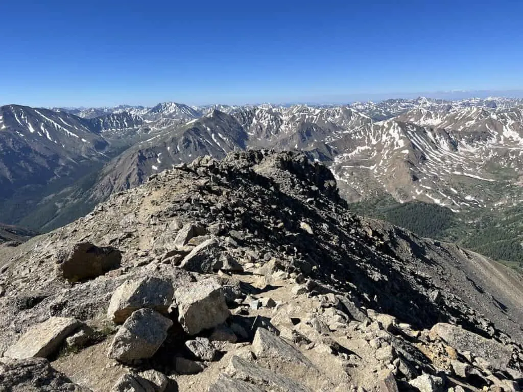
Mount Massive Summit
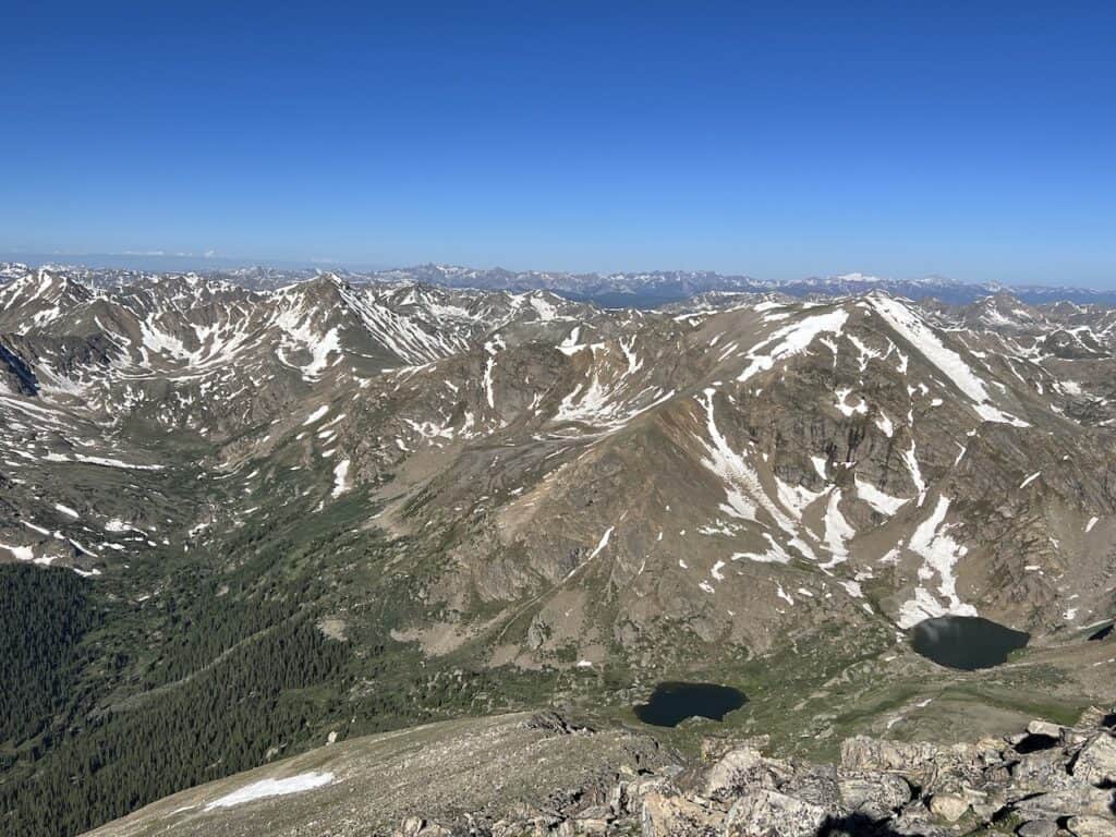
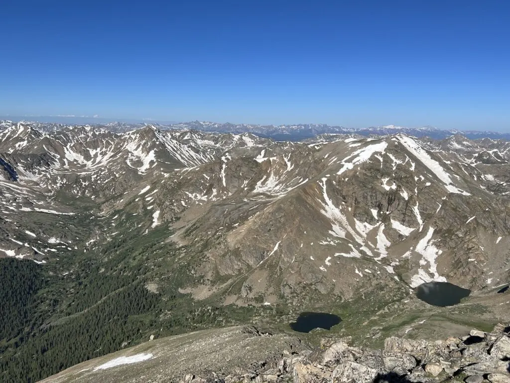
At 14,429 feet, the Mount Massive summit offers 360 degree views of the surrounding landscape. While the eastern views will look flatter towards Leadville, the rest of the views will be never-ending peaks in all other directions.
Spend some time to hang out at the peak, take in the views, enjoy the landscape, and rest up before heading back downwards.
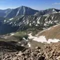
I would also recommend spending some time at some of the fore summits that you would have passed on the way up. I did find some of the views a bit better from them as the ridge was not blocking the mountains looking towards Elbert.


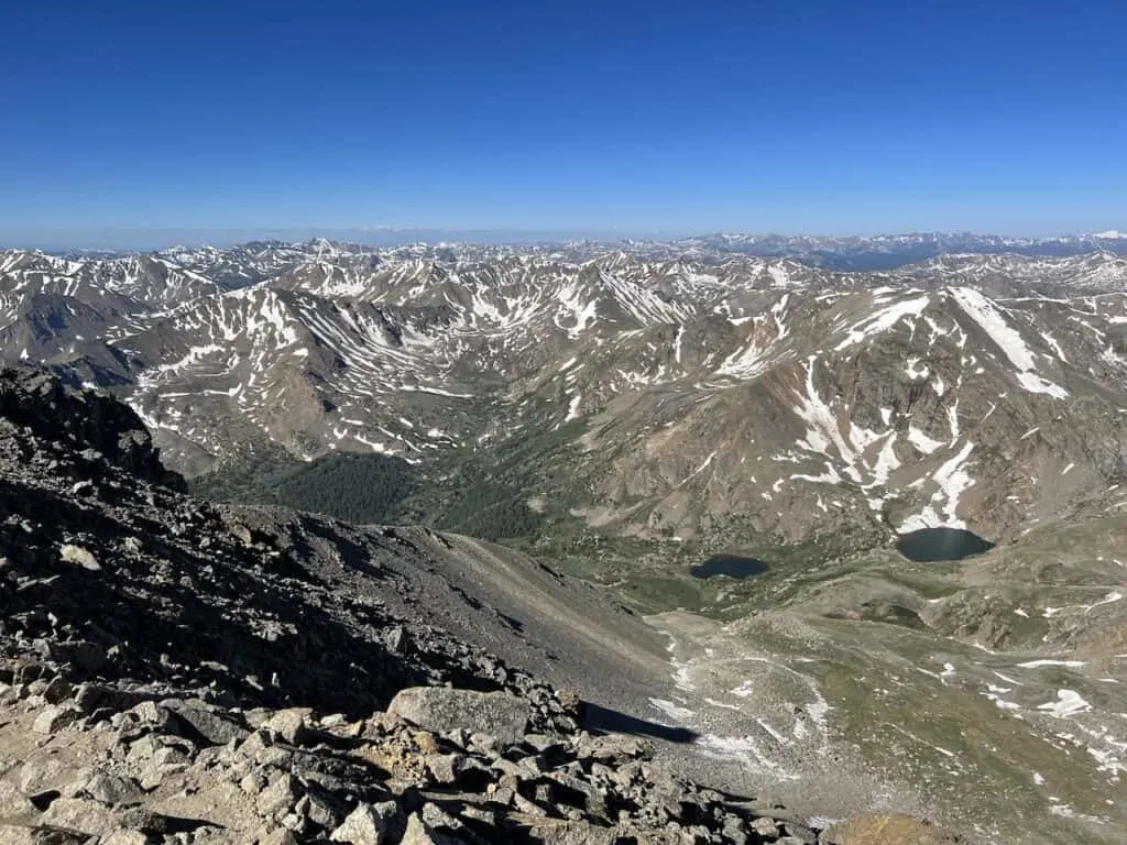


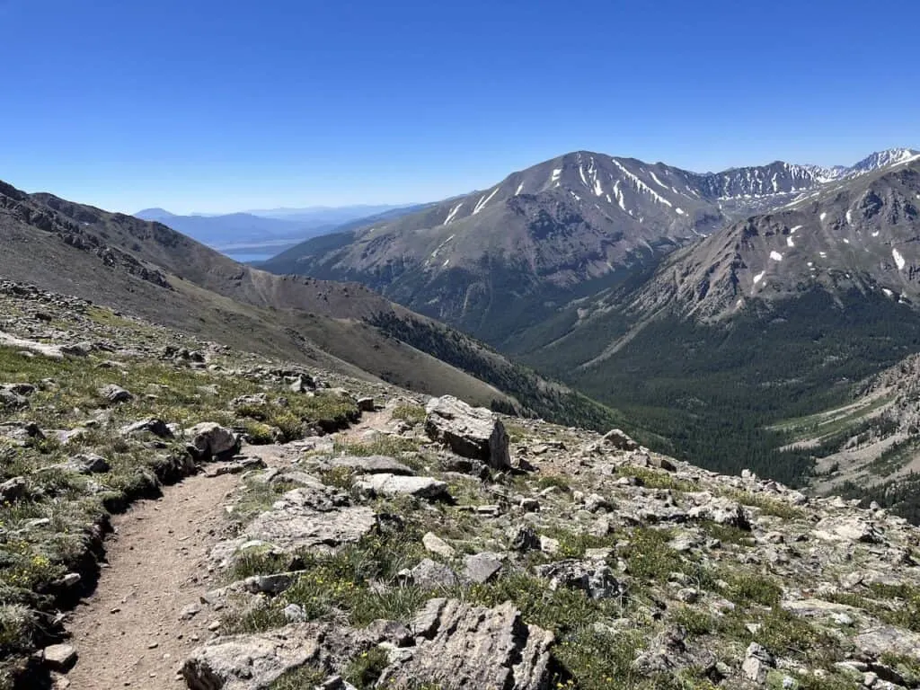
Heading Back Down (3.7 miles)
Remember what I mentioned from earlier on – the main reason why the Southwest Slopes come recommended is because of those views!
Although you will get some great views from the summit and the ridge, there will be even more views as you continue down back to the valley floor.
On the way up, I barely had time to fully enjoy it as I was exerting my energy. However, on the way down, it became much more enjoyable to have that landscape consistently out in front during the descent.


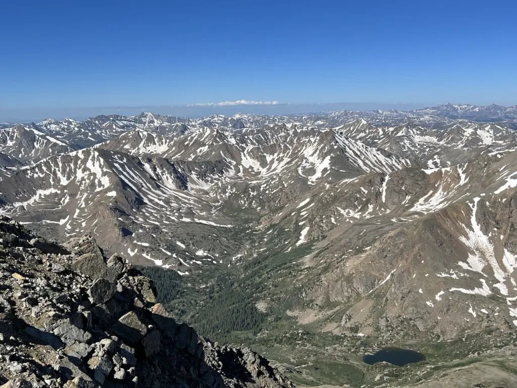
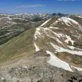
Before you make it off of the ridge though, just be aware of that one intersection where the East Slopes trail meets the Southwest Slopes trail. Stay towards the right hand side on the way down to avoid heading onto the East Slopes route.
While the views will be beautiful all the way through, just be aware of your footing as you head across those rockier portions of terrain. This even more so holds true as you get lower on the trail at the boulder fields.
Once back at the trailhead, hop in your car (or walk the 0.5 miles to your car), and then carefully drive back down the road.
9) East Slopes Route Description
If you are up for the longer, less steep route (or simply don’t have the car to get you to the Southwest Slopes trailhead), then the East Slopes is for you.
With the East Slopes, you should have no problem parking right at the trailhead and then beginning the 6.5 mile route to the summit.
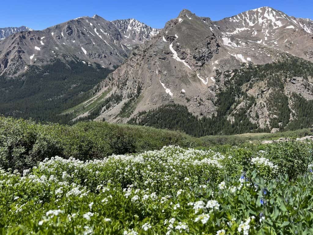
The trail also begins with a forest portion. This time though it is nearly 4 miles below the tree line as you slowly begin to gain that elevation.
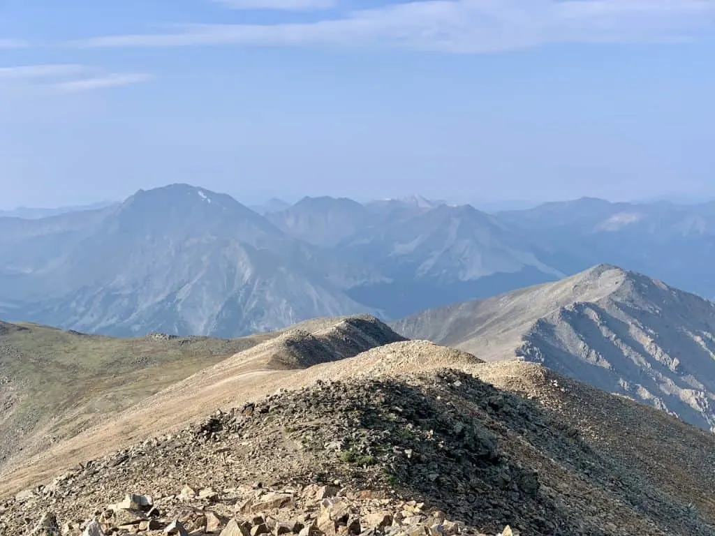
Once past the tree line, Mount Massive will be standing tall out in front of you. However, it is still nearly 3 miles to get there.
Follow the pathway etched into the hillside that curves around the mountain and then slowly up to the ridge. While the trail does begin to get steeper closer to the ridge, it won’t be as bad compared to the Southwest Slopes.
Soon, you will reach the Southwest Slopes intersection and then follow the ridge to the summit to finish up the route.
In the photo below you can see the gradual pathway that makes its way up the East Slopes.

10) Combo Route
While it is rarer to see people combine the two routes, it is possible. The main reason to do this is for those people that want to take part of the Southwest Slopes route but that don’t have the car to get to the trailhead.
My recommendation in this situation is to park at the main Mount Massive parking lot, head up the mountain on the East Slopes, then down the mountain on the Southwest Slopes. Once you reach the North Halfmoon Creek trailhead, it would be a 2.5 mile walk back along a dirt road to the main parking lot.
Altogether, a route like this would come in very similarly to the East Slopes route – 13 miles and 4,500 feet of elevation gain. You will also have the chance to potentially catch a ride back along those 2.5 miles too.

11) Mount Massive vs Mount Elbert
Are you deciding between Mount Massive and Mount Elbert for your hike? Well, both are great options for those that want to take part of some of the highest 14ers in Colorado.
By now you should have a pretty solid idea what the Mount Massive trail is all about.
When it comes to Mount Elbert, there are also a few routes to choose from. The main one is the Northeast Ridge, which essentially has its trailhead directly across from the Mount Massive East Slopes trailhead.
This route comes in at just under 10 miles and +4,700 feet of elevation gain.
Compared to the Mount Massive East Slopes route, Elbert is shorter by 3 miles and has a little bit more of elevation gain. At the end of the day though, these two routes are very similar in difficulty level (of course the Southwest Slopes will be shorter but steeper).
Since these two mountains are right next to each other, you can expect similar views to an extent from the summit.
One main consideration to think about though are the crowds. As the highest peak in Colorado (even if it is just a handful of feet), Elbert will be much more crowded than Massive.
I don’t think you can go wrong with either mountain all said and done. Feel free to check out the Mount Elbert hike overview to learn more about that route.

That wraps up an overview to the Mount Massive hike of Colorado. If you have any questions or comments, be sure to add them in below.
Check out the other Colorado hiking guides up on the site too.
Have fun out there and safe travels!

canva
Friday 8th of May 2026
Your perspective on this topic is certainly thought-provoking. I'm left wondering if there are any particular challenges you've encountered in applying these ideas in practice? Always interested in the real-world application.