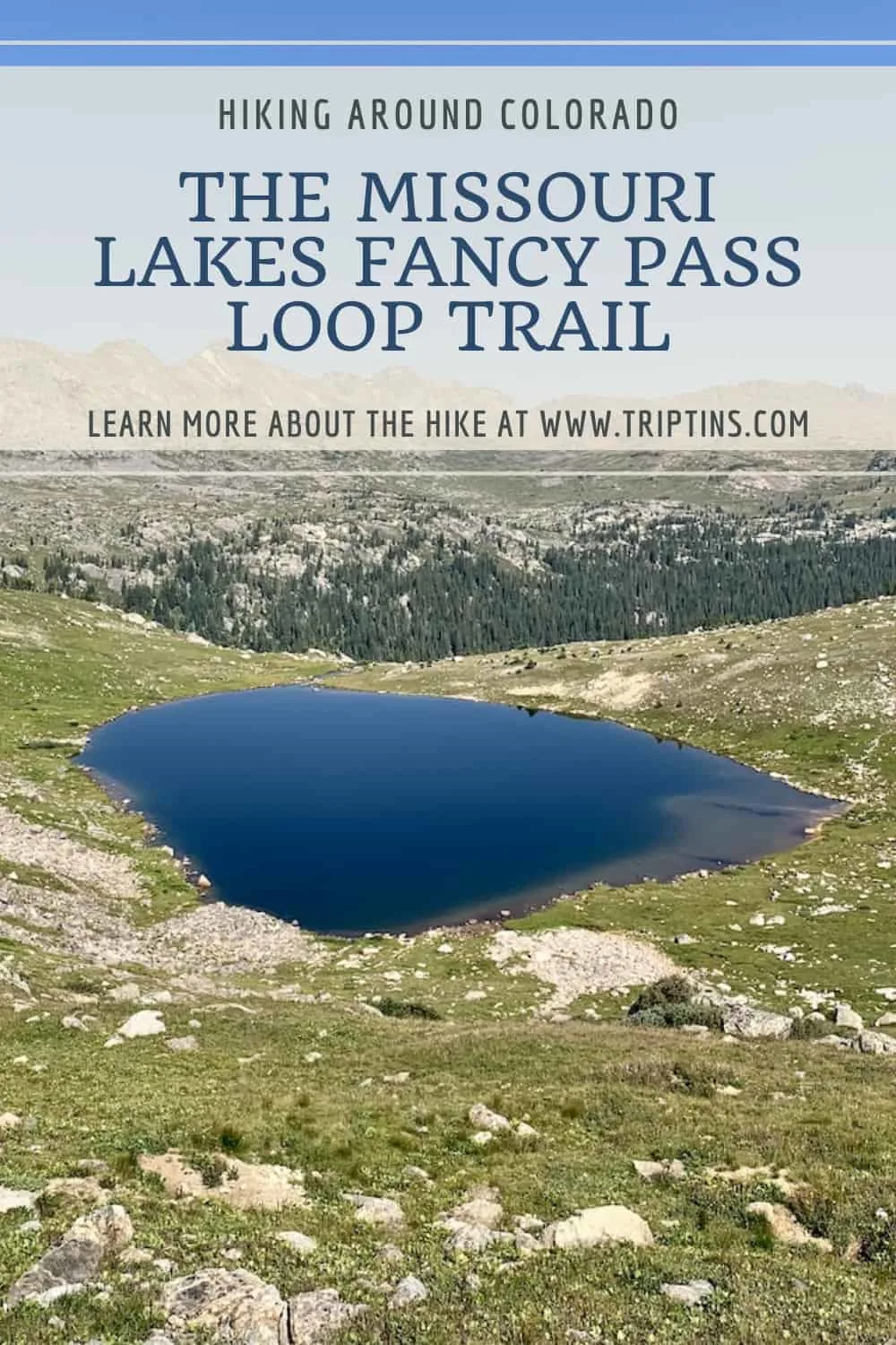
The Missouri Lakes Fancy Pass Loop trail in Colorado is one of the most scenic hikes you can ask for. Over the course of 10 miles, the trail takes hikers over two passes, reaching a high point of 12,380 feet.
Not only will you get some great views from the passes, but you will also enjoy the Missouri Lakes, Fancy Lake, and several other lakes along the way.
It is the perfect option for those that just want to go on a long day hike or for those that may want to make more of a backpacking trip out of it.
This guide will go over all the details and things to know about the trail and how to get you ready to take on the hike for yourself.
* Affiliate Disclosure: This post may contain affiliate links, which means I may receive a commission if you make a purchase through the links provided, at no additional cost to you. Thanks for supporting the work I put into TripTins!
1) Missouri Lakes & Fancy Pass Details
Below are some helpful details about the Missouri Lakes & Fancy Pass loop trail. I will be diving deeper into some of these throughout the guide.
- Hike Name: Missouri Lakes & Fancy Pass
- Starting Point: Fancy Lake Trailhead
- Ending Point: Missouri Lakes Trailhead
- Distance: 10 Miles / 16.1 KM
- Elevation Gain: +2,625 feet / +800 meters
- Duration: 5-8 Hours (based on fitness)
- Highlights: Fancy Lake, Fancy Pass, Treasure Vault Lake, Missouri Pass, Missouri Lakes
This 10-mile loop trail will give you a little bit of everything. Whether that be high mountain passes, beautiful lakes, or the stunning views all around.
Since this is a loop trail, it can be completed in either direction.
My recommendation is to take part of the trail in the counter clockwise direction (starting at the Fancy Lake Trailhead and ending at the Missouri Lakes Trailhead -> more on these next).
The main reason is due to the trail over Fancy Pass being a pretty steep and technical climb. For most, it will be easier to climb up this portion than down from it.
From a views standpoint, you cannot go wrong either way, so I wouldn’t think too much about that when deciding which direction to go.

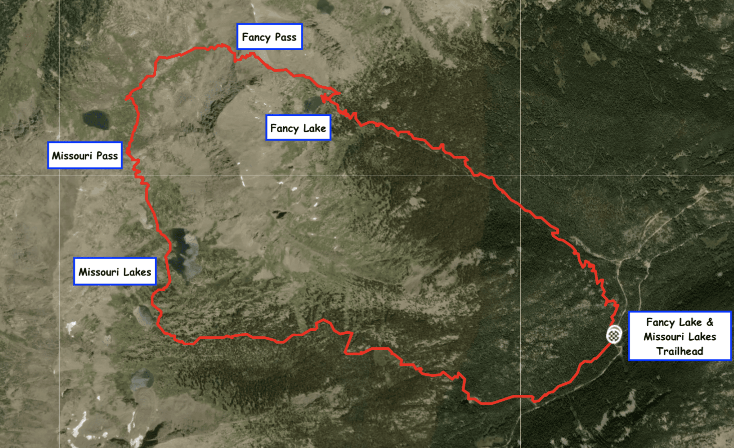
2) Missouri Lakes & Fancy Lake Trailhead
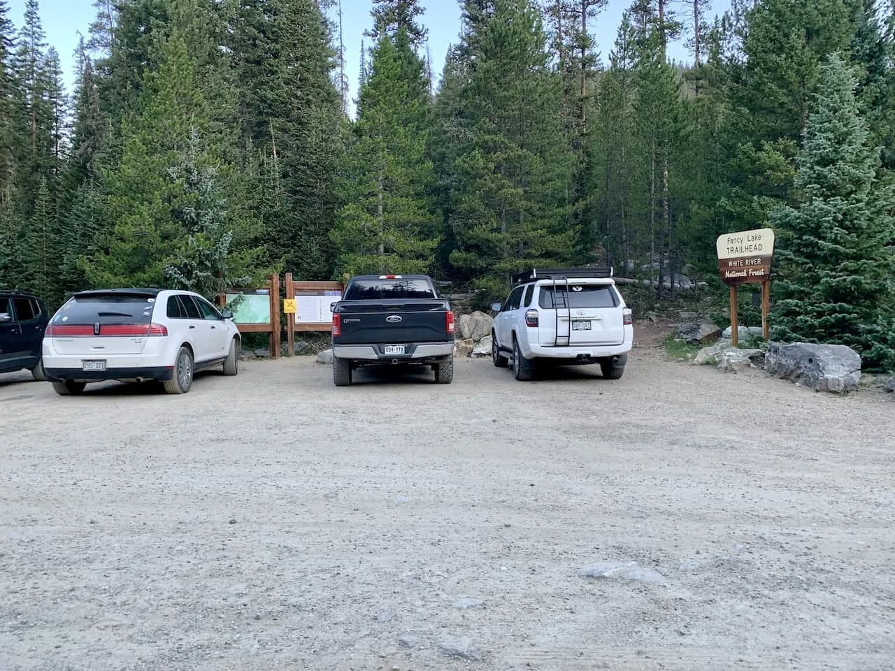
You can see above that I mentioned two different trailheads – Missouri Lakes Trailhead and Fancy Lake/Pass Trailhead. While these are two separate trailheads, they are literally right next to each other (less than 0.1 miles apart), separated by the dirt road.
If looking at the trailheads, Fancy Lake Trailhead will be on the right and Missouri Lakes trailhead on the left. The counter clockwise hike will start at the Fancy Lake Trailhead.
For parking purposes, you certainly can park at either one no matter which direction you end up going on the loop since they are just so close to one another.

3) Directions & Getting to the Missouri Lakes
The directions to the trailhead are pretty straightforward. To start, you will need to get yourself to US 24, where you may be coming from the north or south.
From US 24, you will need to make a turnoff onto Homestake Reservoir Rd (703). After following the road for approximately 8 miles, there will be a right hand turn off onto Missouri Creek Rd (704).
From this turnoff it will be 2.2 miles until you reach the trailhead directly in front of you. To the right will be the Fancy Lake Trailhead parking and to the left will be the Missouri Lakes Trailhead parking.
The trailhead is mostly fine for 2WD cars as long as there is some clearance. I found the last couple miles on road 704 to be a bit rougher, but overall nothing too bad.
→ Renting a car in Colorado? Be sure to check out Rentalcars.com to browse through a variety of car rental options for your trip
4) Missouri Lakes Backpacking
While this 10 mile hike can certainly be done in one day, I met people along the trail who were breaking it up into 2 or even 3 days.
This can be done by spending a night at either Fancy Lake or alongside the Missouri Lakes.
The Missouri Lakes area is definitely a larger surface area so there did seem to be some more campsite spots around the lakes. On my way up I did see a few tents scattered around Fancy Lake, so that could certainly be an option as well.
At the end of the day, it just matters how you would want to split up the days of hiking. For example, you can arrive in the afternoon of day 1, and take a short hike up to Fancy Lake for the night. On day 2, you then set off on the remaining 7 miles.
You can easily switch that around as well by having an earlier start to day 1 and enjoying a night by the Missouri Lakes. On day two it will be just an easy 4 mile downhill to the trailhead.
And if you want to take things even more slowly, you can spend a night at each. This would give you more time to enjoy the surroundings during a camping trip.
» If you enjoy this hike, why not take a look at some of the best hikes in Colorado Springs
Hiking Resources & Checklist
Before heading out for the trails, be sure to read up on some of the hiking resources up on the site. These are here to better prepare you for all types of outdoor adventure.
- Gear: Hiking Packing List
- Weather: How to Prepare for Hiking Weather
- Navigation: Hiking GPS & Navigation
- Tips: 20+ Hiking Tips & Tricks for the Trail
- Accommodation: Book Your Hotel Today
- Rental Car: Book Your Car Rental Today
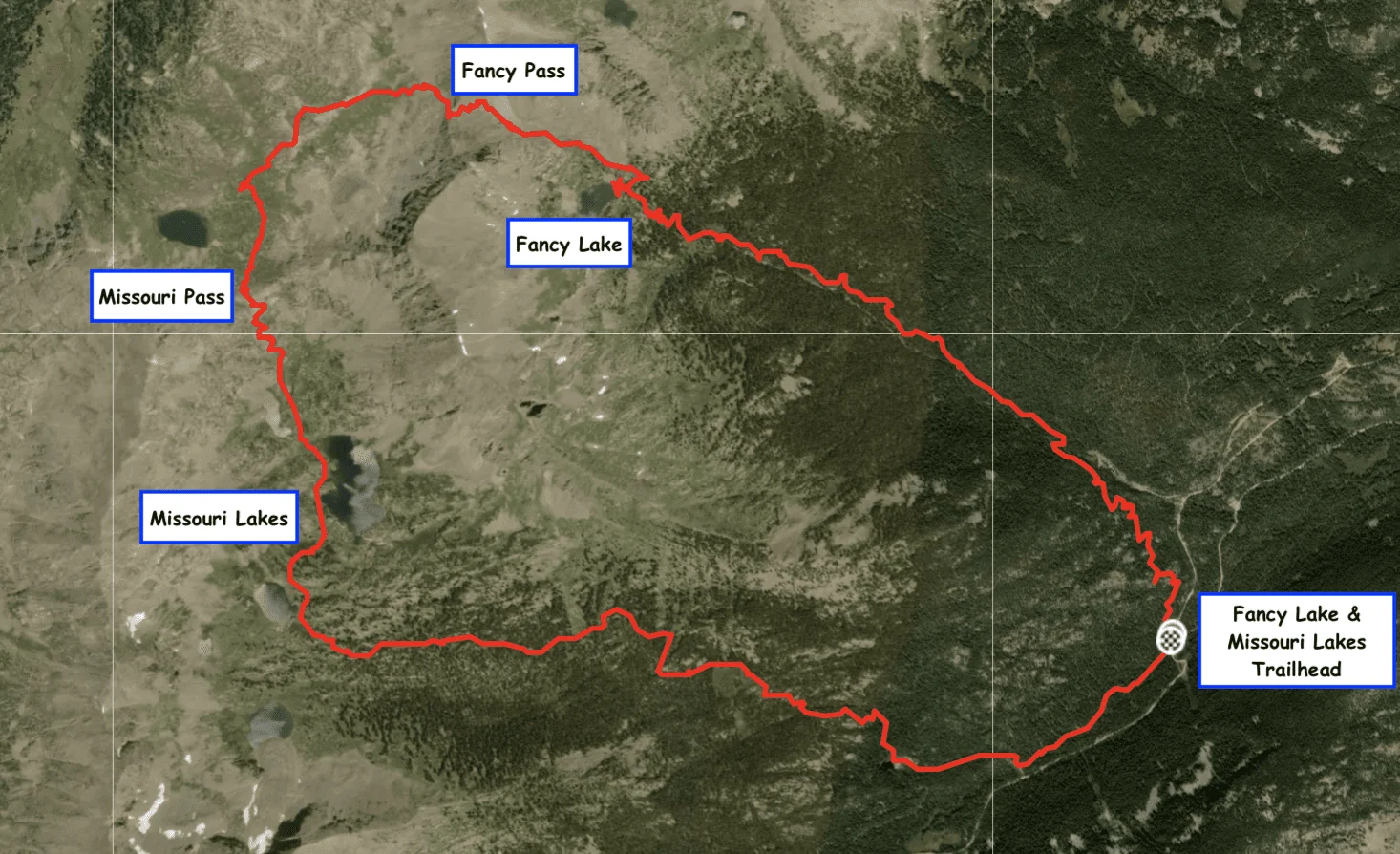
5) Fancy & Missouri Lakes Trail Map & Elevation Gain Profile
Below is the map for the Missouri Lakes Fancy Pass loop trail to give you a bit better idea of what the route looks like.
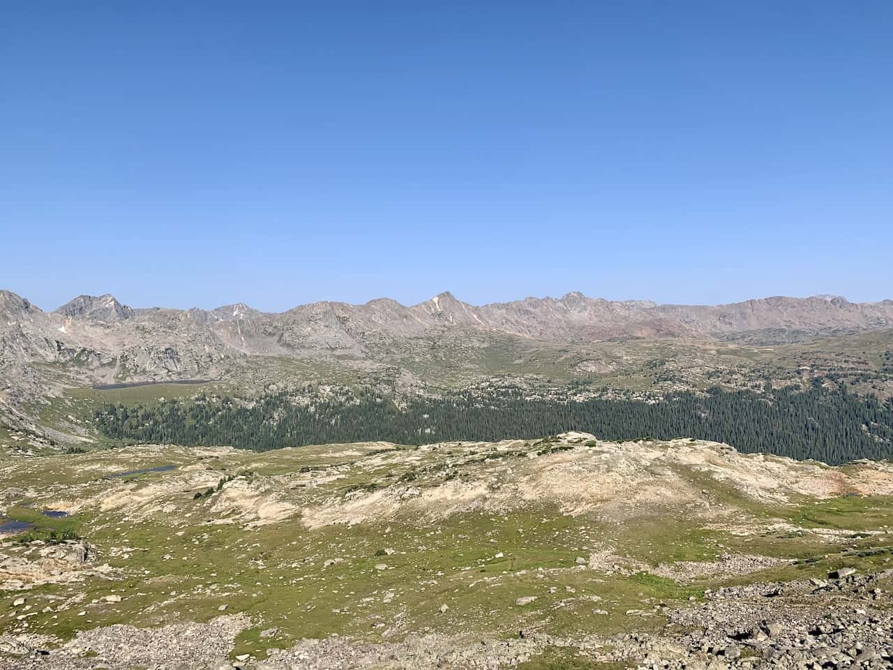
In addition, I have included the elevation gain profile of the hike. You can see there are some ups and downs here as the trail does head up and over two separate passes.

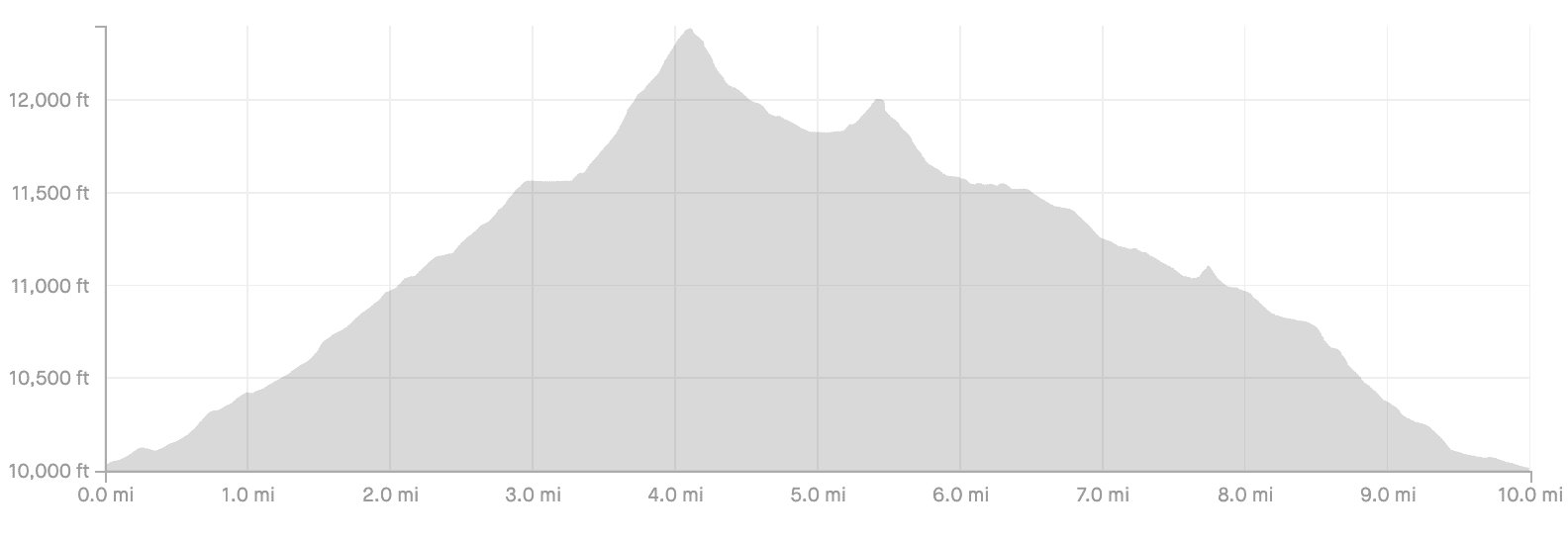
Some of the key elevation points of the trail include:
- Fancy Lake Trailhead Elevation: 10,035 feet
- Fancy Lake Elevation: 11,540 feet
- Fancy Pass Elevation: 12,380 feet
- Treasure Vault Lake Elevation: 11,800 feet
- Missouri Pass Elevation: 11,986 feet
- Missouri Lakes Elevation: 11,550 feet
- Missouri Lakes Trailhead Elevation: 10,017 feet
6) Missouri Lakes Fancy Pass Loop Trail
The remainder of the guide will go into some details of the various sections of the loop trail. Along with some helpful information, you will find some accompanying photos of the trail to give you an idea of what to look out for.
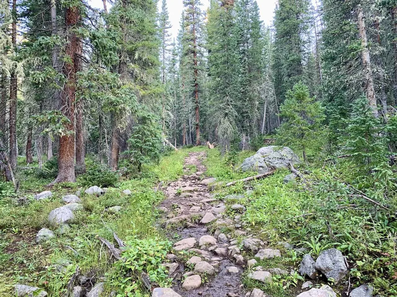
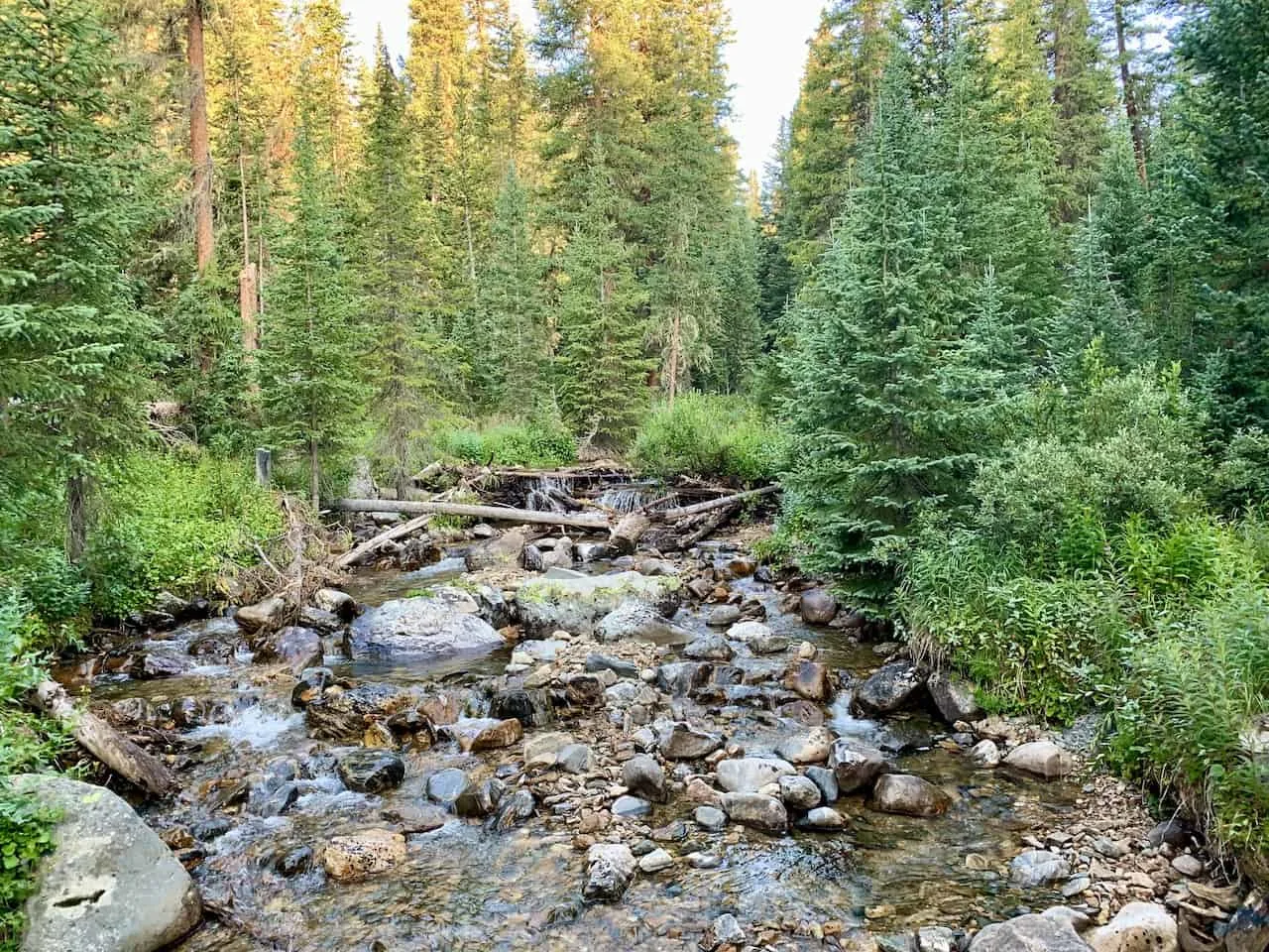
Fancy Lake Trailhead to Fancy Lake (3 Miles)
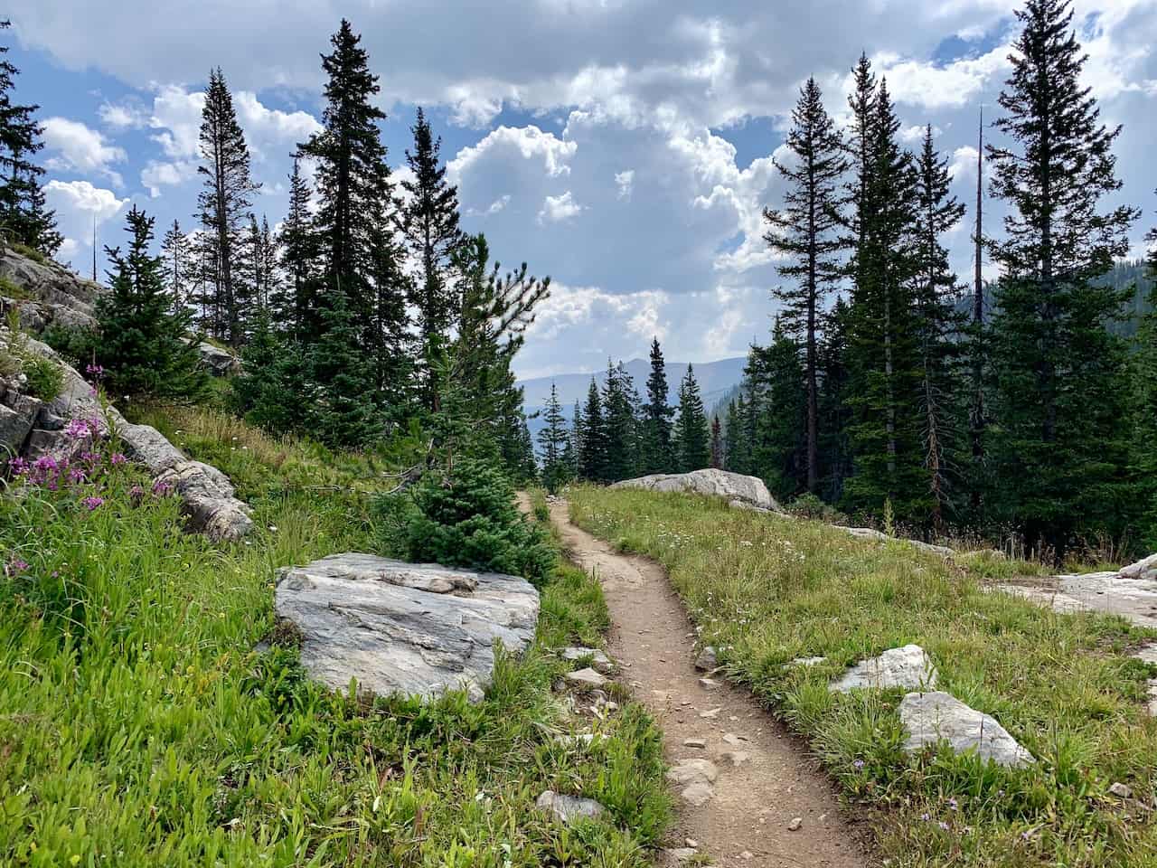
Once you have parked your car near the trailhead, it is time to begin the hike through the forest and up to the first highlight of the day – Fancy Lake.
The trail through the forest is easy to follow as you begin to pick up some elevation along the hike. There will be a couple log crossings to look out for, where you can take in some great views of the flowing river.
Once the dense forest portion of trail is complete, things will begin to open up a bit more as you take in some views of the surrounding mountains and valleys.


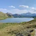
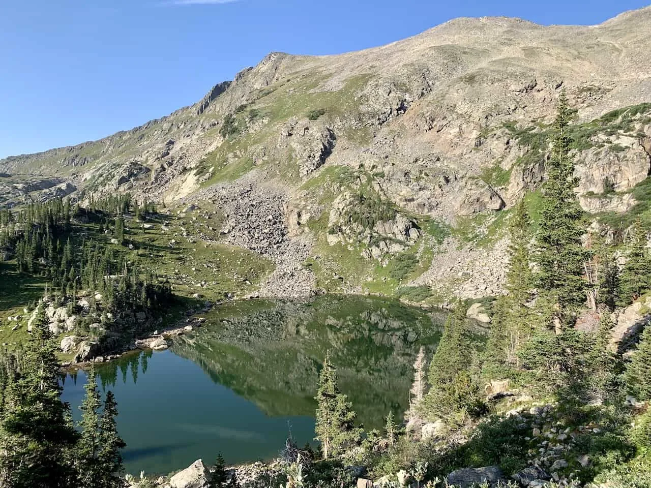
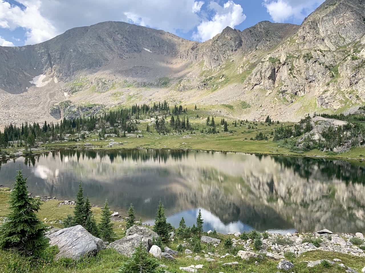
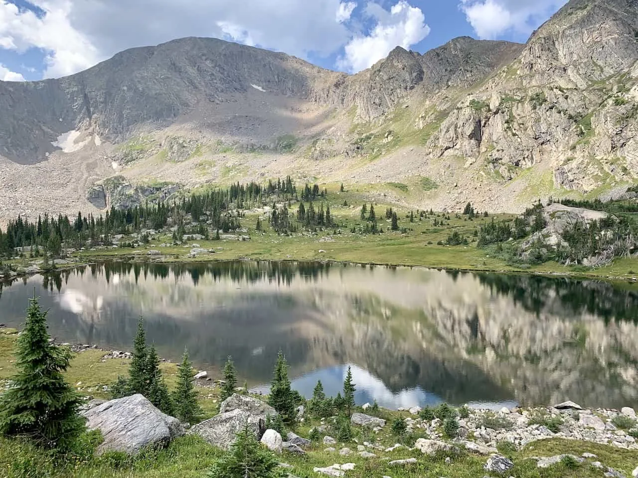
After around 3 miles of hiking from the trailhead, you will arrive at Fancy Lake. Be careful here, as it is easy to miss the turnoff to the lake itself.
Having a navigation app such as Maps.me or AllTrails can be helpful in these types of situations.
On a calm day, the reflections of the surrounding mountains will show up on the lake itself, making it one beautiful landscape to enjoy.


Fancy Lake to Fancy Pass (1 mile)
Once all done with some time around the lake, it is time for the toughest portion of trail towards Fancy Pass.
While it is only a mile or so from the lake up to the pass, there is about 900 feet of elevation gain over some steep terrain.
As you leave the lake, you will need to pay attention as there is another path that heads out in a completely opposite direction. While it is signposted, just be on the lookout here to be certain you are heading up to Fancy Pass.
Now you will begin to walk up alongside the lake as you take in some views from above. The trail will continue to get higher as more and more of the forest landscape and backdrop mountains come into view.


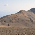
Once up past the views of the lake, the terrain does begin to get steeper and more technical. The trail is not difficult to follow as there is one main dirt path etched into the ground.
However, try to stay focused on the trail and where it is going as you don’t want to venture off here.
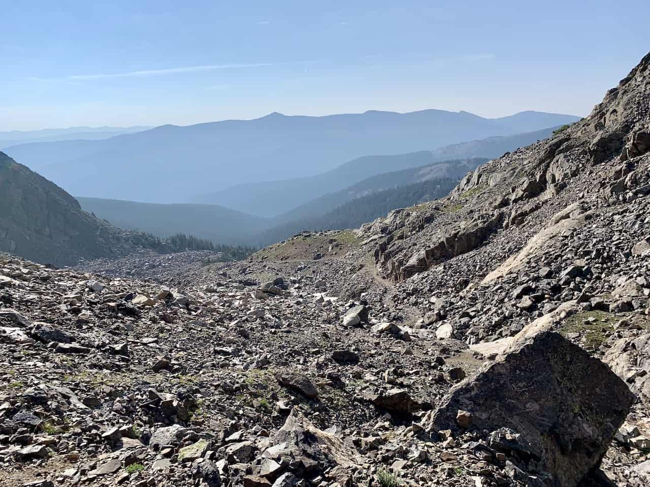

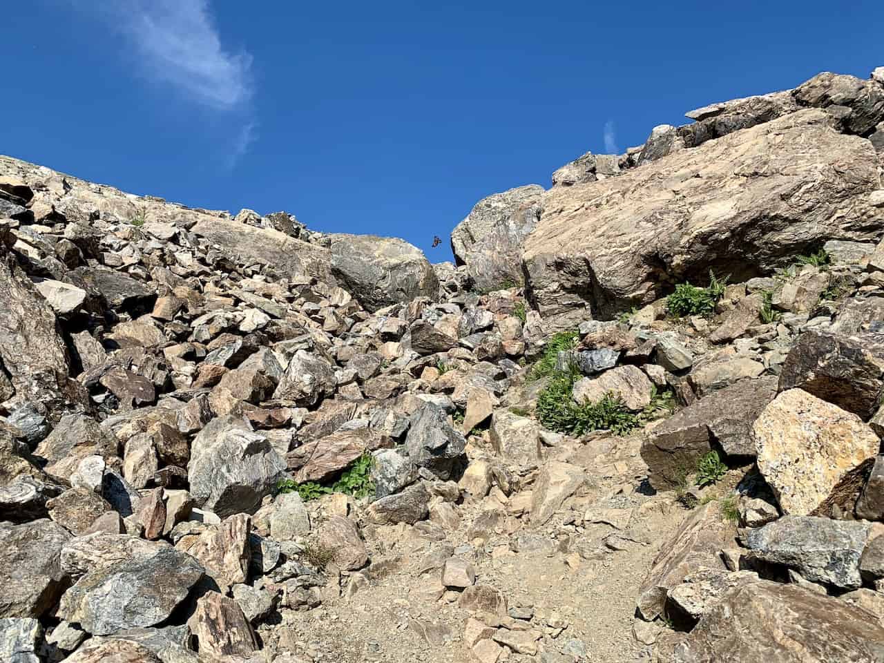

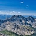
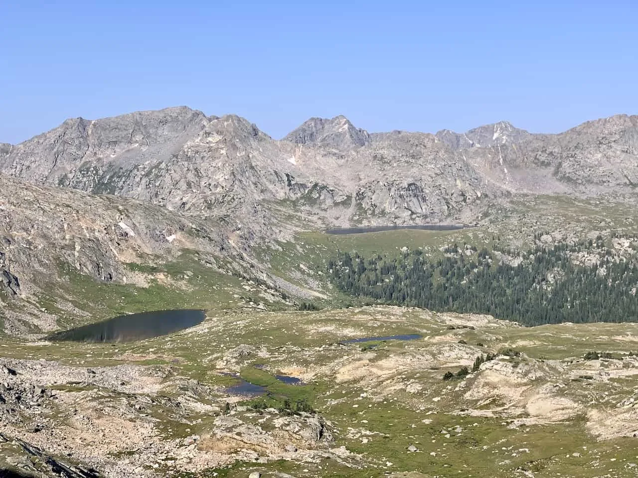
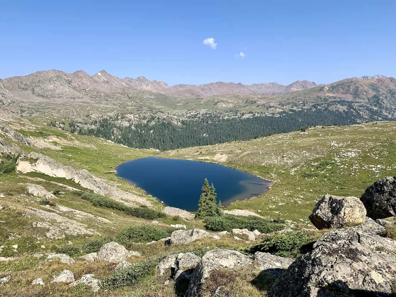
After a mile of climbing, you will reach the top of Fancy Pass with some great views looking down towards the other side of the pass.
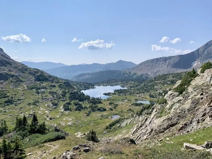
Here will be several different lakes out in the distance that you will begin walking towards.

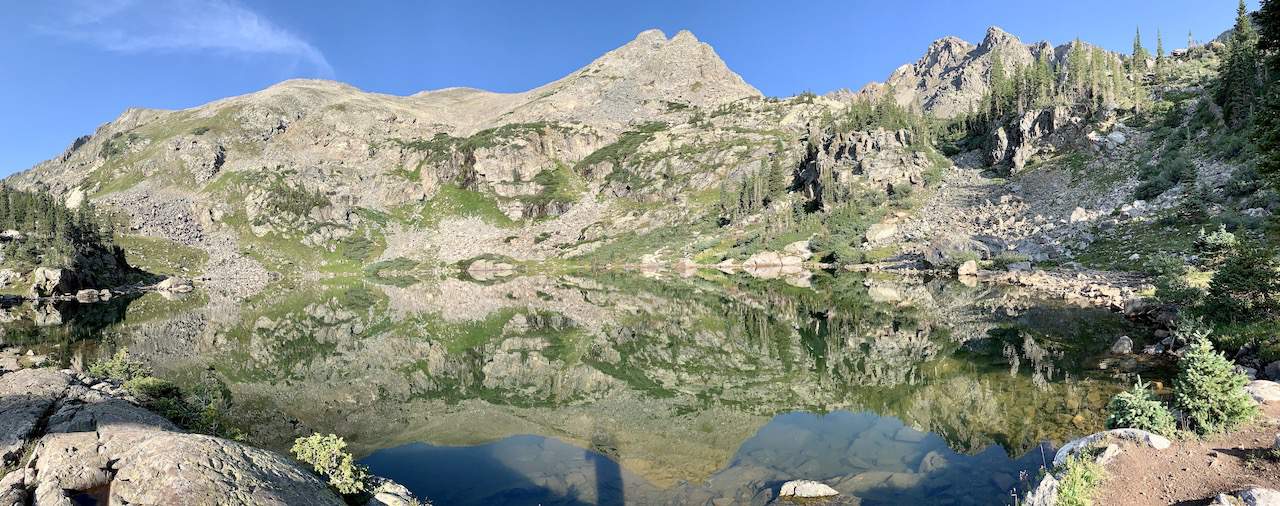
Fancy Pass to Missouri Pass (1.3 miles)
It is now time to follow the path downwards onto the other side of the pass and to the second pass of the day.
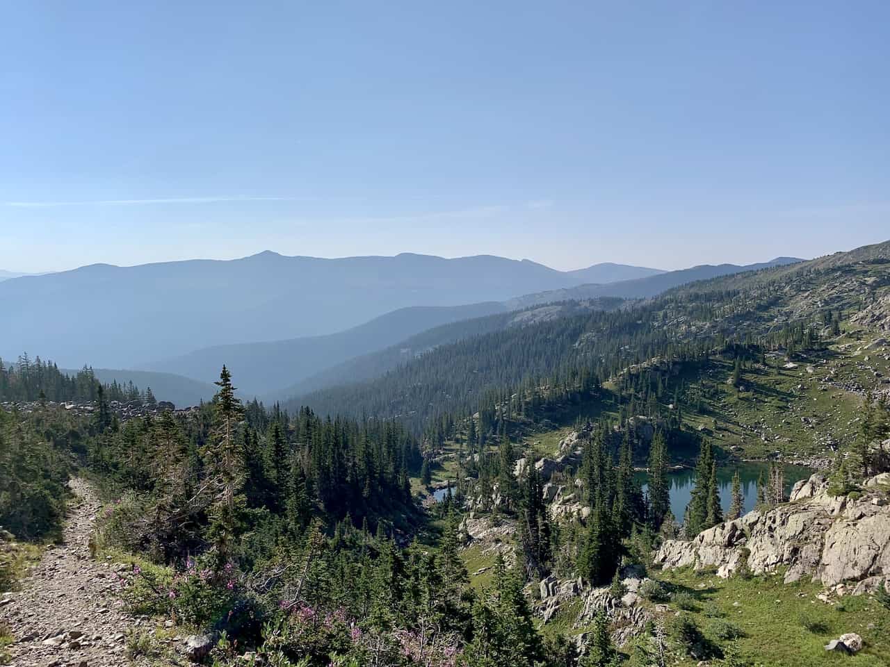
The trail is nice and easy here and you will begin to walk closer and closer to some of the lakes that you just got to view from above.
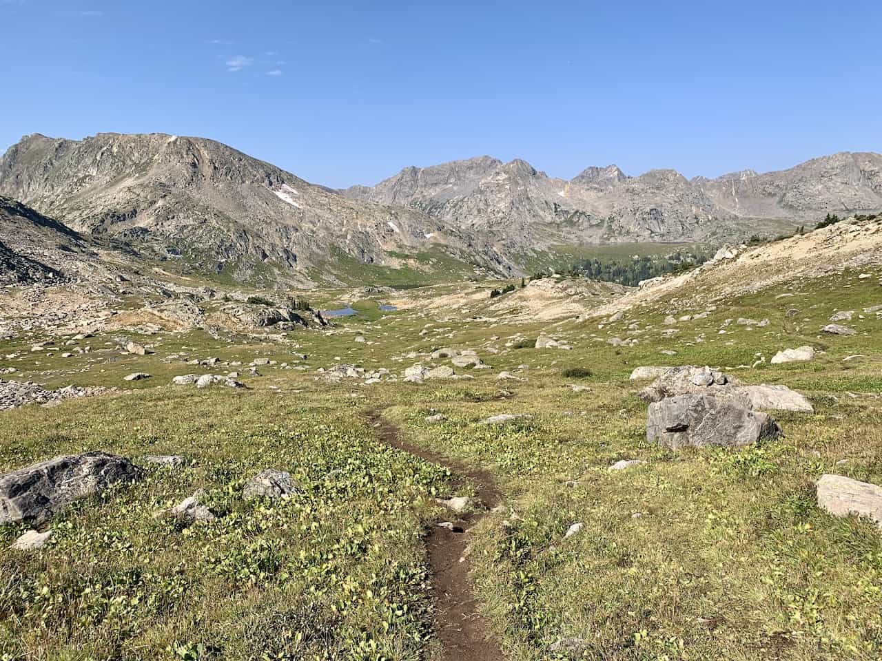
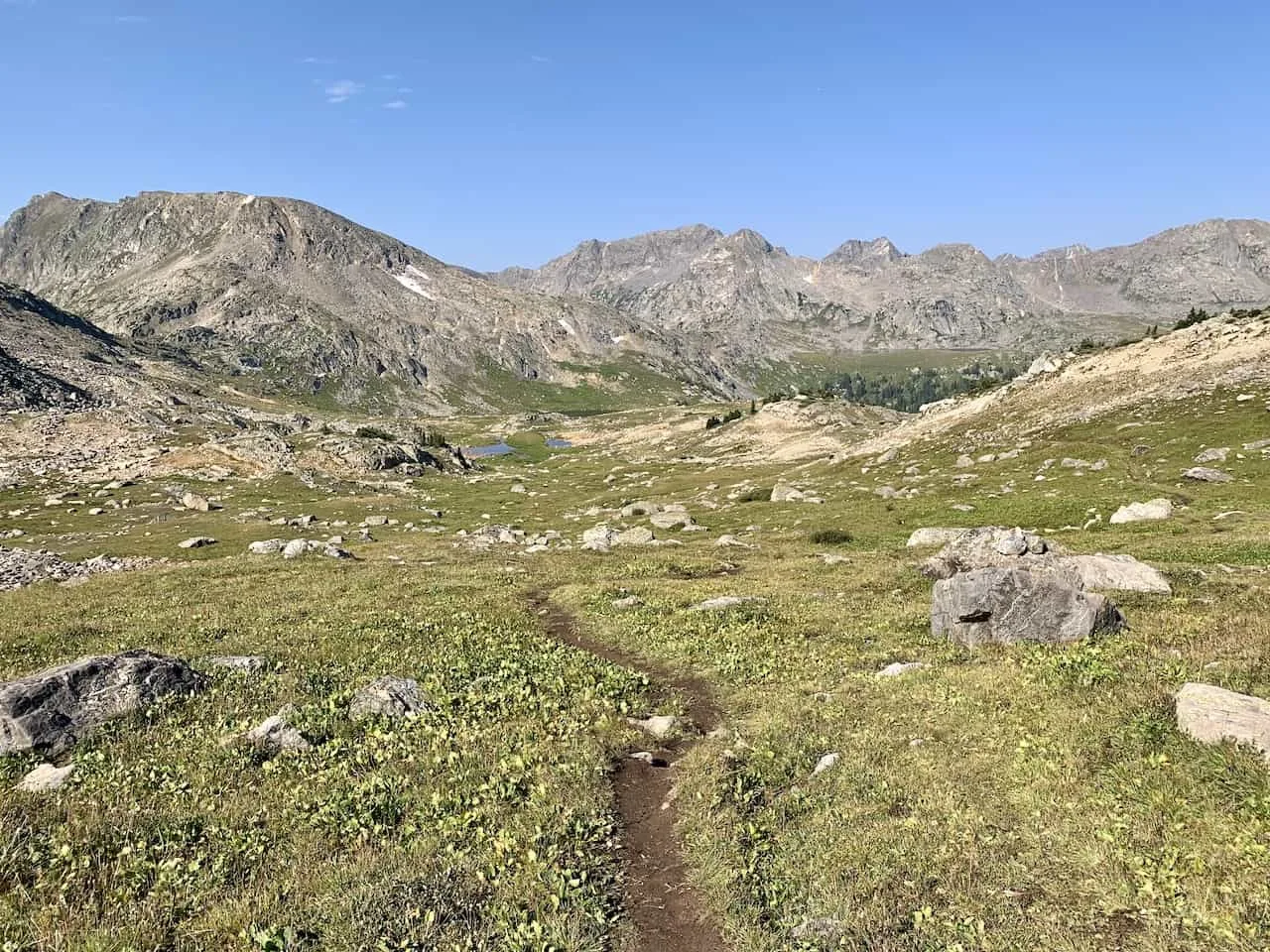
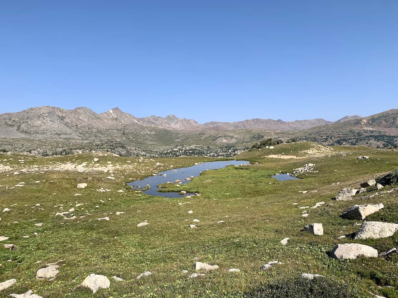
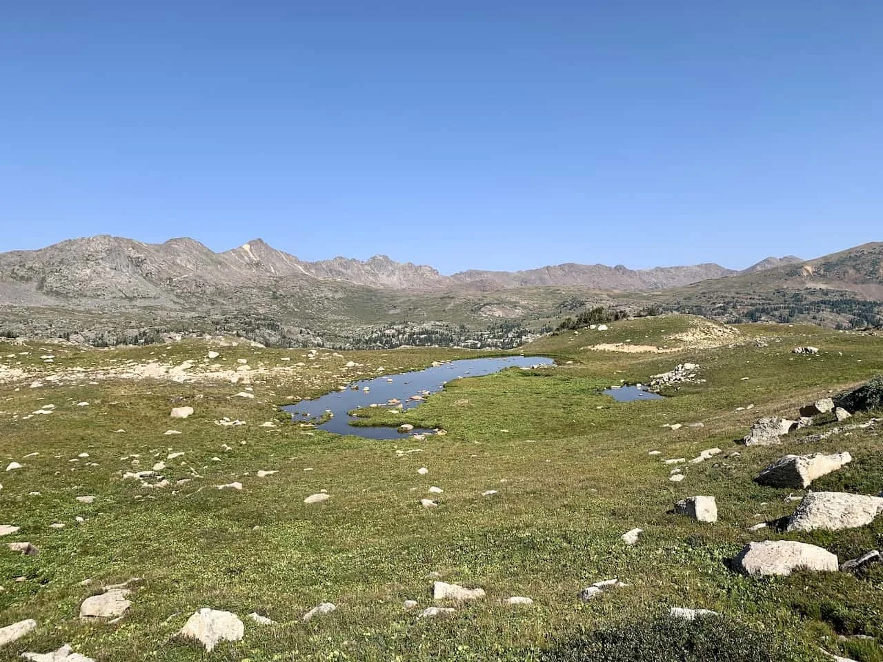
As you get closer to Treasure Vault Lake, there is a secondary trail that veers off to some of the further lakes out in the distance.
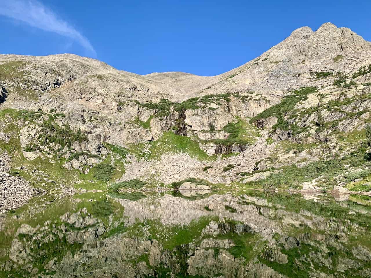
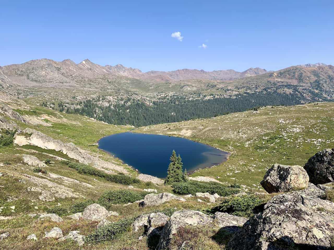
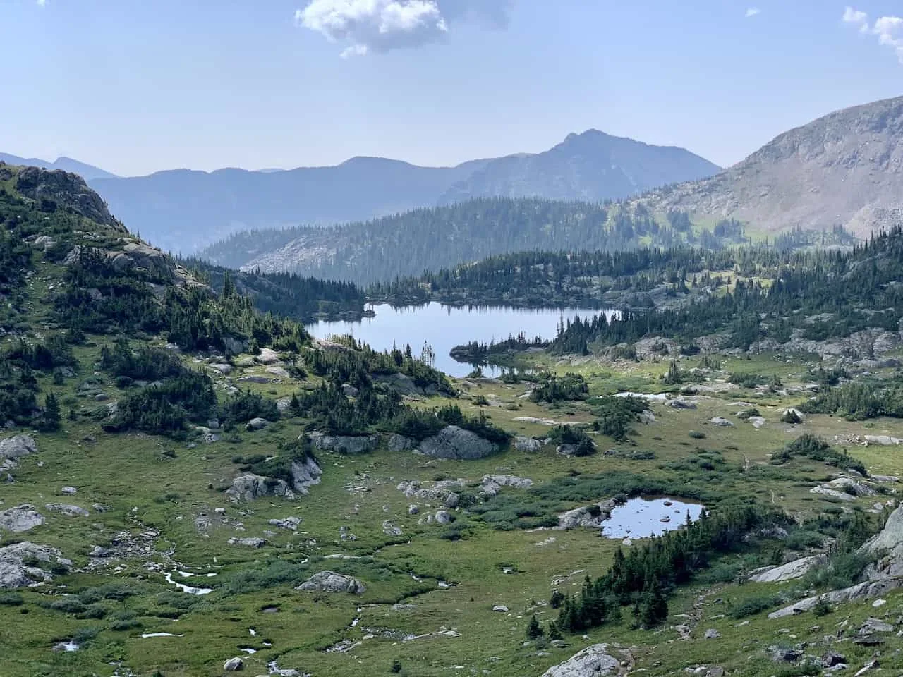
Feel free to continue up to Missouri Pass as you get to take in some views of Treasure Vault Lake, and head up the short incline section towards the pass itself.

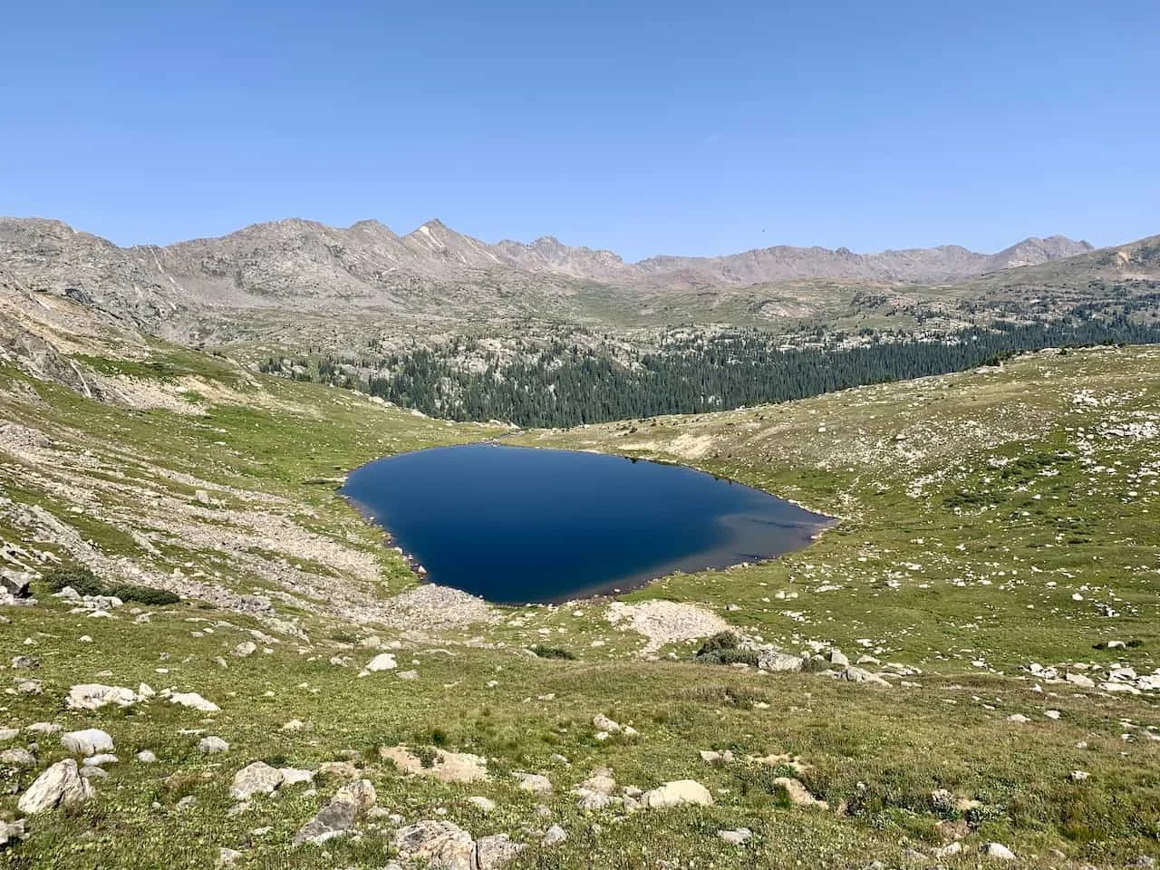
Once on top of Missouri Pass there will be some great views in both directions to enjoy.
Feel free to take a nice break here as you take in Treasure Vault in one direction and the Missouri Lakes in the other direction.

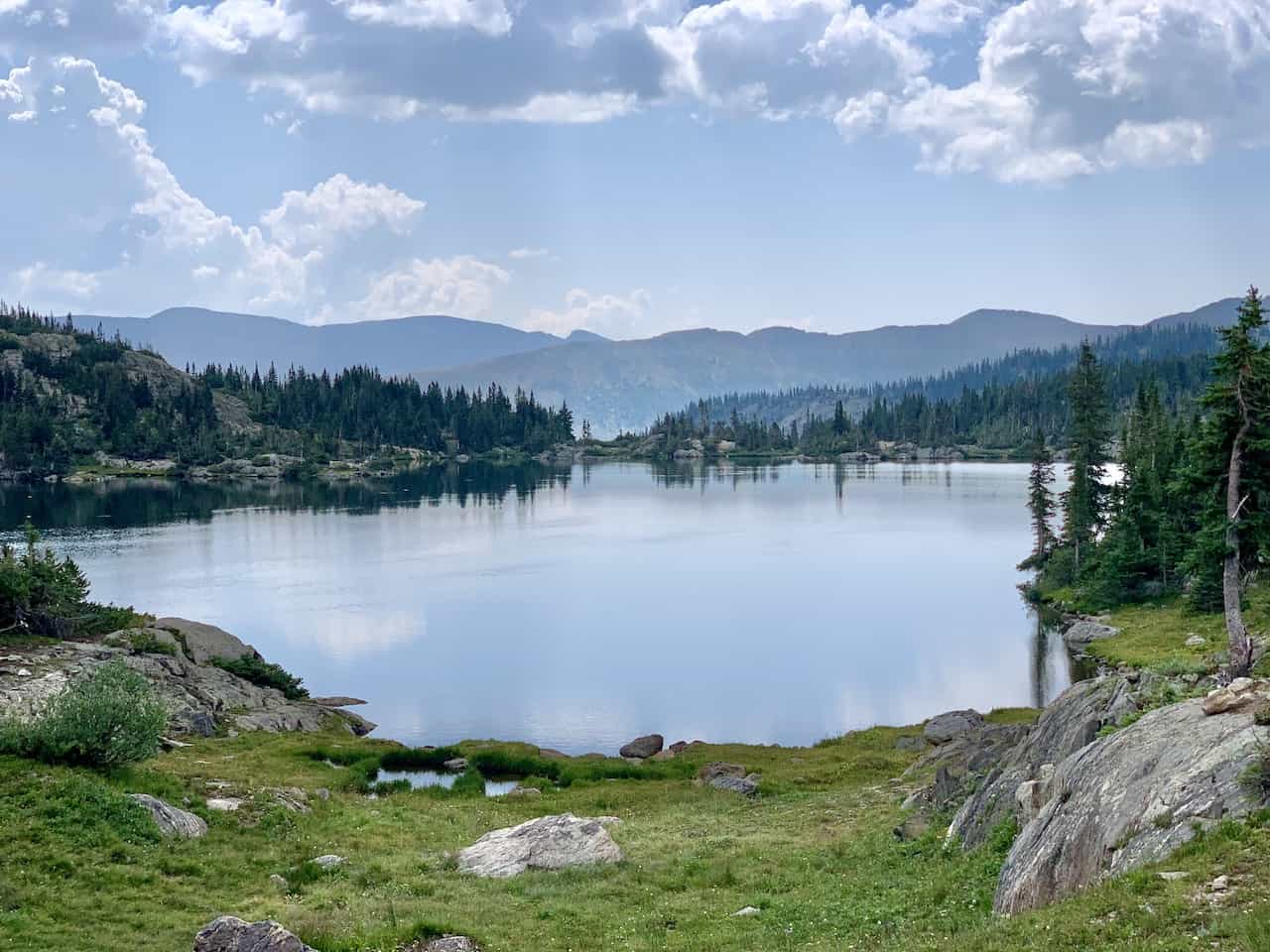
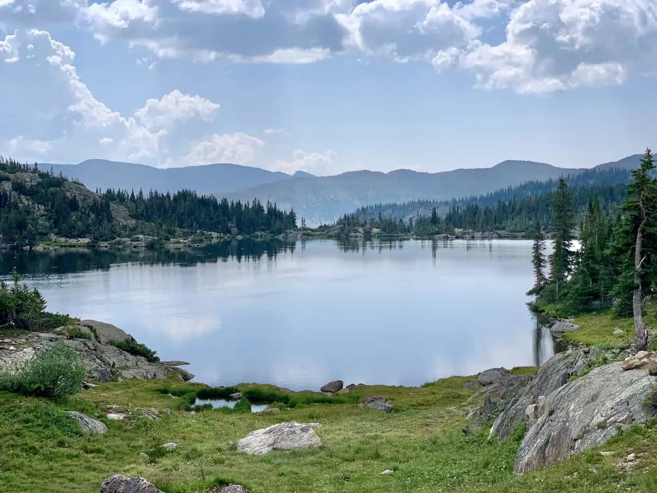
Missouri Pass to Missouri Lakes (1 mile)
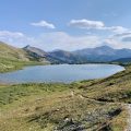
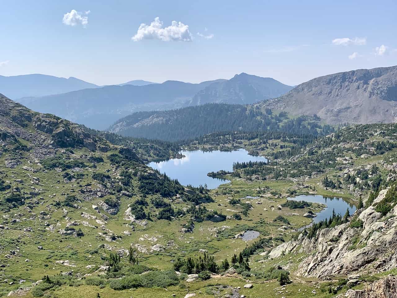
The rest of the hike from here is essentially a downhill hike all the way back to the trailhead. From the top of the pass though, you will first enjoy one of the best parts of the hike as the trail descends a mile down towards the Missouri Lakes.
First you will get to enjoy the views of the lakes from a higher angle, but as you head further down, you will begin to approach the lakes themselves.

Here you will find the main lake surrounded by a whole bunch of smaller lakes on every side. It is just a very serene place to be with the lakes and surrounding mountains all around.
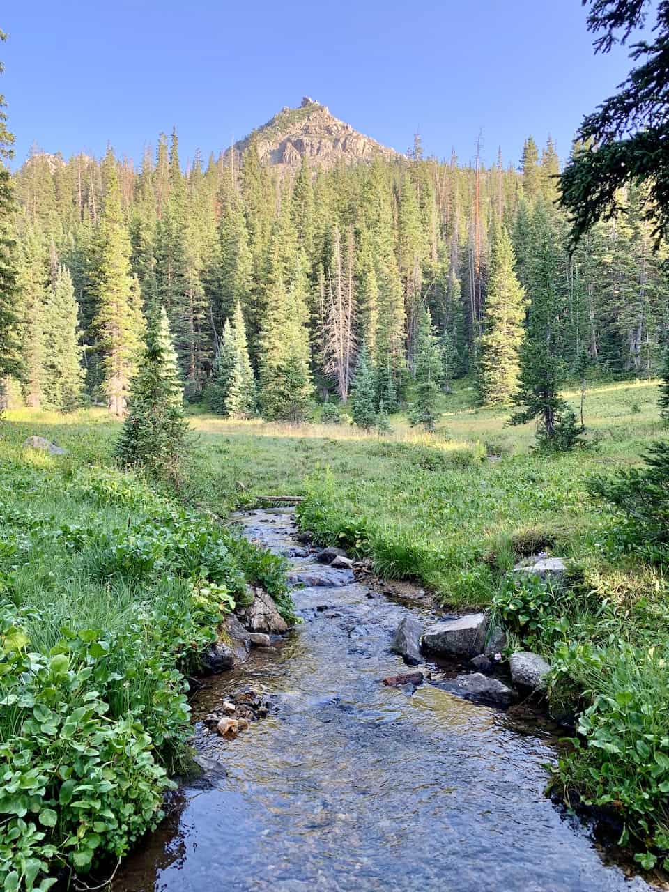
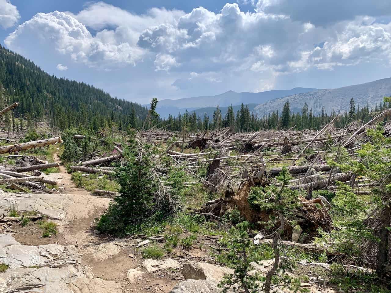
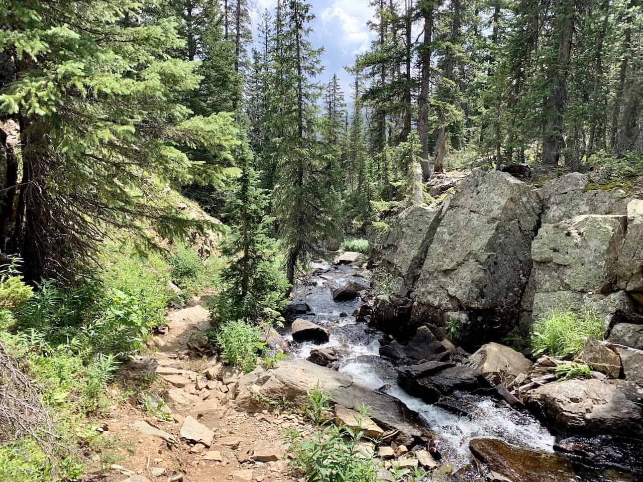
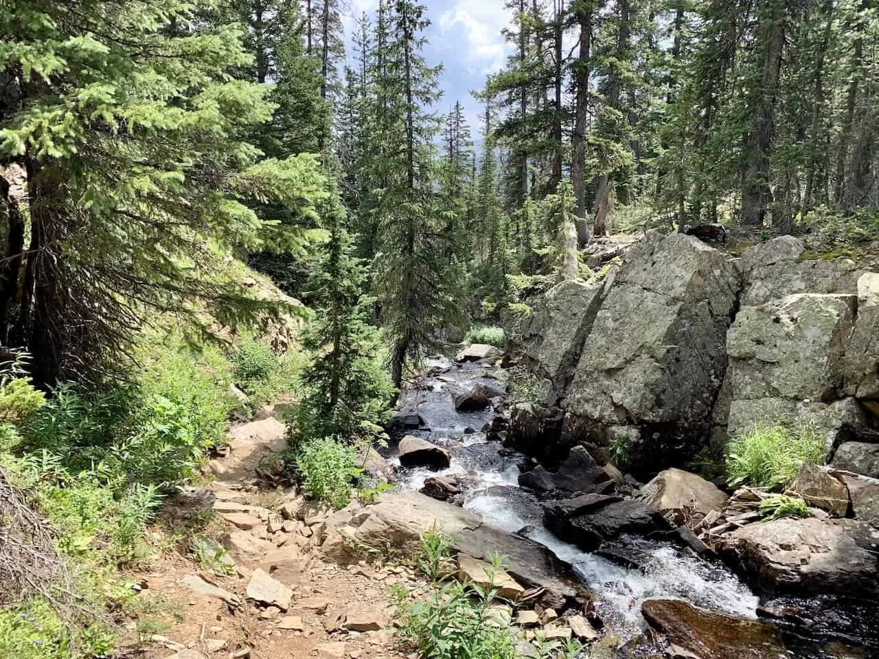
Missouri Lakes to Missouri Lakes Trailhead (3.7 miles)
From the last of the lakes, it is then heading back into the forest for nearly the next 4 miles. You will pass by some nice flower fields, some flowing rivers, and a field of downed trees.


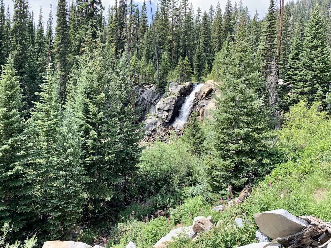
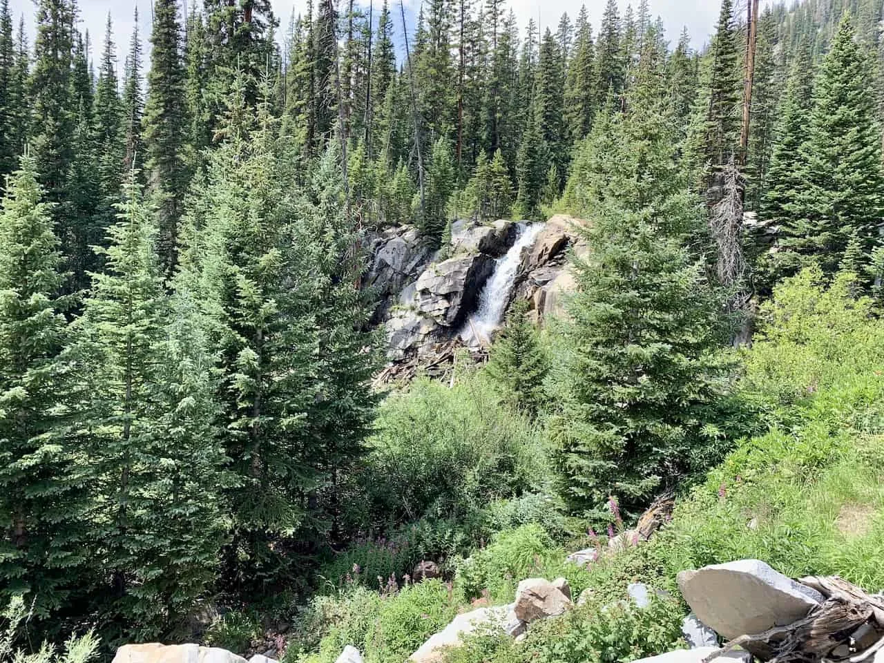
From there the trail continues in the forest as you get some great instances of hiking directly next to the river and some small waterfalls.
The trail continues through the forest, passing by one last lake and a beautiful waterfall before approaching the Missouri Lakes trailhead.
It is just another minute to the Fancy Lake trailhead, where you will end a successful hike in Colorado.
That about wraps up a guide to the Missouri Lakes Fancy Pass loop trail in Colorado. If you have any questions or comments, feel free to add them in below.
Also don’t forget to check out the other Colorado hiking guides such as the one for the nearby Mount of the Holy Cross, the highest point in Colorado – Mt Elbert, or another lake hike to Ptarmigan Lake.
Have fun out there and safe travels!