
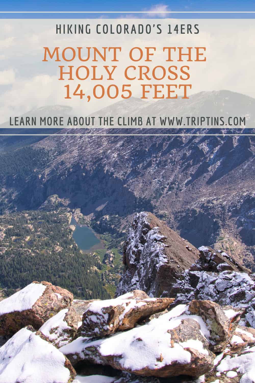
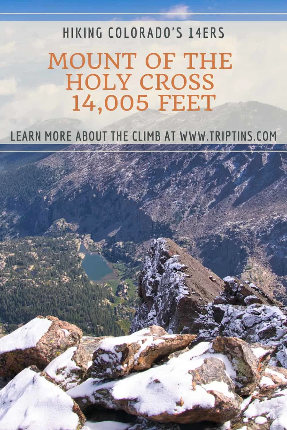
The Mount of the Holy Cross hike in Colorado is one of the top 14er peaks to climb in the state. This demanding 12-mile round trip hike comes with 5,600 feet of elevation gain, making it one of the tougher 14ers out there.
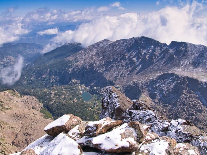
While the hike is a long one, it does come with some of the best views you can ask for from a 14er climb. Whether it is the views from the trail or the 360 degree views from the summit, you are sure to get plenty of them all the way through.
This guide will go over everything there is to know about a Mount of the Holy Cross climb to better prepare you for your trip. Whether it is trail maps, weather, camping, trailheads, or summit photos, this guide will have it all.
* Affiliate Disclosure: This post may contain affiliate links, which means I may receive a commission if you make a purchase through the links provided, at no additional cost to you. Thanks for supporting the work I put into TripTins!
1) Overview & Details
Below is a quick overview of the mountain along with some helpful details to note about the climb.
Mountain Name
Mount of the Holy Cross -> the name Mount of the Holy Cross comes from the cross shaped snowfield on the northeast side of the mountain. Herbert Hoover gave the mountain its name back in 1929.
Mountain Range
The mountain is located on the northern end of the Sawatch Mountain Range, just south of the Beaver Creek and Vail area.
Mount of the Holy Cross Height
The mountain comes in at 14,005 feet / 4,269 meters, just barely getting into the 14er category. Out of the 53 14ers in Colorado, Mount of the Holy Cross is number 51 on the list.
Mount of the Holy Cross Trailhead
The trailhead for Mount of the Holy Cross is the Half Moon Tigiwon trailhead (not to be confused with the Half Moon trailhead for Elbert).
To avoid any confusion though, the GPS coordinates for the trailhead are 39°30’01.6″N 106°25’59.1″W.
Distance & Elevation Gain
The class 2 round trip hike from the trailhead to the summit and back comes in at just around 12 miles. Along with those 12 miles, there will be 5,600 feet of elevation gain.
One thing to note regarding the elevation gain is that there will be an uphill section on the way back down the mountain. More on that next.
Note this is a long hike -> expect a full day out in the mountain at around 7-10 hours for an average hiker.
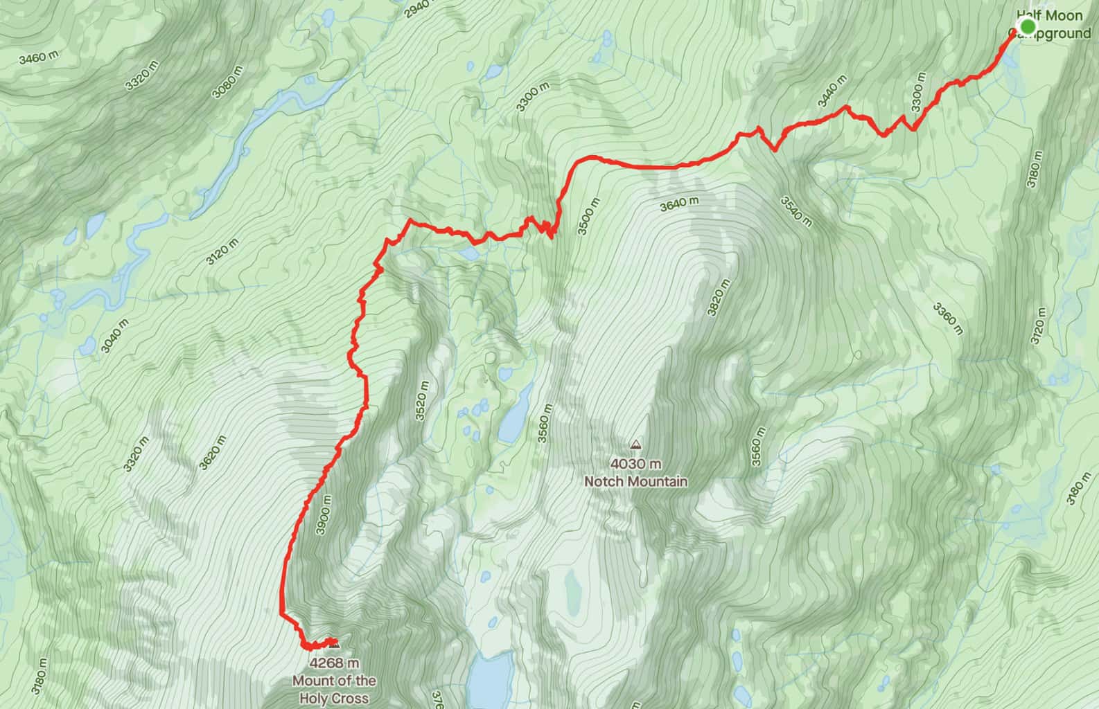
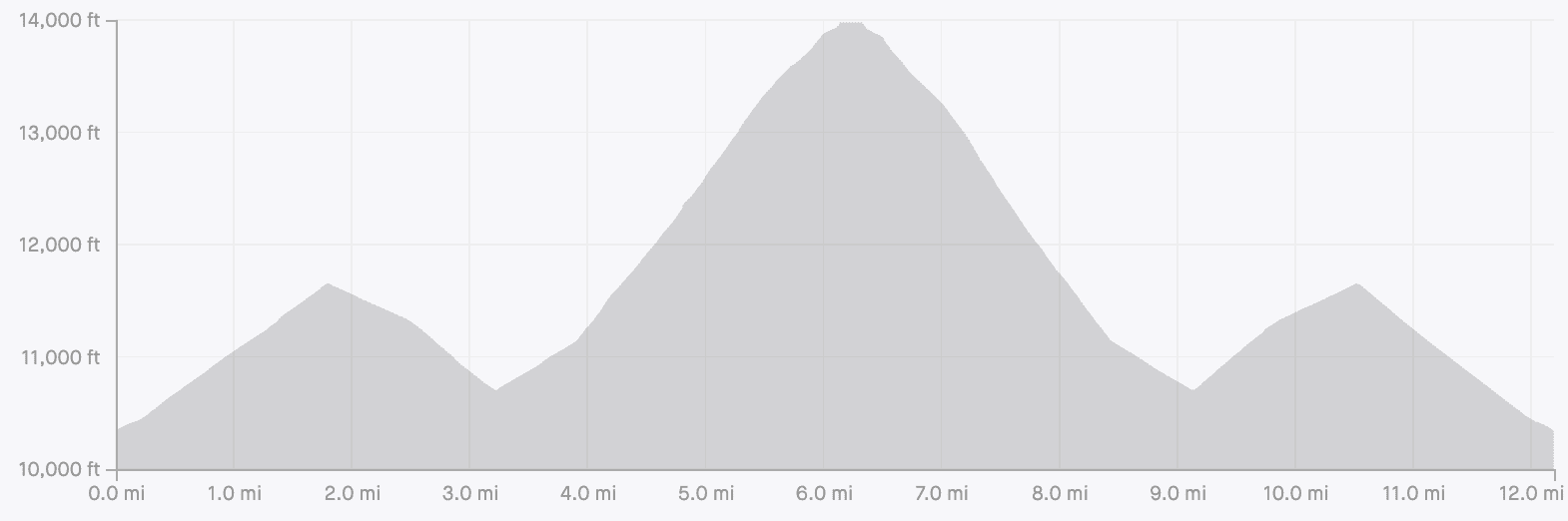
2) Mount of the Holy Cross Trail Map and Elevation Gain Profile
Below you can find the trail map and the elevation gain profile for the Mount of the Holy Cross hike. The trail will begin in the forest, and head up in elevation for around 2 miles.
From there the trail then drops about 1,000 feet in elevation for the next 1.5 miles. After losing that elevation, it will be a consistent uphill towards the summit as you gain more than 3,000 feet of elevation over the next 3 miles.
On the way back to the trailhead you will head back down the mountain, before coming across the uphill section gaining back that 1,000 feet. From there it is just an easy downhill until you are back to the parking lot.


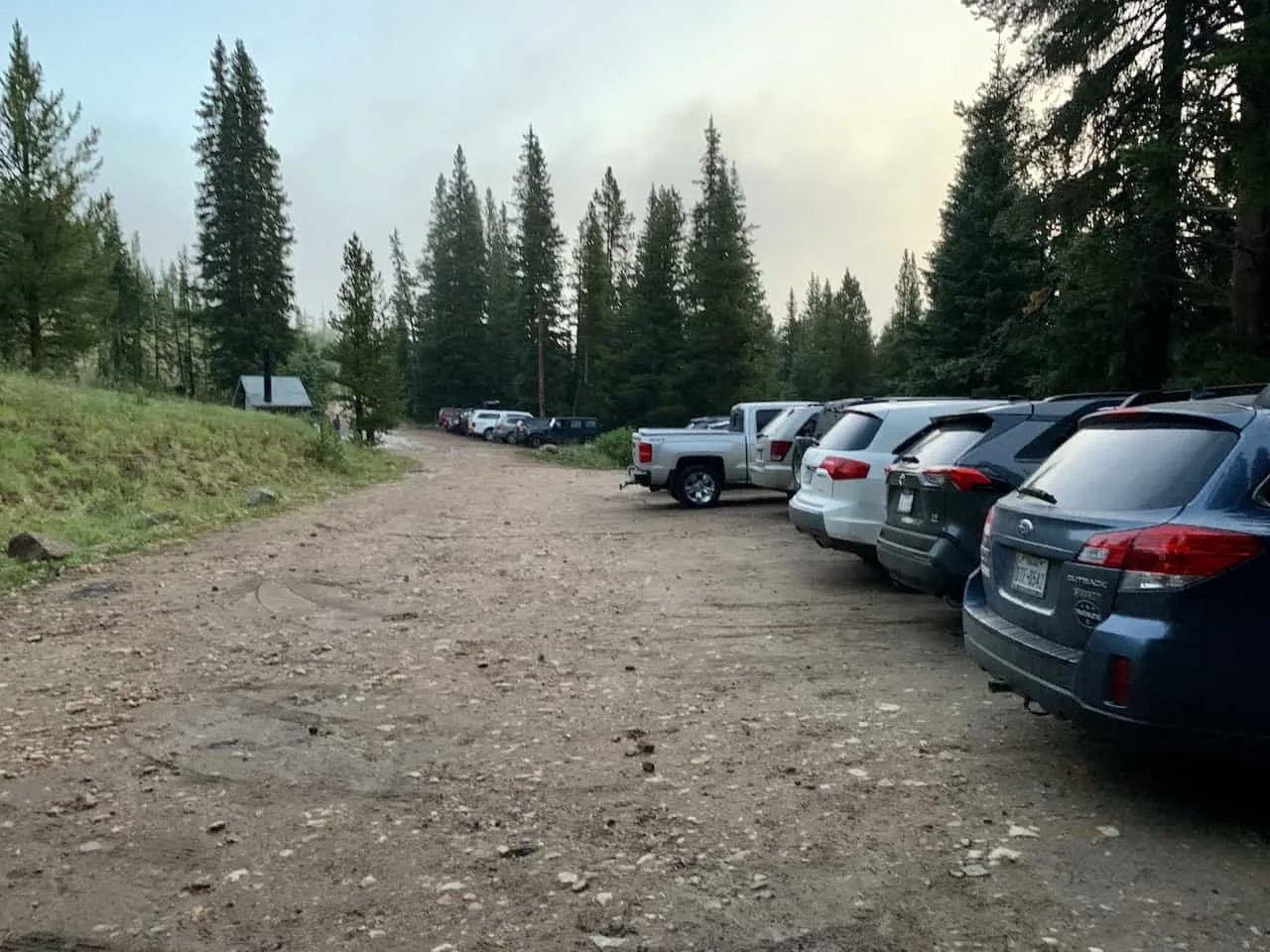
3) Mount of the Holy Cross Trailhead and Directions
The Mount of the Holy Cross trailhead is at Half Moon Tigiwon (39°30’01.6″N 106°25’59.1″W).
The trailhead is located around 8 miles down a dirt 2WD road (Tigiwon Rd). Note that this road is closed each year from November 22 to June 21, however hiking/biking the road is allowed during the closure.
At the trailhead you will find plenty of roadside parking right nearby the starting point of the hike. Also, right near the trailhead you will find the Halfmoon Campground and restroom facilities.
Colorado Car Rental: Looking for a rental car in Colorado? Check out Rentalcars.com for a variety of options that can work well on your trip.

Getting to the trailhead will first require you to get onto US 24. From US 24 you will simply need to make the turn onto Tigiwon Road (Road 707 or Notch Mountain Road on some maps).
It is then 8 miles up Tigiwon Road until you reach the trailhead. The route is quite twisty and turny along the way, but the road itself should be just fine for all vehicles.
4) Mount of the Holy Cross Camping
When it comes to camping there are a couple options here to choose from. You can either camp at the Half Moon campground right at the trailhead or you can camp along the trail.
Since this is a longer hike, many people opt to make this a 2-day climb.
On the trail, there are actually designated camping spots to choose from if you would like to take part of the hike in that type of way.
The camping spots are located around 3 miles into the hike, at the bottom of that 1,000-foot elevation drop near East Cross Creek. So, your first day would just be a 3 mile hike to the campsite, while day two will be a 9 mile hike up to the summit and back to the trailhead.
5) Mount of the Holy Cross Weather
The weather is probably the most important thing to consider when going about a hike up Mount of the Holy Cross.
Hiking in Colorado (especially at elevations like this) can get quite dangerous when the weather turns for the worst.
Before heading out for the hike be sure to check the mountain forecast for the day. It is very important to check the mountain weather and not the weather for the nearest town. The weather in the mountains can be much different than the weather on the ground.
For Colorado 14ers, I like to check a few different sources to get the most up to date and accurate forecasts:
If you are hiking in the summer months, be on the lookout for those afternoon thunderstorms.
While the day can start nice and clear, the weather can turn quickly. The last thing you want is to be caught above the tree line during a thunderstorm.
Always be sure to understand the forecasts and get an earlier start to the day just in case.

6) Colorado Hiking Tips
Check out some hiking tips when it comes to preparing for the trails in Colorado.
Be aware of the elevation: hiking at altitude is no joke and you need to ease your way into the trails. Before taking on hikes from the start, give yourself a day or so to acclimatize.
Stay hydrated: to help with the altitude and the hiking itself, stay consistently hydrated. Take plenty of water and consider a Katadyn Filter Water Bottle for the trail.
Bring bug spray: the bugs can be out in full force on many trails. Put on some bug spray to keep yourself protected while hiking.
Apply sunscreen: the sun can be very strong in the mountains. Applying sunscreen (and wearing a hat / sunglasses), will be very important when it comes to protecting yourself.
Keep an eye on the forecast: the weather can turn suddenly out on the trails. Be sure to check the weather forecasts beforehand to avoid rain & thunderstorms. Afternoon storms can be more prominent in the summer months (so start early!).
Download offline maps: to keep yourself on track, download offline maps for the trail. This can be done by using navigation apps such as AllTrails, Maps.me, and Gaia. You should also download offline Google Maps, as cell service does not always work closer to the trailheads.
Check trail conditions: before committing to a trail, I would recommend looking at the latest trip reports on AllTrails (or 14ers.com for 14er hikes). This is more so important as the summer season starts & ends, as you can get a better idea of trail conditions & snow coverage.
Hiking Resources & Checklist
Before heading out for the trails, be sure to read up on some of the hiking resources up on the site. These are here to better prepare you for all types of outdoor adventure.
- Gear: Hiking Packing List
- Weather: How to Prepare for Hiking Weather
- Navigation: Hiking GPS & Navigation
- Tips: 20+ Hiking Tips & Tricks for the Trail
- Accommodation: Book Your Hotel Today
- Rental Car: Book Your Car Rental Today
7) Mount of the Holy Cross Hike
Taking part of the Mount of the Holy Cross hike will require an early start to the day due to its length. I would recommend starting first thing at sunrise or even prior if you are a slower hiker.
After getting yourself to the trailhead and parking your car, make your way to the front of the lot, where you will find the trail entrance.
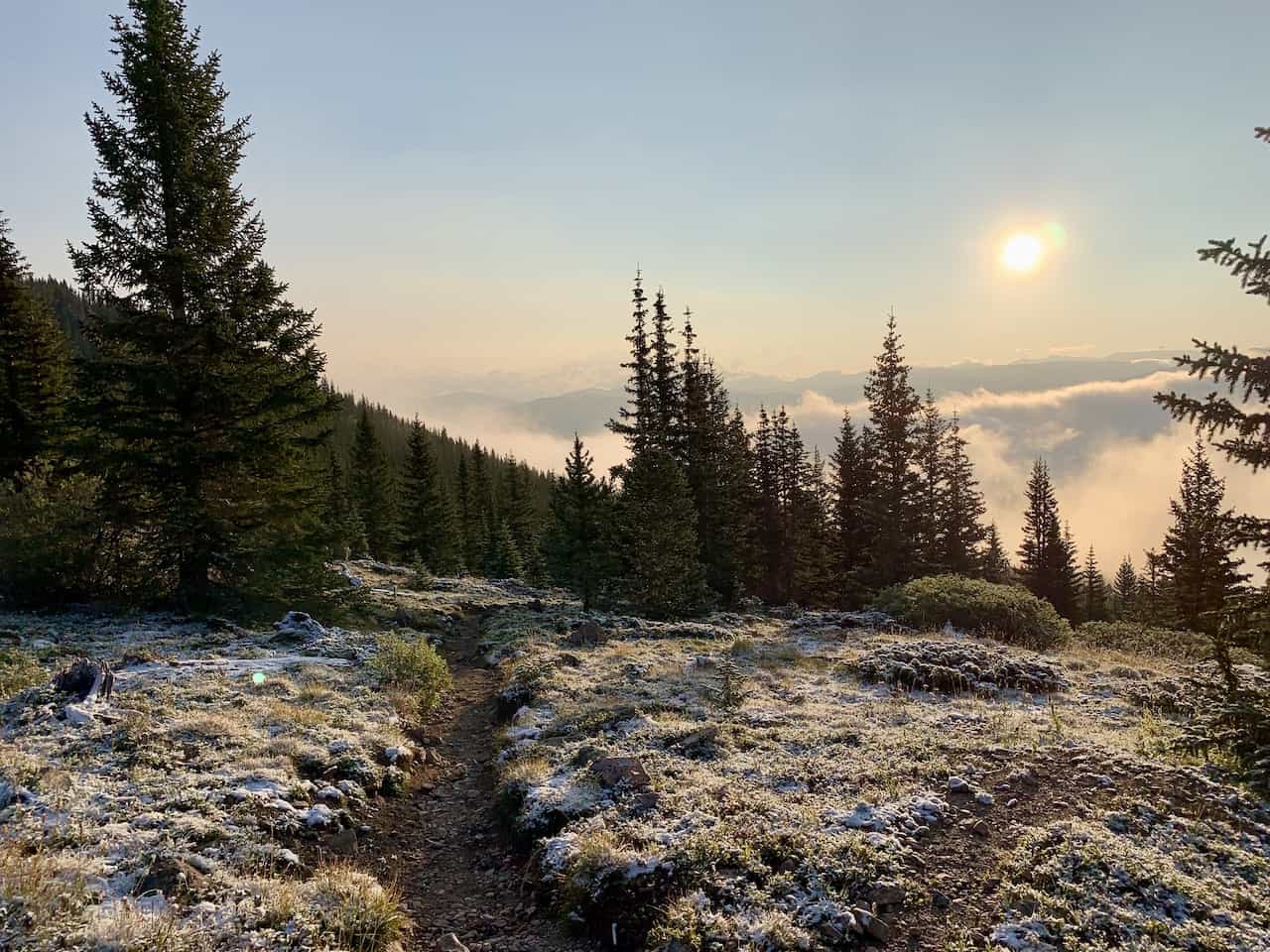
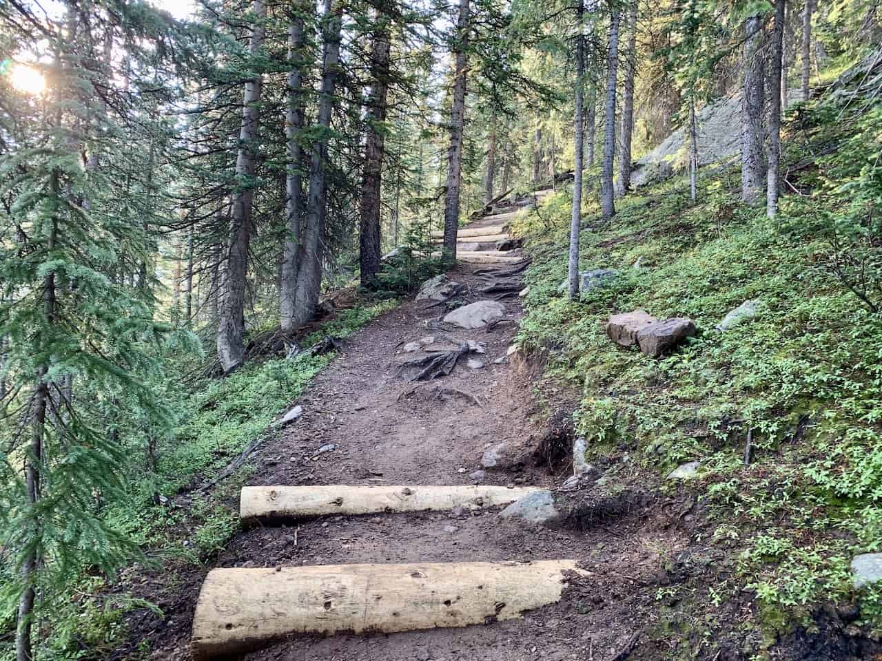
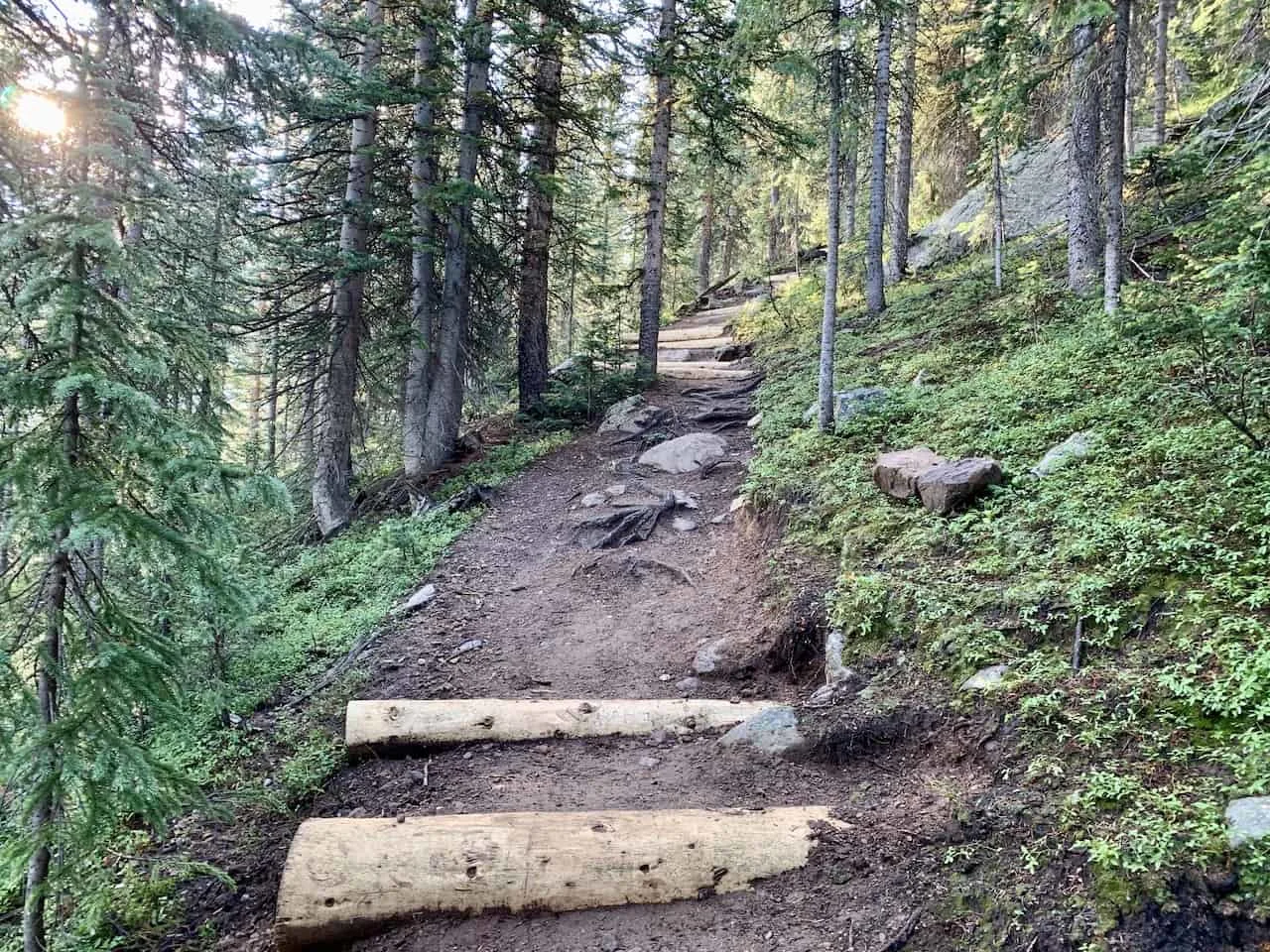
The trail begins in the forest and heads up in elevation from there.
Unlike many other hikes though, the forest here is not too dense at all times so you wont feel completely surrounded in trees.
From time to time the trail really opens up and you get some great views of the surrounding mountains and valleys.

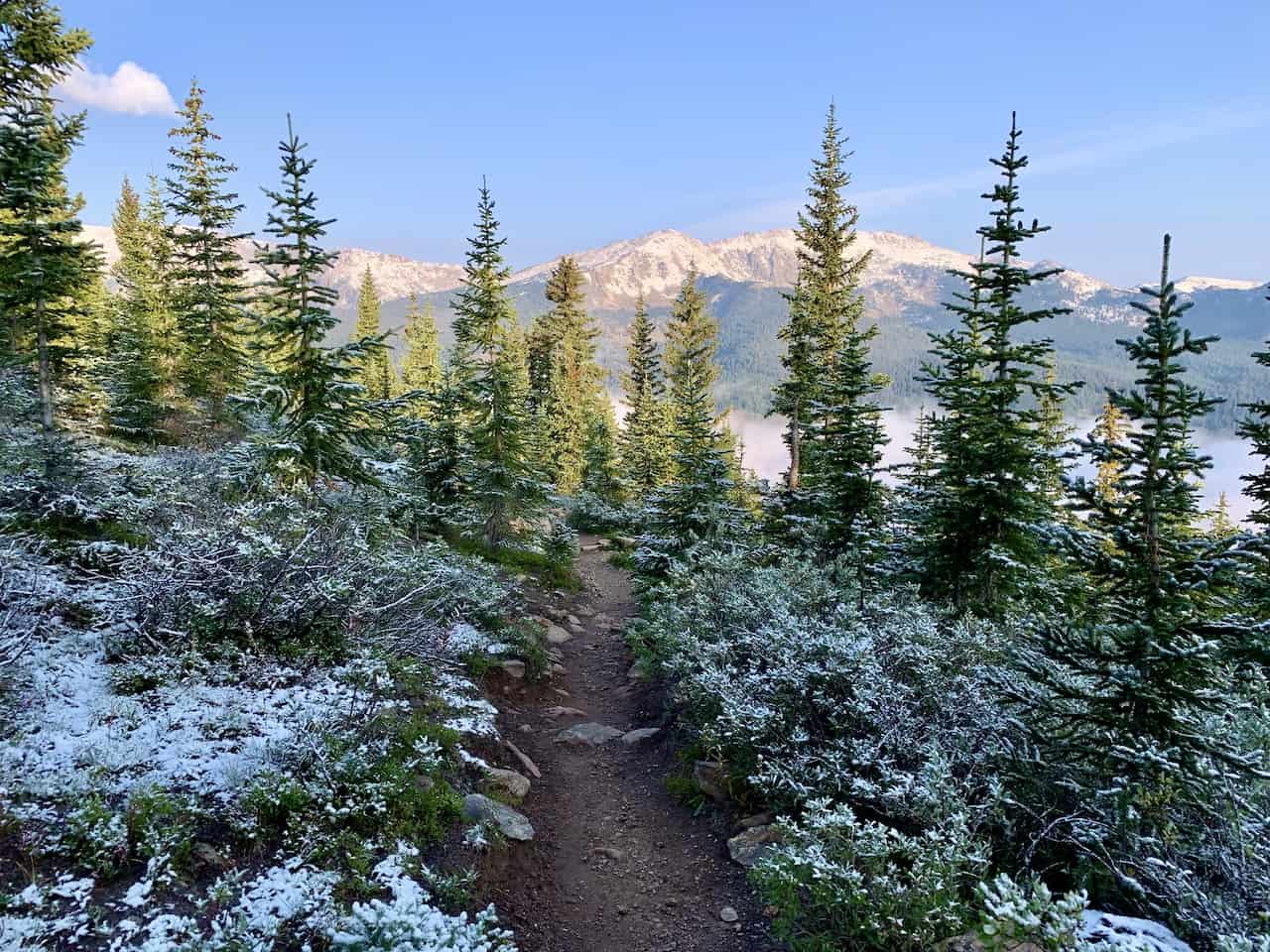

Continue your way up the trail for a couple miles and you will soon get a peak of Mount of the Holy Cross out in the distance.
From here though, you will begin to descend all the way down to the valley floor as you lose about 1,000 feet in elevation.
Here you will come across those campsites I mentioned earlier, and it can be a good spot to sit back and take a break for a bit before continuing on with the climb.
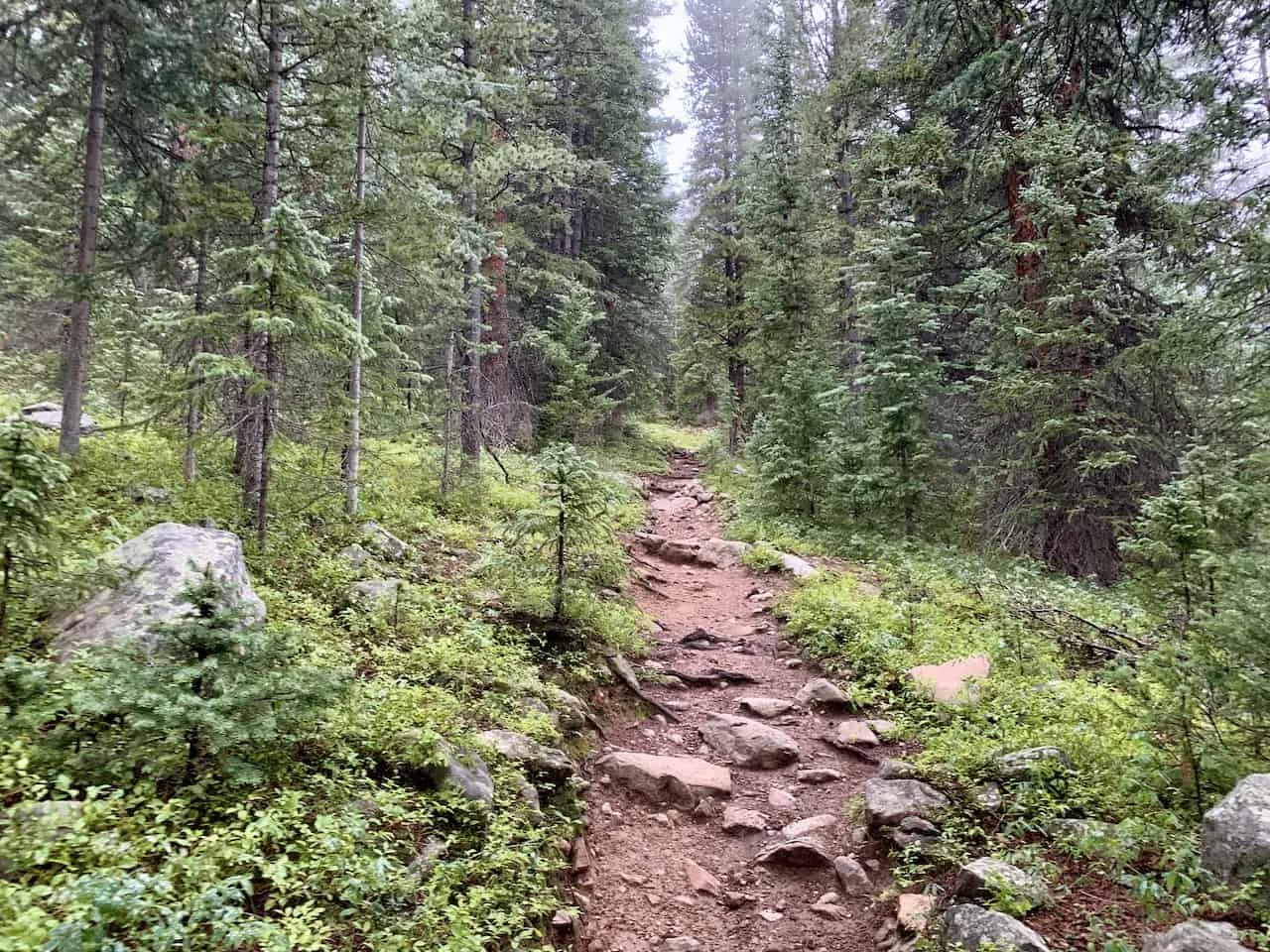
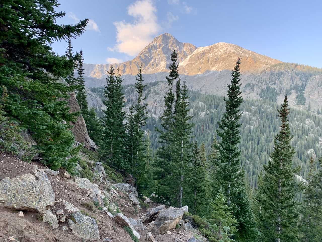
For the most part, the remainder of the hike will be uphill towards the summit.

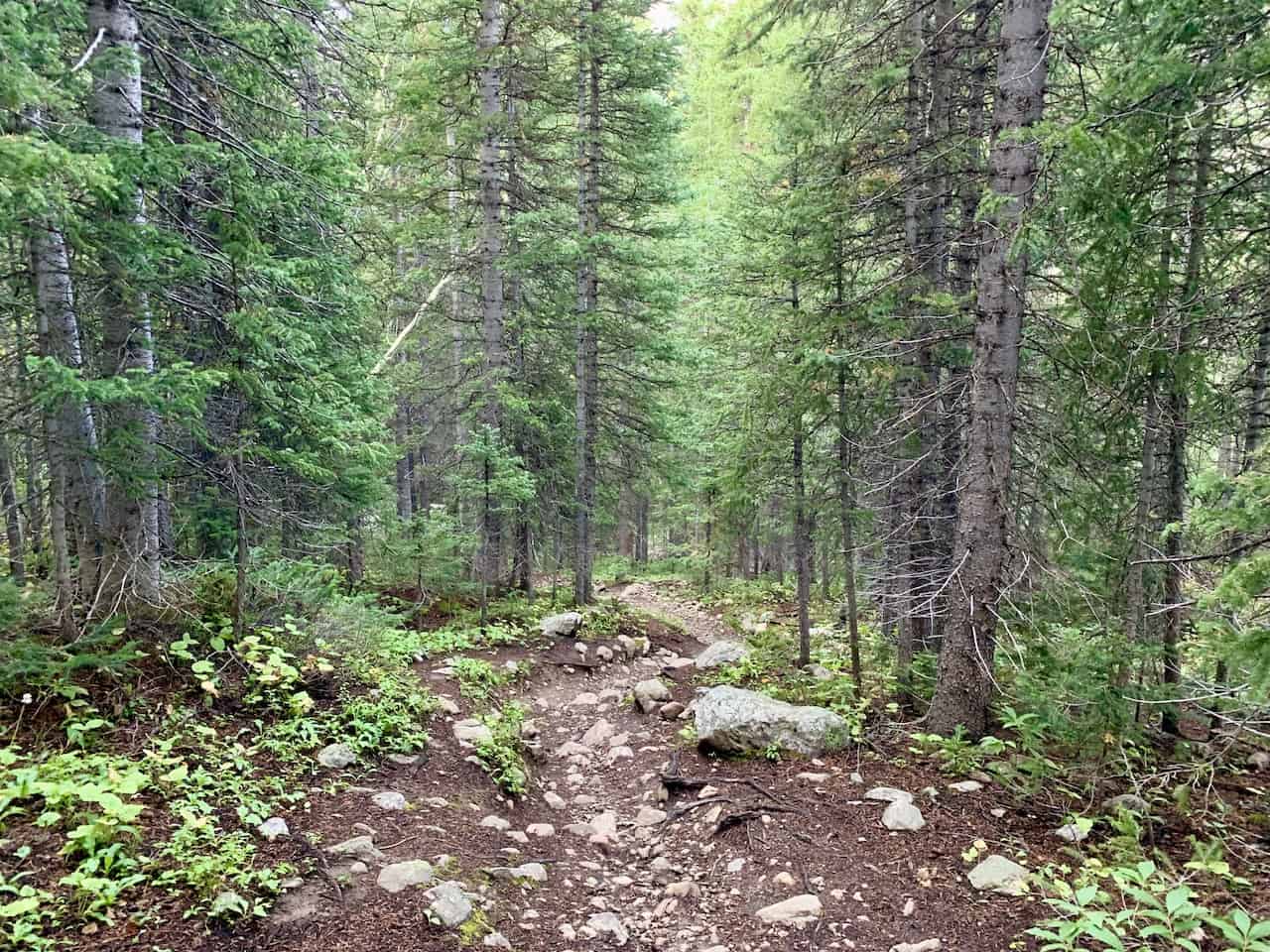

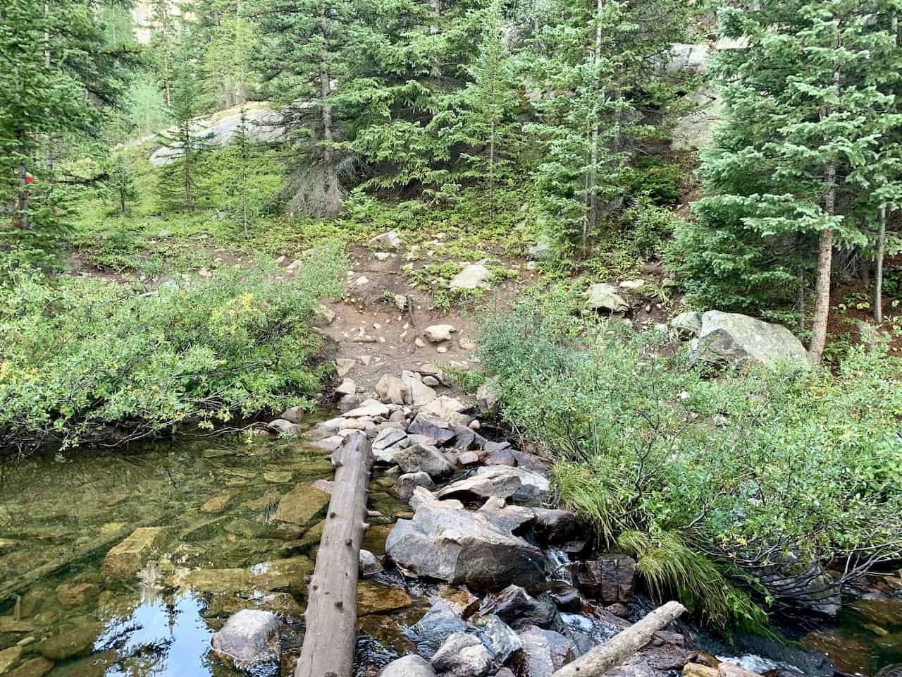

You will then cross the river on the well placed log and begin to climb back up through the forest as you take in some views from time to time. It is an easy to follow rock/dirt path as you continue your way up.
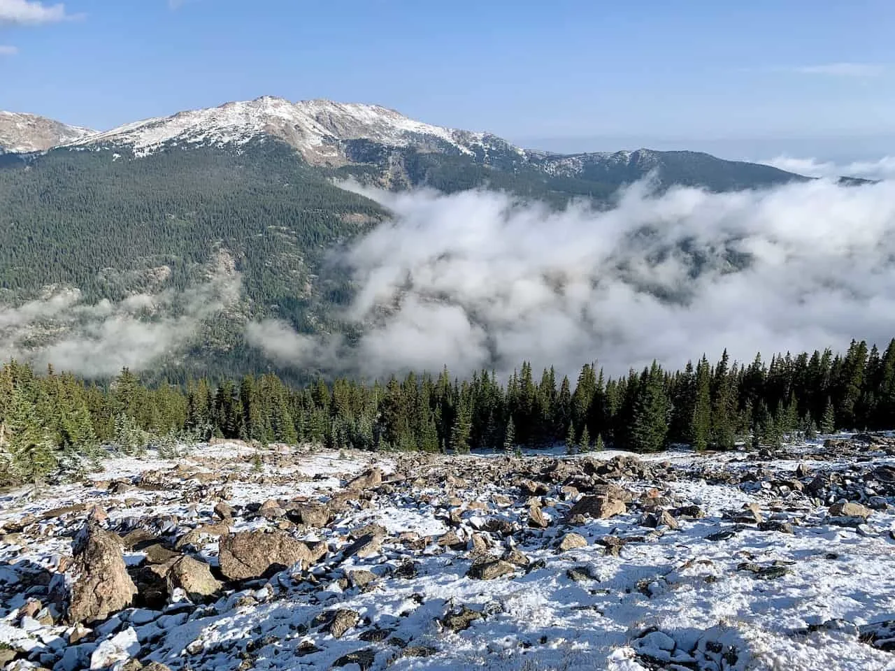
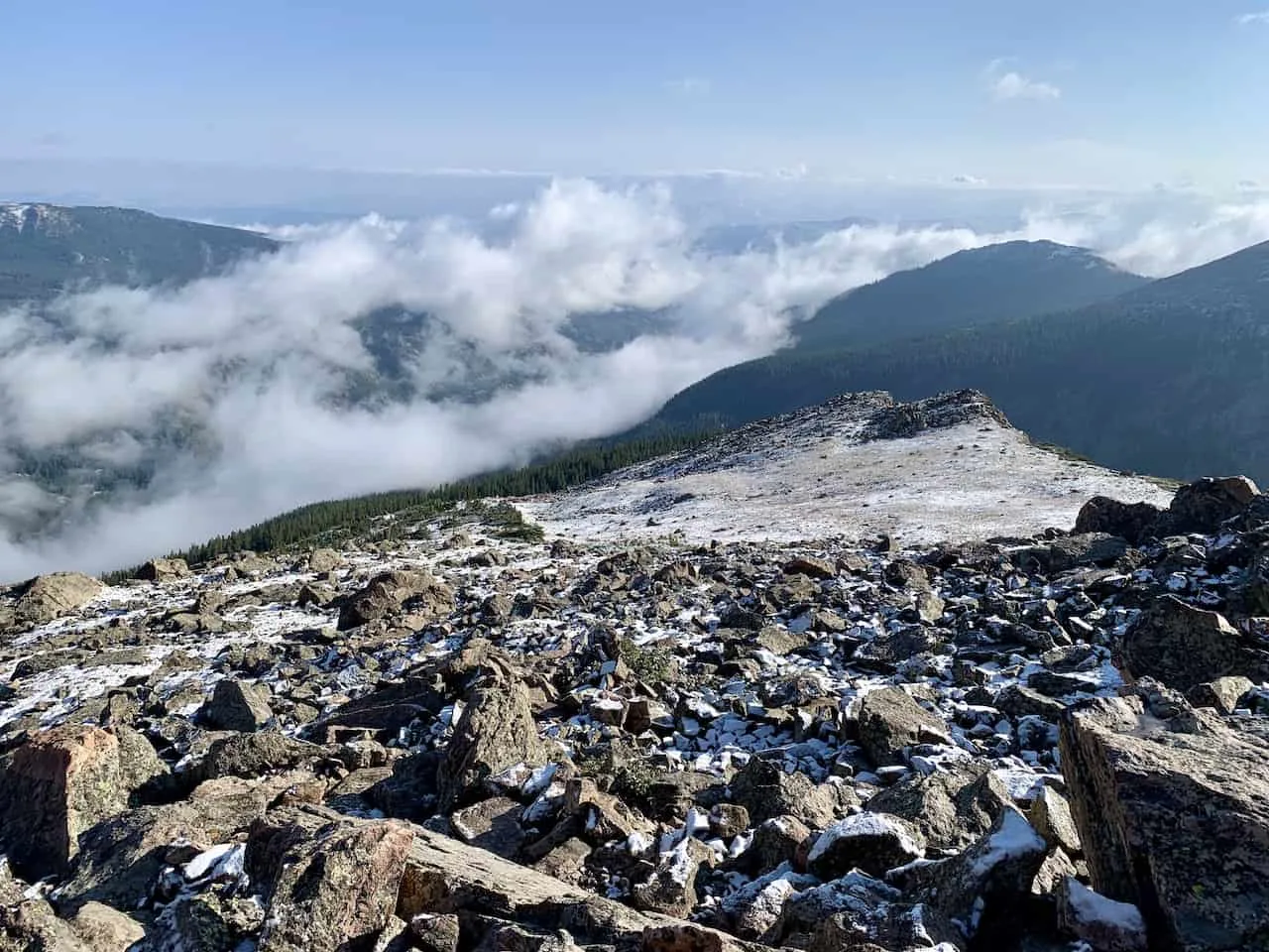
As you continue the climb, you will soon leave behind the forest and be welcomed to more and more views of the surrounding landscapes.
Take a look behind for views of the beautiful valley down below.
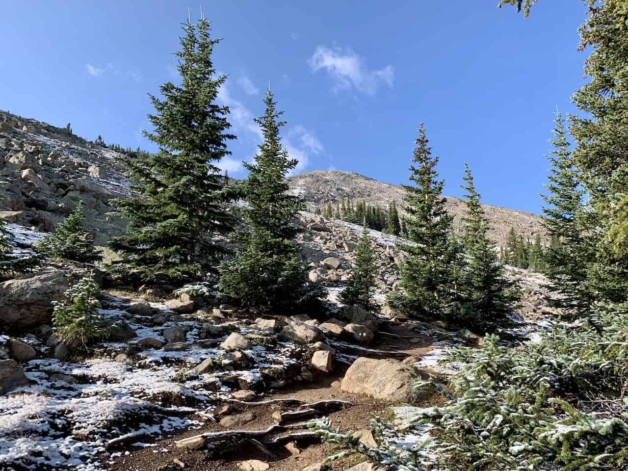


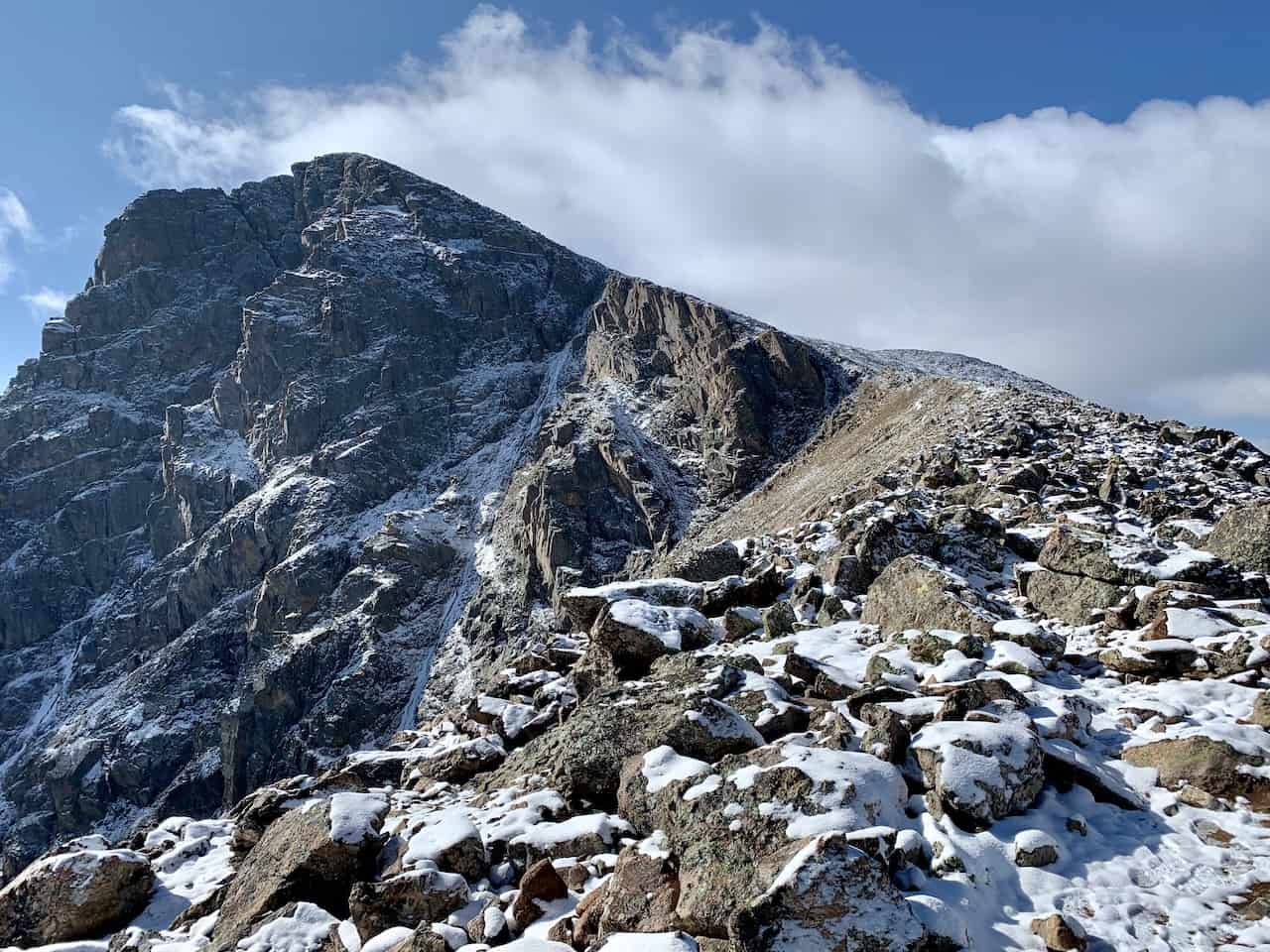
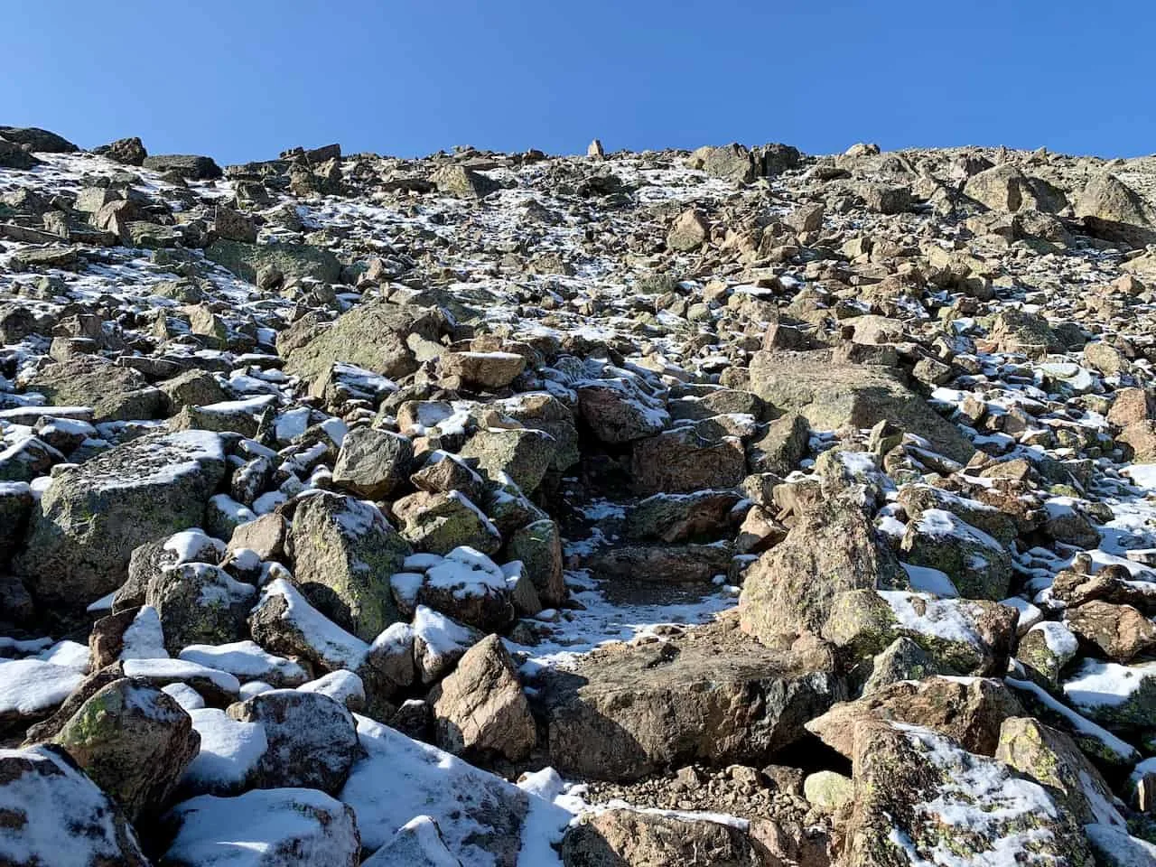
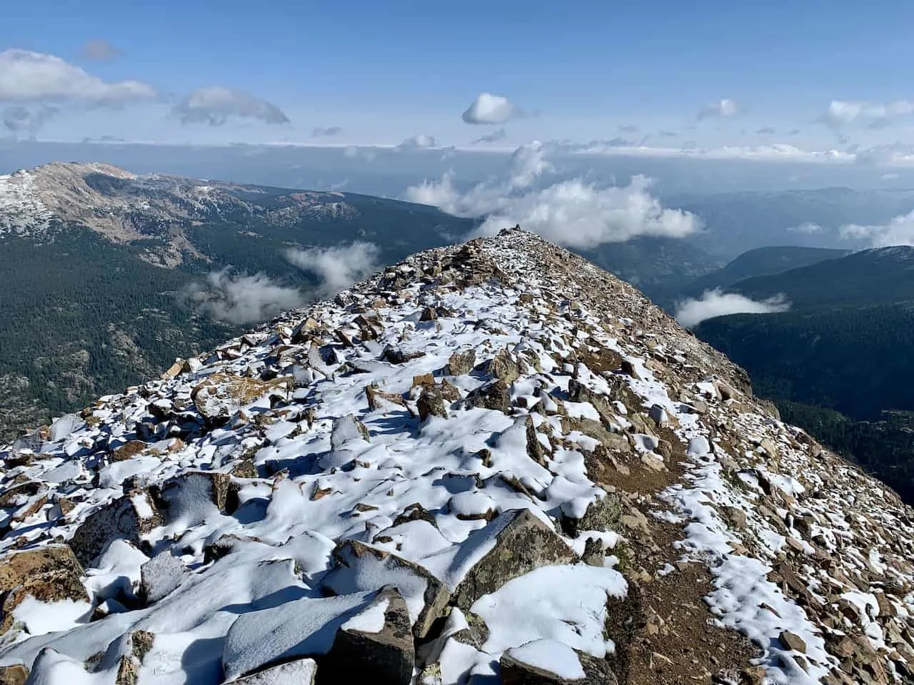
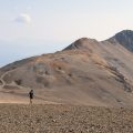
The further you head up this rocky pathway, the closer you will get to the ridge. As you get closer to the ridge, you will begin to get views of the Holy Cross summit way up in the distance.
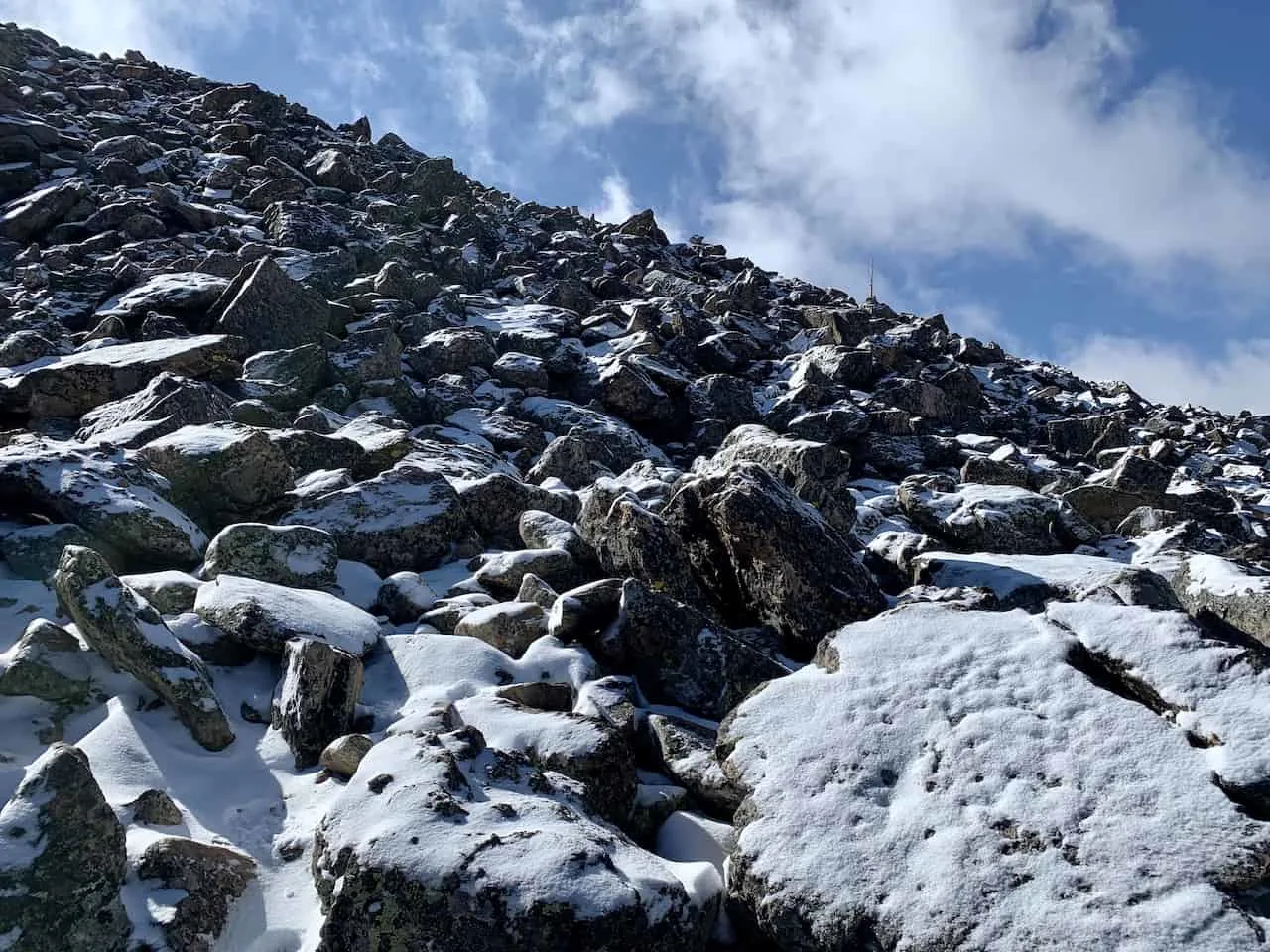
Once you reach the ridge, the path will get much rockier and you must pay attention to the path a bit more.
It will be marked by rock cairns throughout, so be sure to always have the next one in sight as you head on up.

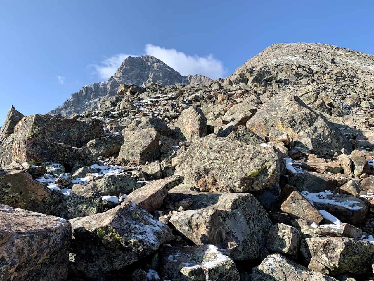
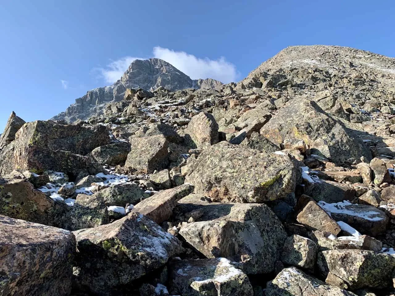
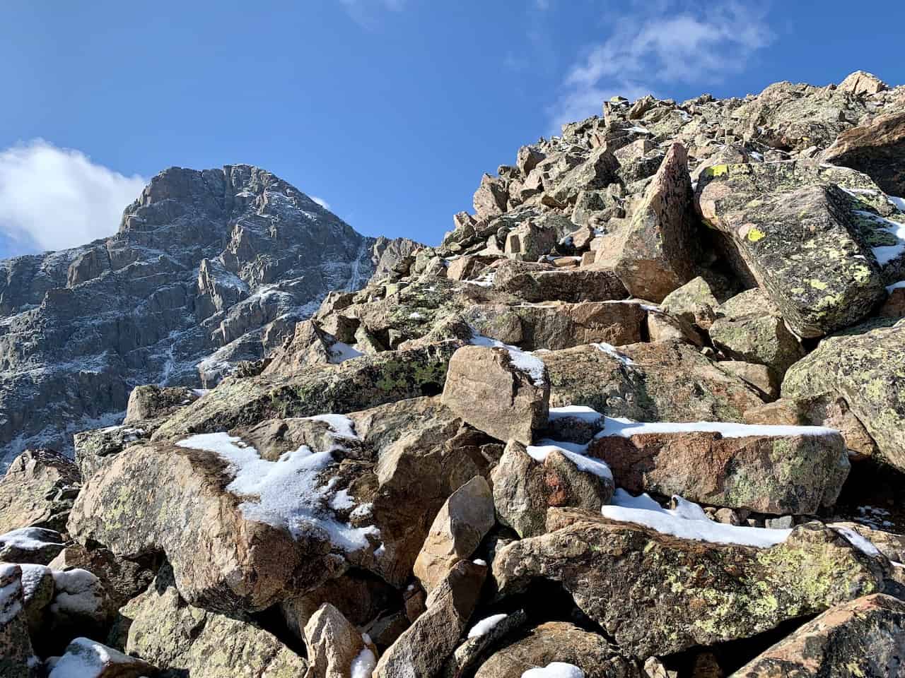

After a long climb up the ridge, you will be welcomed to a flat section of trail that has multiple large cairns guiding the way across. This is a good spot to take a break and enjoy the view before continuing towards the summit.

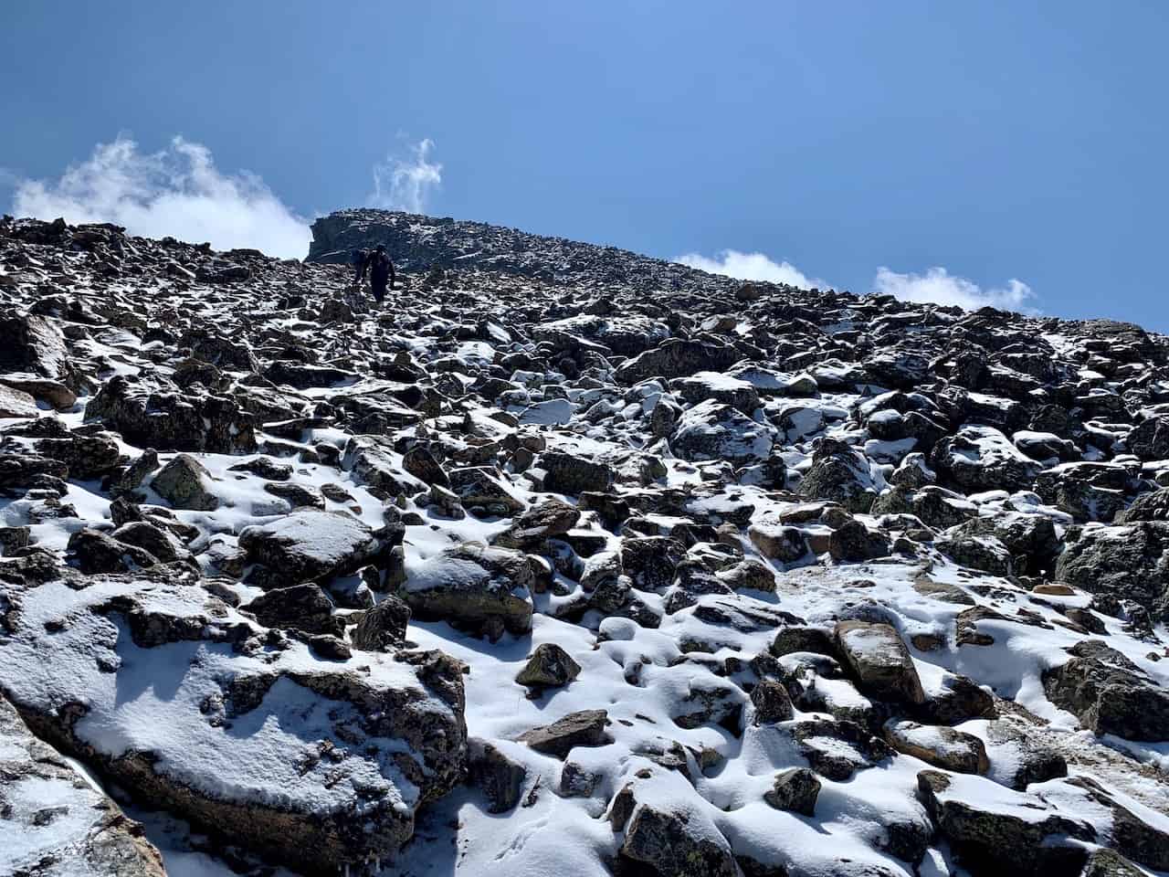
This will now be the hardest part of the trail as the trail does get steeper and harder to follow at times.
Be sure to pay attention to those cairns as well as some helpful poles that have been put in place along the way.
Soon enough, the summit will be right out in front of you. Follow the path to the summit of Mount of the Holy Cross and enjoy the view from up top.


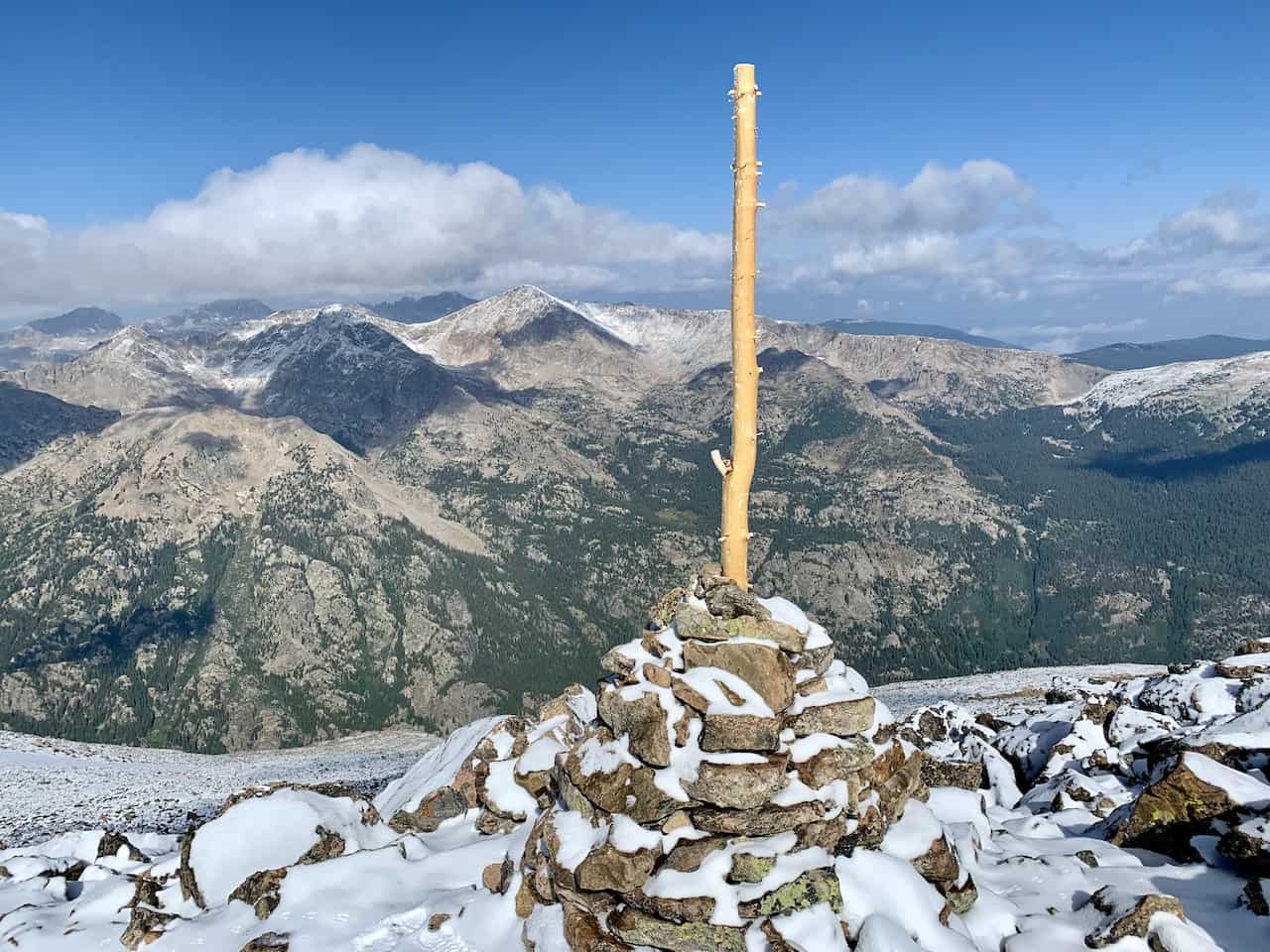

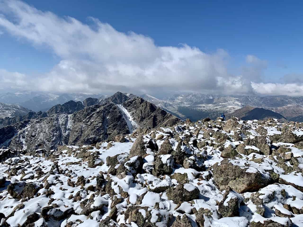
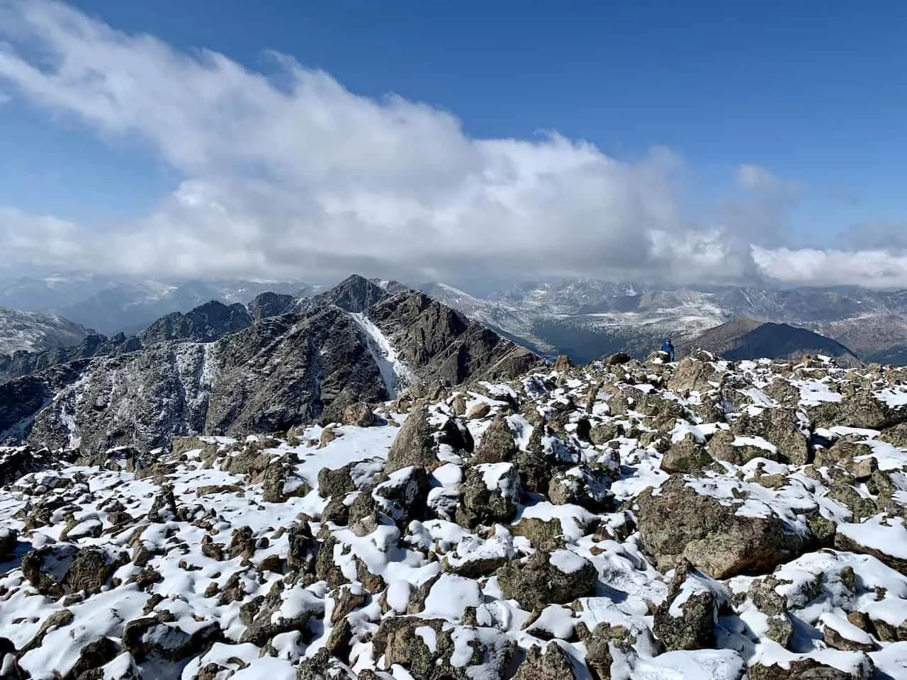
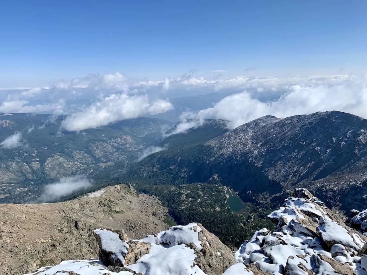
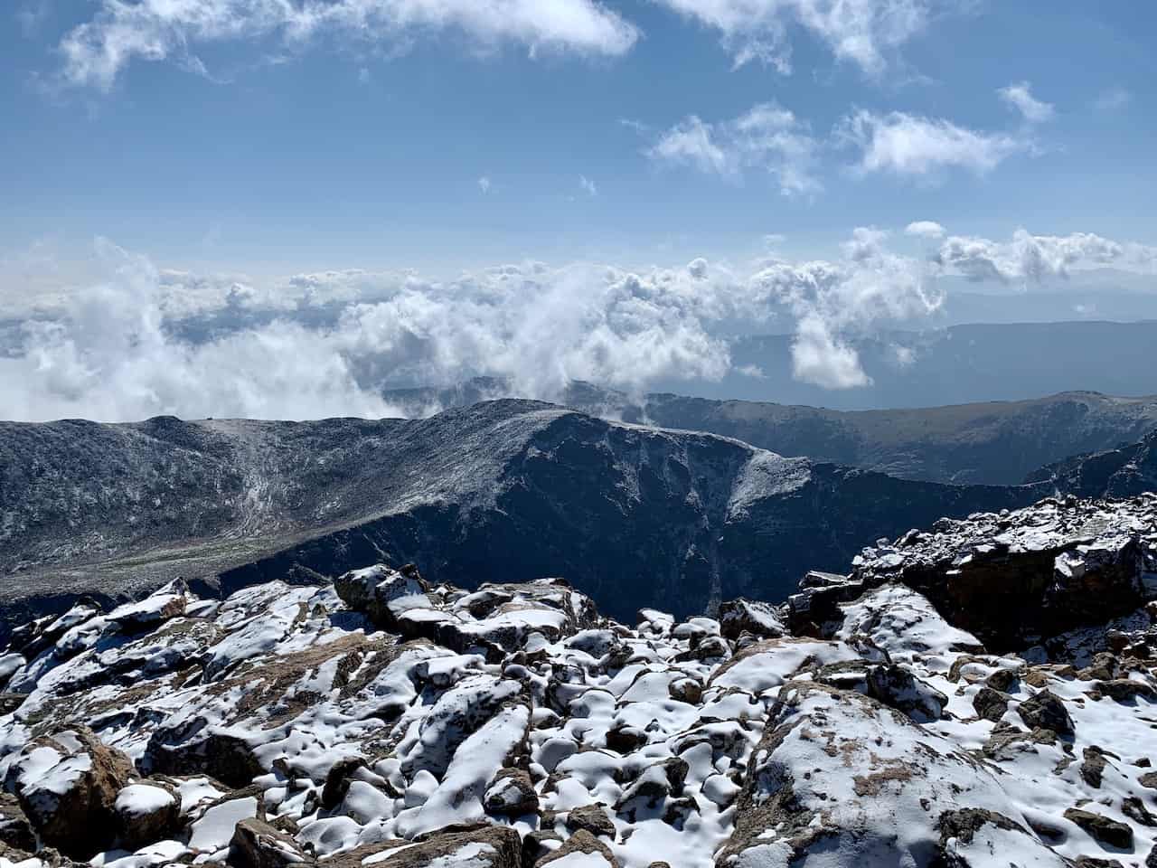
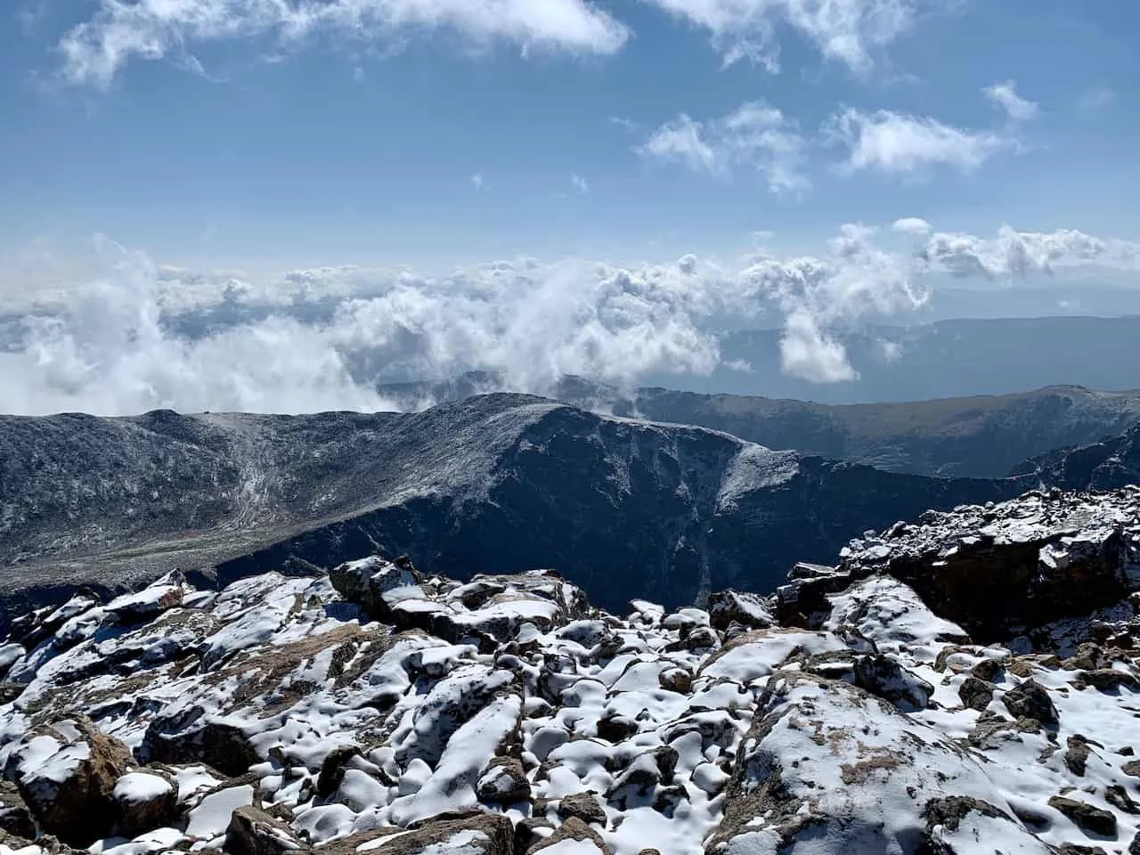
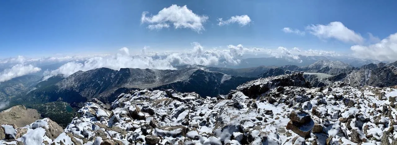
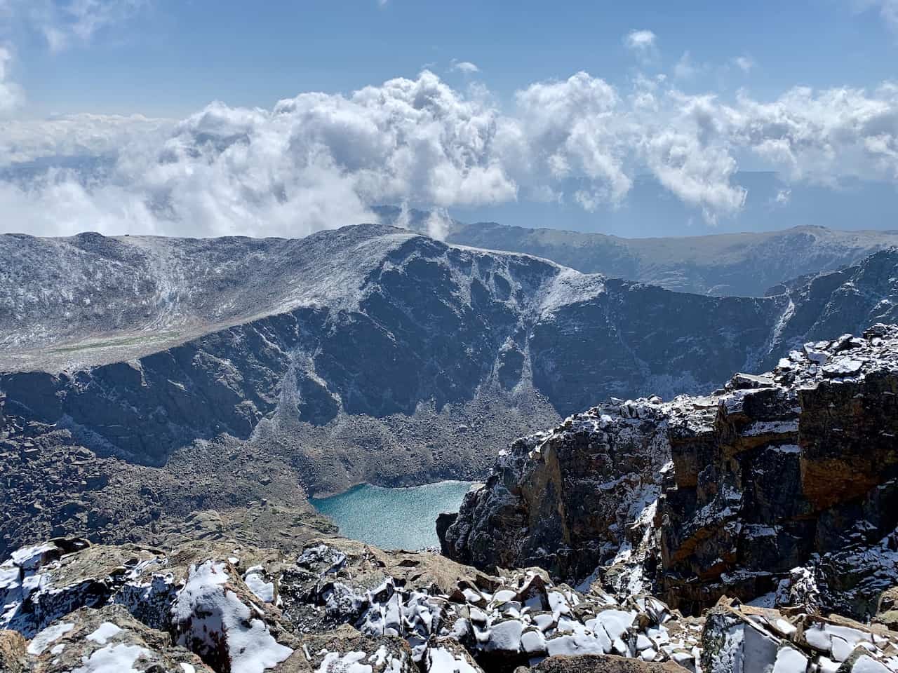
8) Mount of the Holy Cross Summit
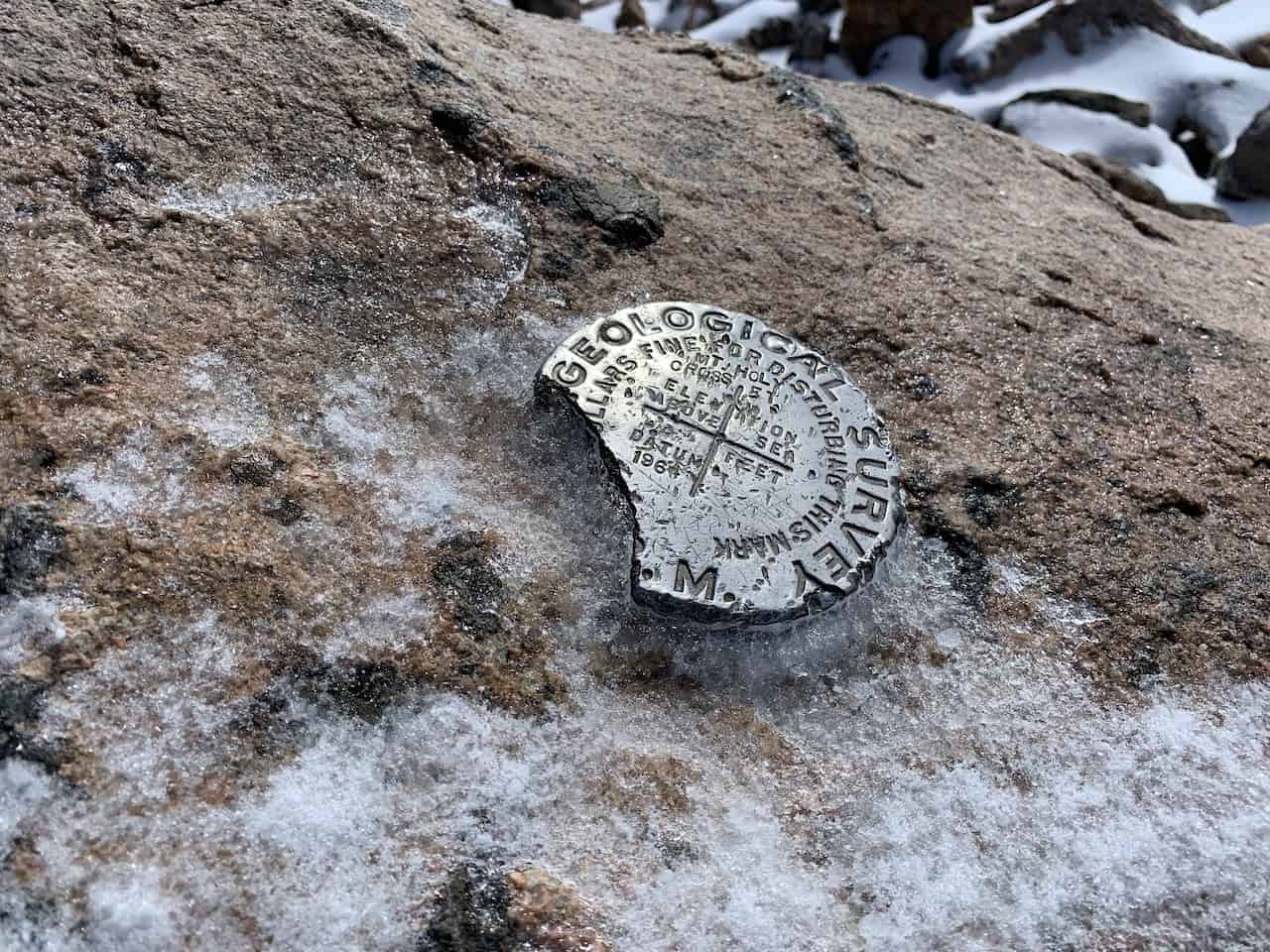
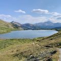
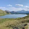
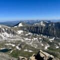
The views from the summit are vast as you take in the 360 landscape all around you. Also on the summit you should find the official marker etched into the ground.
If you walk a bit further past the summit itself, you should get some additional views of the lakes down below. Here are just some of the views you will be able to enjoy from the peak:


Once you are done up top, it is time to follow the path all the way back to the parking lot. Be very aware of where you are going, especially on this first descent back down to the flat part of the ridge.
It is easy to get confused here, so just be sure you are following the cairns and poles back down. Once you reach the flat part of the ridge, things should begin to get easier to follow.
And don’t forget that uphill section that you will need to climb back up once you hit the camping area! But once you make it through that part, you should be in the clear until you reach the trailhead.
9) Frequently Asked Questions
Here are some of the most frequently asked questions regarding the Mount of the Holy Cross hike to better prepare you for the day.
How Difficult is Mount of the Holy Cross?
Mount of the Holy Cross is a difficult hike to part of no matter how you look at it. There is 5,400 feet of elevation gain over 12 miles with some of that coming on the way down to the trailhead.
Coupled with the fact that the climb up the ridge is a difficult path to maneuver on very tricky terrain, makes Holy Cross that much more difficult.
I would only recommend a hike up Holy Cross for those with the appropriate experience. If you believe the one day hike will be too hard to complete, then feel free to split it into 2 or even 3 days to get the climb done.
Where is the Mount of the Holy Cross?
Mount of the Holy Cross is located in the Holy Cross Wilderness area and is part of the Sawatch mountain range. The closest main area would be Vail/Beaver Creek located just up US 24.
How Long Does it Take to Climb Mount of the Holy Cross?
Expect the round trip hike to take 7-10 hours to complete. Due to its length and large amount of elevation gain, this will be one of the longer 14ers to take part of.
If you are set on doing the climb in a day, be sure to start early!
Is Holy Cross a 14er?
Yes, Holy Cross is officially a 14er at 14,005 feet in elevation above sea level. Although it is just the 3rd shortest 14er, it is still one of the more demanding ones out there to take part of.

That about does it for a guide to the hike up Mount of the Holy Cross. If you have any additional questions or comments, be sure to add them in below.
Looking for More 14ers? Check out some more Colorado hiking guides for nearby peaks in the area including:
– Mount Elbert
– Huron Peak
– La Plata Peak
– Mount Yale
– Mount Harvard
– The Decalibron
– Quandary Peak
– Mount Massive
Have fun out there and safe travels!


Rebecca
Saturday 26th of August 2023
Great article!! What do you think about bringing a dog on this one??
Charles
Sunday 27th of August 2023
Hey Rebecca - so I would say it really depends on the dog. Towards the top of the mountain, things can get a bit more rocky, uneven, and steeper. Larger dogs that have experience may be fine, but smaller dogs may need to be carried at some point. It is also very important to bring enough water for both you and your dog, since it can get exhausting higher up towards the summit.