
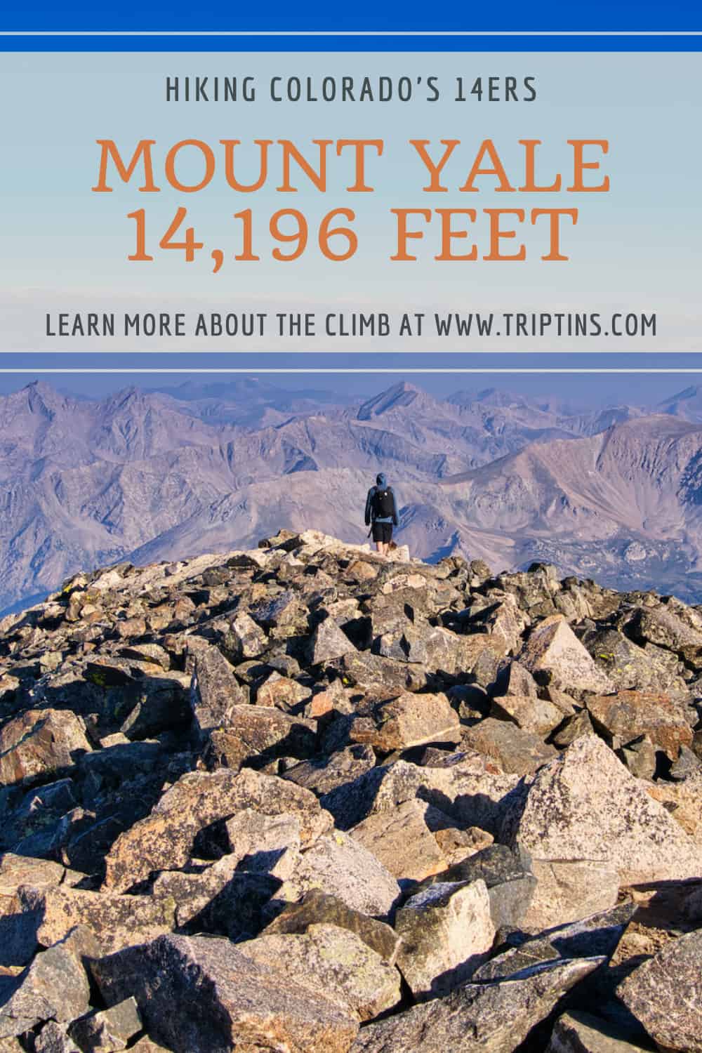
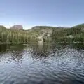
The hike up Mount Yale at 14,196 feet is one of the top 14er options of the Collegiate Peaks in Colorado. This class 2 climb will have you walking through forest, across rivers, up switchbacks, and scrambling across the ridge to make it to the summit.
This guide will go through everything you will need to know about this hike. From trailhead and parking info to elevation details and helpful photos, this guide is here to get you ready to summit Mt Yale.
* Affiliate Disclosure: This post may contain affiliate links, which means I may receive a commission if you make a purchase through the links provided, at no additional cost to you. Thanks for supporting the work I put into TripTins!
1) Overview & Details
Here are some helpful details for the Mount Yale climb and what to expect as you prepare yourself to hit the trail.
Mountain Name
Mount Yale was first climbed all the way back in 1869 by a Harvard research team and Josiah Whitney, an alumnus of Yale.
During their time in the area, the team climbed a couple different peaks. The team decided to call the higher nearby mountain, Mt Harvard, and this mountain, Mt Yale.
Mountain Range
Mt Yale is part of the Sawatch mountain range and is part of the Collegiate Peaks.
Mount Yale Elevation
Mount Yale is 14,196 feet / 4,327 meters in elevation and is the 21st highest 14er in Colorado.
What Class is Mount Yale
Mt Yale is a class 2 mountain climb. For about 90% of the climb, the trail would be considered class 1. However, the last portion of trail along the ridge can get technical and will require a bit of class 2 scrambling.
Mount Yale Trailhead
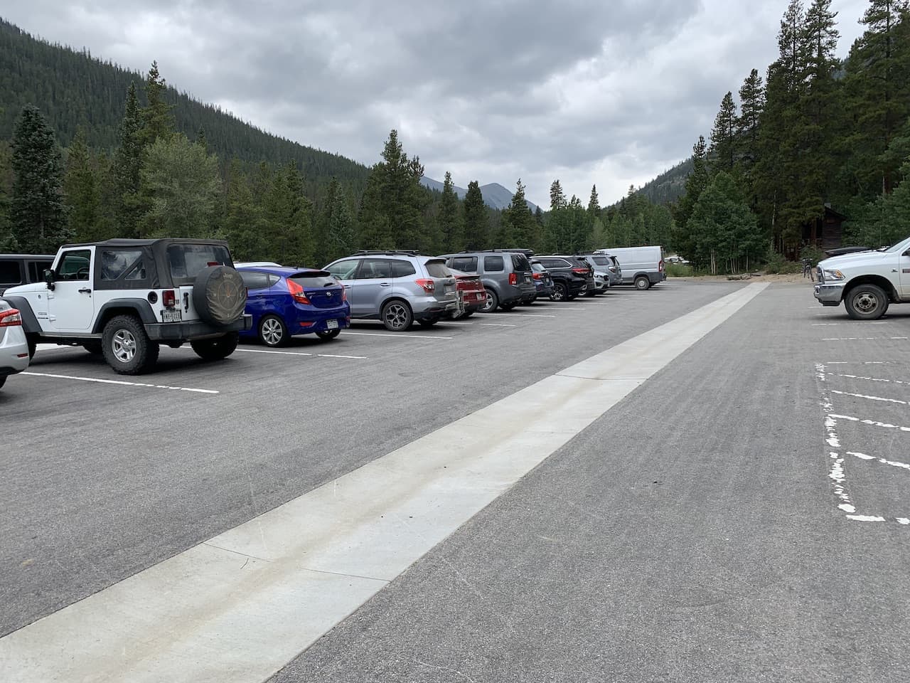
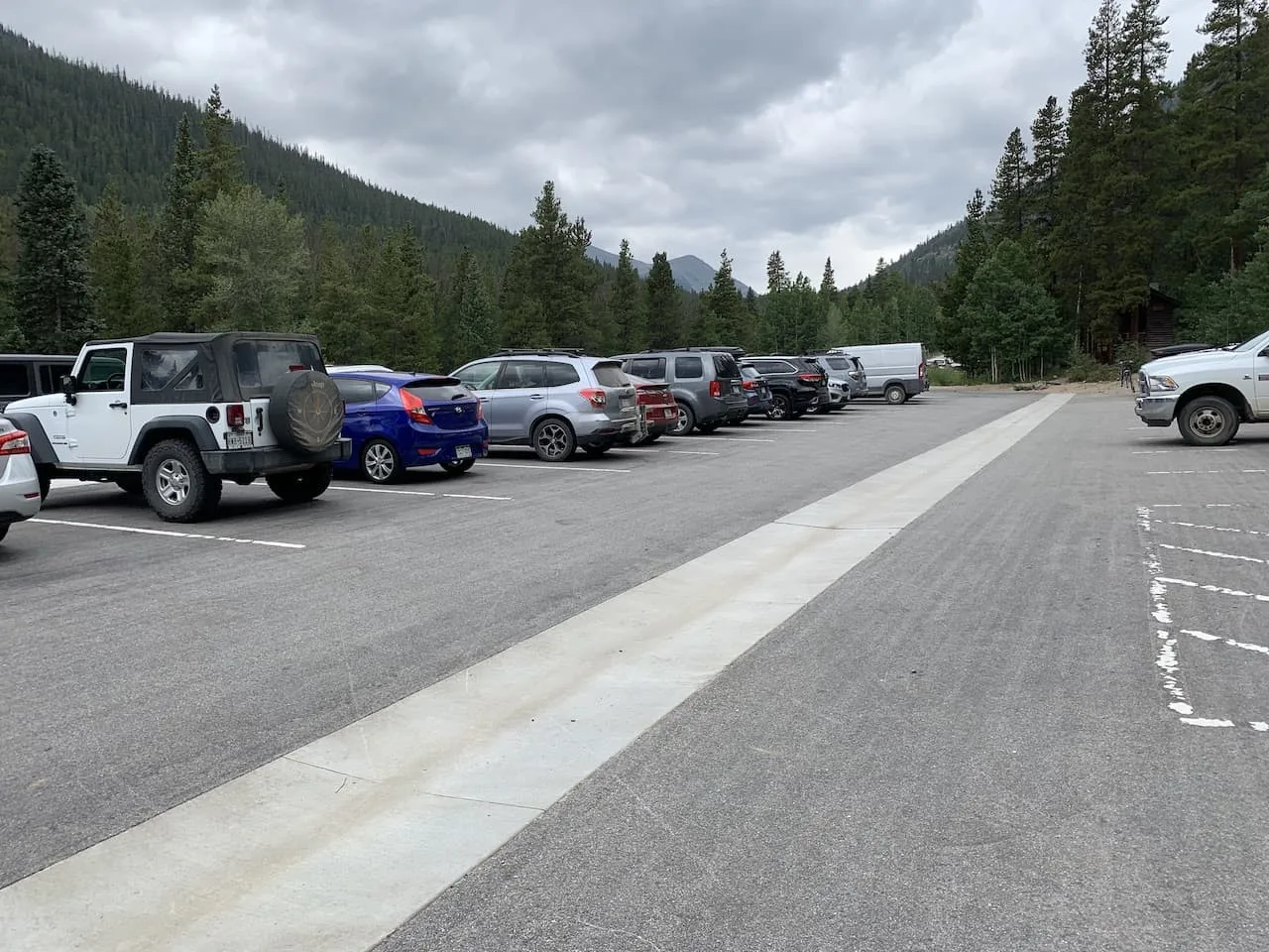
The trailhead for Mt Yale is at Denny Creek, located right off the side of County Road 306. It is a very easy trailhead to get to as there is a big parking lot on a main road, and there is no need to worry about 4WD or dirt roads.
Distance and Elevation Gain
The round trip trail along the main Southwest slopes route comes in at 9.5 miles and 4,300 feet of elevation gain from the parking lot to the summit.
How Long Does it Take to Climb Mount Yale?
Depending on fitness levels Mount Yale should take around 5-8 hours to complete round trip. Around 5-6 hours on the faster side, 7-8 hours as an average time, and 8+ hours on the longer end.
How Difficult is Mount Yale?
I would classify Mount Yale as a moderately difficult hike altogether. For the most part, the hike is not technically demanding. However, the trail still entails nearly 10 miles of hiking with 4,300 feet of elevation gain.
Couple that with the fact that there is some class 2 scrambling involved, it can be difficult staying on your feet for the 7-8 hours of hiking.
I wouldn’t recommend this as your first 14er to go after but it is a great mountain to go for after you have gotten some easier ones done.

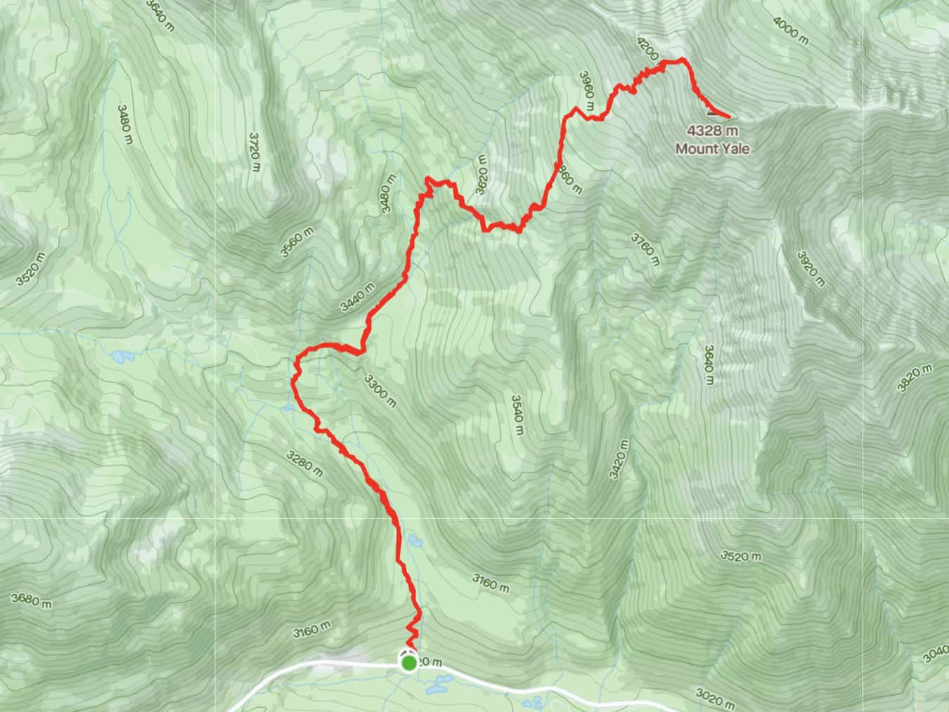
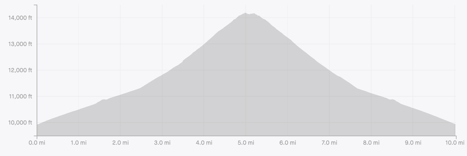
2) Mount Yale Trail Map and Elevation Gain Profile
Below is the Mt Yale trail map and elevation gain profile for the hike. From the trailhead, the hike starts in the forest for the first 3+ miles of the hike, before getting above the tree line.
From the top of the tree line, the trail then begins to get steeper as you head on up to the summit.

3) Mt Yale Trailhead & Directions
The Denny Creek Trailhead is where you will want to direct yourself when taking part of the hike up Mt Yale. Just to be certain, the GPS coordinates of the trailhead are 38°48’53.6″N 106°20’04.1″W.
The trailhead is located directly off the side of the road of County Road 306.
Here you will find a large parking area that can fit 40+ cars. In addition to the main parking lot, there is a spillover lot located right next to the main lot that can hold another 15 or so cars.
Colorado Car Rental: Looking for a rental car in Colorado? Check out Rentalcars.com for a variety of options that can work well on your trip.
Getting to the trailhead is pretty straightforward altogether. From US 24, you simply will make the turn onto County Road 306 once you hit Buena Vista. In Buena Vista the road is called Main Street which extends into 306.
Head down County Road 306 for 12 miles, where you will see the parking lot on your right-hand side (note the spillover lot is located just prior to the main lot).
This also happens to be the road of the Cottonwood Pass. If you continue along further, you will get some chances to take in great views of the surrounding mountains and valleys. You can also find the Ptarmigan Lake trail nearby. Below is a map showing the drive from Buena Vista to the trailhead.
4) Mount Yale Camping
There are several camping possibilities when going about a climb up Mount Yale.
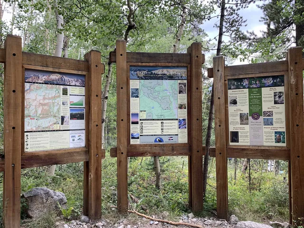
Just a mile prior to the trailhead you will find the official Collegiate Peaks campground. If you are looking for a free option, there are several spots along 306, where you can find a spot. One of these options is across the street from the Avalanche Trailhead.
Another option here is to camp along the trail itself. During my hike up, I did see a few camping sites set up within the first few miles of trail.
» If you enjoy this hike, check out the Missouri Lakes & Fancy Pass loop trail for another amazing trail
5) Mount Yale Weather
The weather is probably the most important thing to consider when going about a hike up Mount Yale.
Hiking in Colorado (especially at elevations like this) can get quite dangerous when the weather turns for the worst.
Before heading out for the hike be sure to check the mountain forecast for the day. It is very important to check the mountain weather and not the weather for the nearest town. The weather in the mountains can be much different than the weather on the ground.
For Colorado 14ers, I like to check a few different sources to get the most up to date and accurate forecasts:
If you are hiking in the summer months, be on the lookout for those afternoon thunderstorms.
While the day can start nice and clear, the weather can turn quickly. The last thing you want is to be caught above the tree line during a thunderstorm.
Always be sure to understand the forecasts and get an earlier start to the day just in case.
6) Colorado Hiking Tips
Read up on some helpful Colorado hiking tips before taking on the trails.
Be aware of the elevation: hiking at altitude is no joke and you need to ease your way into the trails. Before taking on hikes from the start, give yourself a day or so to acclimatize.
Stay hydrated: to help with the altitude and the hiking itself, stay consistently hydrated. Take plenty of water and consider a Katadyn Filter Water Bottle for the trail.
Bring bug spray: the bugs can be out in full force on many trails. Put on some bug spray to keep yourself protected while hiking.
Apply sunscreen: the sun can be very strong in the mountains. Applying sunscreen (and wearing a hat / sunglasses), will be very important when it comes to protecting yourself.
Keep an eye on the forecast: the weather can turn suddenly out on the trails. Be sure to check the weather forecasts beforehand to avoid rain & thunderstorms. Afternoon storms can be more prominent in the summer months (so start early!).
Download offline maps: to keep yourself on track, download offline maps for the trail. This can be done by using navigation apps such as AllTrails, Maps.me, and Gaia. You should also download offline Google Maps, as cell service does not always work closer to the trailheads.
Check trail conditions: before committing to a trail, I would recommend looking at the latest trip reports on AllTrails (or 14ers.com for 14er hikes). This is more so important as the summer season starts & ends, as you can get a better idea of trail conditions & snow coverage.
Hiking Resources & Checklist
Before heading out for the trails, be sure to read up on some of the hiking resources up on the site. These are here to better prepare you for all types of outdoor adventure.
- Gear: Hiking Packing List
- Weather: How to Prepare for Hiking Weather
- Navigation: Hiking GPS & Navigation
- Tips: 20+ Hiking Tips & Tricks for the Trail
- Accommodation: Book Your Hotel Today
- Rental Car: Book Your Car Rental Today
7) Mt Yale Hike
Once you arrive at the trailhead and park your car, it is time to head up the trail. The trailhead itself is located in the center of the parking lot, so just make your way there to begin the hike.
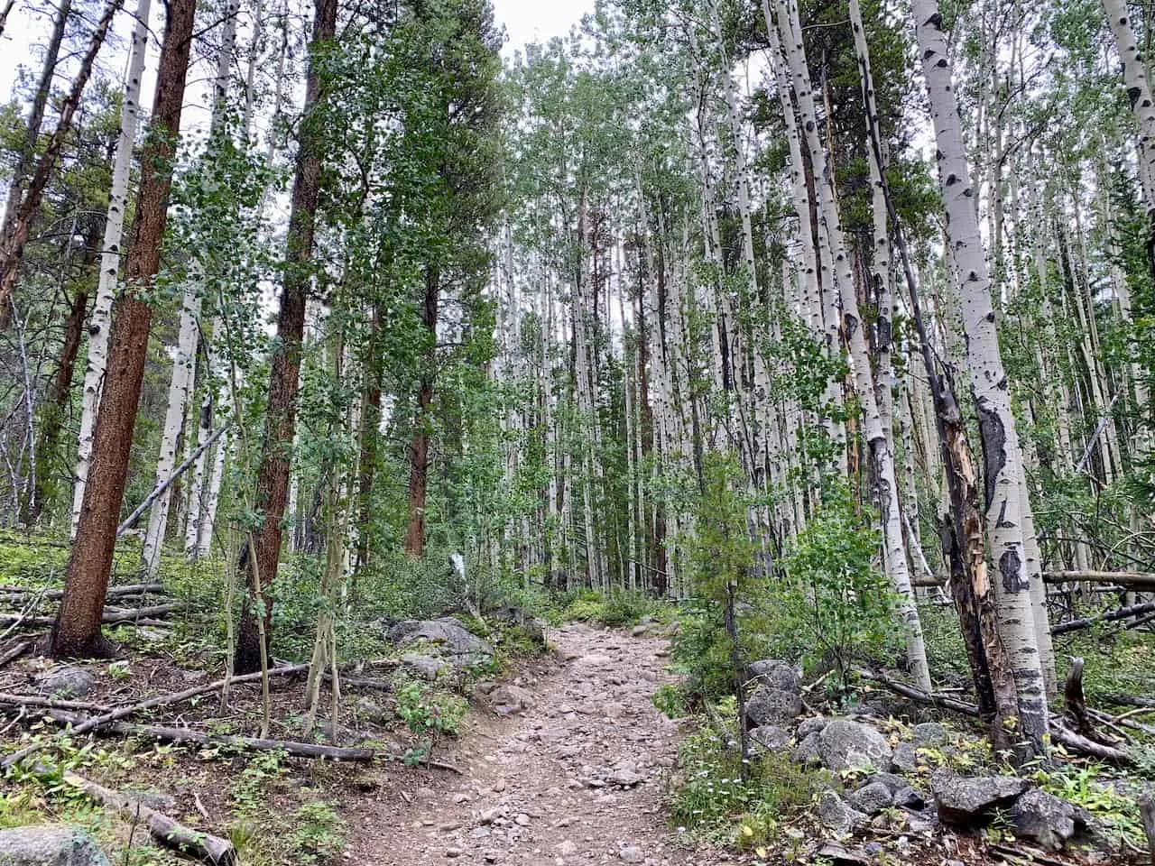
The trail in the forest is quite long as it does make up just over 3 miles and 2,200 feet of elevation gain.
As you can tell in the elevation gain profile from above, the first few miles are on a less steep incline. It is really once you are above the tree line that the grade gets steeper.
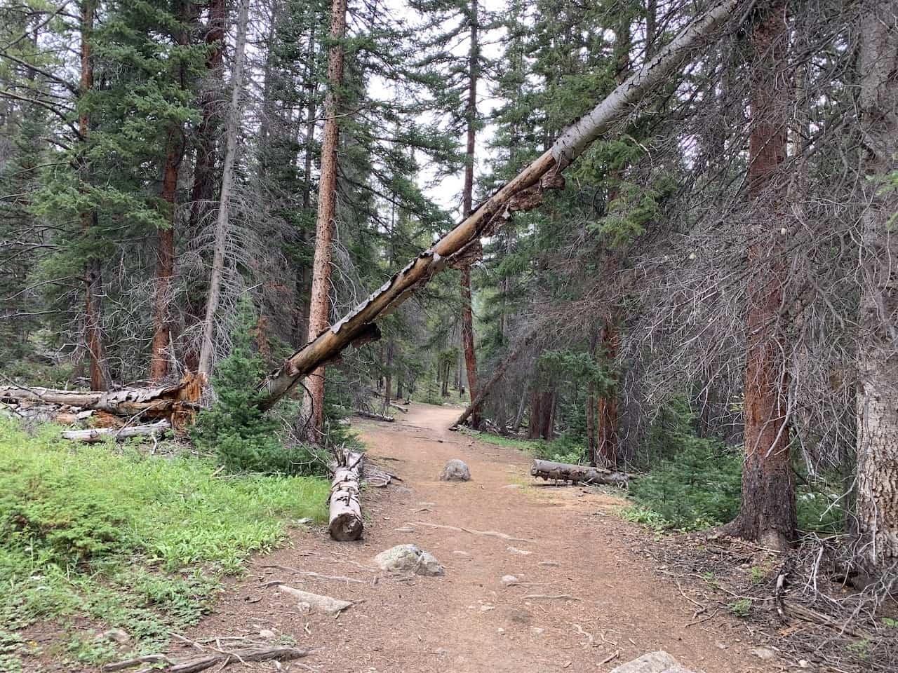
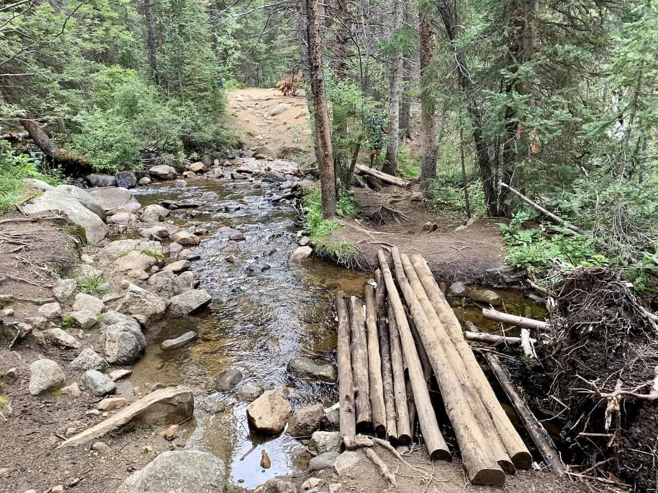
The trail is nice and easy to follow for the most part as you walk the dirt trail further up through the forest and cross a couple log river crossing along the way.


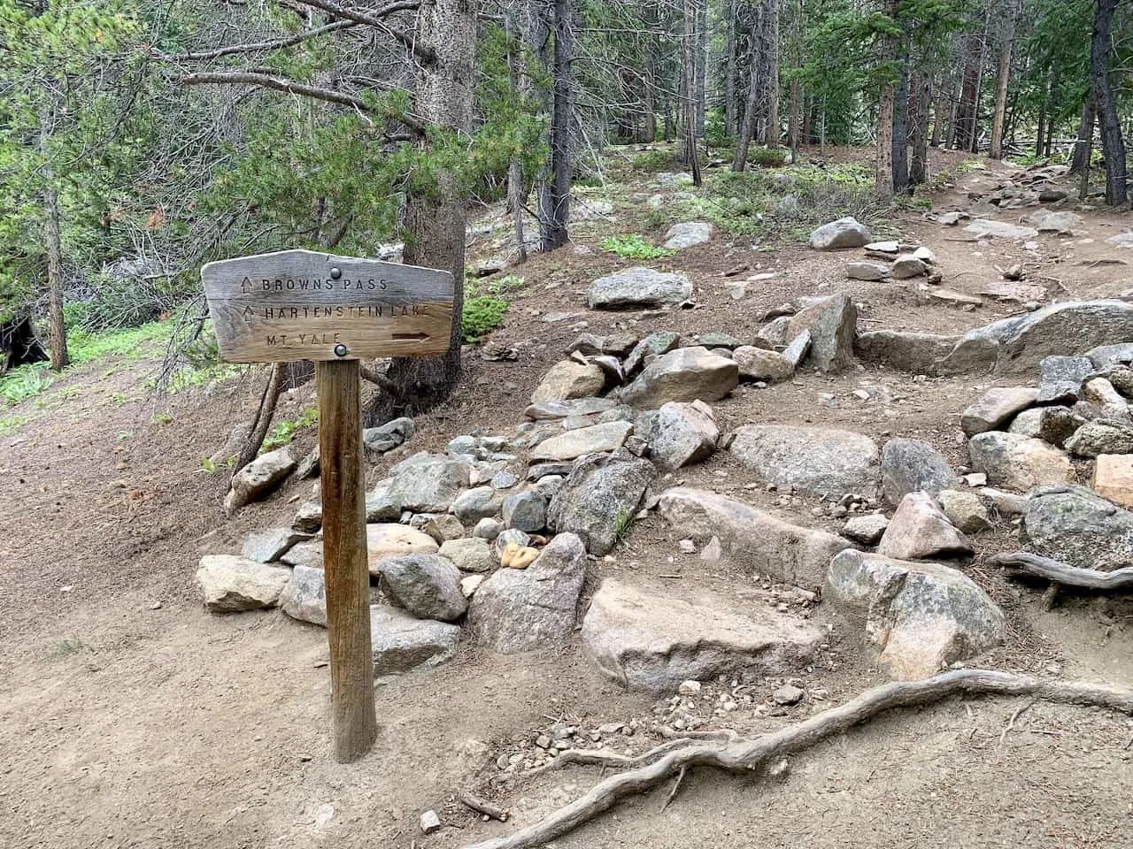
At the 1.5 mile mark though, there is a very important intersection to pay attention to.
To your right will the trail up Mount Yale while to the left is the trail pointing towards Brown’s Pass and Hartenstein Lake. This is easy to miss in the dark if heading up prior to sunrise.

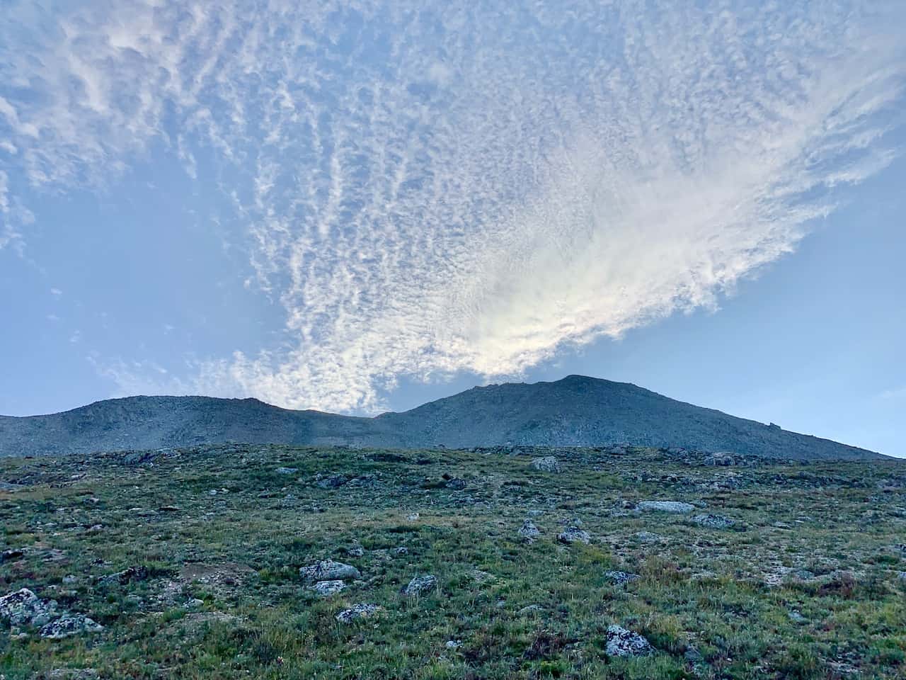
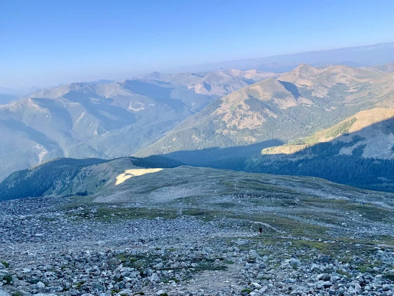
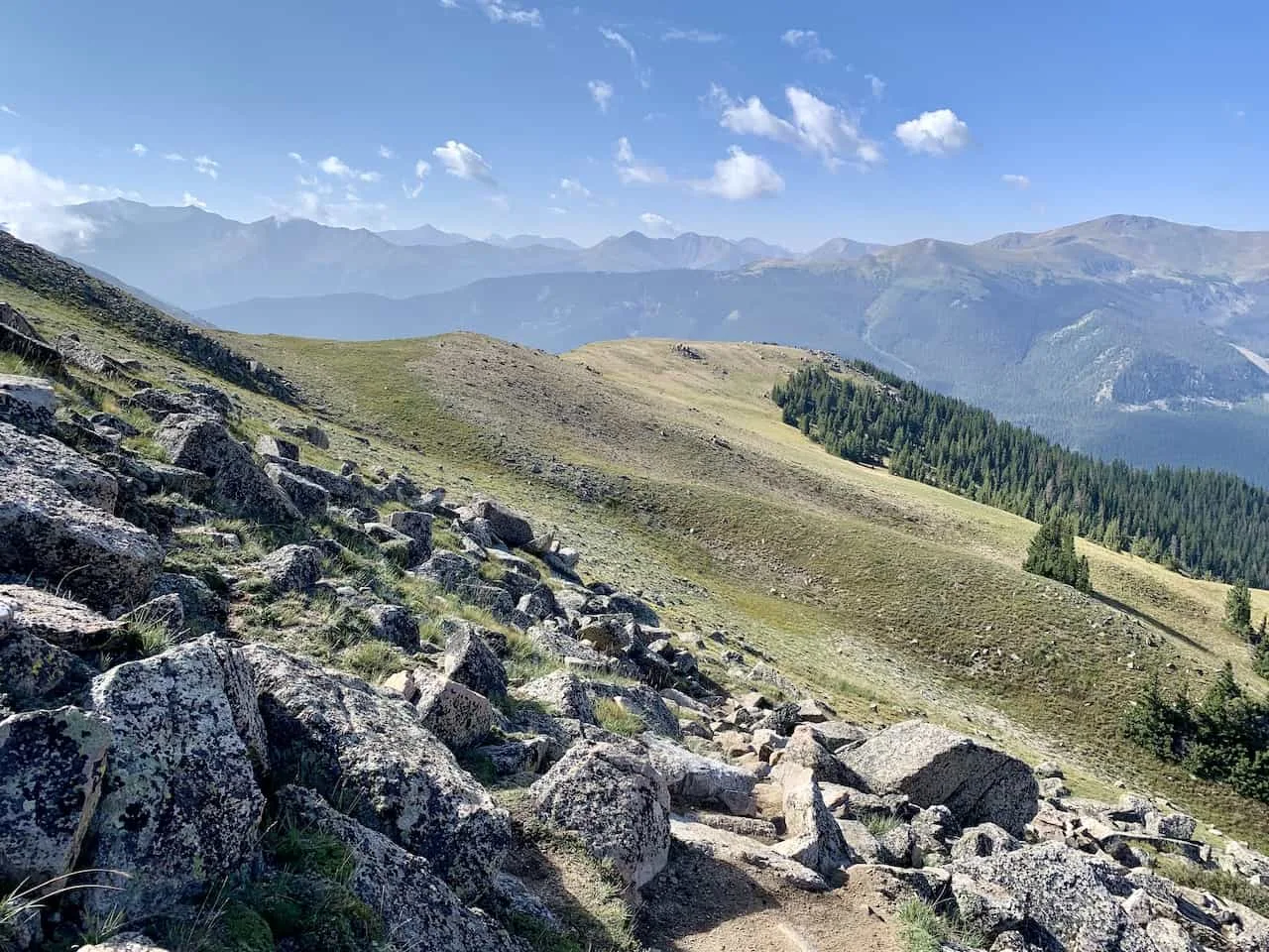
The trail continues to gain elevation as you get further up the mountain. Soon you will exit the dense forest area as you begin to have some views of the surrounding mountains.
There are then a few switchbacks to make your way across before the trail gets above the tree line completely.
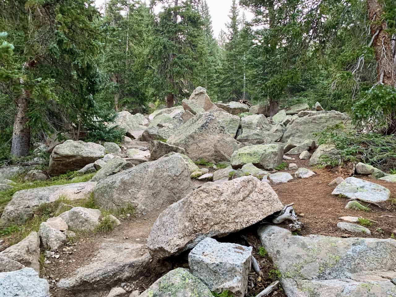

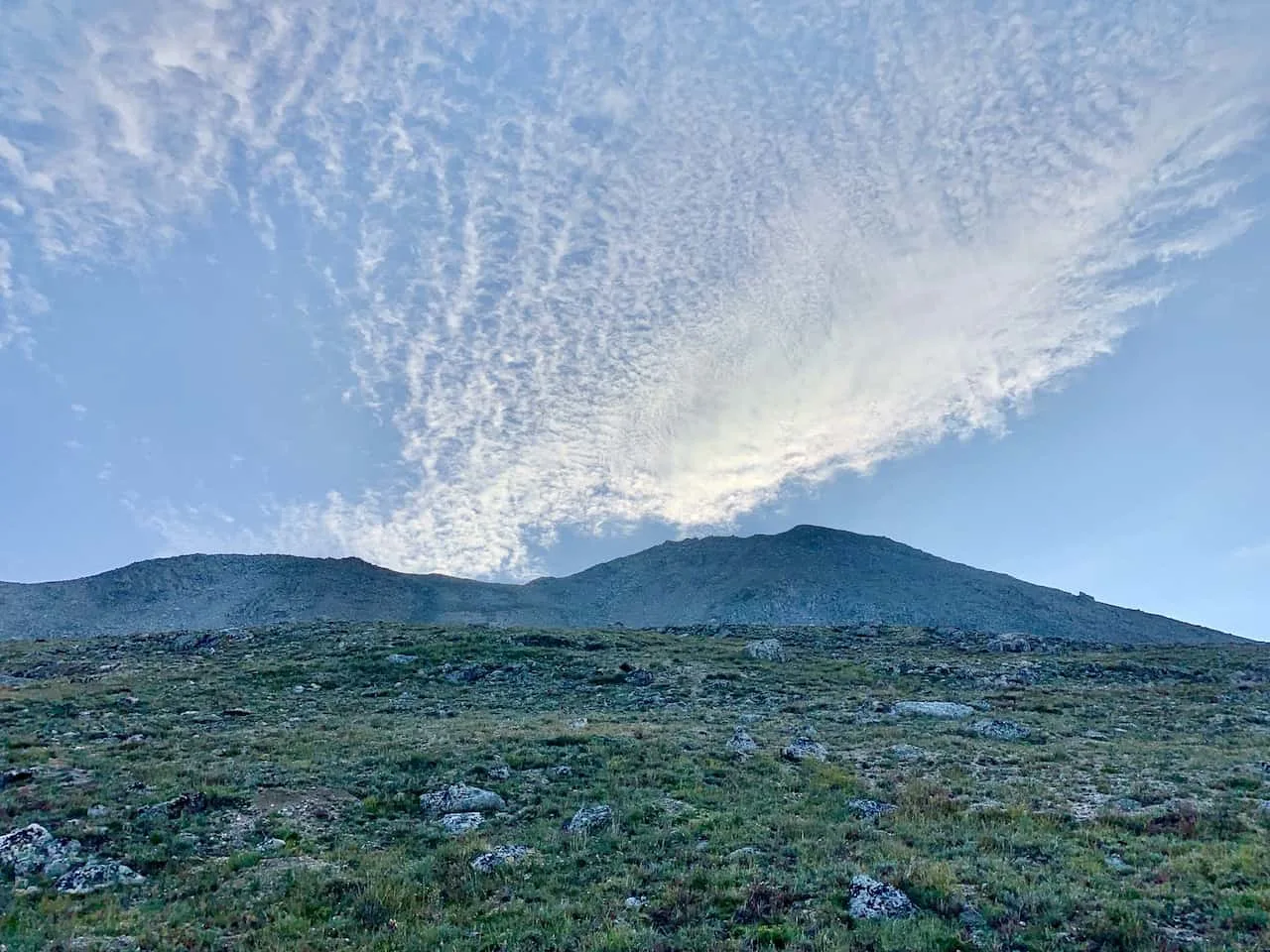
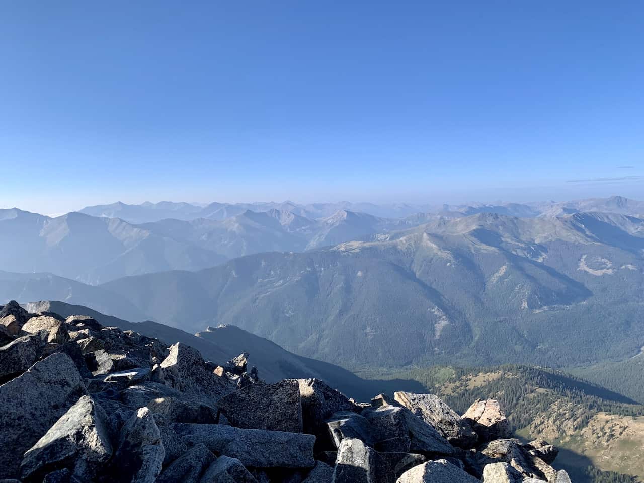
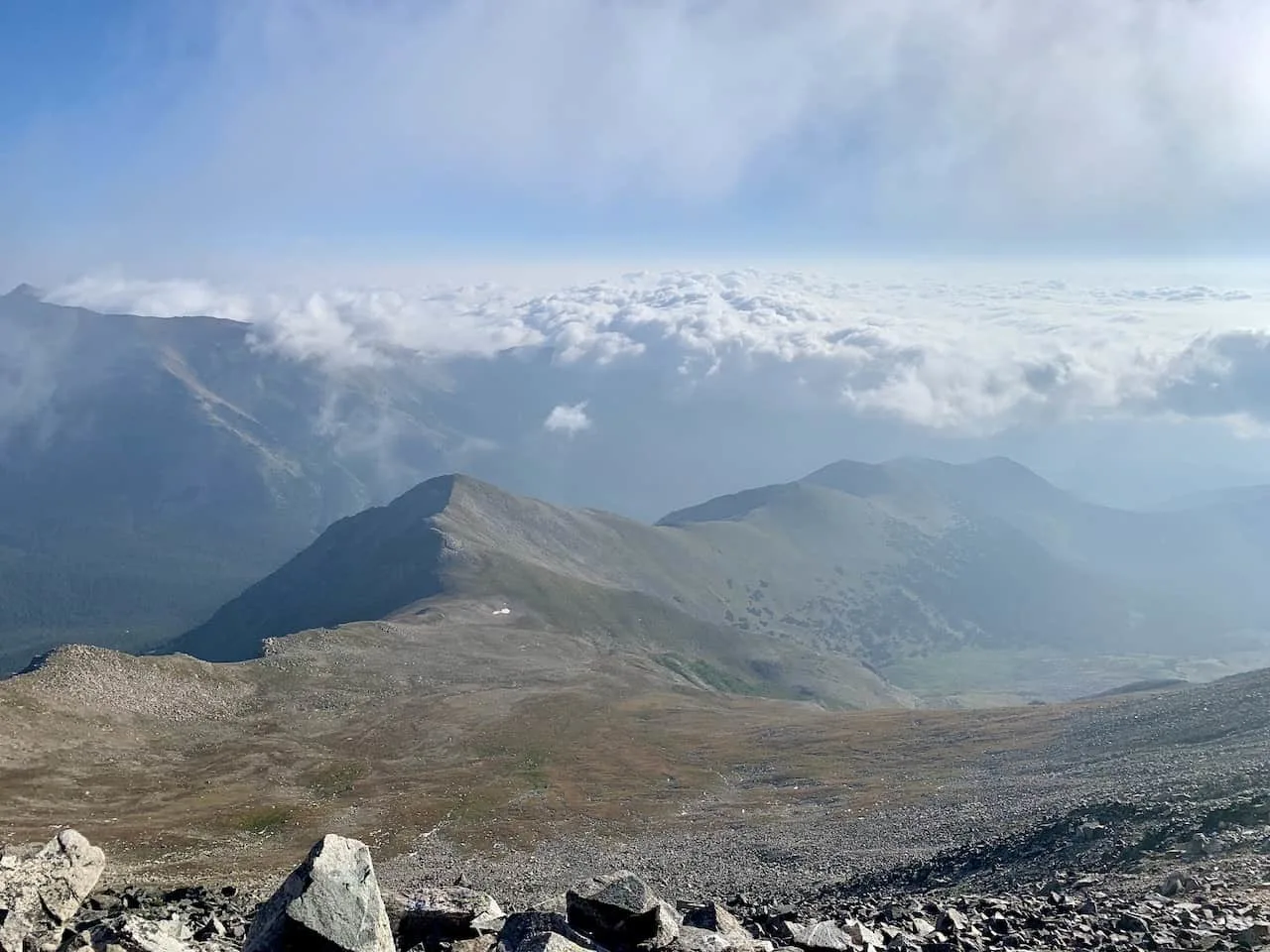
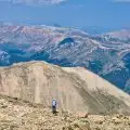
Once above the tree line, the path does begin to get just a bit more tricky as there are some rocks to maneuver around as well. As you climb up here, you will see Mount Yale out in the distance high above.


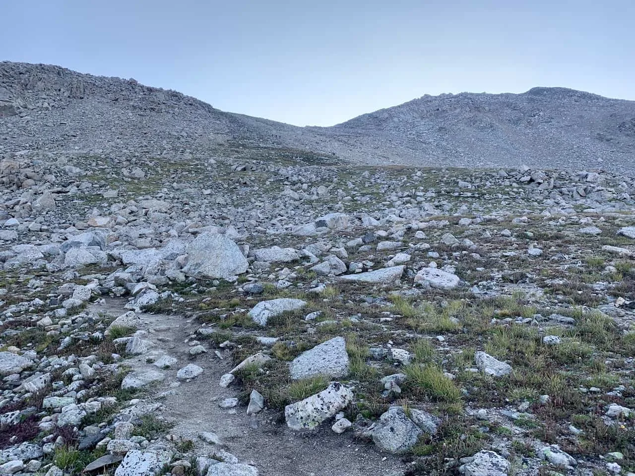
You will soon reach a point where the trail flattens out just a bit as you get closer to the base of the mountain.
From the base of the mountain though, the trail picks up that elevation at a faster pace as the switchbacks begin towards the summit.
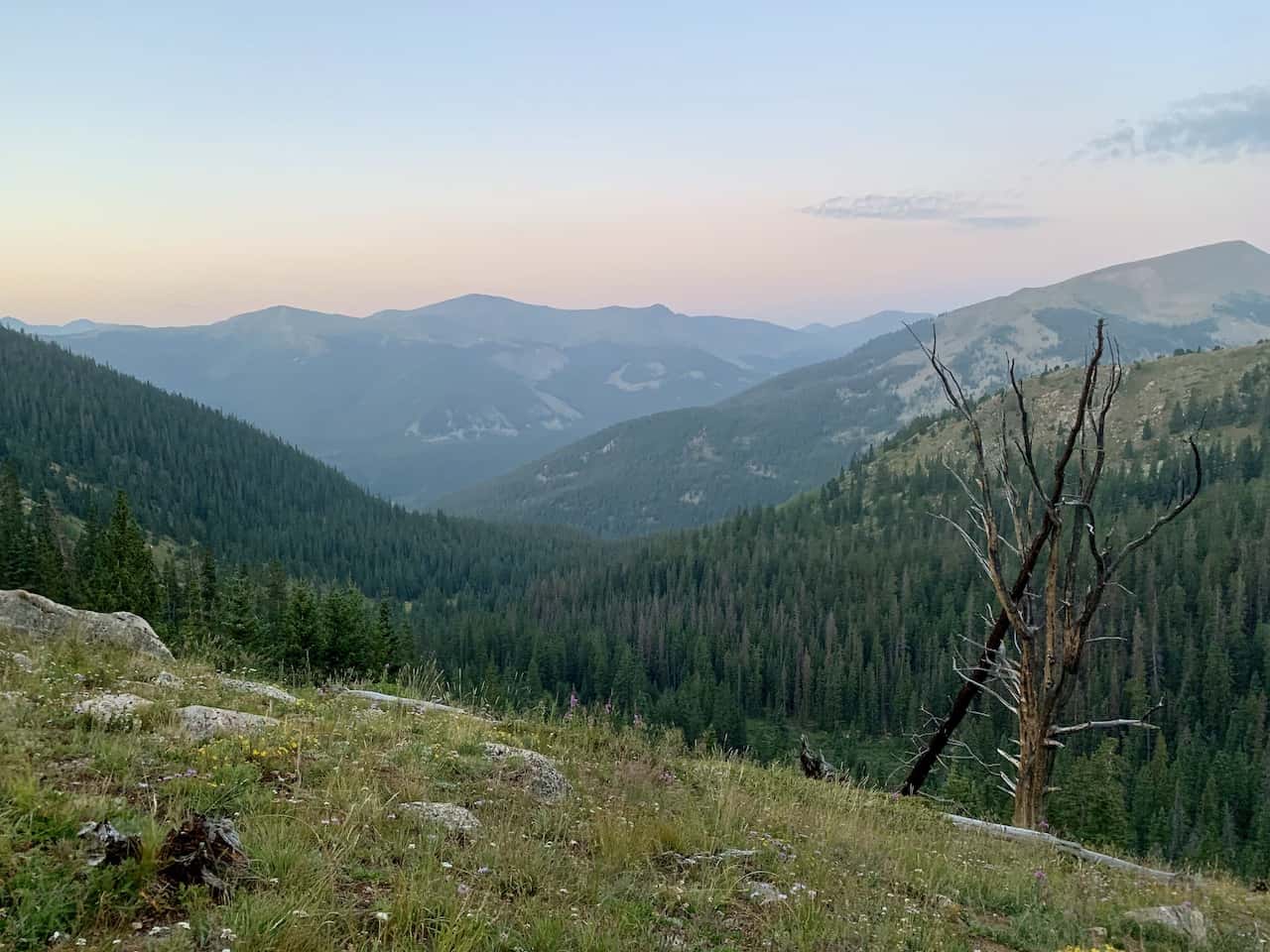
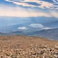
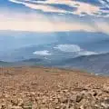
While there is just one easy path to follow here as you zig zag your way up, it can get quite tiring at times. I would recommend taking several breaks along the way and enjoying that beautiful view in the opposite direction.

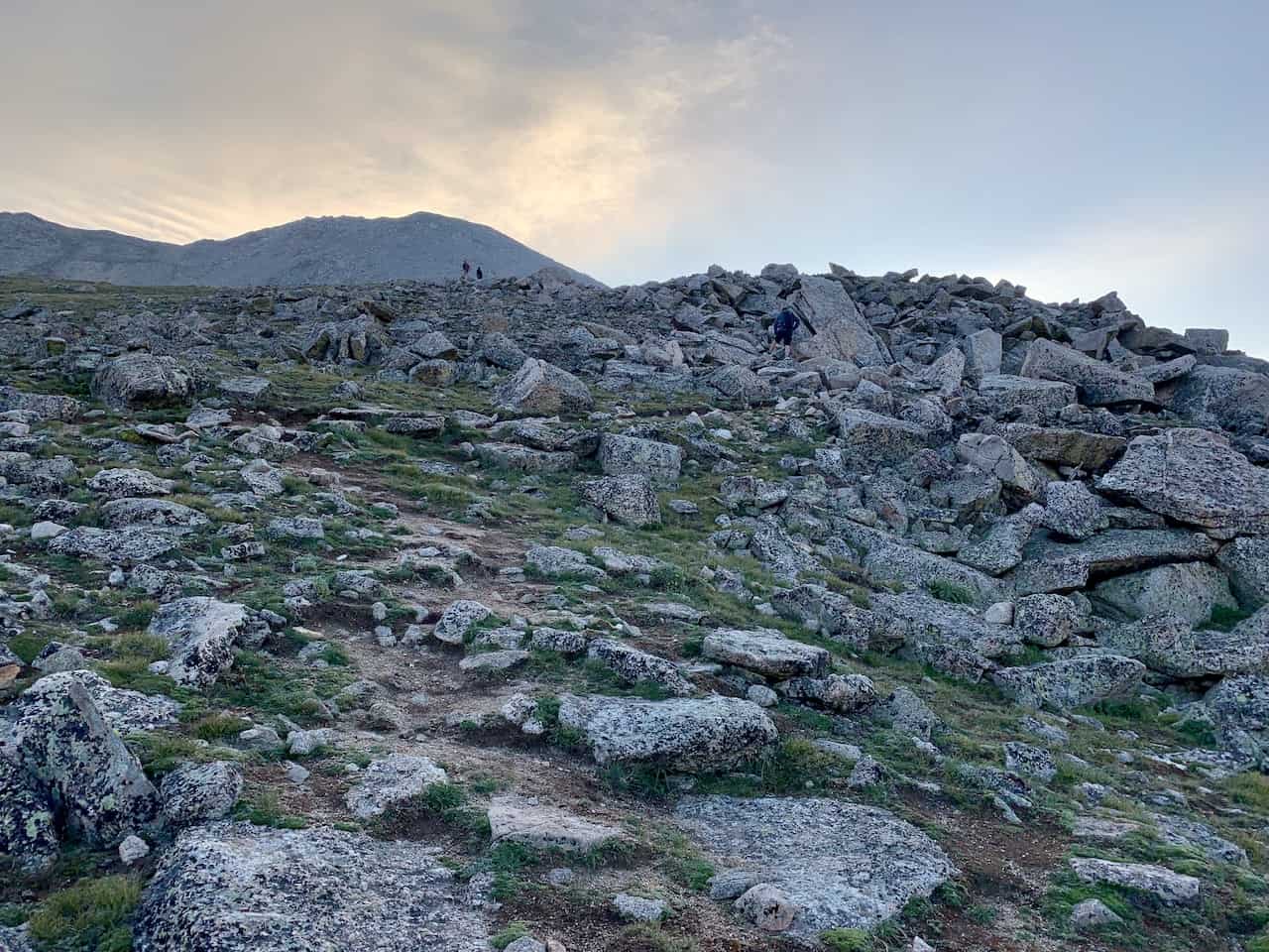
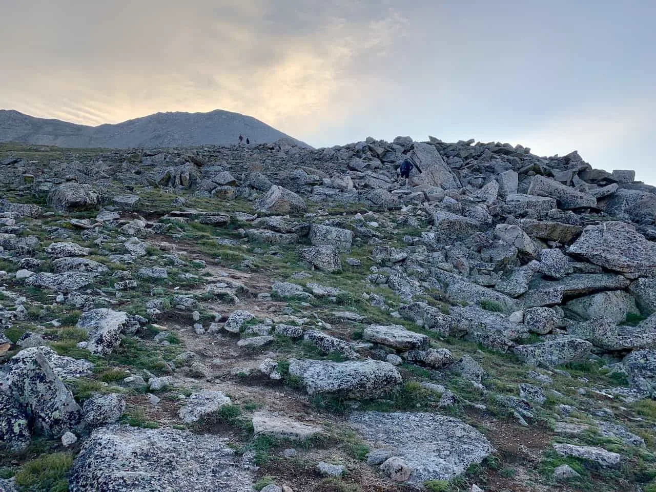
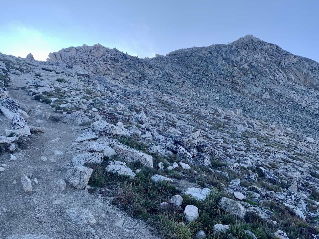
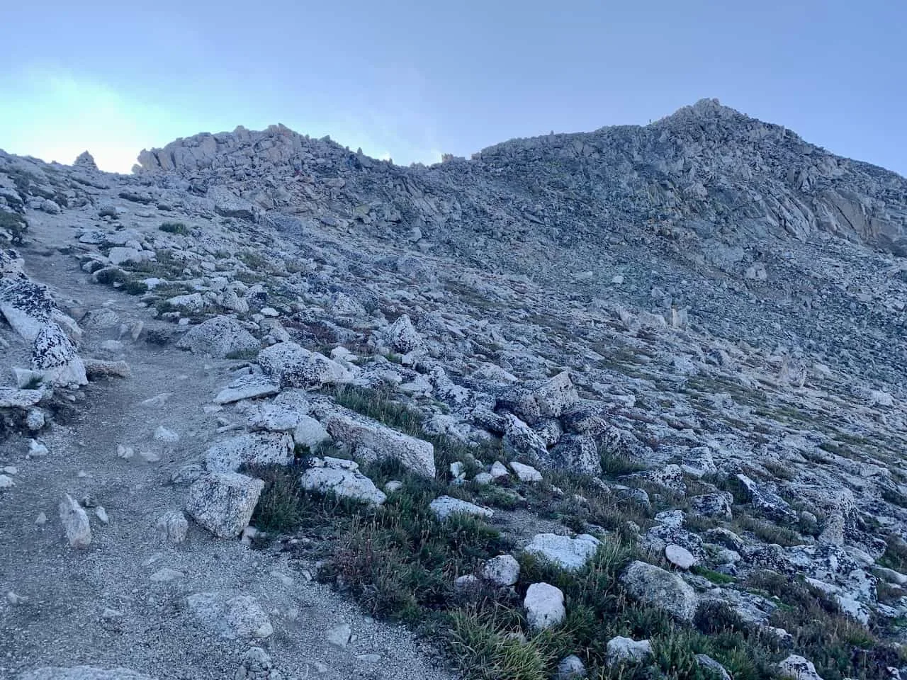
After around half a mile of switchbacks, the trail does start to turn into that class 2 section along the ridge and towards the summit.
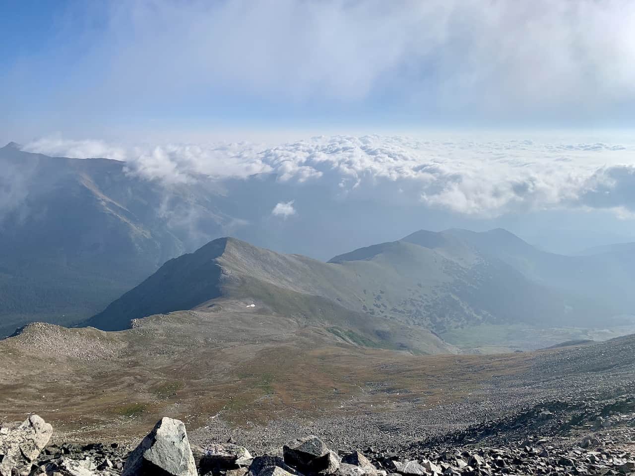
From here you will leave the dirt path behind and begin the rocky traverse along the ridge. Along the way you will want to follow those rock cairns that will help guide you with the easiest pathway up.
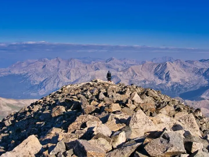
The last few hundred yards of the hike is a bit more of a scramble to the top. You must be very careful on this section and you have to be comfortable with even using your hands in certain spots.
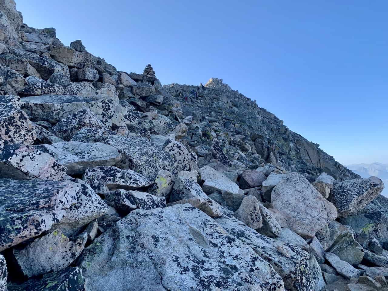

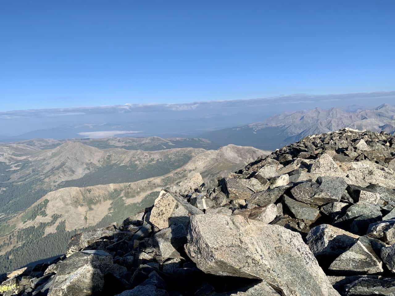
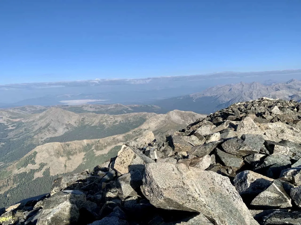
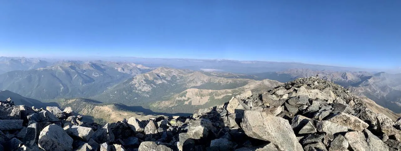
After getting yourself up to the top of the ridge though, it is then just an easy walk across towards the main summit area.
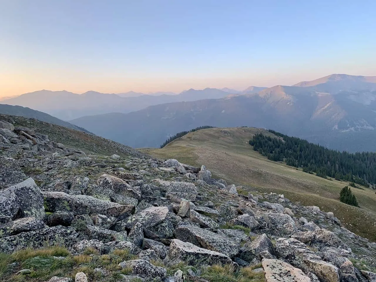
From there you should get some great views all around as you enjoy summiting one of the best 14ers in the area.


From the summit it is then turning back around, heading down the ridge (be careful here!), and making your way back down towards the parking lot to end a successful day out on the trail.

8) Where to Stay
While there are many places you can choose to base yourself around the area, I would recommend staying in either Leadville (60 minute drive) or Buena Vista (20 minute drive).
Leadville is north of the turnoff from US 24 and Buena Vista is right alongside of it.
These are great places to stay if you are looking to not only hike Mt Yale but also many of the other 14ers around the area. Below are a few highly recommended places to stay in each of them.
Leadville
Buena Vista
- Surf Hotel & Chateau
- Best Western Vista Inn
- Mount Princeton Hot Springs Resort (just outside town)
That about does it for a guide to the hike up Mt Yale. If you have any additional questions or comments, be sure to add them in below.
Looking for More 14ers? Check out some more Colorado hiking guides for nearby peaks in the area including:
– Mount Elbert
– Huron Peak
– La Plata Peak
– Mount Harvard
– Mount of the Holy Cross
– The Decalibron
– Quandary Peak
– Mount Massive
Have fun out there and safe travels!


Alex Lewis
Friday 22nd of May 2026
I've read a dozen pieces on this and yours actually said something new. Appreciate the time you put in.
download workshop manuals
Monday 9th of March 2026
i really enjoy reading this masterpiece, i can see a lot of effort were invested into this article, keep up the good job, check out our site at workshopmanuals.co for more information. Thank you
gebäudereinigung berlin
Sunday 22nd of February 2026
this is one of the best article i have came across for very long time, i enjoy reading your article, you really have put on a lot of effort and work, gebäudereinigungberlin24.de is the best building cleaning agency in berlin
james kunor
Friday 20th of February 2026
thank your for this article, keep up the good work
peter larryson
Friday 20th of February 2026
thank your for this article, keep up the good work