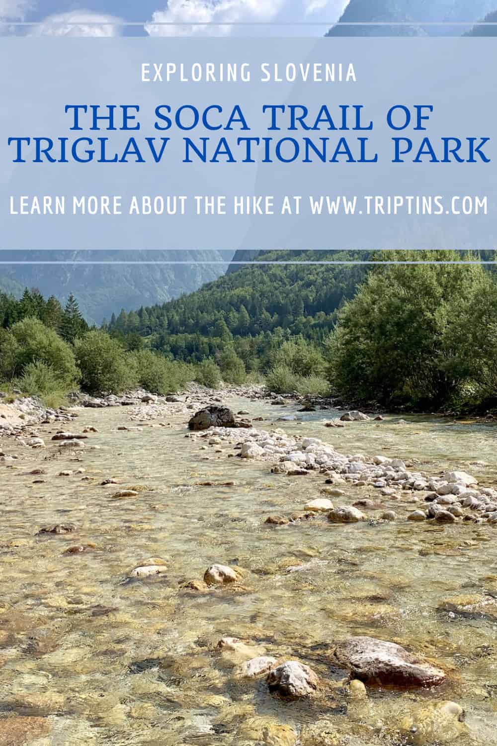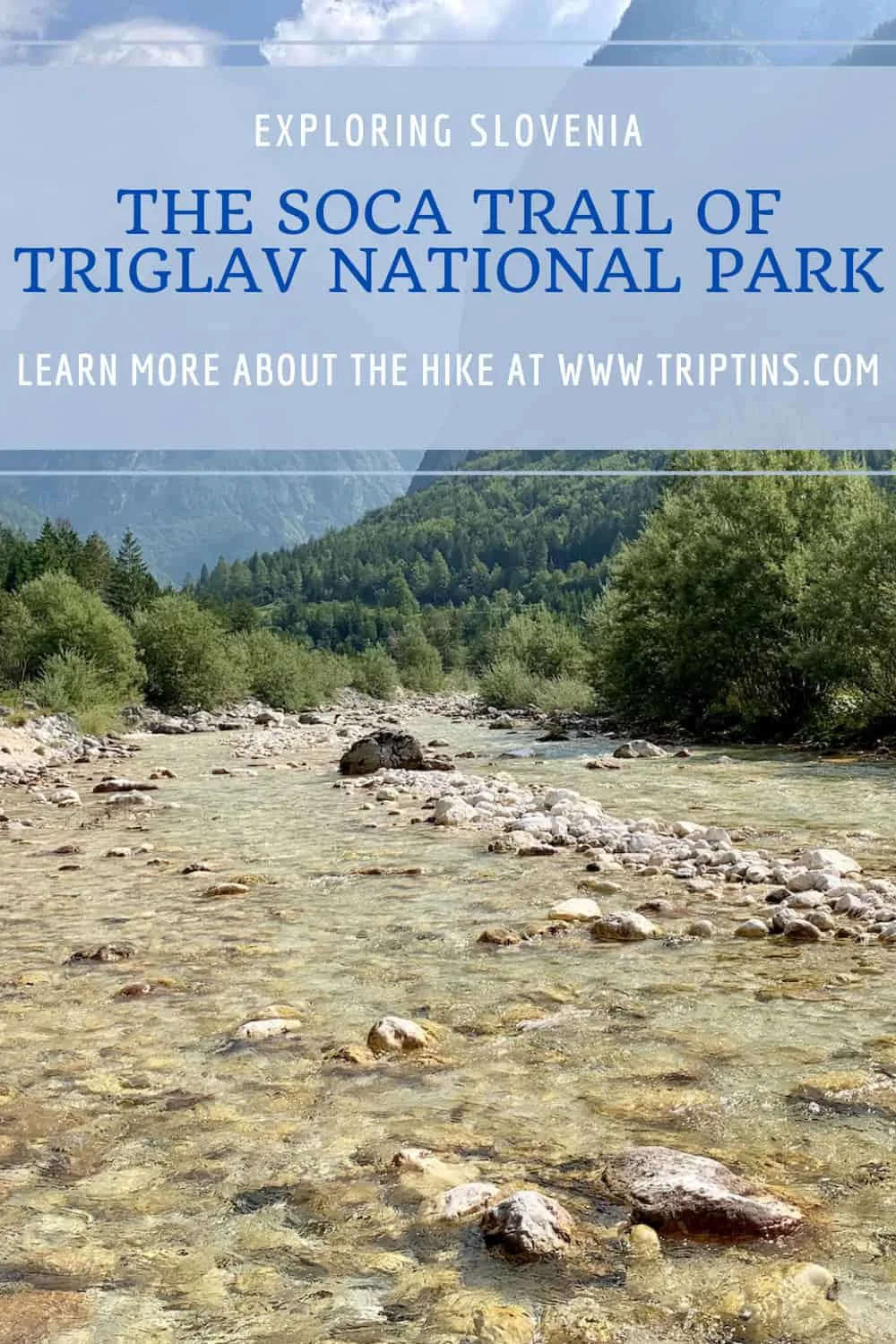
The Soča Trail of Triglav National Park in Slovenia is a 25 kilometer / 15.5 mile hike that starts at the source of the Soča River and ends in the town of Bovec.
All along the way, the stunning turquoise waters of the Soča River will be in view as you hike alongside it, cross bridges over it, and even jump into the river itself.
This hiking guide will go into detail on how you can take part of the entirety of the trail from the source of the river all the way to Bovec and help answer any of your questions along the way.
This truly is one of the best hikes in Slovenia and I hope you get to enjoy it during your time visiting the country.
* Affiliate Disclosure: This post may contain affiliate links, which means I may receive a commission if you make a purchase through the links provided, at no additional cost to you. Thanks for supporting the work I put into TripTins!
1) Soča Trail Overview
The Soča Trail is a one-way route that starts at the Source of Soča River and winds its way along the river ending in the town of Bovec.
During the trail there are also many points of interest that you will pass by such as gorges, waterfalls, monuments, viewpoints, and more.
Here is an overview of the Soča Trail to get you a bit more familiar with what it entails:
Soca Trail Starting Point
The starting point of the trail is at the Source of the Soča River, also called Izvir Soce.
Since this is a one way hike, you must take the local bus from Bovec to Izvir Soce first thing in the morning and begin the hike from there. I will speak more in detail about the bus route in the coming sections of this guide.
While you can do the hike in the opposite direction, I would advise against it for two main reasons.
The first being that it will be harder to time yourself back to Bovec at the end of the hike, and secondly due to the hike being uphill rather than downhill in that direction.
Soca Trail Ending Point
The official ending point is located at a camping site on the outskirts of Bovec.
On Google Maps you may see camps such as Kamp Liza or Kajak Kamp Toni around the endpoint. From here it is another 2 km / 1.2 miles to the center of Bovec.
The town of Bovec is the main place to base yourself during your time in the area. It is well connected to other parts of the country and is the starting point for many other activities (such as white-water rafting).

How Long is the Soča Trail
The Soča Trail comes in at just around 25 KM / 15.5 miles. However, there are a few reasons why your hike will come in longer than that:
- The bus doesn’t stop directly at the Source, so there is extra hiking involved to get tot the starting point
- You may want to visit some of the points of interest, which are just off the main route
- The official end point of the hike is still 2KM / 1.2 miles from Bovec
I would actually plan to hike closer to 32 KM / 20 miles during a day out on the trail, taking all of the above into consideration.
Elevation Gain / Loss
The trail from the Source to Bovec actually loses elevation along the way, however there are certainly a few points where there are uphill sections.
Altogether, expect to gain around 1,200 feet of elevation and lose around 4,400 feet of elevation.
Duration
The hike can be done in 1 or 2 days depending on overall fitness level.
During my time on the trail, I ended up finishing it in 1 day, however for many, 2 days may be the more reasonable expectation. The total hiking time will be close to 10 hours for the day.
If you do plan to split it into two, along the trail there are some places to stay, which I will talk about as well in this guide.

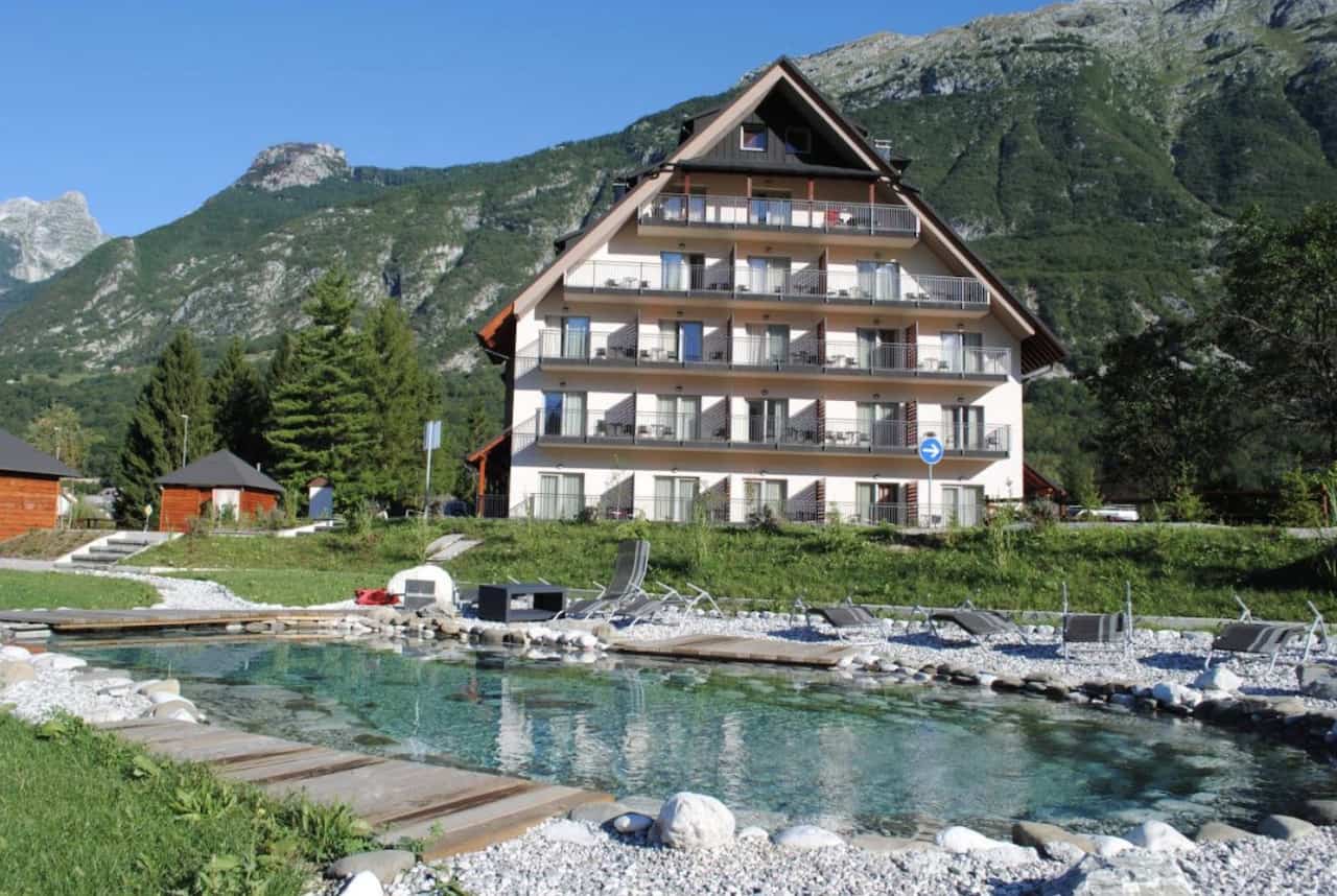
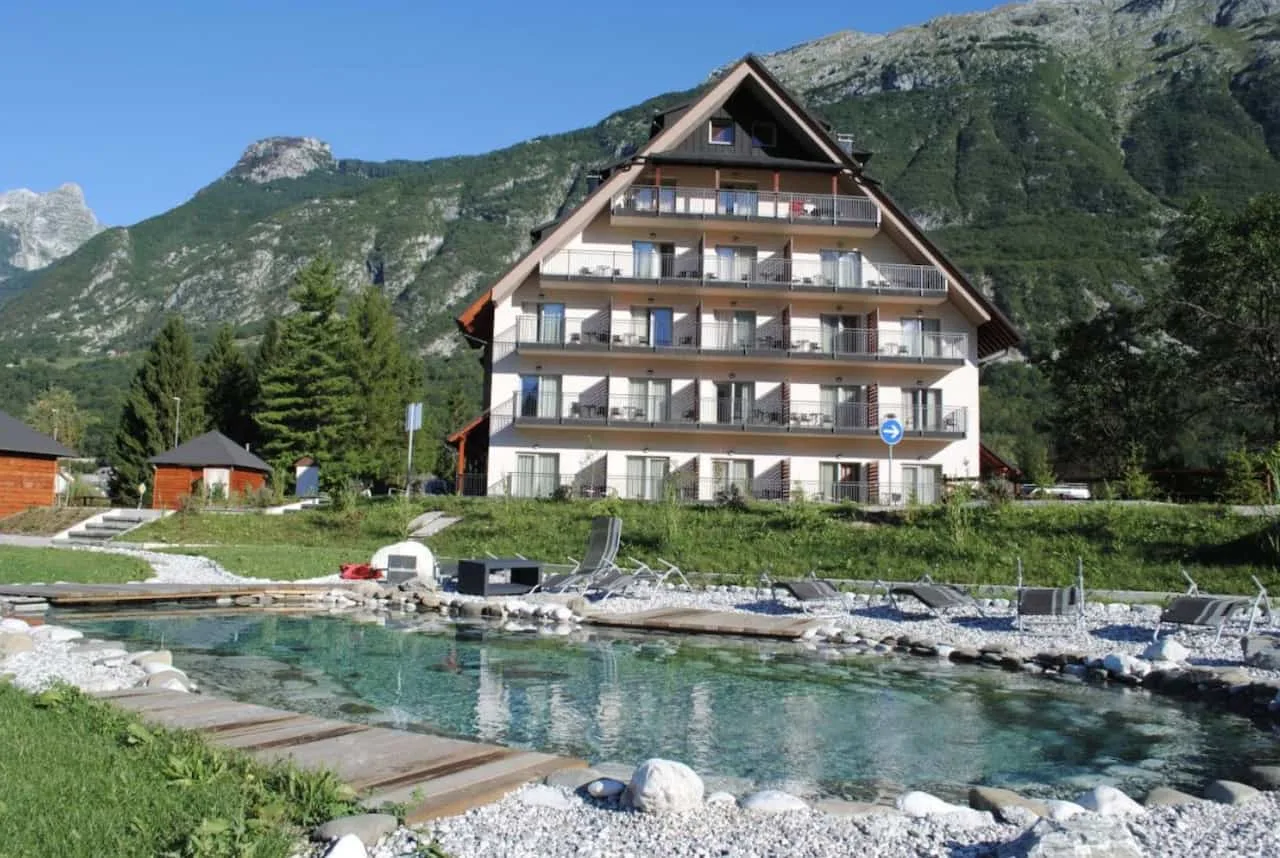
2) Where to Stay in Bovec
If you are taking part of the Soča Trail (and other nearby Slovenia hikes), you will need somewhere to base yourself before and after the hike.
The town of Bovec is the perfect place to stay as there are busses that leave from there to the start of the hike, and the trail actually ends right in town.
Here are a few highly rated and recommended options that will be great choices to stay at during a visit:
→ When renting a car in Slovenia, I would recommend checking out Rentalcars.com for potential options. You will be able to browse through cars based on price, category & other filters, to find the perfect car for your trip.
3) Soča River Trail Map
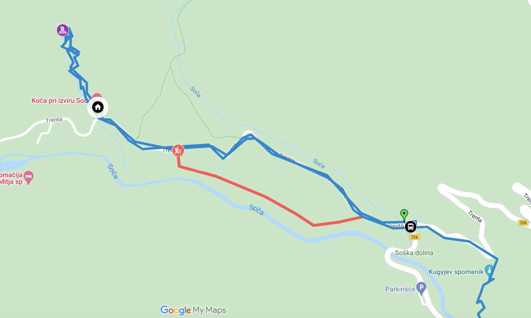
Before moving on, I did want to lay out a map of the route along with some other very important places pinpointed along the way. The map shows the view of the route from the Source of the Soča to Bovec.
Note: this is not the exact route I did as my tracking was not fully working the day I hiked it. But it still will give you a very good sense of what the trail looks like:
4) Soča Trail Bus
In order to take part of the trail, you most likely will want to utilize the Soča Trail bus that leaves from Bovec and stops near the starting point of the trail at Izvir Soce.
The bus stop in Bovec is located by the parking of the Mercator supermarket in the town center. Tickets can be purchased on the bus and costs around 3-4 Euro.

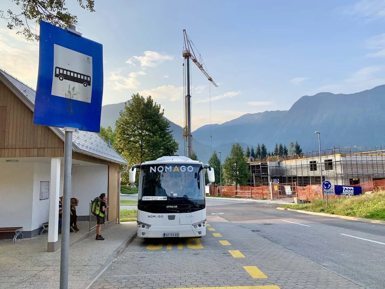
The bus route actually goes from Bovec all the way to Kranjska Gora, and along the way makes around 20 or so stops. Depending on what time of year you go, there will be more or less departures to choose from.
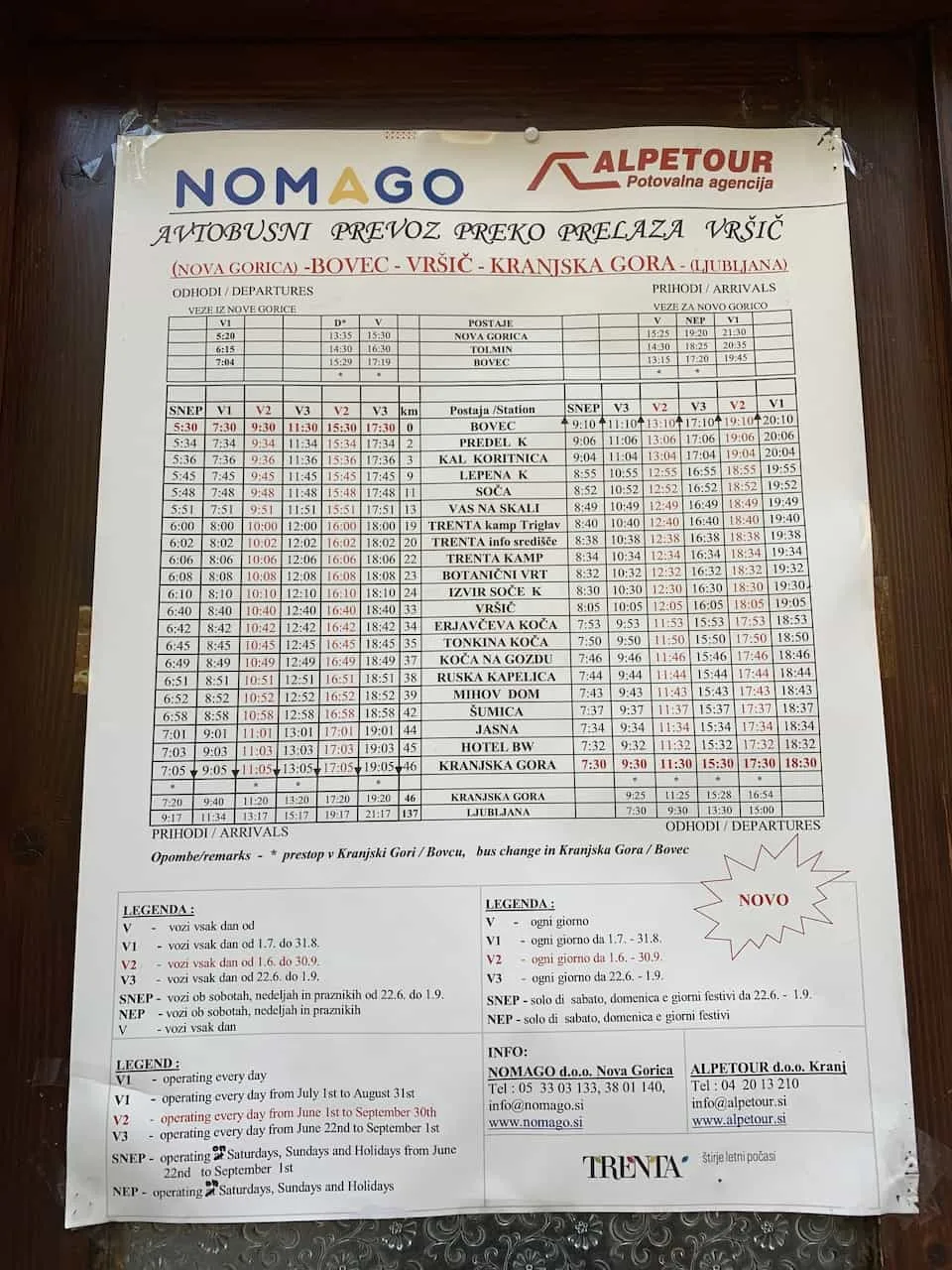
Some busses operate every day, others just for weekends, and a few that are just seasonal. Below is the bus schedule when I visited Bovec.
However, I would highly recommend taking a look at the latest schedules once you arrive in Bovec or touching base with the Bovec tourism office for up to date information.
You can see on the schedule there is a stop called “Izvir Soce K”. This will be the stop you will want to get off at to get to the starting point of the trail. The bus ride should take around 40 minutes from Bovec.

5) Where Does the Soča Trail Start
Now, once you get off the bus, you will not be directly at the starting point. This is why you will probably have more than the 25 KM / 15.5 miles to walk altogether.
The Source of the Soča River is about a mile further away along another road. So, essentially what needs to be done here, is that you will get off the bus, head a mile up towards the Source, and then retrace your steps partially to continue on the Soča Trail.
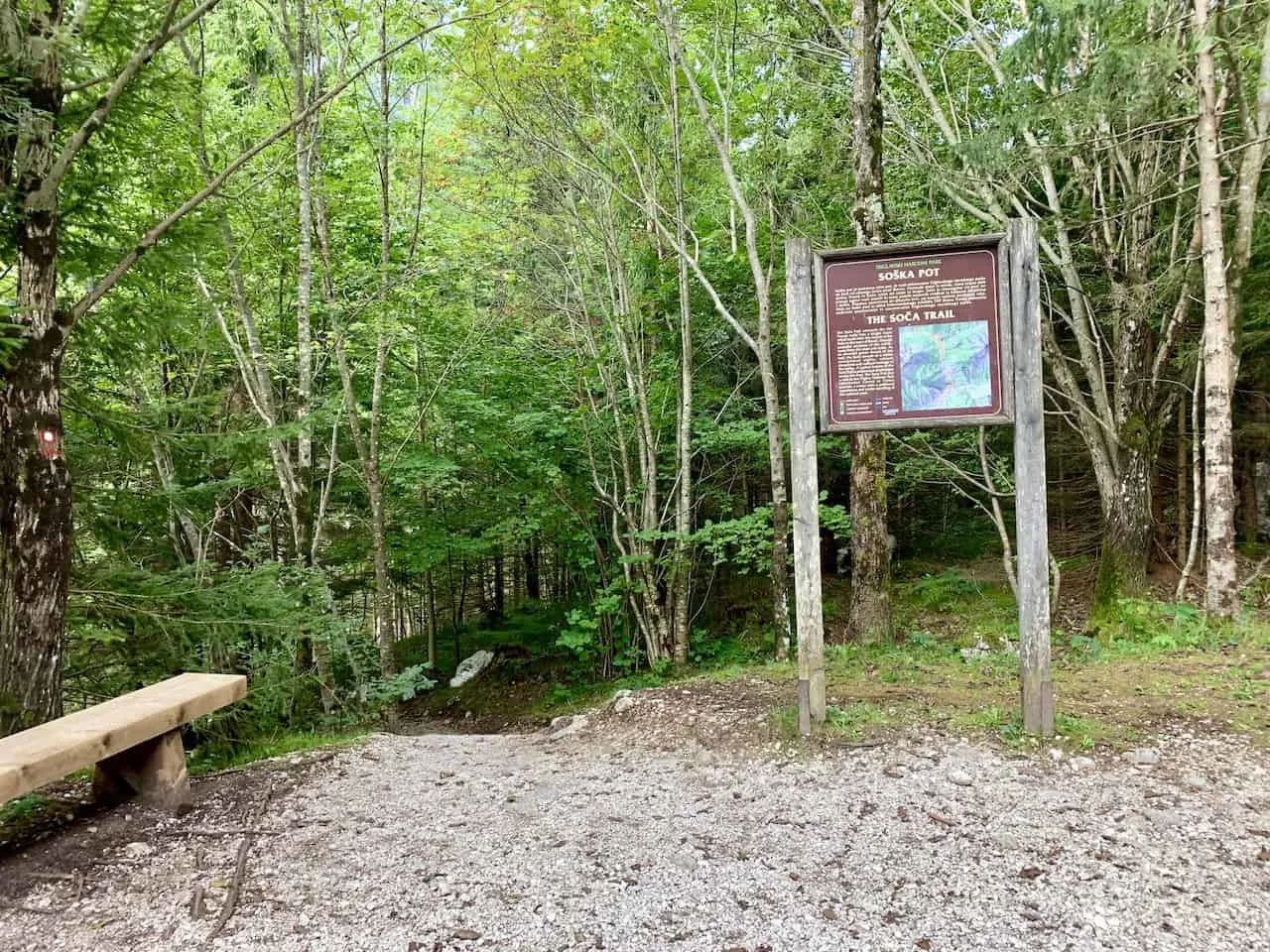
From the bus stop, you will need to follow the road to the Koča pri izviru Soče, a small mountain hut (marked on the map).
Here you will find informational sign boards about the Source of the Soča, and then continue along a short 15 minute hiking trail to the Source itself.

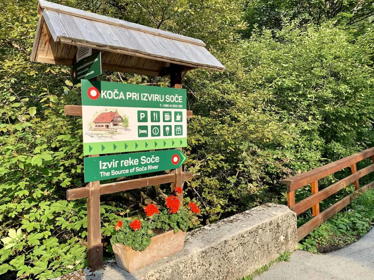
Once you are finished up at the Source, you will retrace your steps back to the mountain hut, and back on the road. As you are retracing your steps, you will see a signboard pointing you down to the Soča Trail (marked in red on the map).
Alternatively, you can just continue back down the road to the bus stop and catch the trail from there instead (marked by the main blue trail).
Zoom into the top of the map to see the starting point section of the trail (screenshot below):
6) Navigation Tips
As the Soča Trail is a very long trail altogether, I did want to mention a few tips to help navigate yourself along it.
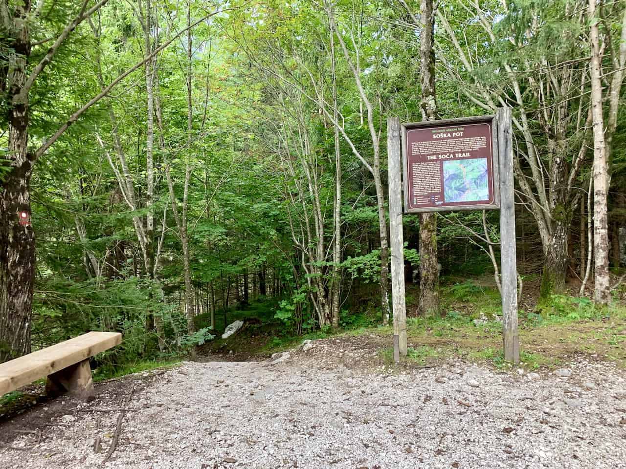
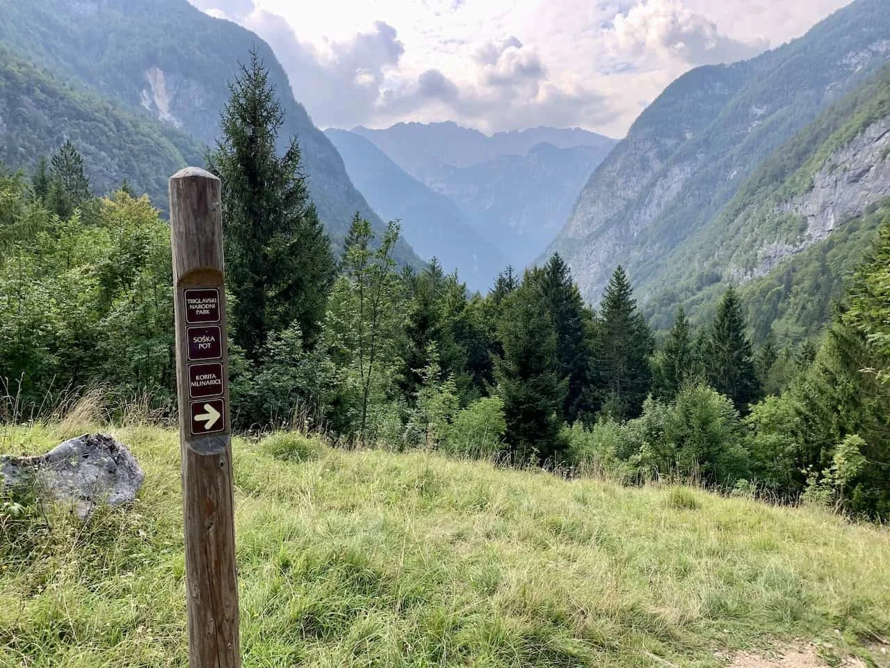
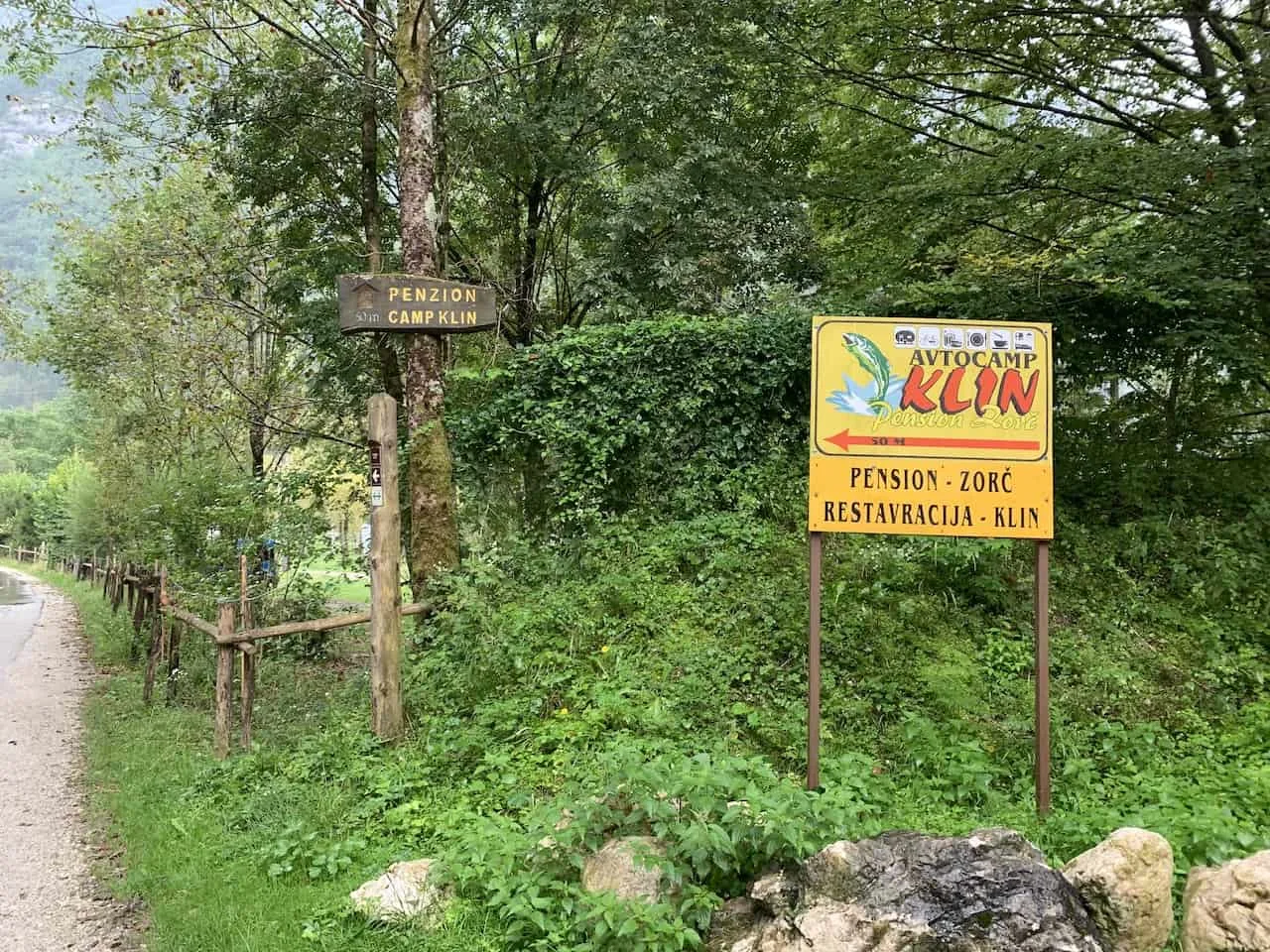
» Follow the “Soska Pot” trail markers -> throughout the trail, you will consistently see small signs with the words “Soska Pot (Soča Trail), written on them. In addition there may be arrow signs alongside the marker pointing you in the right direction.
You may also see markers for the Alpe Adria Trail, which is a longer trail that runs from Austria to Slovenia to Italy. The Soca Trail is part of this longer trail so you will see plenty of both throughout.
» While the trail markers should be fine helping you out directionally, I would recommend using a navigation app like Maps.Me or AllTrails and downloading the route onto the app.
» Near the beginning of the trail it can get a bit confusing as there are many signs pointing you in different directions.
To make things easier, after visiting the Source, follow the signs pointing towards Soska Pot / Kugyjev Spomenik (Dr Julius Kugy Monument), and Korita Mlinarice (Mlinarica Gorge), the next main points of interest. I will talk a bit more about these two points of interest later on.
Besides that confusing beginning portion of the trail, once you are past the monument and gorge, the trail is easier to follow. Simply continue to follow those trail markers and enjoy the hike!
Read More: Take part of the Soca Trail as part of a longer Slovenia road trip around the country

Hiking Resources & Checklist
Before heading out for the trails, be sure to read up on some of the hiking resources up on the site. These are here to better prepare you for all types of outdoor adventure.
- Gear: Hiking Packing List
- Weather: How to Prepare for Hiking Weather
- Navigation: Hiking GPS & Navigation
- Tips: 20+ Hiking Tips & Tricks for the Trail
- Accommodation: Book Your Hotel Today
- Rental Car: Book Your Car Rental Today
7) What to Expect on the Soča Trail
The Soča Trail is a mix of a little bit of everything over the course of the 25 km / 15.5 miles. The trail is a combination of a bunch of different terrains. Some of these include:
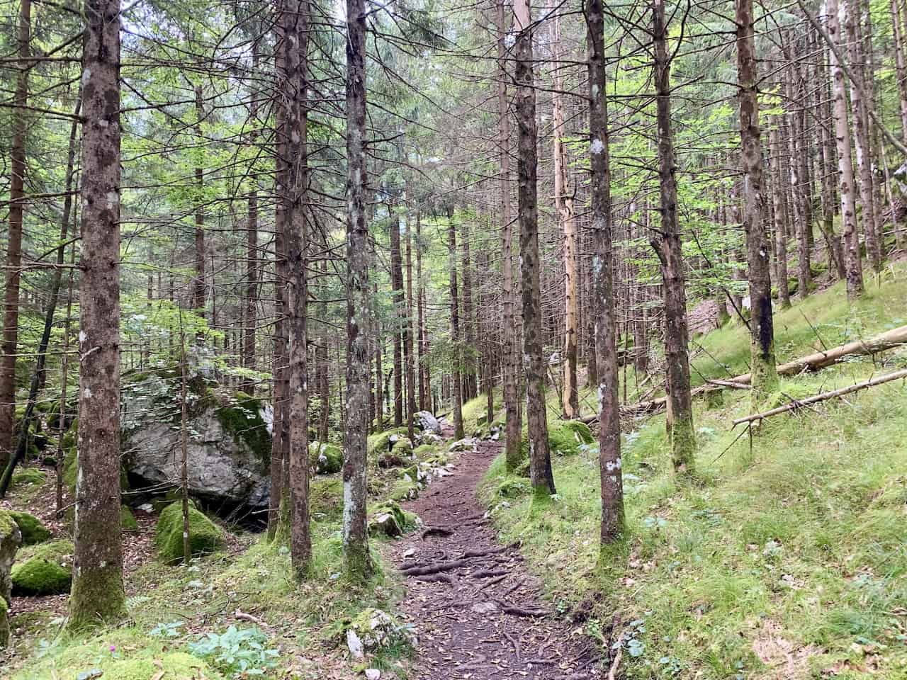
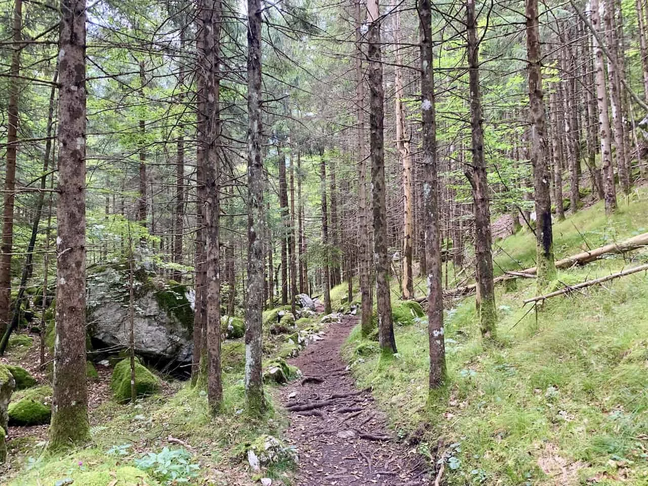
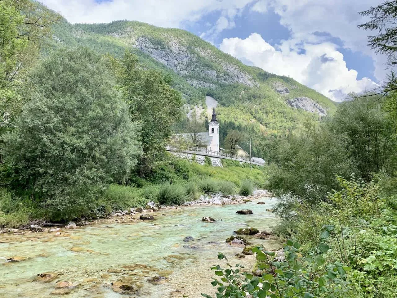
Forest Trail – the Soča River is surrounded by forest and greenery throughout the hike. Due to this, some of the trail will be in the forest itself.
So, while you are certain to spend the majority of time along the river, at other points you may not have any view of the water at all.
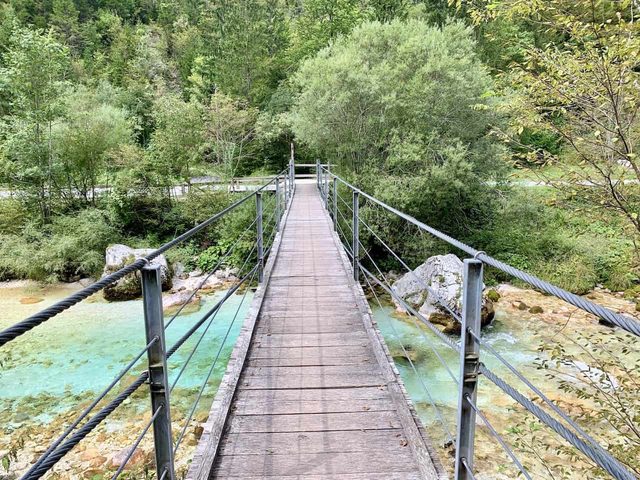
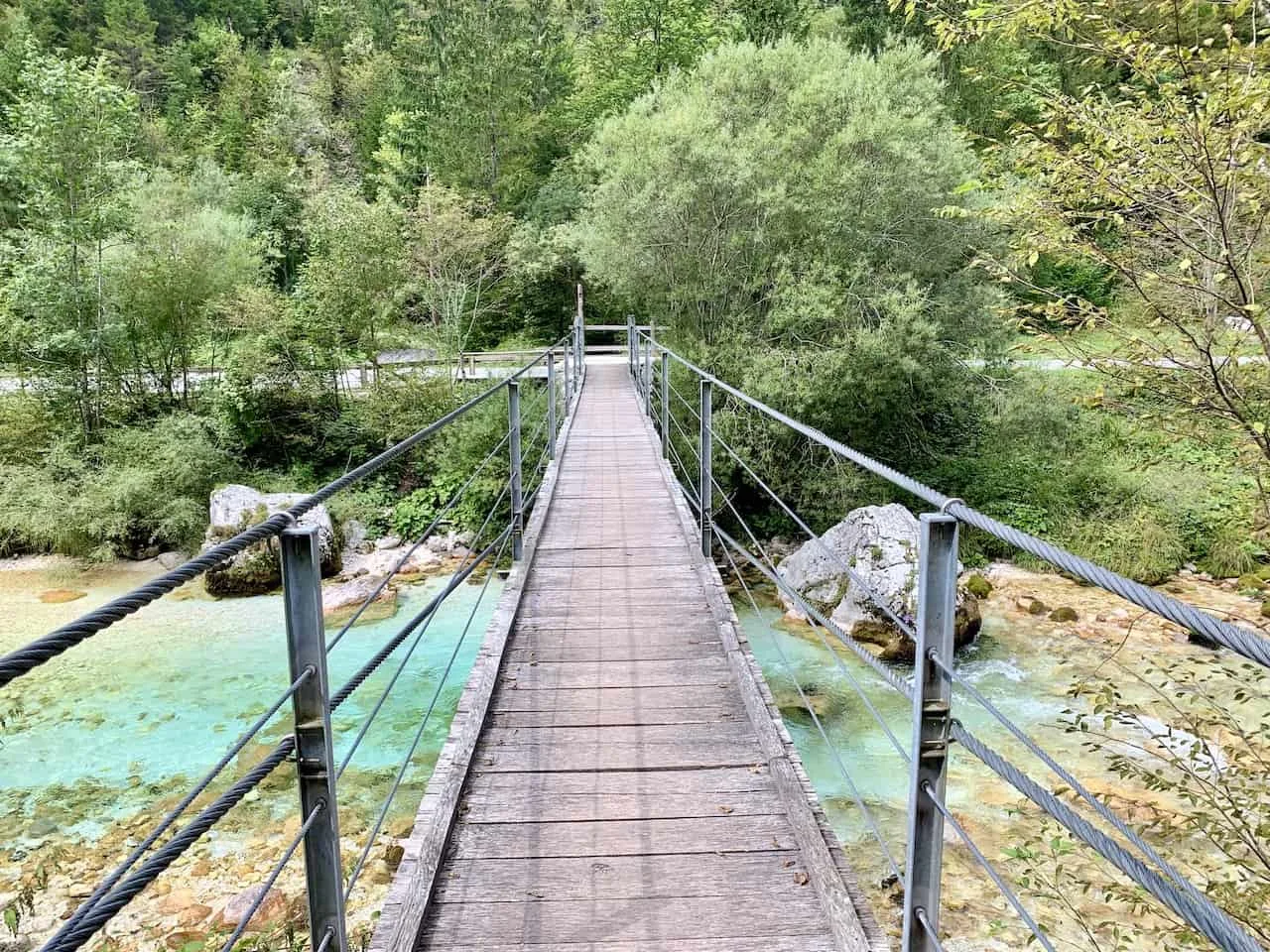
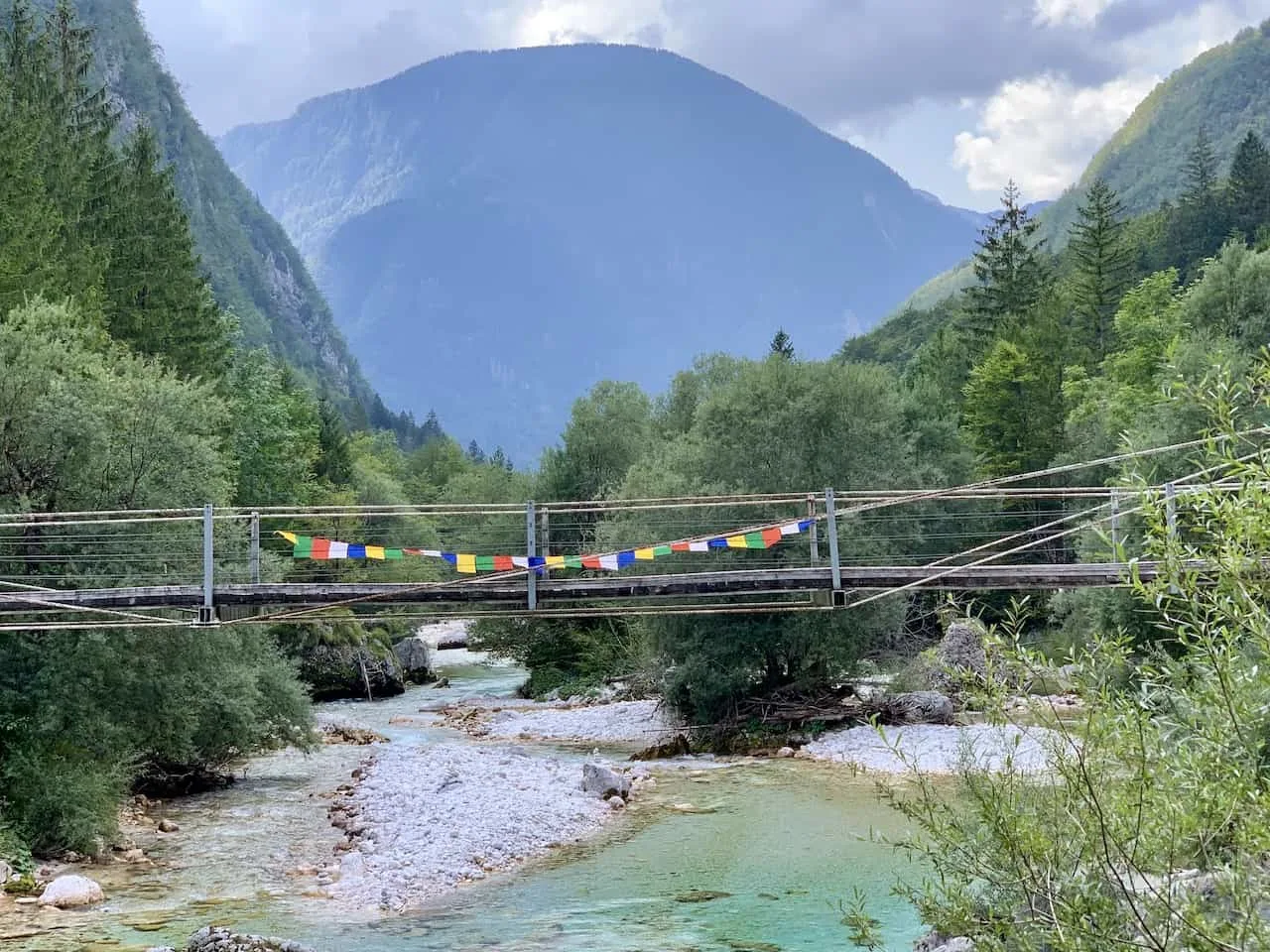
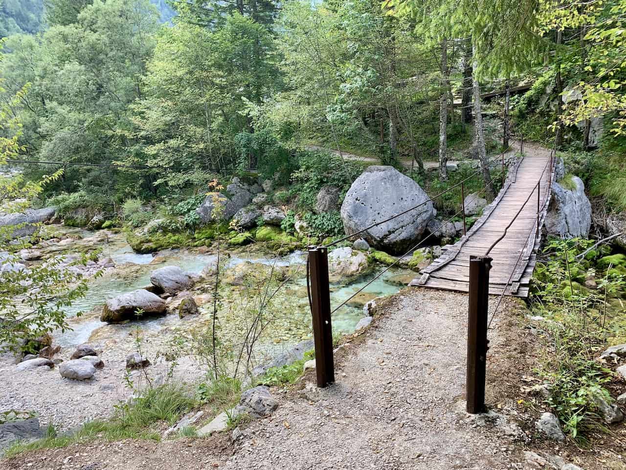
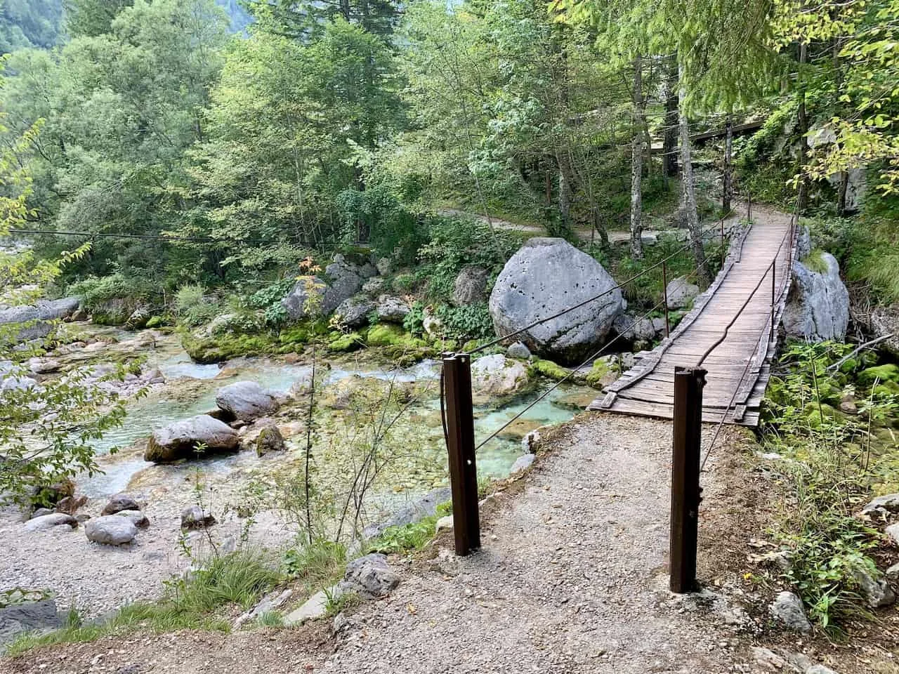
Bridge Crossings – throughout the hike, expect there to be several small bridge crossings that go across the two sides of the river.
These are great spots to enjoy the view in both direction with the river just below your feet.
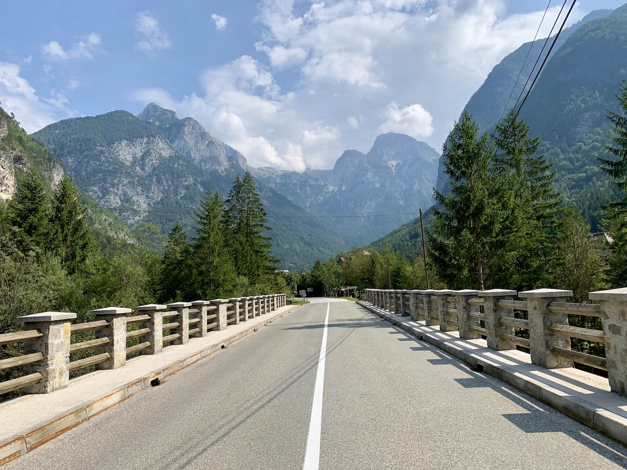
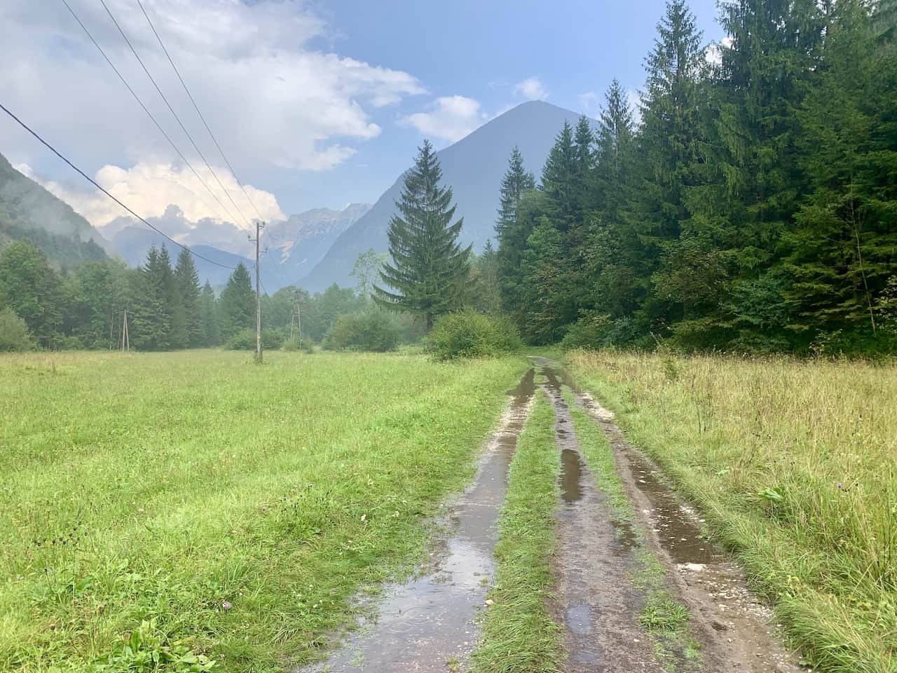
Roadside Walking – there will also be several instances where you will be walking on or directly next to the roadside. These do not happen too often but do expect to have some portions of trail near the road.

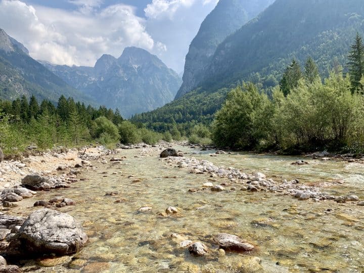
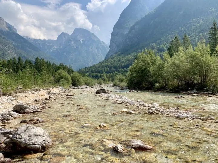
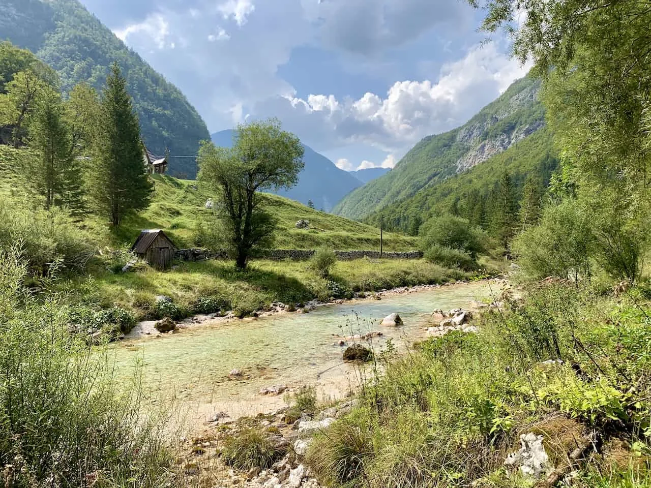
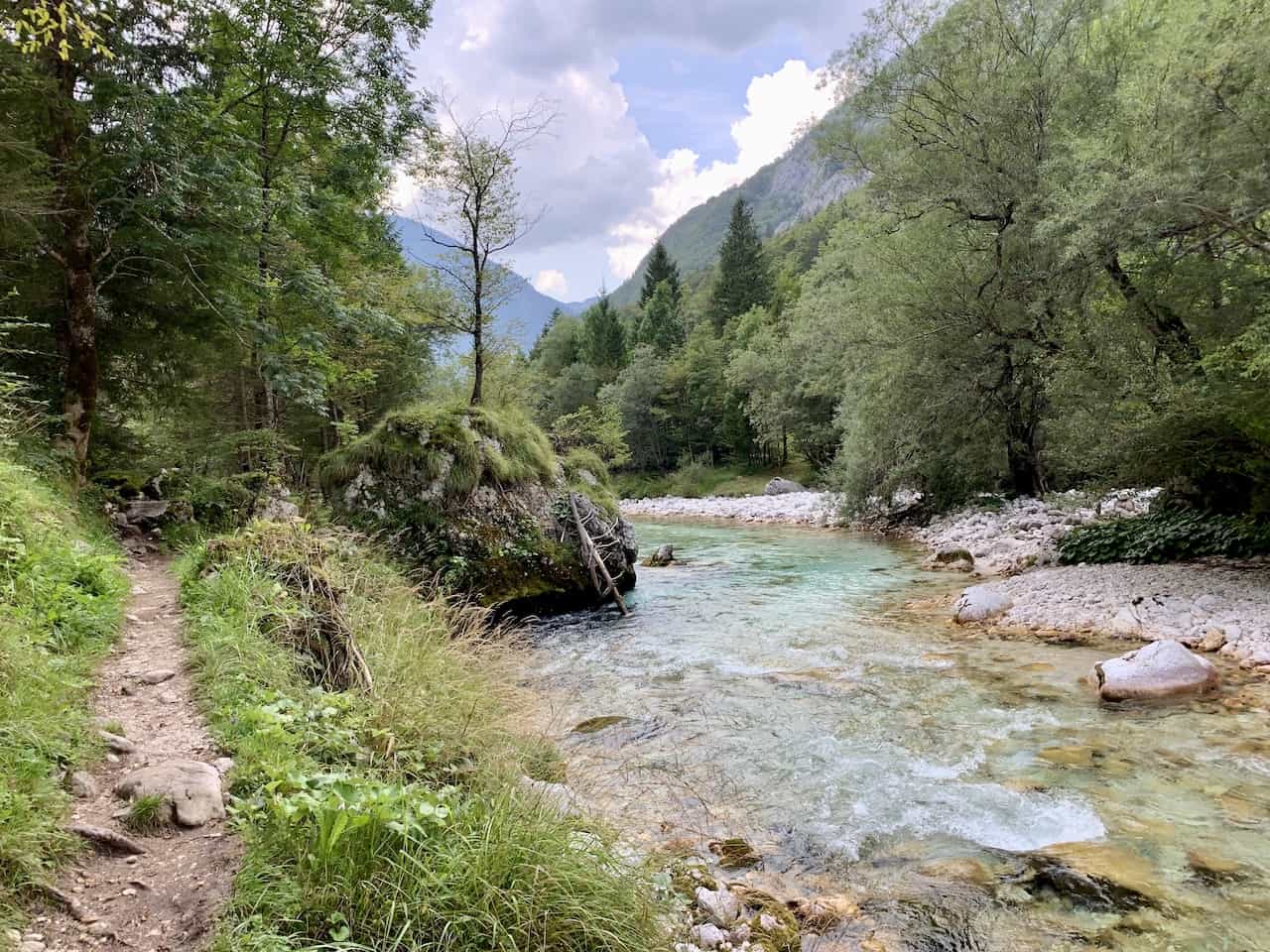
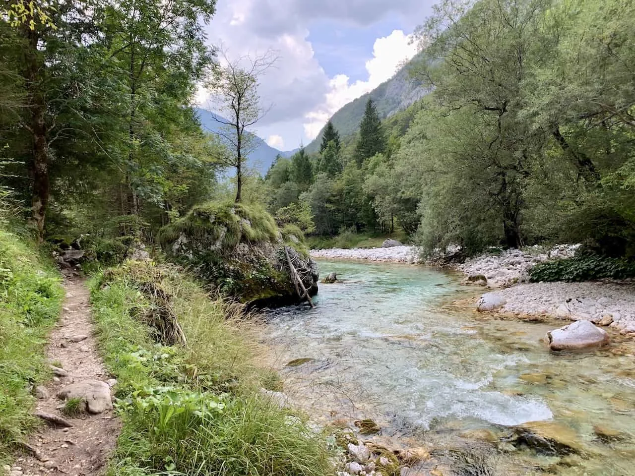
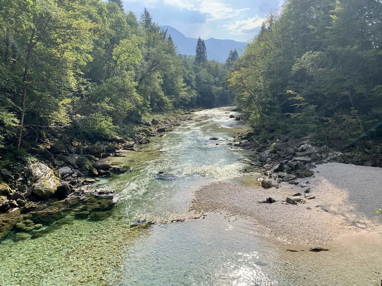
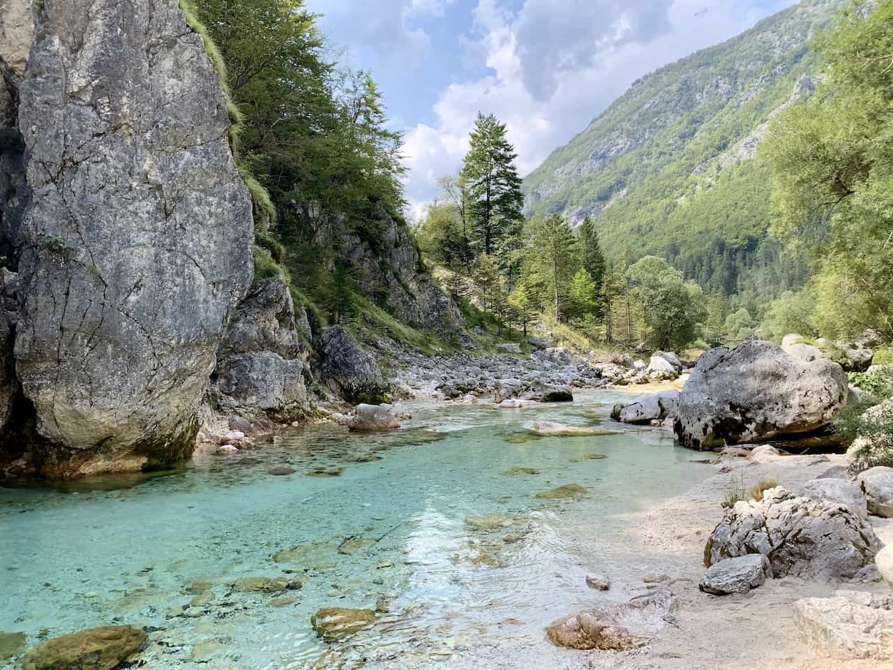
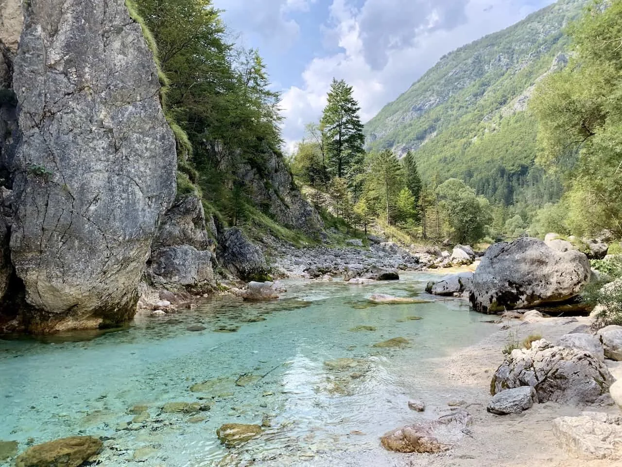
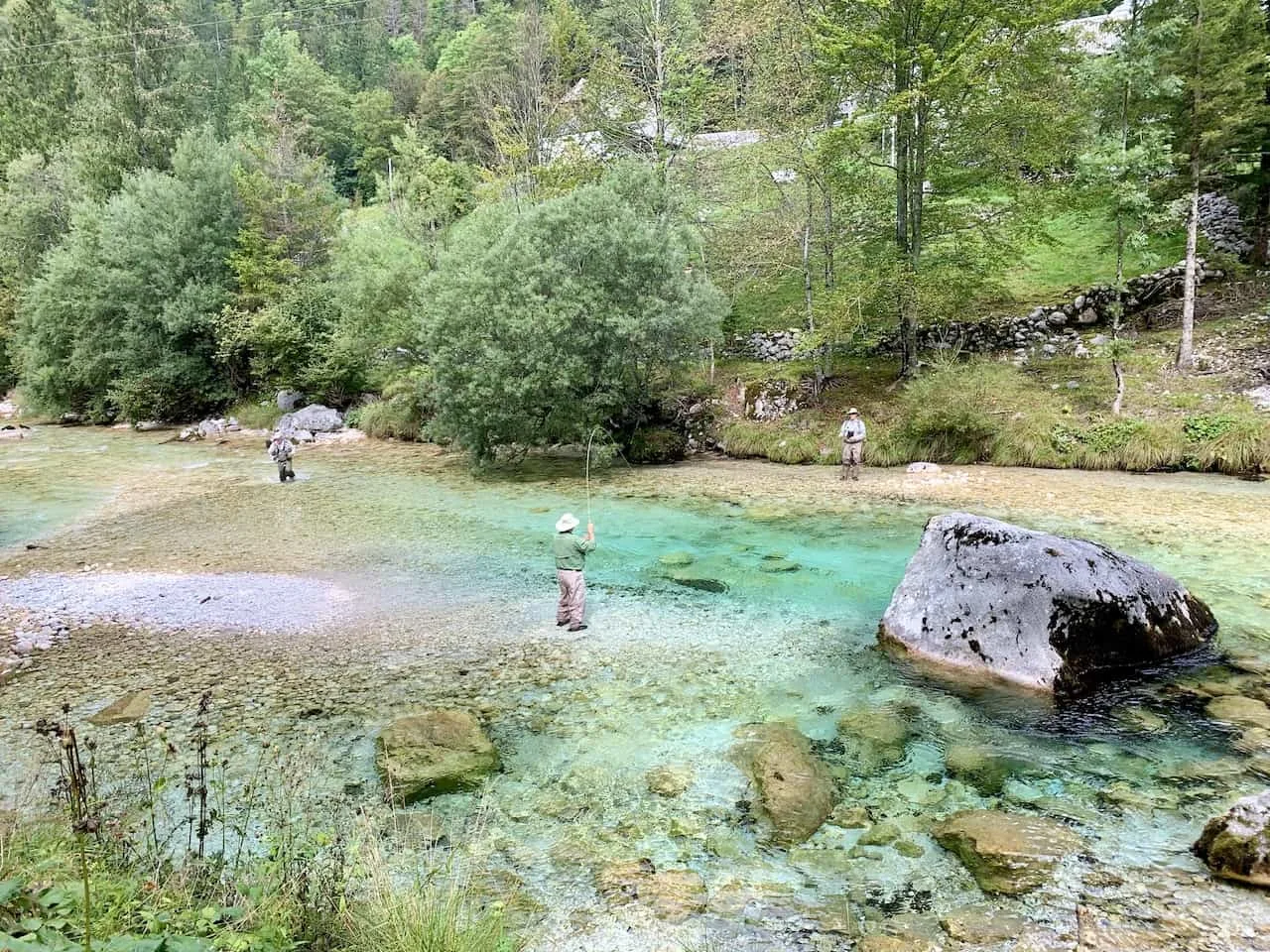
River Trail – with all that said though, do expect a good portion of the trail to be walking right alongside a dirt or rocky trail alongside the river.
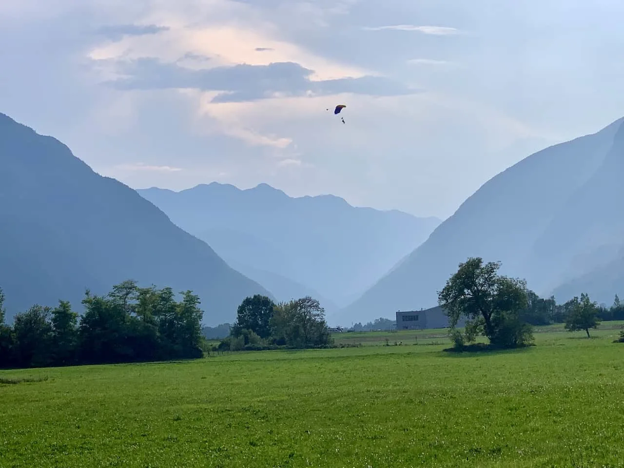
Enjoy the turquoise water views and the surrounding Triglav National Park landscape all around.
→ Don’t be afraid to get nice and close to the river at certain points if you want to take a seat by the riverfront or refill your bottle. I did this frequently during the duration of the trail to take in some more up close vantage points to the Soca River.
→ While the majority of the hike will be downhill you will find consistent inclines and declines throughout. Some of which will be through forest, others on stairs, and a bunch on normal trail.
→ Note there are times when there may be two different routes to choose from that veer off for a short while before meeting back up.
In these instances, it doesn’t necessarily matter which one you take as they do meet back up. I usually always stuck closer to the river in those few instances.
→ While the majority of the hike will be exciting and beautiful to walk through, there are certainly some sections that are just less interesting and further away from the river.
Don’t worry though, because these sections don’t last too long and you should be back to the river in no time.

8) Soča River Highlights
Along the trail, there are 17 points of interest that are marked by signboards. While some of these are just helpful informational boards about the area, others mark actual sites to visit on the trail.
Below are 6 of those highlights that you can decide to stop at during your time on the trail:
Source of the River Soča
“Permanent karst spring of the Soča gushes out of an abyss in a subterranean lake. A safe and well-maintained mountain trail takes visitors to the spring of the Soča.”
As mentioned earlier on, once off the bus, you will need to head further up towards the actual Source of the Soča River. Here you will find a mountain trail that can get tricky at times, towards the Source.
While you can skip this and just start the hike from the bus stop towards Bovec, I would recommend adding the additional time to go to the Source itself.

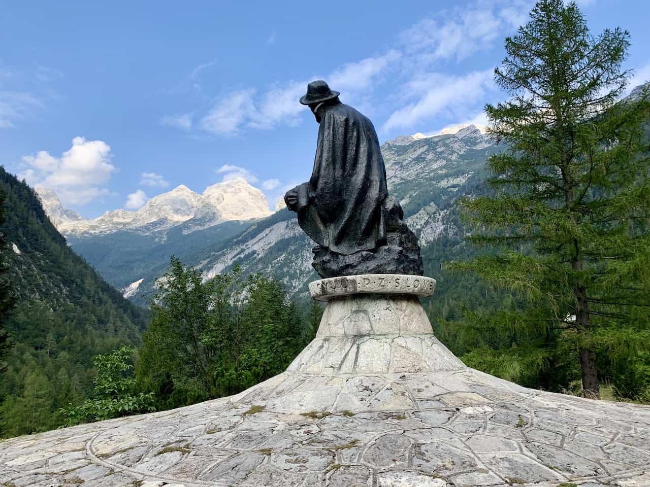
Dr Julius Kugy Monument
“Dr Julius Kugy was a mountaineer, musician and author. He discovered landscape treasures of the mountains of Trenta and wrote about the beauty of the Julian Alps”.
Pretty early on in the hike, you will come across this monument that overlooks the surrounding valley. It is a beautiful view to take in with the mountains and greenery all around.

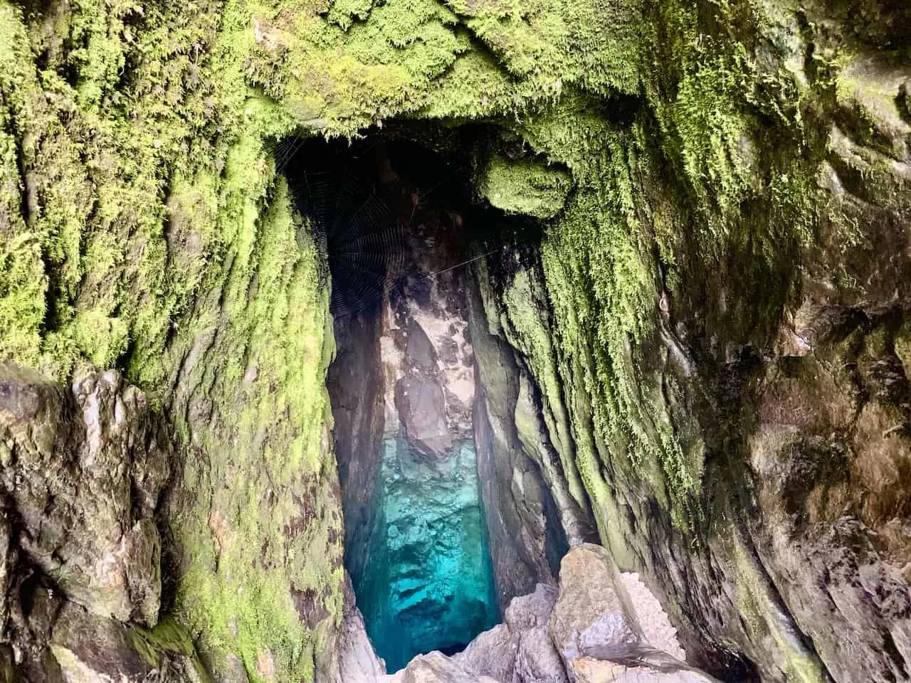
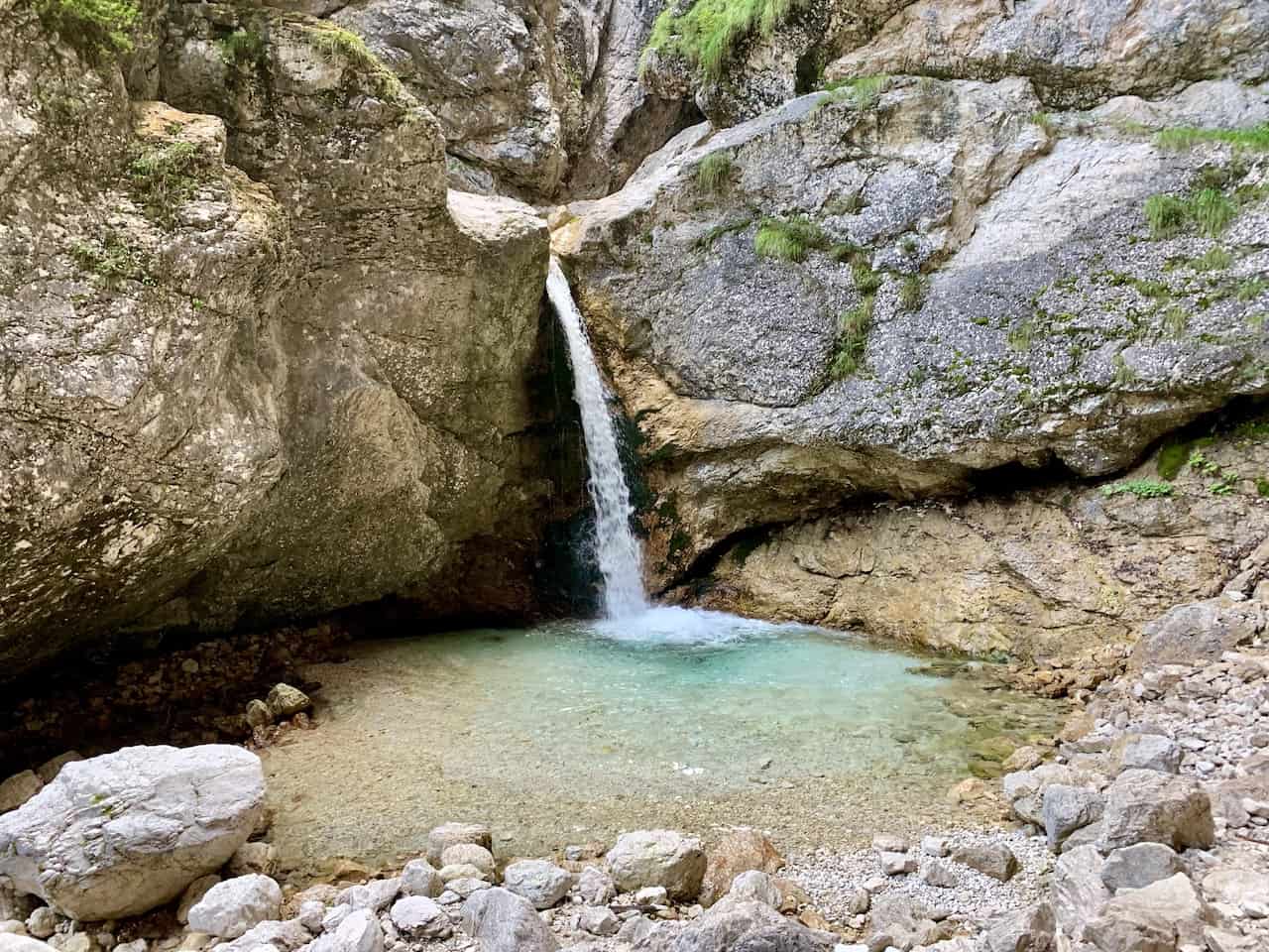
Mlinarica Gorge
“The torrential Mlinarica stream carved a one kilometer long and 100 meter deep gorge that narrows down just before the confluence with the Soča, ending in an 8 meter high waterfall”
Just nearby the monument, you will also find this hidden gorge and waterfall. It is a peaceful and quiet place to enjoy as you take in the view.

Alpinum Juliana
“Protected since 1951, Alpinum Juliana, Slovenia’s only alpine botanical garden and home to about 600 different plant species, is now managed by the Natural History Museum of Slovenia”.
While I didn’t visit the garden, it is possible to get off the main trail and head across the way to take a look at this beautiful attraction.
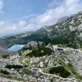
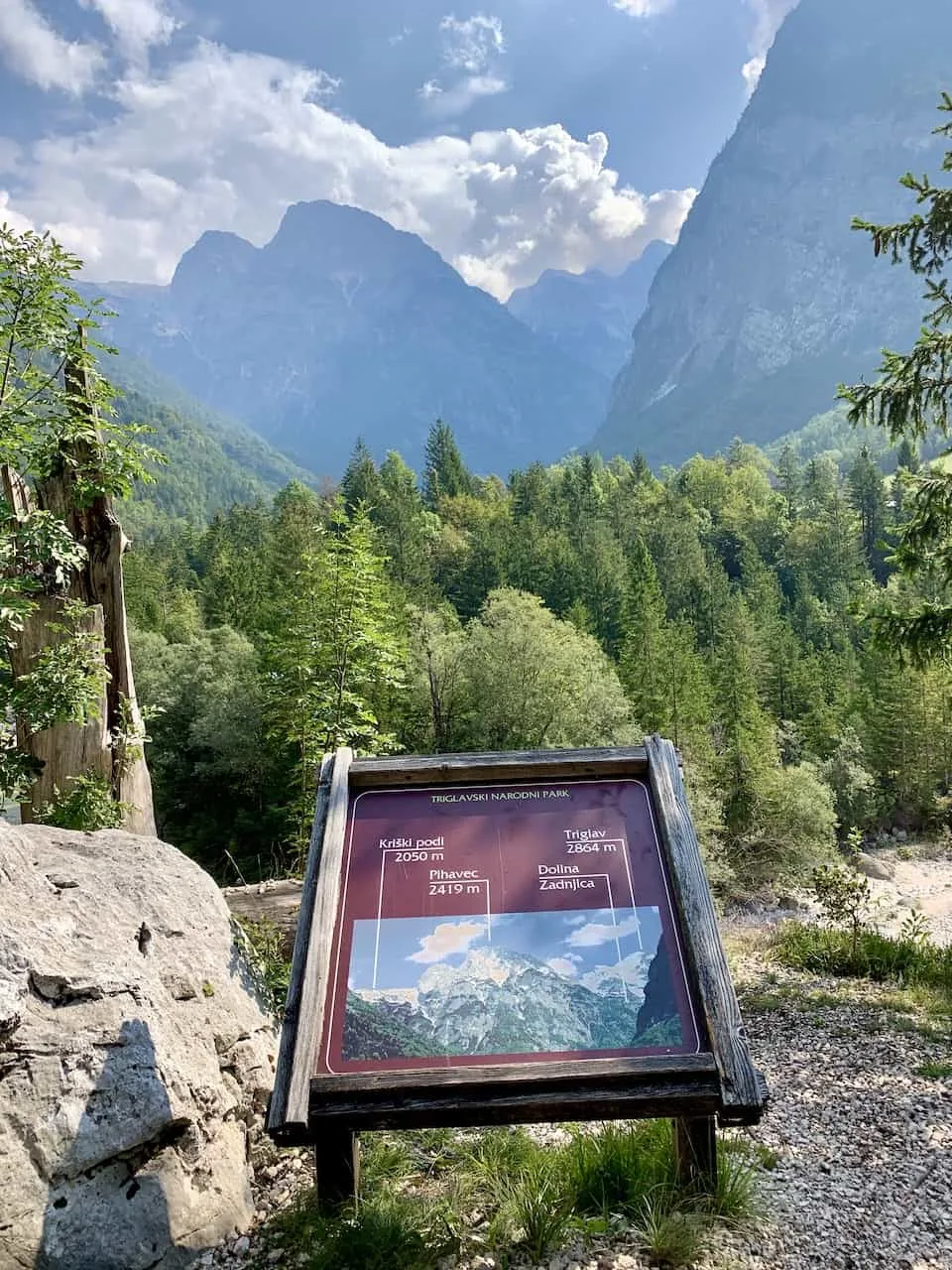
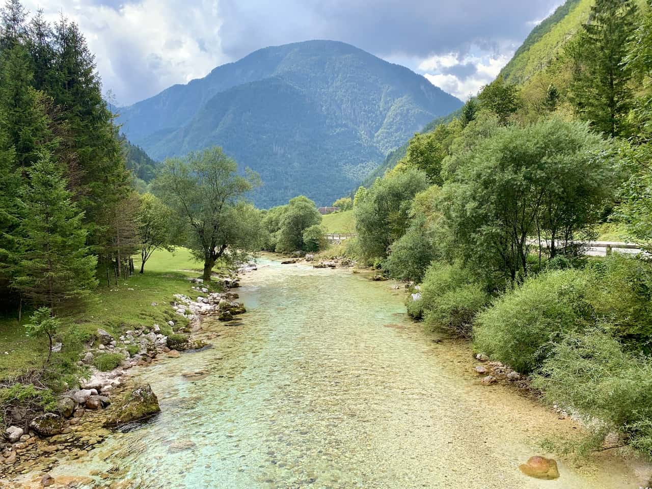
Panorama
“The trail offers a magnificent panorama of the summits rising above Trenta and Soča. The hamlet Na Logu in Trenta offers great views of Mt Triglav.”
While there certainly are some fantastic views all around the trail, there is an official point here where you can get a glimpse of Triglav and the surrounding summits.

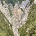
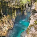
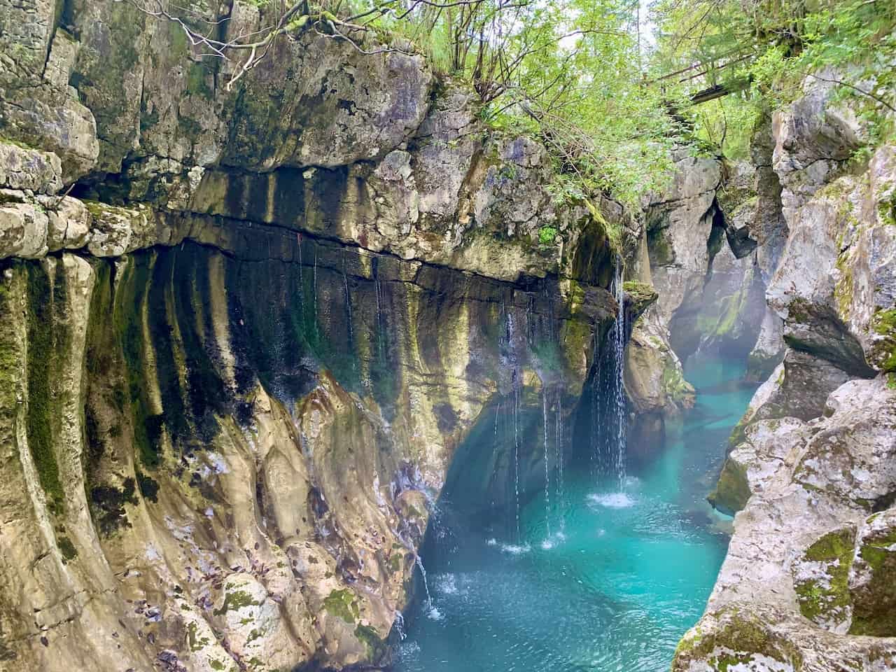
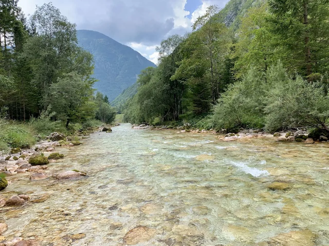
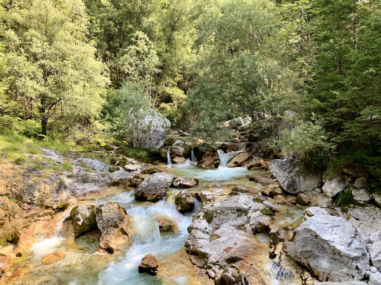
Great Soča Gorge – Velika Korita
“Gorges as a surface phenomenon resulting from river activity are most numerous and most characteristic here, in the Soča valley. Left intact through the ages, the Great Soča Gorge below the village Soča is an impressive natural phenomenon squeezed into a 750-metre-long and 10-to-15-metre deep gorge.”
One of my favorite stops on the trail was the Great Soča Gorge. Heading down on the trail closer to the river here, you will get some stunning views of the gorge itself and the turquoise waters running through it.
9) Hiking the Soča Trail Recap
Here is just a high level recap of hiking the Soca Trail to better help you understand what a day will entail:
→ Take the bus from Bovec to Izvir Soce K and then walk for 20 minutes along the road to Koca pri izviru Soce.
→ Once you reach the Koca pri izviru Soce hut, continue on the hiking path for 15 minutes up along the rocky terrain to the Source of the Soca River. Take in the view from there before heading back down to the hut.
→ From the hut, head back down the same way you came. Just a few minutes from the hut you will pass by the Soca Trail entrance into the forest (marked by the red line in the map from before). You can decide to take this path down, or just head back to the bus stop on the road.
→ Once near the bus stop, follow signs / your navigation app to Kugyjev Spomenik (Dr Julius Kugy Monument) followed by signs to Korita Mlinarice (Mlinarica Gorge). You don’t necessarily need to visit these but I would recommend it.
→ From there, it is really just following the Soska Pot trail signs throughout the remainder of the hike as you make your way through the forest, over bridges, and along the river.
→ The few times where there were more than one trail option to follow, I usually headed on the one closer to the river. I remember there being one instance where it was clearly marked (one trail marked easy and one marked hard), and another time near the Great Soca Gorge, where it was not as obvious.
→ At the end of the trail, you will be near a campground, and from there you will want to follow the road back into town towards your hotel.

10) Soča River Camping & Lodging
If you plan to finish up the trail in one day then no worries about reading this section. For those that want to split the hike into two days, this can be for you.
Along the way, there are camping grounds as well as guesthouses that you can stay at for the night. Splitting the hike into two days while getting to experience a night by the river is a great way to go about your trip.
I pinpointed several of the guesthouses to stay at that are located around 16KM / 10 miles into the trail. Several of these are nice and easy to book too – feel free to use the links below to book a night or two at one of these guesthouses along the route:

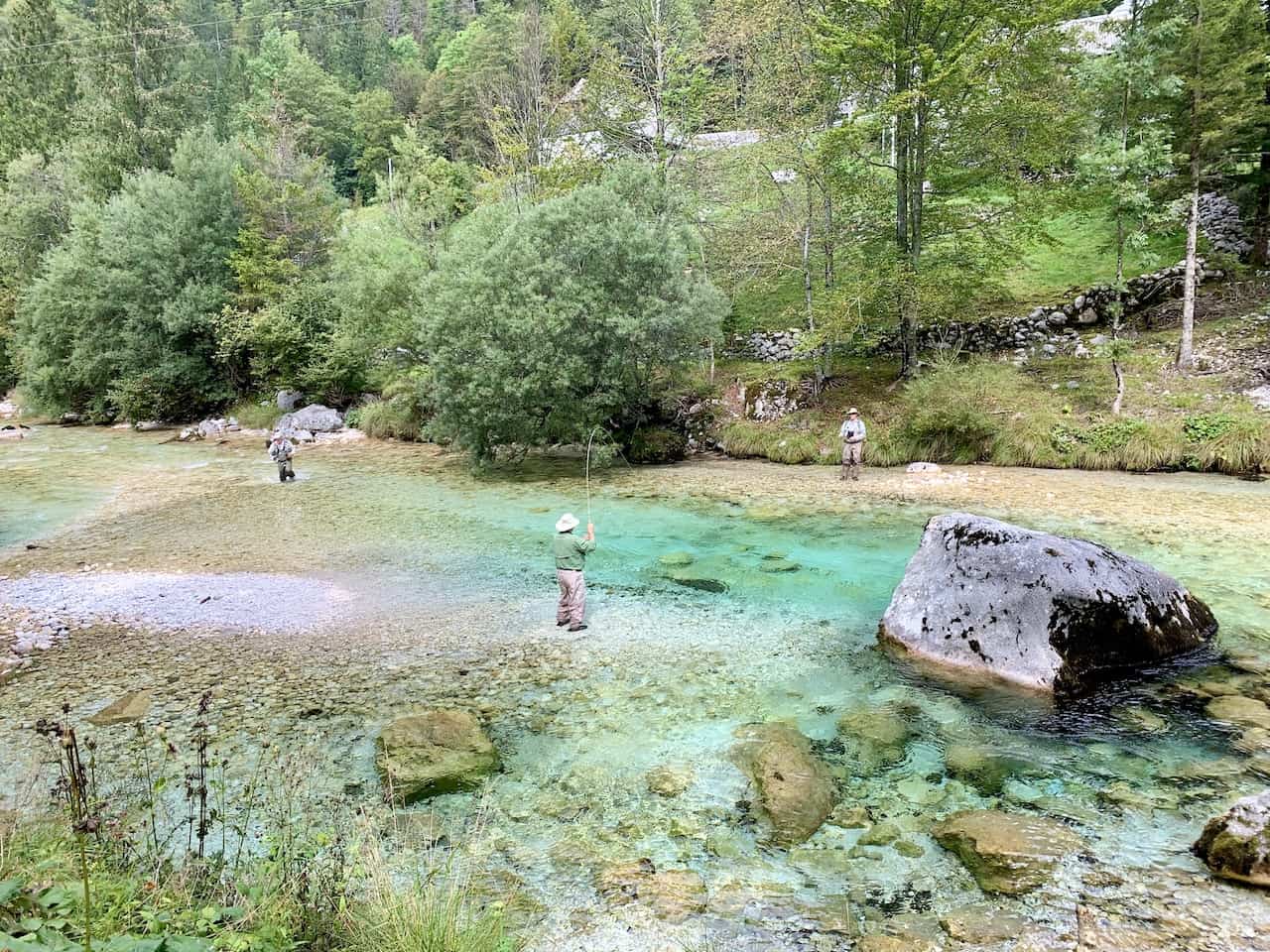
11) Can You Swim in the Soča River
Yes, you can swim in the Soča River but only at certain points of the river.
There are definitely areas along the river that will just be too dangerous to swim in due to narrowness, water flow, etc. However, there are other spots that are more than safe to swim in.
Towards the end of the river, I came across several locals jumping off a 10 foot ledge into the water down below. I gave it a try a few times and it was quite the fun but cold experience to take part of.

12) Soča River Photos
By now you should have a pretty solid knowledge foundation on how to go about the Soča Trail. I will end off here with just a whole set of my favorite photos from the day.
All said and done, this is truly one of the best hikes that Slovenia has to offer.


That about does it for a guide to the Soča Trail of Slovenia. If you have any questions or comments about the hike, feel free to add them in below.
Also, don’t forget to check out the other Slovenia itineraries and guides up on the site like the Seven Lakes Valley hike, Vrsic Pass hike, and Lake Bohinj hiking. Have fun out there and safe travels!