
The Triglav Lakes Valley hike in Triglav National Park is one of the most beautiful hikes in the region. All along the way, the hike will take you past local farms, endless lakes, mountain huts, plenty of greenery, and some stunning mountain views.
This guide will walk you through what to expect out on the trail and how to best prepare yourself for a day (or two) out on the Triglav Lakes Valley hike.
* Affiliate Disclosure: This post may contain affiliate links, which means I may receive a commission if you make a purchase through the links provided, at no additional cost to you. Thanks for supporting the work I put into TripTins!
1) Triglav Lakes Valley Hike Introduction
It is important to note that there are A LOT of different trails to choose from when hiking in the area around the Triglav Lakes Valley.
Some of these routes end up taking you to the same spot, while others will have you going in the completely different direction. Due to this, there is not necessarily one “correct” route to take while going out on this hike in particular but you certainly need to pay attention at intersections.
While the amount of trail options can get confusing, I will do my best to walk you through the exact route I took along with helpful images and sign postings along the way.
This is one hike that I would HIGLY RECOMMEND downloading offline maps for on an app like Maps.me or AllTrails. This way you can easily see the route on your phone and understand where you are in relation to the trail.
I have included a downloadable Google Maps below for you to utilize on the journey that you can overlay onto one of the apps.
This guide in particular is going to walk through the entire circular Triglav Lakes Valley Hike starting at Planino Blato, visiting plenty of lakes in the valley, and passing by mountain huts along the way.
While this is a longer one day hike to take part of, I will also mention a couple alternatives including an earlier turnaround point and potentially making this a 2 day hike instead of 1.
Note that you can take part of the Triglav Lakes Valley hike as part of a 2-3 day climb to the top of Mount Triglav. While I did not take part of the multi day trail, I did climb Mount Triglav separately. Click the link to learn more!

2) 7 Lakes Valley Route
Like I mentioned, this will be for the circular hike starting and ending in Planina Blato and visiting the lakes along the way.
Please note that while this is called the “7 Lakes Hike”, there are more than 7 lakes on the route and in the surrounding areas.
I am sure you will come across other lake names on maps and other hiking guides. This is because you can really take part of the hike from various routes.
Here is the route that I took, which will mention the various highlights and lakes that you will pass by on the trail.
- Planina Blato (Starting Point)
- Planina Pri Jezeru (Lake & Hut)
- Planina Dedno Polje (Farm Houses & Pasture)
- Planina Ovcarija (Pasture)
- Dvojno Jezero & Koca Pri Triglavskih Jezerih (Lake & Hut)
- Mocivec Lake (Lake)
- Jezero v Ledvicah (Lake)
- Zeleno Jezero (Lake)
- Zasavska Koca na Prehodavcih (Mountain Hut)
- Jezero Pod Vrsacem (Lake – view from mountain hut)
- Rjavo Jezero (Lake)
- Jezero Pod Vrsaki (Lake – view from above on trail)
- Planina Dedno Polje (Farm Houses & Pasture)
- Planina Pri Jezeru (Lake & Hut)
- Planina Blato (Ending Point)
Learn More: If you enjoy this hike, why not check out some of the other top hikes in Slovenia during your trip.
3) Triglav Lakes Valley Hike Details
Let’s start this off with some helpful details to note about the trail and what the hike will entail.
- Starting & Ending Point: Planina Blato
- Planina Blato Coordinates: 46°18’38.9″N 13°50’57.7″E
- Distance: 16 miles / 26 km
- Duration: 8-10 Hours
- Elevation Gain: 4,000 Feet / 1,219 Meters
- Overnight Option: Triglavskih Jezerih Hut or Prehodavcih Hut
Alternative Options
Understandingly, a 10+ hour day hike is not for everyone. So, if you are trying to break down the hike a bit more, here are a couple alternative options:
1) Hike back and forth from Planina Blato to the Triglavskih Jezerih Hut. This round trip out and back hike would take around 6-7 hours.
2) 2 day hike with an overnight in the Triglavskih Jezerih Hut or Prehodavcih Hut. You can book huts through the Alpine Association of Slovenia.
Hiking Resources & Checklist
Before heading out for the trails, be sure to read up on some of the hiking resources up on the site. These are here to better prepare you for all types of outdoor adventure.
- Gear: Hiking Packing List
- Weather: How to Prepare for Hiking Weather
- Navigation: Hiking GPS & Navigation
- Tips: 20+ Hiking Tips & Tricks for the Trail
- Accommodation: Book Your Hotel Today
- Rental Car: Book Your Car Rental Today
4) Triglav 7 Lakes Valley Hiking Map
Below is the Google Maps view of the Triglav 7 Lakes Valley Hiking map. This is the route that I took starting and ending in Planina Blato.
To make things easier for you, I would recommend exporting the map as a KML file and then adding it to the Maps.me or AllTrails app.
This will give you the best chance of staying on trail and always knowing where you are in relation to the various lakes and landmarks.
Highlighted in blue is the main route that I took, however you will see a portion of trail highlighted in purple, red, and pink. Below are the explanations behind those:
1) You can make the route a bit more circular after leaving Planina Pri Jezeru, and head to Planina Ovcarija via Planini Visevnik (on the purple line)
2) At the Planina Ovcarija intersection you have the option to go one of two ways. I decided for the right on the blue trail down to the lake and hut (via the Preko Stapc), however the easier red route would be to the left (via Preko Prodov).
3) After leaving the Prehodavcih hut, you will see an additional pink line. For some reason Google Maps was having trouble grabbing the trail I took (pink line), but in reality, either choice works here.
Lastly, the start of the route also may show up a bit off when downloading the KML file. However, you should not have any trouble getting yourself from the starting point towards the first landmark, Planina Pri Jezeru.
5) Getting to Planina Blato
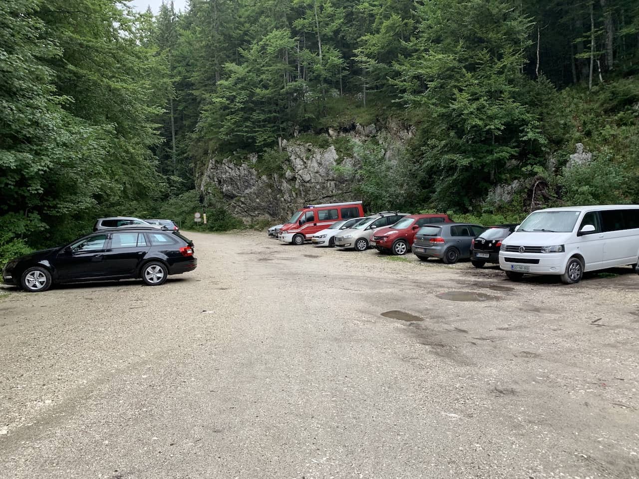
While there are several different starting points to choose from, the most popular and recommended starting point would be Planina Blato.
Planina Blato is easily accessible by car from nearby places like Bled or Bohinj. In order to access the starting point though, you will need to pay a 12 euro fee to access the road.
For the ease of directions, I would recommend just inserting these GPS coordinates into your navigation app -> 46°18’38.9″N 13°50’57.7″E.
Those coordinates will take you directly to the roadside parking lot for the Triglav 7 Lakes Valley hike. From the town of Bled expect the drive to take around 45 minutes (34 KM), and from Bohinj around 25 minutes (15 KM).
The route up to Planina Blato is filled with some twists and turns on a narrow road. Please drive with caution here as you are making your way along. Note that the last portion of road (half mile or so) will be on gravel, however there is no need for AWD here.
Car Rentals: When renting a car in Slovenia, I would recommend checking out Rentalcars.com for potential options. You will be able to browse through cars based on price, category & other filters, to find the perfect car for your trip.
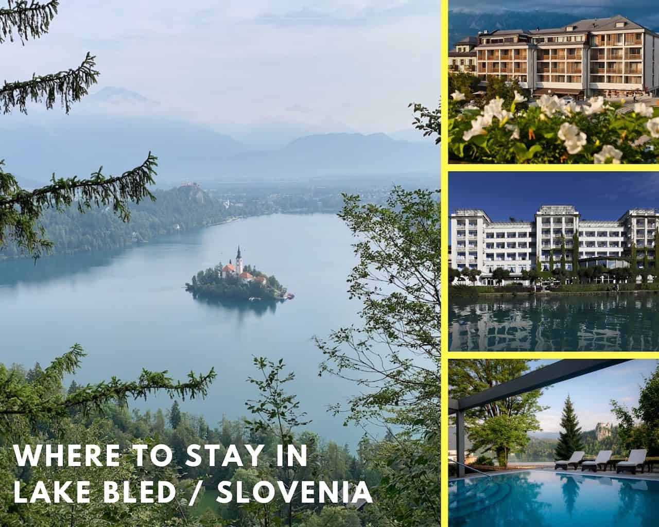
6) Where to Stay in Bled
Bled is a charming little town located closer to the eastern end of the Lake. There are plenty of hotels, guesthouses, and apartments to choose from during a visit to the region. I thought it may be helpful to give three highly recommended options of where to stay.
» Take a look at the Lake Bled Viewpoint Hike guide for more info about how to enjoy one of the best panoramas in the region.
During high season, these hotels will sell out. So once you know your dates I would advise to book your hotel as soon as possible.
Hotel Lovec is located in the heart of Bled, just a few steps from Lake Bled. It offers magnificent views of the lake and the surrounding Alps. All rooms provide air conditioning, a bathroom and a mini-bar. Some also have a balcony with park or lake views and cable TV.
Grand Hotel Toplice -> Book Today
Located on the shores of Lake Bled, the elegant Grand Hotel Toplice features panoramic views of the lake and the Alps. The hotel has a boutique wellness center with a thermal pool, saunas and various massage and beauty treatments. Guests can relax at the lake-view terrace.
Rikli Balance Hotel -> Book Today
Set in the heart of Bled, Rikli Balance Hotel enjoys an elevated position boasting panoramic views of Lake Bled, its Castle and the Julian Alps. It features a modern spa center with indoor and outdoor pools.

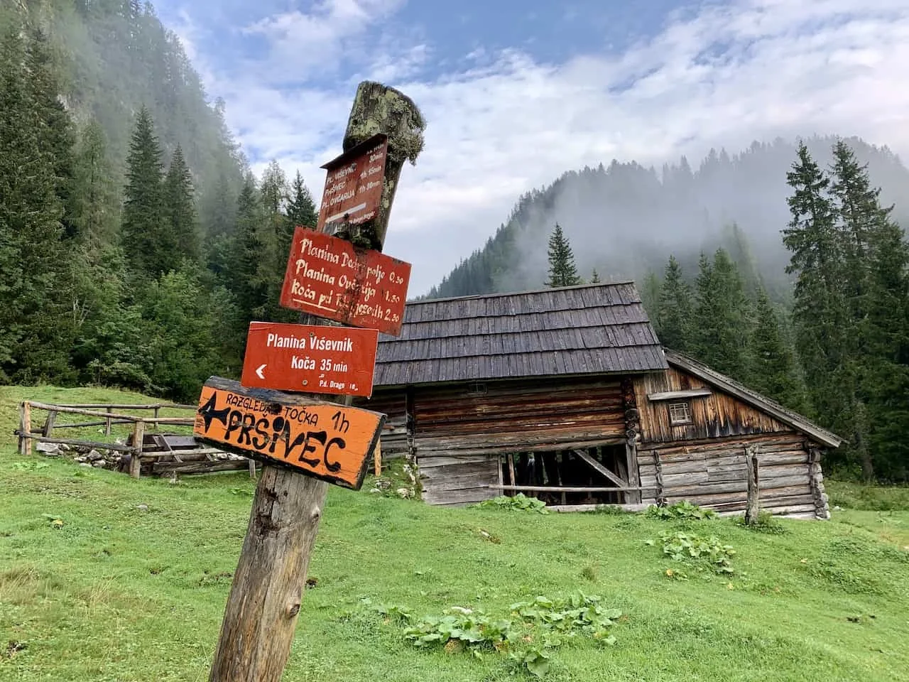
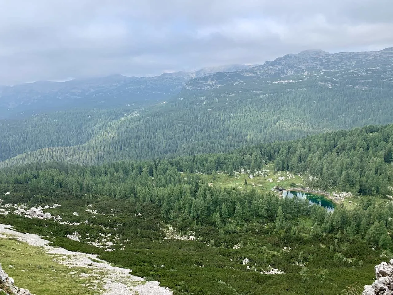
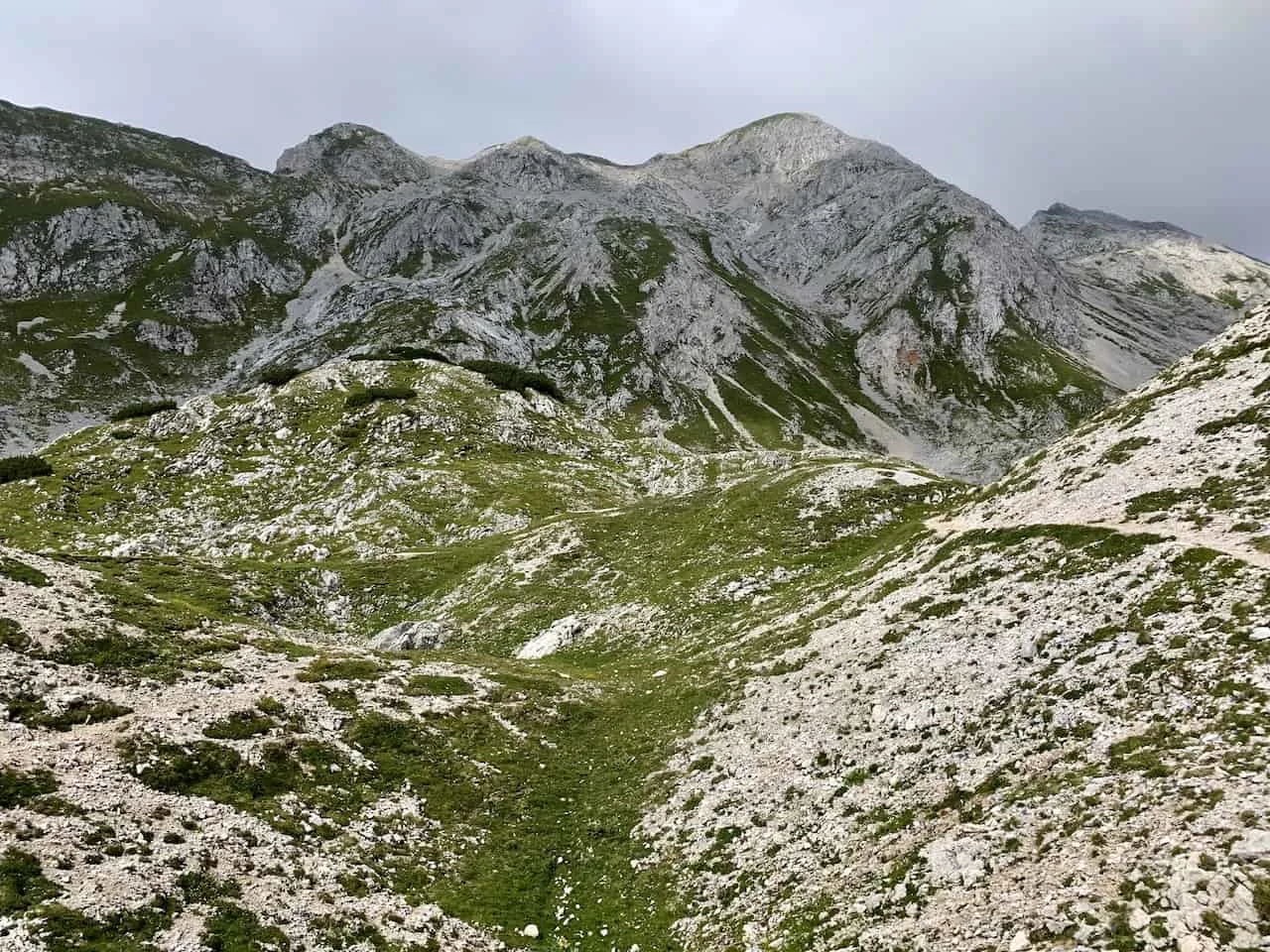
7) Triglav Seven Lakes Valley Hike
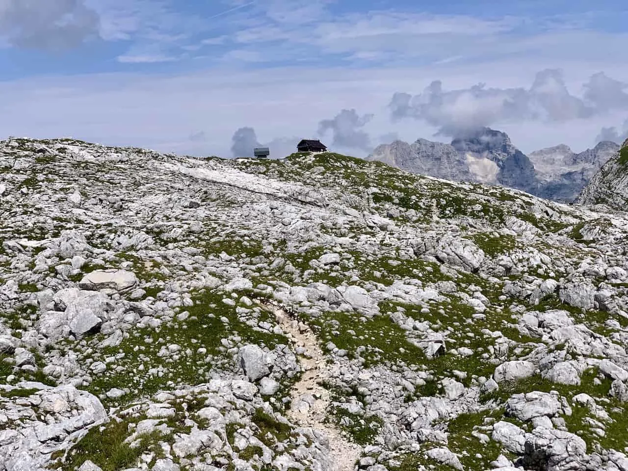
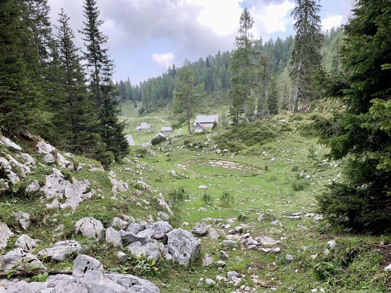
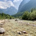
Once you have made it to Planina Blato, park your car, and head to the starting point of the trail. Your first destination is going to be Planina Pri Jezeru, where you will find a hut and pasture overlooking the first lake of the hike.
Throughout the trail, you will have various trail markers, whether they are legitimate trail signs or just markings on rocks. As long as you pay attention to these trail markers and have a navigation app, you should have no trouble getting yourself around safely.
Read More: Take part of the Seven Lakes Valley Trail as part of a longer Slovenia itinerary around the country
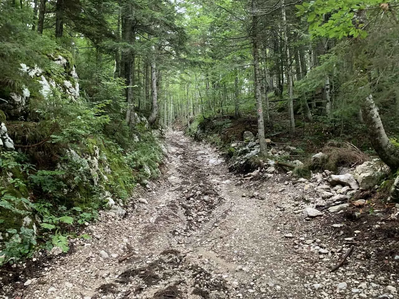
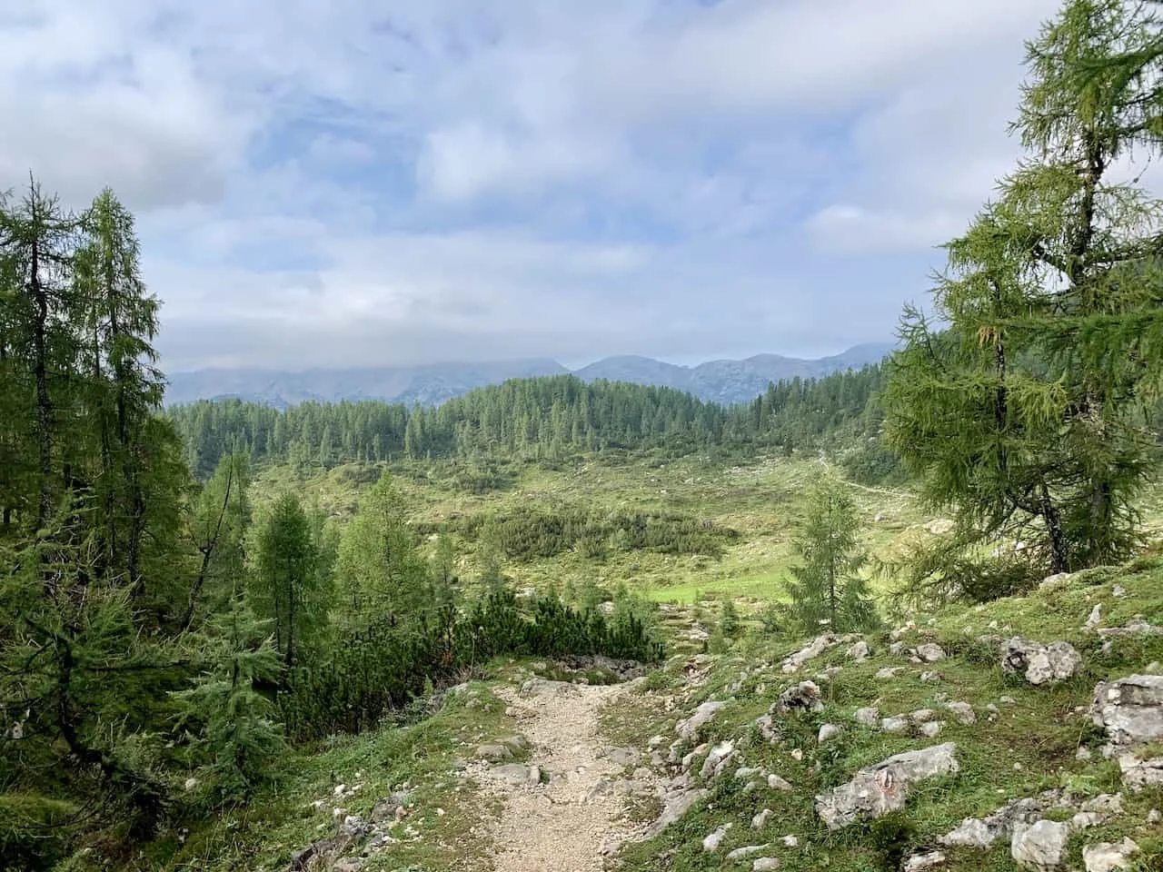
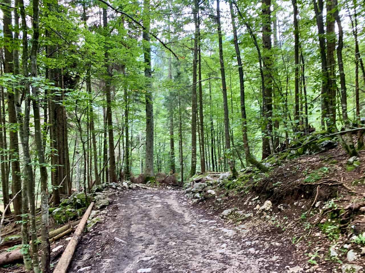
A) Planina Blato to Planina Pri Jezeru (1 Hour)
The first portion of trail will be a nice incline through the greenery filled forest as you follow the signs to Planina Pri Jezeru. The trail will be mostly be made up of dirt and gravel here as you continue your way along.
You will eventually pass by a gate that is there to keep the farm animals in and around 20 minutes later you will reach the open field of Planina Pri Jezeru.
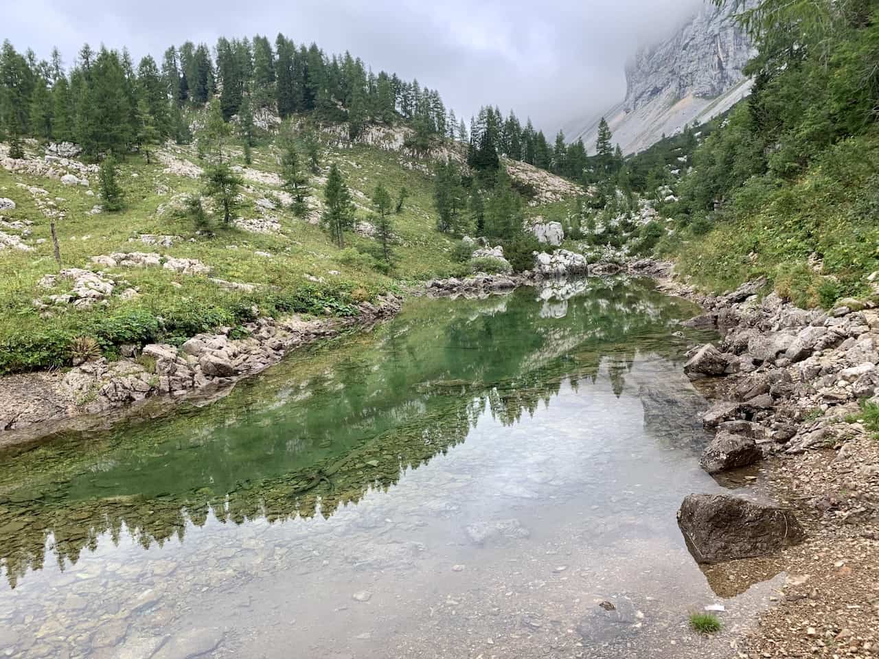
At Planina Pri Jezeru you will find the one main farmhouse, with the lake down below, surrounded by several other smaller farmhouses dotting the field.
Feel free to take a quick break and enjoy the view of your unique surroundings.


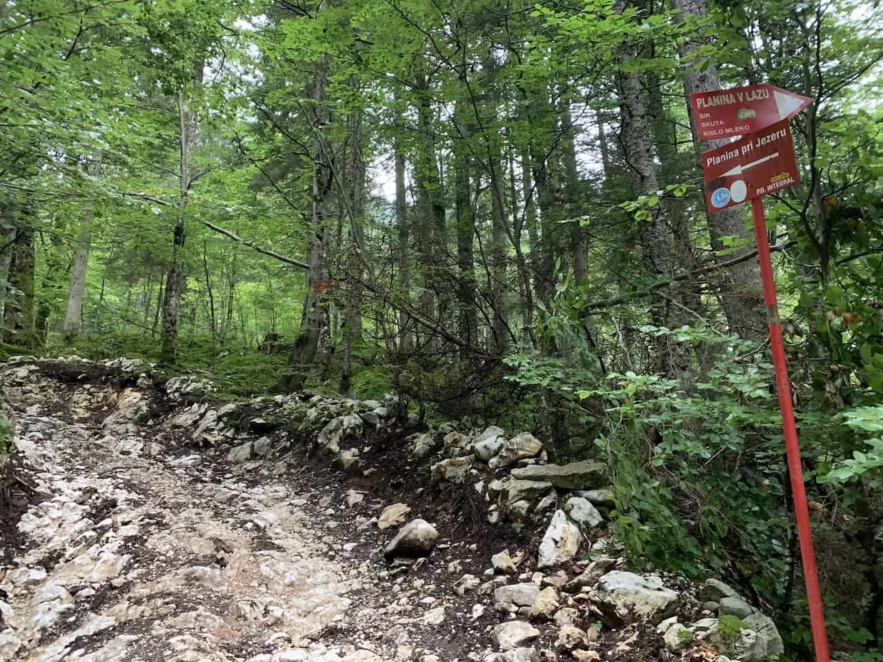

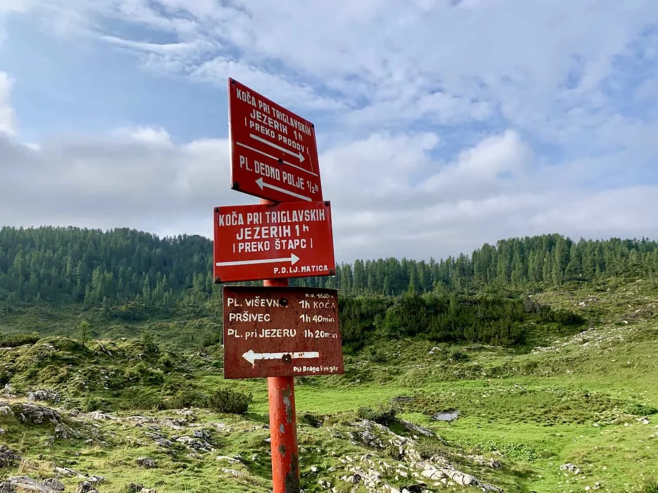
B) Planina Pri Jezeru to Planina Dedno Polje (30 minutes)
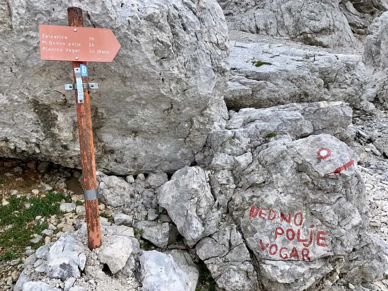
As you are leaving Planina Pri Jezeru, you will see many hiking signs pointing you in various directions. From here you will want to follow the sign towards Planina Dedno Polje, which should be another 30 minute walk.
Remember what I mentioned earlier – you can take other routes that will get you back onto the same path at some point. For example, you could follow the signs to Planina Visevnik and meet up with my route from there (purple line on the map).
Rethinking this route, heading towards Planina Visevnik would probably be a better option in regards to making the route a bit more circular.

However, since I ended up on the Planina Dedno Polje route, that is how I will go about the route here.
Simply follow along the trail towards Planina Dedno Polje for another half hour or so as you head back into the forest on the gravel path. There will be an intersection at some point, but all you need to do is stay straight here.
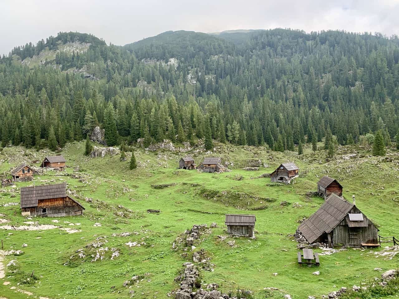
Soon enough, you will be welcomed to the open field of Planina Dedno Polje with its small farmhouses sprawled throughout the open field down below.


C) Planina Dedno Polje to Planina Ovcarija (1 hour)
Up next it the famous double lakes of Dvojno Jezero alongside the Koca Pri Triglavskih Jezerih hut. Here is where many people decide for an overnight if they want to spend multiple days exploring the Triglav Lakes Valley.
Once again, you will come across several hiking signs pointing you in various directions. From Planina Dedno Polje, you will want to follow signs to Planina Ovcarija and Koca Pri Triglavskih Jezerih.
Be sure to follow the correct route here because if you accidentally take the route towards Prehodavcih, you will essentially be doing the route backwards. While people certainly do this, I would recommend heading towards the double lake first in case you do not want to take part of the entire loop.
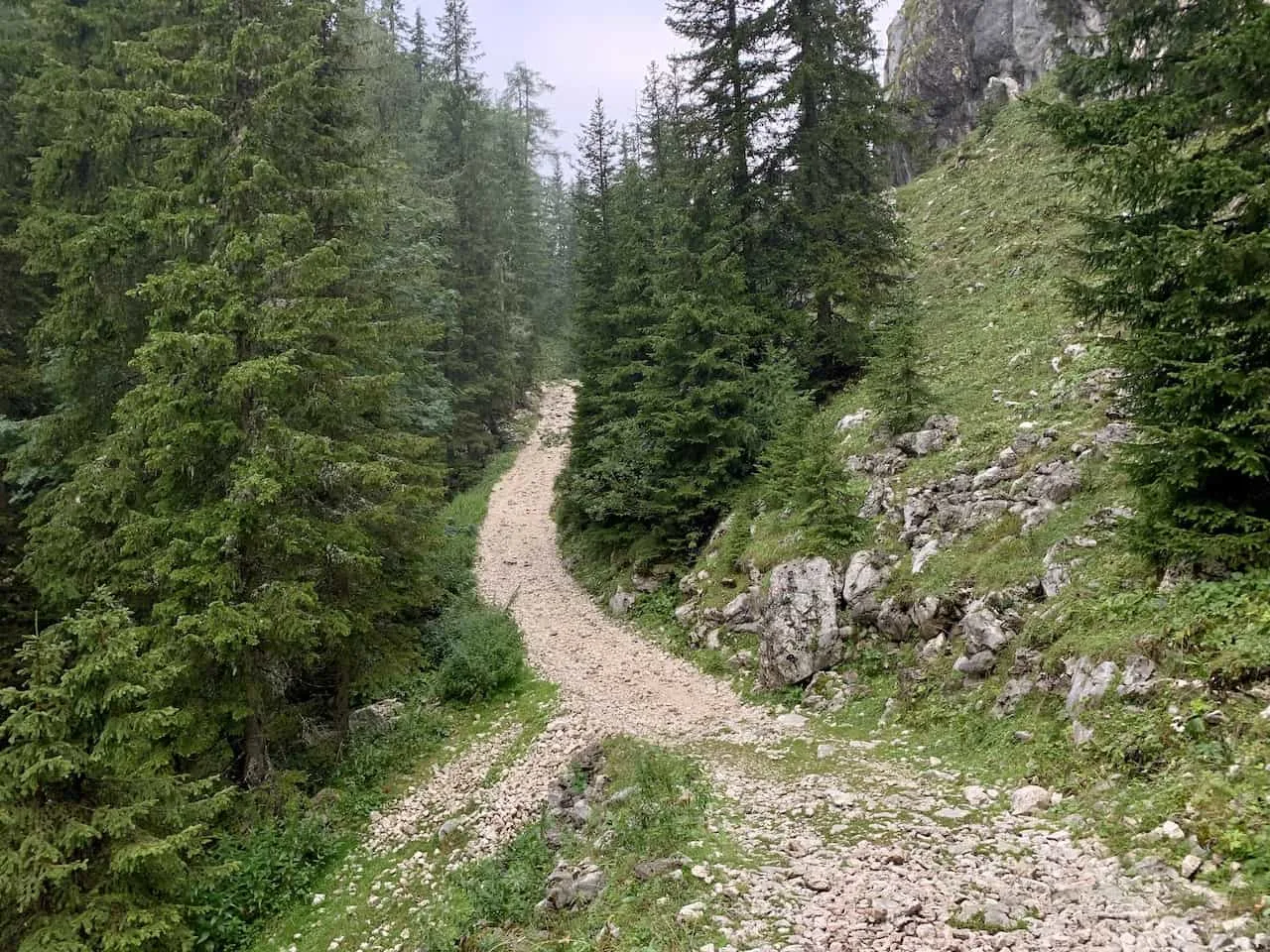
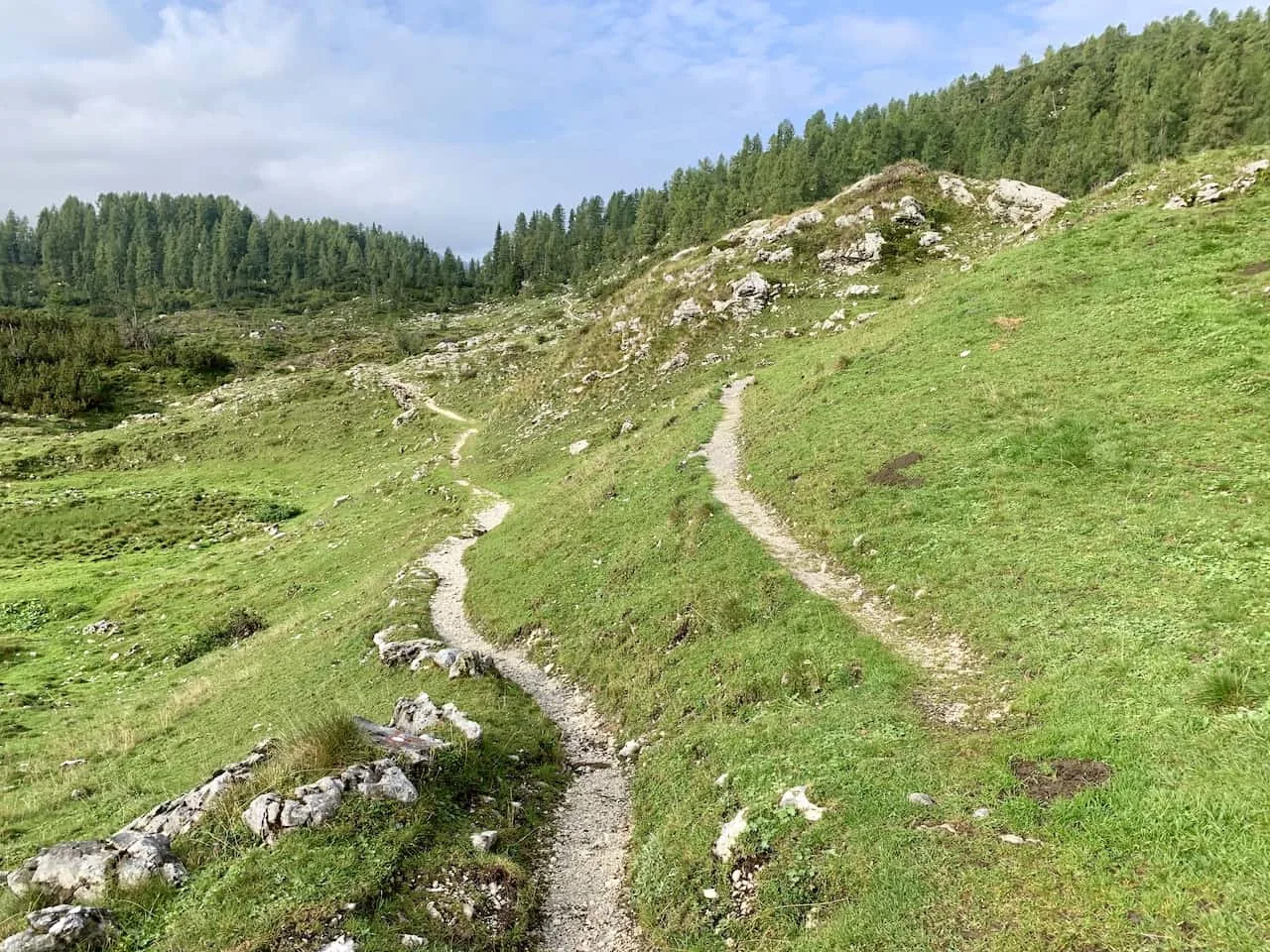
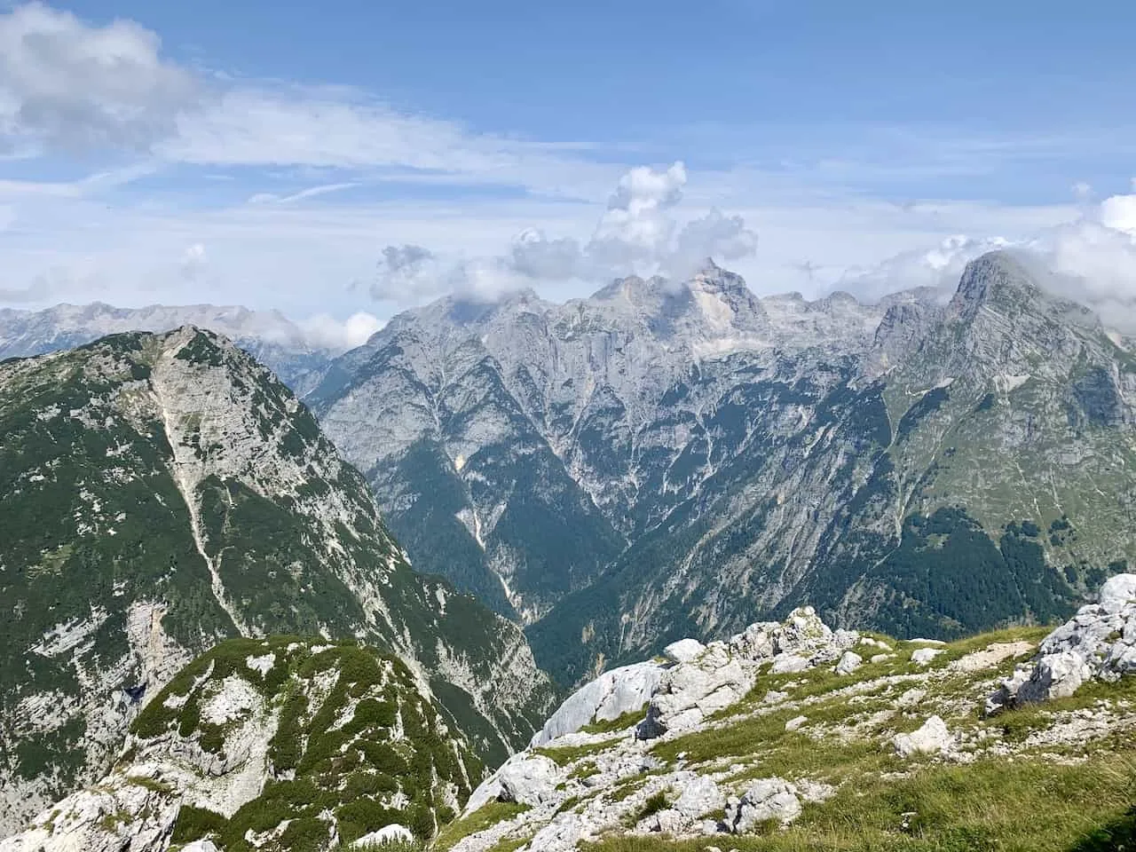
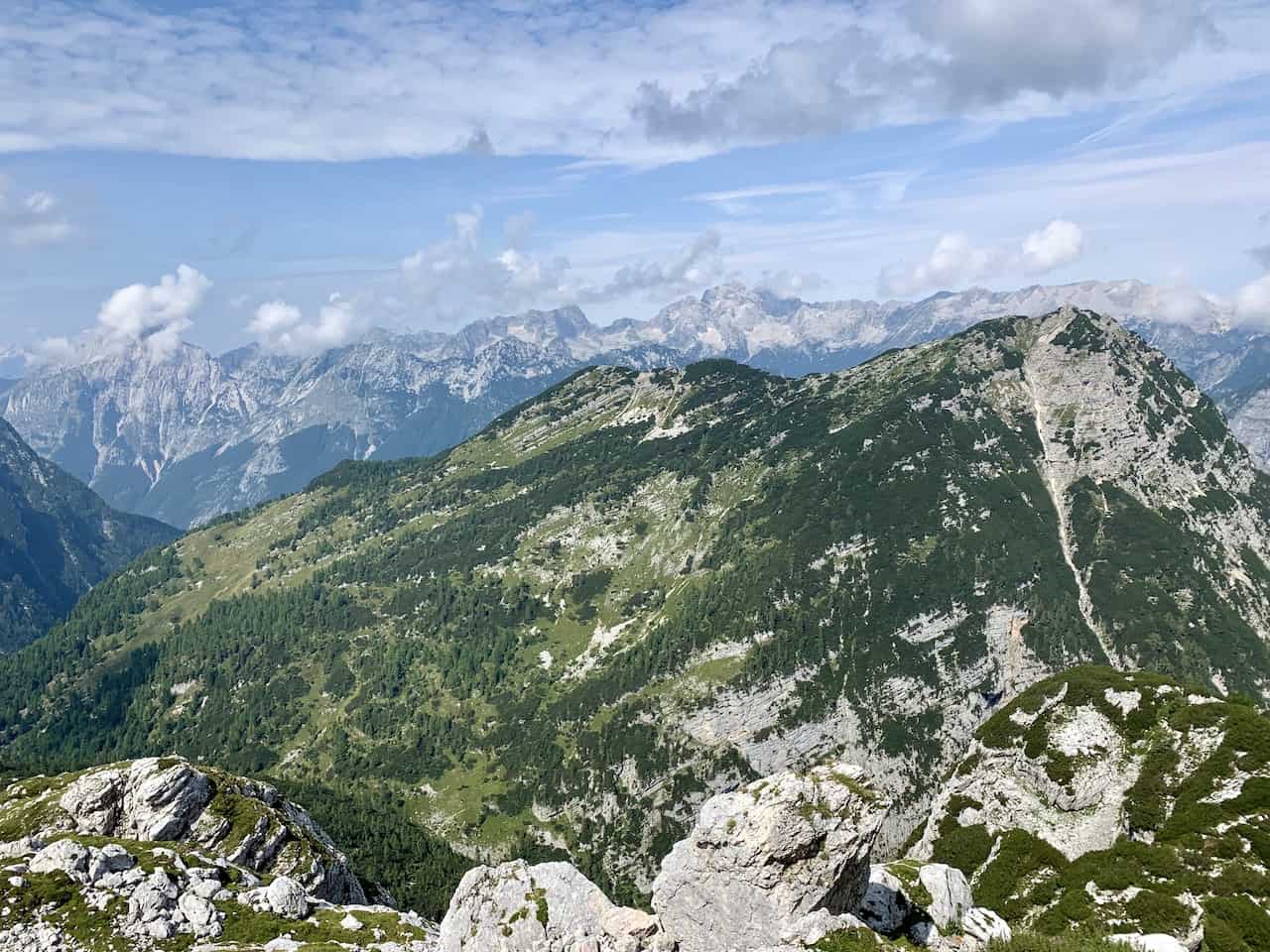
From Planina Dedno Polje, the route does begin to open up more as you continuously gain some elevation. While there will still be trees around you, they will be less dense as you follow the rocky winding trail further into the valley.
D) Planina Ovcarija to Dvojno Jezero & Triglavskih Jezerih Hut (1 hour)
Soon you will reach Planina Ovcarija and from here you will have two routes to choose from towards Dvojno Jezero and Koca Pri Triglavskih Jezerih hut.
The lower route (on the left) takes you there via Preko Prodov while the higher route (on the right) takes you via Preko Stapc.
The map above shows both trail options here with the Preko Prodov route in red, and Preko Stapc as part of the blue route.
The route via Preko Stapc is probably the toughest part of the trail when it comes to incline plus a steeper decline towards the double lakes and hut.
However, with that difficulty also comes beauty as you get to see the lakes and surrounding valley from above.
You can’t necessarily go wrong here, just a matter of preference. I headed up towards the right towards Preko Stapc, which will be the highest point of the trail before making the decline towards the lake.


Before getting to the Preko Stapc saddle, you will come across an intersection with sign markers painted on rocks.
Straight ahead is the route down to the lakes, while to the right is the hike up to Ticarica. Be sure to stay straight here right down towards the lakes.
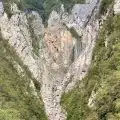
Here is where things start to get steep as you are heading down the mountainside towards the Dvojno Jezero lakes.
While you will have some beautiful views from above, you will need to watch your step as you are making your way down.
You will also find a steel cable that you can hold onto that will help with your balance as you head further towards the lakes.
As you get lower, the trail becomes more manageable as you walk alongside the mountain trail with views of the lakes down below and the forest and mountains surrounding it in all directions.


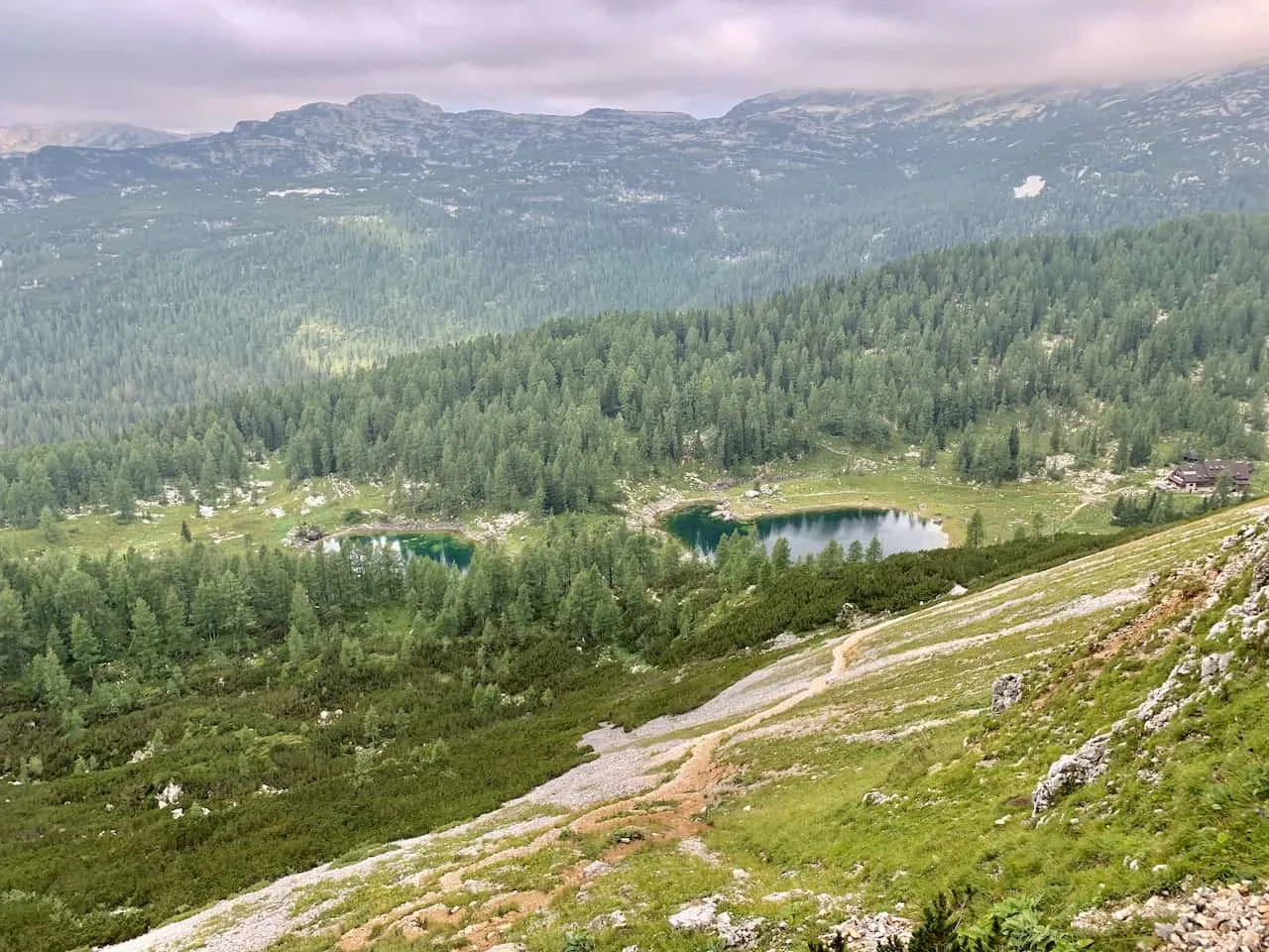
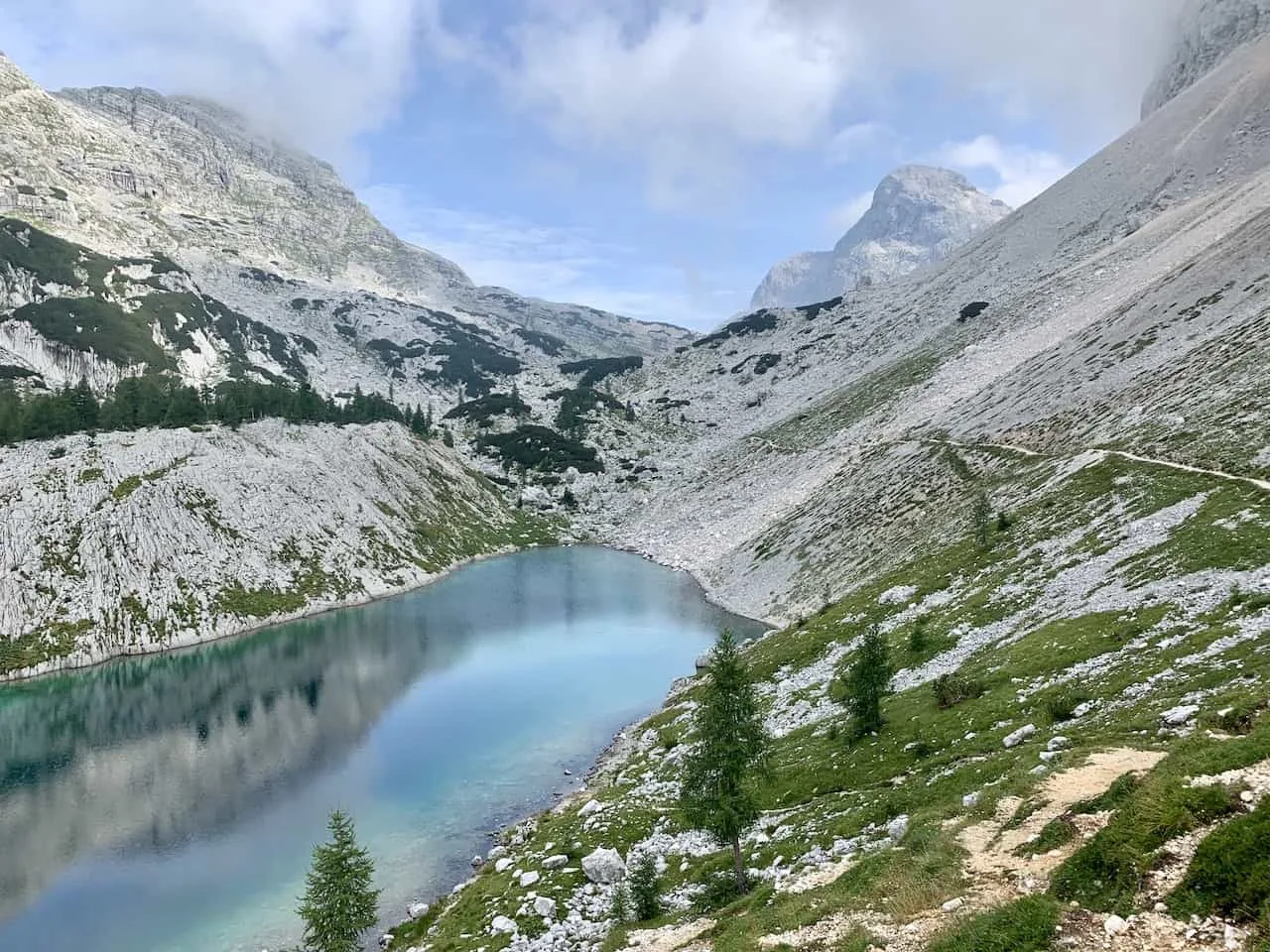
The trail heads into the forest for a bit before opening up directly in between the double lakes of Dvojno Jezero.
I had a bit of a cloudy day when I arrived at Dvojno Jezero, but that still didn’t take away from the scenery out in front of me.
Up ahead you will be able to see the Koca Pri Triglavskih Jezerih mountain hut, where you can take a well deserved break.


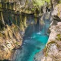
E) Koca Pri Triglavskih Jezerih to Jezero v Ledvicah (45 minutes)
While most people who opt for a day hike end their day at the Triglavskih Jezerih hut before turning back around, in my mind the next portion of the route just cannot be missed.
The route continues behind the Triglavskih Jezerih hut towards Jezero v Ledvicah. If you do not want to do the full loop, I would recommend at least heading to Jezero v Ledvicah before turning around.
Soon after leaving the Triglavskih Jezerih hut, you will pass by Mocivec lake just behind the hut itself.

It is then further along the mostly flat trail towards Jezero v Ledvicah. You need to be super cautious at one point, where the route splits into two. Do not go left here! Just follow the path straight forward. The path to the left will take you to Veliko Spicje, which will be totally towards a different direction.
As long as you are paying attention (and using your navigation app just in case), you should have no trouble getting yourself in the correct direction.
The path will open up to the mountains out in front of you as you make your way through the rock filled terrain.

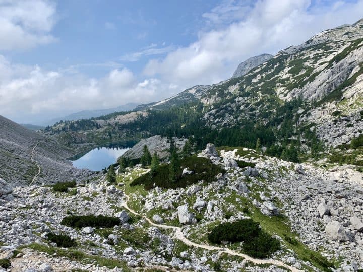
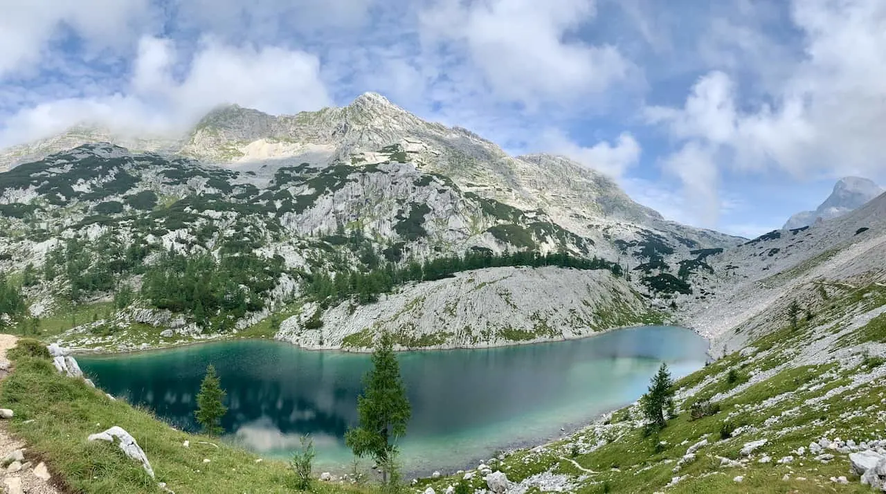
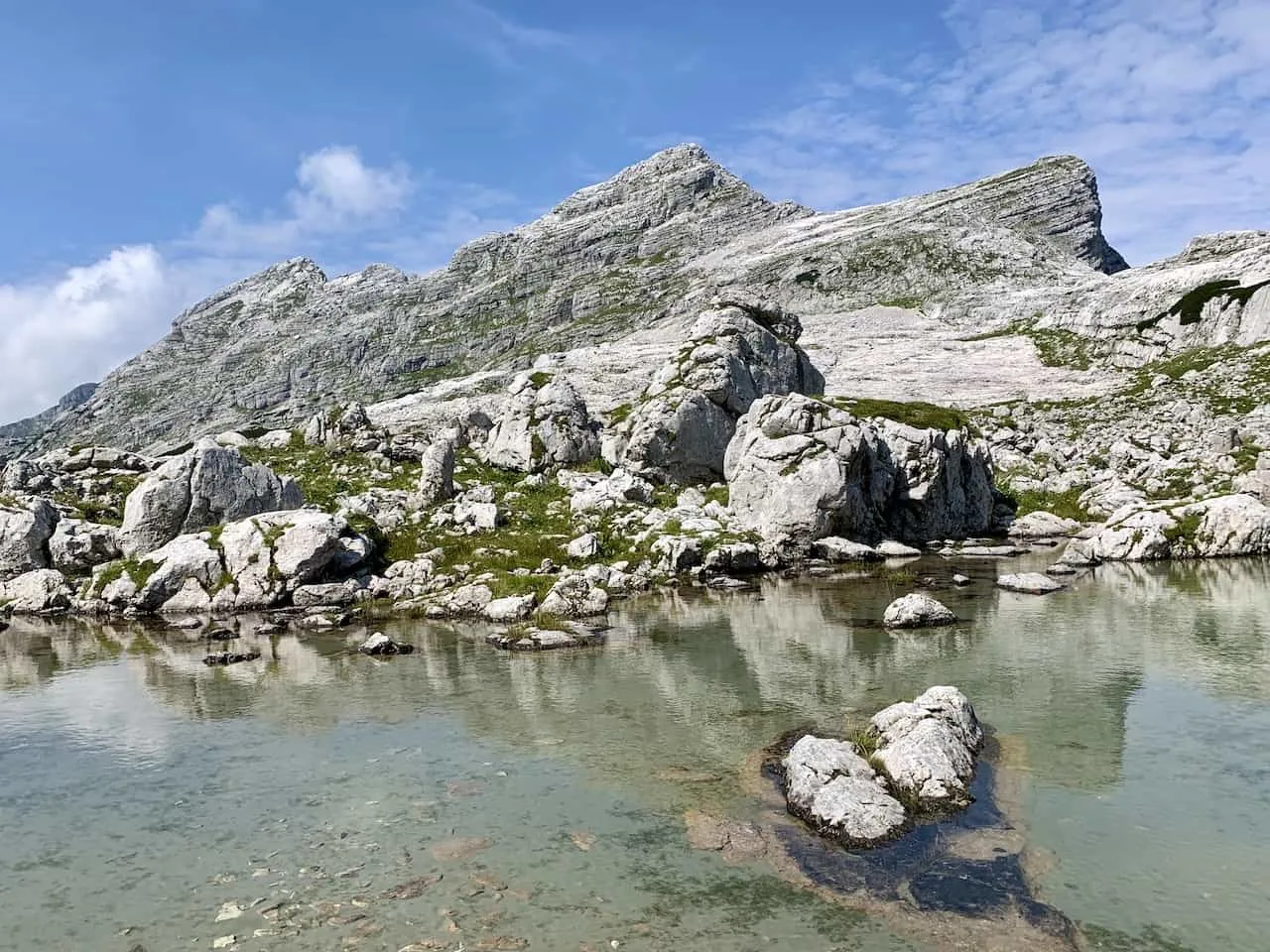
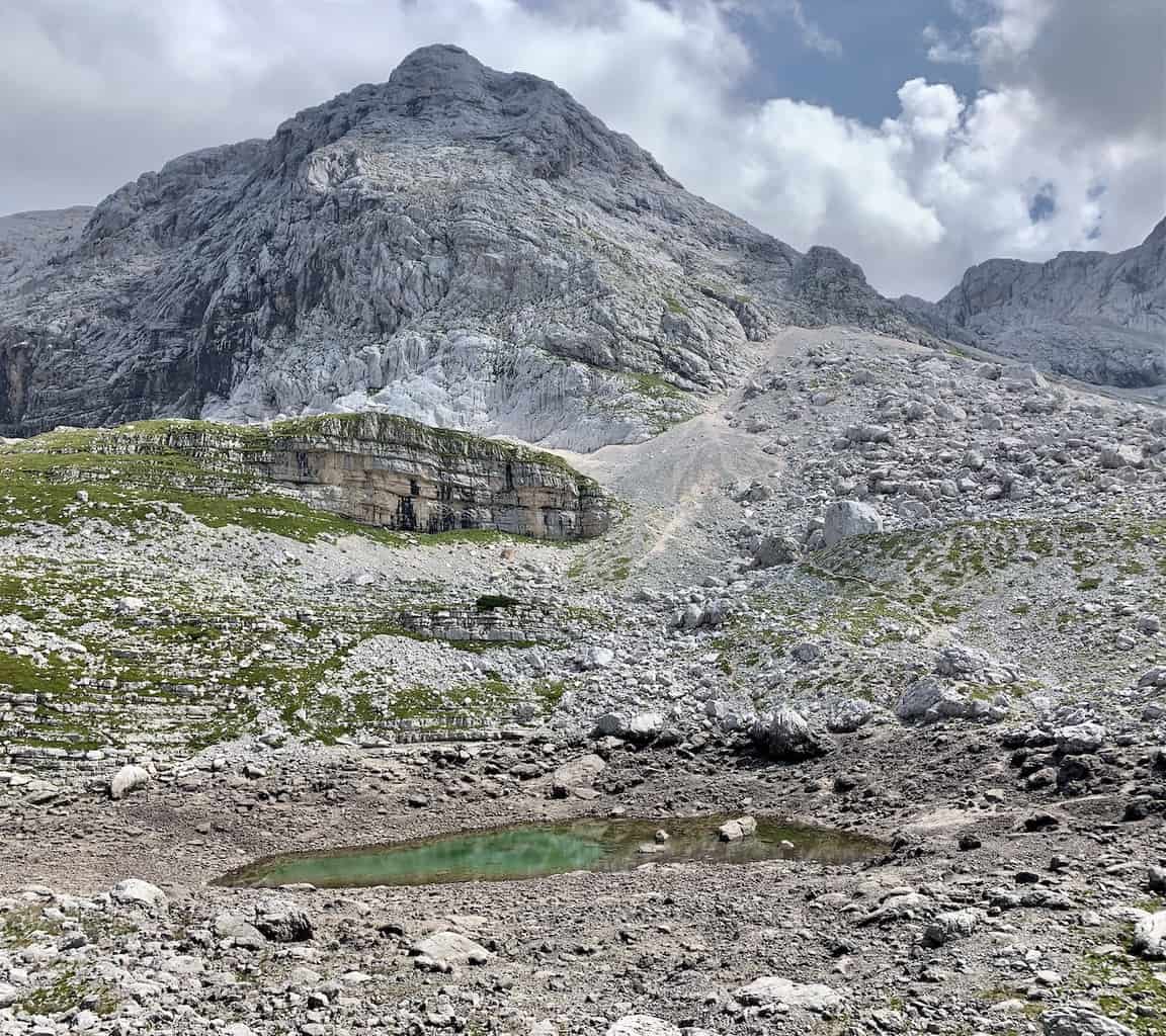
Soon enough Jezero v Ledvicah will come into view as you have just a stunning view of the lake from up above and from all different angles.
The lake has these different hues of blue as you see the surrounding mountain reflections on the lake itself. It is easy to see why this lake is highlighted as a must visit during a trip through the Triglav Lakes Valley.

F) Jezero v Ledvicah to Zasavska Koca na Prehodavcih (1 hour)
After slowly passing by Ledvicah, it is then onto the final mountain hut of the journey – Zasavska Koca na Prehodavcih.
As you follow the route along, be sure to turn around from time to time and get some final views of Ledvicah down below.
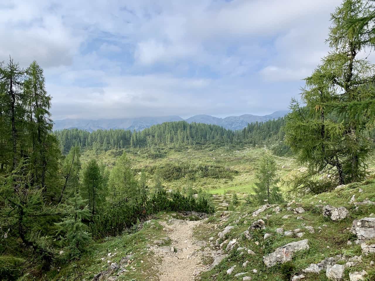
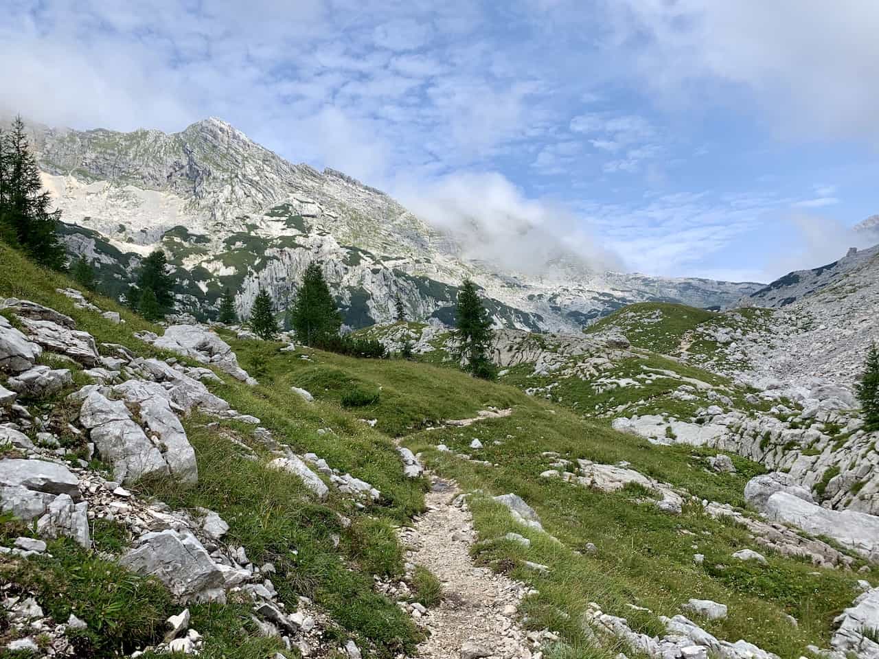
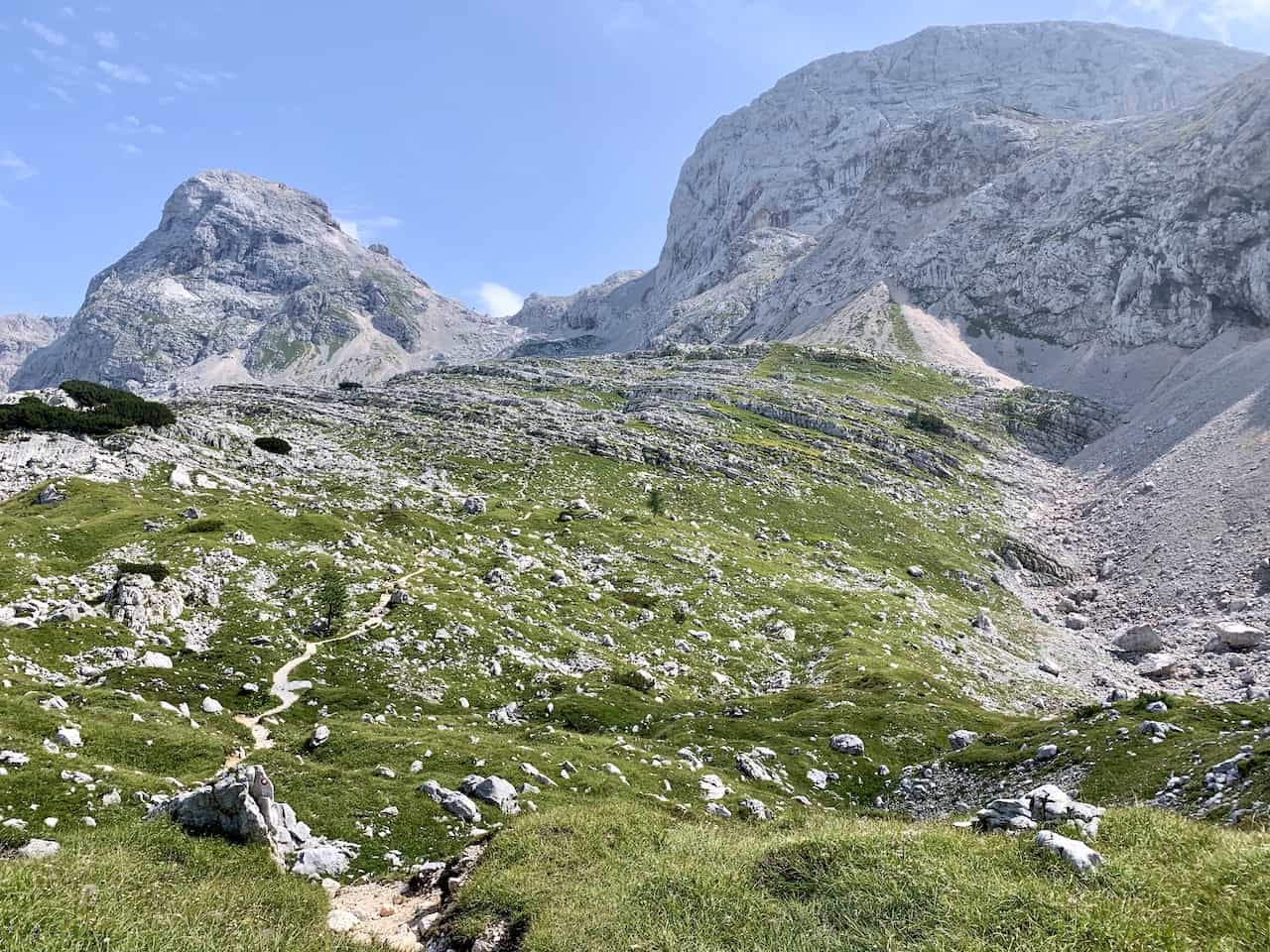
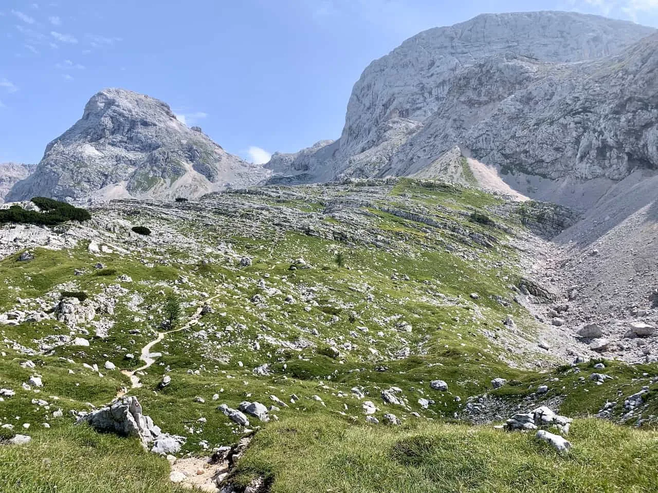
The trail then continues upwards through the green rocky fields as you begin to take in new views and new mountain landscapes.
The mountains here are unlike any other region in the world, so take your time enjoying your surroundings as you make your way past the next lake on the trail.
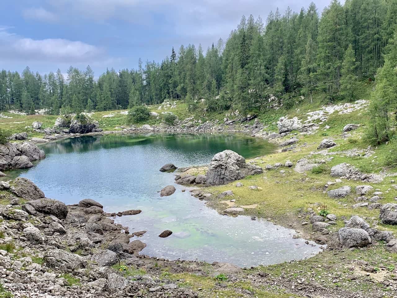
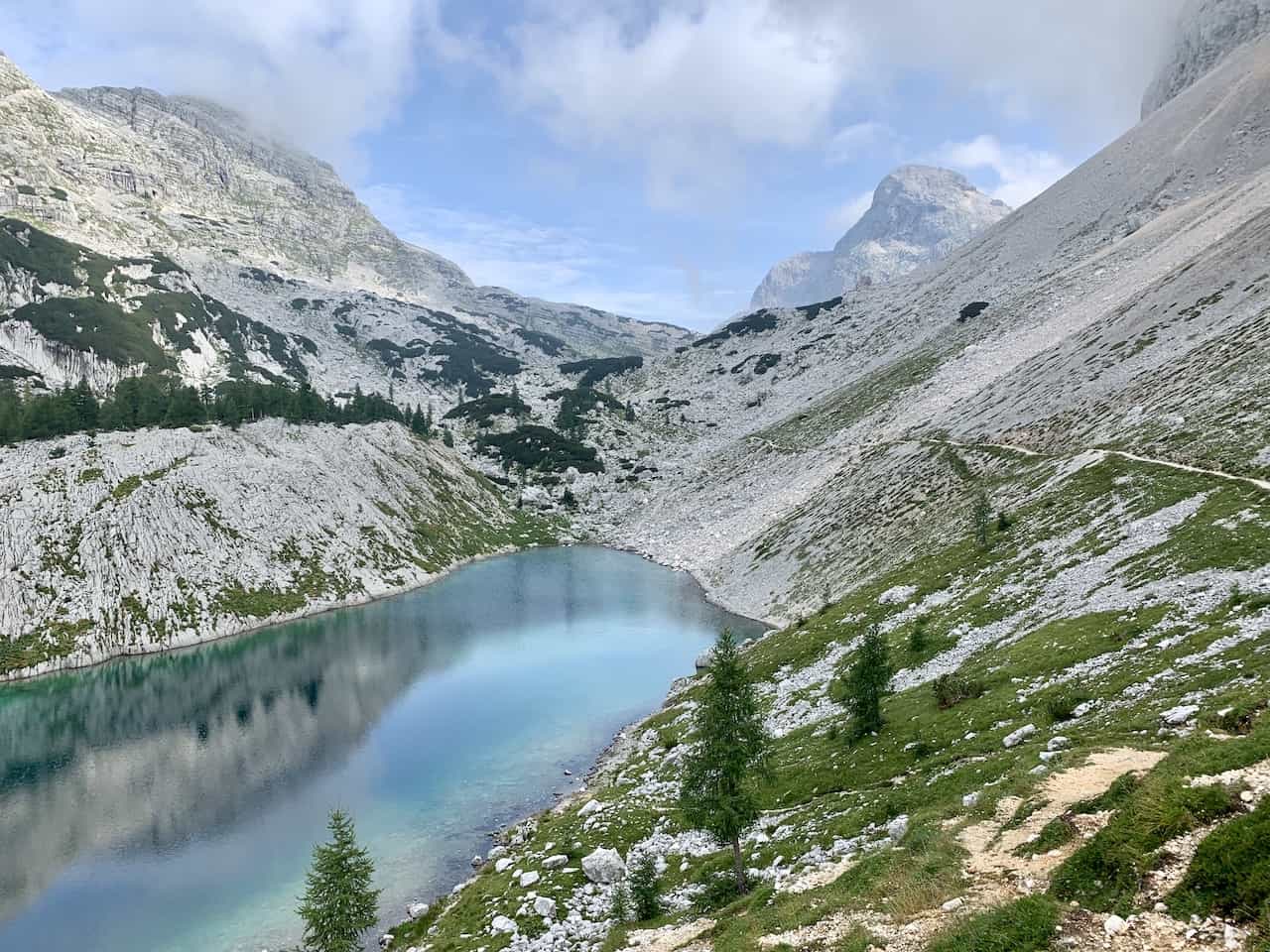
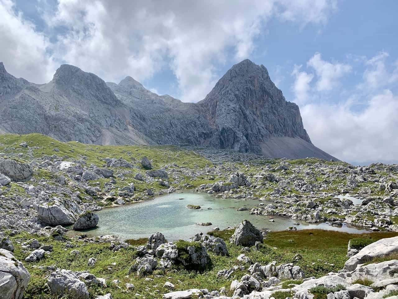
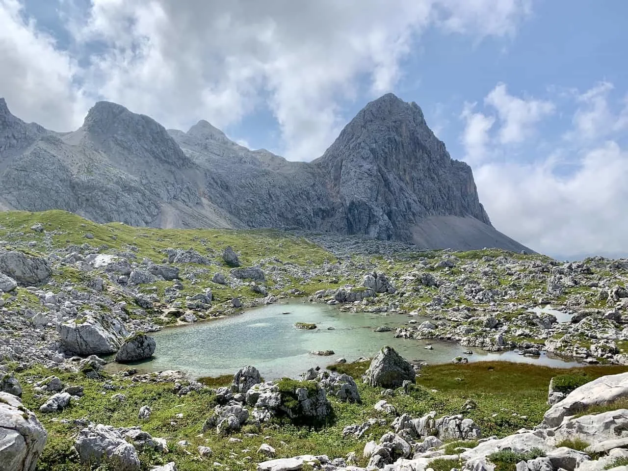
Zeleno Jezero is up next, a perfectly clear shallow mountain lake. The views from all angles here are just surreal to enjoy as you make your way around.
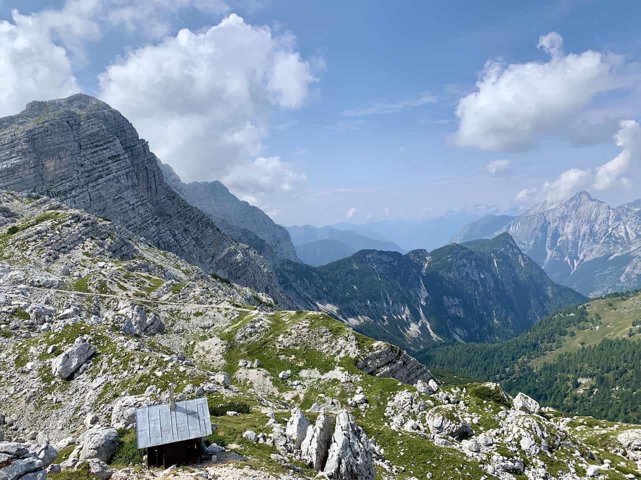
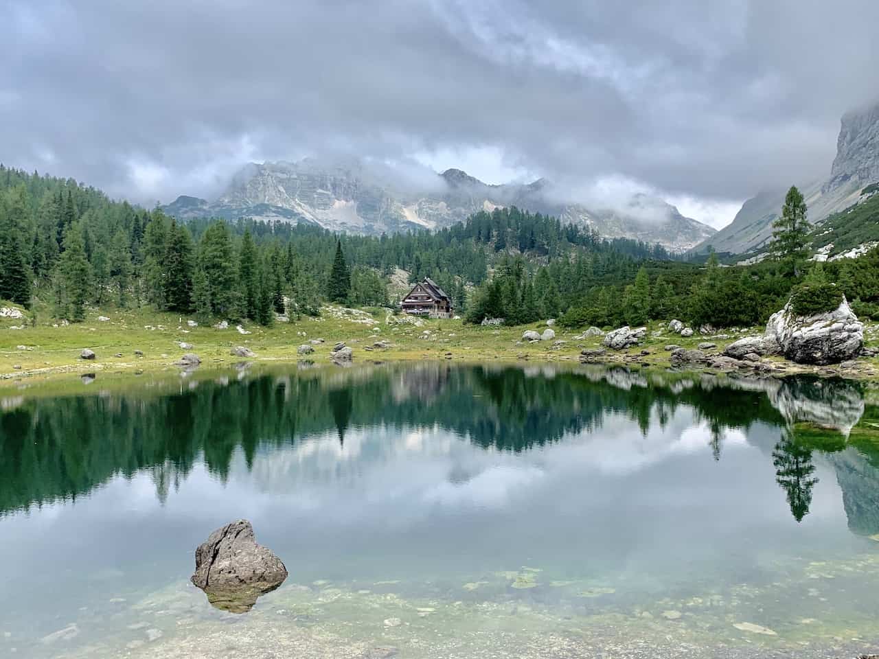
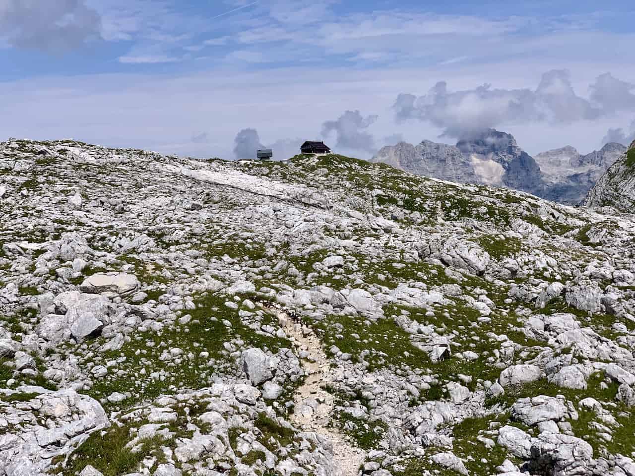
From Zeleno Jezero it is just a 20-30 walk towards the Prehodavcih mountain hut as it slowly comes into view out in the distance.
Once at the hut you will be welcomed to mountain views of the Triglav National Park in every which direction. It is pretty tough beating this type of view after a long day of hiking through the Seven Lakes Valley.
Towards your right you will see the Jezero Pod Vrsacem lake and one of the routes towards Mount Triglav itself.
If a 10 hour day hike is not something you are interested in, I would highly recommend an overnight at the hut. This way you can split the day into two and get to enjoy even more time in the region.


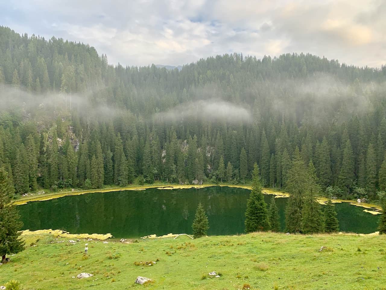
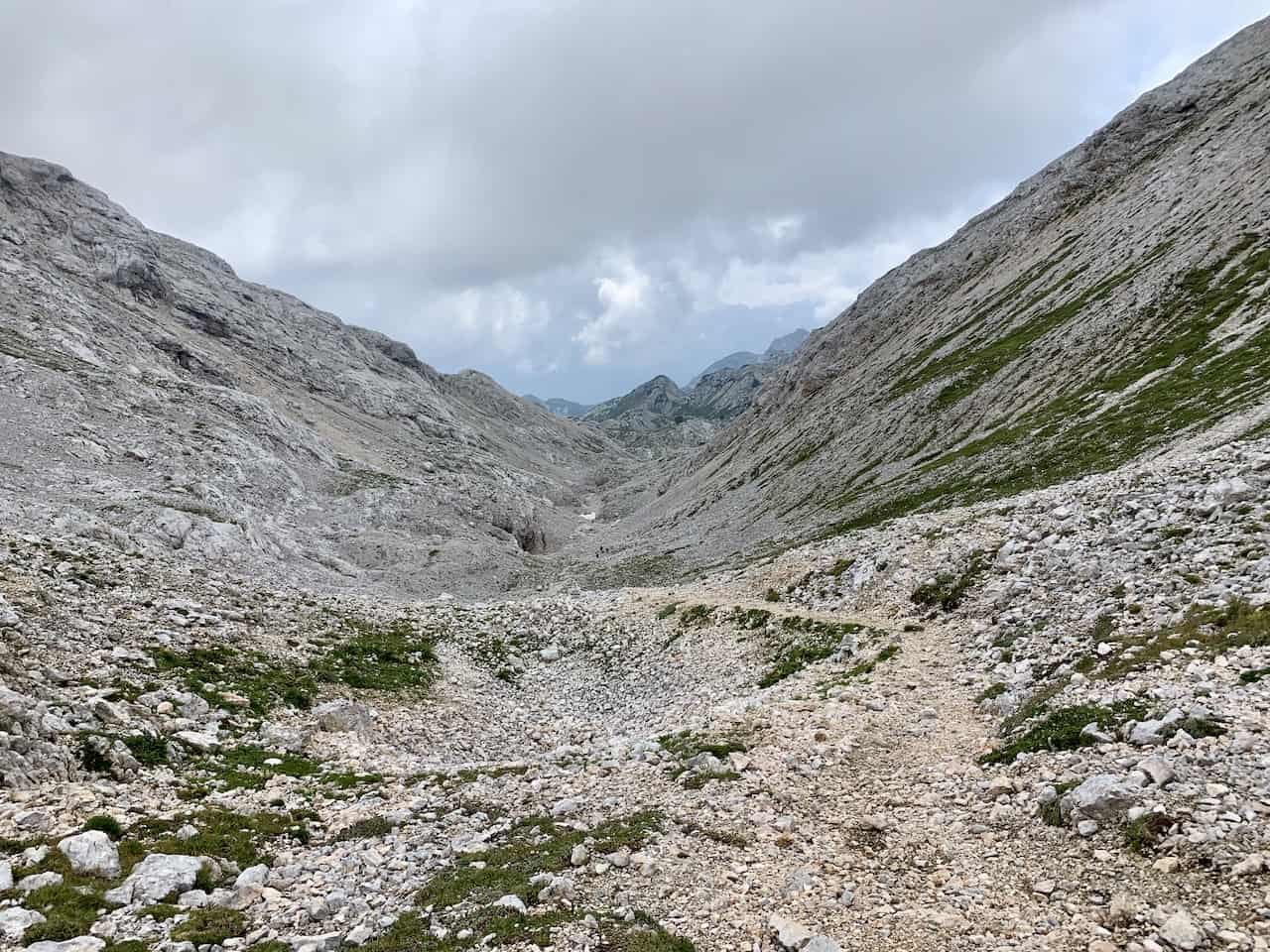
G) Prehodavcih to Planina Dedno Polje (3 hours)
After a well deserved rest at Prehodavcih, it is time to begin the loop back down towards Planina Blato.
Here is where the Google Maps route on the map above was having a bit of trouble getting the path I took for a section of trail.
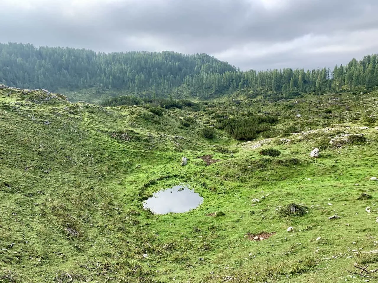
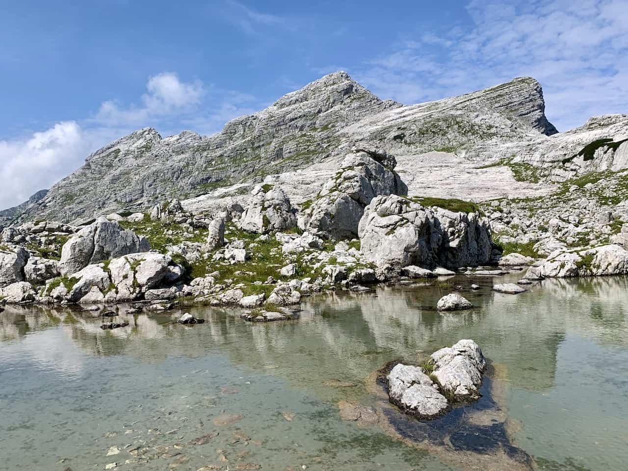
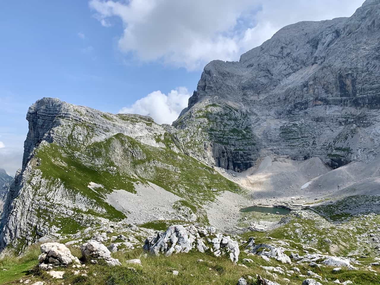
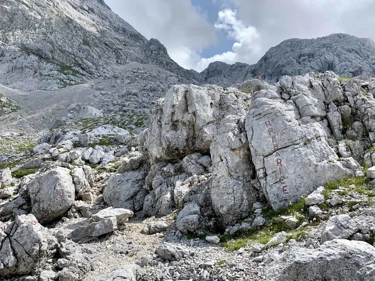
The goal here is to make your way towards the small Rjavo Jezero lake as seen in the image below. From here you will see a few different routes that will take you up alongside the mountainside.
I followed the signs saying Hribarice until I saw the trail markers towards Dedno Polje.


Things can get a bit tough here but this will be the last of the major inclines to expect out on the trail. The path can get steep and slippery so be cautious as you are making your way up.
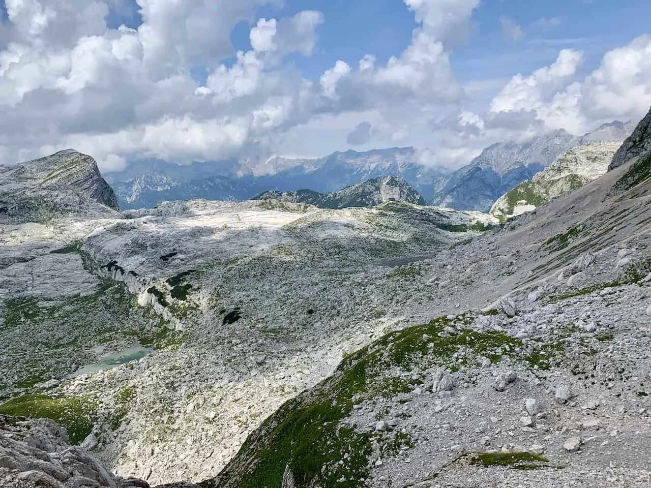
You will once again have some views of the valley from up above as you take in views of the previously visited Zeleno Jezero as well as a smaller lake called Jezero Pod Vrsaki.
Once you are finished the climb here, you will have one last view of the Seven Lakes Valley and the Prehodavcih hut further out in the distance before heading back to the start.

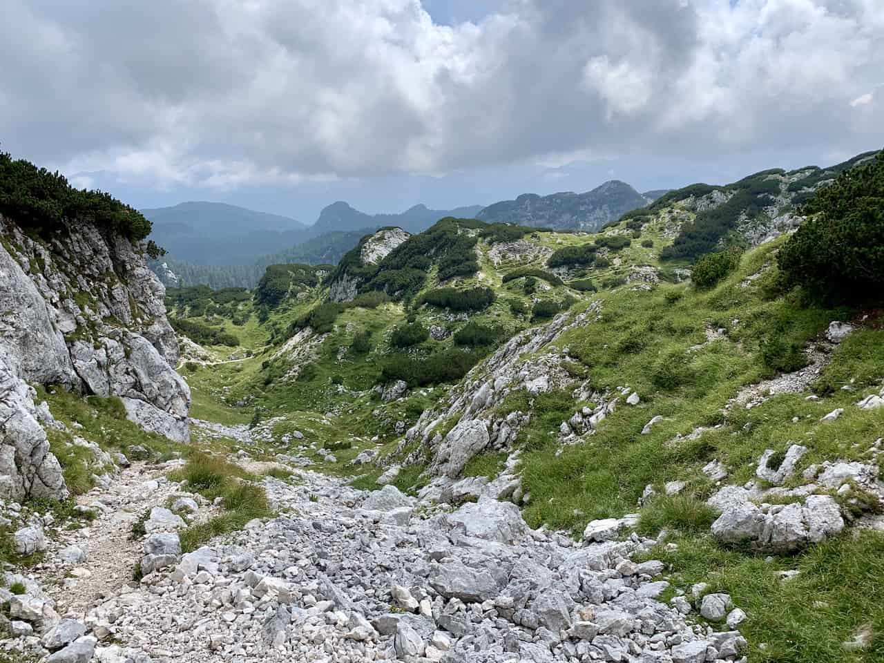
It is a pretty straight shot down this secondary valley towards Planina Dedno Polje. The scenery is still pretty amazing with the greenery filled mountainsides on either side of you as you slowly head back down in elevation.
The hike to Dedno Polje will take around 2-3 hours from the Prehodavcih hut. The trail will slowly get back into the forest and you will once again be welcomed to the Dedno Polje farmhouses.


H) Planina Dedno Polje to Planina Blato (1 hour)
From Dedno Polje, you will then meet up with the same trail you took up from Planina Blato. Around 20 minutes after getting past Dedno Polje you will come across the lake and hut of Planina Pri Jezeru.
From there it is a downhill forested walk back to the parking lot at Planina Blato to end a successful day out in the Triglav Lakes Valley.


At this point of the day you are sure to be pretty tired, so hop back in your car and make your way towards Bled (or wherever else you may be staying).
If you are visiting Triglav National Park, and want to take part of some hiking, then the Triglav Lakes Valley hike is a must do.
It has everything you can ask for in a hike, and even if you do not take part of the entire thing, it is still well worth the effort.
I hope this guide has given you a wholistic overview and sense of what to expect out on the trail. If you have any additional questions or comments feel free to add them in below.
Be sure to also check out the other Slovenia itineraries and guides up on the site. Have fun out there and safe travels!


Jim
Saturday 1st of July 2023
Did this as 2 hike in late June. The section from prehodavcih hut back to the start had one section covered in ice on a steep ridge so it was extremely dangerous without equipment. Crampons and ice picks essential.
Jim
Saturday 1st of July 2023
Would also recommend this hike as overnight only… so you can enjoy the views!!
Harshil
Wednesday 14th of June 2023
Hi, such a great and detailed article. One question though, will it be possible to do this hike in late October? Thanks
Charles
Thursday 15th of June 2023
Hi Harshil - there is always the chance of snowfall as you get into October. That said, the hike still may be possible. It is just hard to know given every year is different. You may also need to check whether or not the huts are open if you want to stay overnight. Enjoy!
Karlijn
Wednesday 24th of August 2022
Hi Charles,
Thank you for the great description of the route! I’m trying to download the gpx file in the way you have explained, but on my phone this is not working unfortunately. Do you have any way to share the gpx file by any chance?
Thanks a lot and looking forward to the walk!
All the best, Karlijn
Charles
Thursday 25th of August 2022
Hi Karlijn - the file will export as a KML format by doing the following: on the top right hand corner of the map you will see a square shape. When you hover over that it will say “view in larger map”. Once you open the map, you will see three vertical dots next to the title of the map. Click these three dots, and then click “download KML”. That should give you the file that you can then upload to an app like Maps.me.
If you need a GPX file, then you will just need to convert the KML file using an online converter. Enjoy the hike!
Sierra
Friday 8th of July 2022
This is very helpful! I will be doing this hike solo in a few weeks. How much water did you bring for the day? Can I buy more water at one of the huts?
Charles
Saturday 9th of July 2022
Hi Sierra - I just usually carry a ~1 liter water bottle on hikes. You can fill up water at the various huts along the hike (or purchase a bottle). Enjoy your time out on the trail!
Ron
Tuesday 14th of June 2022
Hi, enjoy reading it all - full of info & details great work!
we are planning our 2 days hike at the end of June from "Planina Blato" to "Koča pri Triglavskih jezerih" and maybe a little further.
we are a couple with a 2 years child - planning to carry him on with child carrier.
among the optional routes u offered on the trail (purple & red), which one u think will be most suitable for us (regarding the child carrier) we are usually hike but that one is a step forward for us...
thanks for your help! Ron
Ron
Saturday 9th of July 2022
@Charles, Update, we finally hike up to the koča pri triglavskhi jezrih (27.6-28.6.22) it was amazing and challenging with 17kg on back (child carrier with 2 year old child). We didn't walk up to kidney lake because of the hot weather (34°C) and also rain expected at noon, So we decided to go back down to the car first thing on the morning.
We hike acc. To your recommendation to go through "prodov", it's a plus 1.8km but the trail is fit for a child carrier with no stip descents or ascents.
The child also hike alone ~1.5 km in total so that was his first mountain experience to :)
Again, thanks for all the info! It's definitely help us to get their more organized and prepare.
Ron, Shenhav and little Tomer
Charles
Tuesday 14th of June 2022
Hi Ron - thanks for the kind words and I am glad it has helped out with the hike planning. The purple route I can't speak to too well, but I imagine that one should be just fine. I would recommend taking the red route though instead of the route I took (blue route down to Koča pri Triglavskih jezerih). This was certainly the most demanding of downhills and could get tricky with a child carrier. So feel free to take the purple route if you rather make it more circular, but I would recommend taking the red route to avoid the strenuous downhill. Hope that helps!