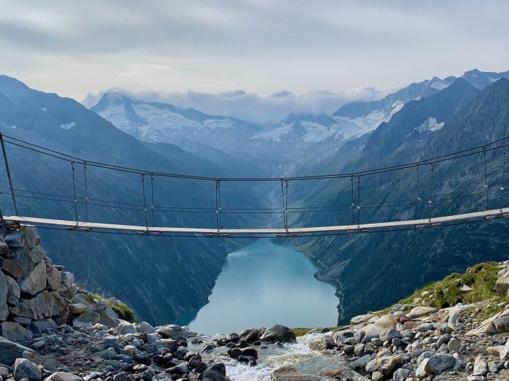

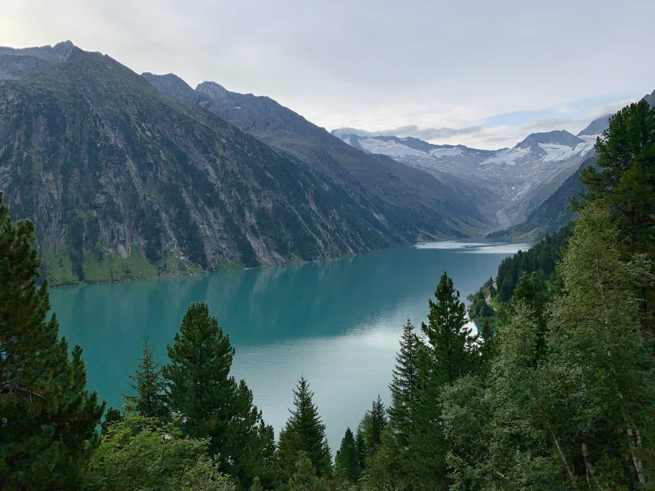
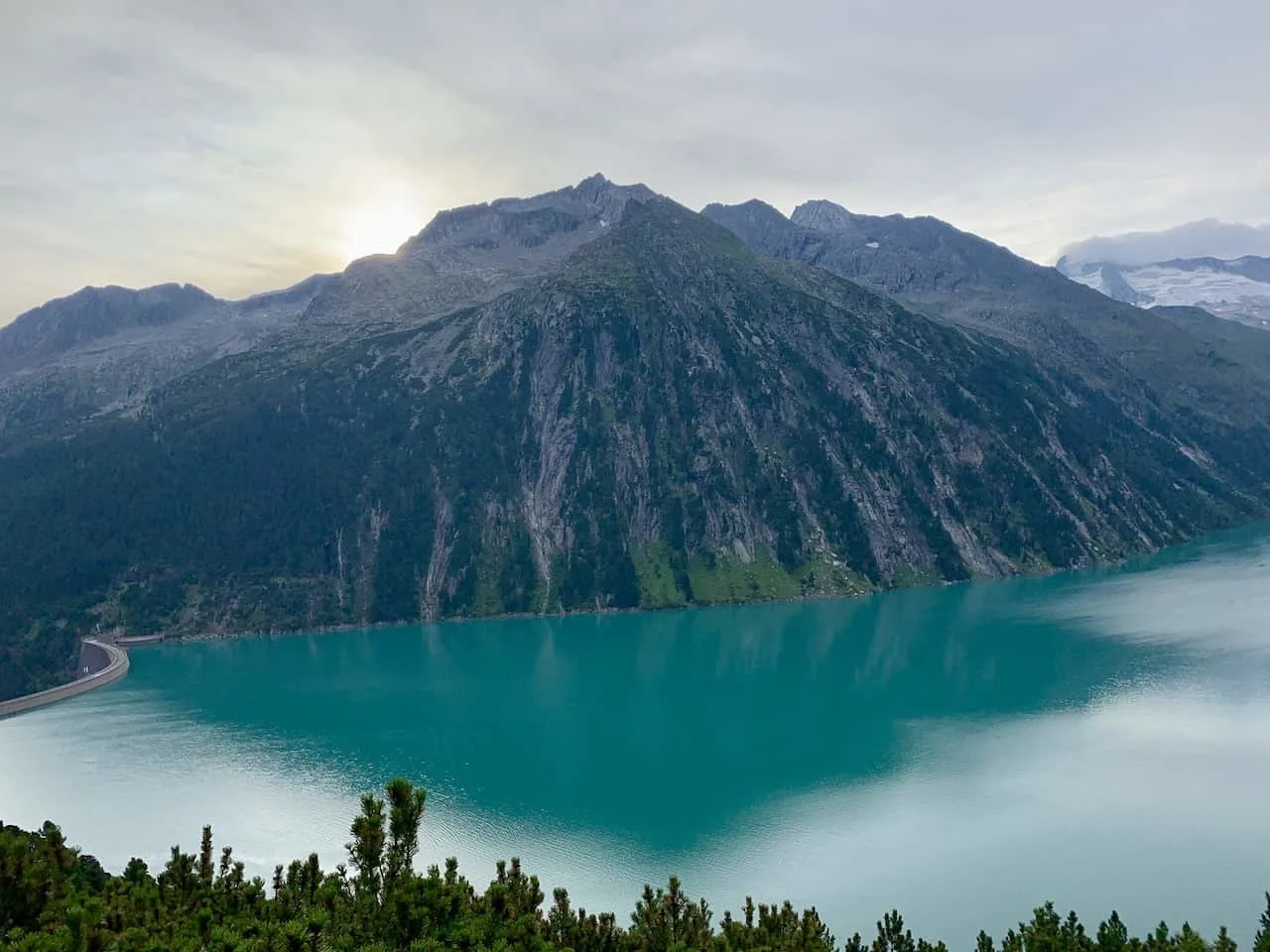
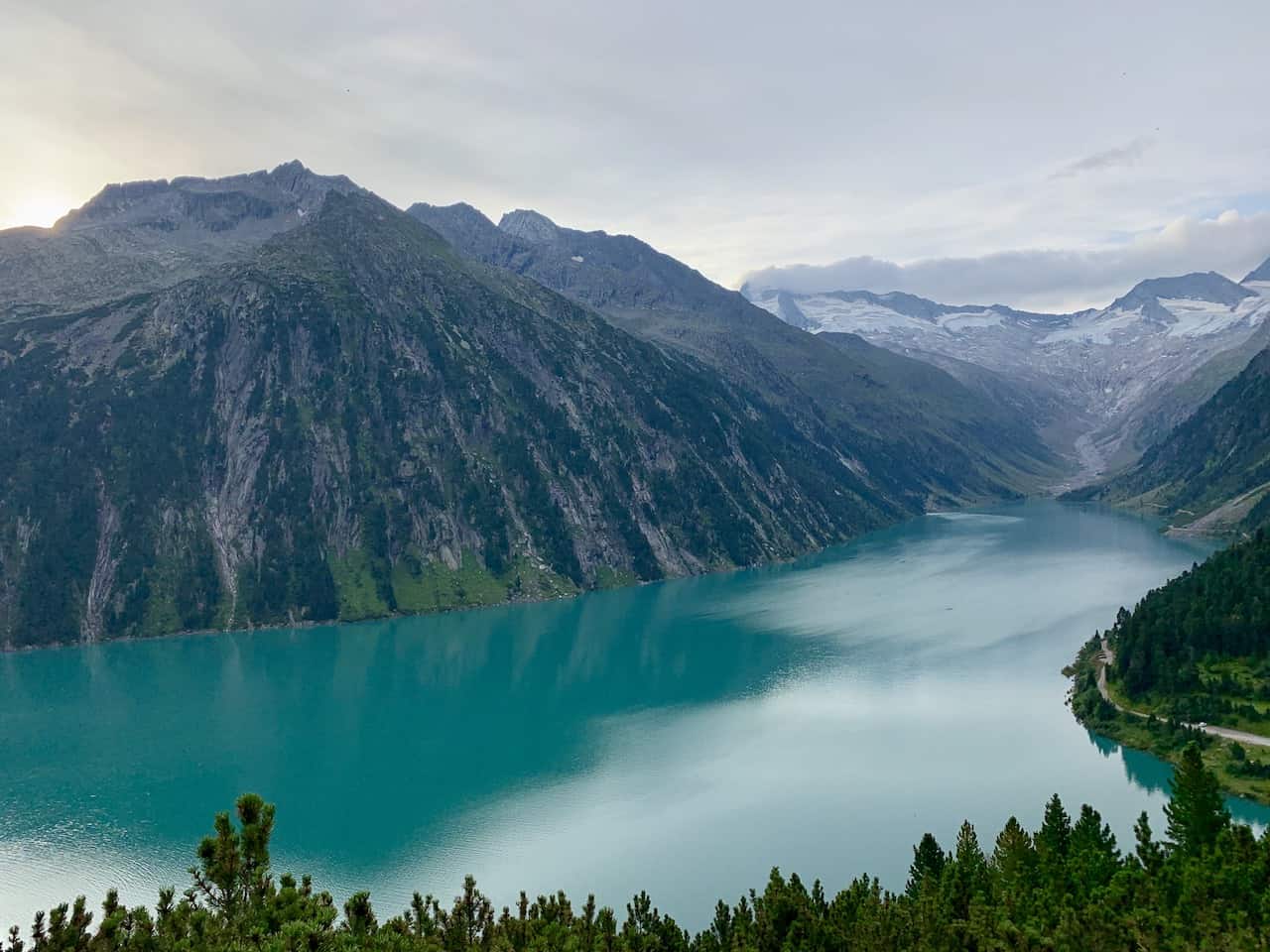
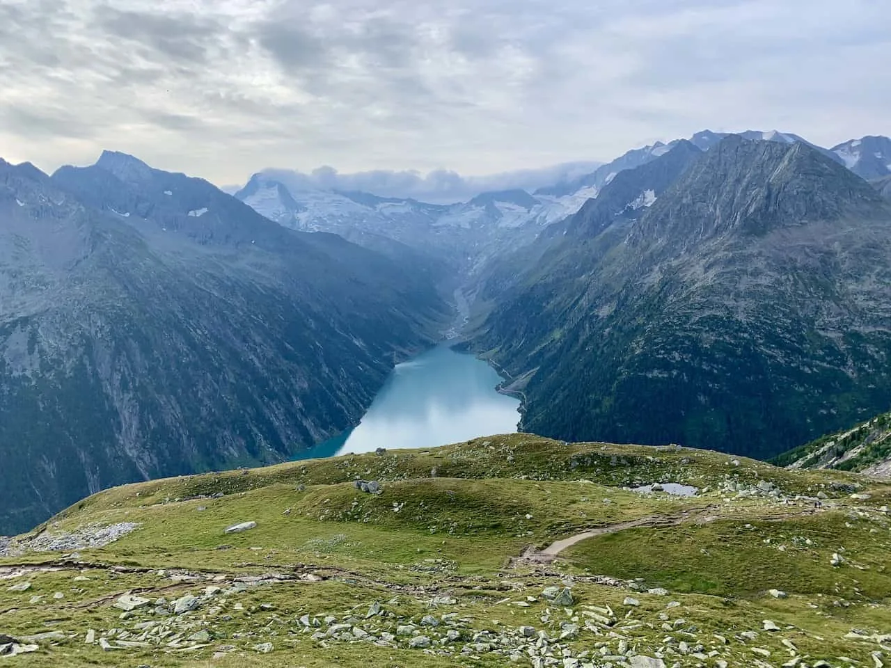
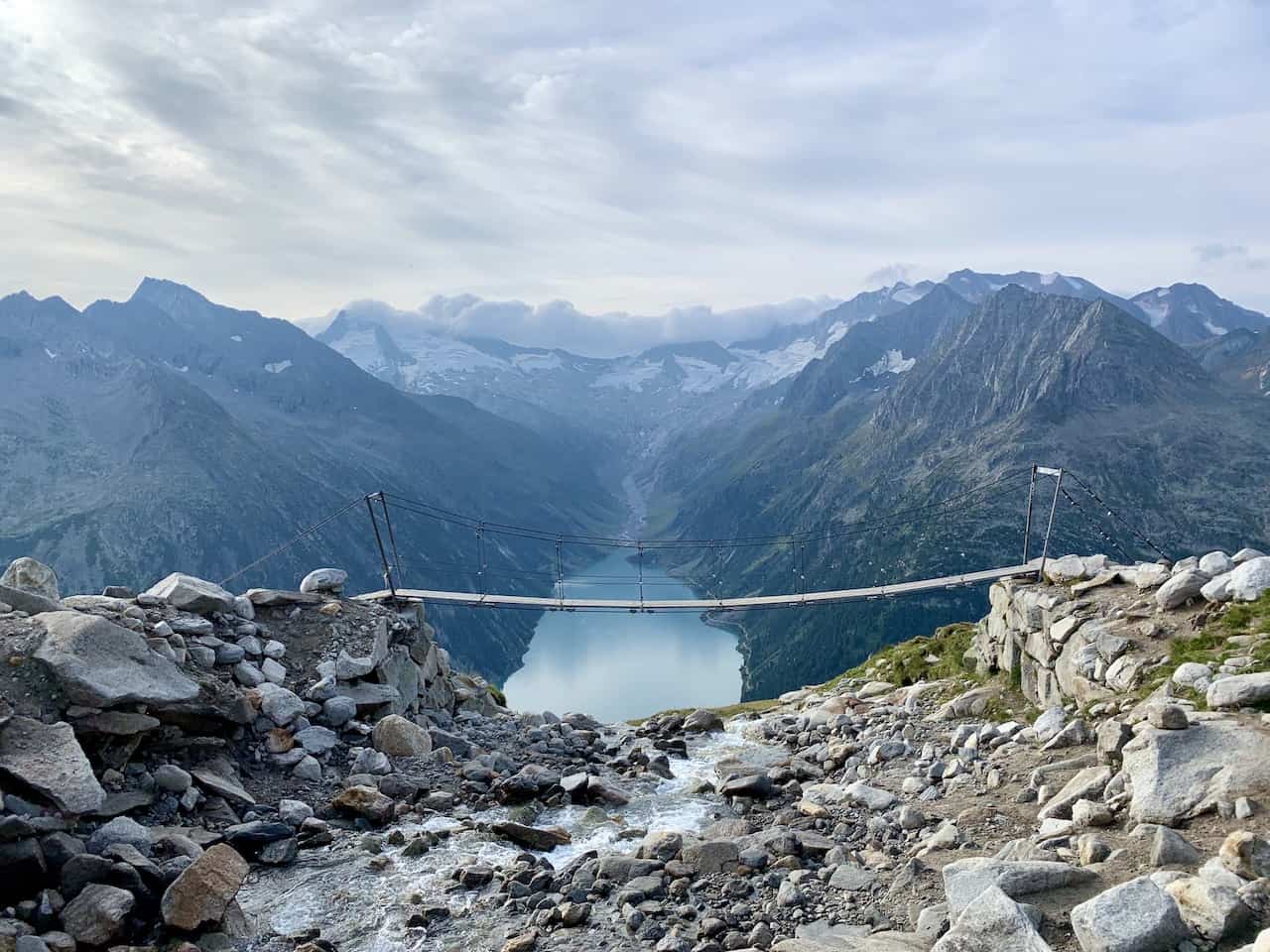
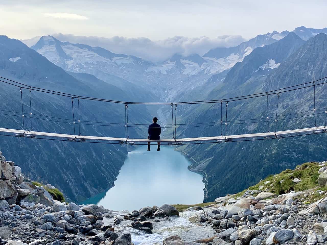
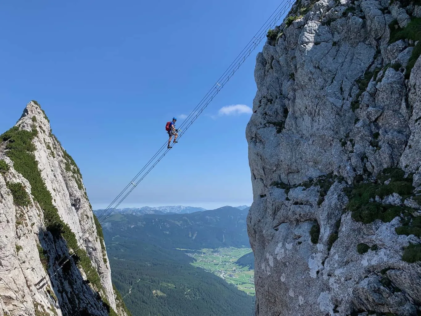
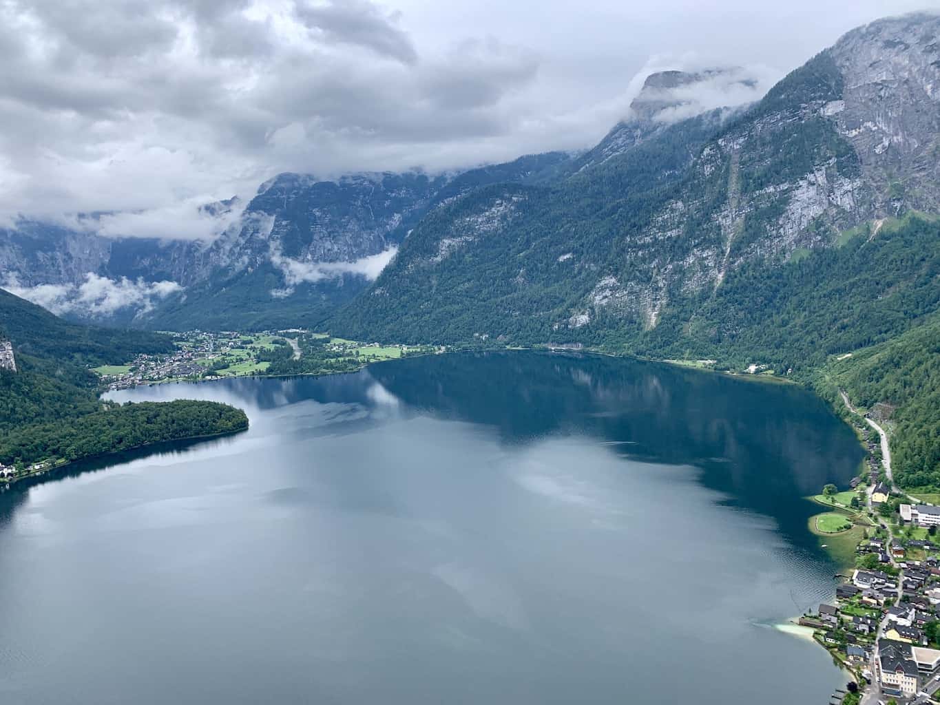
When it comes to viewpoints in the Austrian Alps, it is hard to beat the view from the bridge on the Olpererhütte hike route that overlooks Schlegeis Stausee and the surrounding snowcapped peaks.
Not only will you be able to enjoy a one of a kind view from the bridge, but the hike is also filled with plenty more beautiful landscapes throughout the trail.
This guide will walk you through how to reach the Olpererhütte and what to expect along the way.
* Affiliate Disclosure: This post may contain affiliate links, which means I may receive a commission if you make a purchase through the links provided, at no additional cost to you. Thanks for supporting the work I put into TripTins!
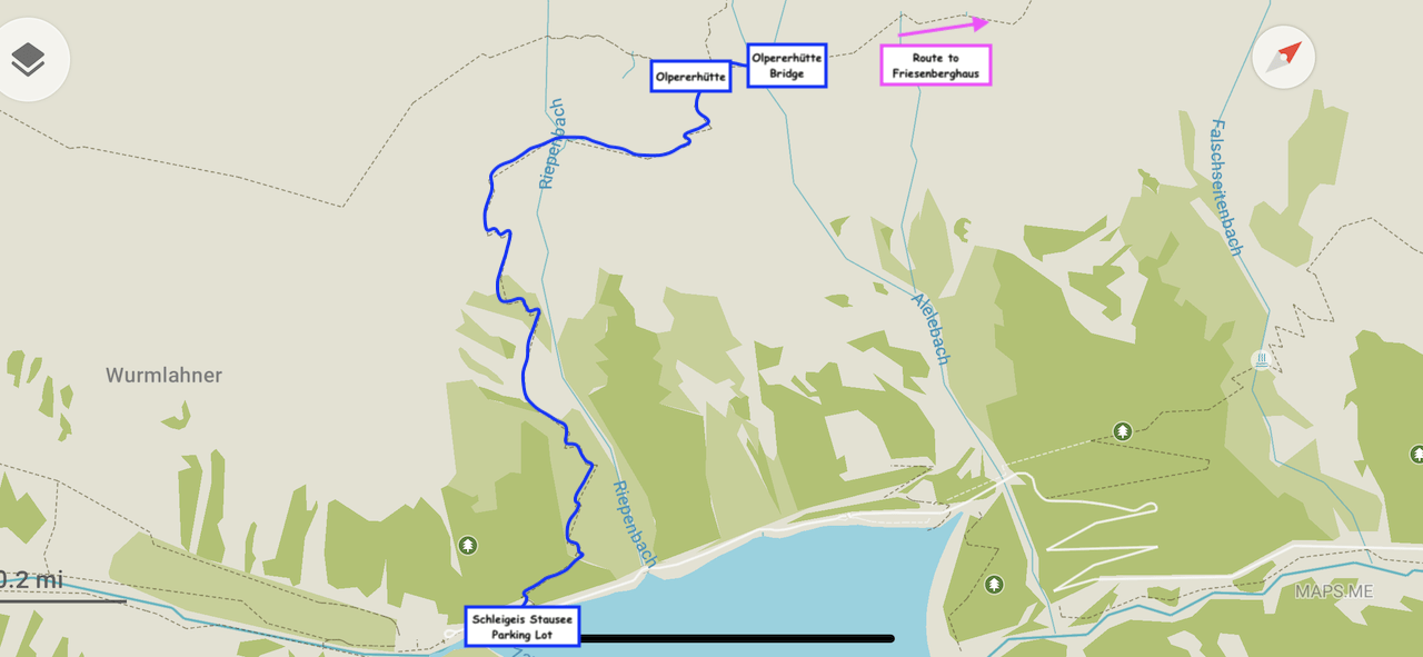
1) Olpererhütte Hike Map
I thought it would be helpful to start out showing the Olpererhütte hike map so you can get a better idea of the actual route.
If you aren’t familiar with the area, the Olpererhütte is a mountain hut, where people can hike to as part of a day trip or a longer overnight hiking route.
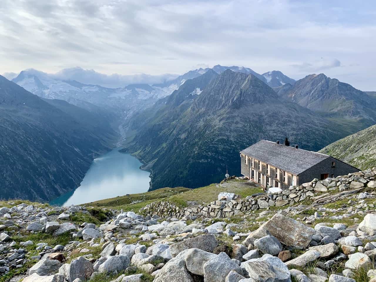
In the hut itself you have the chance to eat food, have drinks, or stay the night in one of their rooms.
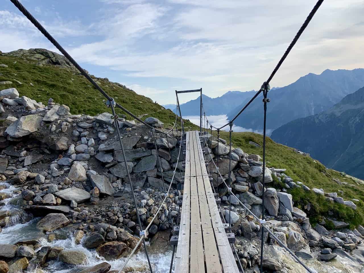
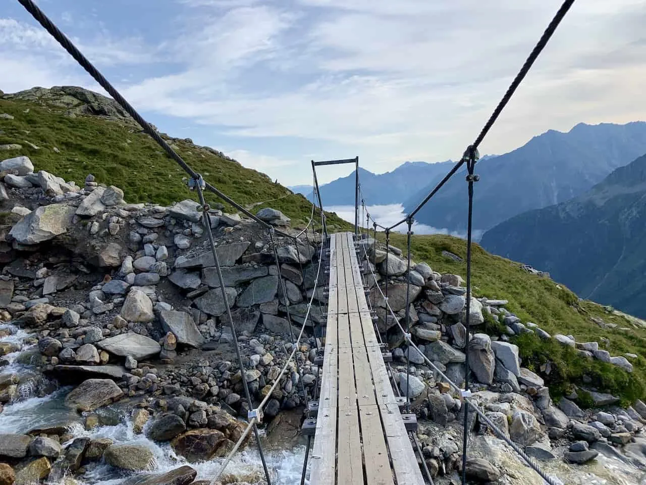
While the views are beautiful from the hut itself, the Olpererhütte bridge is the definite highlight here. To reach the bridge, all you need to do is hike for another 5 minutes or so past the hut.
Once you reach the bridge you can turn back around and head down the same way you came up (~3 hour round trip hike).
If you would like to extend the hike, instead of turning around, you can also head towards the Friesenberghaus (another mountain hut), and complete a loop route ending back by Schleigeis Stausee (~7 hour hike).
This guide will just focus on the hike up to the Olpererhütte and bridge, and then back down the same way.
If you would like to learn more on the longer loop option, then also take a look at the Friesenberghaus Hiking Guide.
2) Olpererhütte Hike Details
As mentioned, there are a few ways to go about a hike to the Olpererhütte.
The main option for those day hikers out there is to simply go from the Schleigeis Stausee parking lot to the Olpererhütte and bridge, and then back down. The below details will go over that route:
- Hike Name: Olpererhütte / Olperer Hut (Elevation: 2,388 Meters / 7,835 Feet)
- Route #: 502
- Starting & Ending Point: Schleigeis Stausee Parking Lot
- Length: 6 KM / 3.7 Miles
- Duration: 3 Hours (~1.5 hours each way)
- Elevation Gain: 600 Meters / 1,969 Feet
- Terrain: Rock / Dirt
- Difficulty: Medium
Learn More: Be sure to check out some of the other top things to do in Mayrhofen during a visit

3) How To Get To Olpererhütte
There are a couple main ways to get yourself to the starting point of the Olpererhütte hike at the Schleigeis Stausee Parking Lot.
You can either choose to head there by driving on your own or you can hop on the local bus.
Driving Your Car
There are two parking lot locations near the trailhead. One smaller lot directly in front of the start of the hike and a larger parking lot another minute drive down the road.
If there is spaces in the smaller lot, it would make more sense to park there. If not, you will just need to walk another 10 minutes or so to the trailhead from the main lot.
Note that you will need to pay a toll of 15.50 Euro to access the Schlegeis Alpenstrasse Alpine Road that goes to the Schlegeis area. The toll booth is about 15 minutes prior to reaching the Schlegeis area.
Car Rentals: If you are renting a car in Austria, be sure to check out Rentalcars.com to browse through options. Once on the site, you will be able to filter by price, car type, rental company, and more, to find the perfect car for your trip to Austria
Taking the Bus
On the other hand, if coming by bus you can take the seasonal 4102 route (~May to September) that runs from Mayrhofen to Schlegeis Stausee.
If coming from another town/city, try to get yourself to Mayrhofen by bus or train and make your way from there.
Schlegeis Notes
Road Opening: Note that the road to get to the Schlegeis area is only open from around mid May to October so taking part of the hike outside of these months will not be possible.
Schlegeis 131: If you have more time in the area, you can also check out the adrenaline options near the lake. This Schlegeis 131 overview will go over it all for you.
Schlegeis Map
The map below shows the location of the two parking lots, the trailhead, the Olperer Hut and the bridge.
4) Where to Stay in Mayrhofen
There are many small towns to stay in when visiting the Zillertal Valley and the Schlegeis Stausee area in particular.
I would recommend staying in the town of Mayrhofen though as it does have a good amount of choices when it comes to accommodation and it is also very centrally located to many different activities around the area.
Since Mayrhofen is a relatively small valley town, no matter where you stay in it, you will be at most a 20 minute walk to restaurants, bars, the cable cars, and the train station.
The drive from Mayrhofen to the start of the hike is just about 35 minutes. Below are some great options to choose from depending on your budget:
- Luxury: Hotel Neue Post | Alpin Lodge das Zillergrund | ElisabethHotel
- Mid Range: Sporthotel Manni | Alpendomizil Neuhaus | Zillertalerhof Alpine Hideaway
- Budget: Birkenhof | Landhotel Rauchenwalderhof | Gasthof Edelweiss
Austria Itinerary: Head to Mayrhofen as part of your 7 Day Austria Itinerary visiting places all over the country and check out the nearby hike up Ahornspitze
5) What To Bring on the Hike
Whenever heading off on longer day hikes, I always recommend being adequately prepared when it comes to the type of gear to bring along.
Check out the below packing list to get you ready for this hike and other hikes in Austria.
Hiking Packing List
In general when it comes to hiking, there are a few main aspects to consider. These includes clothing layers, hiking shoes, hydration & fuel, electronics, and other essentials.
Below in a breakdown of some of the top items, but be sure to check out the Hiking Packing List for a more comprehensive view.
Clothing Layers
Layering is going to be a top consideration when hiking. You will want to be prepared for all sorts of weather so you can be comfortable in different situations. Some items may include:
→ Hiking Shorts
→ Hiking Pants
→ Short Sleeve Shirt
→ Long Sleeve Shirt / Sun Hoodie
→ Mid Layer Fleece
→ Puff Jacket (not always needed)
→ Packable Rain Jacket (Columbia Watertight II)Note that your layers should be made of moisture wicking material as they are breathable and quick drying.
Footwear
Having appropriate footwear will also be very important. You will want to have shoes with the necessary grip and support to keep you safe on the trail.
→ Hiking Shoes (Keen Targhee)
→ Hiking Socks (Darn Tough)Other Essentials
Whether it is hiking gear, electronics, or just some miscellaneous items, here are some other essentials to bring along on hikes.
→ Hiking Backpack (Osprey Talon 22) & Rain Cover (Joy Walker Cover)
→ Hiking Poles (Black Diamond Trekking Poles)
→ Water Bottle (CamelBak Chute or Katadyn Filter Bottle)
→ Portable Charger (Anker PowerCore 5000mAh)
→ Action Camera (GoPro Hero)
→ Energy Bars & Snacks
→ Hat & Sunglasses
→ Sunscreen & Bug Spray
6) The Olpererhütte Bridge Hike
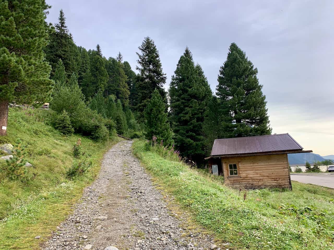
Now that you have a better idea about logistics, let’s talk about the hike itself. Once you park your car, make your way to the trailhead located right across the street from the first parking lot (pinned on the map above).
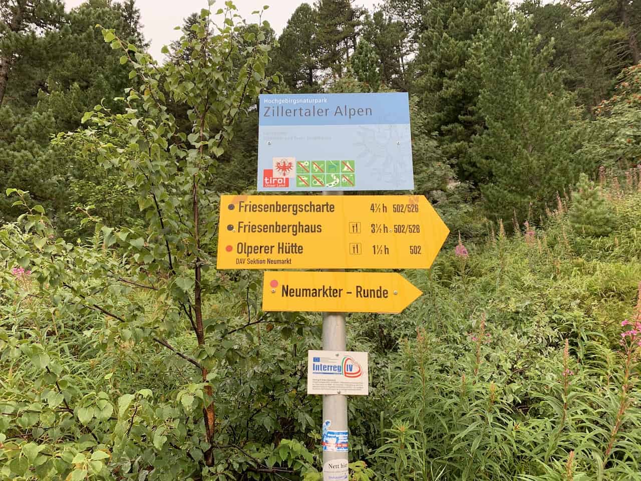
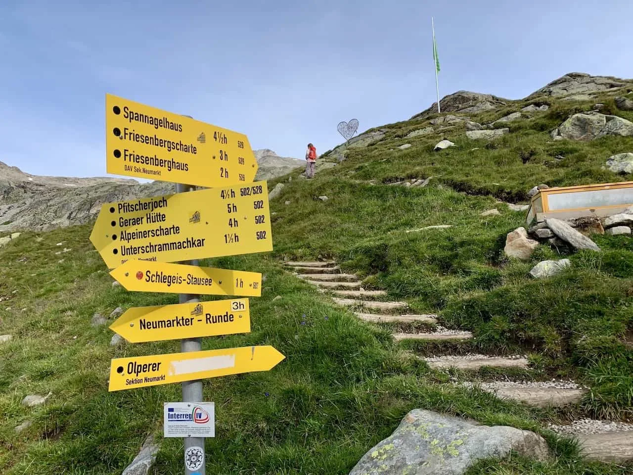
From the trailhead you will just need to follow those yellow hiking signs towards the Olpererhütte (trail #502).
Getting to the hut will be the hard part since you will be gaining around 600 meters of elevation from the road.
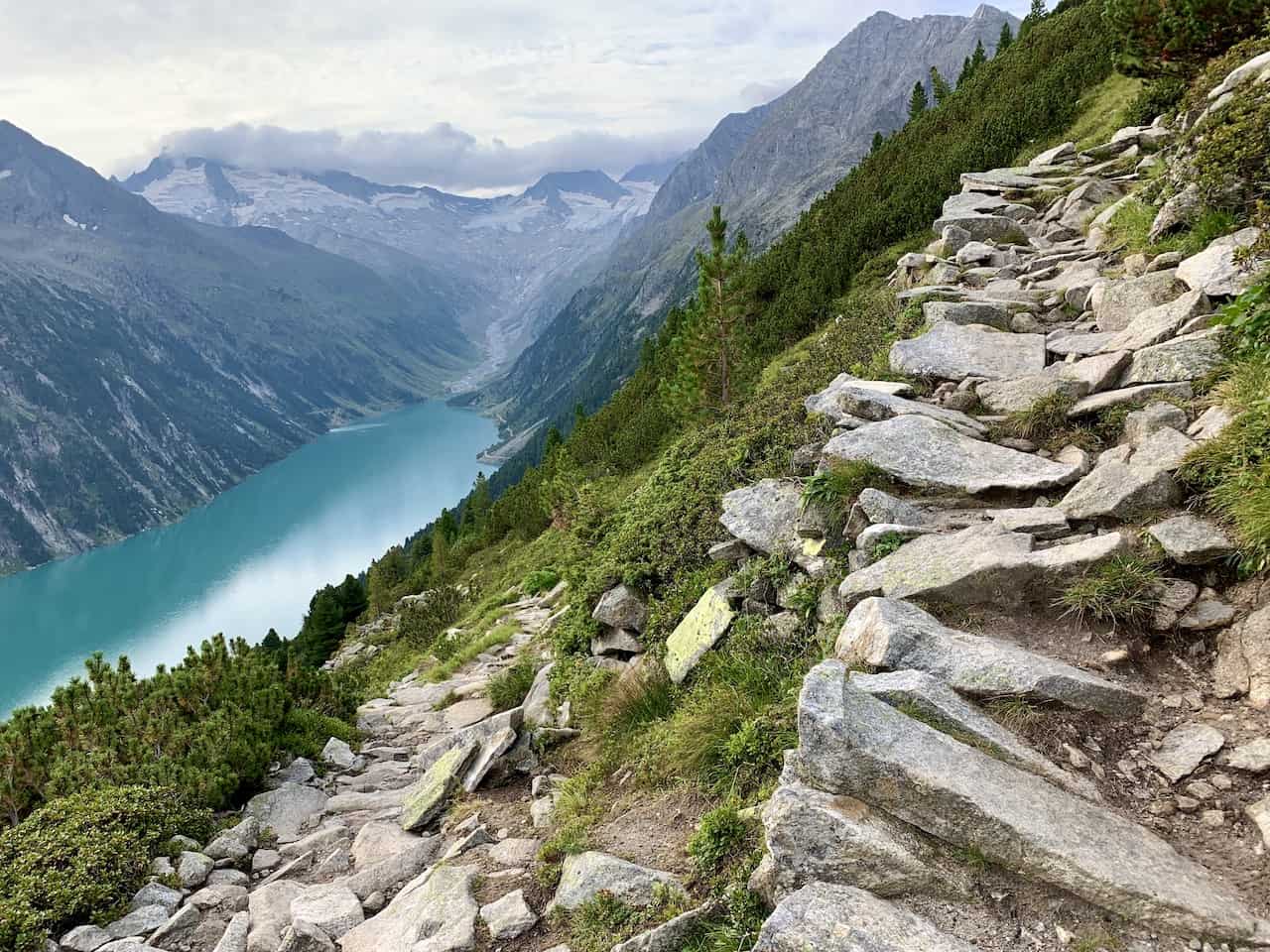
This will mostly be on packed dirt and rocks. The terrain will not always be flat here, so do watch your step heading up.
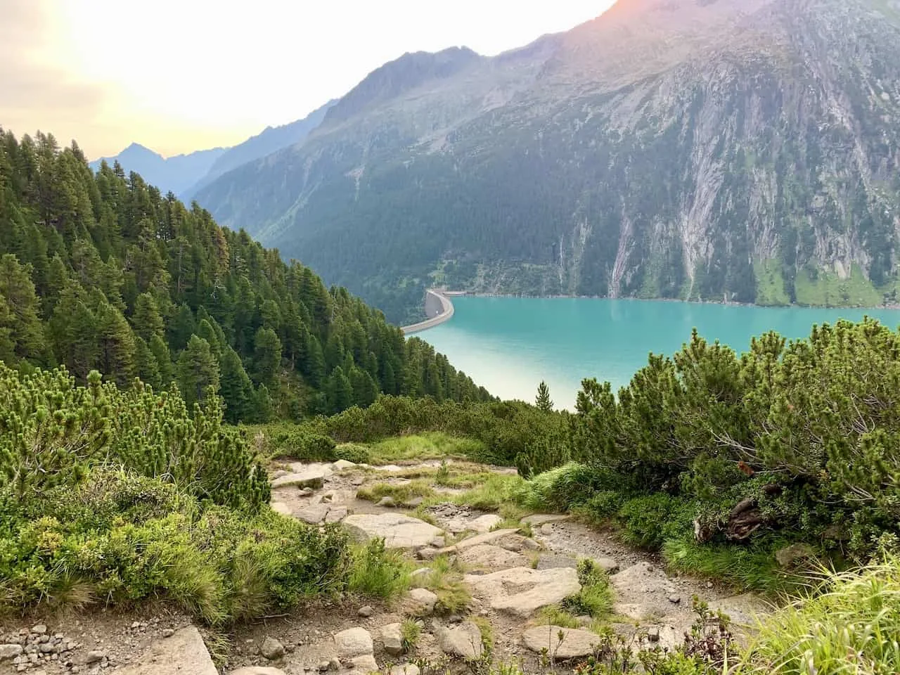
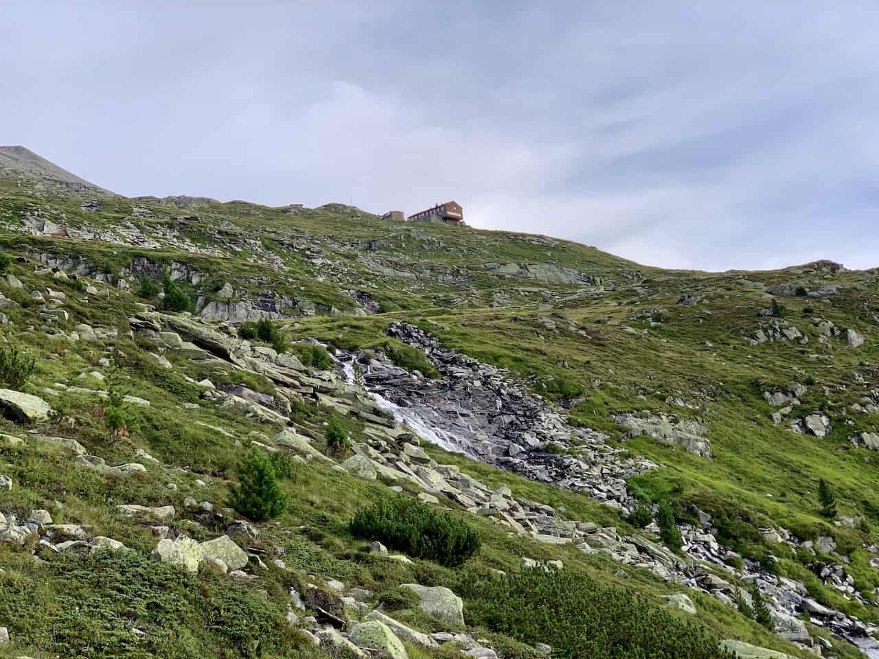
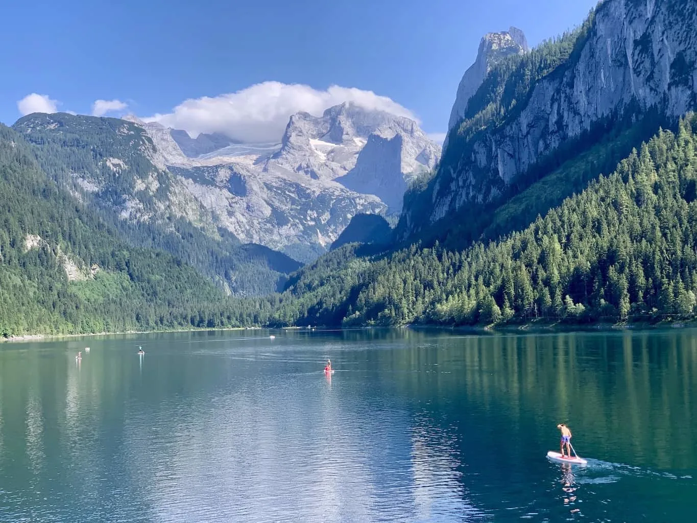
You will make your way up through the surrounding trees as you get some great views behind you of Schlegeis Stausee and the surrounding mountains out in the distance.
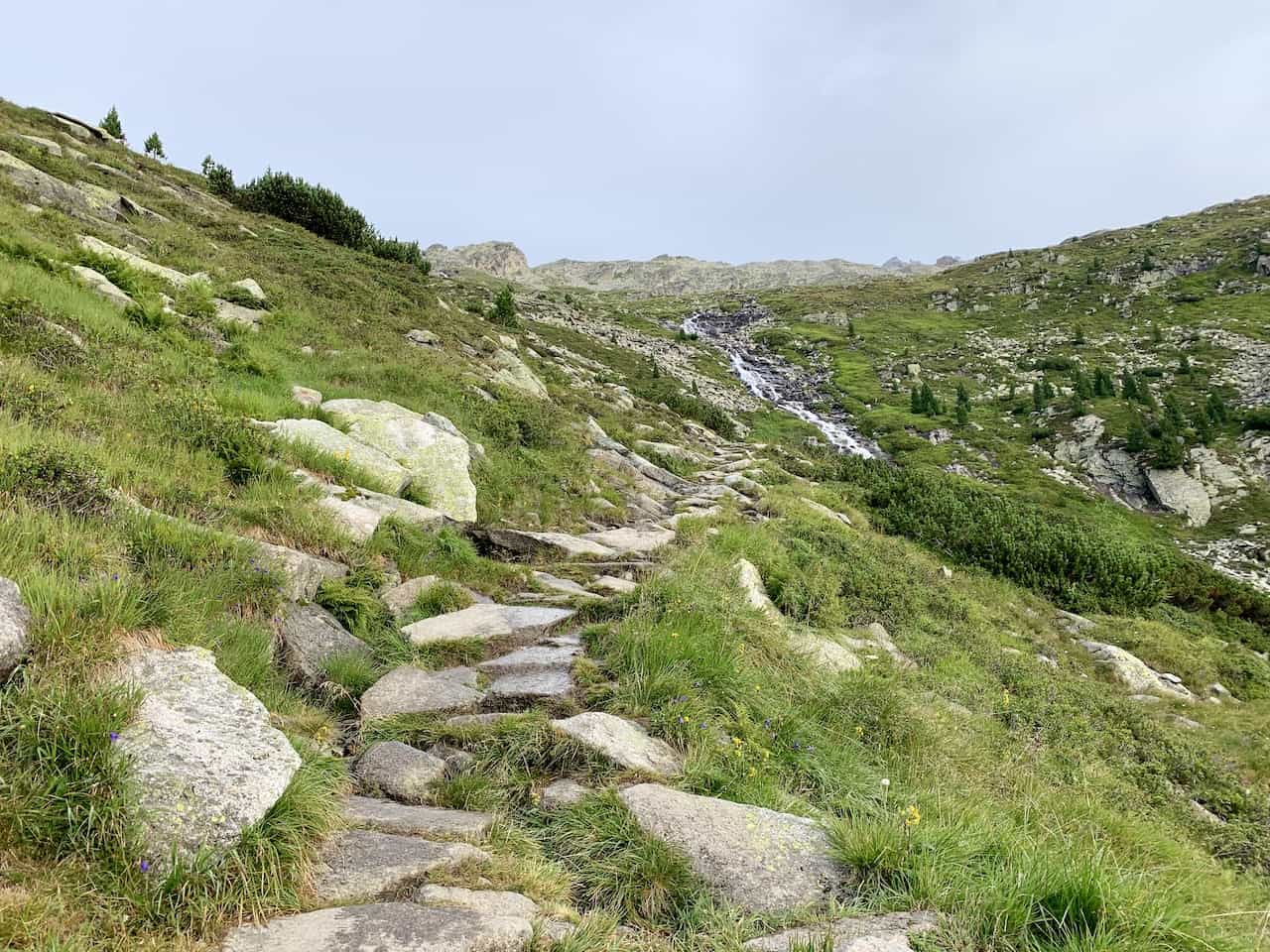
The route will continue upwards on a zig zagging path and you will eventually clear the trees with even better views of the lake down below.


The terrain will also turn much more rocky at some points, where you will need to watch each and every step you make. The pictures below show some of these uneven rocky surfaces.
You are also sure to hike by some waterfalls and rivers coming down the side of the mountains along with some places to sit down and enjoy the view.

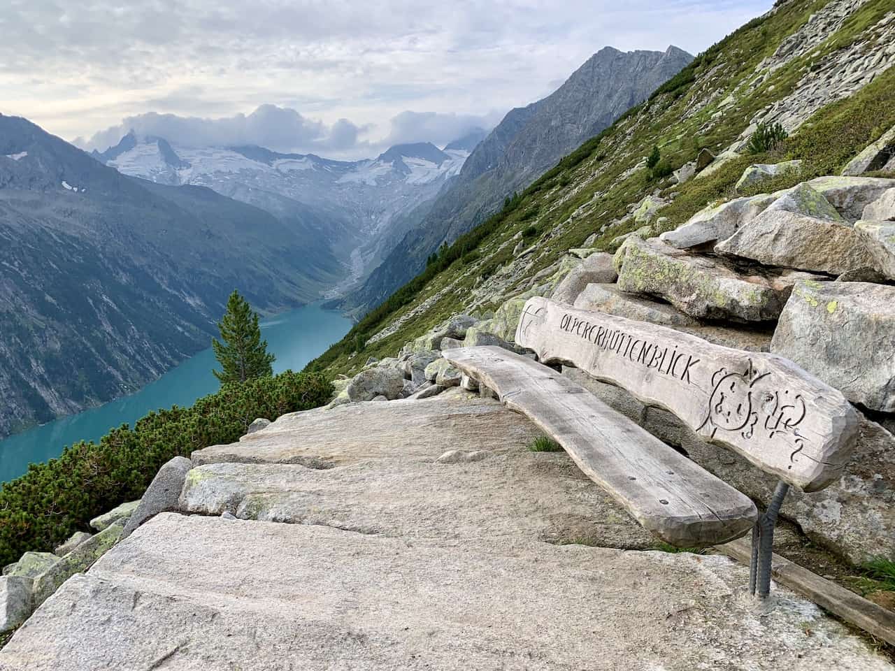
Soon enough you will continue up the rolling hill and see the Olpererhütte getting closer and closer. When you reach the hut, you will be able to enjoy some new angle views of the lake down below with the glacier capped mountains up above.
At the hut, you can take some time to sit down, relax, and have some food/drink. You can also decide to do so on the way back after you visit the Olpererhütte bridge – whatever works for you!

From the hut to the bridge you will want to follow the route pointing you the Friesenberghaus (route #526), which heads behind the hut and to the right.
From the Olperer Hut, it is just a 5 minute walk until you reach the bridge.

Before you know it, you will reach the Olpererhütte suspension bridge and will have the chance to enjoy the view from the bridge and take some photos.
Just be careful when taking those pictures since you will need to maneuver your way onto rocks that are on a river/stream.
After enough time enjoying the view from the bridge, you can retrace your steps to the hut and then back down towards the parking lot.
If you are up for a longer, more challenging hike then you can continue onto the Friesenberghaus and then loop back around to the parking lot.
I hope this guide has given you a better idea on how to tackle the Olpererhütte bridge hike on your own. If you do have any questions or comments be sure to write them in below.
Also feel free to browse through some other Austria itineraries and guides on the site.
Have fun out there and safe travels!


Lotte Ruby Schartau
Monday 28th of September 2020
Wow. Amazing. Can you do this hike in the winter/when there is snow?
Charles
Wednesday 30th of September 2020
Hi there - from my understanding you are not able to do the hike in the winter due to the fact that the road to Schlegeis Stausee is closed. The road is usually open from May to October so your best bet will be during that time.
Hope that helps!