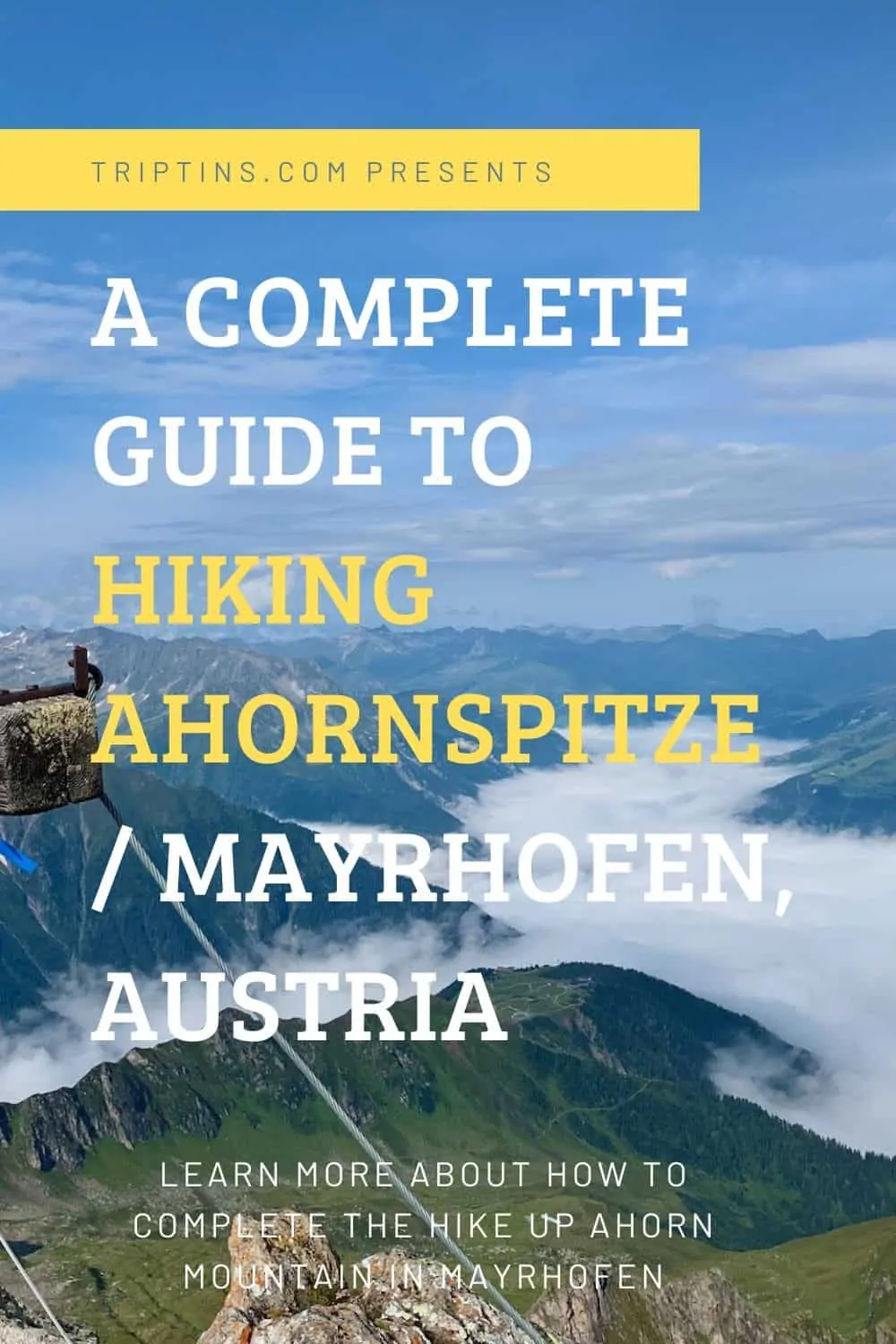
The Zillertal Alps in Austria are home to some of the best hiking opportunities that you can ask for.
One of the top options in the area is the hike up Ahornspitze, located just above the valley town of Mayrhofen.
This guide will go over all you need to know to take part of the hike for yourself and it will talk about what to expect along the way.
* Affiliate Disclosure: This post may contain affiliate links, which means I may receive a commission if you make a purchase through the links provided, at no additional cost to you. Thanks for supporting the work I put into TripTins!
1) Ahornspitze Hike Facts
Below are some helpful facts to know about the hike up Ahornspitze. Note that the information provided is starting from the top of the Ahornbahn cable car.
You could start the hike from the bottom of the valley, however that would include an additional +1,300 meters / 4,300 feet of elevation gain.
- Hike Name: Ahornspitze
- Starting & Ending Point: Top of Ahornbahn Cable Car (1,978 Meters / 6,490 Feet)
- Ahornspitze Elevation: 2,973 Meters / 9,754 Feet
- Elevation Gain: + 995 Meters / 3,264 Feet
- Length: 12 KM / 7.5 Miles
- Duration: 6 -7 Hours
- Terrain: Dirt/Rock
- Cable Car Hours: 7:30AM – 5:00PM / Mid June to October (Oct opens at 8:30AM)
- Cost: 28 Euro (round trip cable car)
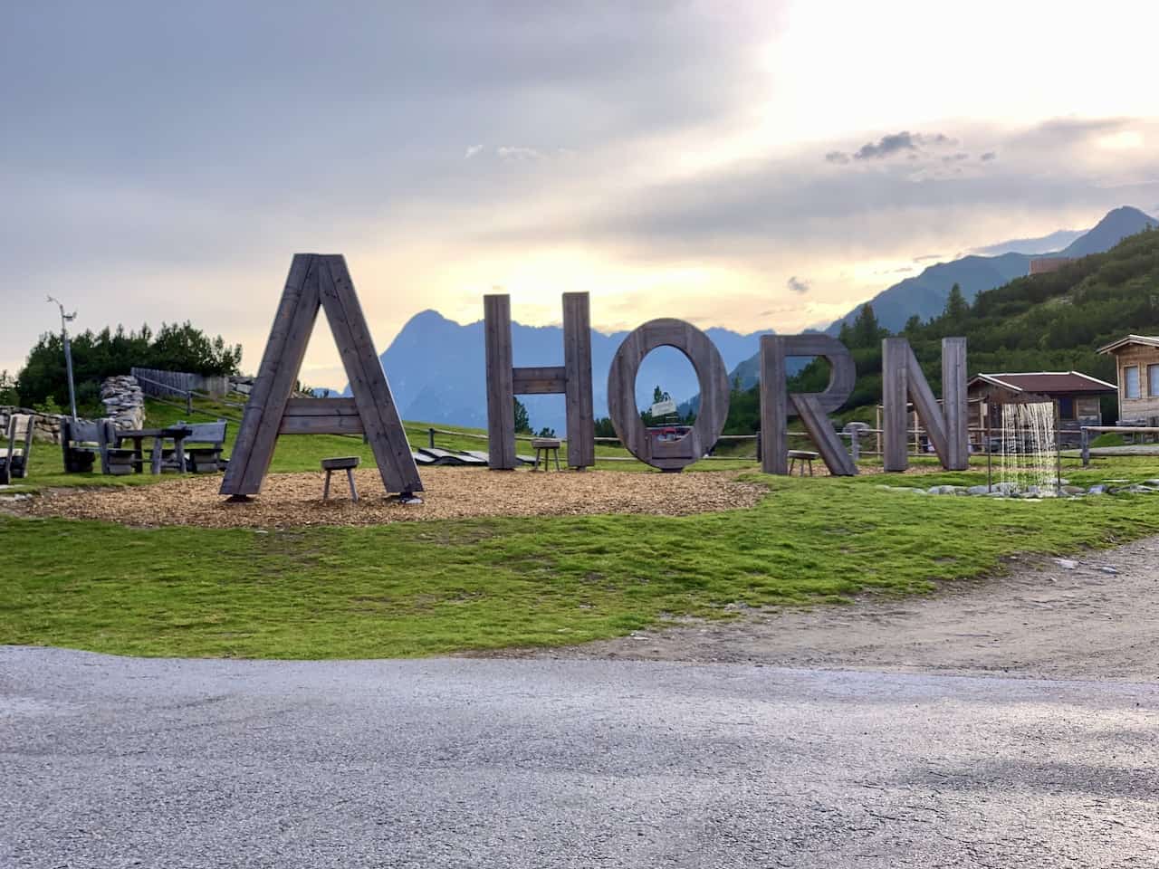
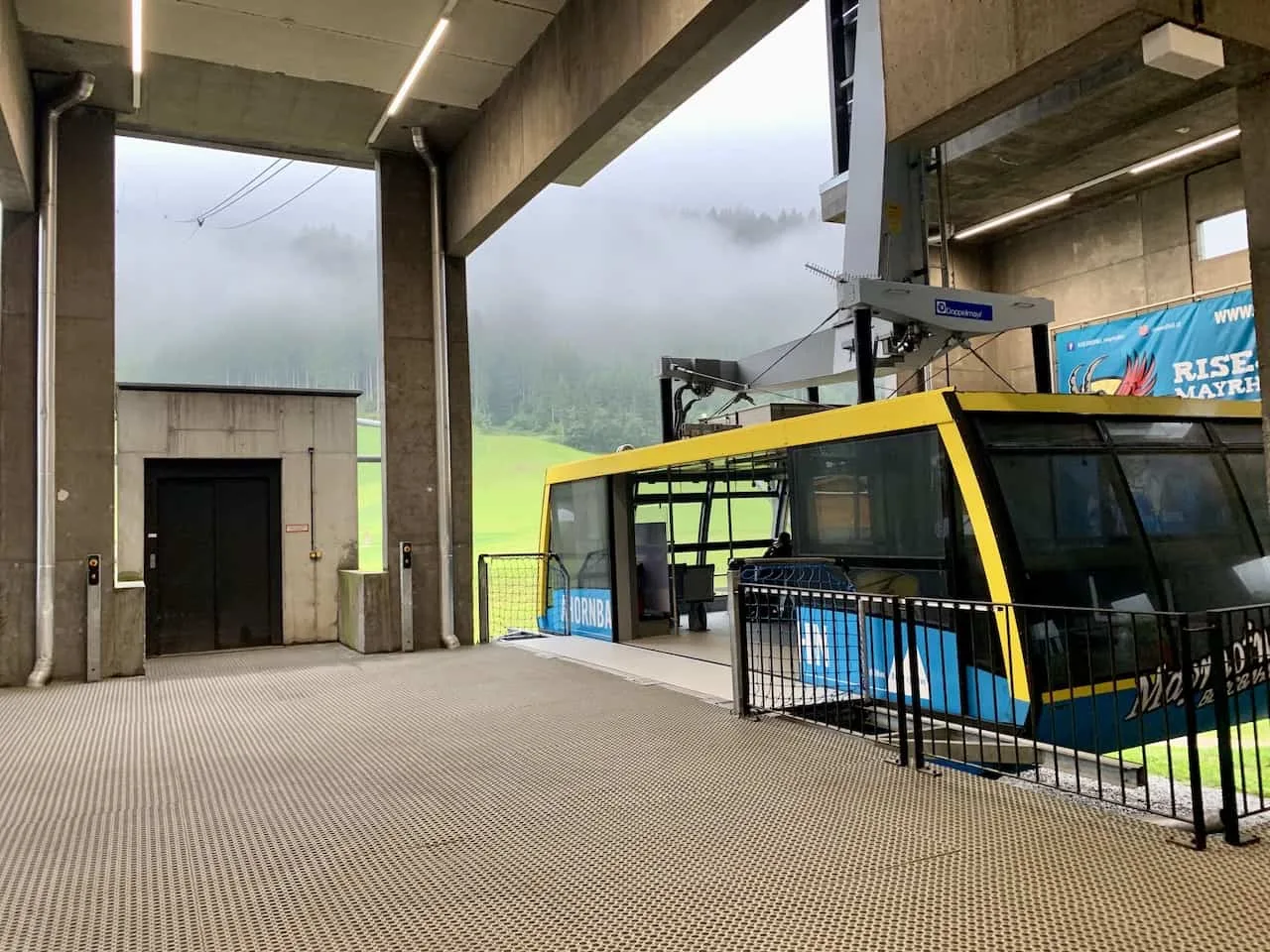
As mentioned, the hike starts at the top of the Ahornbahn cable car that leaves from the town of Mayrhofen. Once you arrive at the top cable car station, you can begin the route up to Ahornspitze.
While there is one main route to take up and down, there are some additional options to make it more of a loop route, which I will show in the next section.
Learn More: Be sure to check out some of the other top things to do in Mayrhofen during a visit
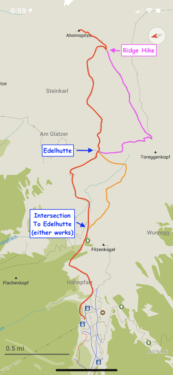
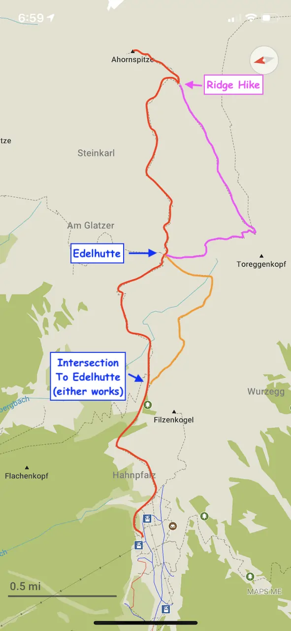
2) Ahornspitze Map
Below you can see the hiking route up from the Ahornbahn to the Ahornspitze summit. Highlighted in red is a normal route up the mountain.
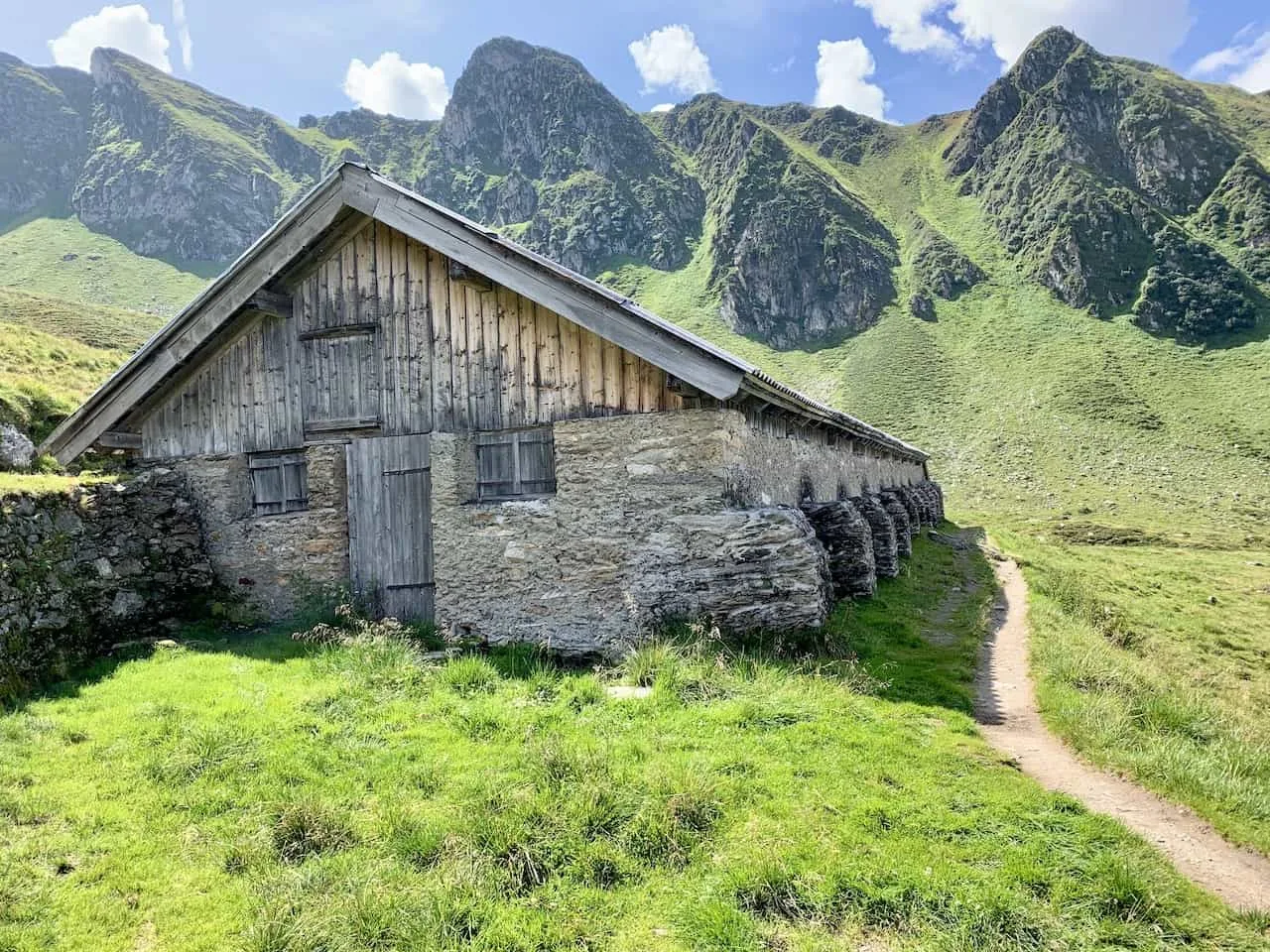
About half way up is the Edelhutte, which makes for a great pit stop option on your way up or down. As you make your way towards the hut you can also decide to take the orange highlighted route for a portion of the trail.
Once at the hut, you can have some food and drinks here and can take in some beautiful views of the surrounding mountains.
The Edelhutte also offers the option to sleep overnight inside the hut. This is great for those who want to enjoy their time on the mountain and can split the hike up into two days.
If you aren’t a keen hiker, walking up from the Ahornbahn to just the Edelhutte can be a great option for you too.
After you depart the Edelhutte, the route begins to increase its incline steadily as you slowly make the rocky ascent to the top.
Once all finished up top, you can either head down the same route you came OR you can head down the pink labeled ridge route which eventually meets back up at the Edelhutte.
To give you a sense of what I did when climbing the mountain:
- Started on the main route (highlighted in red)
- Took the right hand side of the intersection (highlighted in orange) to the Edelhutte
- Continued onto the summit (back onto the red route)
- After leaving the summit I took the pink ridge route back down to the Edelhutte
- And I finally got back on the main red labeled route back to the Ahornbahn.
NOTE: these colors do not signify any sort of color coded signs on the mountain. I just laid it out this way to make the map more visual and easier to read.
This way I was able to get the most out of the mountain and not repeat too much of the same paths. Feel free though to do whatever you are most comfortable with as there really isn’t a right or wrong choice here.
3) When to Hike Ahorn Mountain
Due to its high elevation and rocky terrain, the Ahornspitze should not be attempted when covered in snow.
I can really only recommend you head off on the hike when the Ahorbahn opens up in the summer time. The first cable car for hikers leaves around 7:30AM (June to September).
You will also want to think about which particular day you will want complete the hike. Since this hike is at elevation, hiking in poor conditions, whether it be rain, wind, clouds, can ruin your hiking experience.
For this reason I would recommend climbing on the best weather day possible during your time in Mayrhofen.
Believe me when I say you will want to see those views, so try and avoid days where cloud coverage looks poor.
There are two main ways to get a better idea of the weather up on the mountain.
First you will want to take a look at weather websites that actually have mountain weather forecasts (not just the weather down in the valley that can be much different). Take a look at Meteoblue and the local Bergfex weather site.
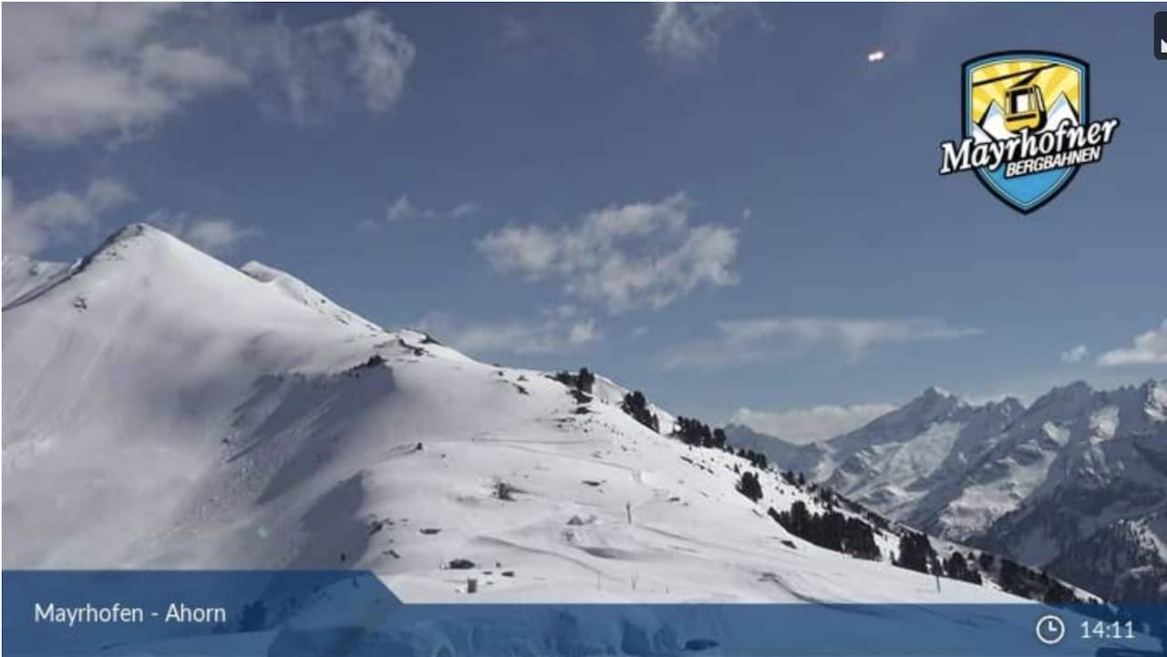
Secondly, you can also take a look at the Ahornbahn Webcam. While the webcam just shows what the weather looks like from the top of the cable car, it does give you a bit better idea vs just the valley weather.
For instance, the day I climbed up, the valley was full of clouds and I couldn’t see a thing down there.
However, by looking at the webcam I could see that they were just low lying clouds in the valley. From the webcam I could see that the mountain weather was nice and clear.
→ If you are renting a car in Austria, be sure to check out Rentalcars.com to browse through options. Once on the site, you will be able to filter by price, car type, rental company, and more, to find the perfect car for your trip to Austria.

4) What to Bring on the Hike
Whenever heading off on longer day hikes, I always recommend being adequately prepared when it comes to the type of gear to bring along.
Check out the below packing list to get you ready for this hike and other hikes in Austria.
Hiking Packing List
In general when it comes to hiking, there are a few main aspects to consider. These includes clothing layers, hiking shoes, hydration & fuel, electronics, and other essentials.
Below in a breakdown of some of the top items, but be sure to check out the Hiking Packing List for a more comprehensive view.
Clothing Layers
Layering is going to be a top consideration when hiking. You will want to be prepared for all sorts of weather so you can be comfortable in different situations. Some items may include:
→ Hiking Shorts
→ Hiking Pants
→ Short Sleeve Shirt
→ Long Sleeve Shirt / Sun Hoodie
→ Mid Layer Fleece
→ Puff Jacket (not always needed)
→ Packable Rain Jacket (Columbia Watertight II)Note that your layers should be made of moisture wicking material as they are breathable and quick drying.
Footwear
Having appropriate footwear will also be very important. You will want to have shoes with the necessary grip and support to keep you safe on the trail.
→ Hiking Shoes (Keen Targhee)
→ Hiking Socks (Darn Tough)Other Essentials
Whether it is hiking gear, electronics, or just some miscellaneous items, here are some other essentials to bring along on hikes.
→ Hiking Backpack (Osprey Talon 22) & Rain Cover (Joy Walker Cover)
→ Hiking Poles (Black Diamond Trekking Poles)
→ Water Bottle (CamelBak Chute or Katadyn Filter Bottle)
→ Portable Charger (Anker PowerCore 5000mAh)
→ Action Camera (GoPro Hero)
→ Energy Bars & Snacks
→ Hat & Sunglasses
→ Sunscreen & Bug Spray
5) Where to Stay in Mayrhofen
Since Mayrhofen is a relatively small valley town, no matter where you stay in it, you will be at most a 20 minute walk to restaurants, bars, the cable cars, and the train station.
Below are some great options to choose from depending on your budget:
- Luxury: Hotel Neue Post | Alpin Lodge das Zillergrund | ElisabethHotel Premium Private Retreat
- Mid Range: Sporthotel Manni | Alpendomizil Neuhaus | Zillertalerhof Alpine Hideaway
- Budget: Birkenhof | Landhotel Rauchenwalderhof | Gasthof Edelweiss
To take part of the hike up Ahornspitze, you also don’t necessarily need to stay in Mayrhofen itself.
While Mayrhofen is definitely the most convenient option, you can also reach the Ahornbahn station from towns like Zell am Ziller, which is closer to the entrance of the valley, or even as far as Innsbruck.
Austria Itinerary: Head to Mayrhofen as part of your 7 Day Austria Itinerary visiting places all over the country
6) The Hike up Ahornspitze
Now that you have a bit better idea of how to prepare for the hike, let’s get into the hike itself and what you can expect all along the trail.
I will walk through the hike in the same way mentioned above, taking into account the loop option rather just going up and down the same route.
Ahornbahn to Edelhutte (1.5 Hours)
The first part of the trail is the route from the top of the Ahornbahn station (1,978 Meters / 6,490 Feet) to the Edelhutte (2,238 meters / 7,342 feet).
This portion of trail will take you up just 260 meters / 853 feet in elevation gain, so you shouldn’t expect it to be too difficult.
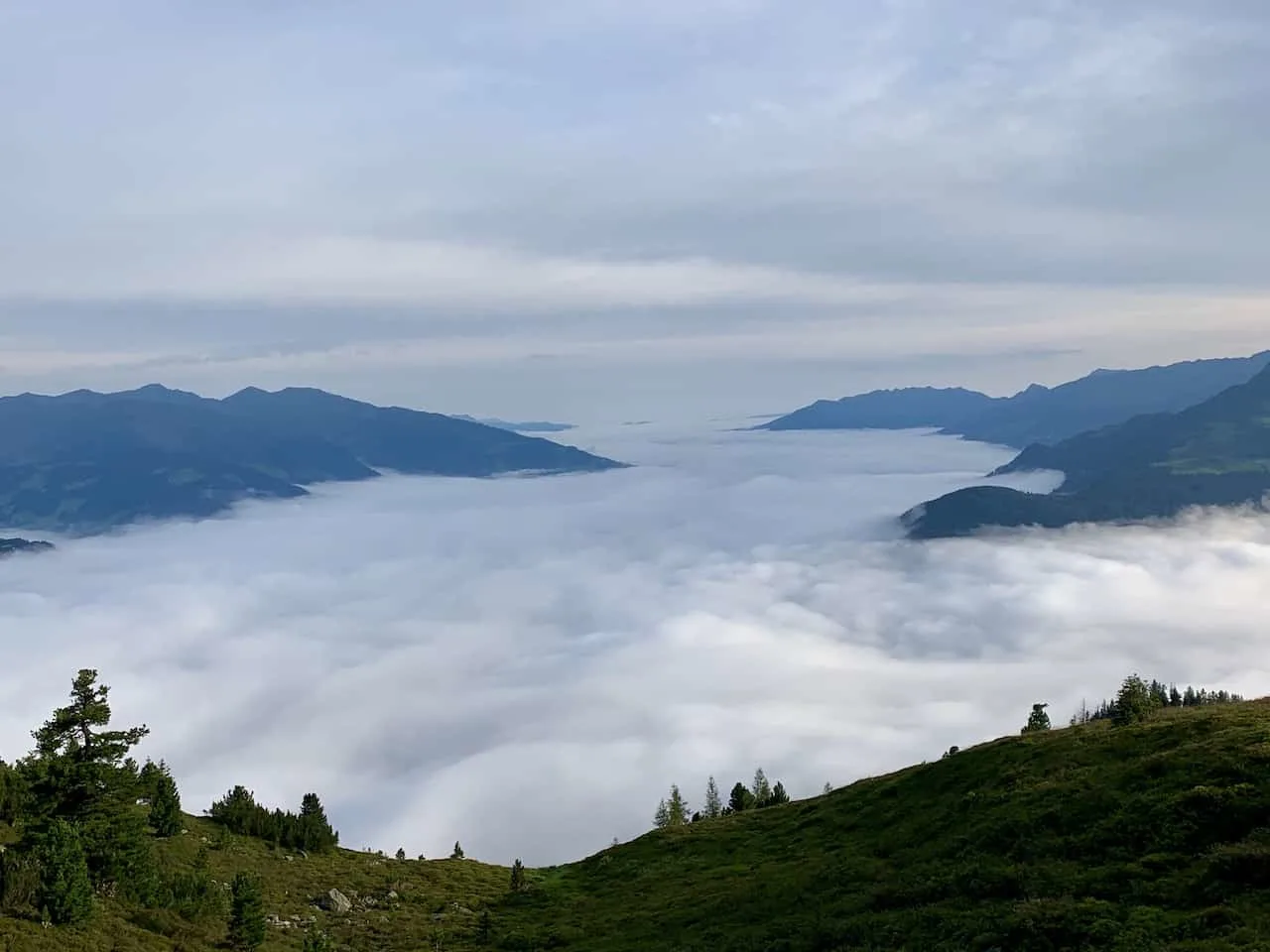
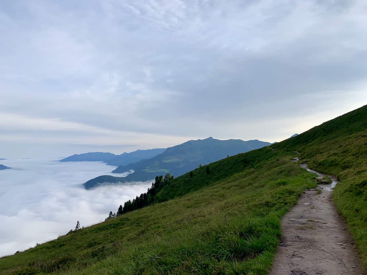
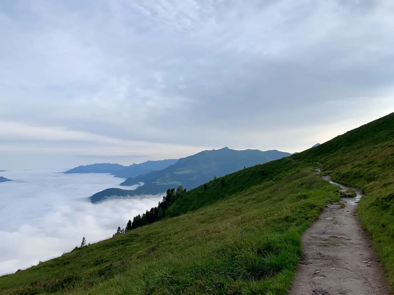
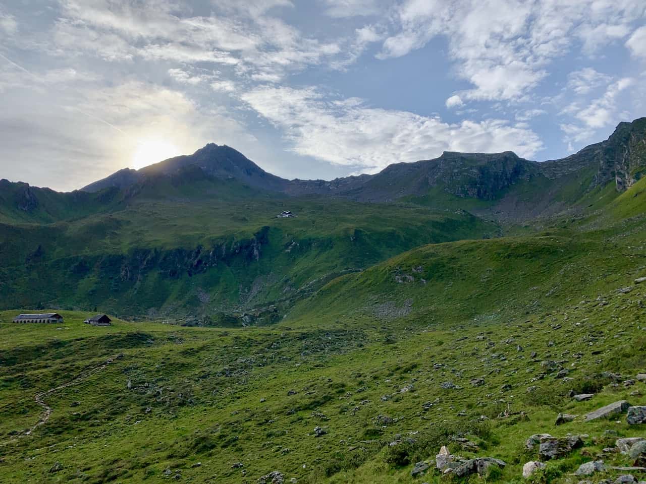
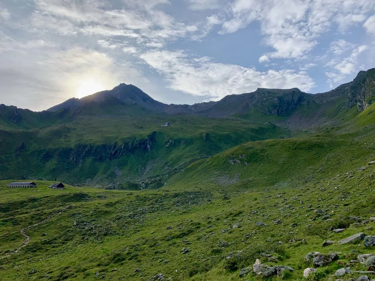
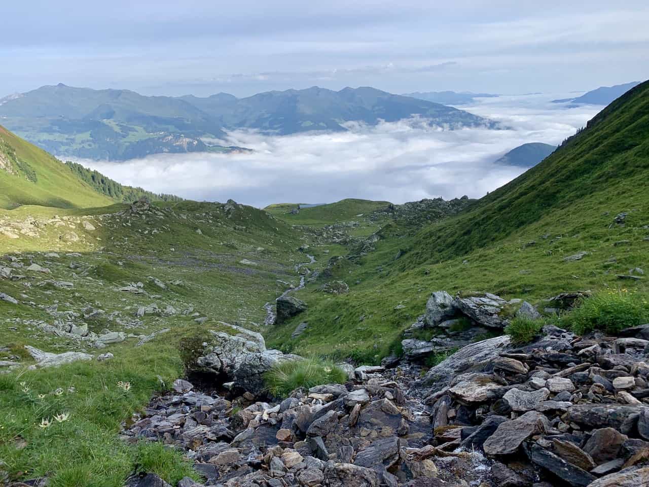
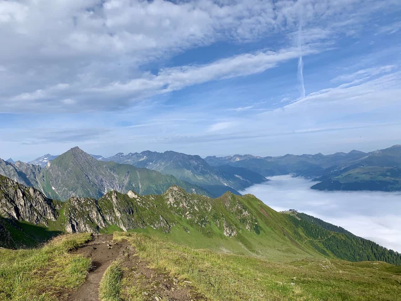
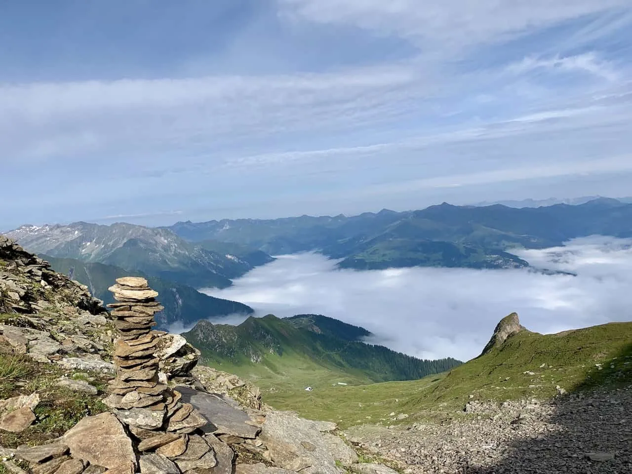
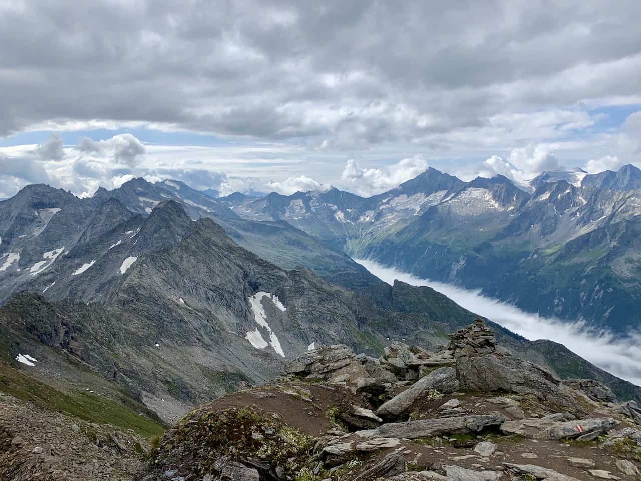
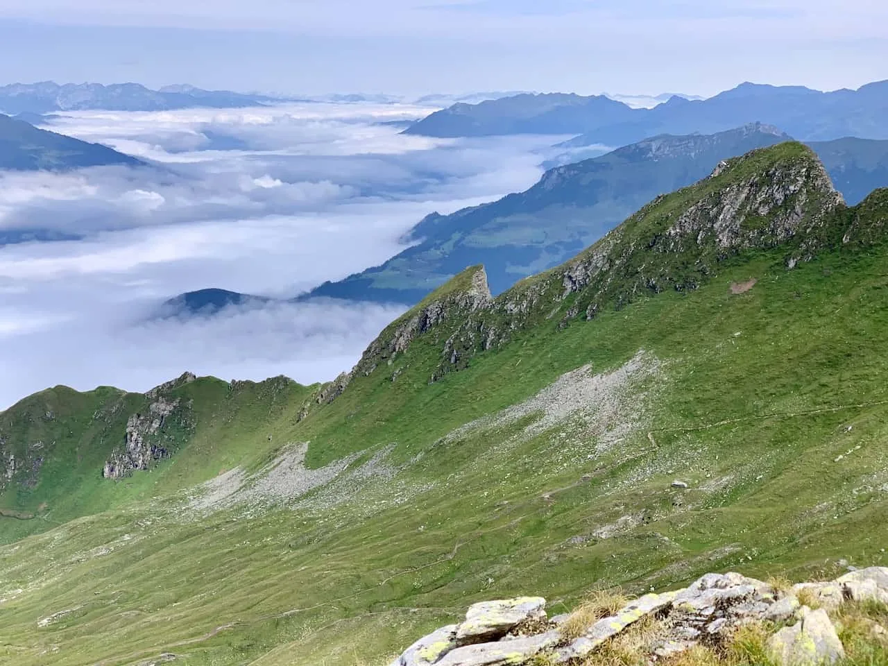
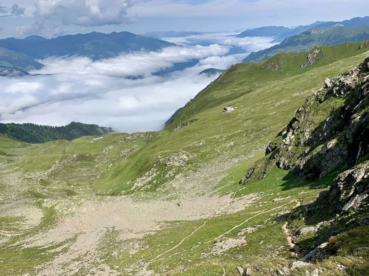
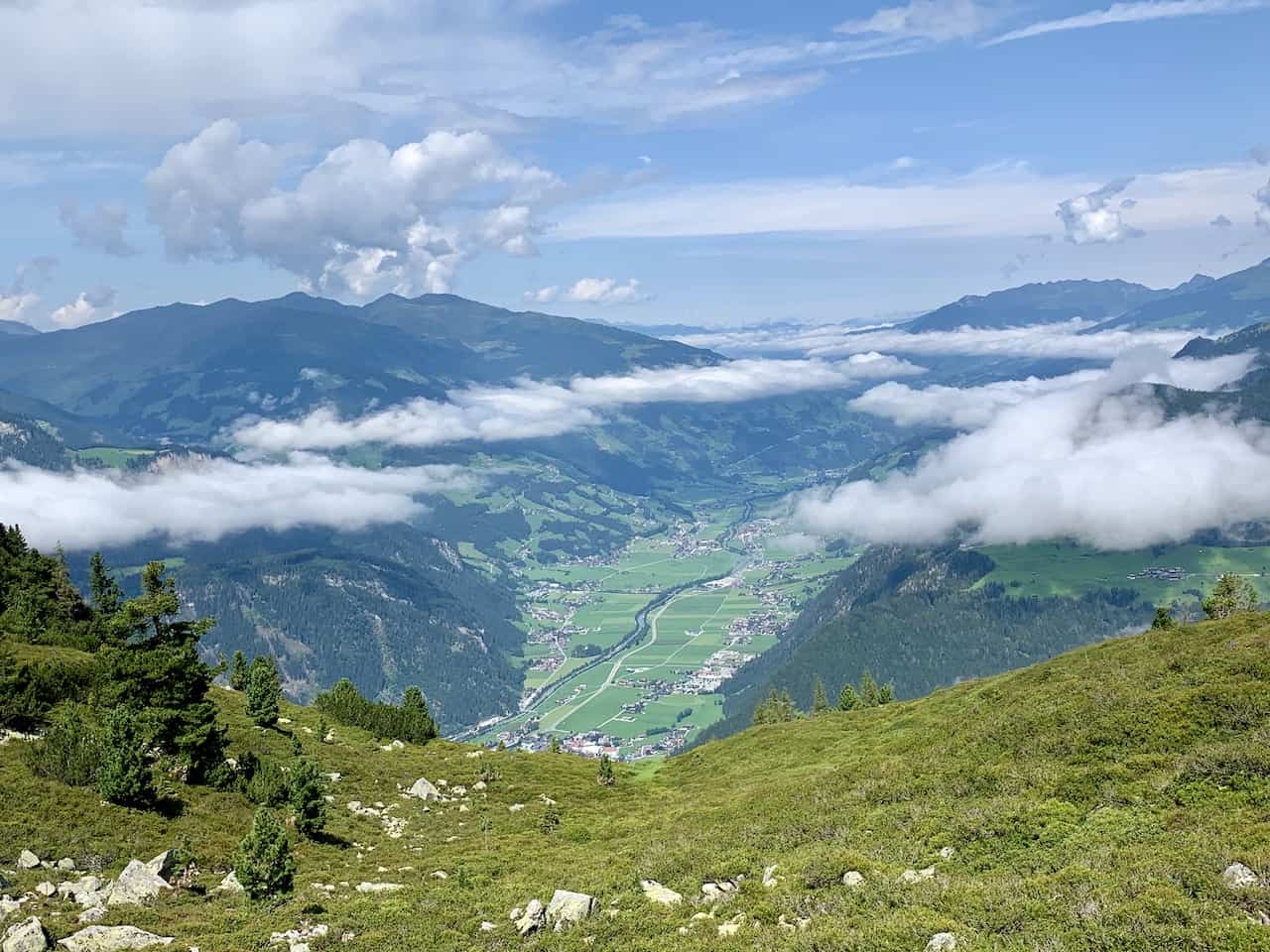
Once you get off the Ahorbahn you will already get to see the fantastic views in every which direction. There will be mountain ranges out in the distance with the valley down below.
As you can see in the pictures, the beginning of my day had clouds filling up the valley making it a pretty scenic landscape to enjoy on the way up.


You will continue to make the walk on the dirt path on the side of the mountain with the valley off to your left and the Ahornspitze up out in front of you.
Throughout the trail you will also see some yellow hiking signs pointing you in the right direction. Just be sure to follow correctly and you should have no problem getting yourself up.
At one point you will see the intersection mentioned in the map above. The image below shows the hiking sign that points to the Edelhutte in two different directions.
It really does not matter which option you go with here as they both take you to the same spot. On my way up I took the route to the right, and on my way down I took the other route.
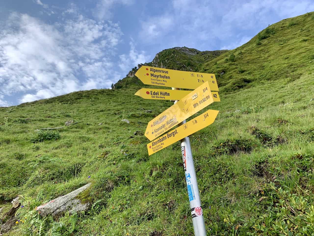

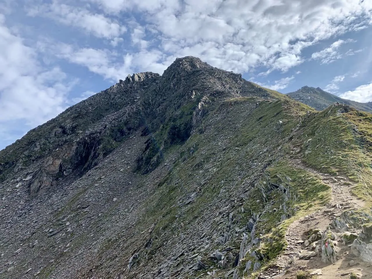
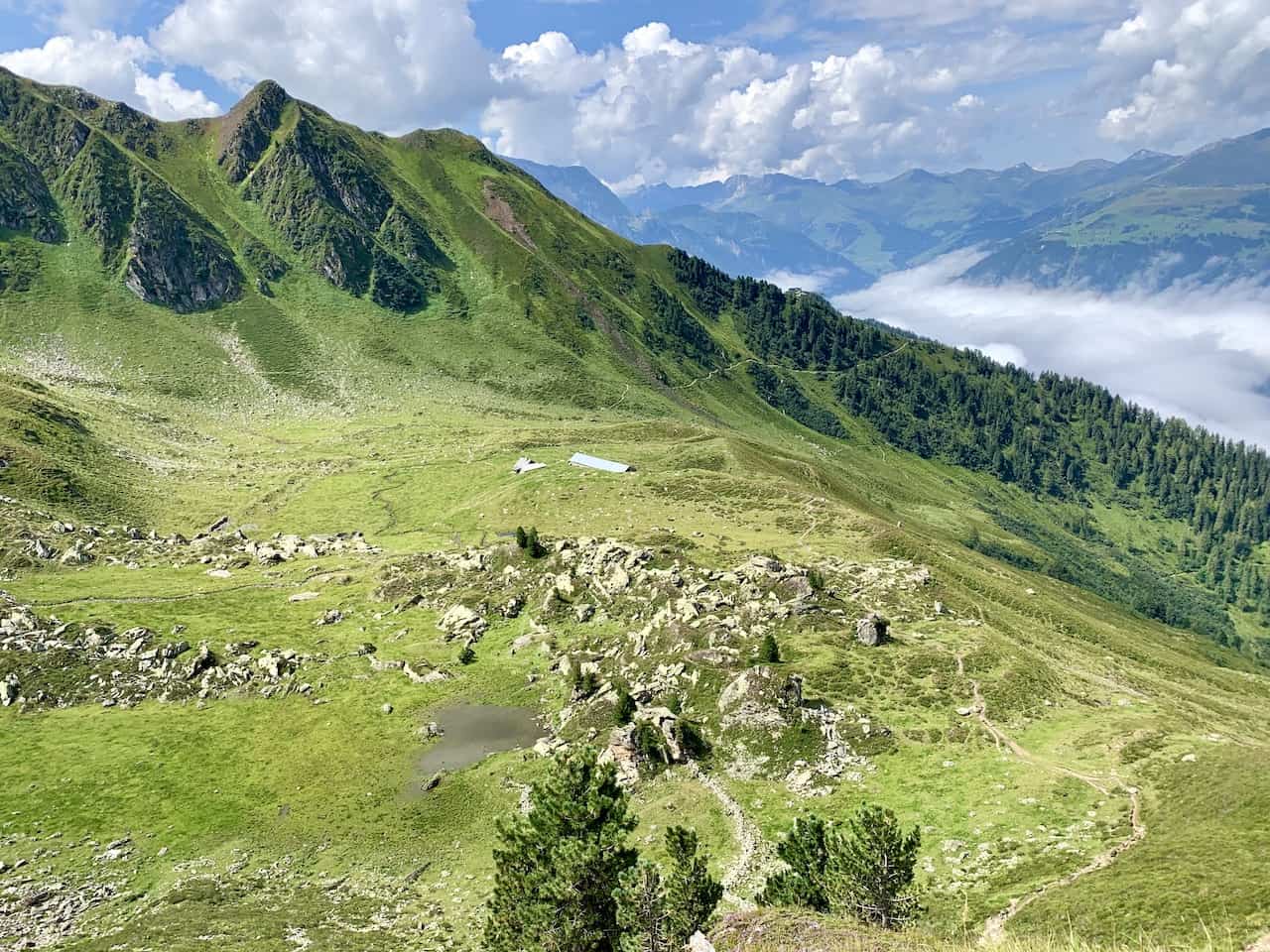
The path to the right will take you away from the side of the mountain as you turn inwards and towards the green landscape with the Edelhutte and Ahornspitze out in the distance.
You will find that the path will turn a bit more rocky and not as smooth as you make the ascent towards the hut. Behind you will be the valley and various mountains further back.
Continue the circular route around the greenery, and soon enough you will have the Edelhutte right in front of you.

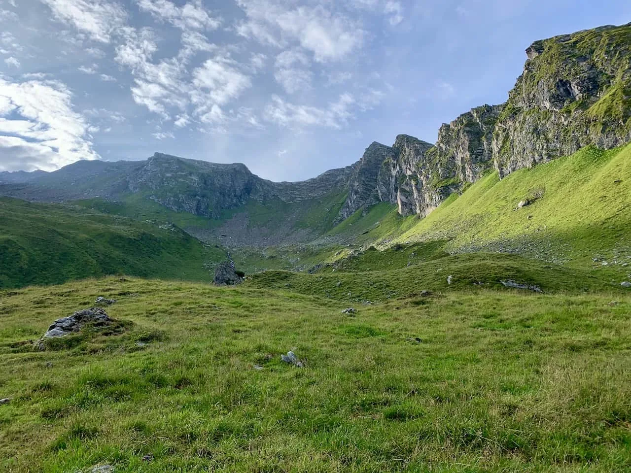

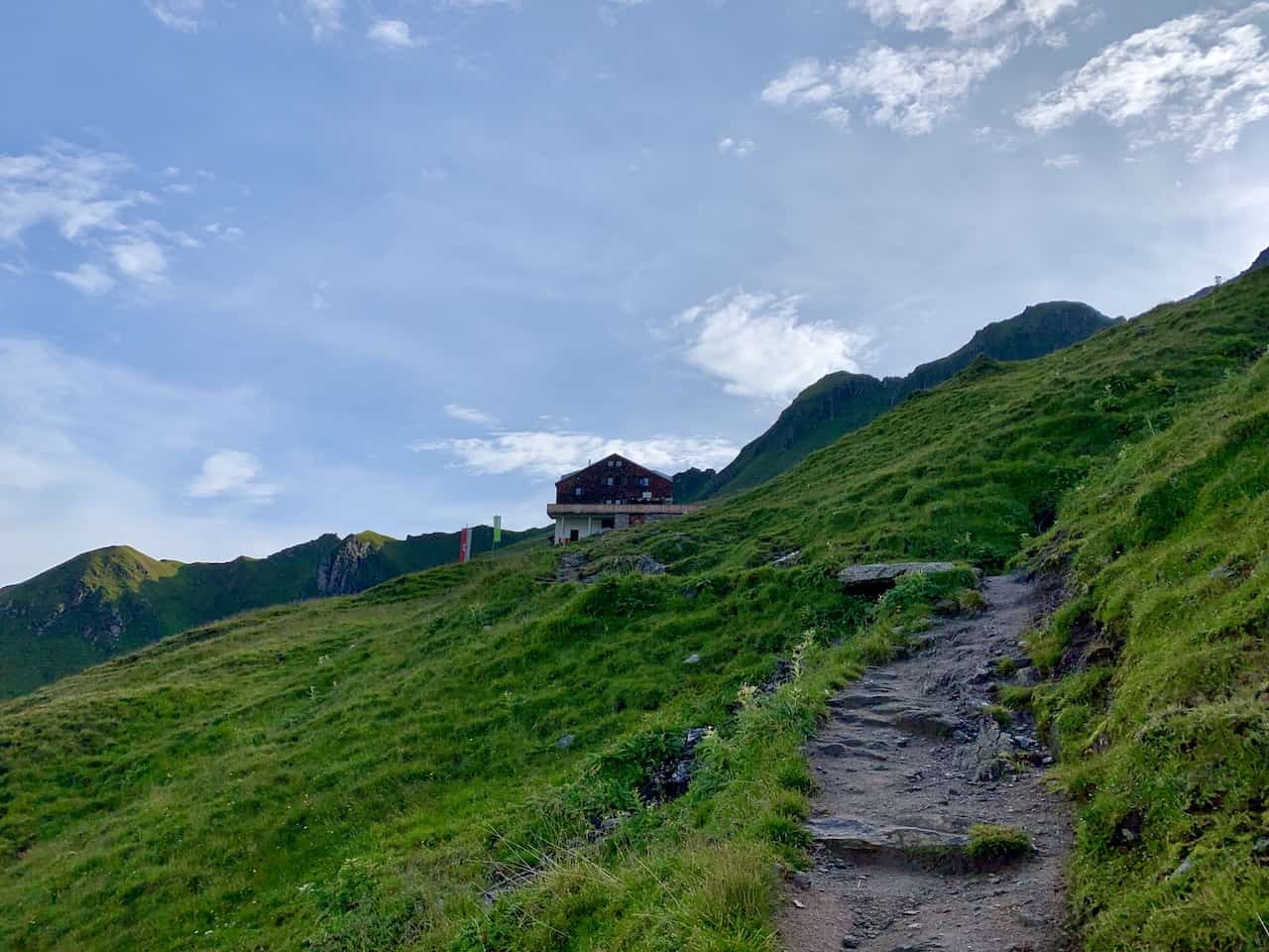
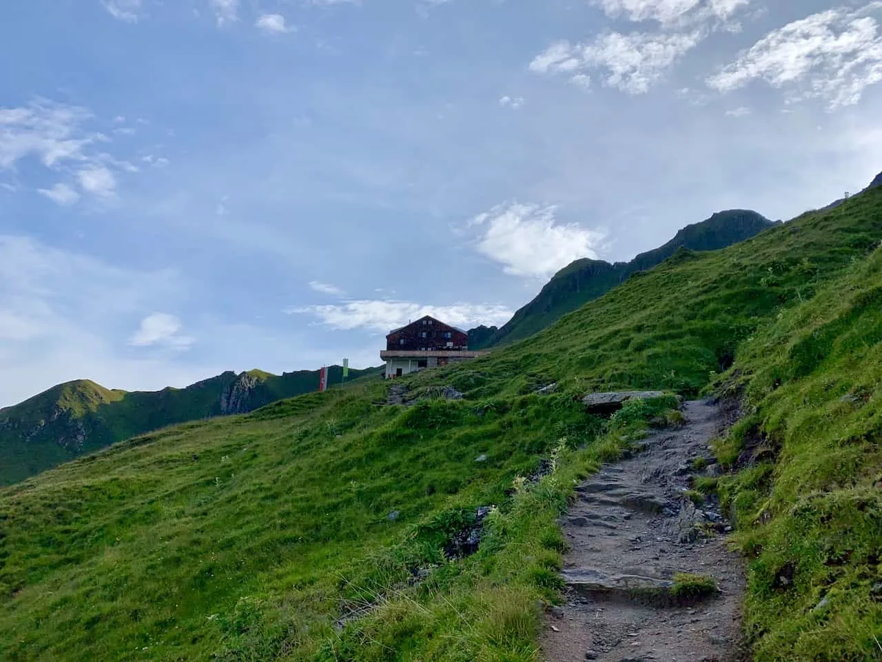
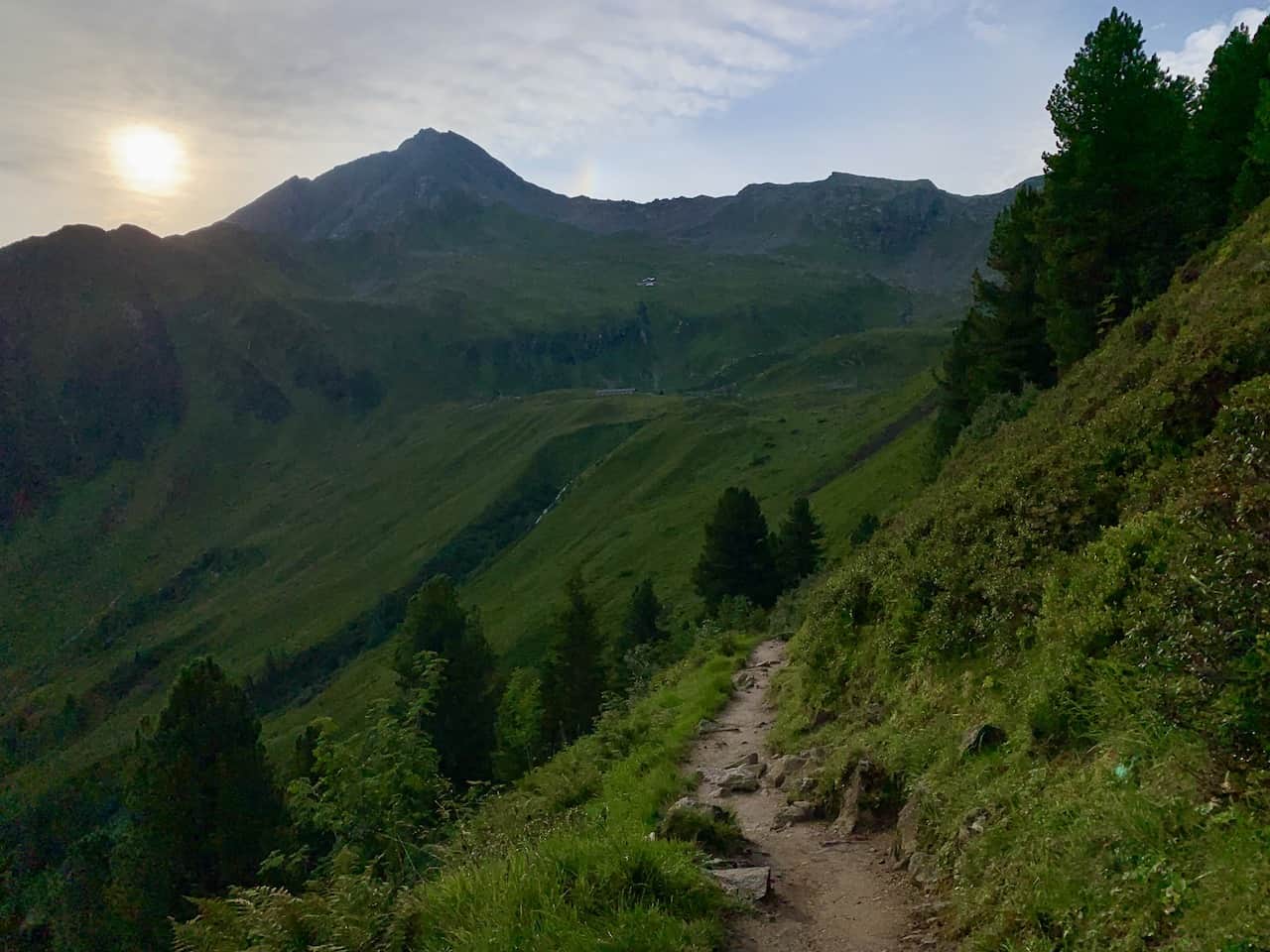
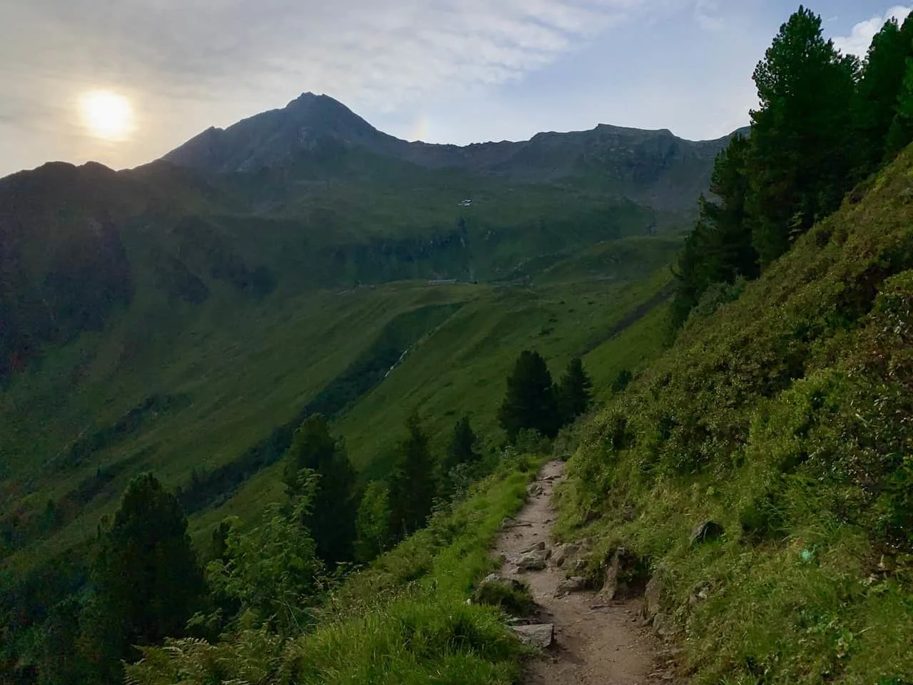
Edelhutte to Ahornspitze (2 Hours)
After taking a break at the Edelhutte and enjoying that view, it is time to begin the tough ascent to the summit. Follow the signs behind the hut and continue the hike up the dirt path.
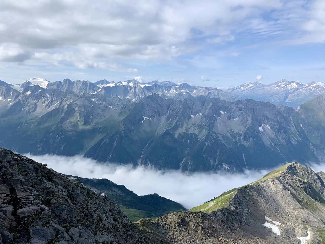
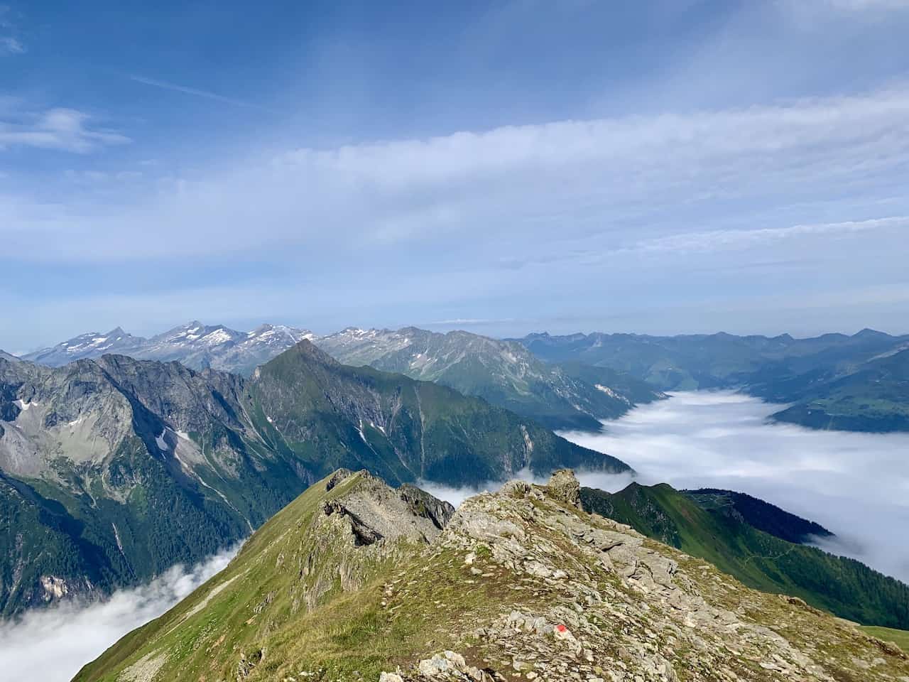
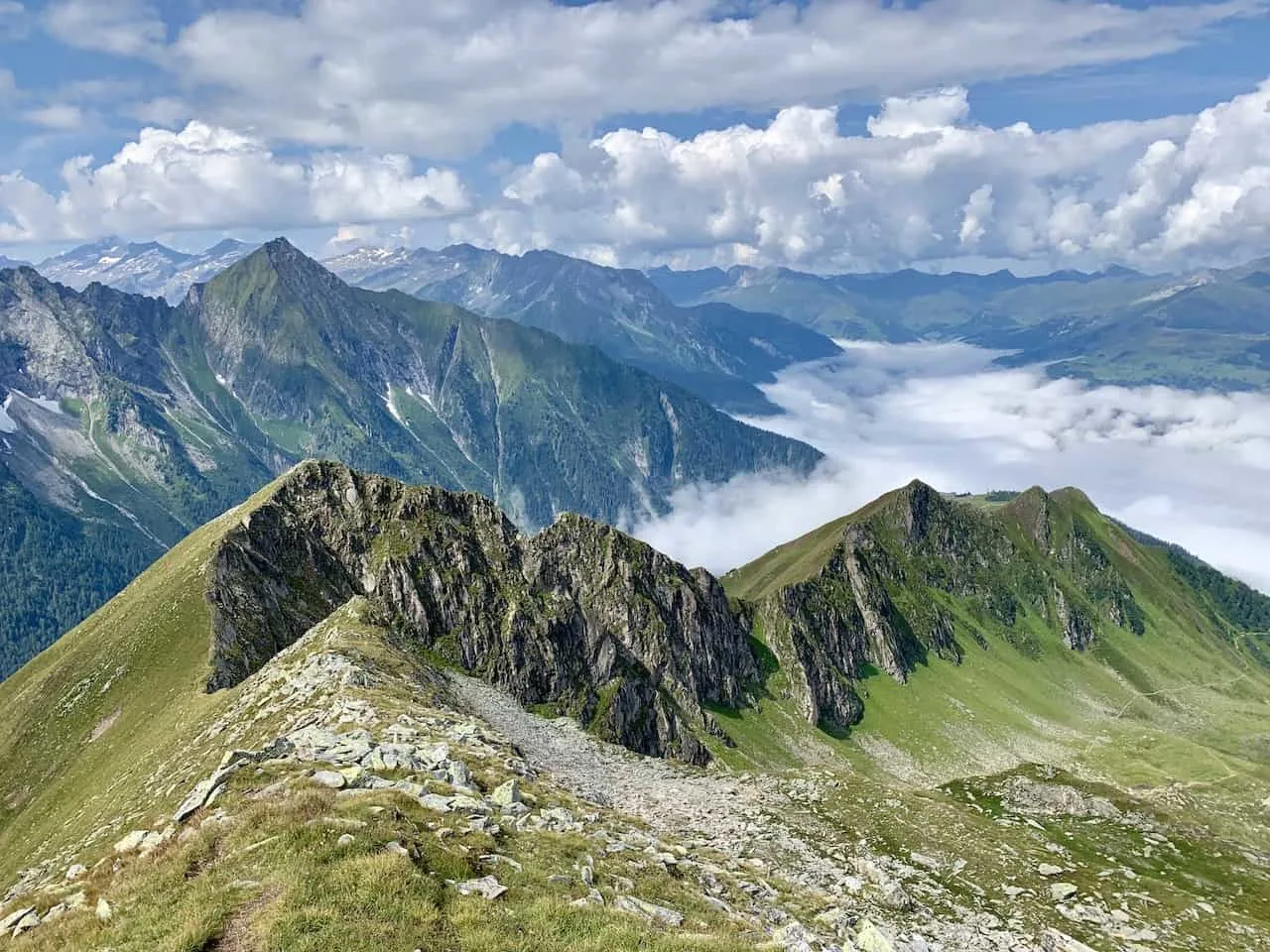
As you continue to get higher the views will start to get better and better. You will have the beautiful greenery right down below with more of the valley and surrounding peaks coming into view.

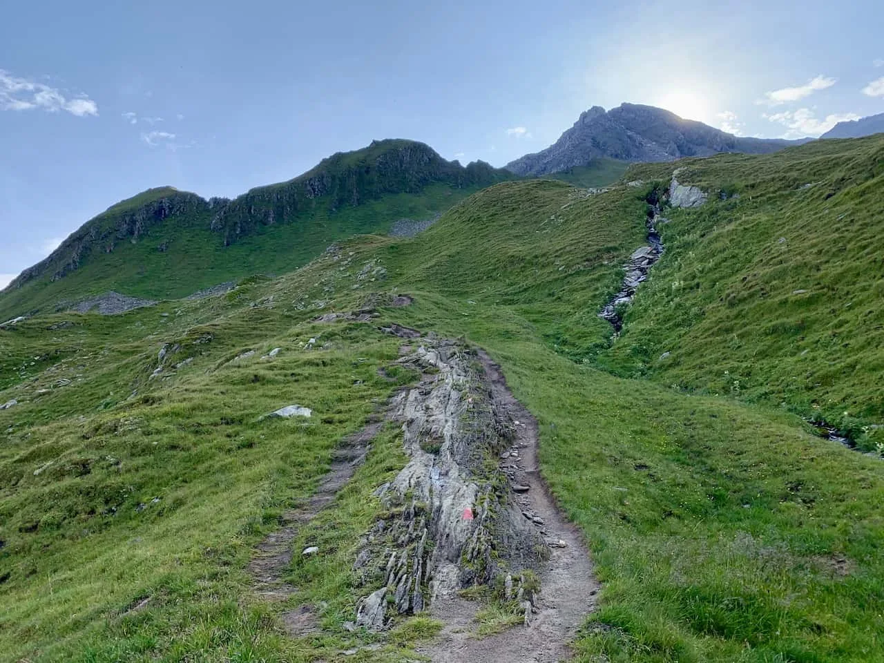
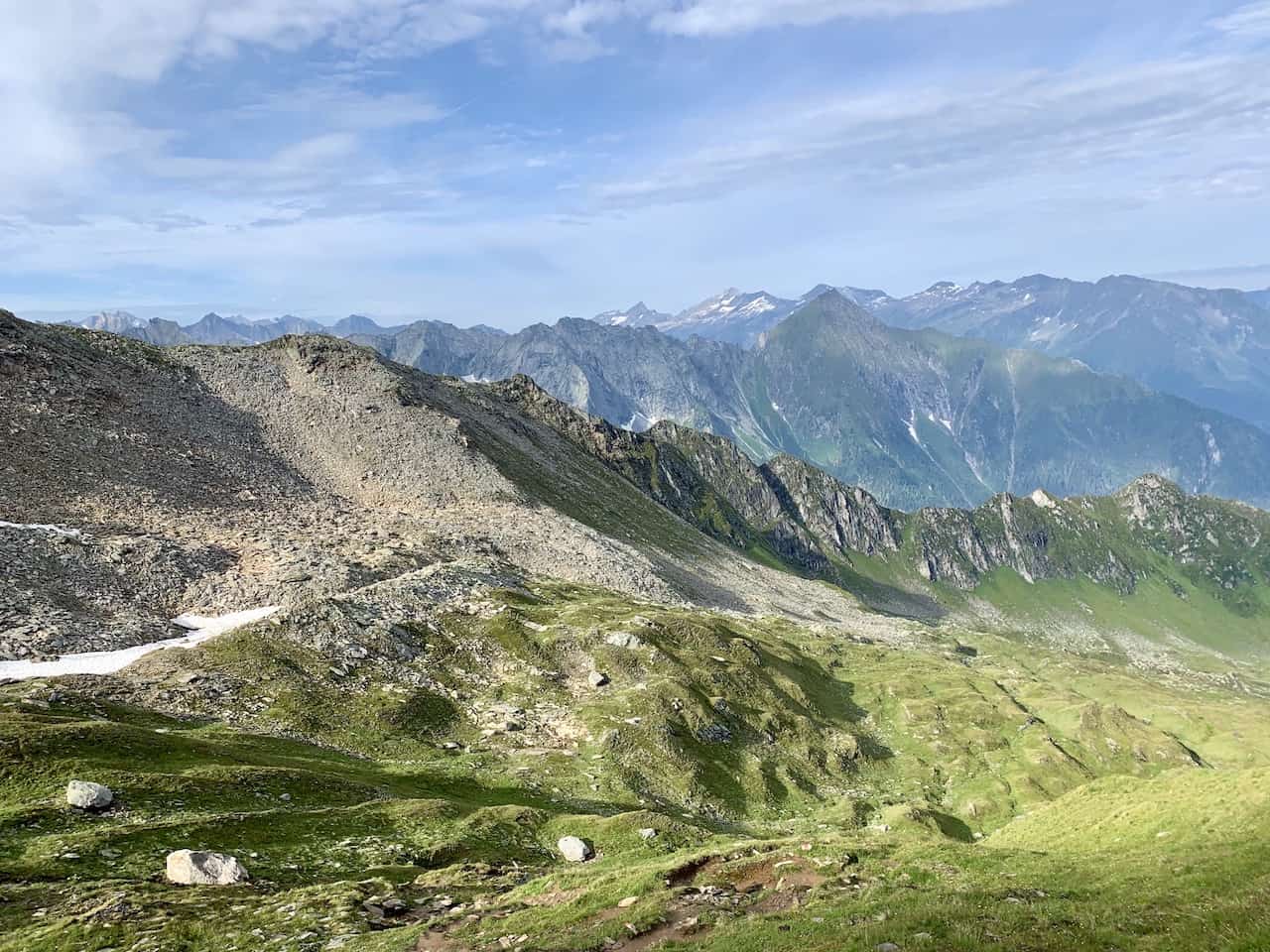
At one point the path will not be a nice dirt path anymore but rather a rocky traverse to the saddle of the mountain. Be careful here as you do not want to misstep and hurt yourself in anyway.
Once on top of the saddle you will be entering the final ascent towards the summit to your left. On your right you will see another path on the ridge line of the mountain.
This is the path that I took down back to the Edelhutte (more on that soon).
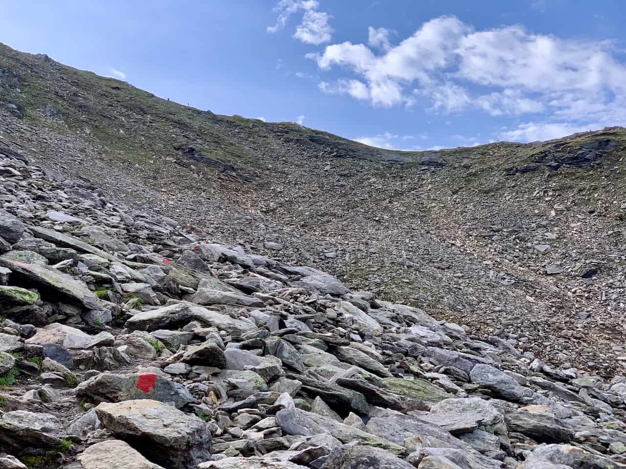
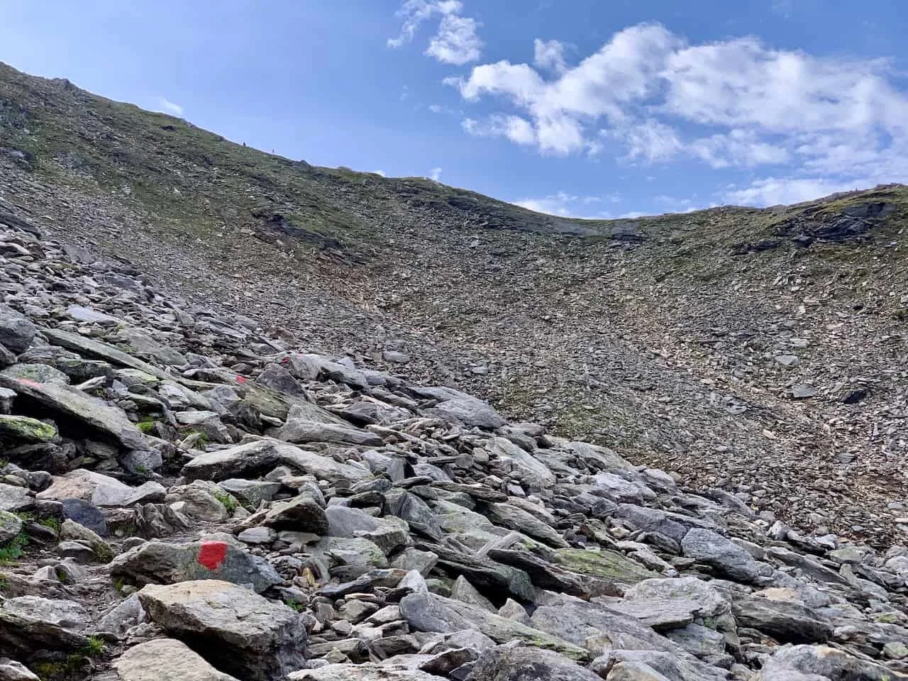

The final portion of trail up to the summit of Ahornspitze will consist of some rocky dirt paths as well as some real rock scrambling as you get closer to the top.
Again, please take your time here as not only are you gaining a good amount of elevation but you are also doing so on rocky terrain.
On the rocks you will see the red and white markers, which you should be following up to the summit.
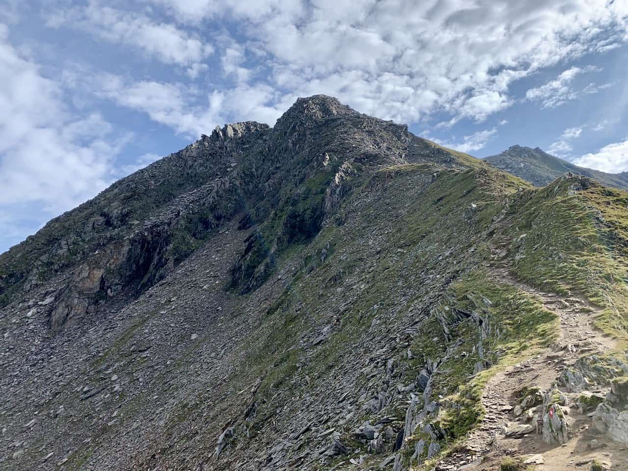

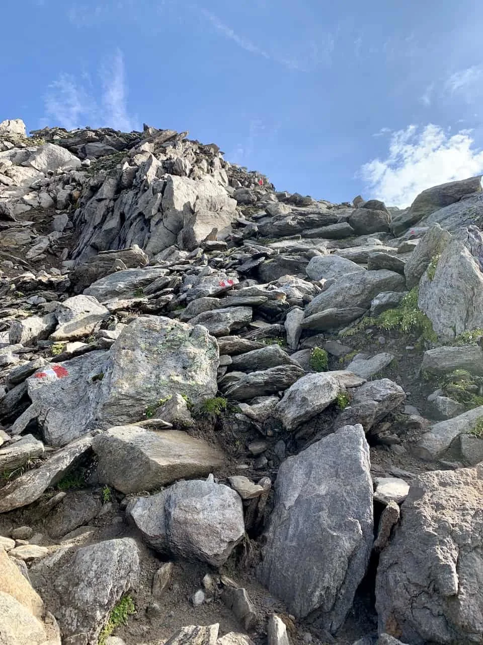
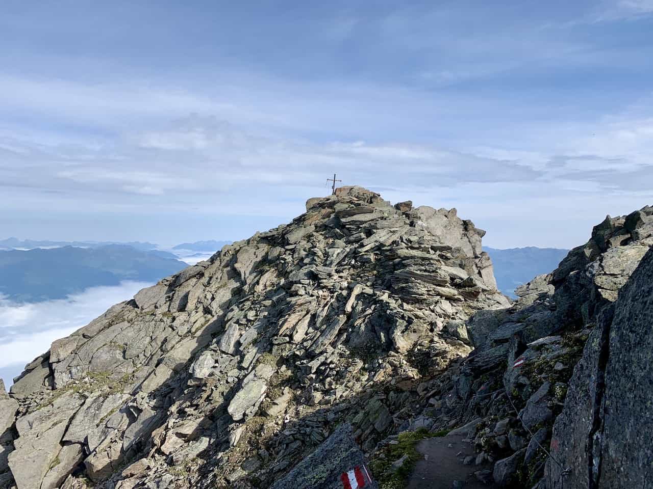
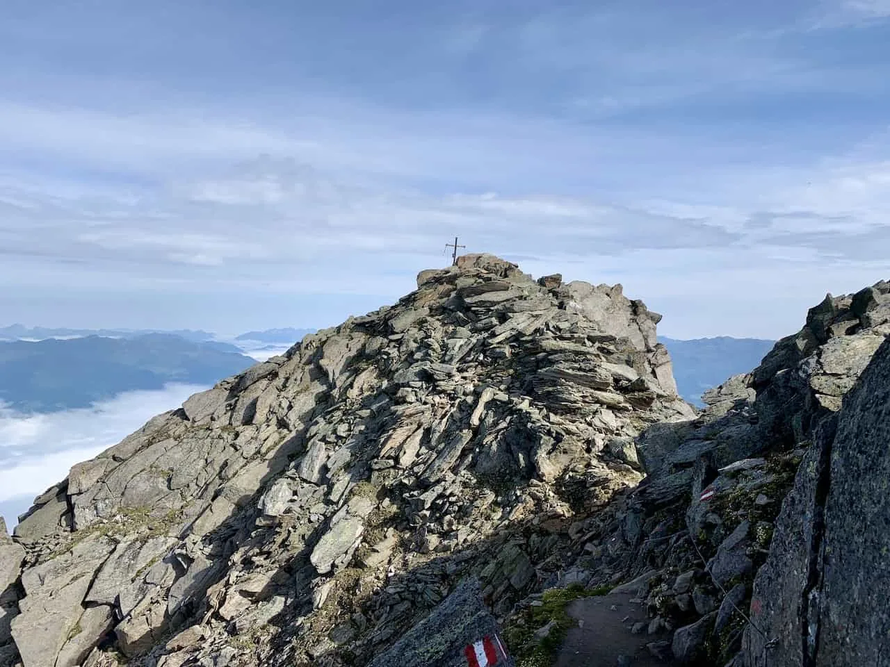
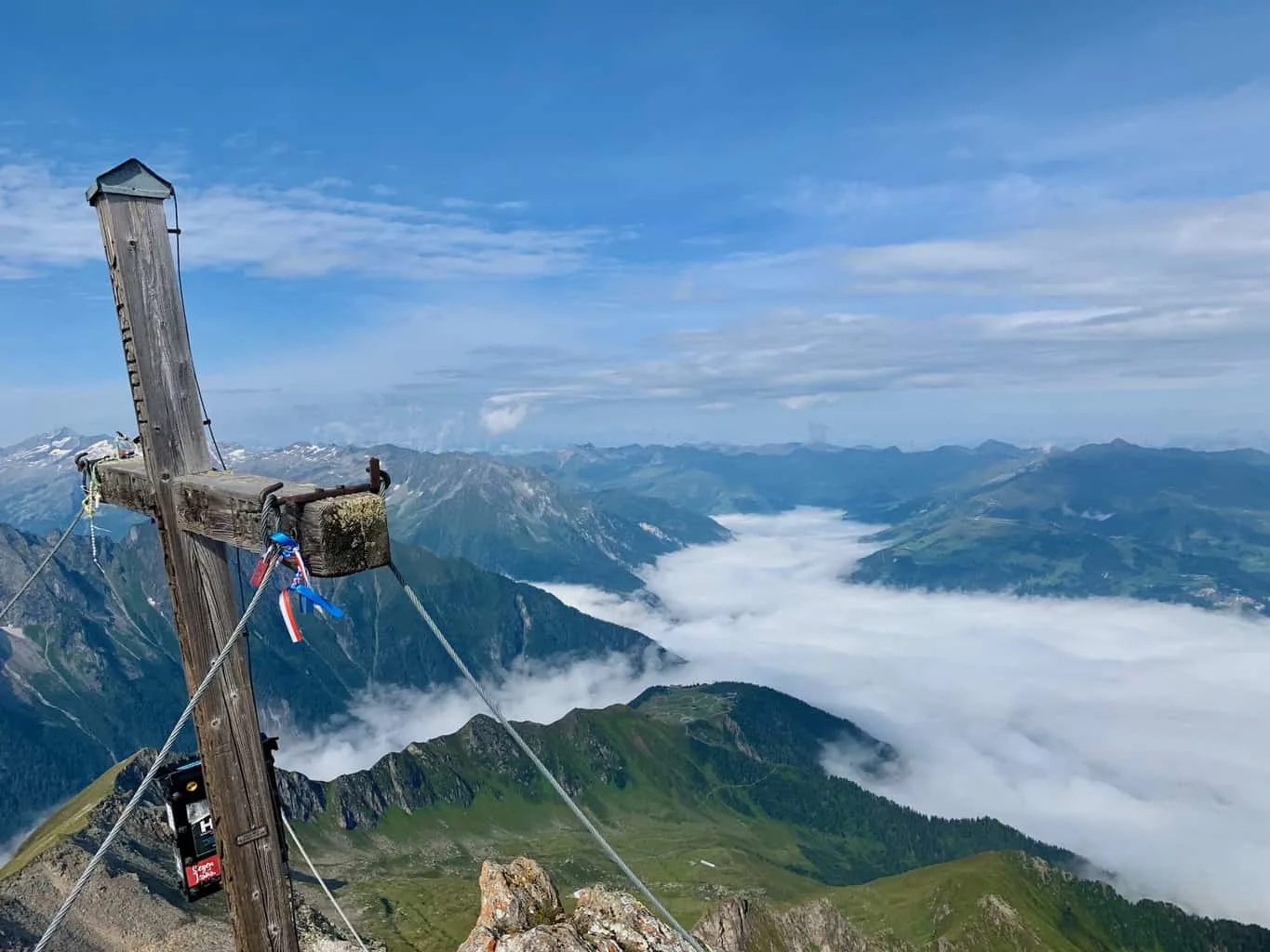
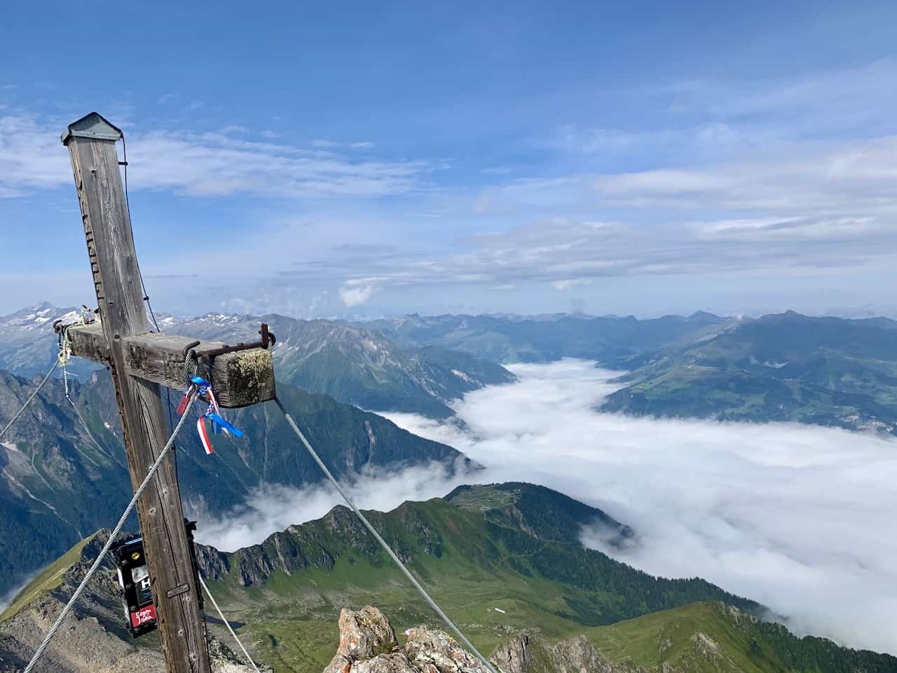
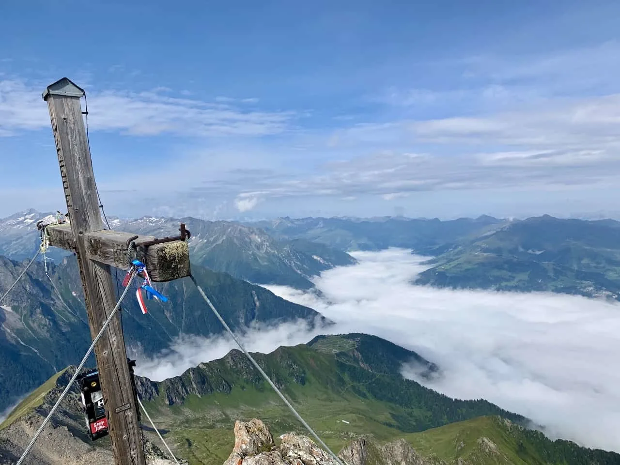
As you approach the top, you will notice that the actual summit of the Ahornspitze is just around the corner. Follow the markers and fixed rope to the cross that sits on top of the Ahornspitze.
Once on top, you will truly be able to take in all types of views in every which direction. Surrounding you will be never ending mountain ranges with the valley down below going on for miles.


Ahornspitze Summit to Edelhutte (2 Hours)
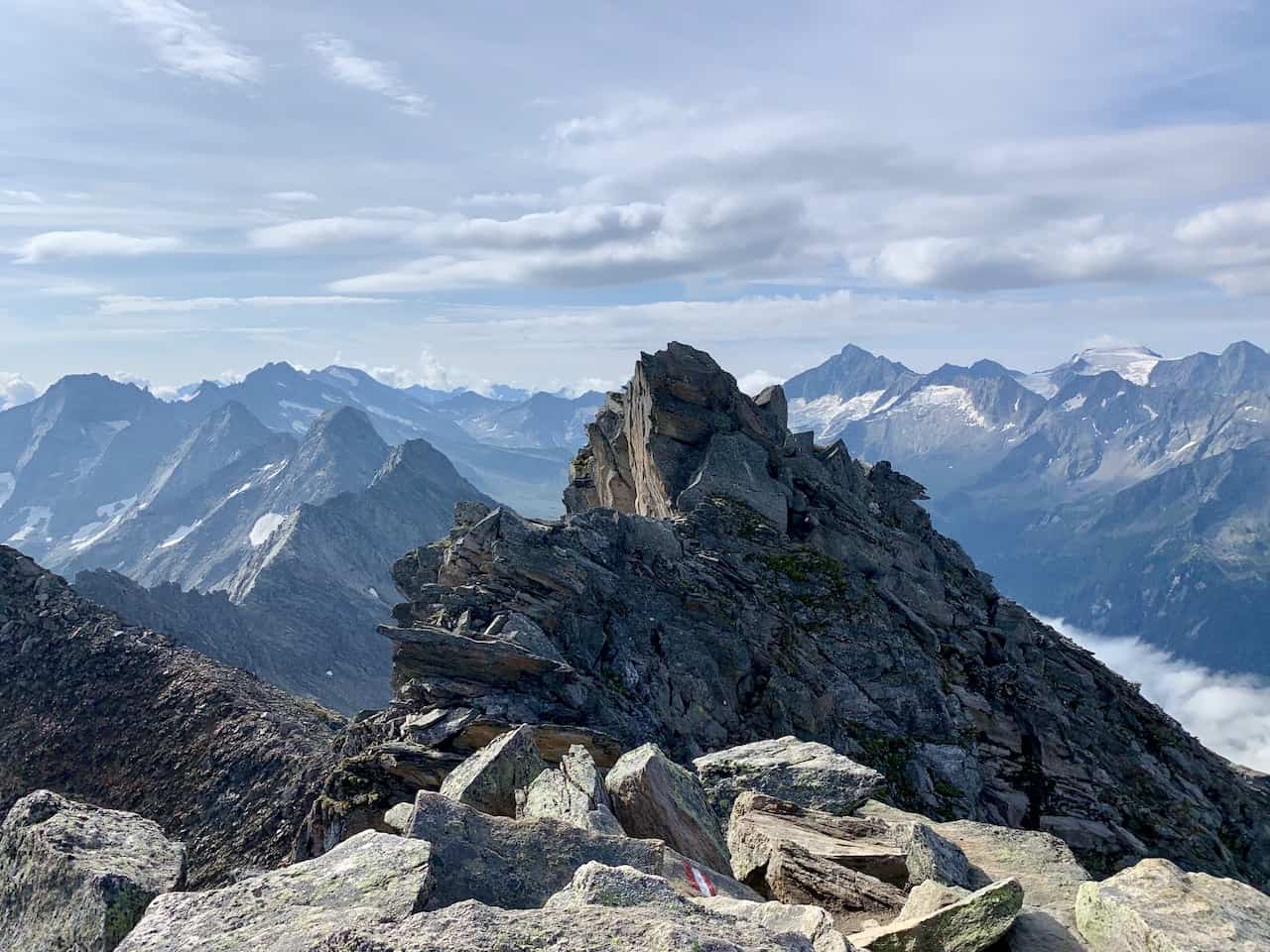
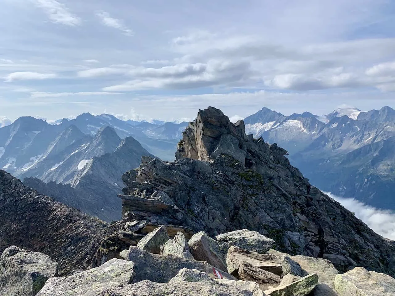
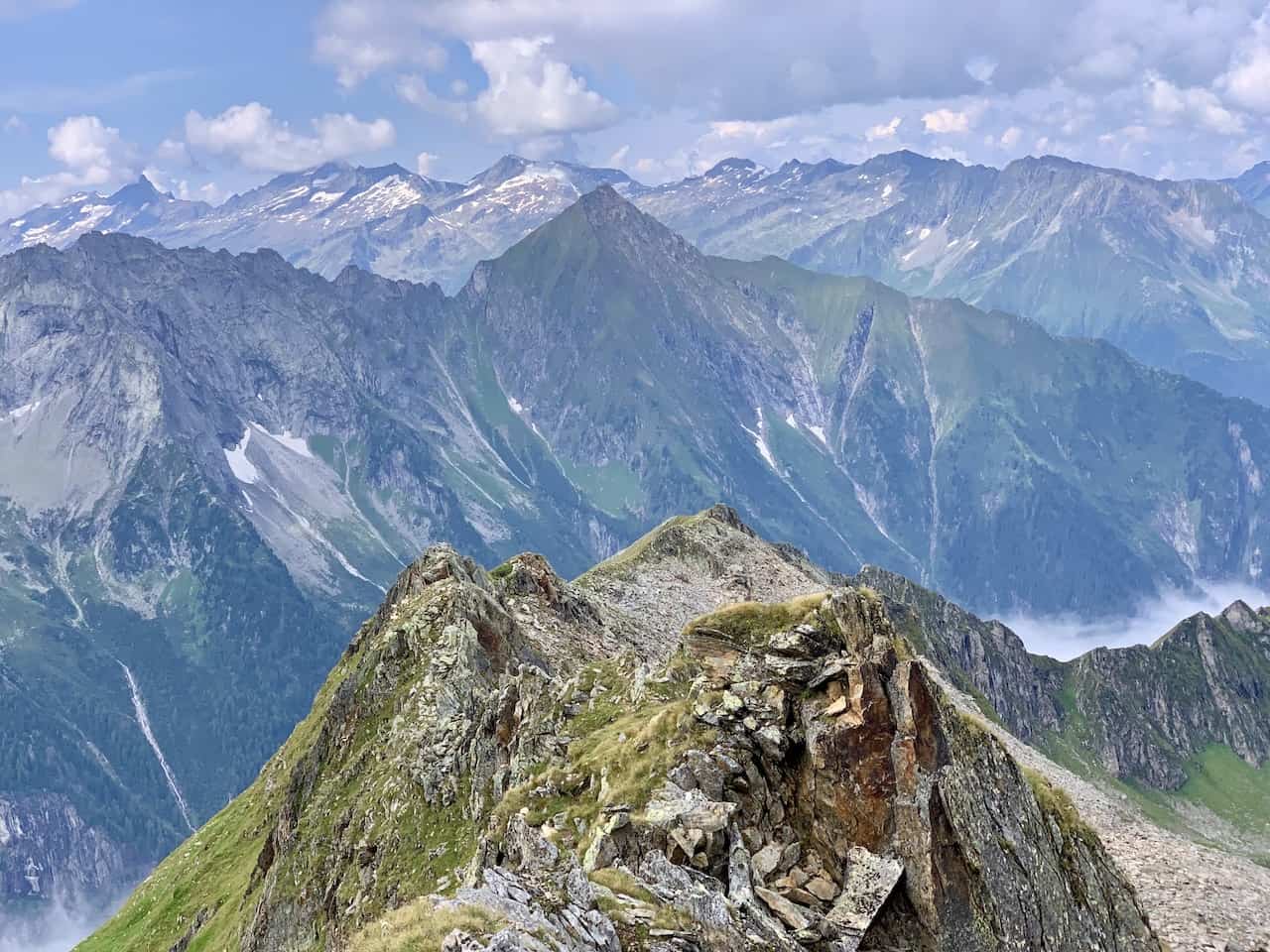
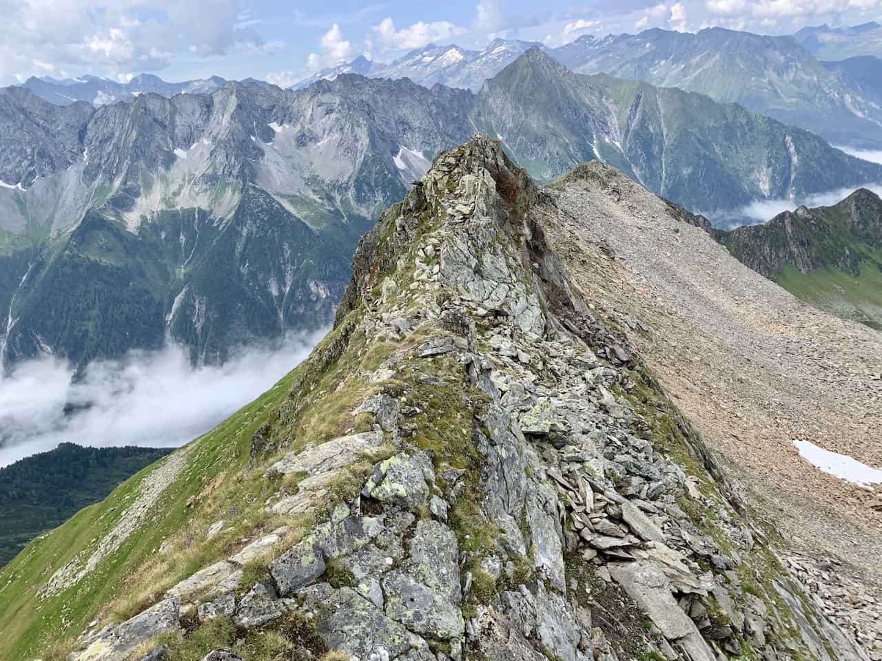
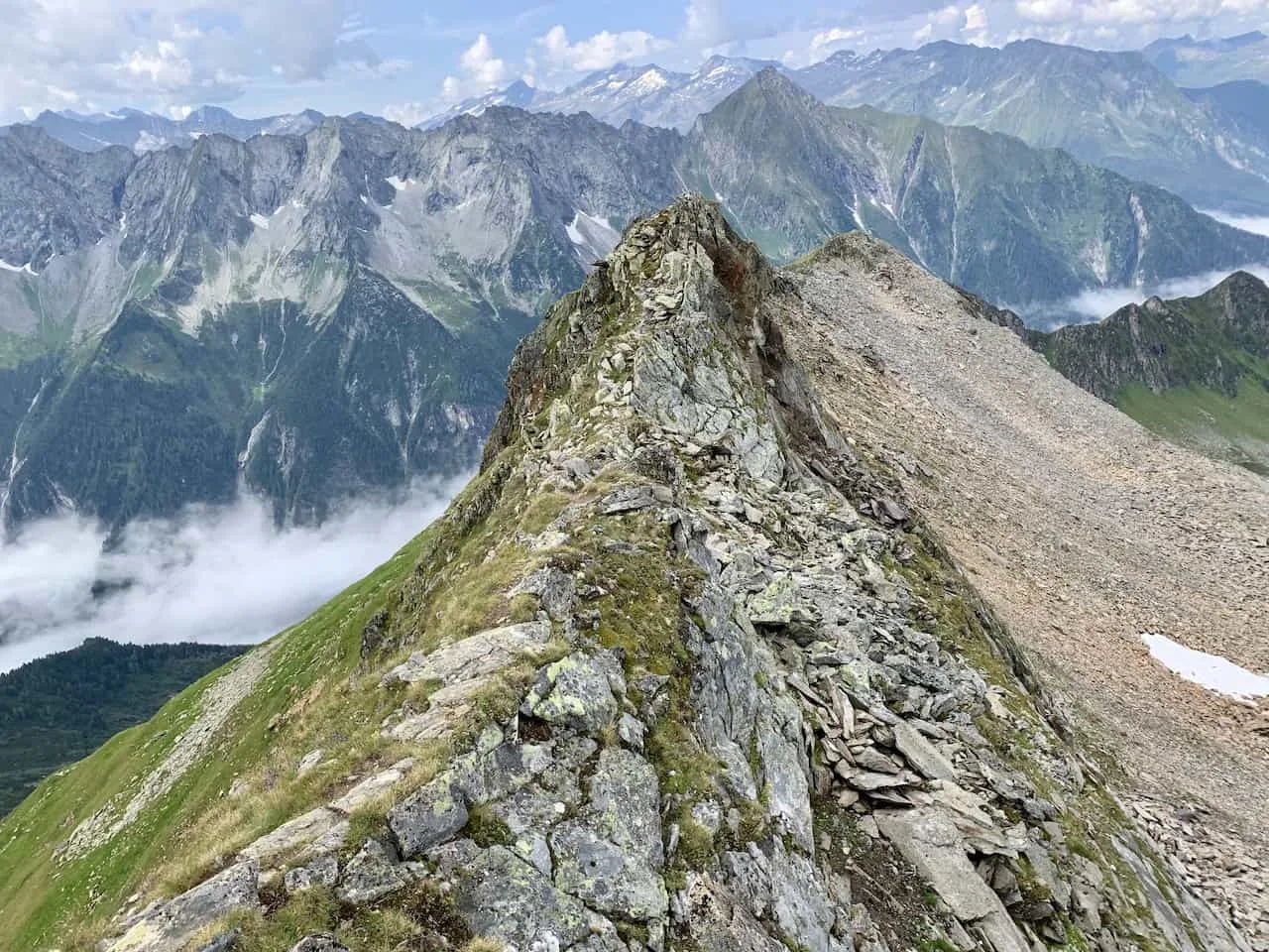
After enjoying the summit for some time, it is time to retrace your steps back to the starting point. You can either do so in two different ways – either go down the same exact path you came up on OR head down the ridge route.
Once you get back to the saddle, you will have the option to turn right on the same path you ascended on or you can head directly straight as you follow the red arrow markers along the ridge line.
If you do want to head on the ridge, check out some of the details and images below that explain the route.
You can see that it can be a bit rocky and narrow at some points so if you are not comfortable hiking this portion then I would advise to just take the same route as before.
If you are comfortable heading on the ridge, get ready for some beautiful views out in front of you with the greenery and valley off to the side. You can also see in the third picture, the route you came up on etched into the mountainside.


Soon enough you will see a sign pointing you towards the right hand side back to the Edelhutte. This will be quite the decline as you hold on to some fixed rope sections to help you balance yourself.
You will then continue on the rocky dirt path towards the hut, where you will meet back up with the original route.


No matter which option you choose (original route or ridge route), feel free to hang out at the hut, have some drinks or lunch and enjoy the view before continuing back to the Ahornbahn.
Edelhutte to Ahornbahn (1 Hour)
Once you are ready to head out from the Edelhutte, it will just be a quick 1 hour walk back down. However, before you head down, remember that you will have two options to choose from.
For a portion of the trail from the Edelhutte to the Ahornbahn there are two different route options (red vs. orange). So depending on preference, you can either head on either one of these down.
Since I took the inner route up (orange), I decided to take the route closer to the valley back down (red route on the map from the Edelhutte to Ahornbahn).
It is a beautiful easy path to follow with views and greenery all around as you make the walk down.


Eventually you will reach the starting point of the hike right back at the top of the Ahornbahn station. You can decide to hang out around the area for a bit before taking the cable car down to the bottom.
That about does it for a recap to the hike up and down Ahornspitze! I hope everything written above has given you a good idea of what to expect on the mountain and how to complete the trek on your own.
If you have any questions or comments feel free to add them in below. Also be sure to check out the other Austria itineraries and guides up on the site.
Some of these include a 3 Day Vienna Itinerary, a Salzburg Day Trip and a Hallsatt Itinerary.
If you are up for a much more thrilling and adventurous hike, check out the Donnerkogel Klettersteig overview up on the site.
Have fun out there and safe travels!