
Some of the highlights of driving through Austria include the various viewpoints, lakes, glaciers, and mountains that you will come across along the way.
One of those highlights in particular is the Grossglockner High Alpine Road, where you can enjoy all of the above.
This guide will focus in on the Glocknerhaus to Kaiser Franz Josefs Hohe hiking trail, one of the top activities to take part of during a visit on the road.
* Affiliate Disclosure: This post may contain affiliate links, which means I may receive a commission if you make a purchase through the links provided, at no additional cost to you. Thanks for supporting the work I put into TripTins!
1) What is the Grossglockner High Alpine Road
While this guide won’t go in depth on the Grossglockner High Alpine Road, I still wanted to give a brief overview of what exactly it is.
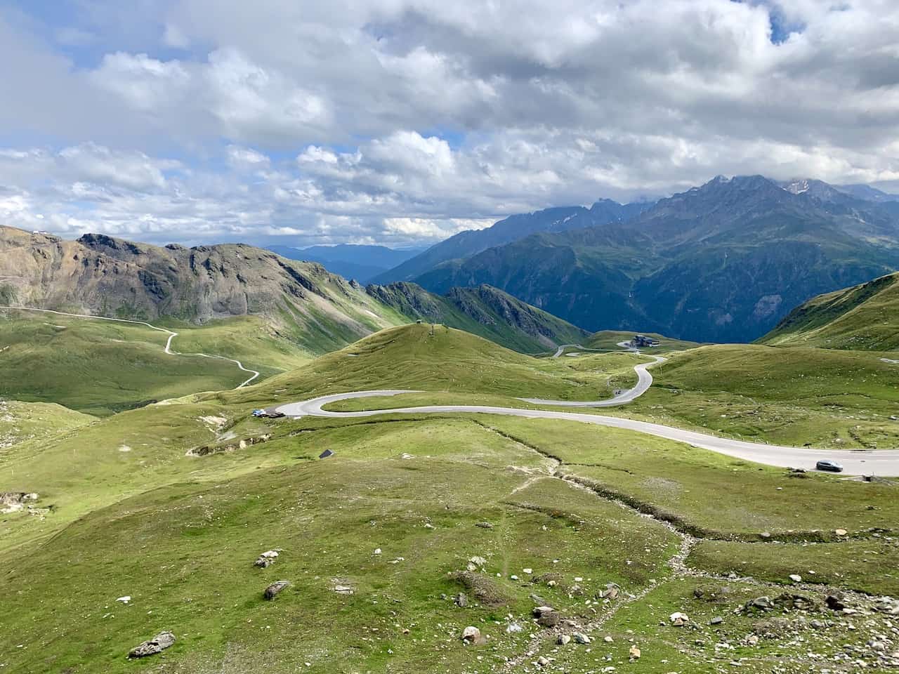
The high alpine road is a 48 km / 30 mile mountain pass road with 36 hairpin like curves that wind their way up and down the surrounding mountainside.
The highest point of the road reaches 2,571 meters / 8,435 feet!
The road is named after the tallest mountain in Austria – the Grossglockner. At 3,798 meters / 12,461 feet, the mountain can be viewed from several different vantage points, with one of the closest views at the Kaiser Franz Josefs Hohe.
The main scenic portion of the road, between Ferleiten and Heiligenblut requires a toll to enter. Due to its high elevation, this portion is only open during certain times of year for safety reasons.
So, whether enjoying the Grossglockner High Alpine Road as part of a road trip or day trip, I highly recommend a visit during your time in Austria.

2) Where is the Grossglockner High Alpine Road
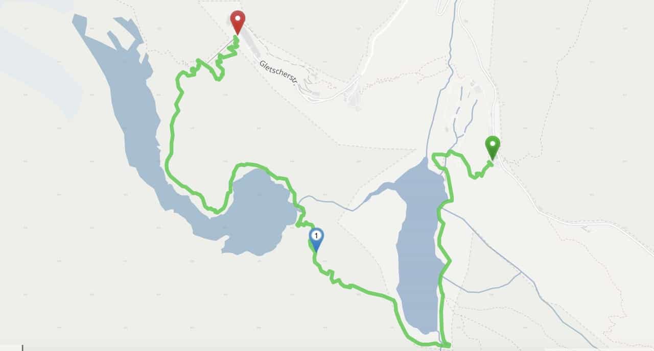
As mentioned, the toll booth section of road begins in Ferleiten in the north and ends in Heiligenblut in the south. I have highlighted both of those entry / exit points on the map below.
Also highlighted are the starting and ending points of the Glocknerhaus to Kaiser Franz Josefs Hohe hiking trail, which takes you down towards the glacier lakes below.
I actually made the day trip to the high alpine road when spending a few days in the Bavarian town of Berchtesgaden (1.5 hours away).
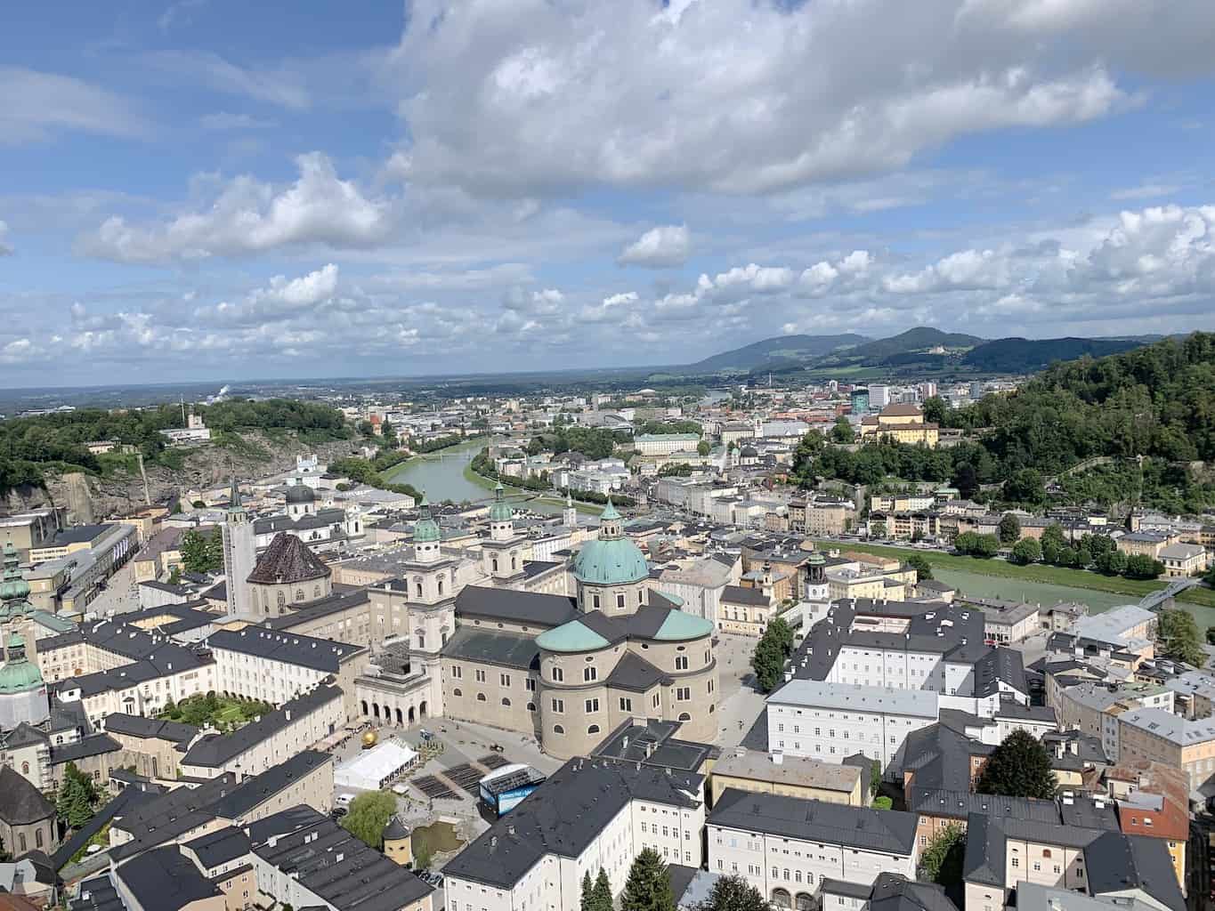
However, you could also day trip from nearby places such as Zell am See (15 minutes), Salzburg (1.5 hours), or even Innsbruck (2 hours).
Car Rentals: If you are renting a car in Austria, be sure to check out Rentalcars.com to browse through options. Once on the site, you will be able to filter by price, car type, rental company, and more, to find the perfect car for your trip to Austria.
3) Hours & Costs
Every year the opening and closing dates may vary slightly but expect the road to be open sometime in May and close sometime in October/November. For 2023 the hours are as follows:
- June 1 – August 31: 5:30AM to 9:00PM
- Sep 1 – October/November (closing date TBD): 6:00AM to 7:30PM
- The last entrance onto the road is 45 minutes before the night lock
The prices to access the road are different by vehicle. See below for the latest prices:
- Private Car: 40 Euro
- Motorcycle: 30 Euro
- Trucks: 49 Euro
- Bus: 6.30 Euro per adult / 3.10 Euro per child
4) What to Bring on the Hike
Hiking Packing List
In general when it comes to hiking, there are a few main aspects to consider. These includes clothing layers, hiking shoes, hydration & fuel, electronics, and other essentials.
Below in a breakdown of some of the top items, but be sure to check out the Hiking Packing List for a more comprehensive view.
Clothing Layers
Layering is going to be a top consideration when hiking. You will want to be prepared for all sorts of weather so you can be comfortable in different situations. Some items may include:
→ Hiking Shorts
→ Hiking Pants
→ Short Sleeve Shirt
→ Long Sleeve Shirt / Sun Hoodie
→ Mid Layer Fleece
→ Puff Jacket (not always needed)
→ Packable Rain Jacket (Columbia Watertight II)Note that your layers should be made of moisture wicking material as they are breathable and quick drying.
Footwear
Having appropriate footwear will also be very important. You will want to have shoes with the necessary grip and support to keep you safe on the trail.
→ Hiking Shoes (Keen Targhee)
→ Hiking Socks (Darn Tough)Other Essentials
Whether it is hiking gear, electronics, or just some miscellaneous items, here are some other essentials to bring along on hikes.
→ Hiking Backpack (Osprey Talon 22) & Rain Cover (Joy Walker Cover)
→ Hiking Poles (Black Diamond Trekking Poles)
→ Water Bottle (CamelBak Chute or Katadyn Filter Bottle)
→ Portable Charger (Anker PowerCore 5000mAh)
→ Action Camera (GoPro Hero)
→ Energy Bars & Snacks
→ Hat & Sunglasses
→ Sunscreen & Bug Spray
5) Grossglockner Hiking Details
Now that you have some details about the Grossglockner High Alpine Road, let’s talk more about the hiking trail in particular.
Below are some helpful points of information for the Glocknerhaus to Kaiser Franz Josefs Hohe hiking trail.
- Starting Point: Glocknerhaus
- Ending Point: Kaiser Franz Josefs Hohe
- Length: 5.8 km / 3.6 miles
- Elevation Gain*: 476 meters / 1,562 feet
- Duration: 3 Hours
- Terrain: Dirt / Rock / Gravel
- Difficulty: Easy
*You can save a good portion of elevation gain if you take the quick Gletscherbahn cable car ride up to the Kaiser Franz Josefs Hohe at the very end of the trail.
Since the day is a combination of the high alpine road and the hike itself, I would advise getting an early start to enjoy it all.
You will want to stop along the road itself to take some pictures and enjoy the views from time to time, and you are sure to do the same along the hike.
6) One Way Hike Details
The starting point is at the Glocknerhaus and the ending point is at Kaiser Franz Josefs Hohe. This is a one way trail, meaning you will need to find a way back to the starting point, where you would have parked your car.
There are a few options here to choose from:
1) Hitch a 5 minute ride back with someone leaving from the parking lot
2) Catch the local bus that leaves from Kaiser Franz Josefs Hohe every 1-2 hours (ask the folks at Kaiser Franz Josefs Hohe for details on the daily schedule once you get there)
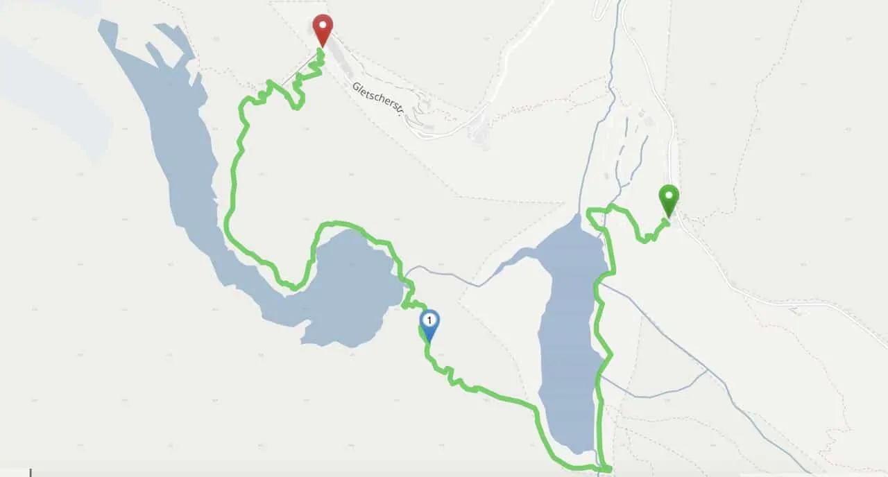
3) Hike back on the road, but do not walk through the tunnel as it is very dangerous to do so. Below is a screenshot of the hike back that heads on the road, and then switches onto a trail to avoid walking through the tunnel. This hike back should be about 45 minutes.

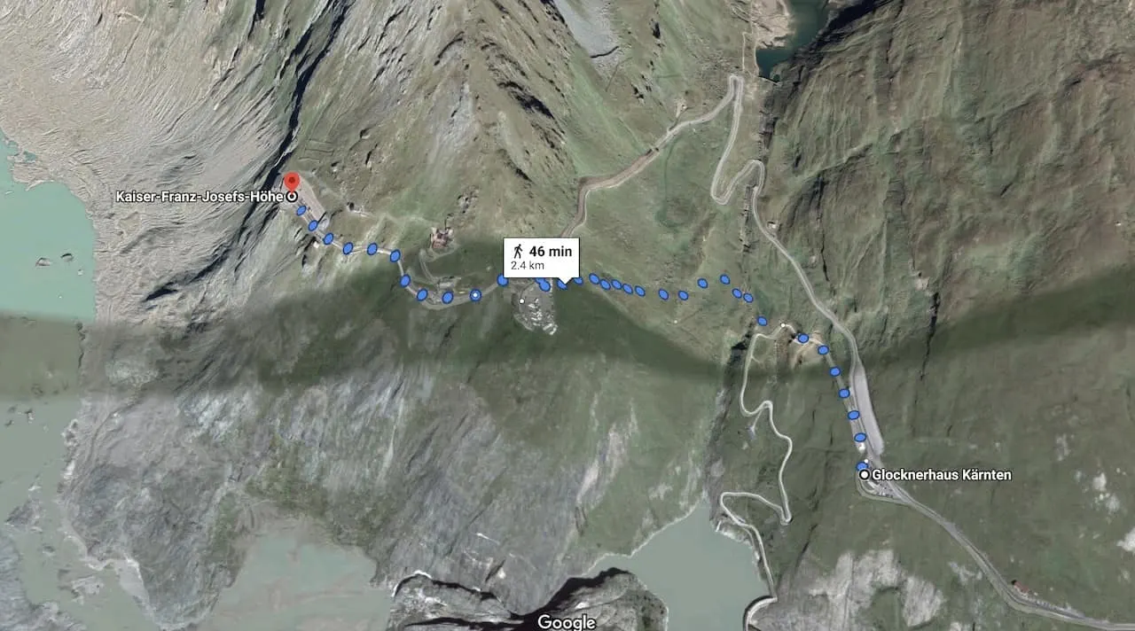
7) Glocknerhaus to Kaiser Franz Josefs Hohe Hike
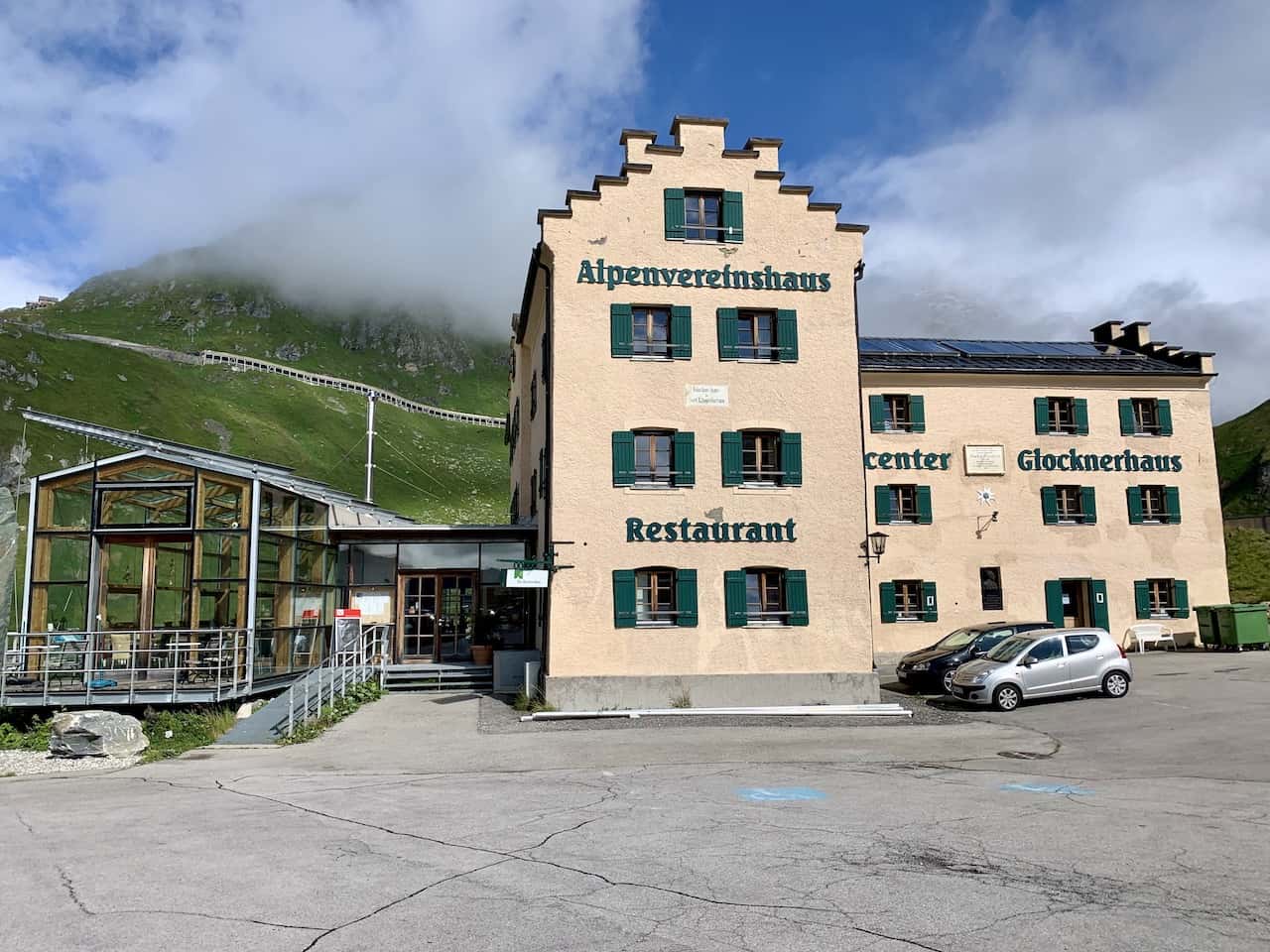
Once you have made your way around the twists and turns of the Grossglockner High Alpine Road, you will turn off the main road and towards the Glocknerhaus.
The house will be on the left hand side of the road, and you can find a parking spot before beginning the hike from there.
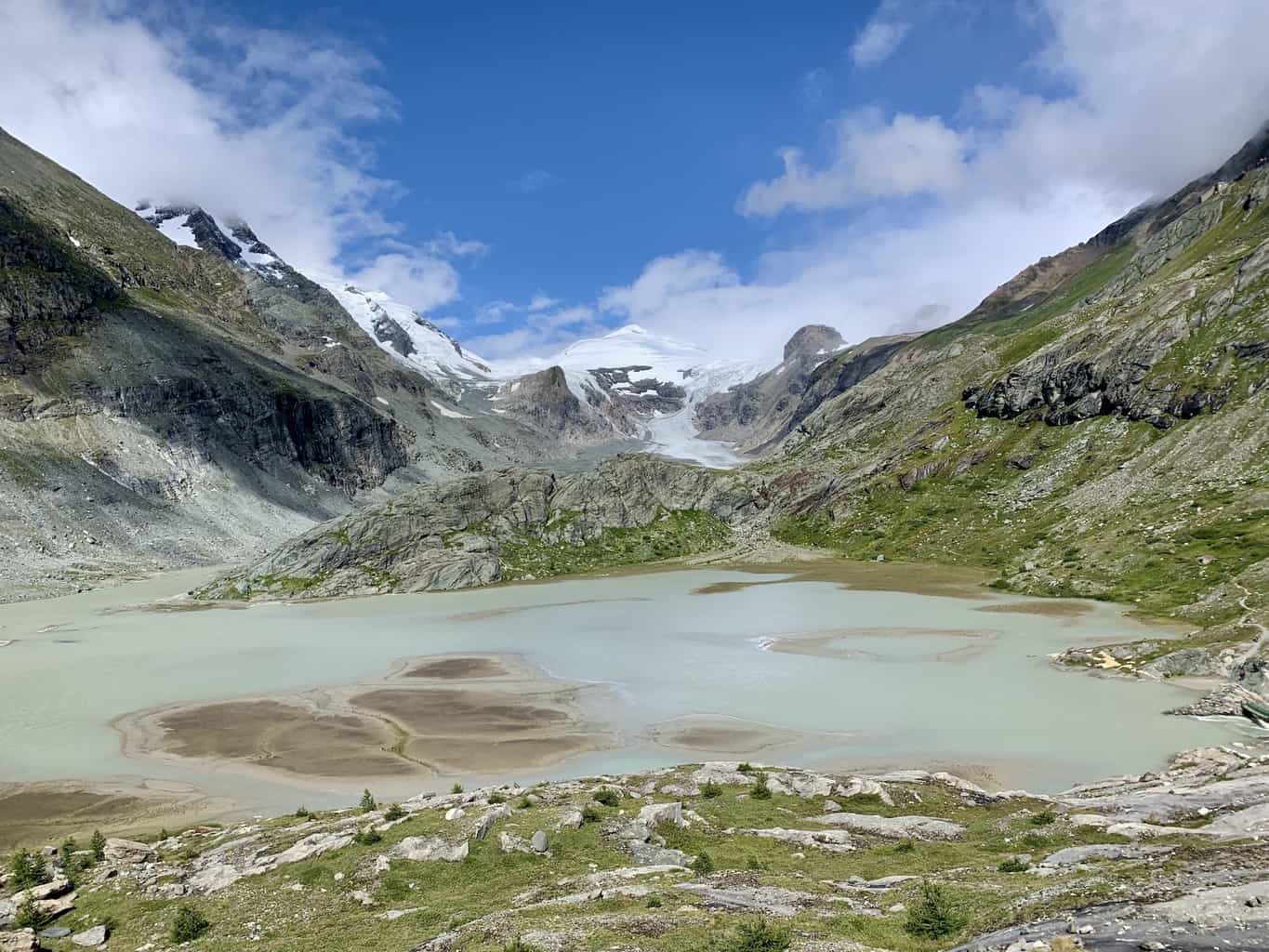
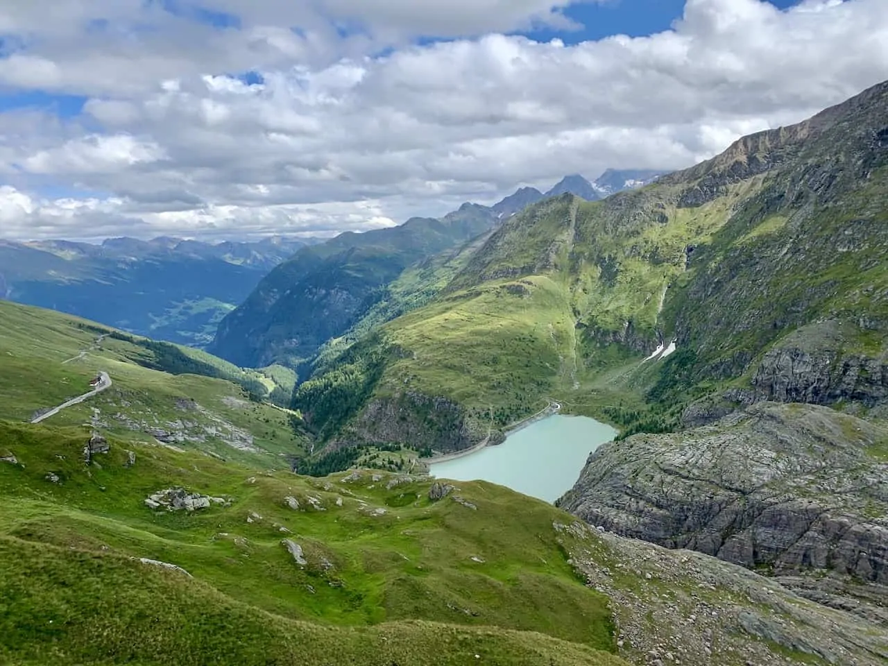
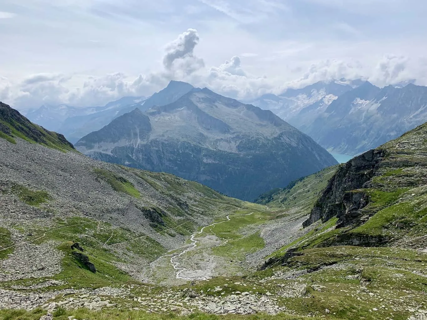
The beginning of the hike will be a downhill dirt trail as you head down to the Speicher Margaritze dam. The glacier water lake below will be surrounded by the greenery of the mountainside that hovers up above it.
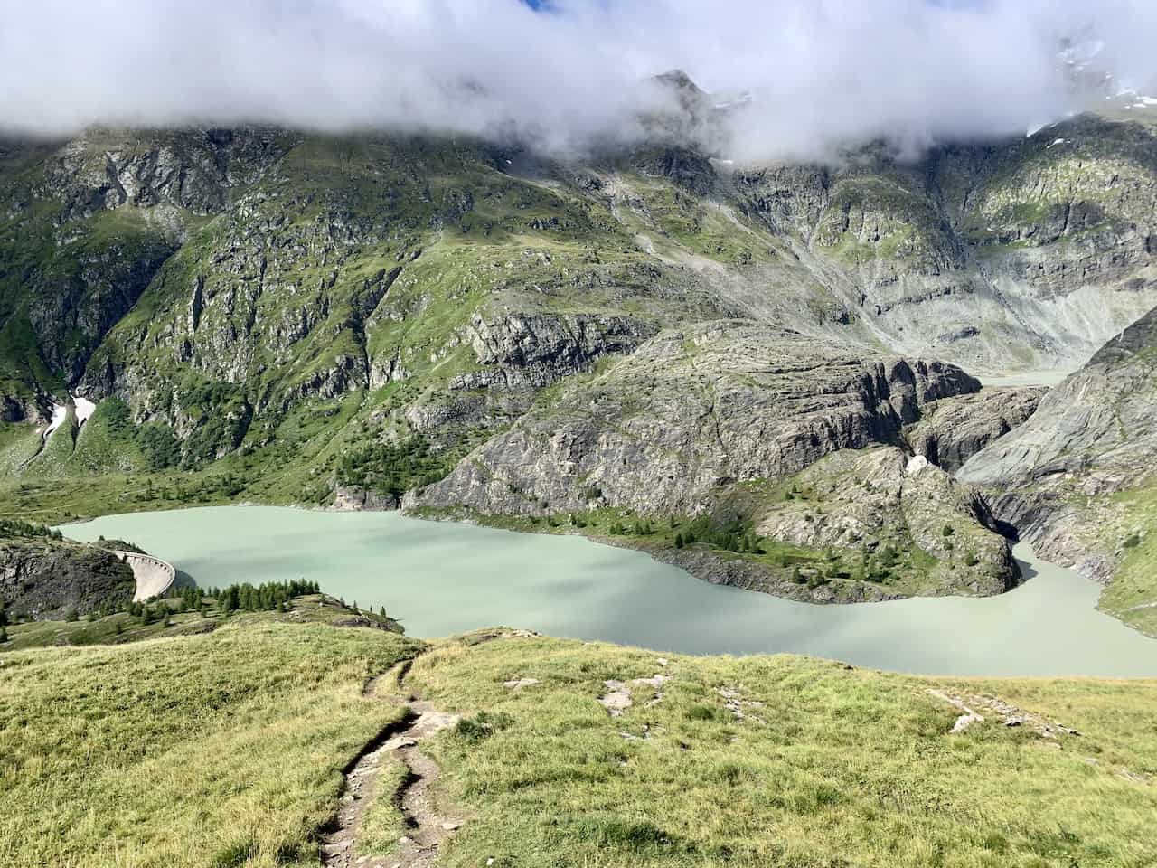
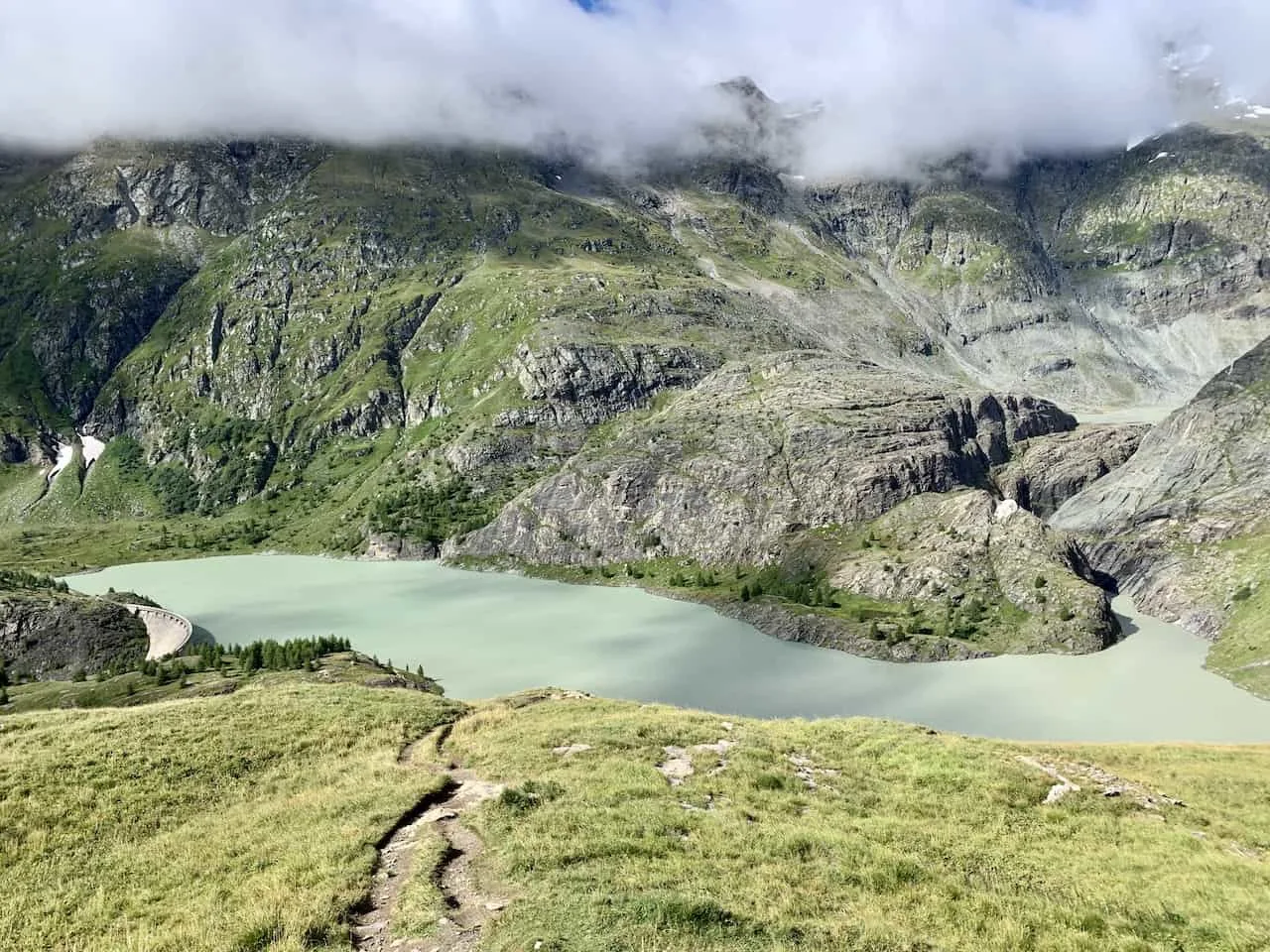
The path will turn from dirt to gravel as you continue your way down, passing by various streams, and you ultimately will end up on the concrete path that makes up the wall of the dam.
From here you will get some great views straight down the valley as the landscape goes on for miles.
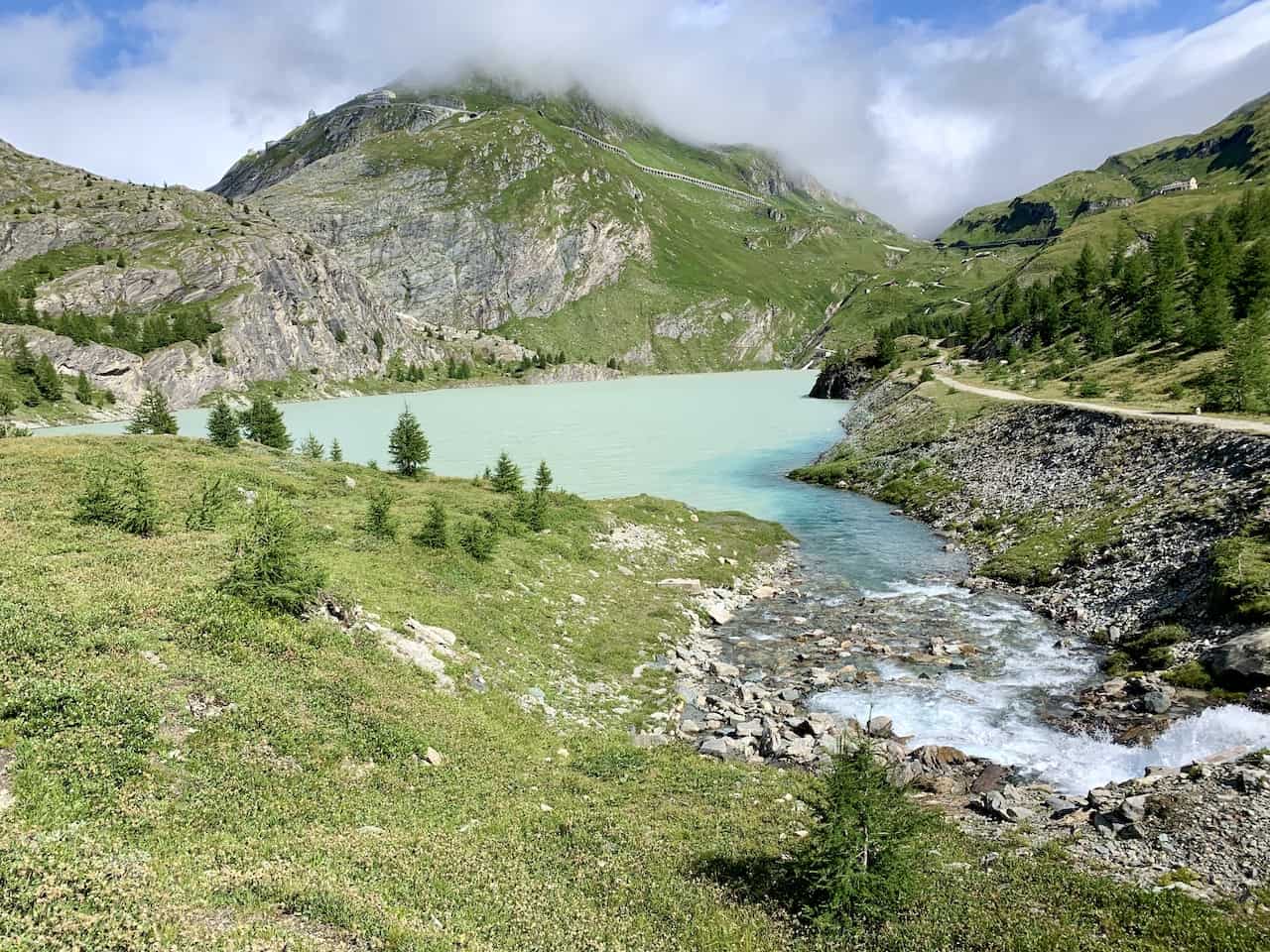
Continue alongside the Speicher Margaritze, as you circle around the dam with the mountain greenery and glacier rivers out in front of you.
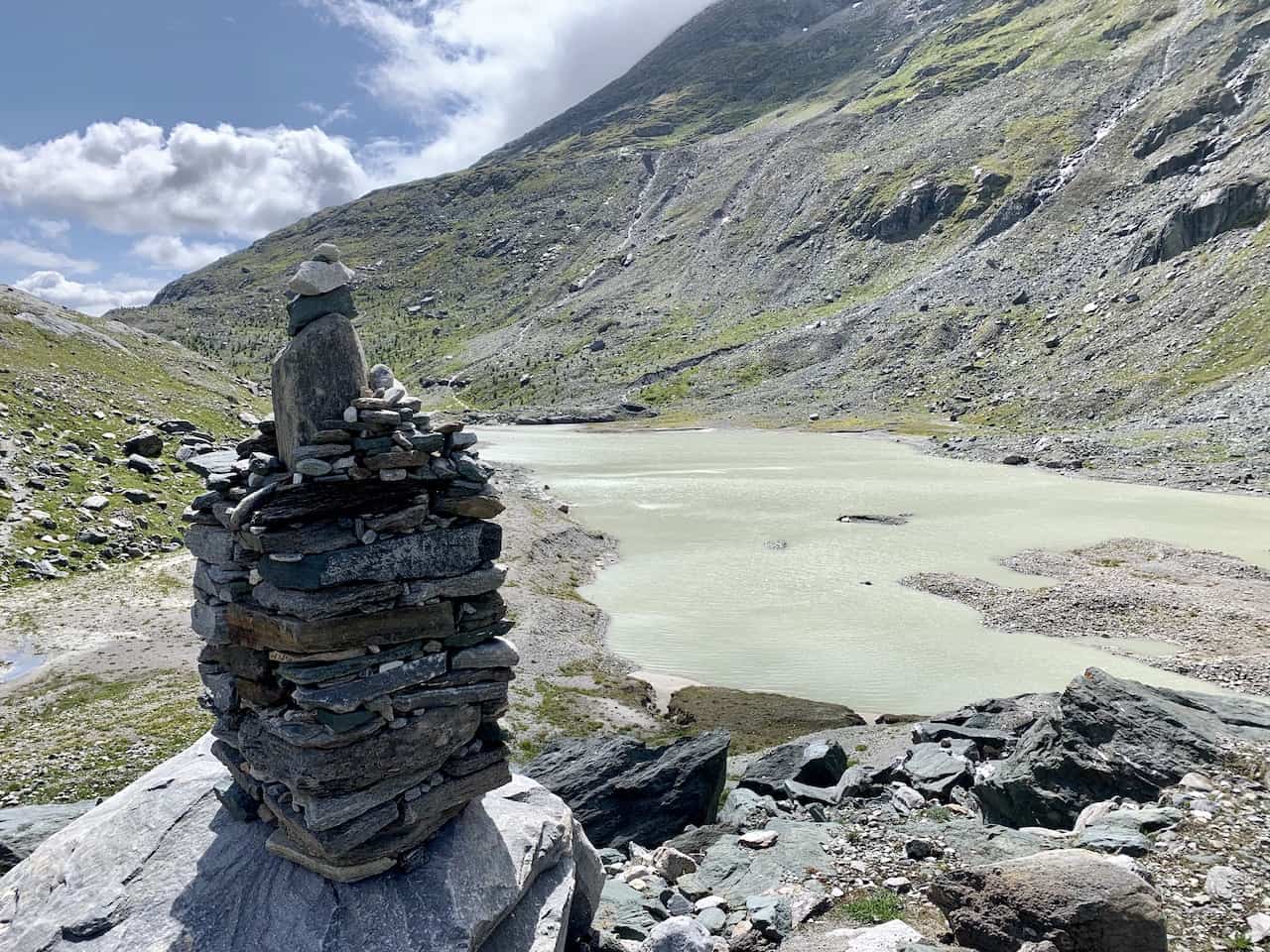
Throughout the way you will simply need to follow the signs to Franz Josefs Hohe or Gletscherweg Pasterze, and the red/white trail markers.

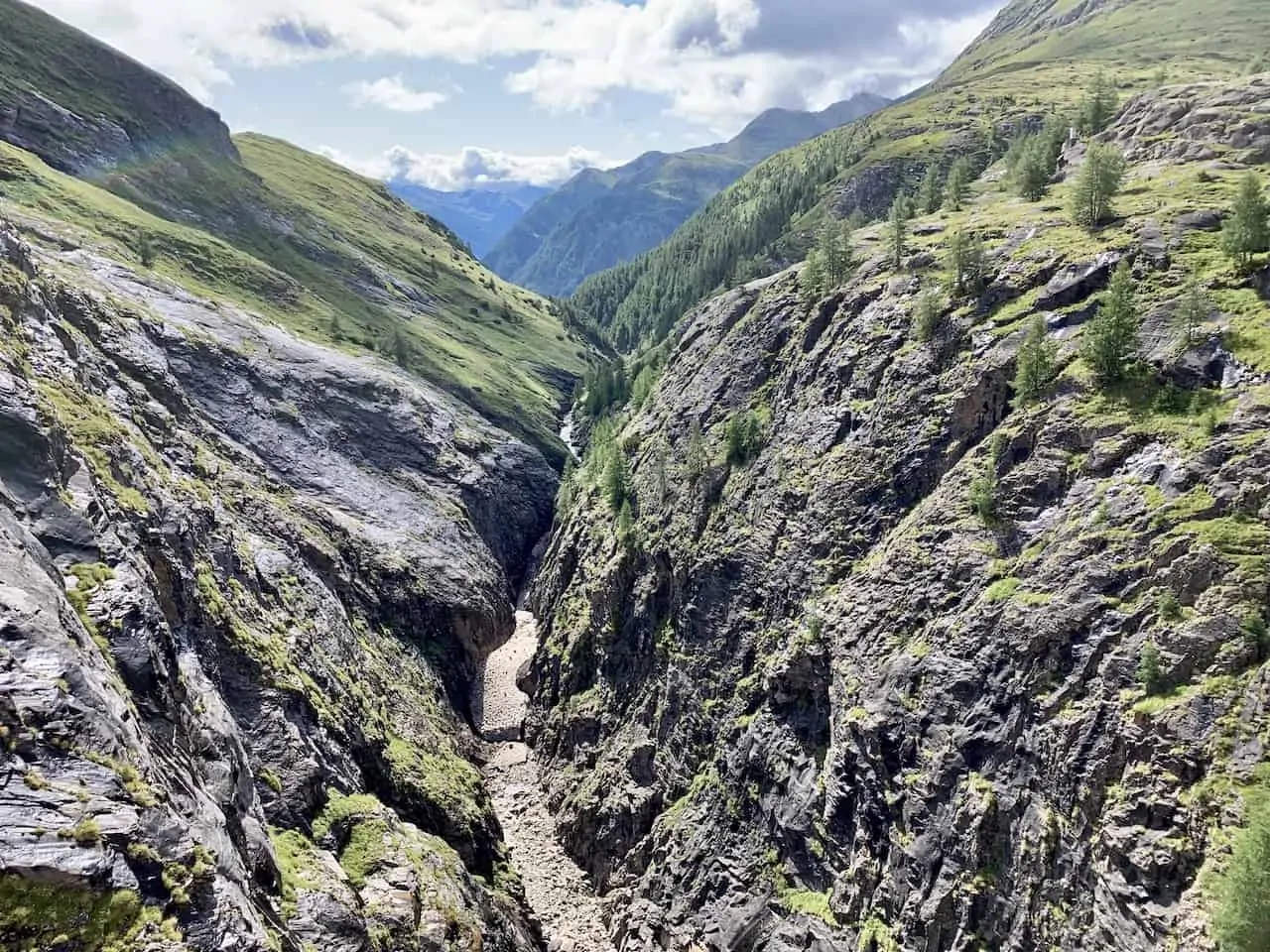

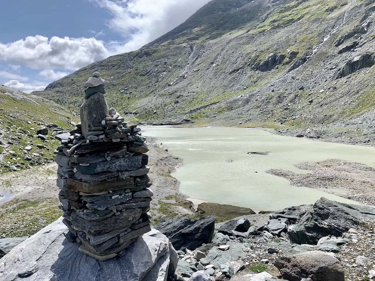
Once you circle the lake, the rocky trail will begin to gain some elevation as you head to the next portion of the hike up to the Sandersee.
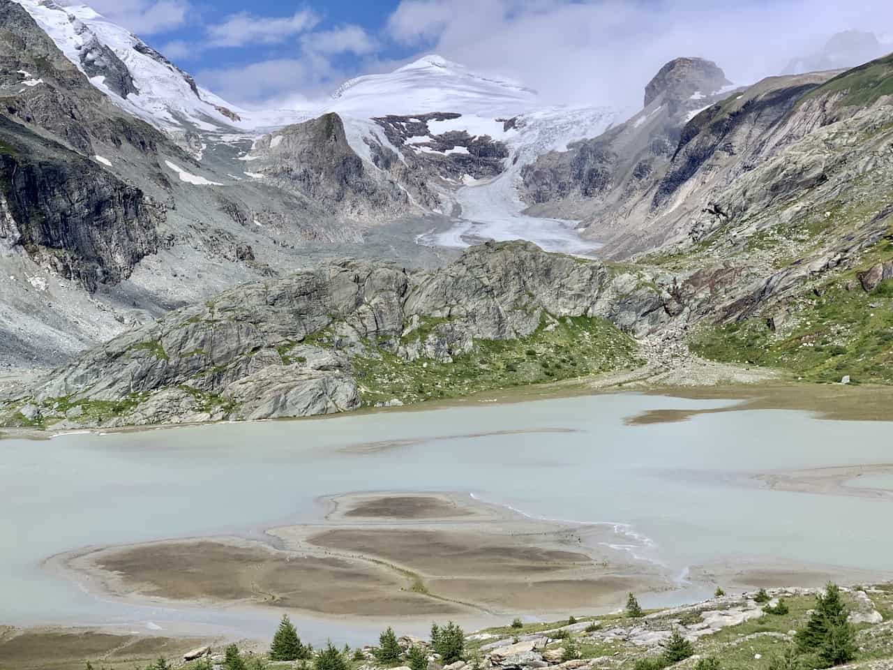
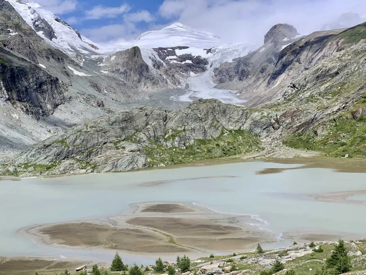
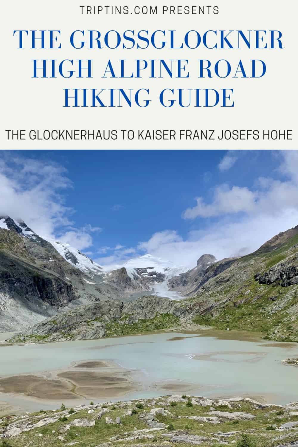
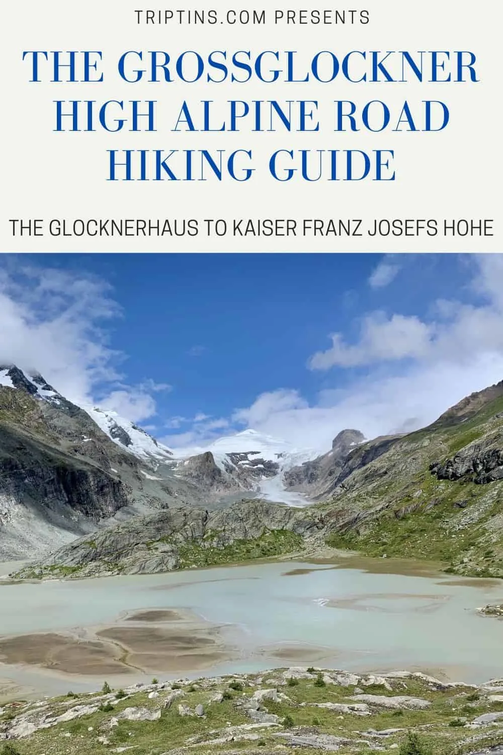
Soon you will leave the Speicher Margaritze behind, and out in front of you will be Sandersee, and the Pasterze glacier way out in the distance.
It is a beautiful landscape shot as you have the greenery mountainside, blue glacier lake, and white glacier and mountains all in view.

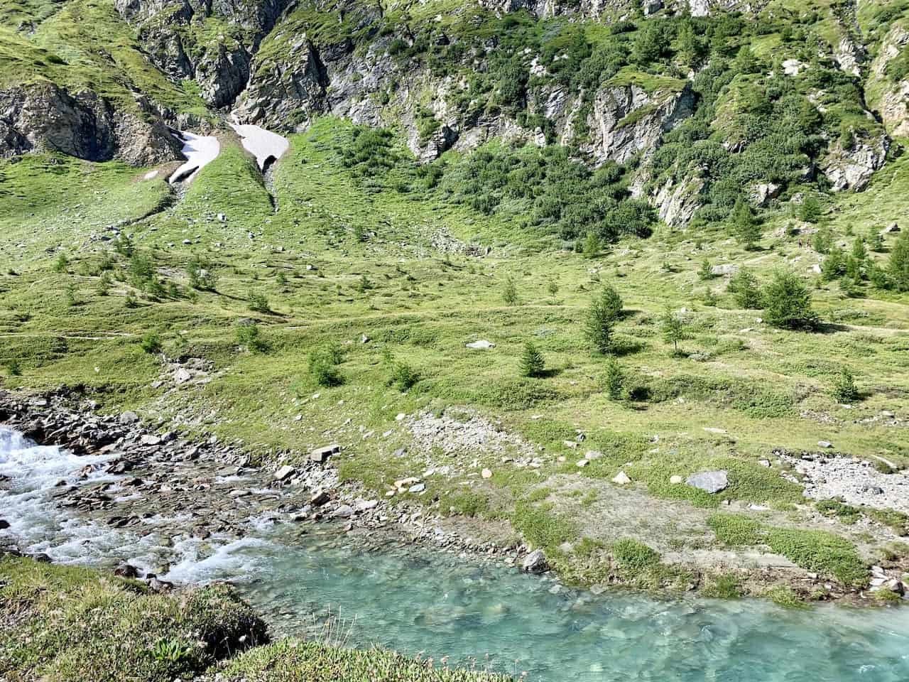
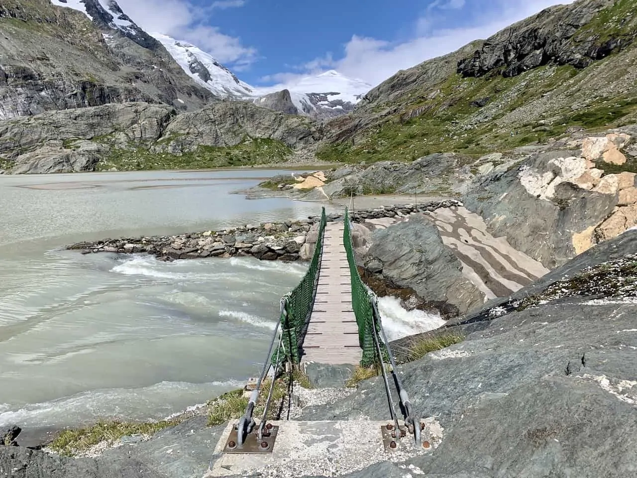
From here you will walk around the right hand side of Sandersee, passing over a suspension bridge with the roaring rapids down below.
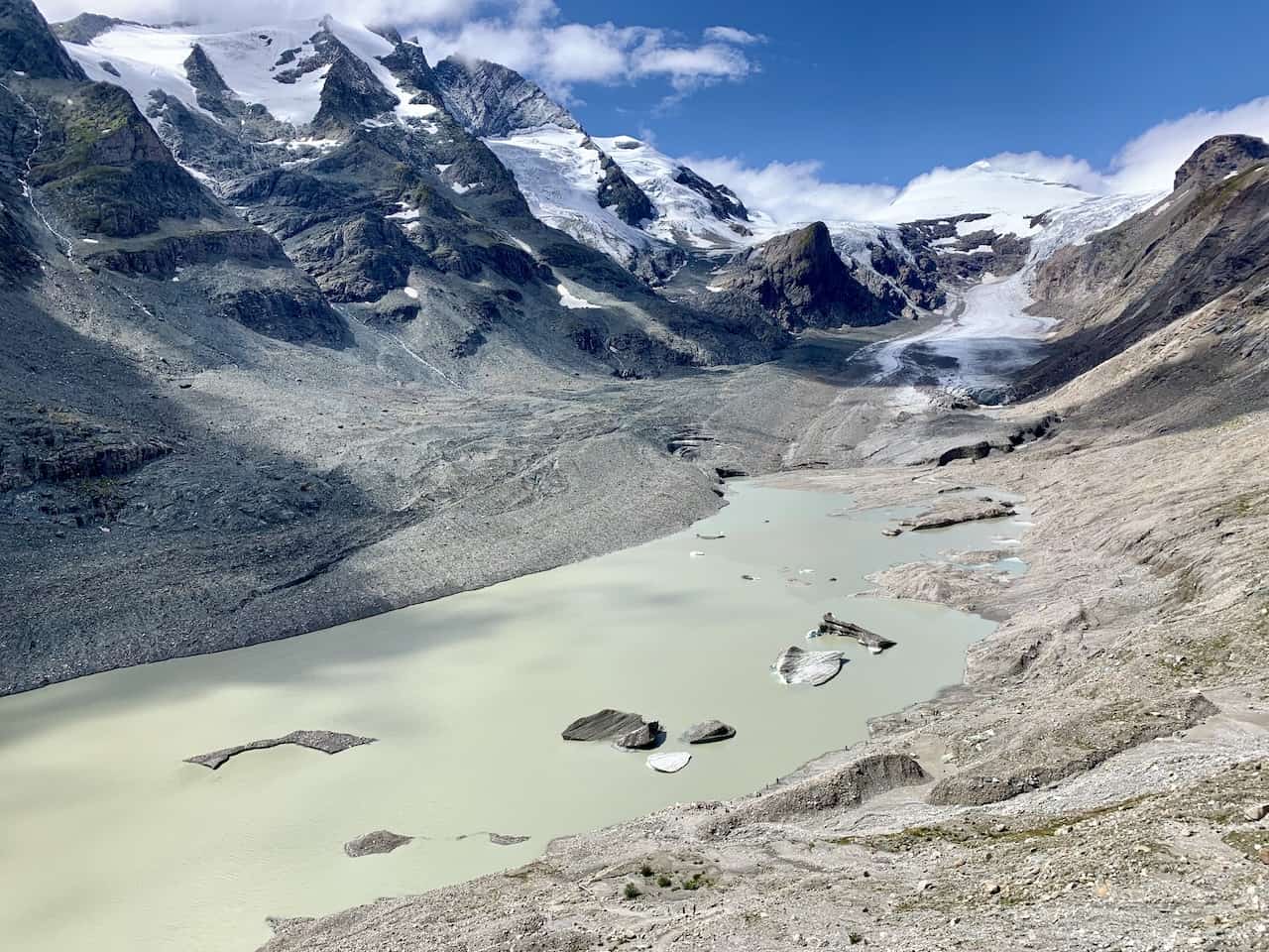
Along the way you are sure to see countless waterfalls coming down from the mountainsides and into the glacier lakes. Continue along the pathway which will soon take you towards the main Pasterze glacier lake.

The last portion of trail takes you a bit higher above the Pasterze glacier lake as you see the numerous icebergs floating in the lake, with the white glacier further out in the distance.
From here you can decide to either continue the trail all the way to the tongue of the glacier or you can end your hike and head on up to the Kaiser Franz Josefs Hohe.
To get up to KFJH, you can choose to just finish up by hiking up yourself or by taking the short Grossglockner Gletscherbahn cable car up.
Learn More: Check out this guide to the Pasterze Glacier Hike if you are interested in extending your time on the trail

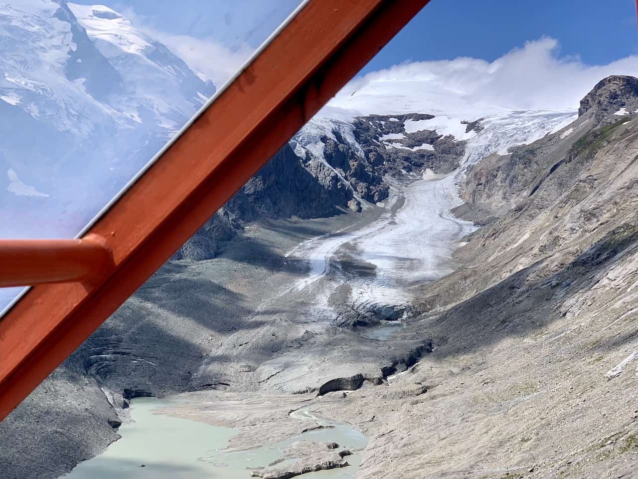

Once you reach the Kaiser Franz Josefs Hohe, you can enjoy some more views from above and head on into the restaurant to have a nice meal with a view.
After enjoying some lunch at the restaurant, it is time to make your way back to the Glocknerhaus, where you left your car at the beginning of the day.
As mentioned you can decide to either hitch a ride back, take the bus, or hike back along a shorter trail.
After reaching the Glocknerhaus, you will get to enjoy the Grossglockner High Alpine Road once more as you zig zag your way back to your next destination.

That about wraps up a guide to the Glocknerhaus to Kaiser Franz Josefs Hohe hiking trail along the Grossglockner High Alpine Road. If you have any additional questions or comments feel free to add them in below.
Also be sure to check out the other Austria itineraries and guides up on the site. You may enjoy some other hikes like Ahornspitze, Olperer Hut, or a Via Ferrata route.
If you are interested in some cities don’t forget to check out this 7 Day Austria Itinerary, 3 Day Vienna Itinerary and Hallstatt Itinerary.
Have fun out there and safe travels!


Michael
Sunday 23rd of April 2023
Hi do you enter from heiligenblut and exit from Fusch?
I am travelling from cortina de Ampezzo
Charles
Monday 24th of April 2023
Hi Michael - it matters where you are heading next after the hike. From Cortina de Ampezzo, it would make sense to enter at Heiligenblut, take part of the hike, and then exit from whichever entrance makes mot sense for your next stop on your trip. Enjoy!