
A visit to Queenstown, New Zealand isn’t complete without taking part of some scenic hiking trails around the area.
One of the fan favorite hikes is the Queenstown Hill Walk, which takes hikers from the city center up to a viewpoint overlooking the vast natural landscape surrounding Queenstown.
This guide will go into detail about the Queenstown Hill track and how to take part of it during your next visit to New Zealand!
* Affiliate Disclosure: This post may contain affiliate links, which means I may receive a commission if you make a purchase through the links provided, at no additional cost to you. Thanks for supporting the work I put into TripTins!
1) Queenstown Hill Walk Overview
Below are some important things to know about the walk up Queenstown Hill to better prepare you for your visit:
- Track Name: Queenstown Hill / Te Tapu-nui (Mountain of Intense Sacredness)
- Starting & Point: Belfast Terrace
- Mid-Point: Summit of Queenstown Hill
- Distance: 5 km / 3.1 miles (round trip)
- Elevation Gain: +500 meters / +1,640 feet
- Hike Time: 2-3 Hours
- Queenstown Hill Height: 907 meters / 2,975 feet
Time of Year: Queenstown Hill can be climbed at any time of year, even in the winter months. If you are climbing when there is snow on the ground, just be careful of your step as the pathway may be a bit trickier.
Difficulty: I would consider Queenstown Hill on the easy-moderate side. The trail itself is easy to navigate and does not have much technicality to it. The elevation gain involved (especially if walking up from the town center) is where things can get tougher.
Sunrise / Sunset: While I made my up during the daytime, this is a perfect hike to enjoy during sunrise or sunset. There will be few crowds, open parking spots, and you will get to take in views with the best light of the day.
Hiking Note: The above metrics are indicative of the hike beginning at the “official” Belfast Terrace starting point. Many people who opt to take part of the trail, begin the hike in the center of Queenstown. This is most notably done due to the lack of parking at the trailhead or not having a car to begin with.
If you are walking up to the trailhead from the center of Queenstown, expect to add on an additional 30 minutes of walking (round trip) and around +100 meters / +328 feet of elevation gain.
→ Prepare yourself for hiking around New Zealand by taking a look at my Hiking Packing List that goes over many of the essentials for a hike like this one

2) Queenstown Hill Directions & Trailhead
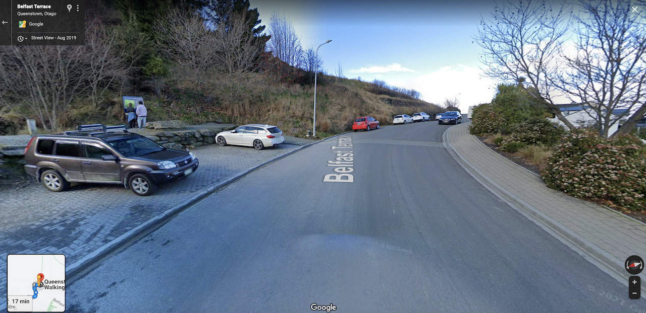
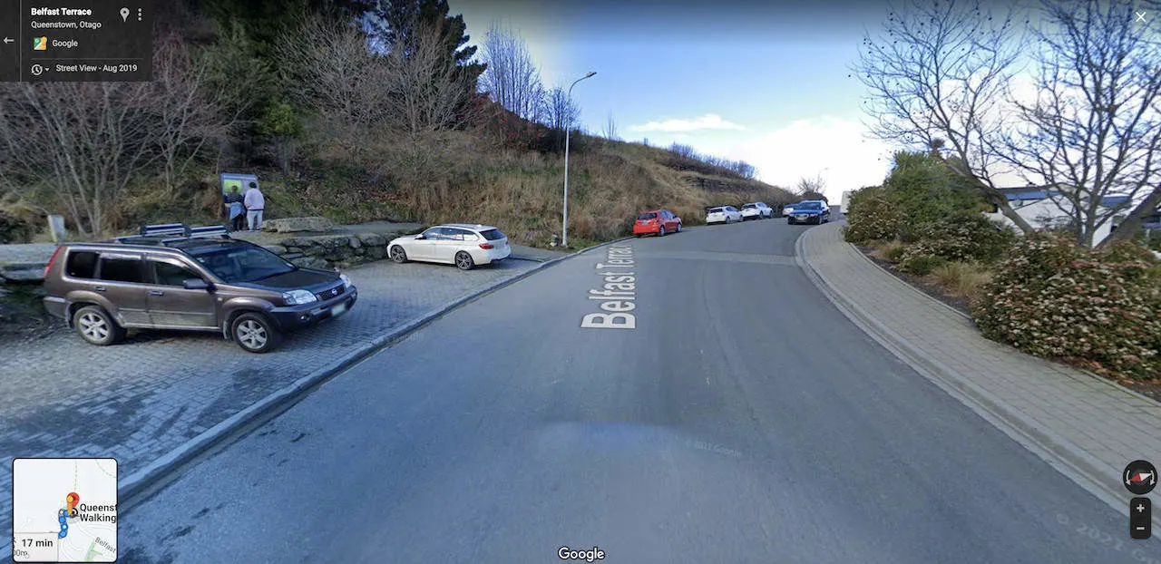
The Queenstown Hill trailhead is located on Belfast Terrace between Kerry Drive and Pinnacle Place. The GPS coordinates of the parking lot are: 45°01’38.7″S 168°39’59.8″E.
If you are driving up to the trailhead, there is only room for about 5 cars in the official parking lot on the side of the road. However, you can also find street parking nearby as well (see screenshot of the parking situation below).
→ Be sure to check out Rentalcars.com when it comes to renting a car in New Zealand. The site will show you car options & prices from a variety of companies. This ensures that you will be able to choose the perfect car (and deal) for your trip to the country.
Simply type in the GPS coordinates or “Queenstown Hill Walking Track” into your navigation app and you should be taken directly to the starting point.
On the other hand, if you are not driving up to the trailhead, you will need to make the walk up from the city center of Queenstown (or wherever you may be staying nearby).
The nice thing here too, is that you should see street signs pointing you up in the right direction.
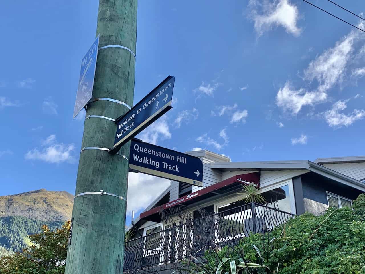

If you have GPS going on your phone, you should be able to see the quickest walking route to the trailhead. The route from downtown will most likely take you up towards Malaghan Street, which is a nice steep street to walk up.
Once you reach the end of the street, there is a staircase that heads through some trees and ends up just a minute away from the trailhead.
The map below shows the trailhead pinpointed down in addition to the walking route from the city center.
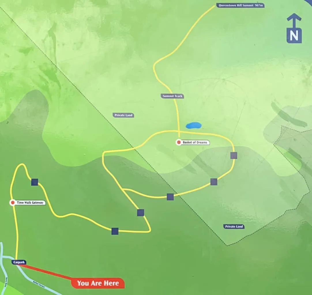
3) Queenstown Hill Map
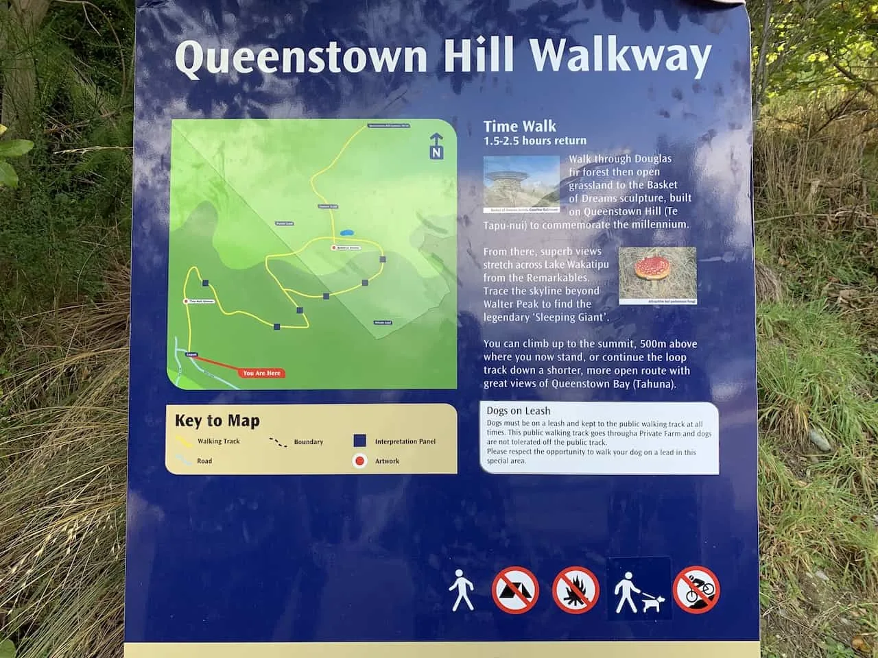
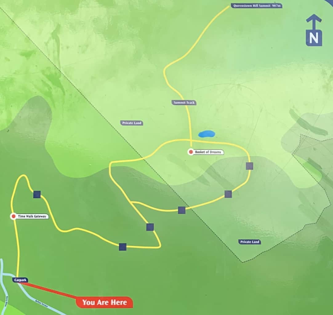
Below you can find the official Queenstown Hill hiking map that is situated at the trailhead. There are a few important things to know about the route:
• Along the way you will find 6 interpretation panels (marked by the blue squares) that will give you some additional insight about the history of Queenstown.
• You will reach a point in the first half of the hike, where the pathway splits into two and meets up at the Basket of Dreams sculpture.
You can pick from either one here – the route to the right is longer but is a bit more scenic, while the trail to the left is shorter but steeper (you can choose to do one way up and the other down).
• Once you reach the Basket of Dreams sculpture, the hike isn’t finished! Continue along the summit track to reach the peak.
• The hike does make its way through private land, so be sure to stay on the trail during the entirety of the climb up.
→ Take part of the Queenstown Hill hike as part of a longer New Zealand itinerary
4) Queenstown Accommodation
In the following section I will dive into the hike itself, but I did first want to mention some of the top accommodation choices in Queenstown.
During peak season, Queenstown does fill up so you will want to book your hotels well in advance.
Below are some of my top recommendations to choose from that are highly rated and reviewed:

Hiking Resources & Checklist
Before heading out for the trails, be sure to read up on some of the hiking resources up on the site. These are here to better prepare you for all types of outdoor adventure.
- Gear: Hiking Packing List
- Weather: How to Prepare for Hiking Weather
- Navigation: Hiking GPS & Navigation
- Tips: 20+ Hiking Tips & Tricks for the Trail
- Accommodation: Book Your Hotel Today
- Rental Car: Book Your Car Rental Today
5) Queenstown Hill Walk
After making your way to the trailhead, either by car or by walking up from the city center, it is time to officially begin the hike to the summit.
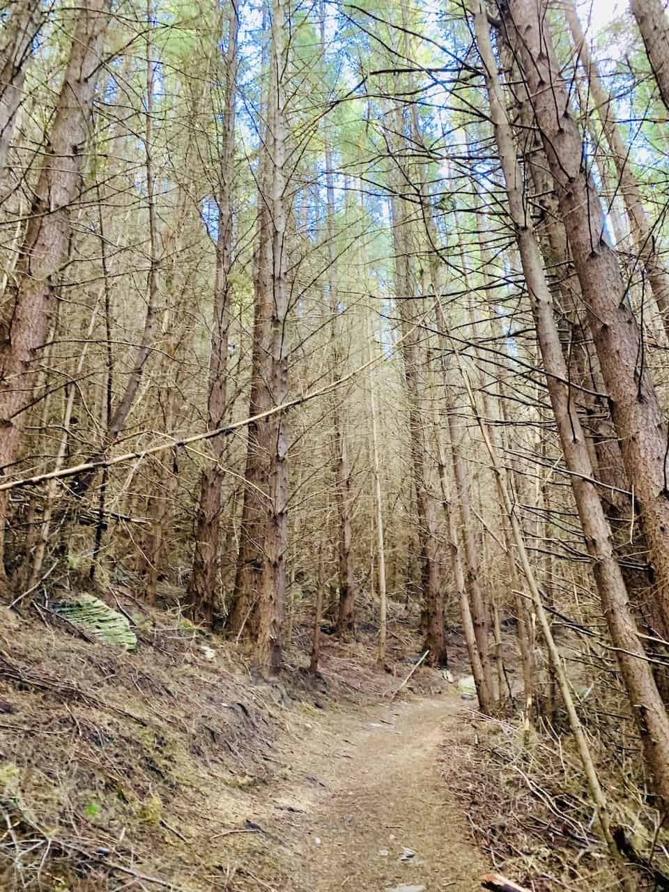
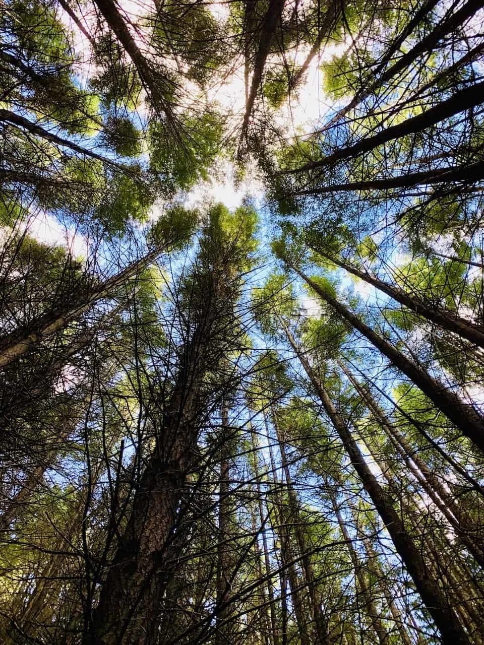
The first part of the trail will be through the dense Douglas fir forest as you begin to gain elevation.
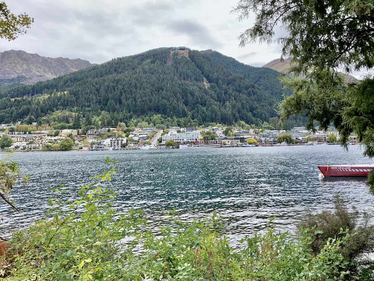
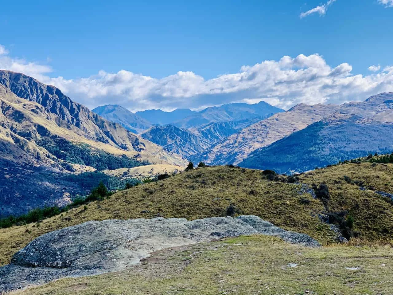
The trail itself is easy to follow and is just made up of mostly dirt. As you are walking up this portion of trail, there will be some views out behind you overlooking Queenstown, Lake Wakatipu, and the surrounding mountains.


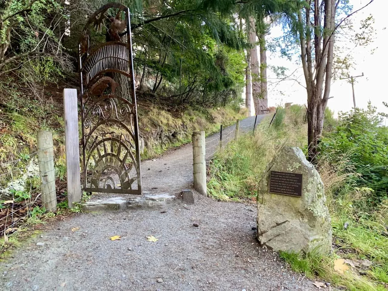
Not too long after the start of the trail you will reach the Time Walk Gateway. This open gate sculpture has a signboard on a nearby rocks that reads:
“This pathway leads to our future. With each step, we seek the guidance and wisdom of those who have gone before us; we walk with a sense of hope, that those who follow in our footsteps beyond the year 2000 can do so with the same sense of pride in, and protection for, this beautiful place”
Note: the year 2000 reference is in regards to commemorating the millennium at the time.

Once past the gate, the trail then weaves its way through the forest, where from time to time you should be able to get some views of the surrounding landscape. Along the way you will also pass by those 6 interpretation panels to read through if interested.
After the third panel, is where the intersection comes into play. Here you can go right or left – both of which will take you up to the Basket of Dreams.
I headed up to the right on the way up, passing through more forest and some partially blocked scenic viewpoints.


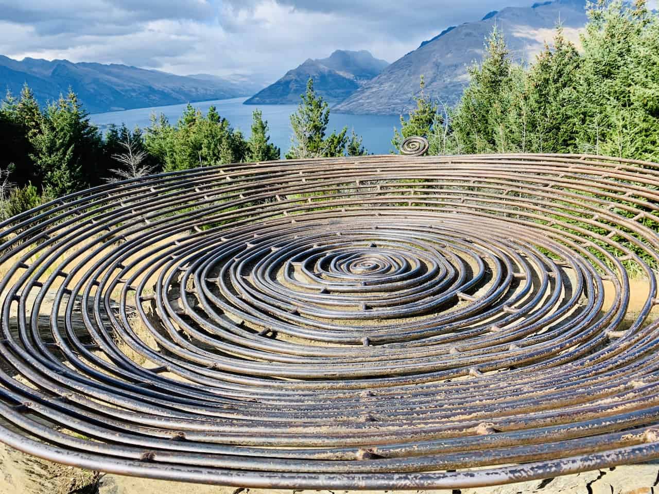
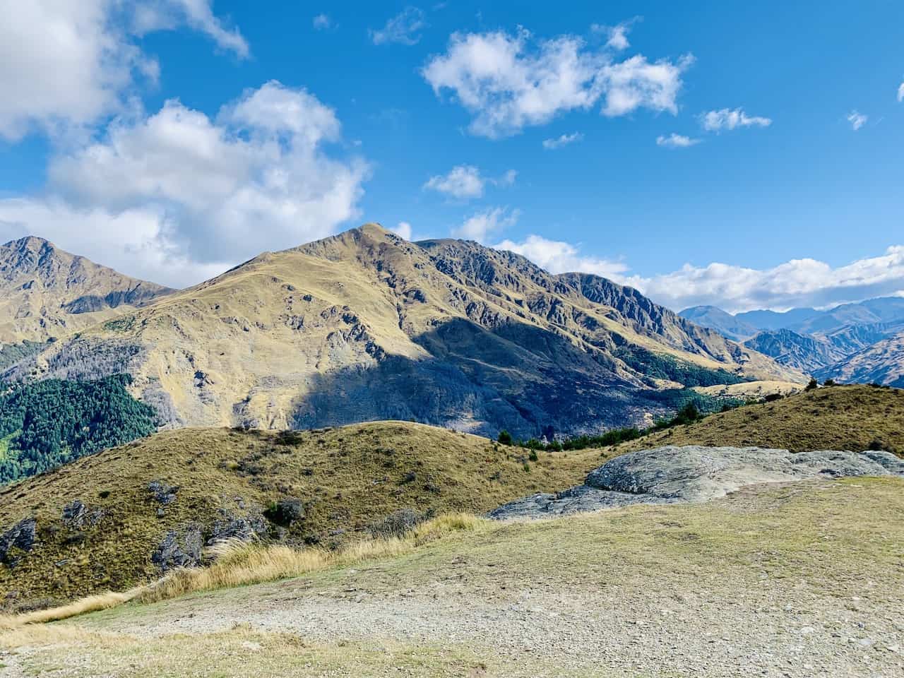
The landscape then begins to open up as you exit the forest and approach the Basket of Dreams sculpture – built to commemorate the new millennium.
From here the views are quite beautiful as you have the statue in foreground and the lake & mountains further out in the distance.
However, the better views are up towards the true summit of Queenstown Hill and even further past the tree line.

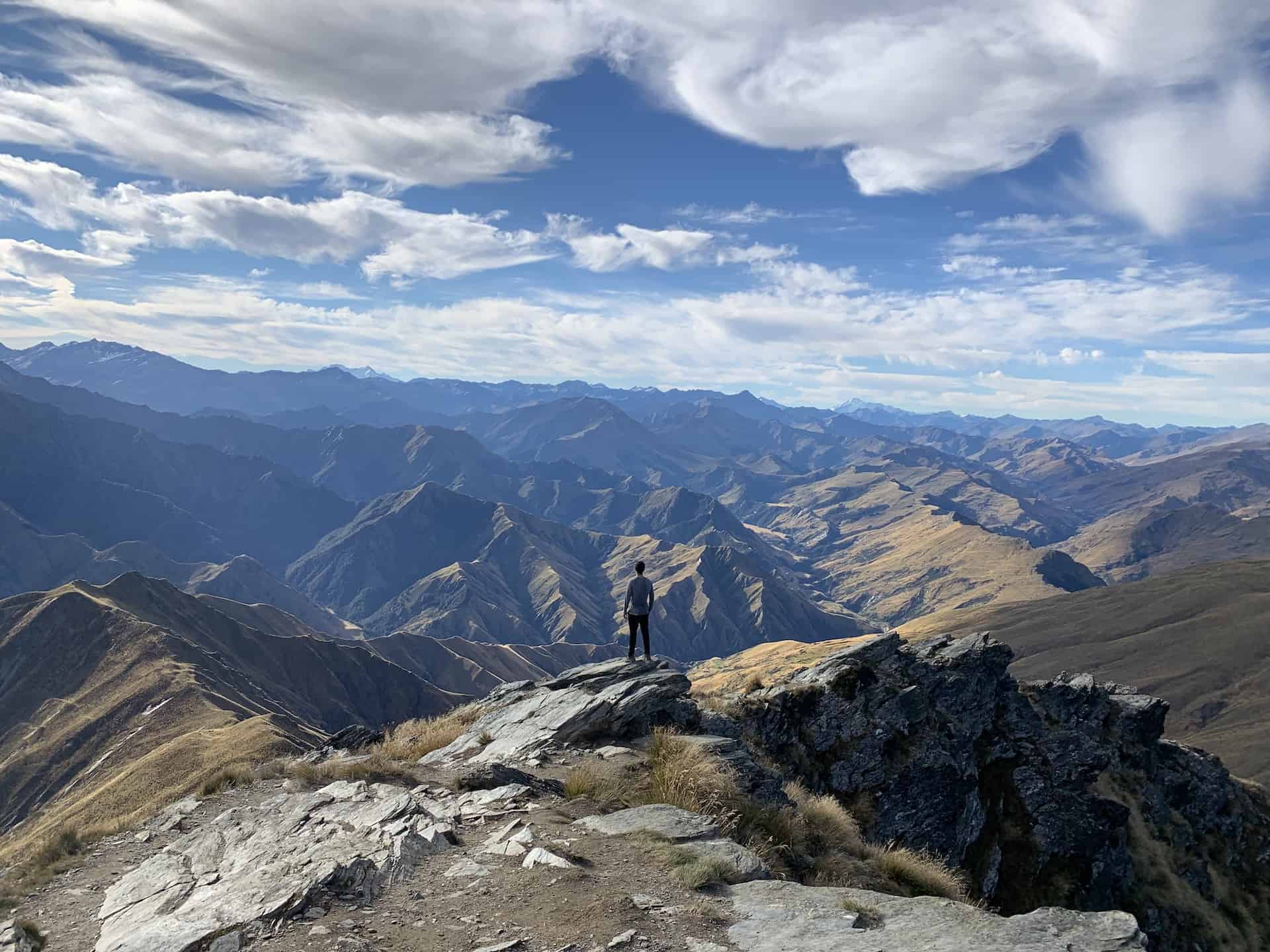
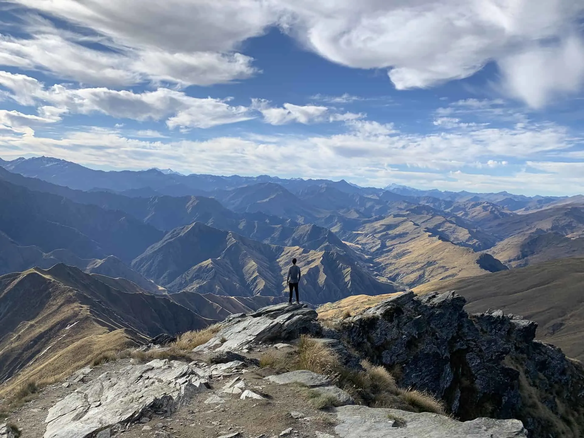
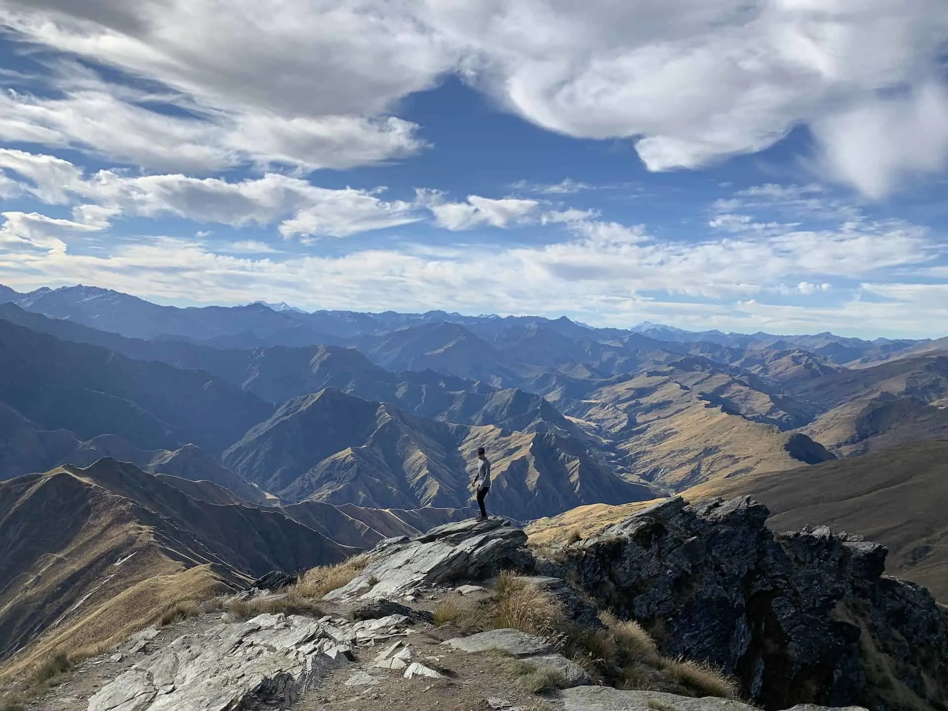
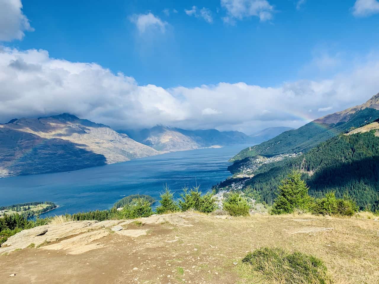
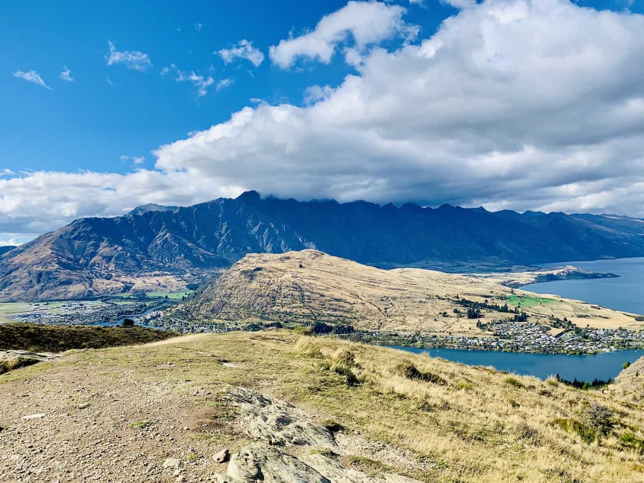
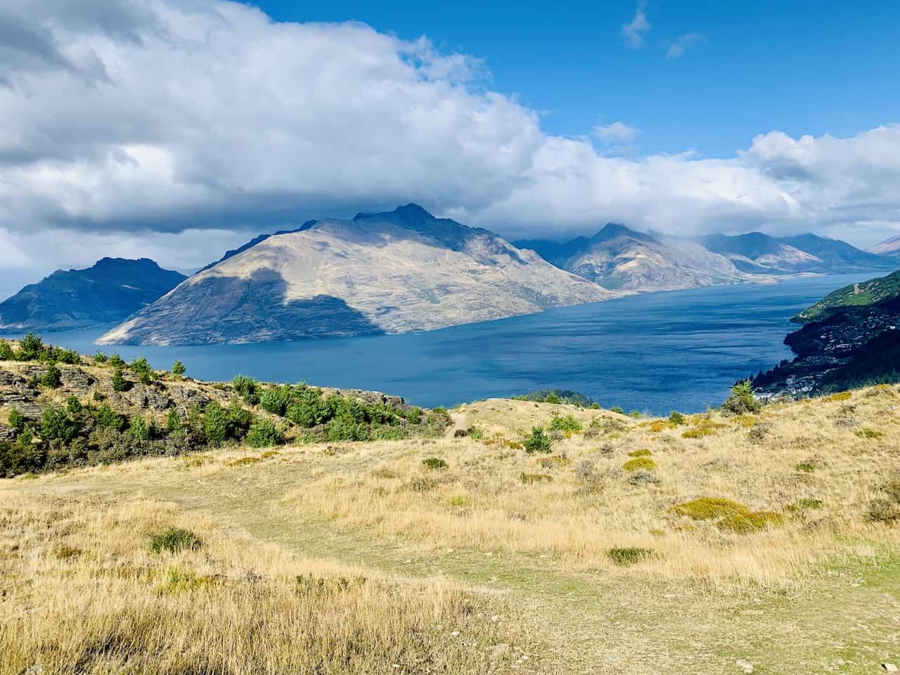
After another 15-20 minutes of hiking up the hill, you will reach the summit of Queenstown Hill at 907 meters / 2,975 feet in elevation. From here the views are quite scenic as you get different landscapes in all directions.
In your view will be Queenstown, Lake Wakatipu, Ben Lomond, the Remarkables, as well as many other mountains in both directions. It is the perfect place to just sit back and enjoy the view (and maybe you will get a nice rainbow like I did!).
→ Learn more about the Ben Lomond track and what a hike like that entails


Once you have taken enough time up top, you can then follow the pathway back down to Belfast Terrace.
The hike down should be much quicker than the way up (~45 minutes), as you pass by the Basket of Dreams, and then choose either pathway to the trailhead. You can opt for the same path you took up or you can head on the alternate – either works!
As you reach the trailhead at Belfast Terrace, it is then onto the city center (or any other attraction) by foot or car (if you drove up).
6) Your Questions Answered
Below are some of the most frequently asked questions regarding the Queenstown Hill walk along with some helpful answers:
Can you Bring a Dog on Queenstown Hill?
Yes, you can bring a dog onto the Queenstown Hill hike. However, note that dogs do need to be leashed at all times.
How Long Does it Take to Walk Up Queenstown Hill?
Depending on fitness levels, it should take anywhere from 45 minutes to 1.5 hours to hike up Queenstown Hill.
The trail does gain +500 meters / +1,640 feet, so for some that may take a little while to climb (not including the walk from the city center).
And remember, everything you hike up, you must hike back down as well. But that should be quicker and easier to get through.
How Long is the Queenstown Hill Track?
The Queenstown Hill Track comes in at just around 5 km / 3.1 miles round trip. However, note that the distance can vary depending on which route you take up to the summit.
If you end up taking the shorter (but steeper) pathway at the intersection, the distance will be a bit shorter.
Also remember, if you need to start and end the hike in the city center, that will add approximately another 1 km / 0.6 miles each way (2 km / 1.2 miles round trip).
Where Does the Queenstown Hill Start?
The Queenstown Hill hike starts at a small parking lot located on Belfast Terrace (GPS coordinates: 45°01’38.7″S 168°39’59.8″E).
If you do not have a car, then the hike will start from wherever in Queenstown you will be walking over from.
Can You Drive Up Queenstown Hill?
No, you cannot drive up Queenstown Hill. If you want to enjoy those views from the summit, then you must work for them. Access up the trail is by foot only (no cars or bicycles are allowed).
The closest a car can get to Queenstown Hill will be at the Belfast Terrace parking lot.
Is Queenstown Hill Worth It?
To sum up, yes, Queenstown Hill is definitely worth the effort.
While there is certainly some elevation gain involved in the route, the overall hike is not too difficult. Once you have reached the summit, you will get to enjoy some of the best views in the area and come back down feeling accomplished.
So, if you are trying to get some hiking in when visiting Queenstown, then a walk up Queenstown Hill should be on the list.

I hope this guide has helped you out better prepare for a Queenstown Hill summit walk. If you have any questions or comments, feel free to add them in below.
Also, don’t forget to check out the other New Zealand itineraries and guides up on the site like a 2 Week South Island Itinerary. Have fun out there and safe travels!