
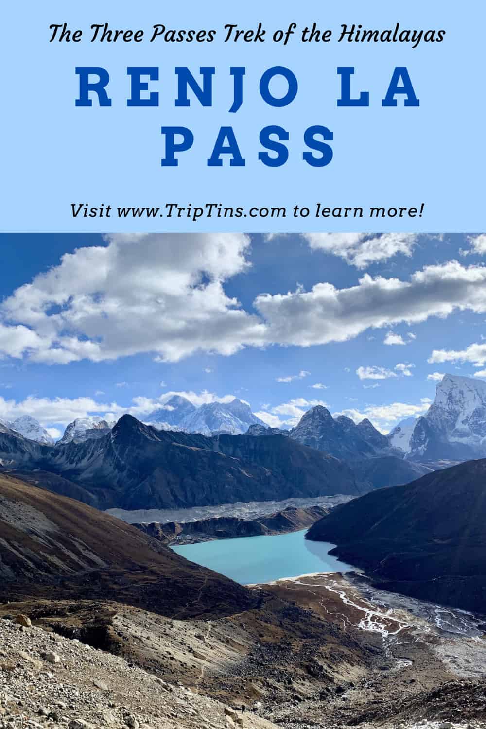
Whether you are taking part of the Three Passes Trek or just visiting the Gokyo Lakes, a hike over the Renjo La Pass can be part of your overall itinerary in the Himalayas.
The Renjo La Pass connects the Gokyo region to a less visited area that includes villages such as Lungde and Thame. From the top of the pass, you will be welcomed to stunning views of Mount Everest and the surrounding landscape.
This guide will go through how to add the Renjo La Pass to your trek and what to expect out there on the trail.
* Affiliate Disclosure: This post may contain affiliate links, which means I may receive a commission if you make a purchase through the links provided, at no additional cost to you. Thanks for supporting the work I put into TripTins!
1) Where is the Renjo La Pass
Adding on the Renjo La Pass to your overall itinerary is usually done in one of two ways. While the below are a couple of the main ways to go about it, you can surely get imaginative with your trek to figure out other options.
Three Passes Trek + EBC
The Renjo La Pass is one of three passes that are part of the longer Three Passes trek (also includes the Kongma La Pass and Cho La Pass).
I would recommend heading in the counter clockwise direction if doing so, meaning that the Renjo La Pass would be the final of the passes that you would take part of. While this is just a recommendation, many also opt for the clockwise direction.
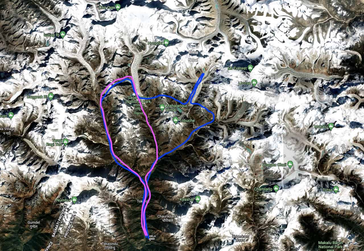
At a high level, the counter clockwise route heads from Lukla to Dingboche, where it then veers off to Chukhung. From Chukhung the route goes over the Kongma La Pass down to Lobuche and then onwards to Everest Base Camp.
On the way back from EBC, the trek then splits off to Dzongla, where you will then go over the Cho La Pass to the Gokyo Lakes.
After visiting the lakes, it is then over the Renjo La Pass, and down around towards Namche and then onto Lukla.
Note: you do not necessarily need to take part of the Kongma La Pass in this option
» Learn more in the Three Passes Trek guide up on the site
Gokyo Lakes
If you are not interested in visiting Everest Base Camp and are solely interested in the Gokyo region, there is another option here.
From Namche Bazaar, instead of heading further along the standard Everest Base Camp route, you can head straight towards the Gokyo Lakes via Dole and Machhermo.
After visiting the lakes, you can then head over the Renjo La Pass and head back around towards Namche.
Below is a map outlining those two main options (Three Passes Trek in blue and Gokyo Lakes + Renjo La in pink):
2) Renjo La Pass Details
Below are some helpful high level details about the journey from Gokyo to the Renjo La Pass and then down to Lungde.
Starting Point: Gokyo
Gokyo Elevation: 15,584 feet / 4,790 meters
Mid Point: Renjo La Pass
Renjo La Pass Height: 17,585 feet / 5,360 meters
Ending Point: Lungdhen (Lungde)
Lungdhen Elevation: 14,370 feet / 4,380 meters
Distance: 11.7 miles / 18.8 km
Duration: 5-7 hours
Elevation Gain: 2,572 feet / 784 meter gain | 3,842 feet / 1,171 meter loss
Thame: instead of stopping for the night in Lungde, you can continue another 3 hours further towards Thame. This will all depend of your timing and fitness levels.

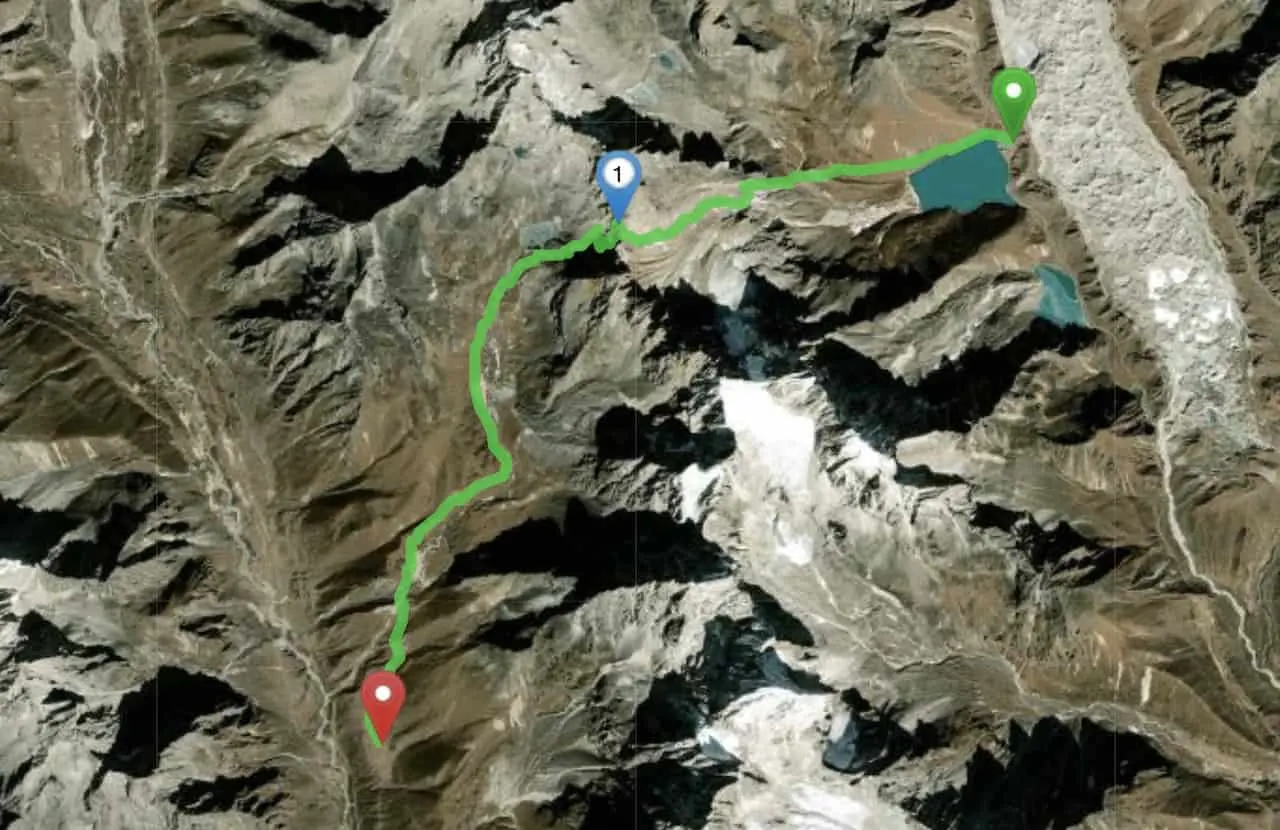
3) Renjo La Pass Map
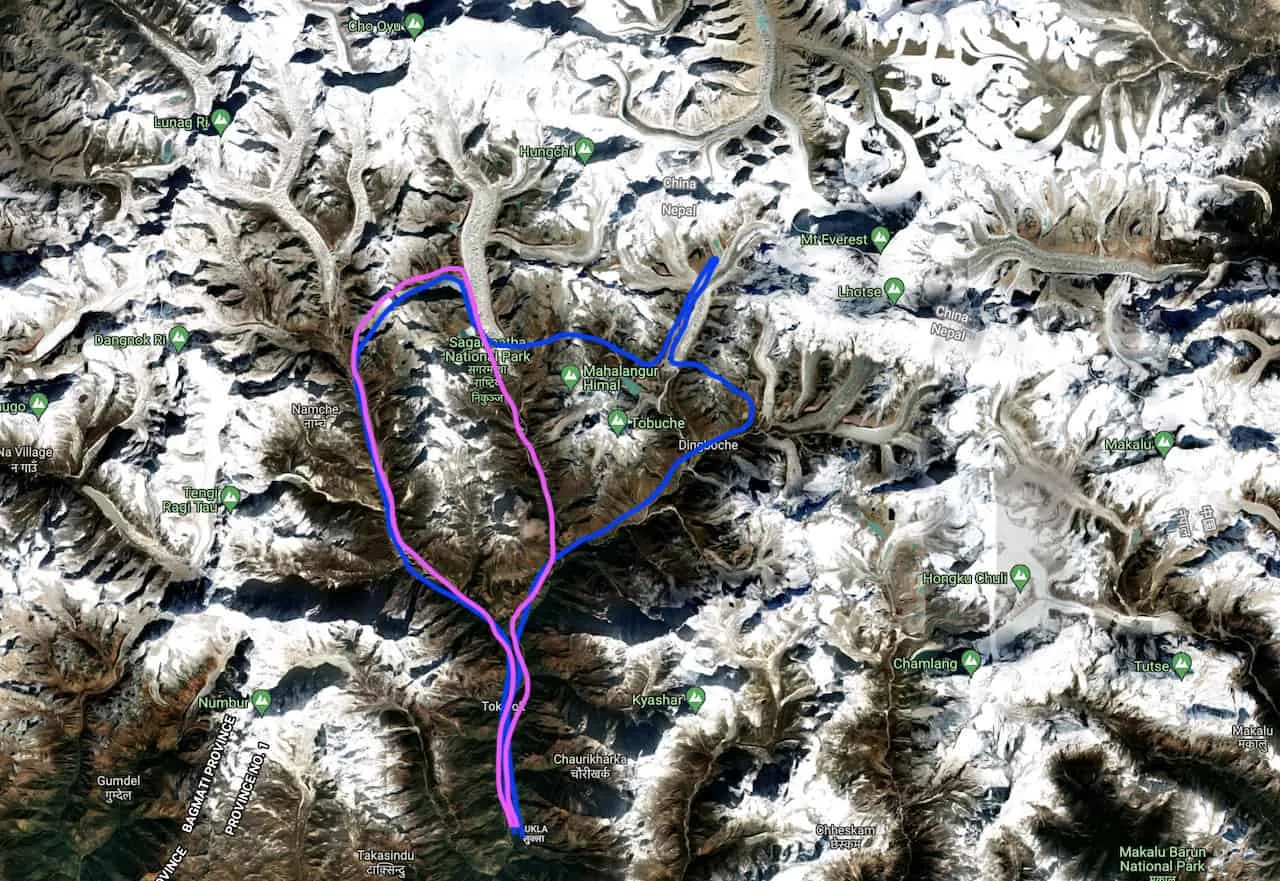
Below you can find the map that shows the aerial view route between Gokyo to Lungde via the Renjo La Pass.
As you can see the route begins in Gokyo village, circles the main lake and then heads on up towards the top of the Renjo La Pass.
After reaching the top of the pass, you will then zig zag towards the bottom and head further down the valley.
As you then circle your way around, you will begin approaching the village of Lungde. Just continuing straight from here for another couple of hours and you will reach Thame, if that better suits your trek for the day.

Considering travel insurance for the Himalayas?
World Nomads offers coverage for more than 150 adventure activities as well as emergency medical, lost luggage, trip cancellation and more.
For years, World Nomads has been protecting, connecting & inspiring independent travelers, offering travel insurance & safety advice to help you travel confidently. Their mission is to support and encourage travelers to explore their boundaries.
World Nomads has simple and flexible travel insurance that has been designed by travelers for travelers. Even if you leave home without travel insurance or your policy runs out, you can buy or extend out on the road.
Get a quote for a World Nomads travel insurance policy today!
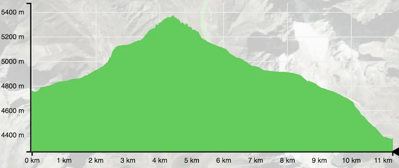
4) Elevation Gain Profile
When heading over a mountain pass such as Renjo La, you can expect a ton of incline and decline in a single day. The same holds true here for the other two passes in the region.
During the first 3 miles (5 km), the hike is essentially all uphill from Gokyo towards the top of the pass. There are certainly a few flatter sections during this portion of trail but for the most part you will be heading up in elevation.
Once you reach the high point of the Renjo La Pass at 17,585 feet it is then a steady downhill all the way towards Lungde. Although it is downhill, that does not necessarily mean it is so much easier than the uphill.
Overall, it is one of the tougher days out on the trail and you must be comfortable with up to 7 hours of continuous hiking.

5) The Renjo La Pass Trek
Now that you have some good background on the Renjo La Pass, let’s dive a bit deeper into the trek itself. As mentioned, you can do this in either direction (clockwise vs. counter clockwise).
While I ended up doing so in the counter clockwise direction from Gokyo to Lungde, you can certainly do the opposite as well.
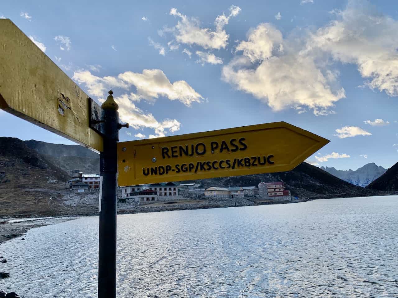
Once you have some breakfast and check out of your guesthouse it is time to head out over the Renjo La. You will follow the pathway out of Gokyo in the same direction of Gokyo Ri, which you may have climbed the previous day.
You will reach an intersection at the base of Gokyo Ri with a sign pointing you to the left towards the Renjo La Pass.

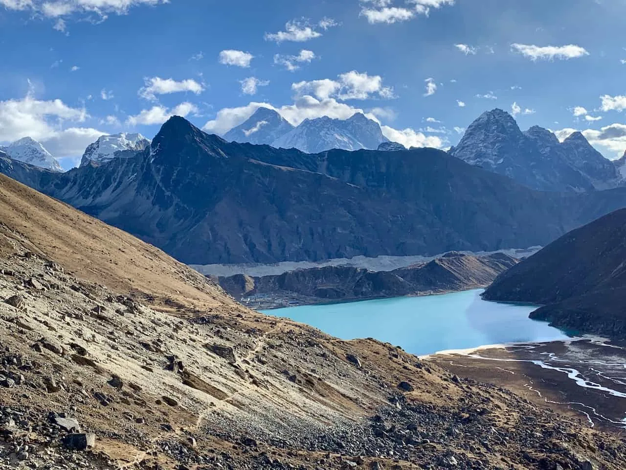
The path is etched on the mountainside and wraps around the main Gokyo Lake here. It is a slight uphill around this section and an easy trail to follow as you make your way around the lake.
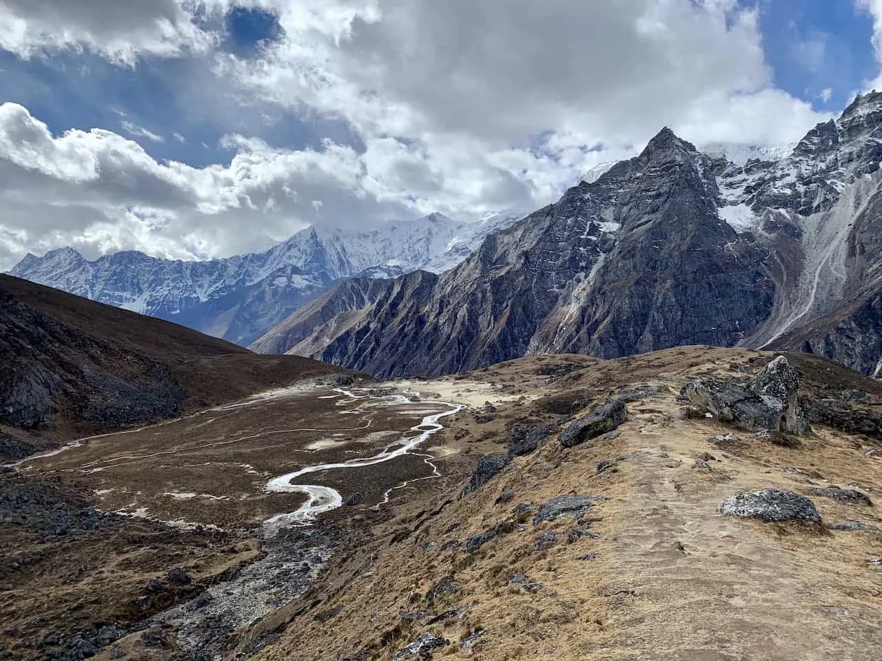
Once past the lake, the incline begins to get a bit steeper as you gain some elevation. Throughout this journey further towards the pass, the views behind you will just get better and better.

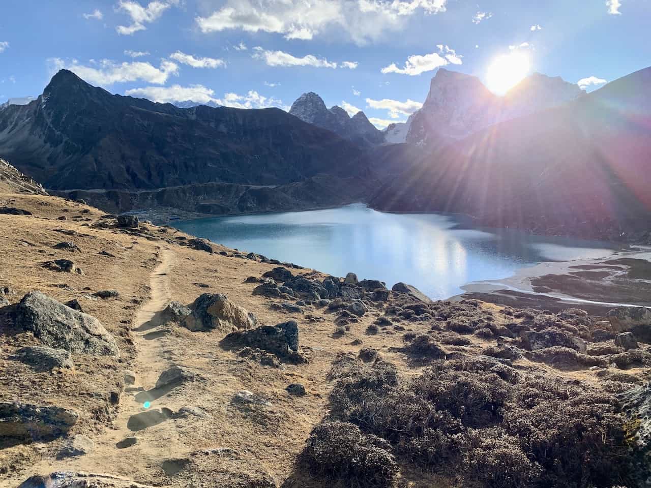
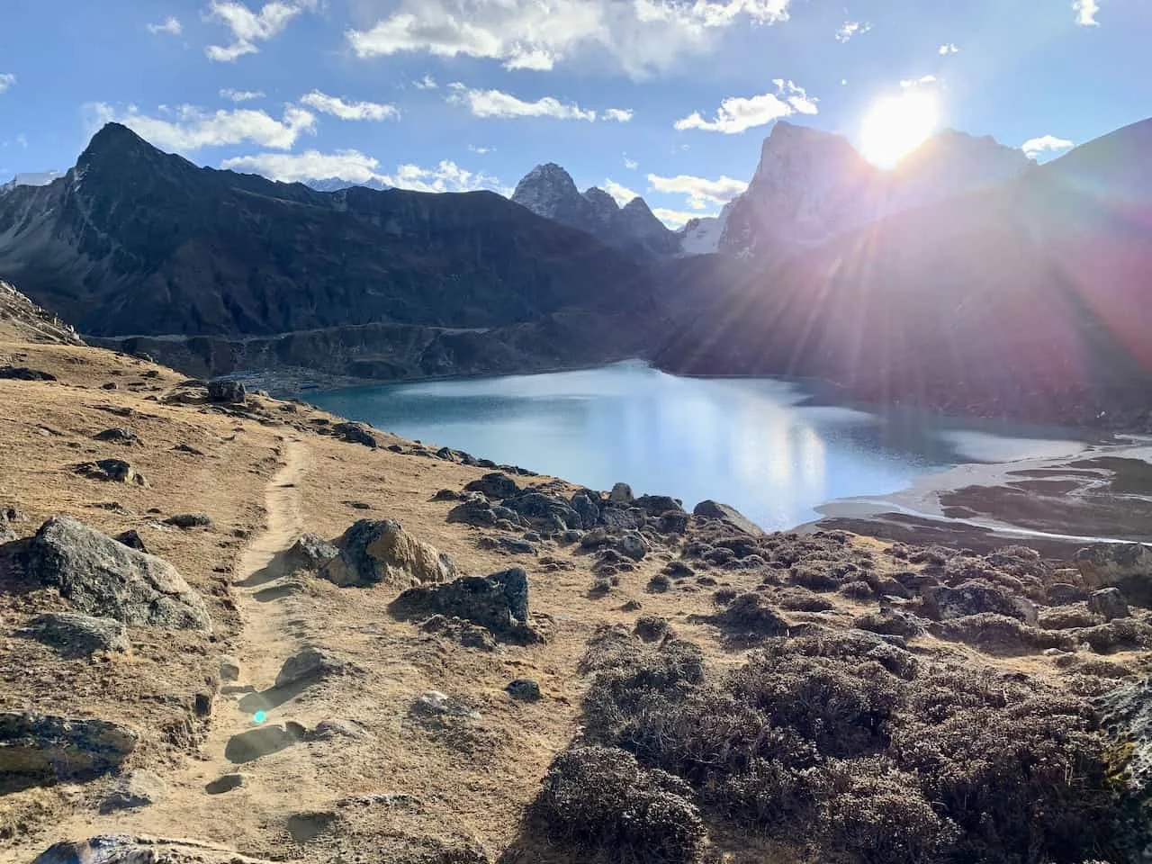
Be sure to turn around from time to time to enjoy the views of the lake itself alongside the small village out in the distance.
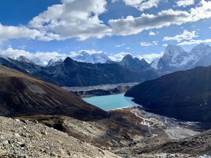
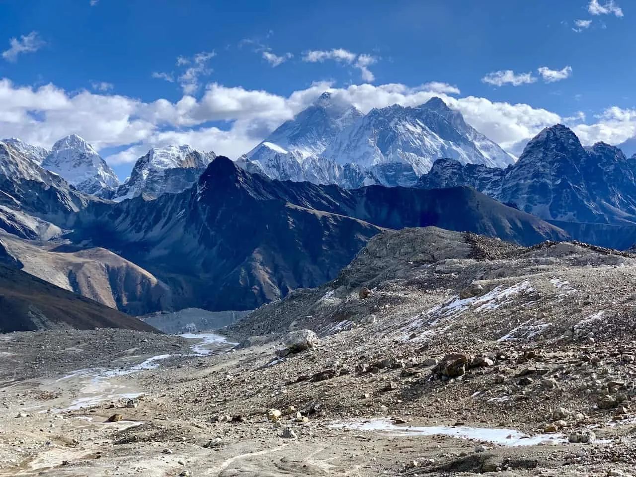
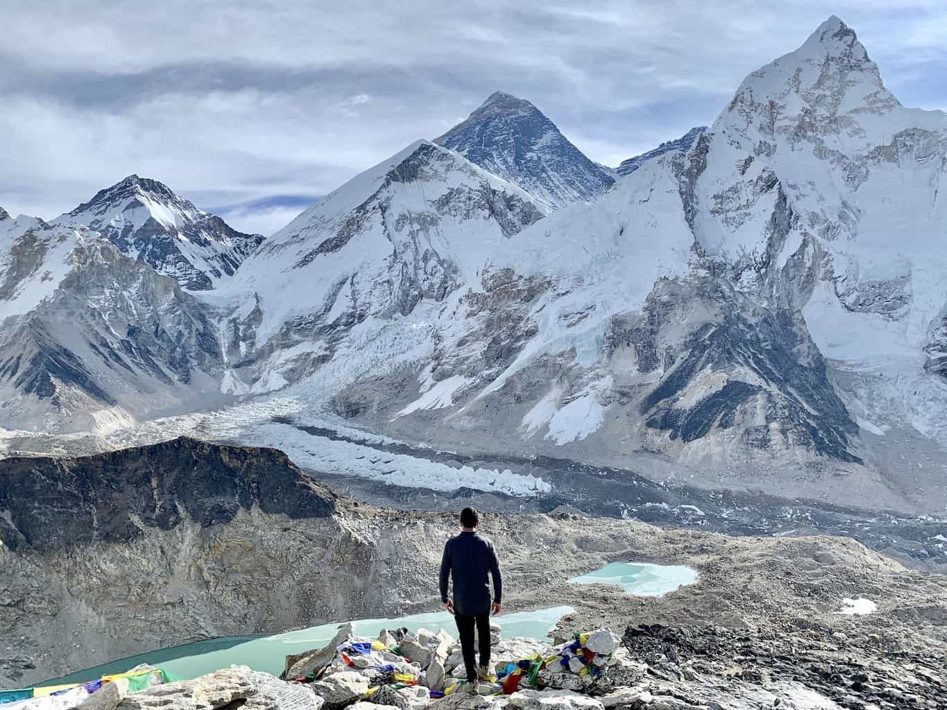
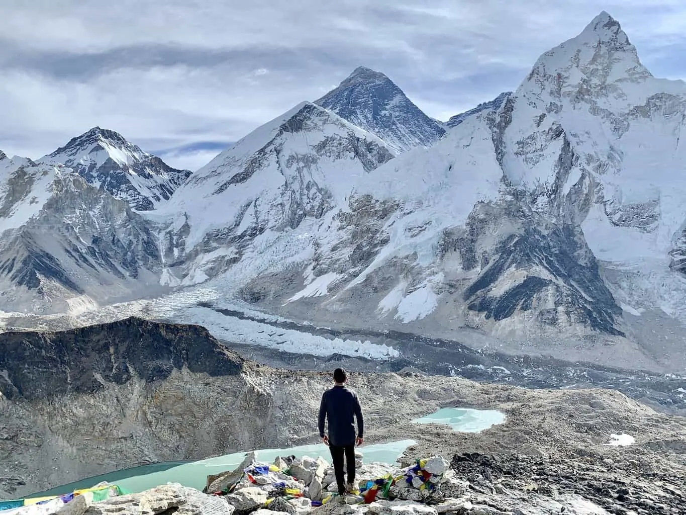
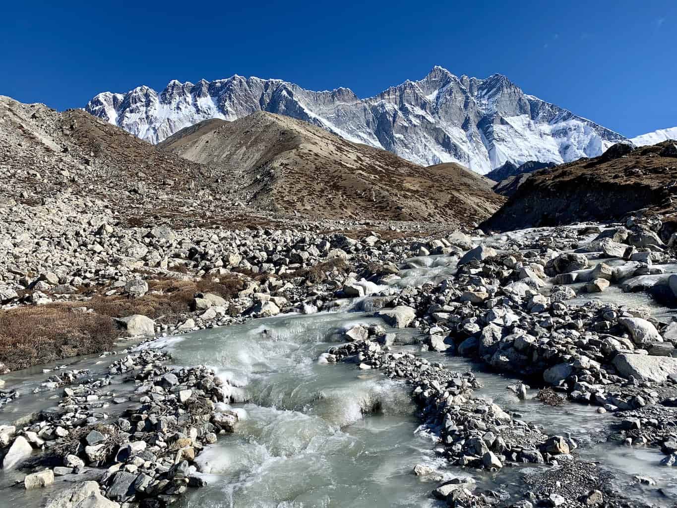
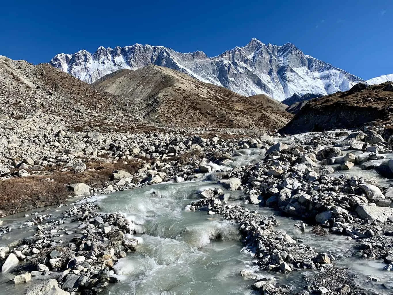
As you get even further up the trail, the highlight of the trek comes into view. Mount Everest itself will begin appearing behind the lake and the Ngozumpa Glacier.

It is around this time though that things are going to start to get difficult.
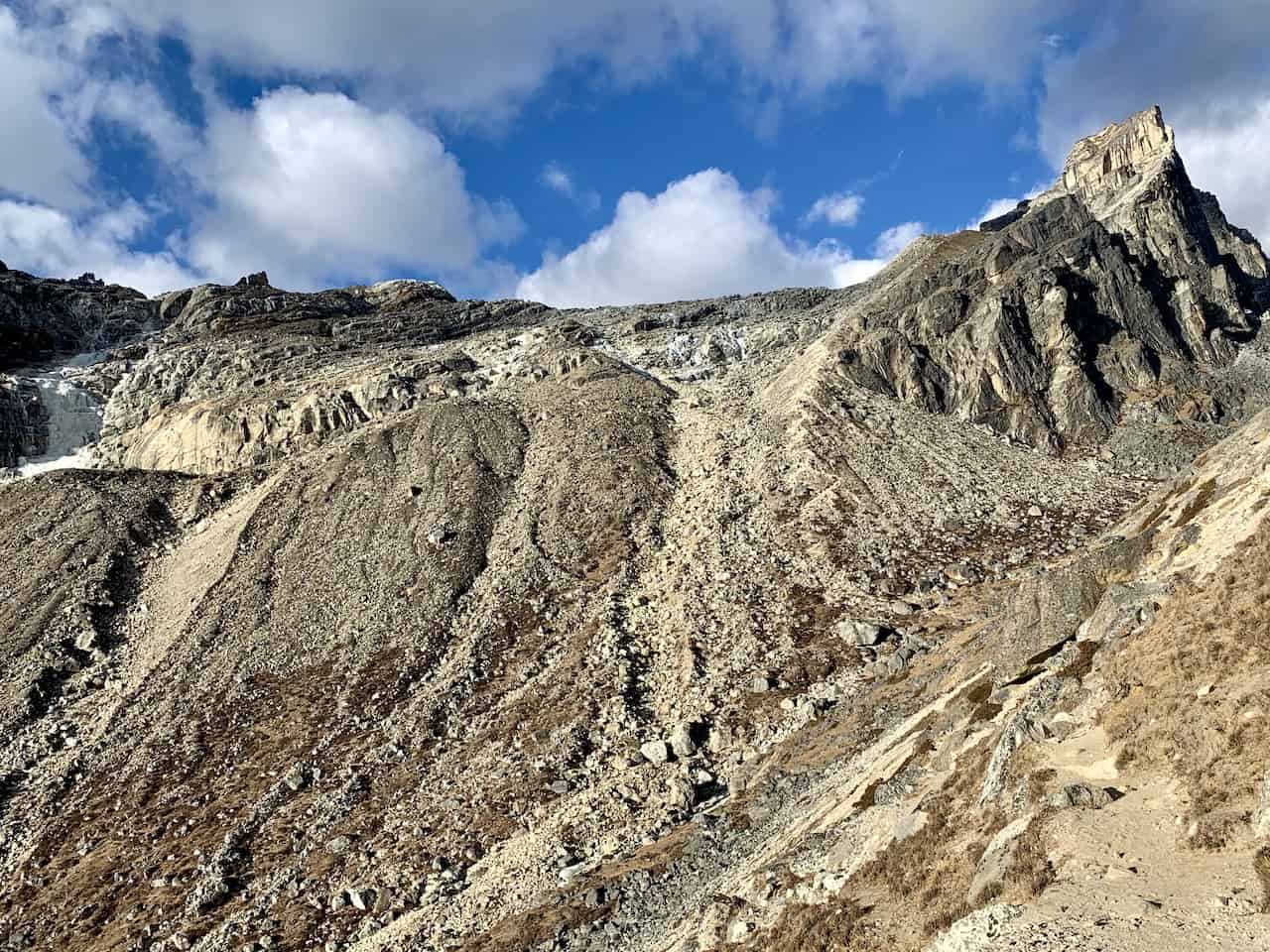
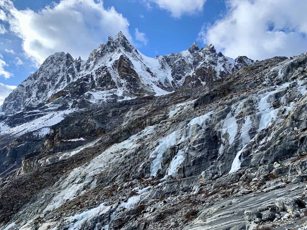
After the slight incline that you will be climbing for the first mile or so, the switchback section begins. During this portion of trail you will be zig zagging up a steeper section of terrain.
Be sure to take your time here as the trekking can get quite difficult and tiresome. Don’t exert all of your energy and be sure to take breaks when needed. It doesn’t last for too long (maybe a third of a mile) but it can get tiring.


After this switchback though, things get easier for a bit as you are back on a less steep incline.
You will see the back of the valley out in front of you with the hiking trail etched into the ground. And don’t forget to take in those views behind you!

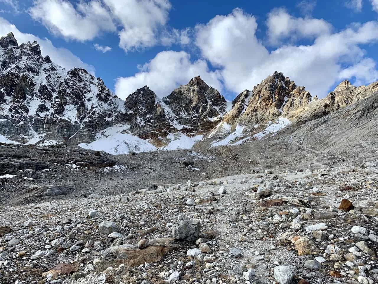

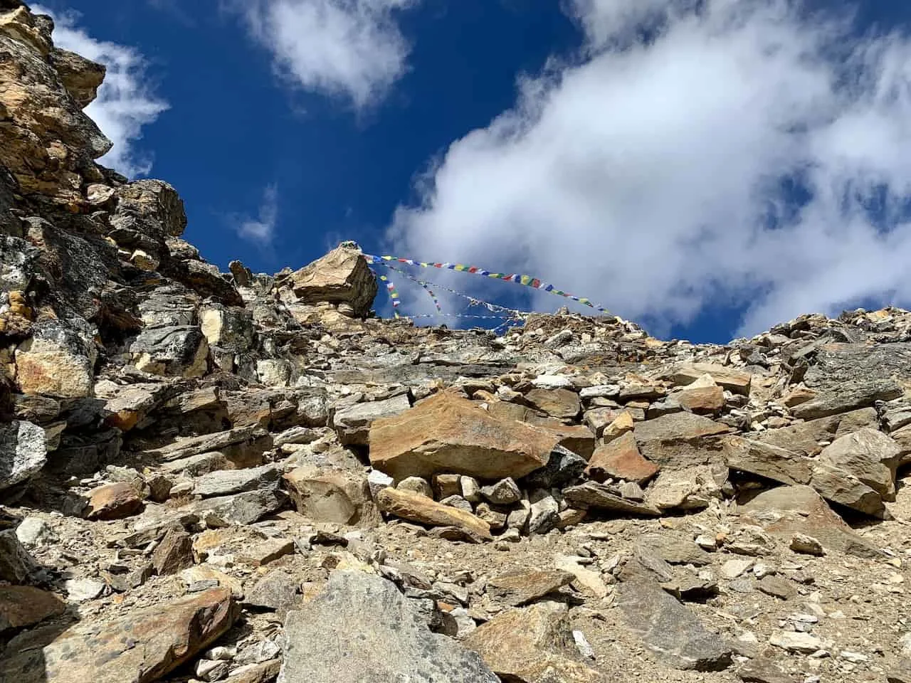
The last half a mile or so does pick up incline as you begin to approach the top of the Renjo La Pass. Slowly make your way up (while taking breaks as needed) and get yourself to the top.
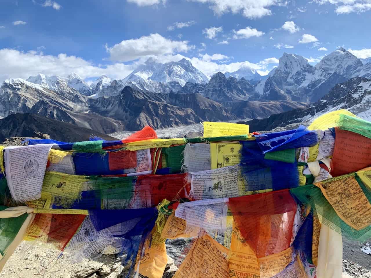
The top of the pass is marked with Sherpa prayer flags so it is impossible to miss. Be sure to spend some time up here enjoying the view and taking in the last view of Mount Everest for now.

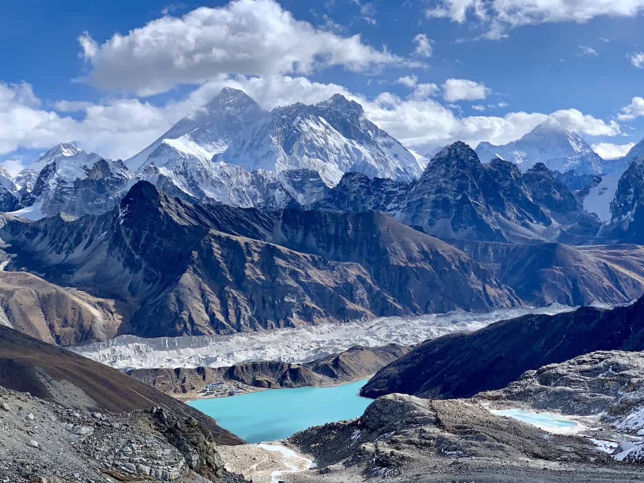

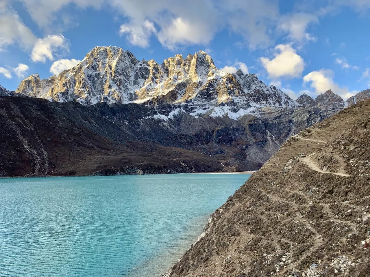
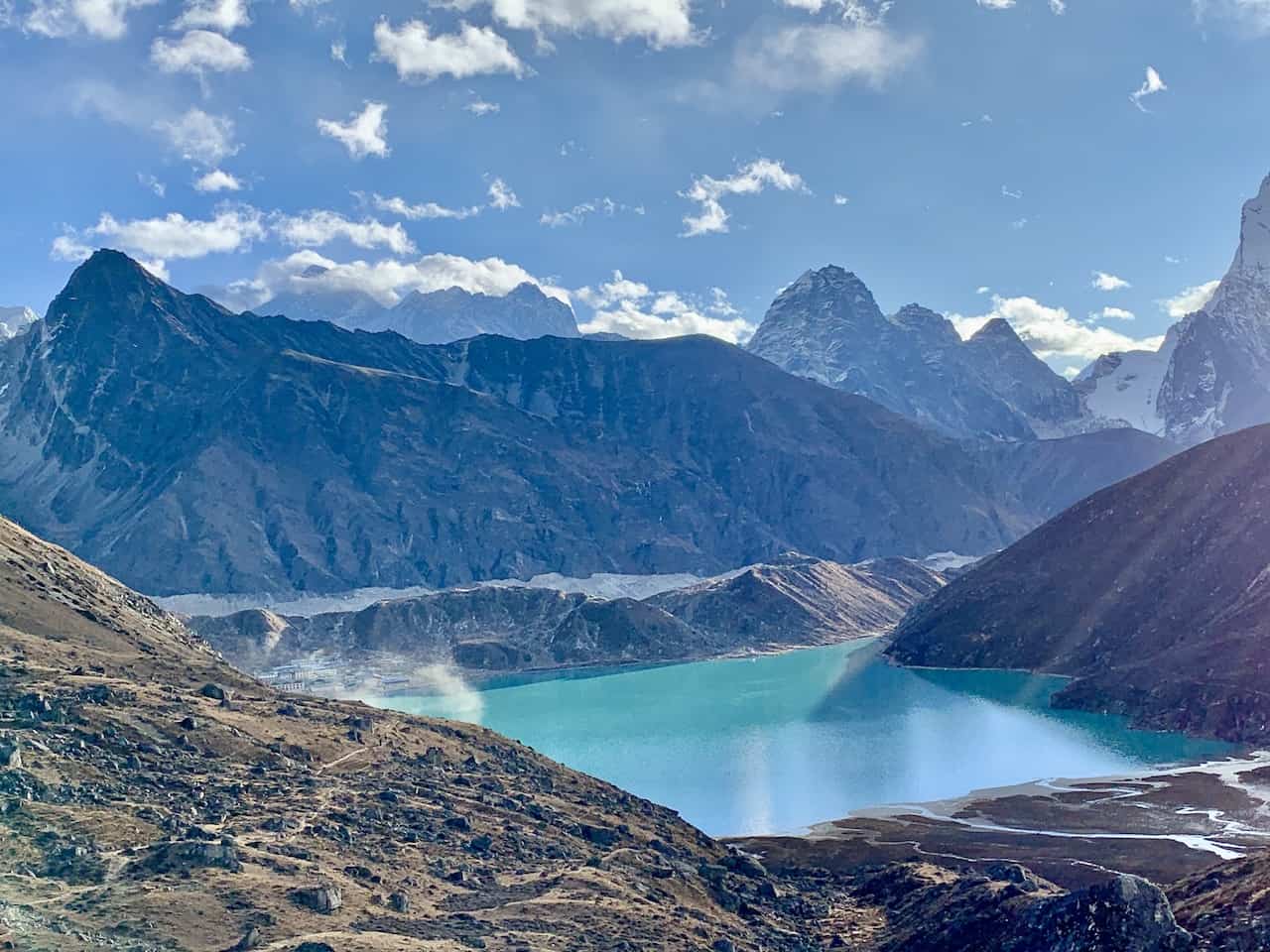
On the other side of the Renjo La Pass you should see another lake down below surrounded by various mountains. Once you are all down up top, it is time to begin that trek down.
Be very careful here as the terrain is tricky and steep. Take your time as needed and do not rush downhill. It is easy to lose your footing so just be cautious on those downhills.
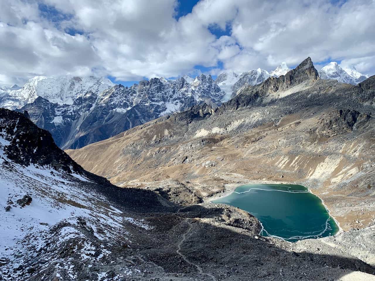

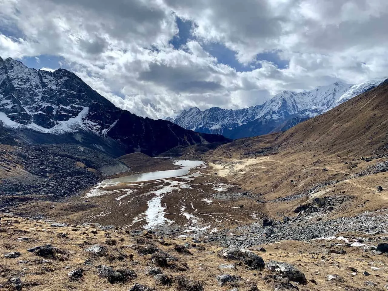
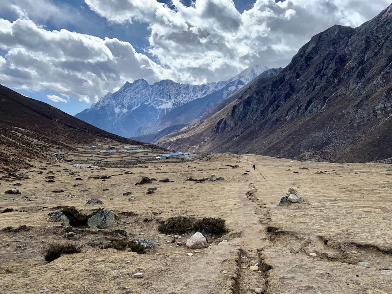
After reaching the lake down below, the hard part will be finished. All that is left now is a downhill / flat walk further down the valley towards Lungde.
You should get some stunning valley and river views here as it is a very easy and enjoyable hike to finish out your day.


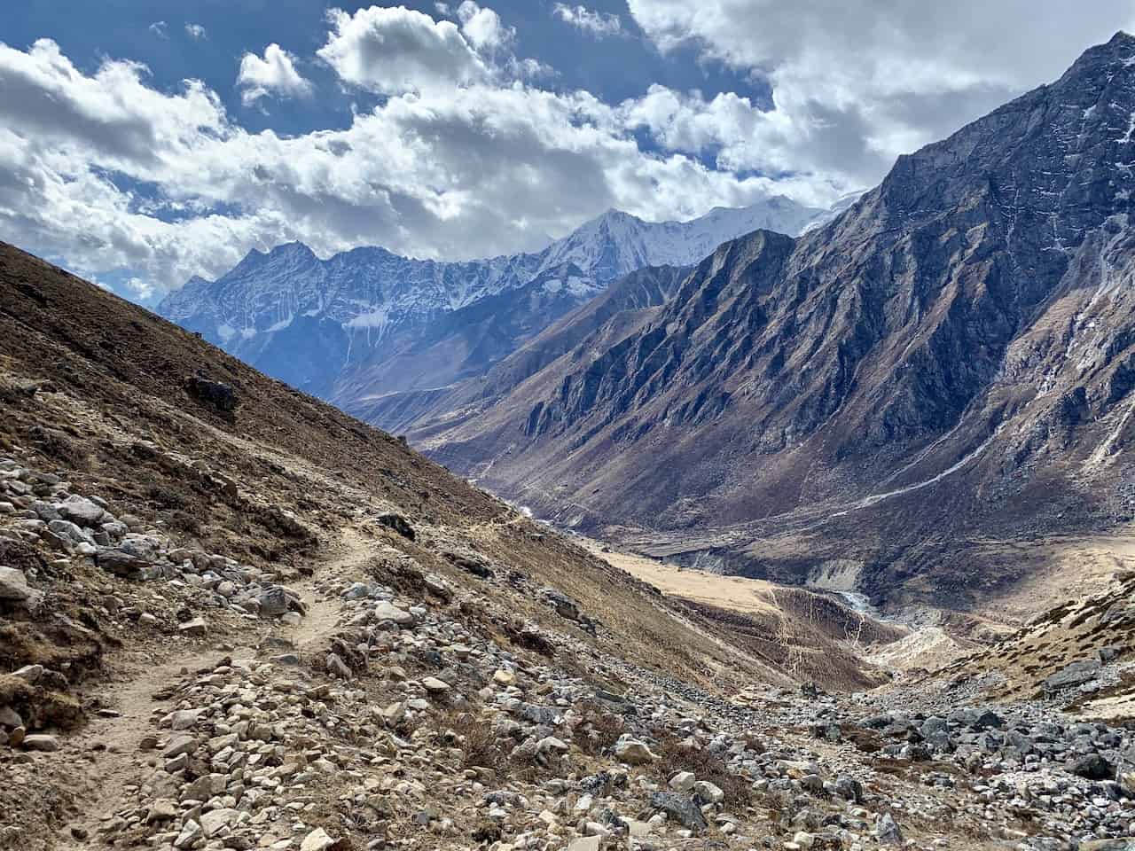
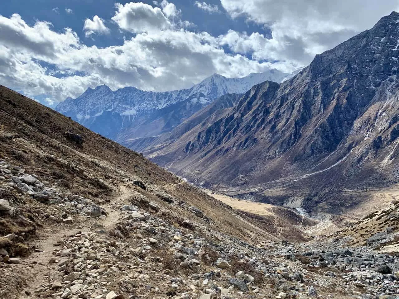
Soon enough you will see the small village out in the distance, where you can find a teahouse and call it a day. Next up will the trek to Thame and Namche Bazaar followed by the trek back out to Lukla.

6) Renjo La Pass Difficulty
Many who are thinking about heading up the Renjo La Pass ask about the difficulty levels of such a trek.
I would say if you are taking part of the Three Passes Trek, and therefore doing Kongma La as well, you should have no trouble with this pass. Same goes for if you decide to hike up Gokyo Ri. I found that hike to be more challenging than the Renjo La Pass.
Overall, while the Renjo La Pass is quite high in elevation, the trek up to it is not the steepest and therefore not the most difficult.
You will be dealing with that one tough switchback section, but I did find the remainder of the hiking quite pleasant (especially with those Everest views).
I will say though, that the trek down can be quite tricky. Luckily the steep downward portion does not last too long as the trail flattens out as you approach that second lake.
If you are visiting the region and want to enjoy one of the best views of Mount Everest, then I would recommend the trek up the Renjo La Pass.
That about does it for a guide to the Renjo La Pass trek of the Himalayas. If you do have any questions or comments, feel free to add them in below.
Also don’t forget to check out all the other Nepal itineraries and guides up on the site. Have fun out there and safe travels!


Marcel
Saturday 1st of April 2023
Hello , I really enjoyed the blog on the Renjo la pass doing it anti clockwise ,my concern is the acclimatization along the way , should we stay two nights at Namche and also two nights at Machermo? Thanking you Kindest regards
Charles
Monday 3rd of April 2023
Hi Marcel - during my trek I did the full Three Passes trek so I did not go through Machermo. However, staying two nights in each of Namche and Machermo seems to be a good way to go about it for acclimatization. Enjoy the trek!