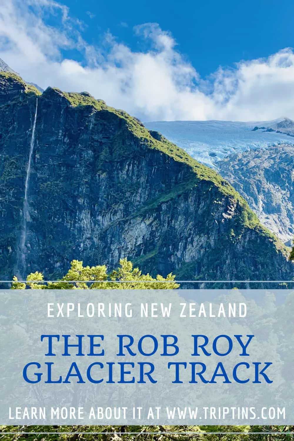

Located just over an hour away from Wanaka is the beautiful Rob Roy Glacier Track. During this hike you will have the chance to walk along a river, through a forest, and onwards to two viewpoint areas overlooking the Rob Roy Glacier.
It is a perfect day trip to take part of during a visit to New Zealand as you get to explore Mount Aspiring National Park.
This guide will go through logistics, trails details, and more, to get you prepared for a visit. By the end of reading through, you should be well on your way to enjoying the trail for yourself.
* Affiliate Disclosure: This post may contain affiliate links, which means I may receive a commission if you make a purchase through the links provided, at no additional cost to you. Thanks for supporting the work I put into TripTins!
1) Rob Roy Glacier Track Details
Below are some helpful details to know about the Rob Roy Glacier Track and what it entails:
Hike Name: Rob Roy Glacier Track
The name of the track is named after the Rob Roy Glacier, which you will get a view of halfway through the hike. Rob Roy McGregor is where the name originally came from. He was a Scotsman who was one of the first Europeans to explore the area in the 1870’s.
Where is the Rob Roy Glacier Track
The track is located in the larger Mount Aspiring National Park, just outside of Wanaka. The park was formed in 1964 and makes up 356,181 hectares of beautiful remote wilderness.
Starting & Ending Point: Raspberry Flat Carpark
The starting and ending point of the hike is at the Raspberry Flat Carpark, located around 50 km / 30 miles from Wanaka.
Mid-Point: Rob Roy Glacier Upper Lookout
The hike is an out and back type of hike, as you walk from the carpark to the lookout area and then back on the same path. At the lookout area, you will get some of the best views you can ask for of the surrounding glacier and natural landscape.
How Long is the Rob Roy Glacier Track
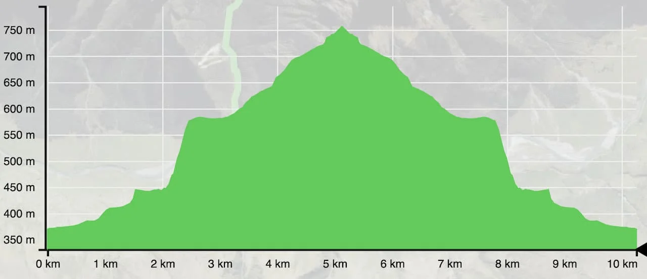
The round-trip hike comes in at 10.3 km / 6.4 miles. Depending on how much walking around the lookout spots you do, the length may be a bit more than that.
Rob Roy Glacier Track Time
Expect to spend 3-4 hours on the trail depending on your fitness level in addition to how long you want to spend at the lookouts.
During my experience, the total hiking time was closer to 4.5 hours, just because I spent a good amount of time relaxing by the upper lookout.
Rob Roy Glacier Track Elevation
The track gains around +410 meters / +1,345 feet of elevation. With that said, you will essentially also lose most of that elevation on the way back down too.

2) Wanaka to Rob Roy Glacier
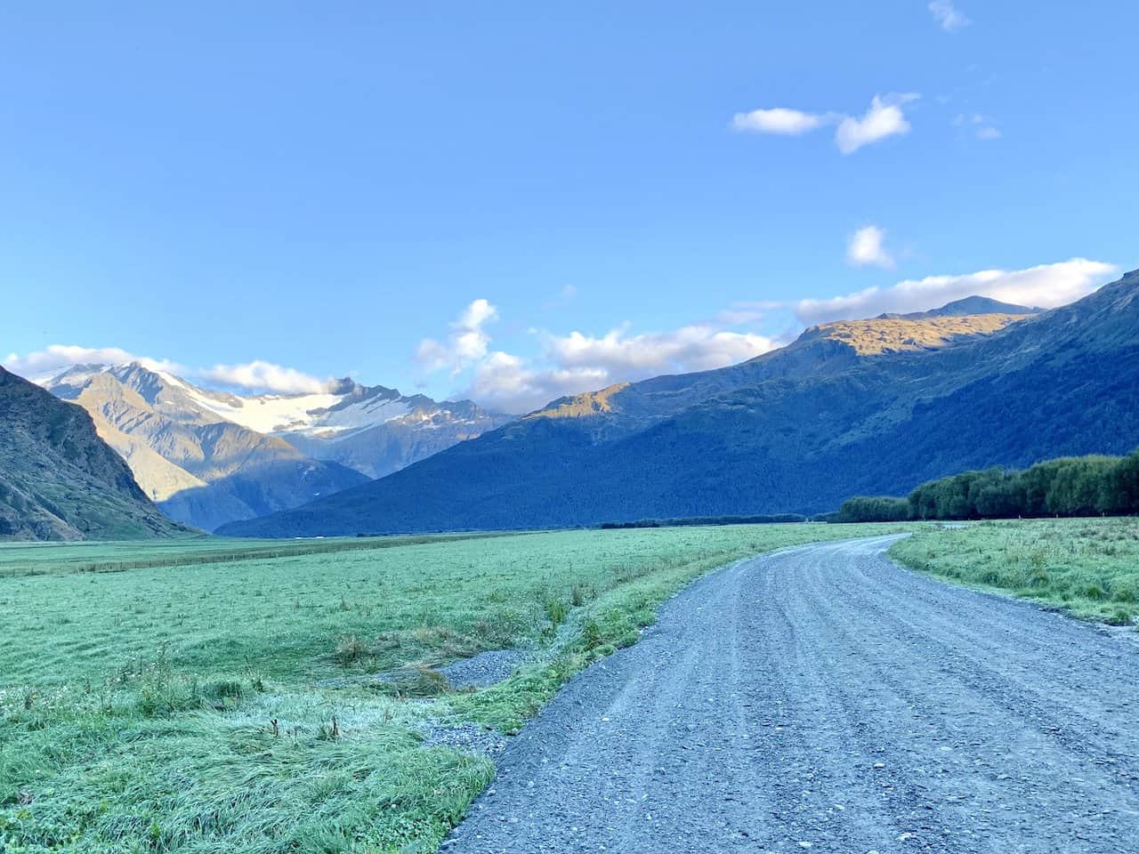
The starting point of the hike is located right at the Raspberry Flat Car Park. You can go about a trip to car park in one of two ways – driving yourself or taking a shuttle.
Raspberry Flat Car Park
The Raspberry Flat car park is the starting point for the Rob Roy Glacier track as well as several other hikes around Mt Aspiring National Park.
Some of these include the West Matukituki Track, Aspiring Hut, and the French Ridge Hut. The parking lot itself is pretty large and can fit 50+ cars.
Driving on Your Own
If you have your own car, you will be able to drive yourself from Wanaka (or wherever else you may be coming from) to the car park.
The drive is 50 km / 30 miles from the Wanaka town center and should take around 1-1.5 hours.
It is very important to note that the last 30 km / 18 miles of the drive is not on a paved road.
The gravel makes up the majority of the drive, so things can get a bit slower on this portion of road. Also note that the last 10km / 6 miles of the road can get washed over in recent rains, making it more dangerous to drive (especially for smaller cars).
Some car companies will explicitly state in their terms and conditions that driving down this road is not allowed. So, even if you have a car, you may not be allowed to drive there yourself.
But don’t worry – whether you don’t have a car at all, or your car rental company doesn’t allow, there is another way.
→ Be sure to check out Rentalcars.com when it comes to renting a car in New Zealand. The site will show you car options & prices from a variety of companies. This ensures that you will be able to choose the perfect car (and deal) for your trip to the country.
Shuttle from Wanaka to Rob Roy Glacier
The second way to get yourself to the starting point is by taking a shuttle from Wanaka. Ritchie’s was the service I used when I was there. However, if they are not running shuttles during your time in the area, check out some of the other local Wanaka transport companies for your trip.
The shuttle was super efficient, making a couple pick ups and then going to the car park. It waited for around 5 hours once we arrived to give us plenty of time to enjoy the hike and then some.
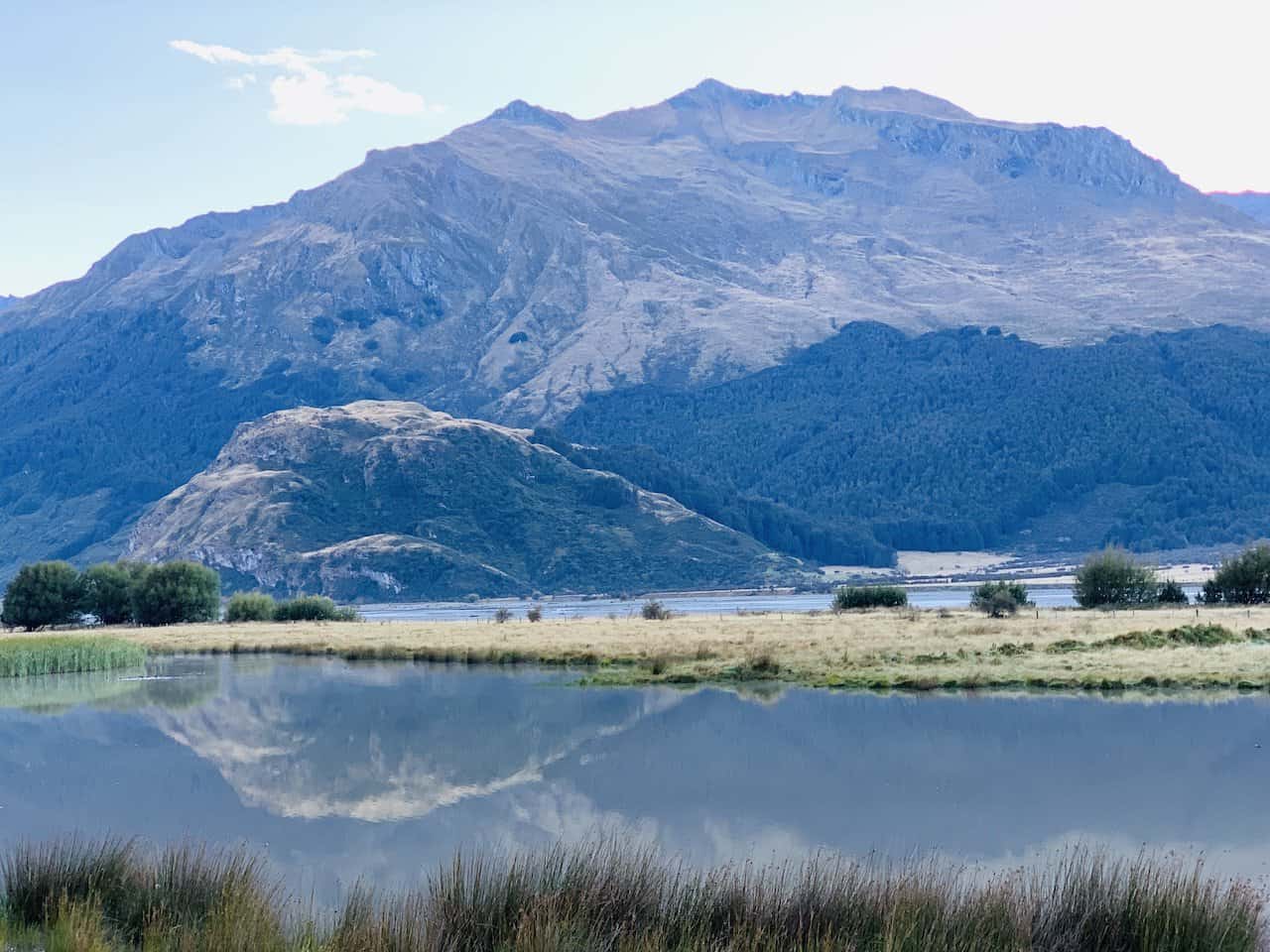
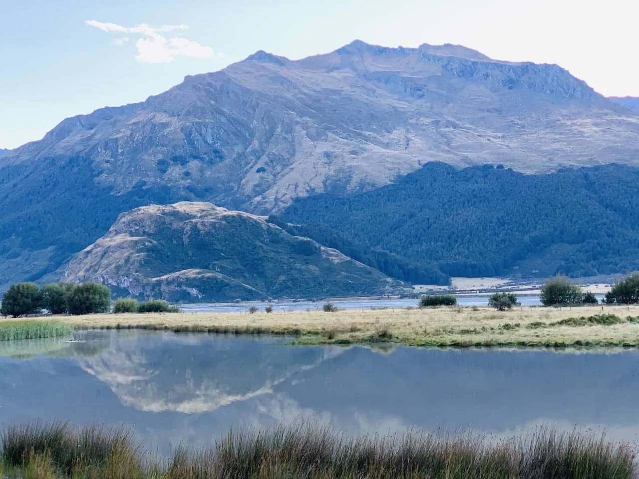
Whether you are driving on your own or taking the shuttle, be on the lookout for some spots to pull onto the side of the road for some photos.
There were a couple of times where the surrounding scenery was just surreal to take in. And don’t worry, the shuttle should be making a stop or two along the way for some photo ops.

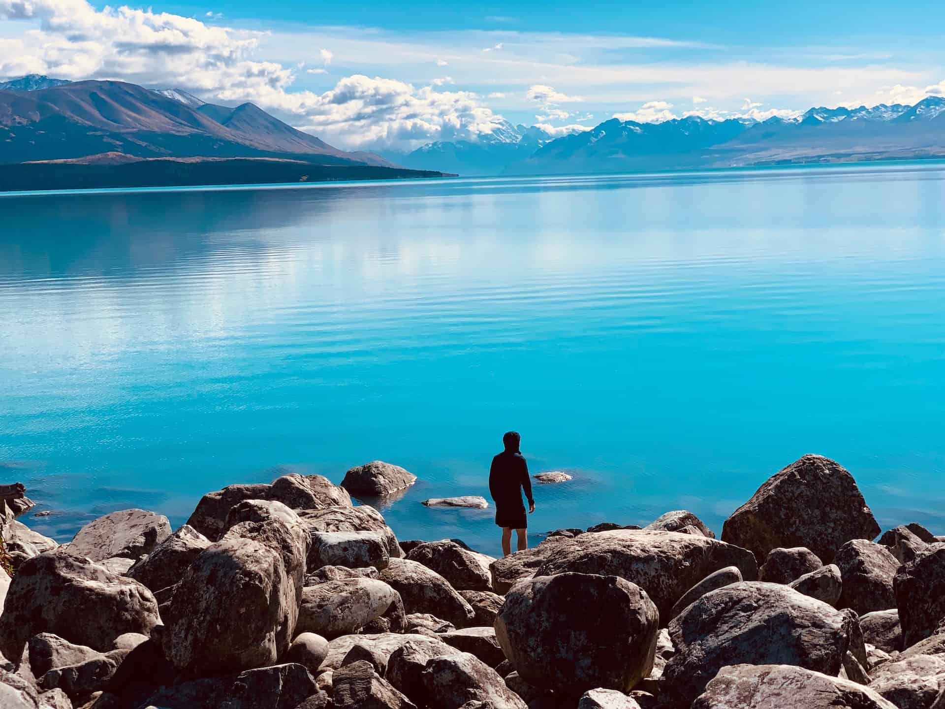
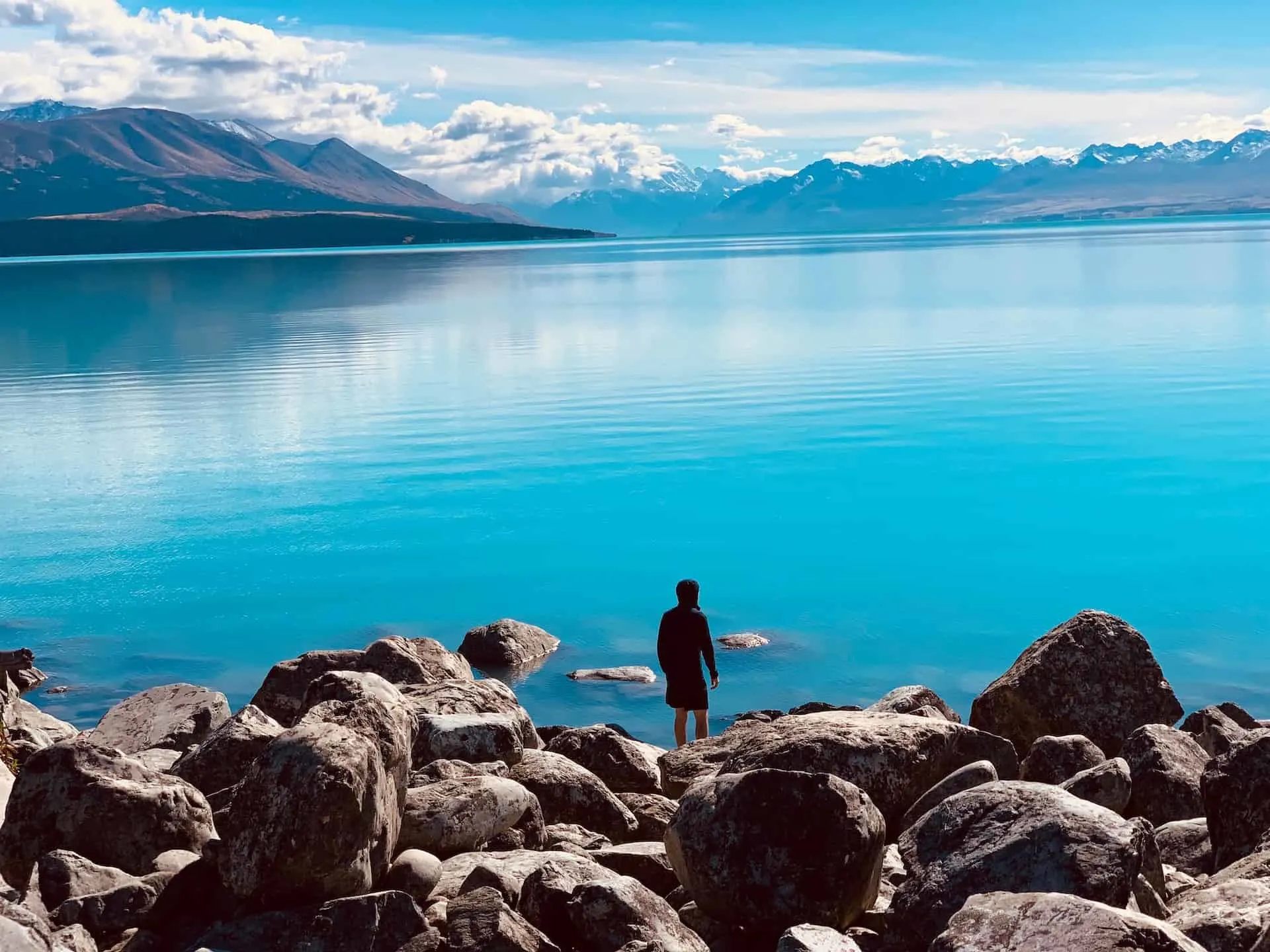
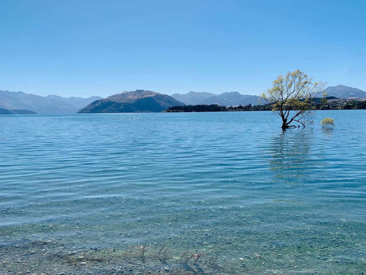
3) Where to Stay in Wanaka
Wanaka is a small lakeside town with plenty of small restaurants, bars, cafes, and shops. There are several accommodation options to choose from at various price points.
Below are some recommended options to browse through:
4) Mount Aspiring National Park Weather
While hiking the Rob Roy Glacier track is a top highlight during a visit to Wanaka, unfortunately the weather can sometimes get in the way.
Mountain weather in general can be very unpredictable on a day to day (or even hour to hour) basis.
This is even more so the case when dealing with the South Island of New Zealand. Mt Aspiring National Park is located very close to ocean making the weather even that more uncertain.
Understandingly, it can be difficult to build a day by day itinerary and have the weather cooperate perfectly.
That is why I would recommend being a bit more flexible with your schedule. If the Rob Roy Glacier is a top priority for you, then be sure to pick a day with the most appropriate weather to take part.
When searching for weather, I wouldn’t just put in “Wanaka”. Instead search for Rob Roy Glacier itself. Since the glacier is quite a distance from Wanaka, these two weather forecasts can be different. By checking out the glacier weather, you should have a more accurate understanding.
Hiking Resources & Checklist
Before heading out for the trails, be sure to read up on some of the hiking resources up on the site. These are here to better prepare you for all types of outdoor adventure.
- Gear: Hiking Packing List
- Weather: How to Prepare for Hiking Weather
- Navigation: Hiking GPS & Navigation
- Tips: 20+ Hiking Tips & Tricks for the Trail
- Accommodation: Book Your Hotel Today
- Rental Car: Book Your Car Rental Today
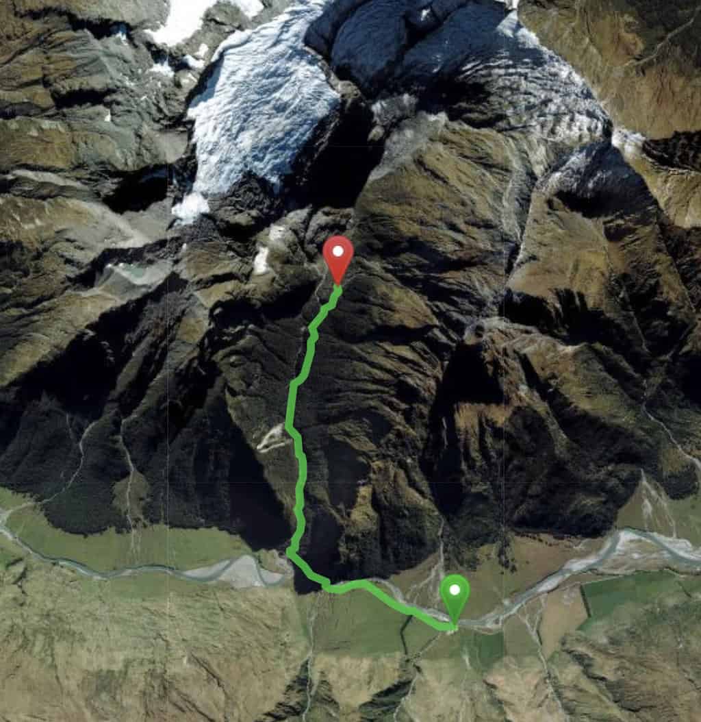
5) The Rob Roy Glacier Track Hike
Now that you have some background information and know how to get yourself to the starting point, let’s dive into the hike itself.
The trail is very well signposted throughout, so I don’t see anyone having an issue with getting onto the trail and towards the final lookout. Note that around the car park area, there are additional hiking trails. But as long as you follow the signs you should be good to go.
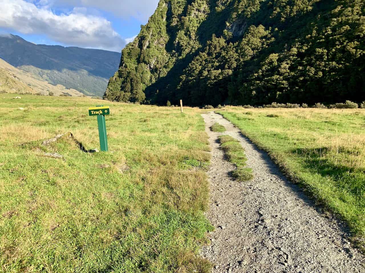

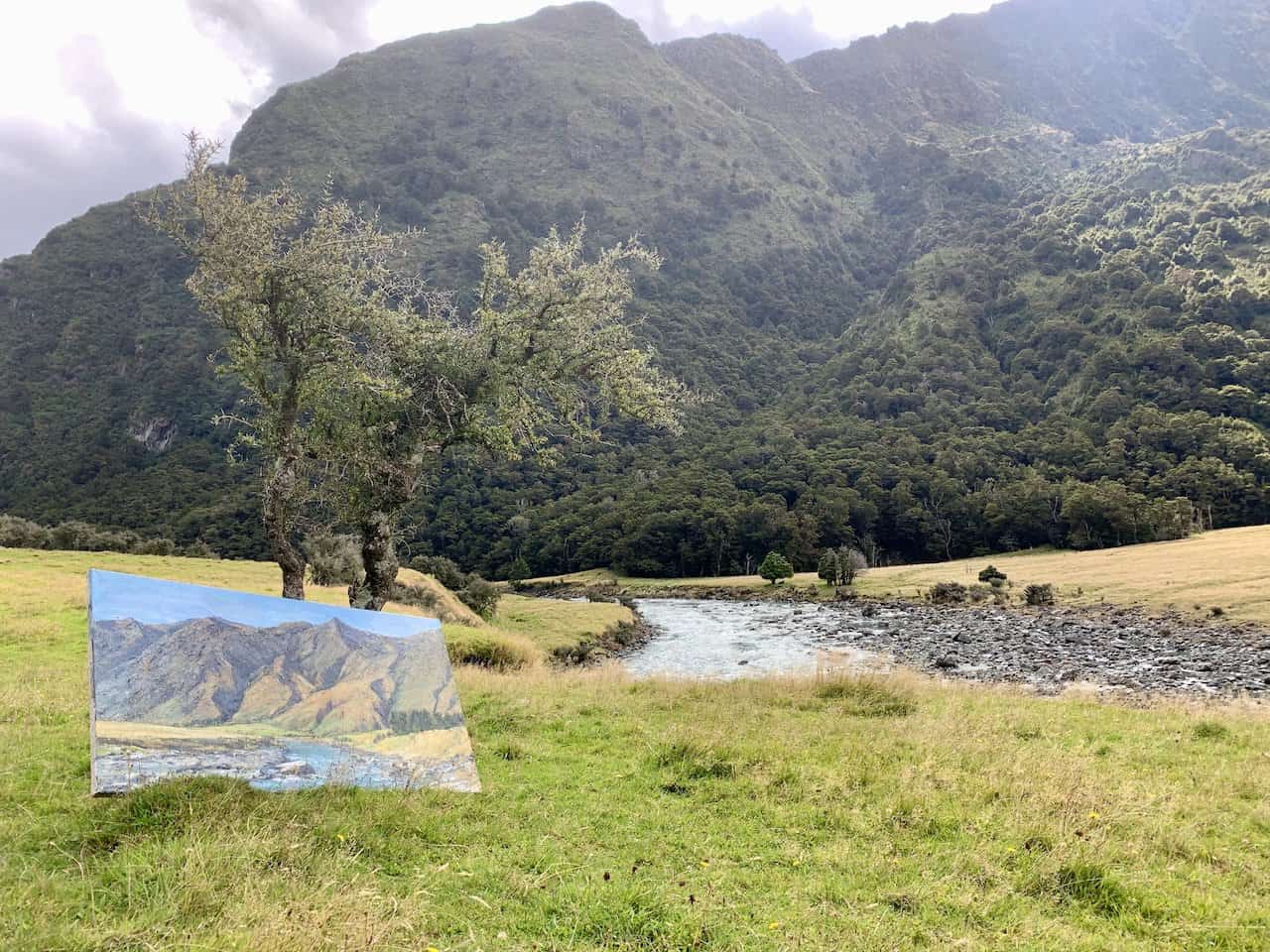
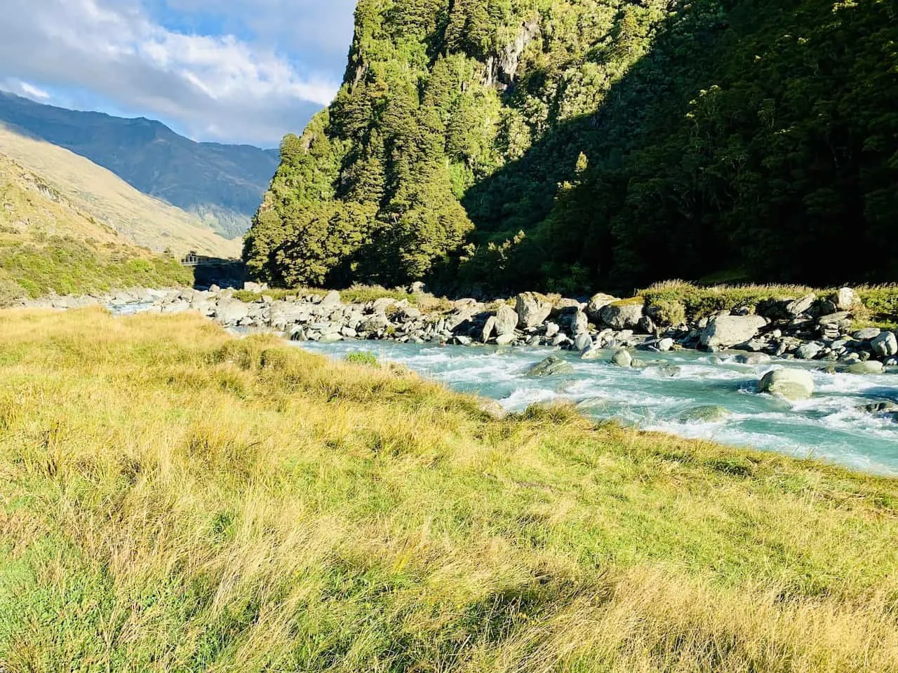
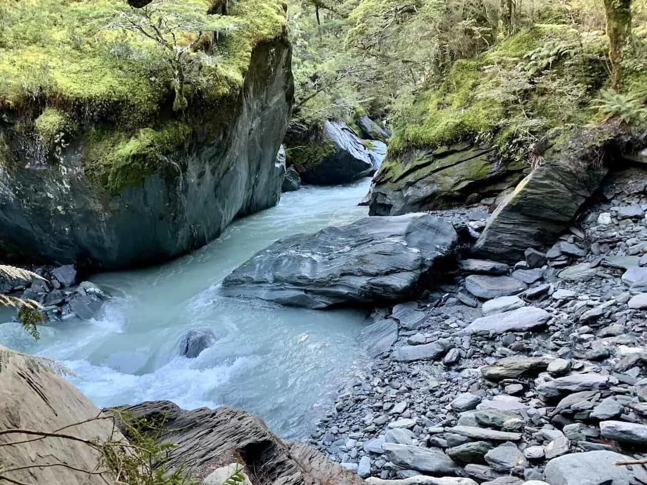
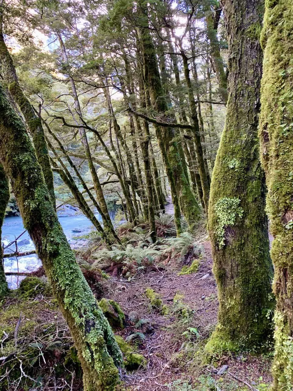
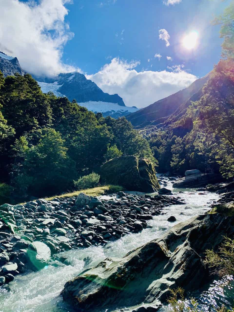
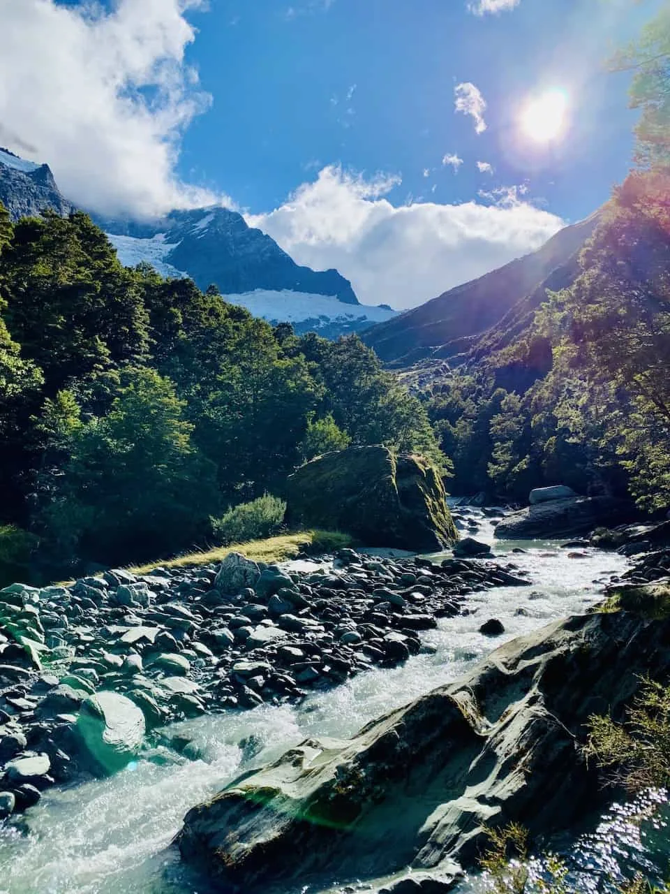
From the car park, simply follow the trail along the West Matukituki River. You will first cross over a small bridge near the car park and then the trail follows the river for around 1.5 km.
You will have some nice views of the valley and river throughout as you take on this first portion of trail.


You will then be welcomed to a large swing bridge to cross over the river itself. Just before you cross the bridge, you will see a trail sign with some informative info. The sign reads:
“From here the track crosses the Matukituki River then climbs steadily through the forested gorge of Rob Roy stream to reach a sub alpine basin above the tree line.
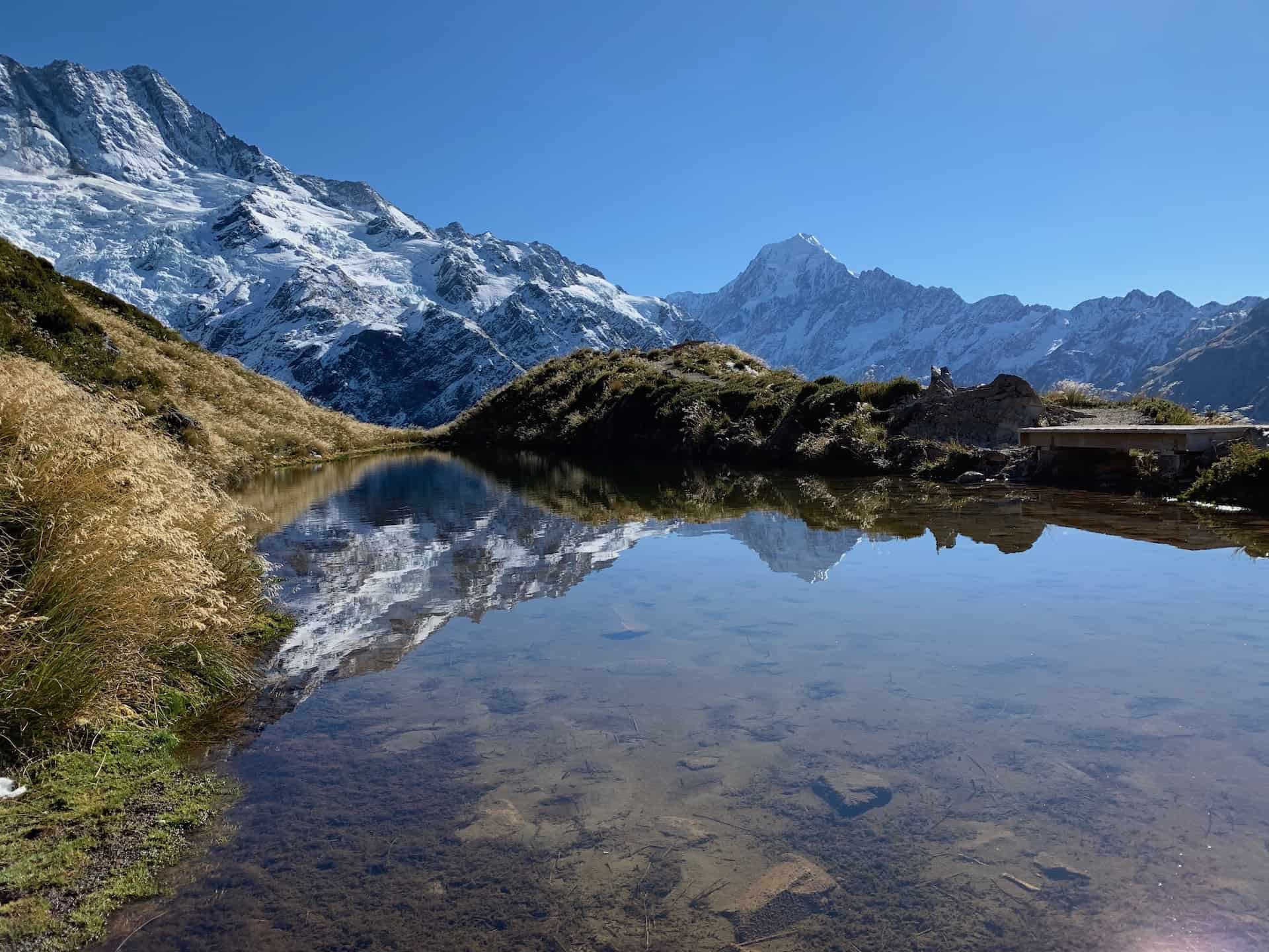
Rob Roy Valley is in Mount Aspiring National Park and provides tantalizing glimpses of the park’s alpine character, lofty peaks, shimmering snowfields, and the impressive Rob Roy Glacier perched precariously above towering rock walls.
The original swing bridge was built here in 1987 as the National Parks Centennial Project to give access to this spectacular corner of the park. The bridge was replaced in 2013.
The track ends a short distance above the tree line – 730 meters above sea level – a steady climb of 330 meters above this point. Up there you’ll find more information panels, giving you the chance to relax, take in the view, and learn more about this upland valley before retracing your steps.”

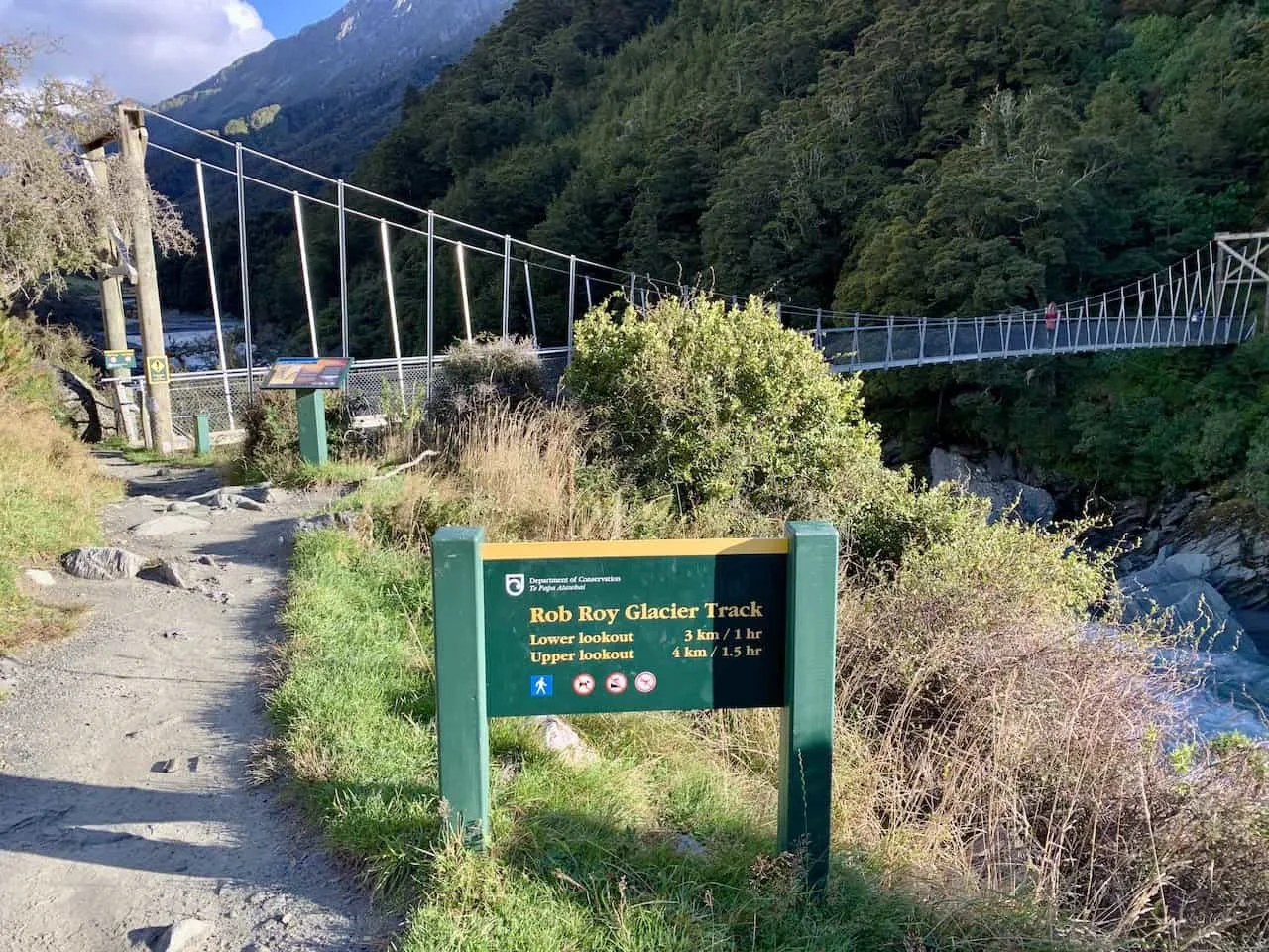
Note: there is a trail that continues along the river. So, if you are somehow not paying attention and walk past the bridge, you will end up on a different trail. I have a hard time believing that could happen, so simply cross over the bridge and into the forest.
Before going into the forest, be sure to take in the view on the bridge overlooking the river in each direction.
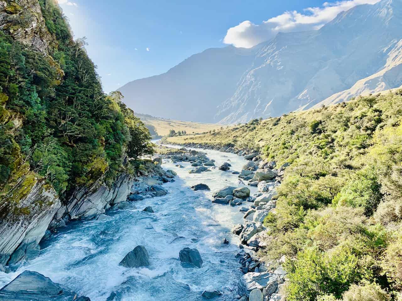

From here the trail begins to climb steadily as you gain elevation further up into the mountainside.
As you head up this steeper section of trail, there will be some great elevated views of the valley down below and ice-capped mountains out in the distance.

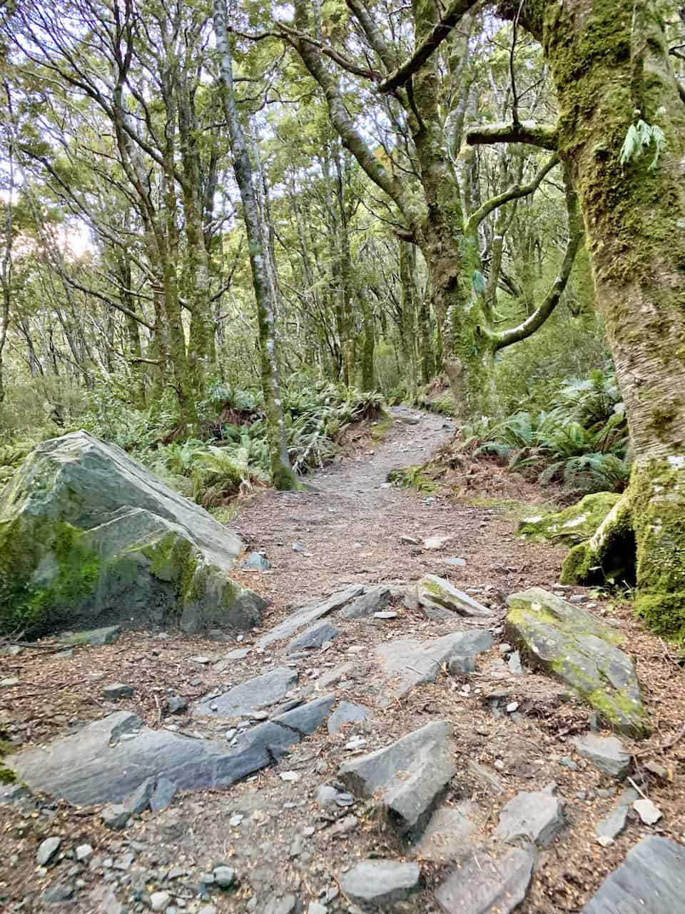
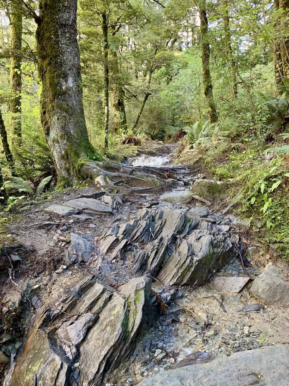
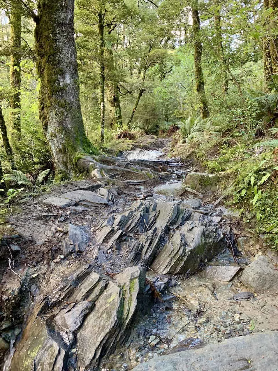
It is then back in the forest, where you will be walking through for the next several kilometers.
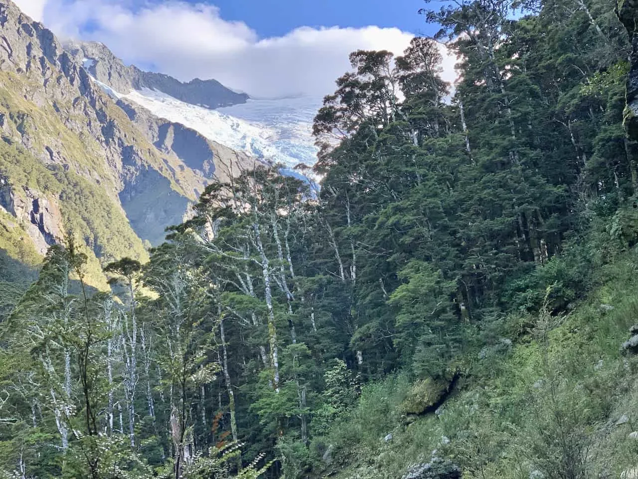
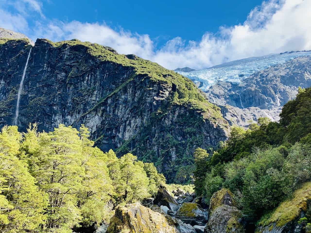
Along the way you will get glimpses of some glacier runoff and even get a view of the Rob Roy Glacier way out in the distance.


A few years back there was a mudslide that took out a portion of the trail (after I had visited). Due to this, the trail was closed for some time as they built a new portion of trail that circumvents the danger area.
Around 3.5 km / 2.2 miles in you will come across a staircase that will get you safely around and onto the next portion of trail.
Below are some photos from the trail prior to the closure. So, there is a chance that some of the following will no longer be on the official trail. Either way, after getting yourself up and over the newly installed stairs, it will just be another 10 minutes or so to the first viewpoint area.


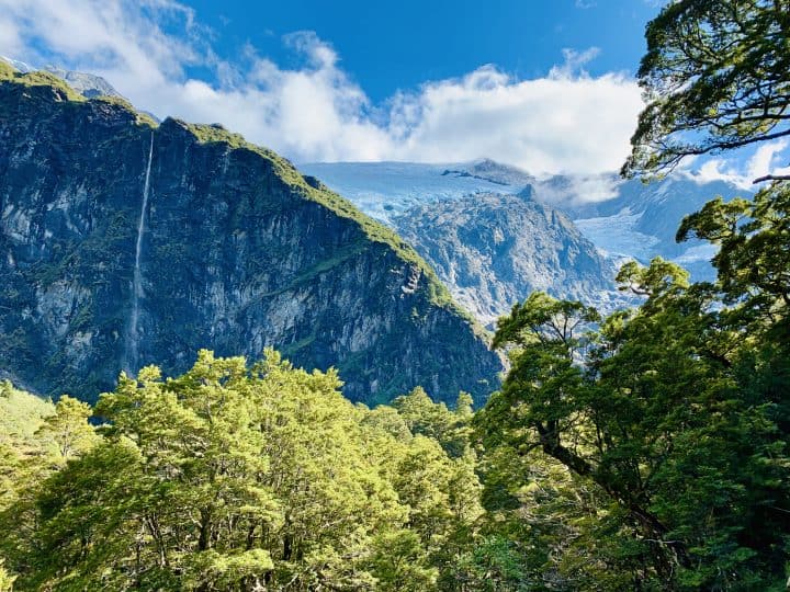
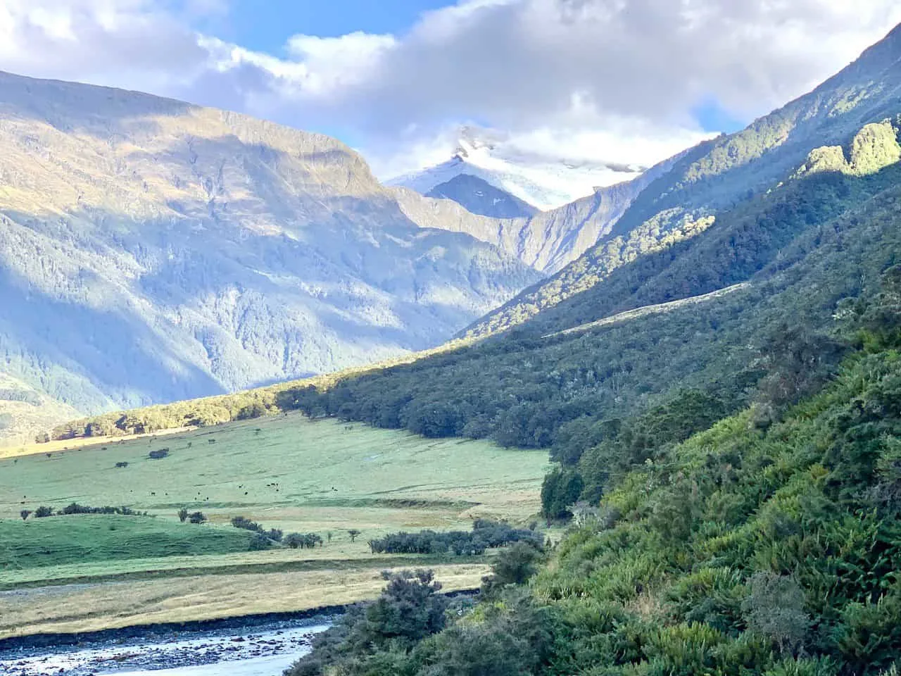
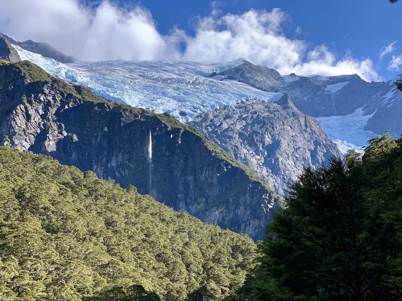
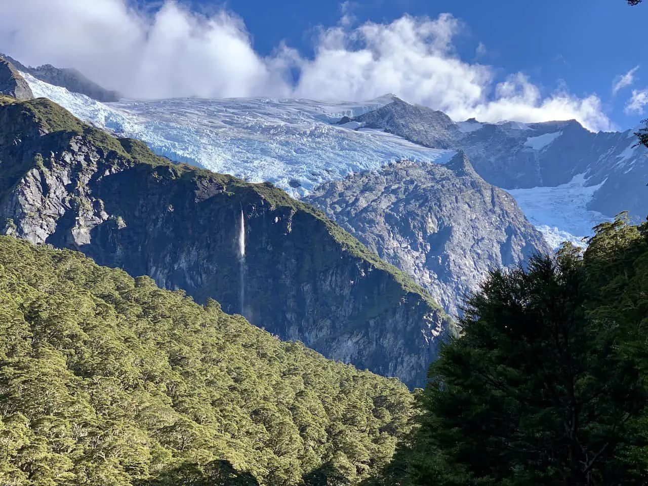
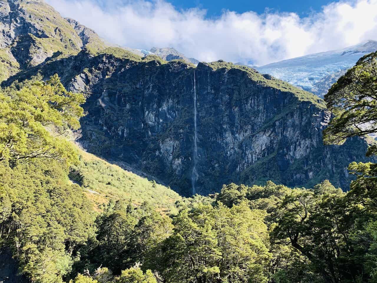
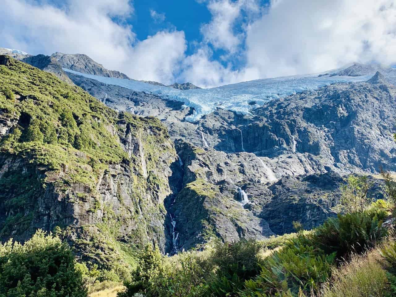
Rob Roy Glacier Lower Lookout
From the lower lookout area, you will get your first look at some more expansive views of the Rob Roy Glacier.
Up above will be the glacier covered mountain and down below is the greenery filled forest. You may even get some nice waterfalls coming off of the mountain walls.
Feel free to take a nice relaxing break here as you enjoy the view and the natural landscape.

Rob Roy Glacier Upper Lookout
From the lower lookout, it is another 20-30 minutes until you reach the final upper lookout section of the glacier track.
During this portion of trail, you will be walking right alongside the river, with the glacier views out in the distance.
Soon enough, you will arrive at the upper lookout. There is plenty of space to find a spot to take a seat and just sit back and relax.
From this area, you will have a vaster view of the glacier and mountains. I ended up spending 30+ minutes here taking it all in.


Once you have had enough time at the lower and upper lookouts, it is time to retrace your steps all the way back to the parking lot.
This will essentially be a downhill hike as you make your way back down the stairs, through the forest, back across the bridge and then finally to the car park. From there it is back to Wanaka, to end a successful day out on the trail.
6) Rob Roy Glacier vs Roys Peak
One common question that comes up is how to compare Rob Roy Glacier vs Roys Peak.
In the case you only have enough time for one hike in Wanaka, you will need to make that sort of decision. If you have more than one day, then I would highly recommend taking part of both (and even the Isthmus Peak Track).
When it comes to Rob Roy Glacier vs Roys Peak though, these are going to be two very different types of experiences.
By now you should have a pretty solid understanding of what the glacier hike entails. An overall easy hike along the river and through the forest with some views along the way. The grand finale being two lookout spots as you see the glacier from down below.
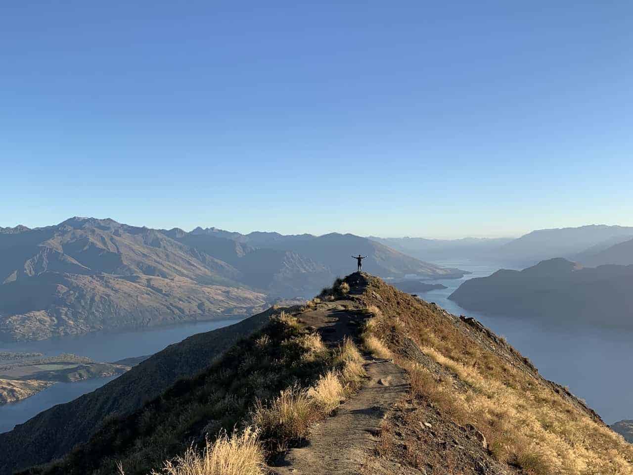
On the other hand, the Roys Peak hike is a demanding mountain climb gaining 1,228 meters / 4,029 feet along the way. Demanding on fitness levels, the Roys Peak hike can take close to double the amount of time too.
During a climb up Roys, you will not have any forest though to hike through. Instead you will have pretty constant views of Lake Wanaka and the surrounding mountains. With those views does come a long and zig zagging climb to the top.
Once up there though, the views are tough to beat. On a clear day you can see the surrounding beauty of the area for miles and miles.
If you would like to learn more about the climb up, feel free to take a look at the Roys Peak track hiking guide up on the site.
At the end of the day, this is all going to come down to preference and physical ability if deciding between the two.

That about wraps up a guide to the Rob Roy Glacier Track. If you have any questions or comments, feel free to add them in below.
Also, don’t forget to check out the other New Zealand itineraries and guides up on the site like this New Zealand South Island Itinerary.
Have fun out there and safe travels!