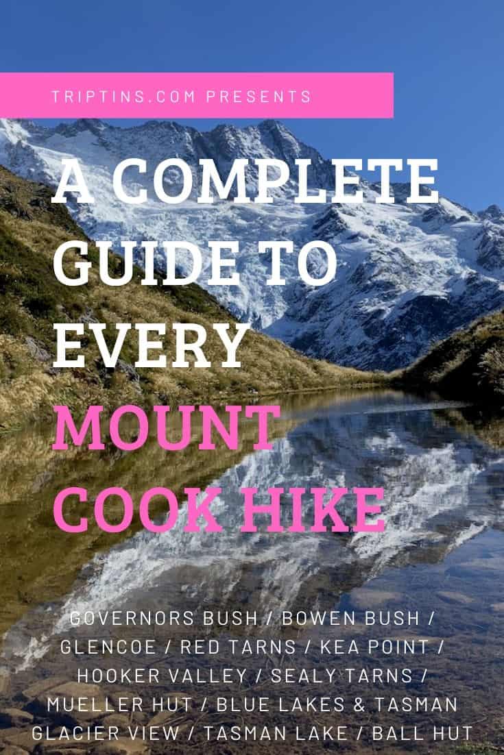

Mount Cook National Park on the South Island of New Zealand is home to some of the best hiking trails in the entire country. This guide will go over each of the Mt Cook Hikes to give you a better idea of what types of trails are offered in the area.
There is everything from mountain hikes to valley trails to bush walks, so no matter what you are looking for Mount Cook National Park will have something for you. Read on to learn more about hiking around Mt Cook and everything there is to know about the trails.
* Affiliate Disclosure: This post may contain affiliate links, which means I may receive a commission if you make a purchase through the links provided, at no additional cost to you. Thanks for supporting the work I put into TripTins!
1) How to Get to Mount Cook National Park
If you want to take part of any of the hiking trails in Mount Cook National Park, you will need to make your way to the area around Mount Cook Village.
Some of the hiking trails start within the village itself, while a bunch of the others are within a 10-15 minute drive.
The easiest way to go about your time in New Zealand is by having your own car to take you around. You will be on your own schedule and easily will be able to make your way from one spot to the next without worrying about public transportation.
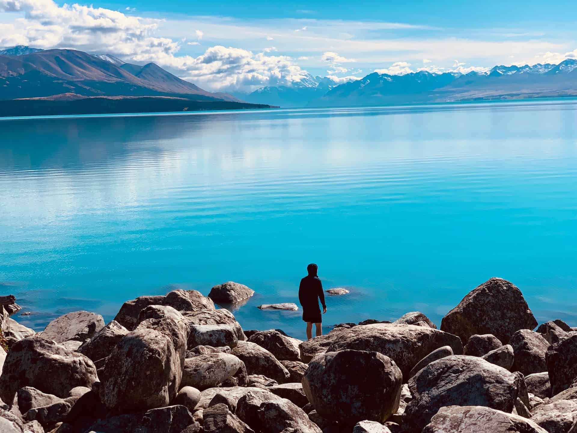
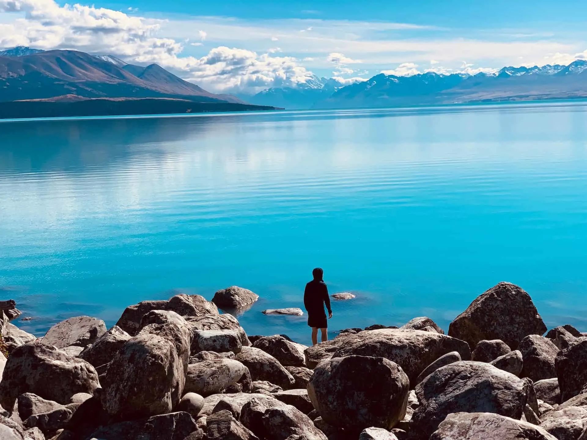
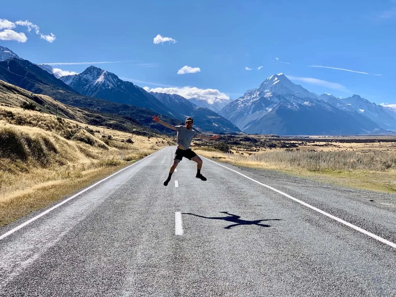
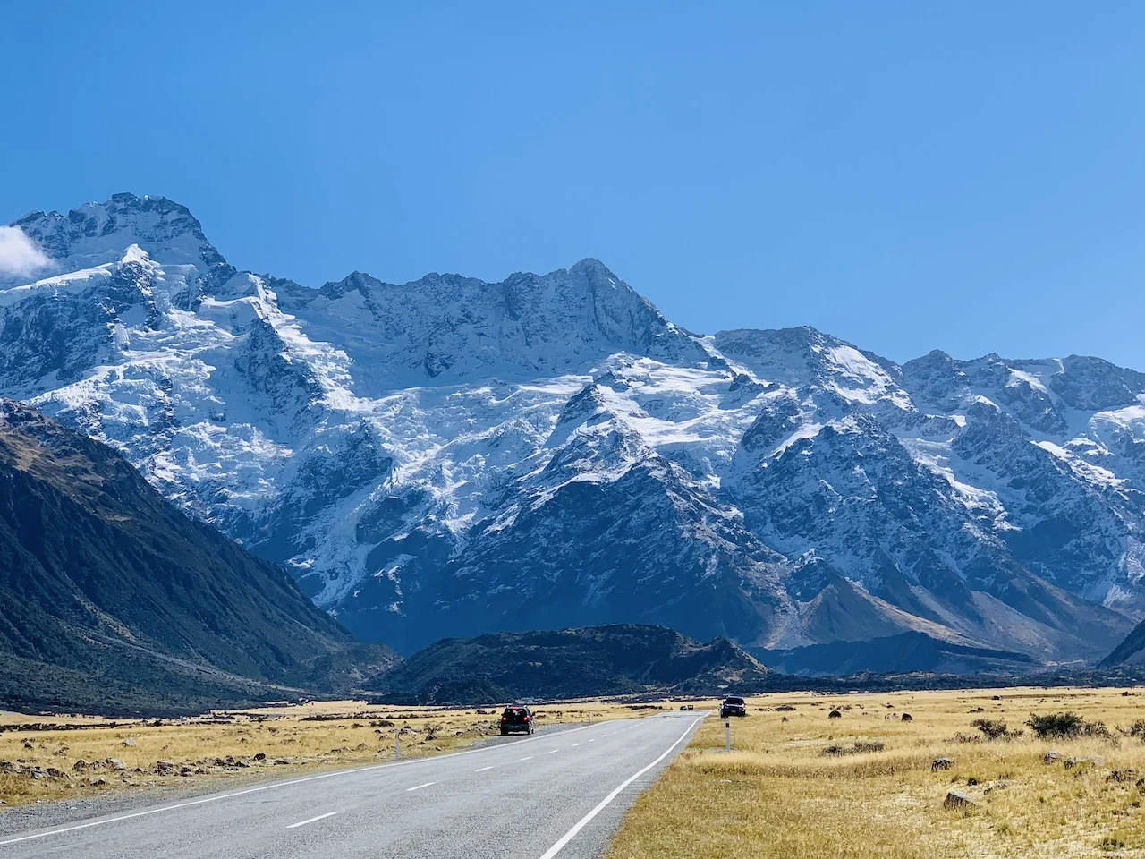
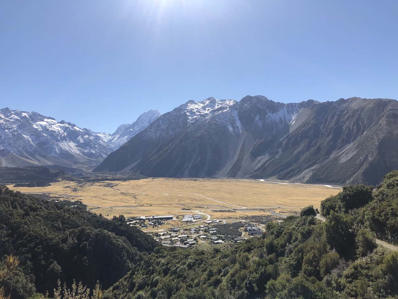
Driving Tip: Along the way up to Mount Cook Village there will be several opportunities to pull off on the side of the road and get some incredible photos of Mt Cook out in the distance (like the one below!).
» To learn more about the NZ roads, take a look at the Driving in New Zealand Guide up on the site.
If you do not have your own car, the next best option is to take a bus to get you to Mount Cook Village.
You can take a look at a company like Intercity that has daily busses to and from Tekapo to Mount Cook Village. Once in the village you can walk, bike, or maybe even hitchhike to some of the trailheads.
→ Be sure to check out Rentalcars.com when it comes to renting a car in New Zealand. The site will show you car options & prices from a variety of companies. This ensures that you will be able to choose the perfect car (and deal) for your trip to the country.

2) Where to Stay Near Mount Cook National Park
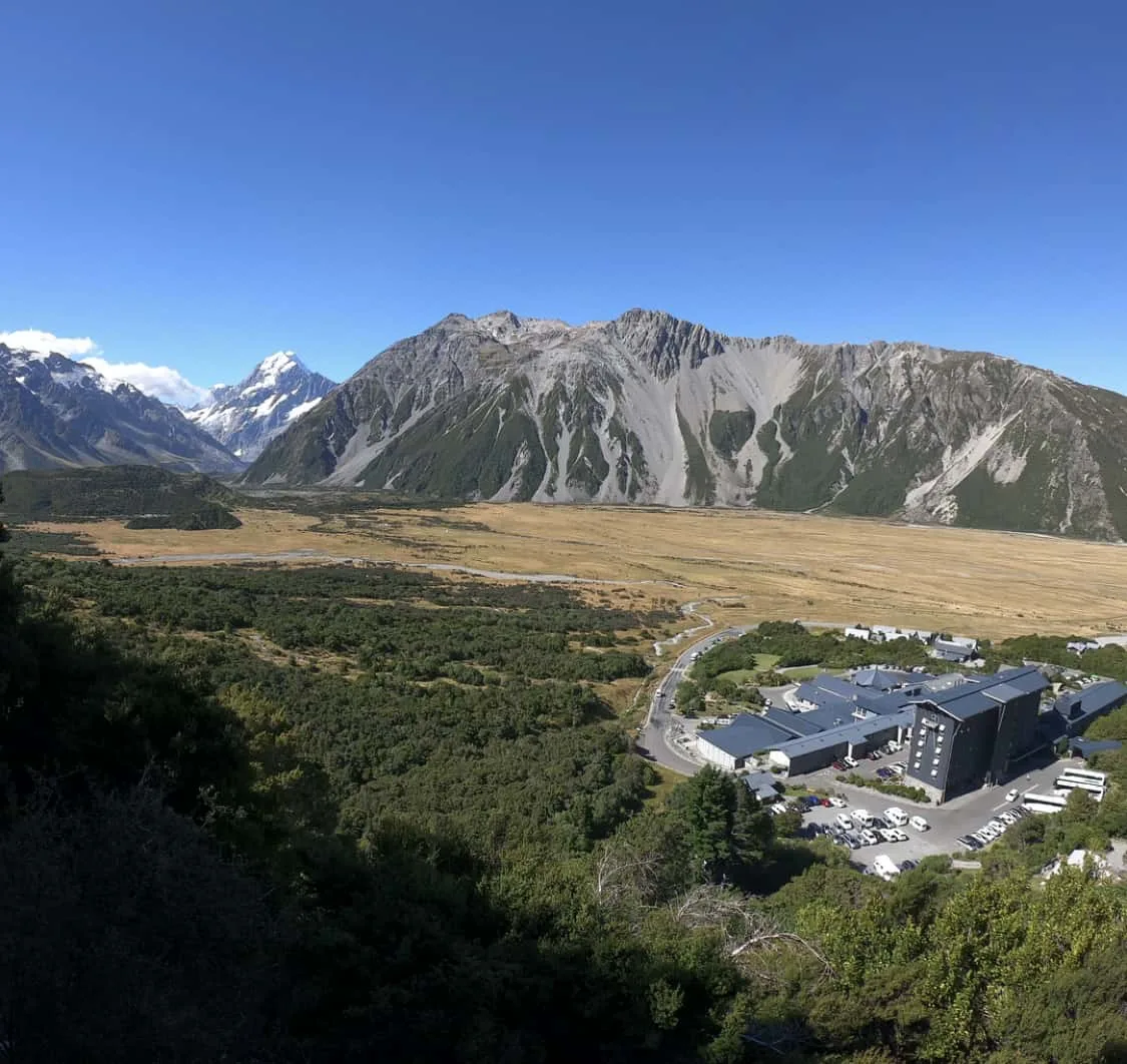
As mentioned above, Mount Cook Village is the main town where most of the Mt Cook hikes are located around. If hiking these trails is a priority for you, I highly recommend staying within the village itself.
There are not too many accommodation options to choose from but below would be some of the main choices when deciding where to stay.
- Hermitage Hotel
- Aoraki Mt Cook Alpine Lodge
- Aoraki Court
- YHA Mount Cook Village
- Mount Cook Lodge and Motel
If you cannot find accommodation within the village, you can also take a look at some options in the towns of Twizel and Tekapo, which would be some of the closest main towns from Mount Cook.

3) Mount Cook National Park Weather
I say this a lot when it comes to hiking (especially when going up to higher altitudes) but if you want to get the most out of these trails you need to pay attention to the weather forecasts.
Hiking in cloudy/rainy conditions will not be the same experience as hiking on a clear day.
If you want to take in the views (and believe me you do!) then try and be as flexible as you can when deciding what day to hike. Remember that the weather down in the valley and village may not be the same another 1,000+ meters up in the sky.
If you have some poorer weather days, maybe head off on some bush walks instead of trying to head off to the Mueller Hut. Just keep an eye on the forecast and go from there.
When deciding which day to take part of certain hikes I recommend taking a look at the Mount Cook National Park weather. Keep an eye on cloud coverage, rain probability, and number of sun hours as it gets closer to your time around Mount Cook.
» If you are wondering what to bring along when taking part of hikes in general take a look at the comprehensive Hiking Packing List that I put together. It includes everything I bring along on day hikes, and it will have you better prepared when taking part of trails all over New Zealand.
Hiking Resources & Checklist
Before heading out for the trails, be sure to read up on some of the hiking resources up on the site. These are here to better prepare you for all types of outdoor adventure.
- Gear: Hiking Packing List
- Weather: How to Prepare for Hiking Weather
- Navigation: Hiking GPS & Navigation
- Tips: 20+ Hiking Tips & Tricks for the Trail
- Accommodation: Book Your Hotel Today
- Rental Car: Book Your Car Rental Today
4) Mt Cook Hikes Trailheads
Below I have listed out the 11 Mt Cook hikes that you can decide between. Those 11 trails can be reached from 3 different places – Mount Cook Village, White Horse Hill Campground, and the Tasman Glacier Car Park.
I have included screenshots from the maps.me app that show the different hikes from each trailhead. In the next section I give a bit more detail on each hike in particular.
A. Mount Cook Village Trailhead
From Mount Cook Village you can reach 4 different trails. So even if you do not have a car in the village, you can still easily take part of these by just stepping out of your front door.
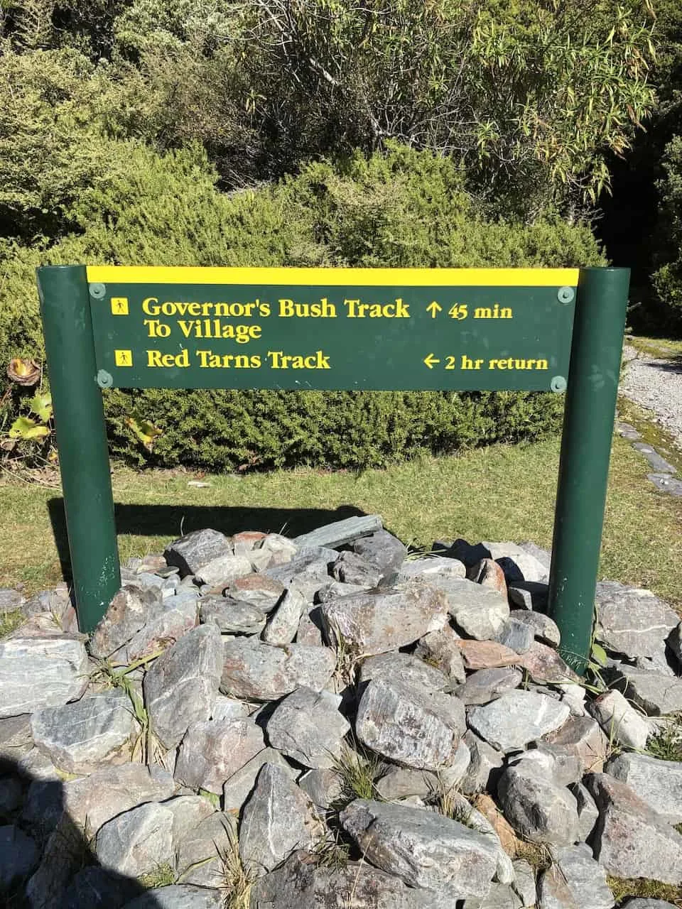
1. Governors Bush Walk
2. Bowen Bush Walk
3. Glencoe Walk
4. Red Tarns Track
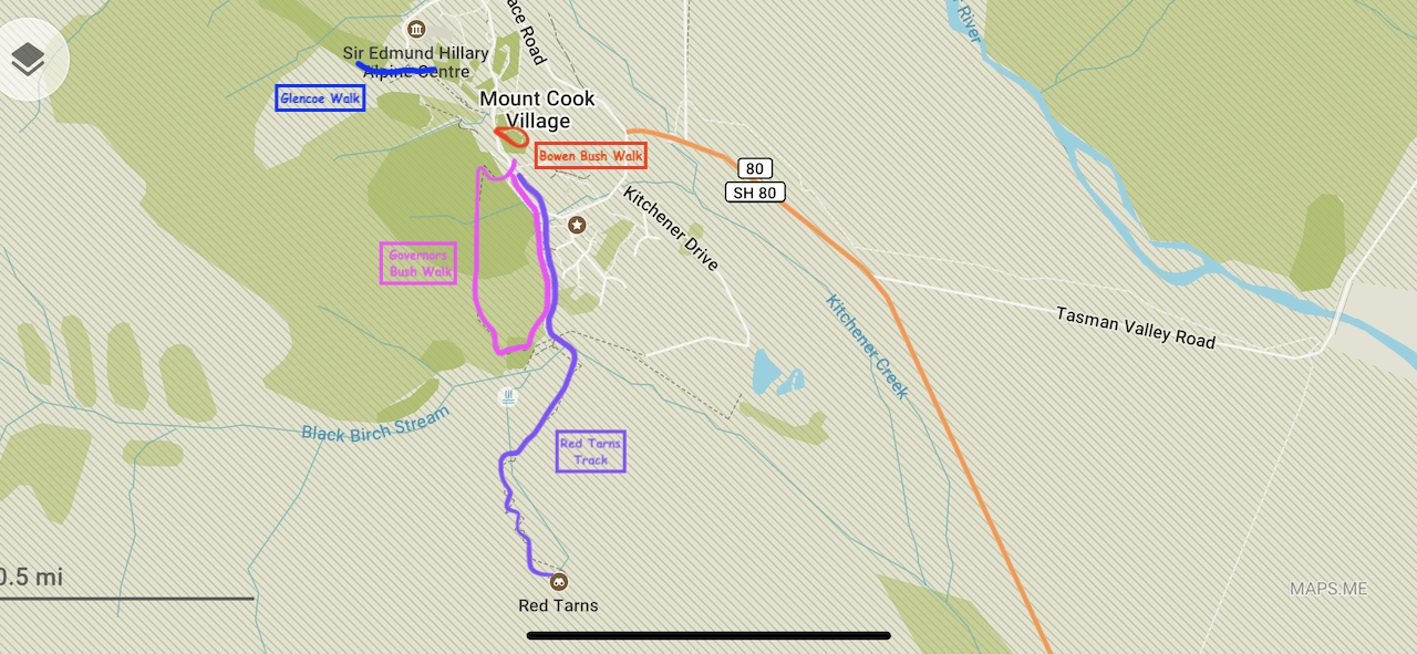

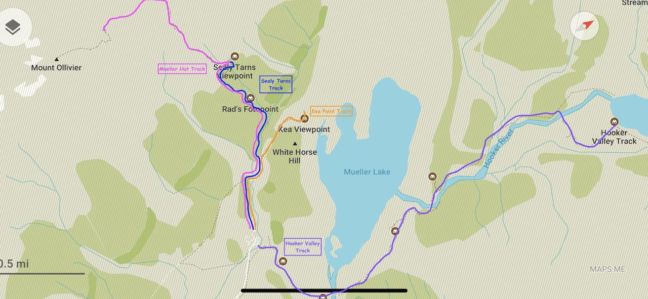
B. White Horse Hill Campground
A 7 minute drive from Mount Cook Village you will find the White Horse Hill Campground. From the campground parking lot you can choose from another 4 trails. If you do not have a car you can walk the additional 45 minutes from the village to the campground.
1. Kea Point Track
2. Hooker Valley Track
3. Sealy Tarns Track
4. Mueller Hut Track

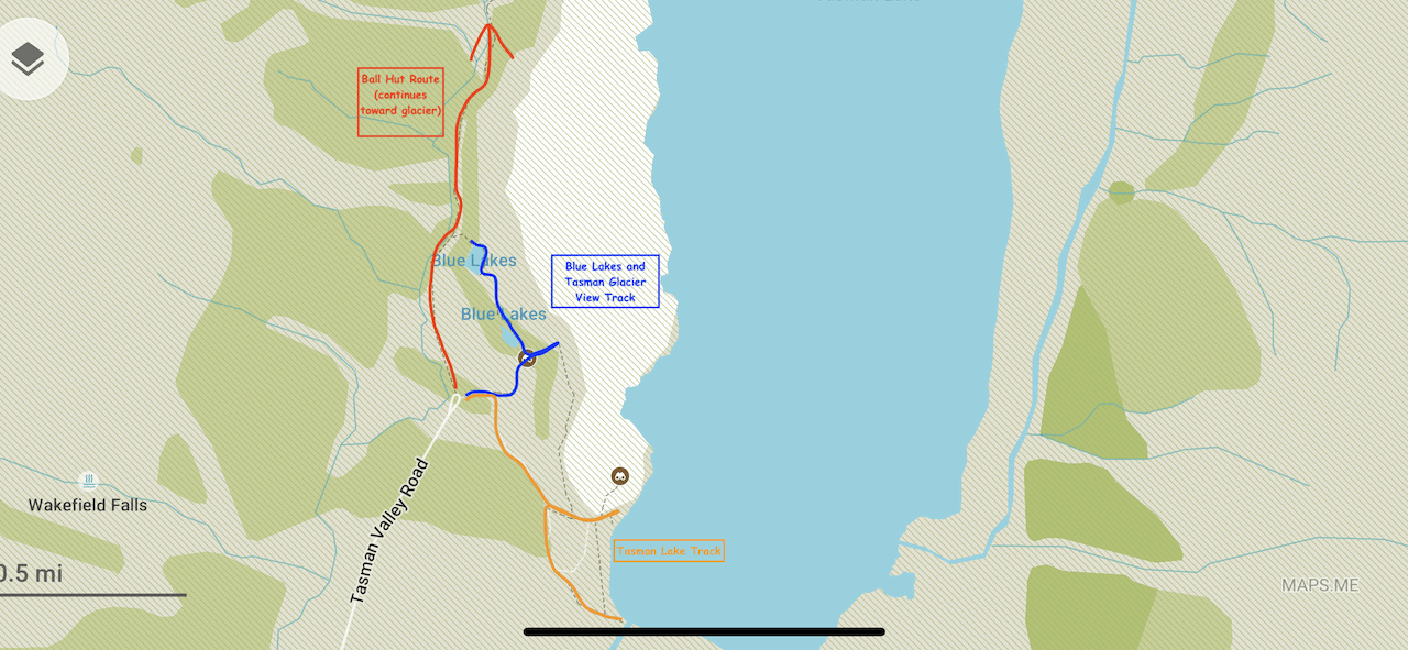
C. Tasman Glacier Car Park
The final 3 trails can be accessed from the Tasman Glacier Car Park, a 15 minute drive from Mount Cook Village.
1. Blue Lakes and Tasman Glacier View Track
2. Tasman Lake Track
3. Ball Hut Route

5) Mt Cook Hikes
There are 11 official Mt Cook hikes in the national park. Some of them are simple 10 minute bush walks while others are 8+ hour uphill mountain climbs. I will go into a bit more detail on each below.
Governors Bush Walk
Length: 1.5 KM / 0.9 Miles
Time: 45 Minutes
Difficulty: Easy
Elevation Gain: None
If you are looking for a nice short bush walk then the Governors Bush Walk could be for you. You can start the walk right at the Mt Cook Village Public Shelter and complete the loop from there.
Another option is to add the Governors Bush Walk to the longer Red Tarns Track if you would like to get in some views from above.

Bowen Bush Walk
Length: 0.2 KM / 0.1 Miles
Time: 10 Minutes
Difficulty: Easy
Elevation Gain: None
An even shorter bush walk located right across the street from the Self Service Petrol Station is the 10 minute walk through the Bowen Bush.
Glencoe Walk
Length: 0.5 KM / 0.3 Miles
Time: 30 Minutes
Difficulty: Easy
Elevation Gain: 40 Meters / 131 Feet
Right behind the Hermitage Hotel is the Glencoe Walk. While much of the walk is done through the trees, you will be welcomed to a nice viewpoint of Mount Cook Village and the Hooker Valley out in the distance. Do note there is a bit of elevation gain to get those views.

Red Tarns Track
Length: 4 KM / 2.5 Miles
Time: 2 Hours
Difficulty: Medium
Elevation Gain: 300 Meters / 984 Feet
While the previous few trails are pretty easy bush walks, the Red Tarns Track is one of the more difficult in the area.
This 2 hour round trip hike also starts at the Mt Cook Public Shelter and includes a 300 meter ascent up a mountain overlooking the entire valley with Mt Cook out in the distance. So if you are looking to get in those views then the Red Tarns is for you.
» Learn More in the Red Tarns Track Hiking Guide
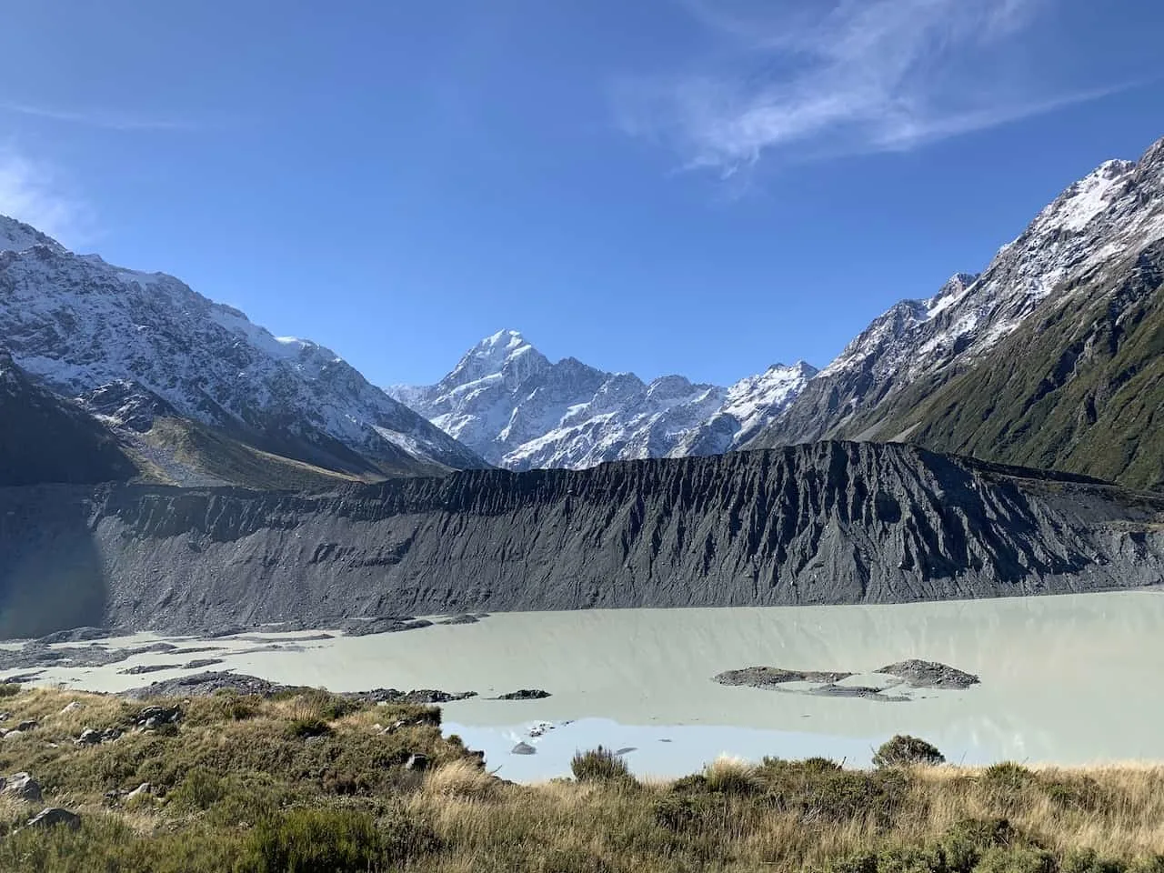
Kea Point Track
Length: 2.8 KM / 1.7 Miles
Time: 1 Hour
Difficulty: Easy
Elevation Gain: 95 Meters / 312 Feet
Moving away from Mt Cook Village, the Kea Point Track starts at the White Horse Hill Parking Lot.
This 1 hour round trip hike is a pretty flat trail that takes you right up to a viewpoint of the Mueller Lake and its moraine wall with Mt Cook out back.
» Learn More in the Kea Point Track Hiking Guide

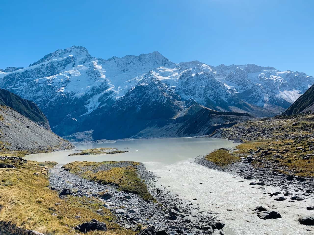
Hooker Valley Track
Length: 10 KM / 6.2 Miles
Time: 3 Hours
Difficulty: Easy
Elevation Gain: 80 Meters / 262 Feet
Arguably the most famous of hikes in Mount Cook National Park is the Hooker Valley Track. It is a beautiful trail that takes you along Mueller Lake, across 3 suspension bridges, and into the Hooker Valley right up to Hooker Lake.
Since it is in the valley, the hike is pretty flat the whole way through, making it a hike that most can take part of.

Sealy Tarns Track
Length: 5.8 KM / 3.6 Miles
Time: 4 Hours
Difficulty: Difficult
Elevation Gain: 600 Meters / 1,969 Feet
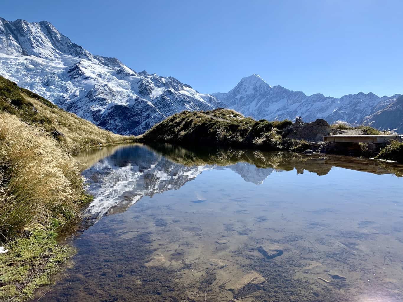
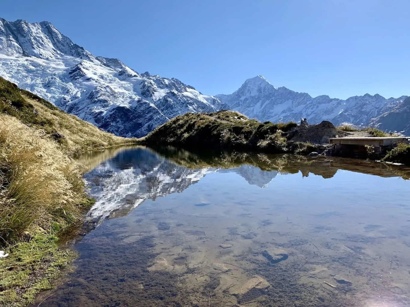
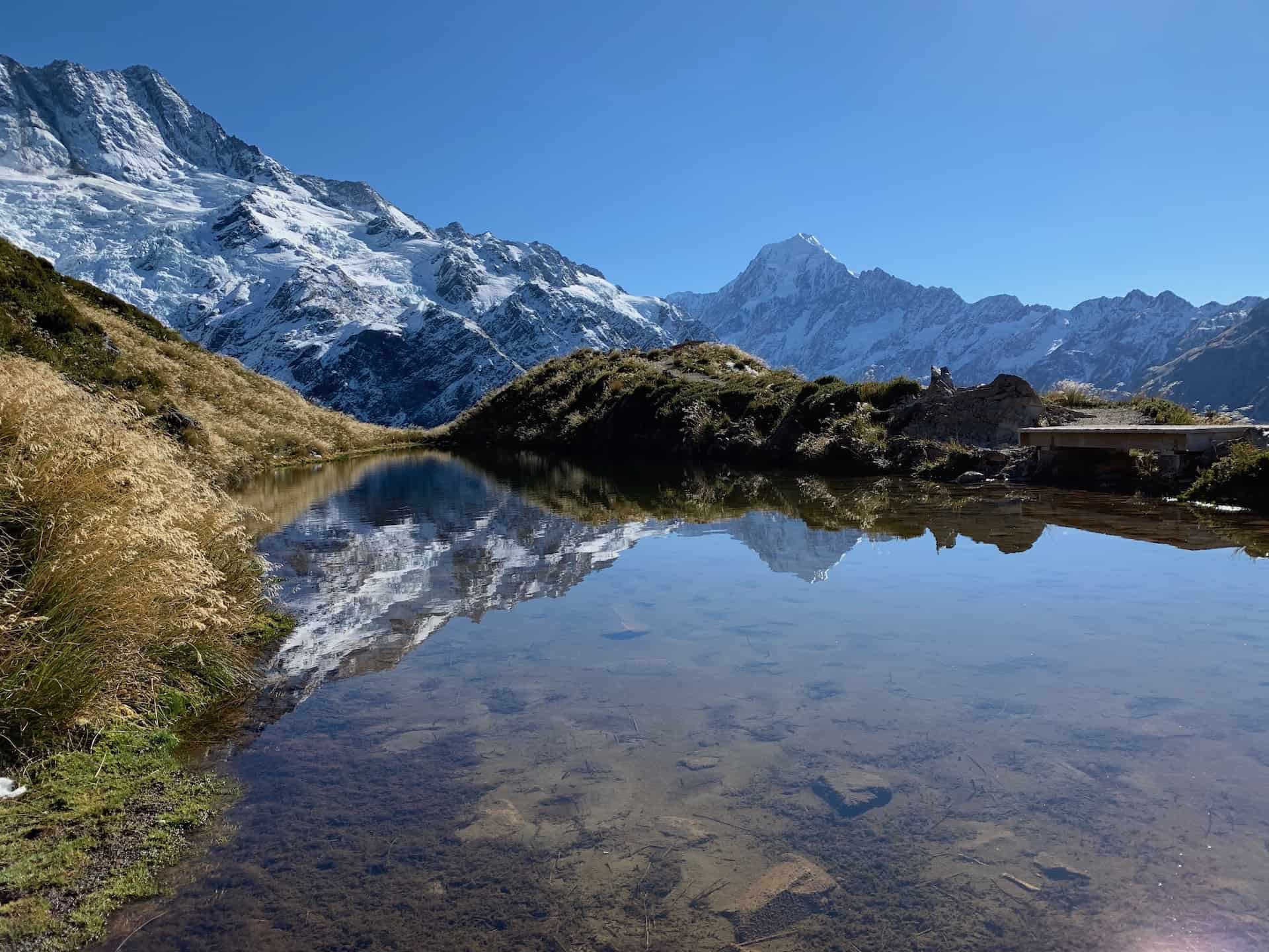
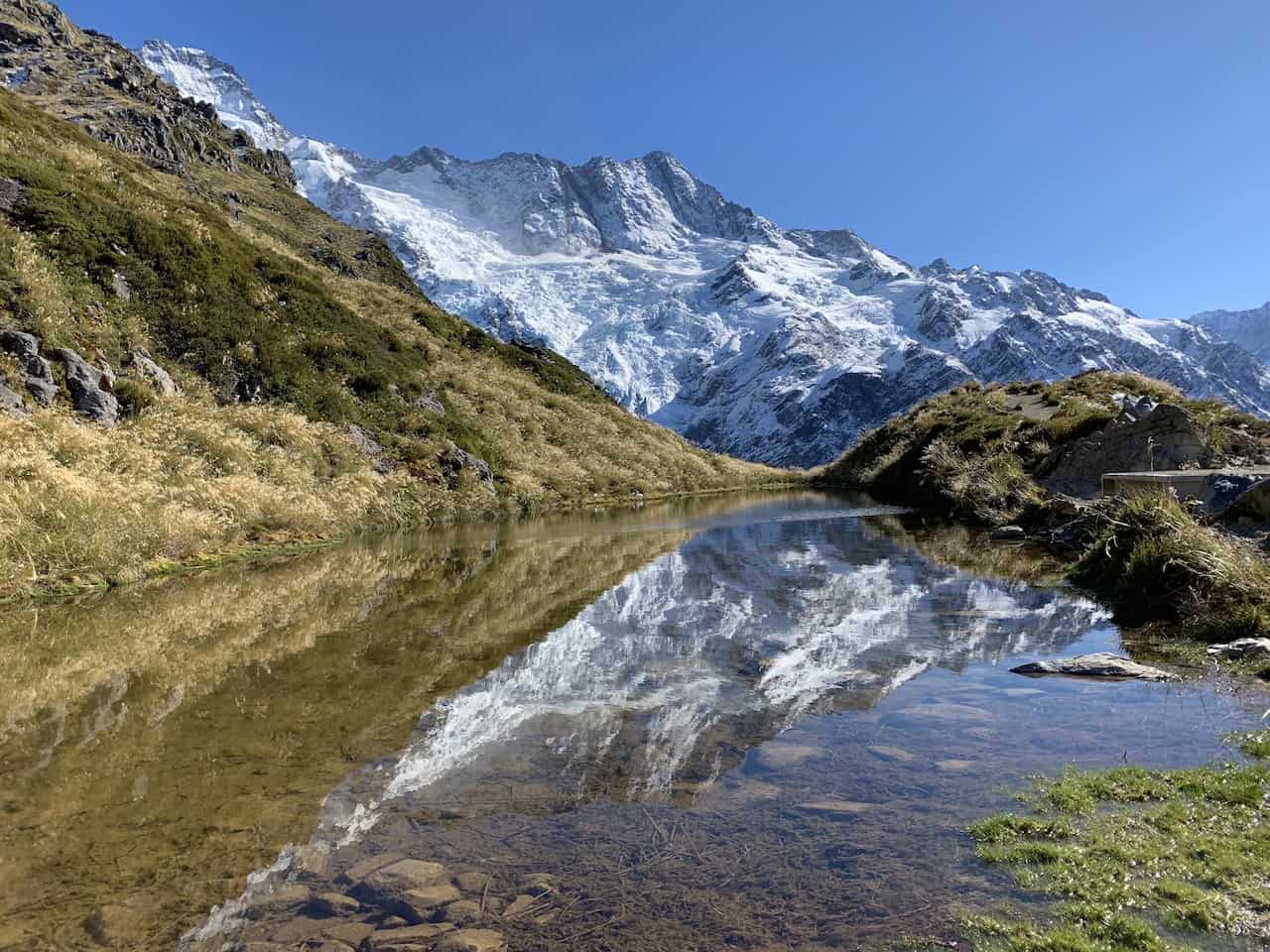
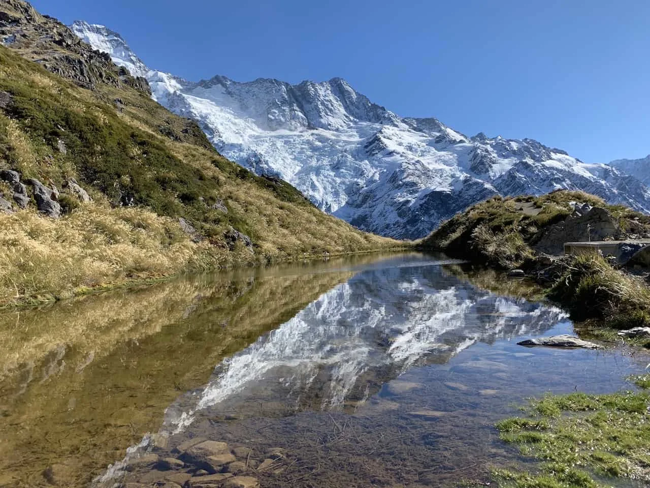
If you are looking to get some incredible views from above, the Sealy Tarns Track is for you.
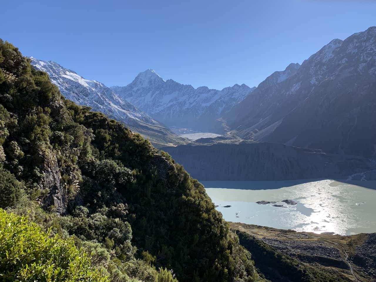
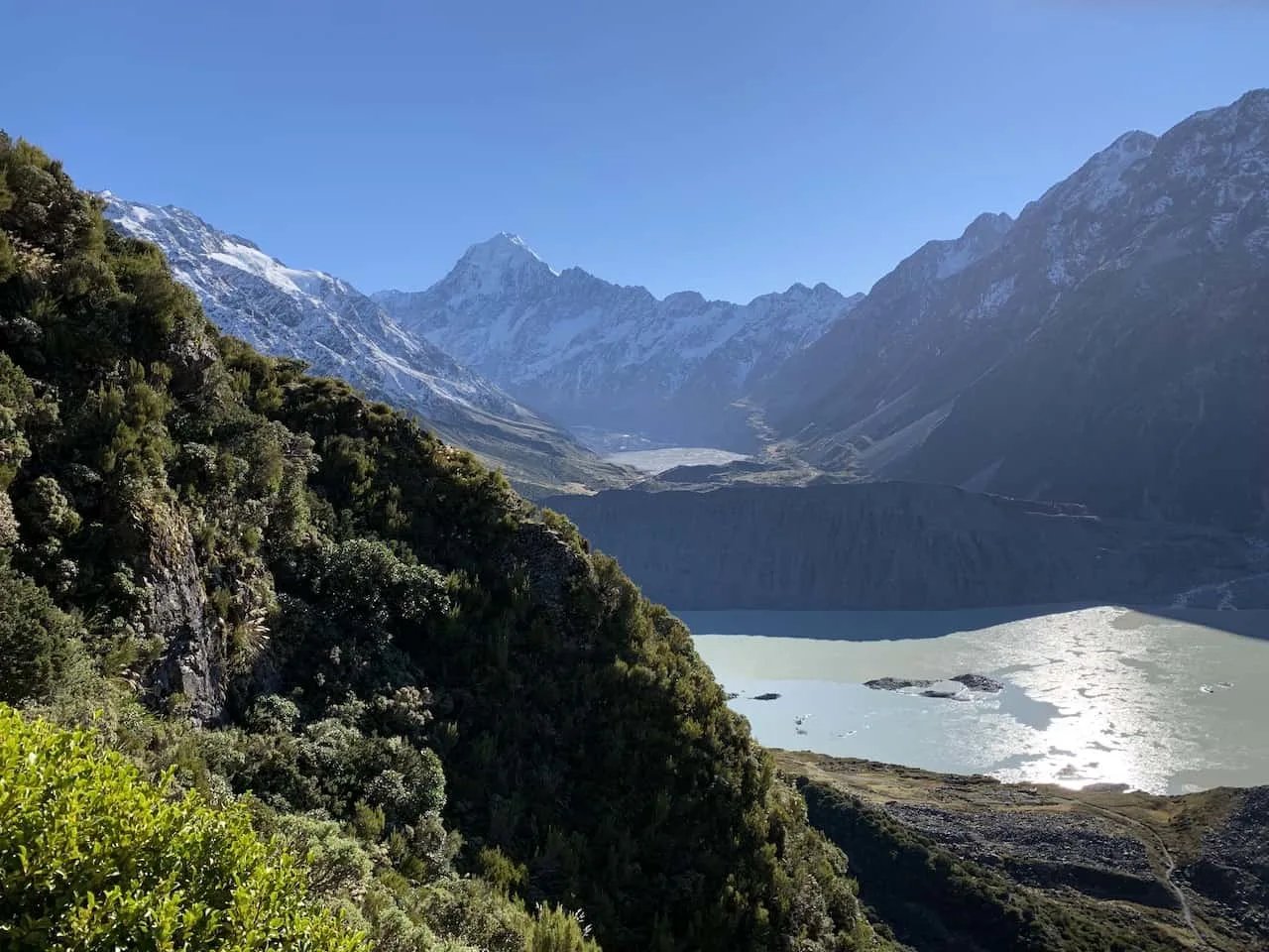
A 2,000+ step staircase takes you high above the valley with the Mueller Lake, Tasman Lake and Mt Cook all in view.
At the Sealy Tarns you will come across a beautiful mountain lake with some reflections of the snow capped peaks out in the distance.
» Learn More in the Sealy Tarns Track Hiking Guide
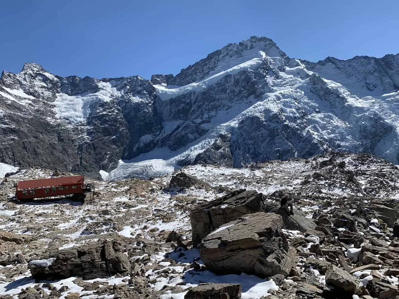
Mueller Hut Track
Length: 10.4 KM / 6.5 Miles
Time: 8 Hours
Difficulty: Difficult
Elevation Gain: 1,040 Meters / 3,412 Feet
Optional Overnight: Mueller Hut Booking
While the Sealy Tarns track takes you pretty high up, the Mueller Hut track takes you even further up.
The track is actually an extension of the Sealy Tarns track so if you want to continue taking in those vast views from a higher vantage point, continue the rocky path to the Mueller Hut.
Many people complete the hike in one day but you also have the option to complete it in 2 days with an overnight in the hut itself.
» Learn More in the Mueller Hut Track Hiking Guide

Blue Lakes and Tasman Glacier View Track
Length: 2.5 KM / 1.5 Miles
Time: 1 Hour
Difficulty: Easy
Elevation Gain: 100 Meters / 328 Feet
One of the hikes to take part of at the last trailhead of the Tasman Glacier car park takes you to the Blue Lakes and Tasman Glacier View.
During this 1 hour trail you will pass by 3 different lakes and have the chance to enjoy of the Tasman Glacier from above.
» Learn More in the Blue Lakes and Tasman Glacier View & Tasman Lake Track Hiking Guide

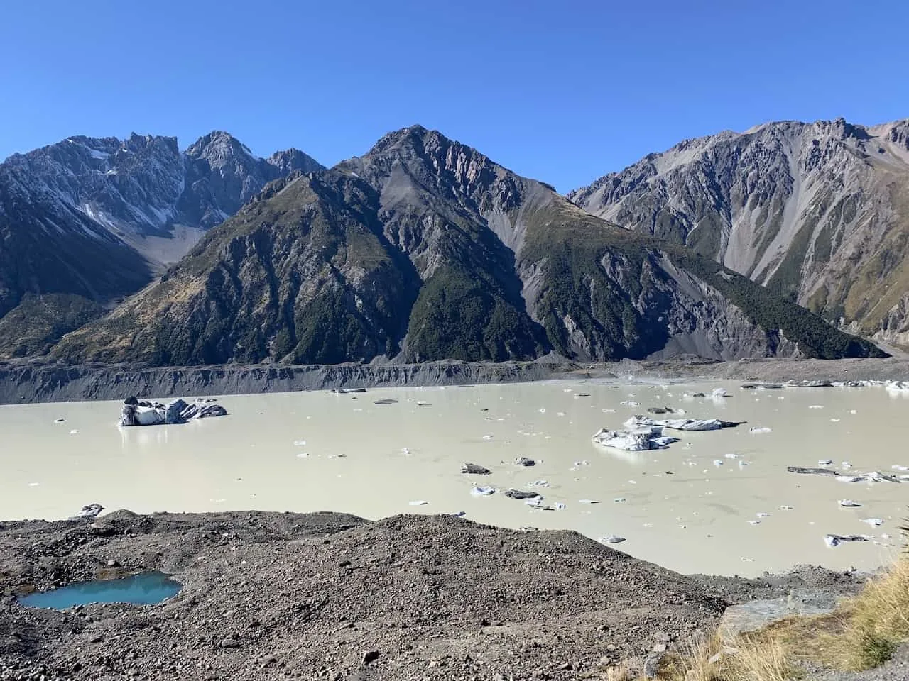
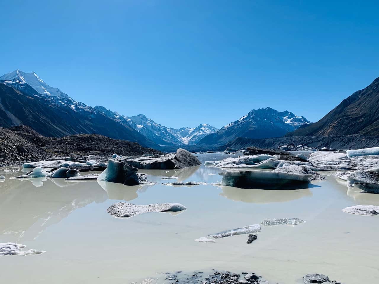
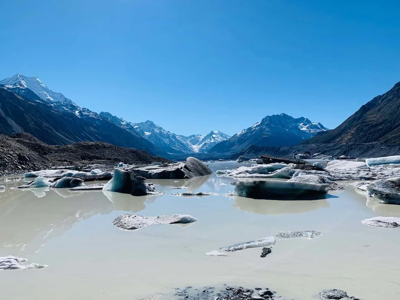
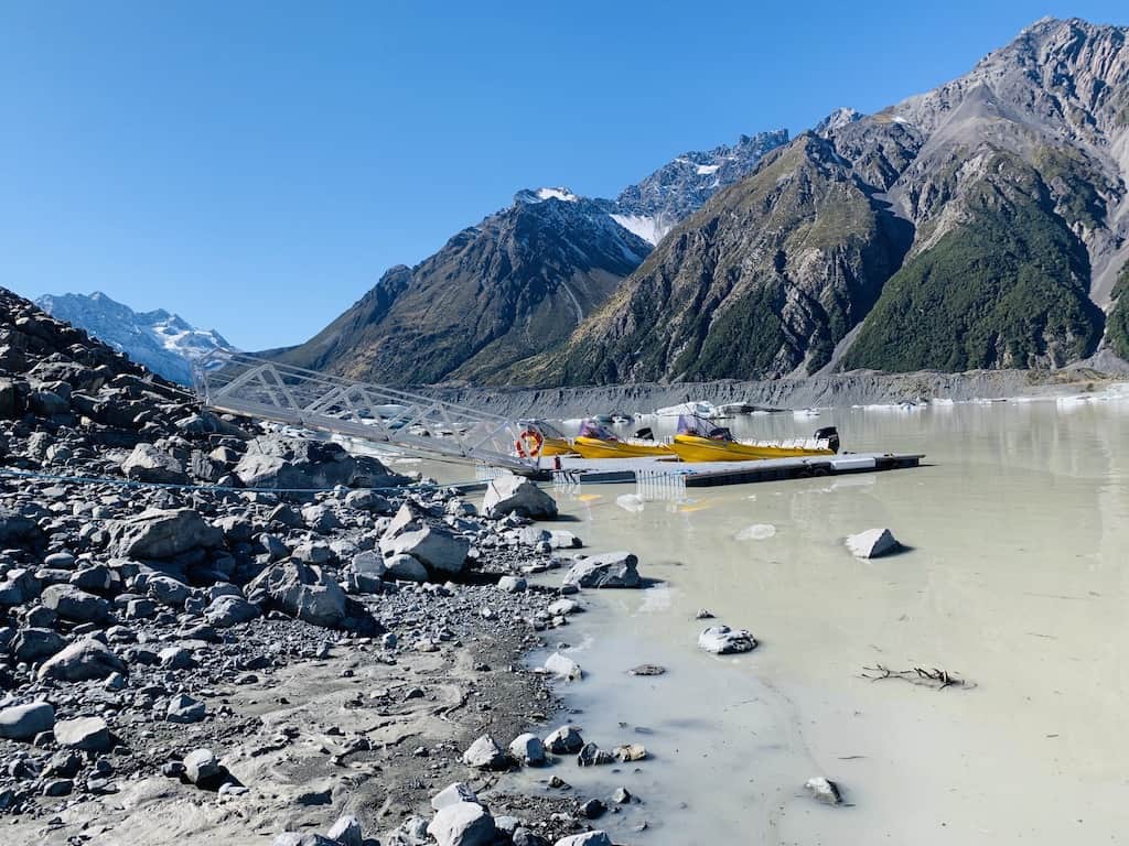
Tasman Lake Track
Length: 2.5 KM / 1.5 Miles
Time: 1 Hour
Difficulty: Easy
Elevation Gain: None
You can decide to do the Tasman Lake track as a standalone hike or add it onto the the previous hike.
This track will take you to the bottom point of the Tasman Lake as you see where the lake meets the river. You can get right up and close to the lake and see the floating icebergs from up close.
The hiking guide linked above also goes into detail about the Tasman Lake Track if you want to learn more.
Ball Hut Route
Length: 15.6 KM / 9.7 Miles
Time: 8 Hours
Difficulty: Difficult
Elevation Gain: 100 Meters / 328 Feet
The last track in Mount Cook National Park is the Ball Hut Route. It is a bit more of a challenging landscape to get to the Ball Hut but it does come with some beautiful views along the Tasman Lake and onto the Tasman Glacier.
6) Mount Cook National Park Activities
While hiking is one of the main things to do in the Mount Cook area, there are still plenty more activities to take part of during your time there. Some of the most popular options include:
1) Cycling – there are a several cycling trails that can take you along the valleys below the mountain ranges of Mount Cook. You can rent bikes in town once you arrive.
2) Glacier Boating – hop on a small boat and get up and close to the icebergs of Tasman Lake. You can learn a bit more about the Mount Cook area and enjoy some time out on the water.
3) Heli Glacier Hiking – if you want to actually hike on a glacier then this may be for you. A short helicopter ride will bring you onto the Tasman Glacier, where you can spend a few hours hiking throughout the incredible landscape.
4) Scenic Flights & Helicopter Rides – a flight above Mount Cook National Park will have you in awe as you take in the views from above. You will get to see the vast landscape of the national park from a bird’s eye view.

If staying for just a day or staying for a week, there are plenty of trails to keep you busy. I hope this Mt Cook hikes guide has given you a better sense of all the different hiking options that you have within Mount Cook National Park.
Feel free to check out the other New Zealand itineraries and guides up on the site and if you have any questions just write them in below.
Join in on these Mt Cook hikes as part of your New Zealand 14 Day South Island Itinerary or 3 Week New Zealand Road Trip!
Have fun out there and safe travels!