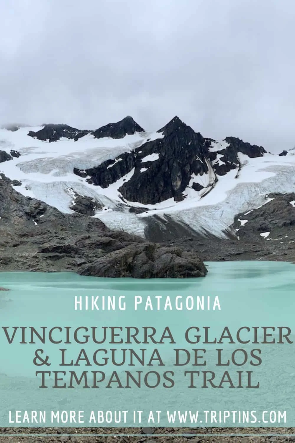
The Vinciguerra Glacier & Laguna de los Tempanos trail is one of the top hikes to take part of during a trip to Ushuaia. Located just a 15-minute drive from the town center is the trailhead of this beautiful hiking trail.
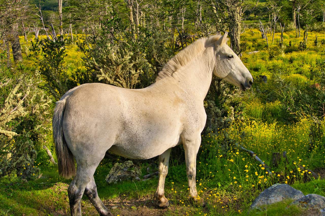
As you hike up to the glacier and lagoon you will be welcomed to a variety of scenery including rivers, forests, and mountains all along the way.
Read on to learn more about the Vinciguerra Glacier & Laguna de los Tempanos trail, and to get yourself prepared for a beautiful Patagonia hiking experience.
* Affiliate Disclosure: This post may contain affiliate links, which means I may receive a commission if you make a purchase through the links provided, at no additional cost to you. Thanks for supporting the work I put into TripTins!
1) Vinciguerra Glacier & Laguna de los Tempanos Details
Below are some helpful facts regarding the trail up to the Vinciguerra Glacier & Laguna de los Tempanos.
- Hike Name: Vinciguerra Glacier & Laguna de los Tempanos
- Trailhead GPS Coordinates: -54.764343, -68.301304
- Round Trip Distance: 11.5 km / 7.2 miles
- Elevation Gain: +650 meters / +2,132 feet
- Hiking Duration: 4-6 hours
The hike out to the Vinciguerra Glacier & Laguna de los Tempanos is going to be an out and back route.
From the starting point, you will head along the trail towards the glacier and lagoon. Once you reach the endpoint, you can decide to spend additional time walking around the lagoon and glacier before turning back towards the starting point of the hike.
During my time on the trail I spent closer to 6 hours on the hike as I did want to enjoy the lagoon and glacier for an extended period of time. If you don’t care to spend too much time there, your hiking time may be closer to 4-5 hours.

Learn More: Take a look at this Ushuaia itinerary to get a better idea on how to put together a comprehensive trip to the region.
2) Getting to the Starting Point
The starting point of the hike is located on the outskirts of the town center, around 7 km / 4.3 miles from Ushuaia. The most realistic way to get there is going to be by car or taxi.
Rental Car
If you have your own car, then you will have the flexibility to be on your own schedule and make your way there and back without any worries. You simply will need to put the GPS coordinates of the starting point into your navigation: -54.764343, -68.301304.
Renting a Car? When searching for rental cars, feel free to check out Rentalcars.com for potential options.
Taxi
On the other hand, if you do not have your own car, then you will want to grab a taxi from the Ushuaia town center.
You can either get one on your own or more simply just have your hotel call one for you. Plan to spend the equivalent of $10 USD to get to the trailhead from town (plus another $10 to get back).
If you are taking a taxi, you will need to plan the return journey as well since taxis aren’t just hanging out by the trailhead. Just let the taxi driver who dropped you off, know what time for them to return.
Here is where you may want to give yourself a bit more time. I told the taxi driver to come 6 hours later (dropped off at 8:00AM and returned at 2:00PM). This gave me plenty of time to hike the trail and spend some time all around the glacier and lake.
3) Packing List
You must come prepared with the appropriate packing list when going about hiking in Patagonia. Layers, rain jackets, good hiking shoes are just some of the essentials.
The weather can consistently change and so can the terrain. You will want to prepare yourself for all situations, so I would recommend you take a look at the day hike packing list I put together for the trails.
There are certain parts of Patagonia trails that can get very soggy and muddy, so having appropriate footwear and socks is a must.
Hiking Resources & Checklist
Before heading out for the trails, be sure to read up on some of the hiking resources up on the site. These are here to better prepare you for all types of outdoor adventure.
- Gear: Hiking Packing List
- Weather: How to Prepare for Hiking Weather
- Navigation: Hiking GPS & Navigation
- Tips: 20+ Hiking Tips & Tricks for the Trail
- Accommodation: Book Your Hotel Today
- Rental Car: Book Your Car Rental Today
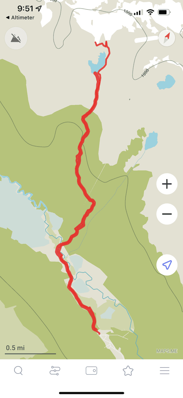
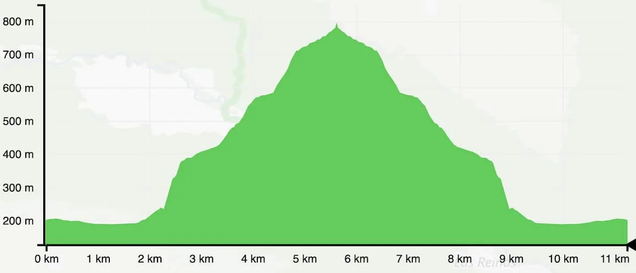
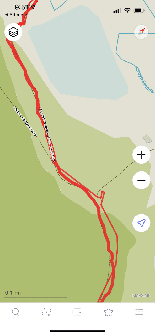
4) Hiking Map & Elevation Gain Profile
Below you can find both a screenshot of the trail map and the elevation gain profile of the hike. You can see the first portion of trail is going to more open as you hike alongside the river.
But soon you will cross the bridge over the river, up through the forest, and then further towards the lake and glacier. It is mostly all an uphill climb besides for the hike alongside the river.


5) Vinciguerra Glacier & Laguna de los Tempanos Trail
Let’s now get into what to expect out on the trail itself with some photos along the way. Once you have made it from Ushuaia to the trailhead, it is time to begin the hike.
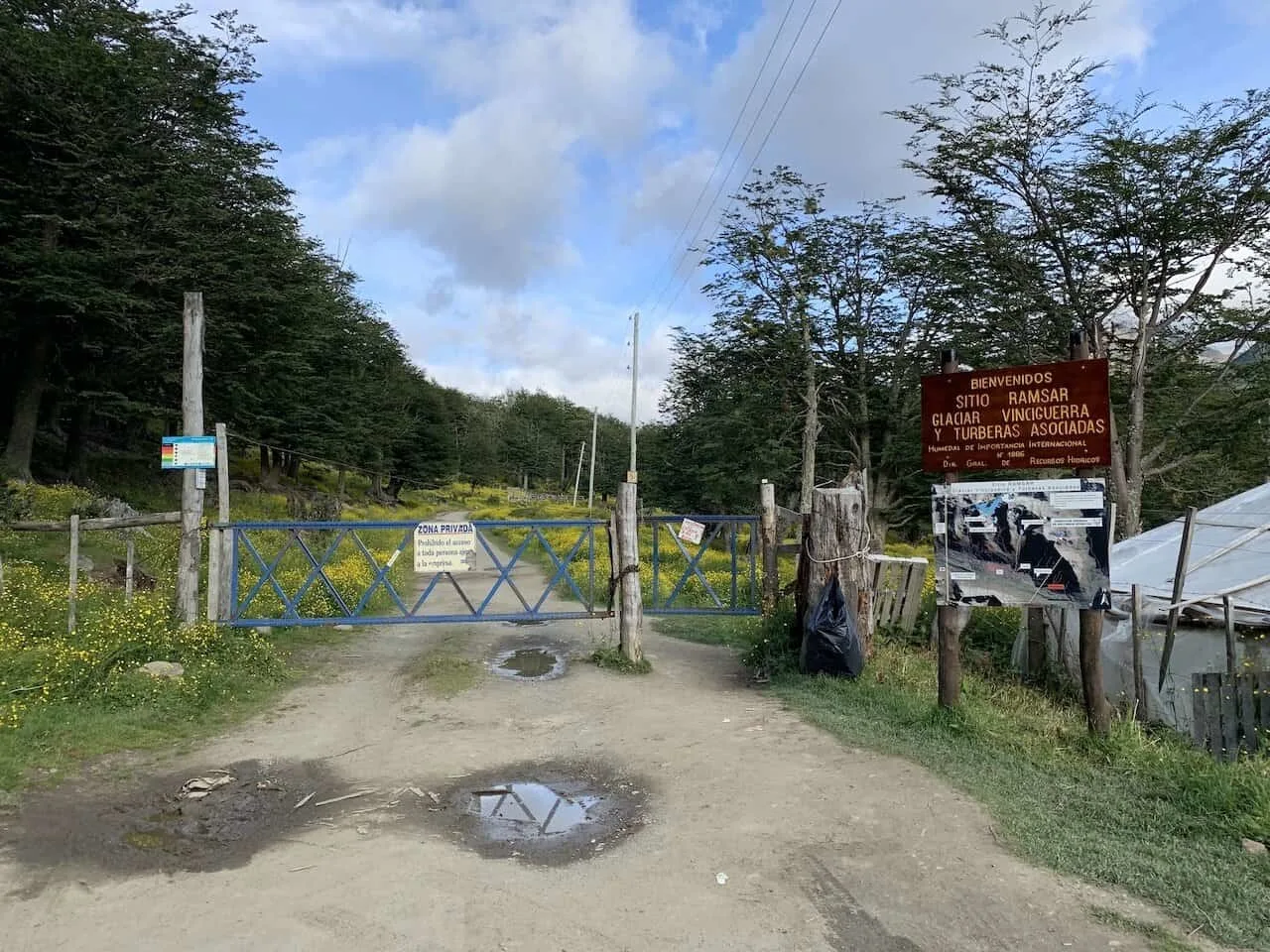
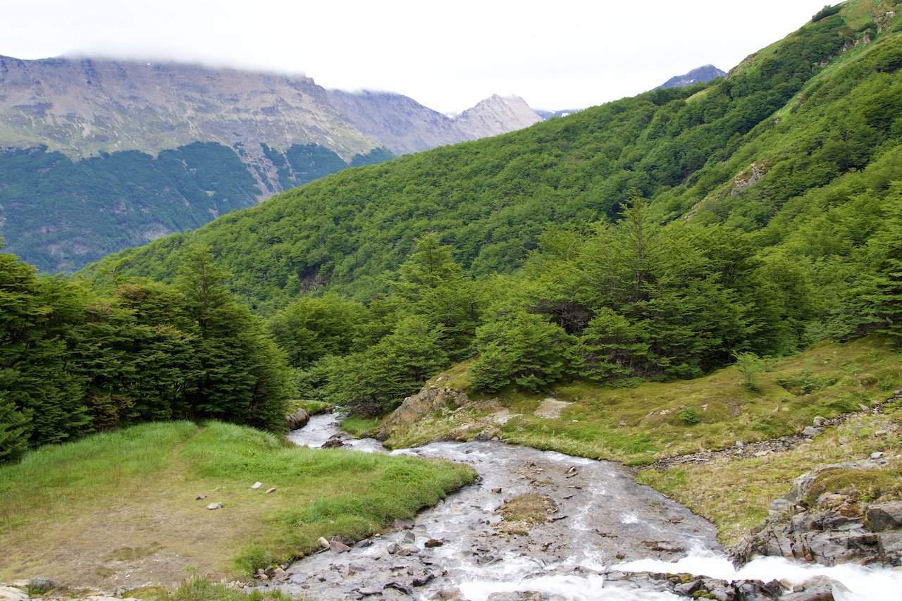
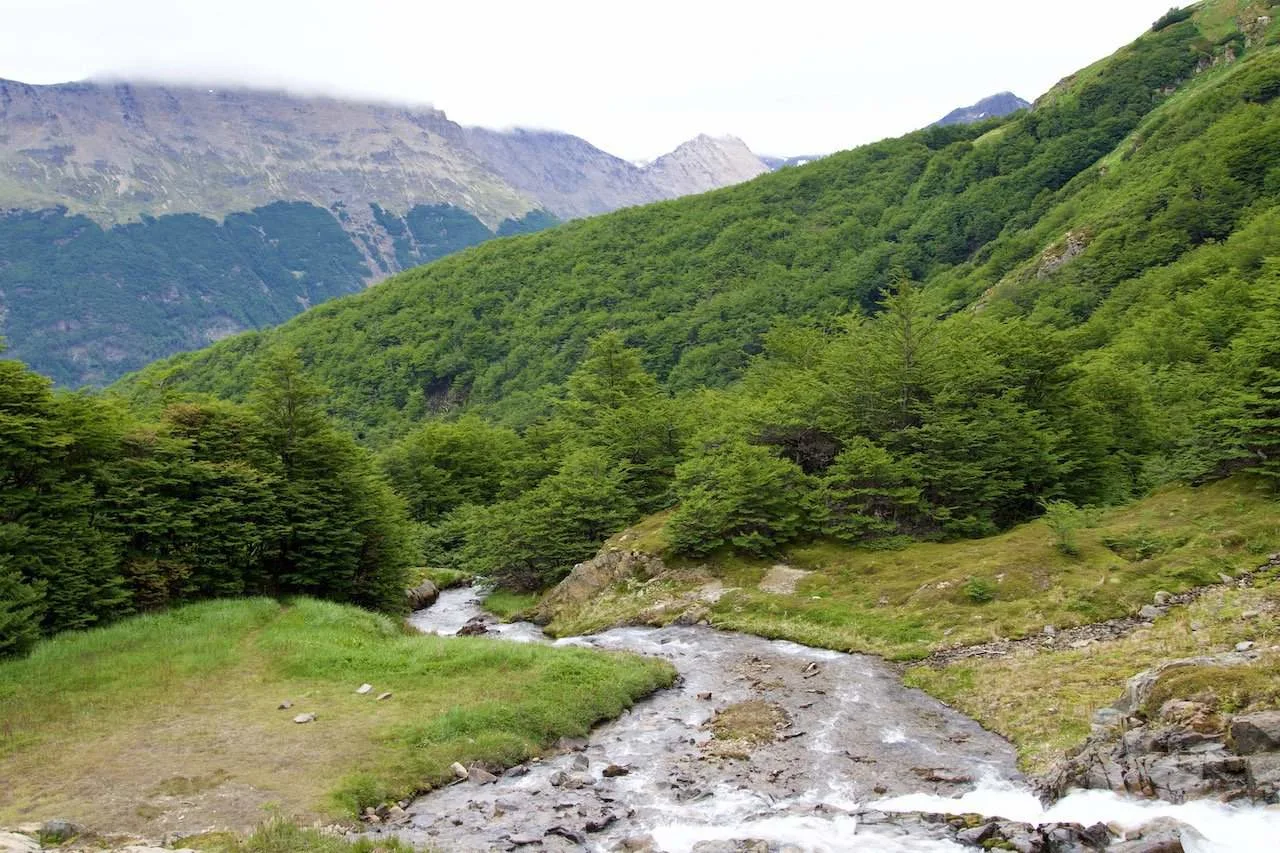
Trailhead to Bridge
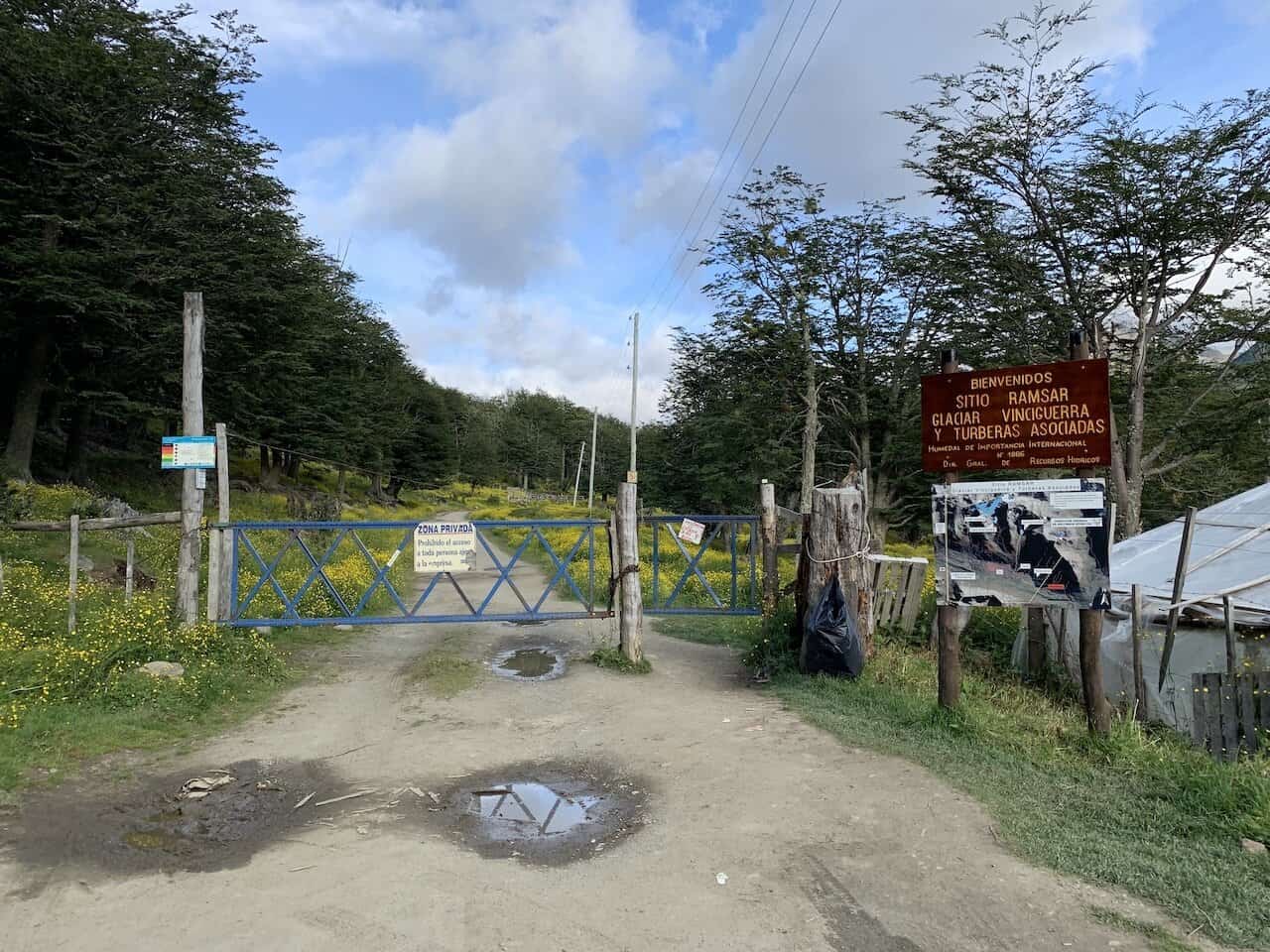
At the trailhead, you will be welcomed to a closed gate alongside the official hiking map. Simply open up the gate and make your way along to the other side (but be sure to close it too!).
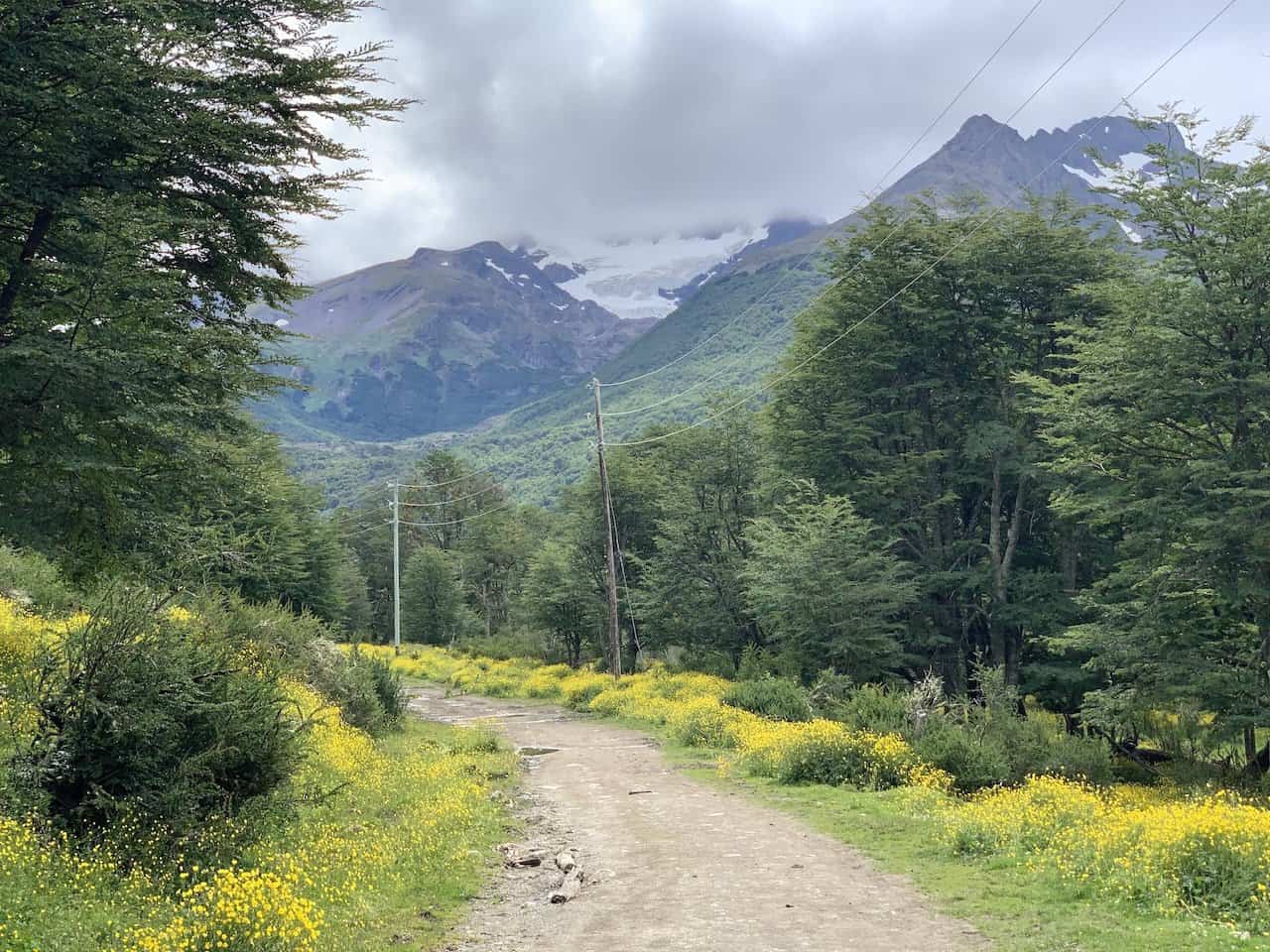
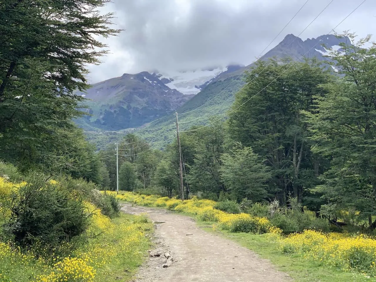
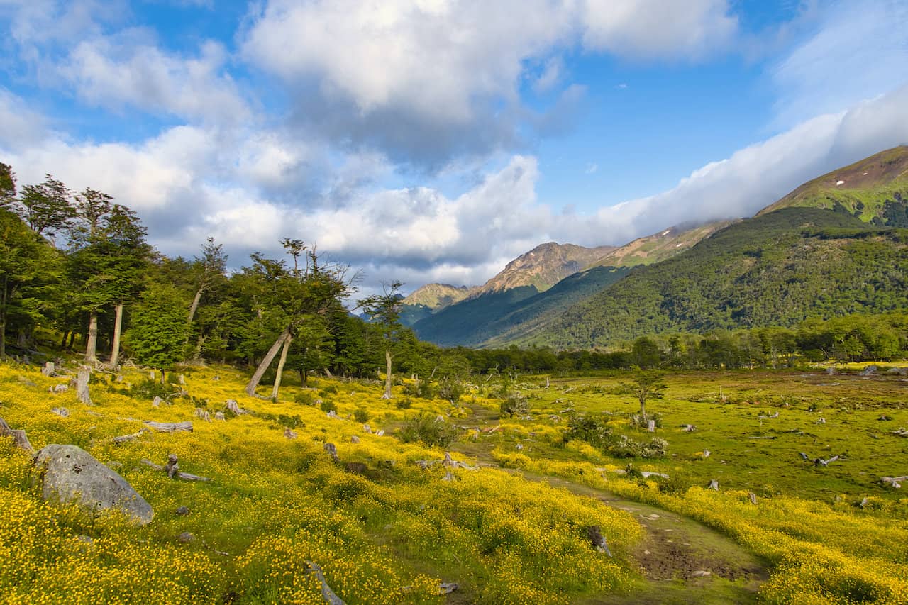
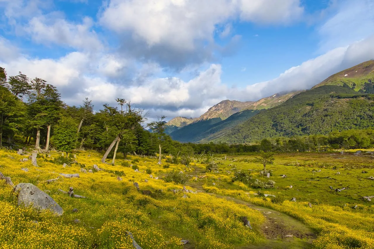
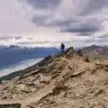
The start of the hike has some pretty amazing landscape and was one of my favorite sections of trail.
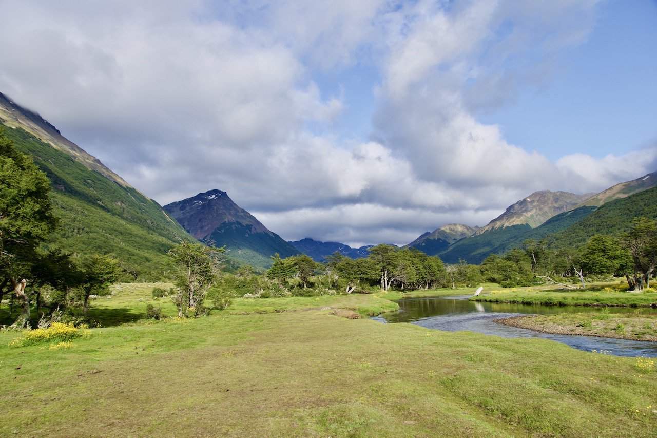
The route makes it way through fields of yellow flowers and a green meadow as you get glimpses of the mountains further out in the distance.
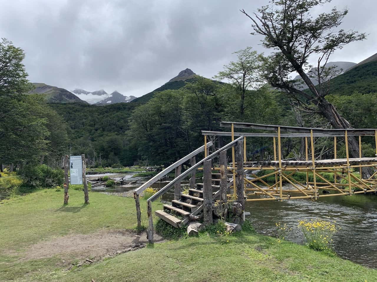
The trail will then make its way just alongside the flowing river as you enjoy the peaceful water with the surrounding nature. After about 1.8 km / 1.1 miles, the route heads over a bridge onto the other side of the river.


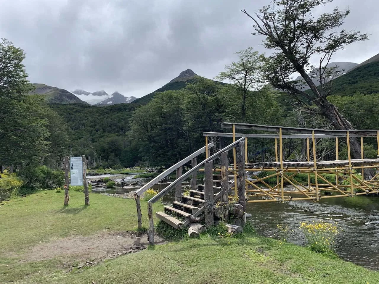
Note: during this first portion of trail, you will come across two intersections that happen one right after another. These are marked with trail markers and signs, so this should not be an issue if you are paying attention to the trail.
You can see the two alternate routes on the map below. Having a navigation app handy (like Maps.me or AllTrails), will keep you in line as you make your way along the trail.


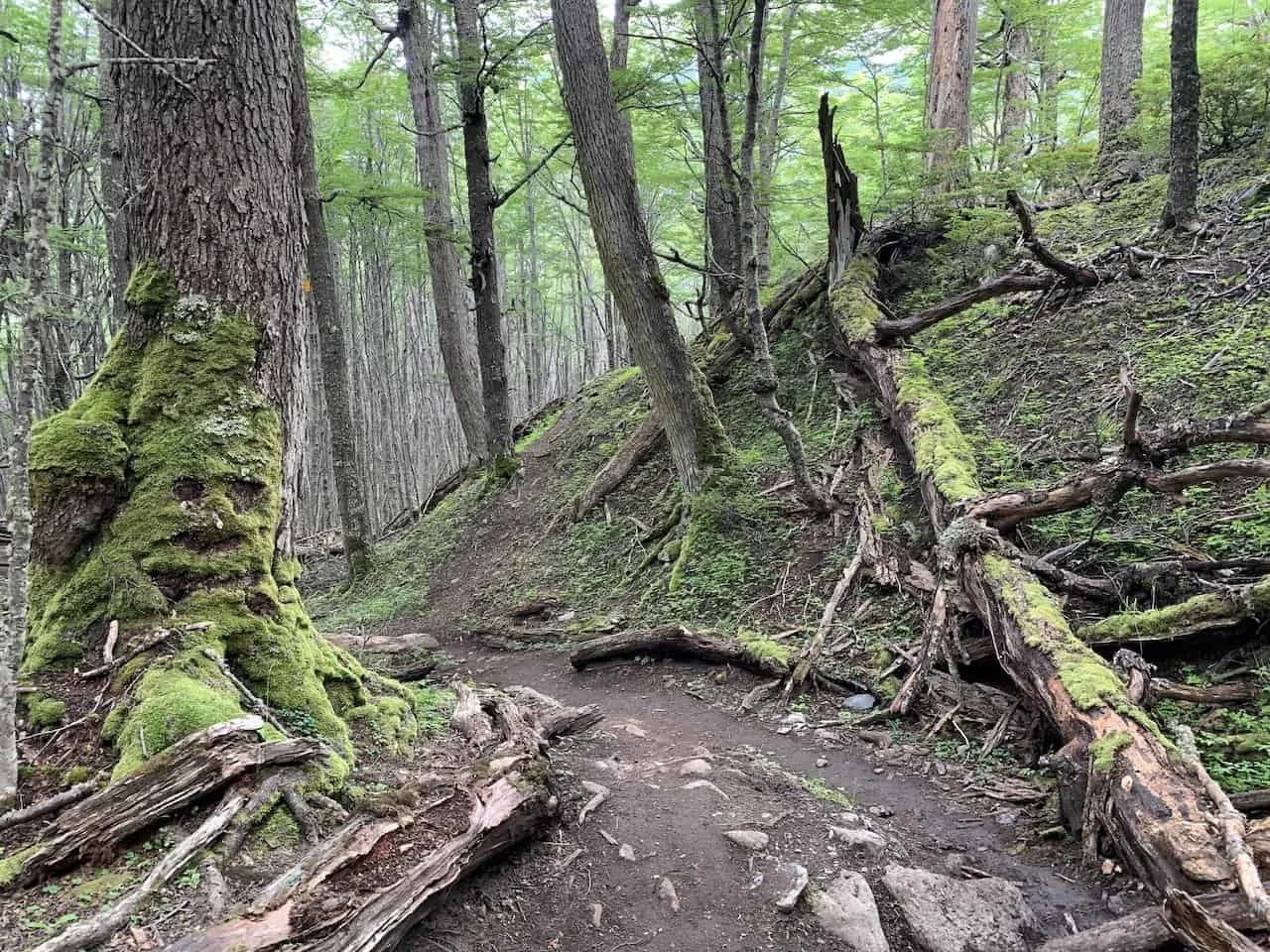
Through the Forest
By now, there really hasn’t been much elevation gain. But once you cross the bridge and into the forest, the elevation begins.
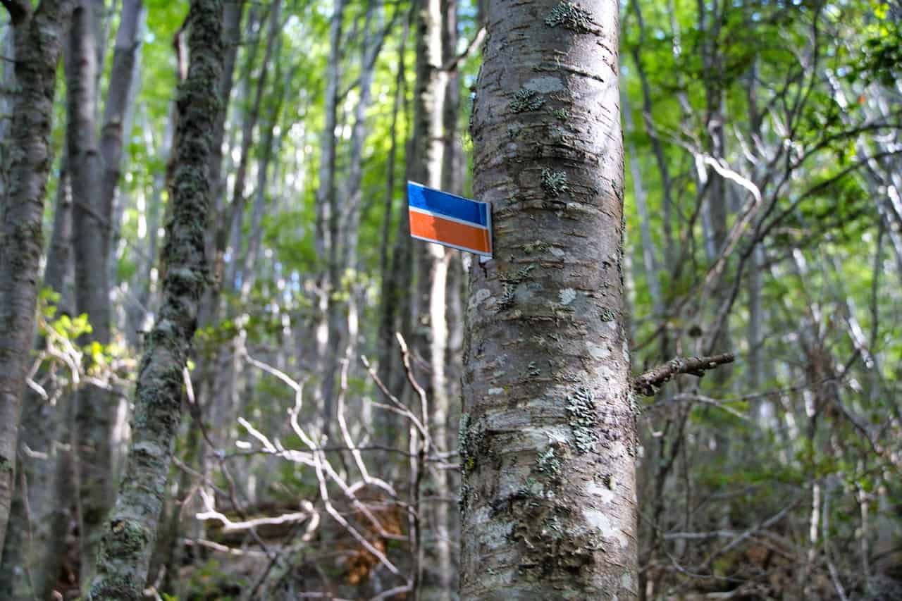
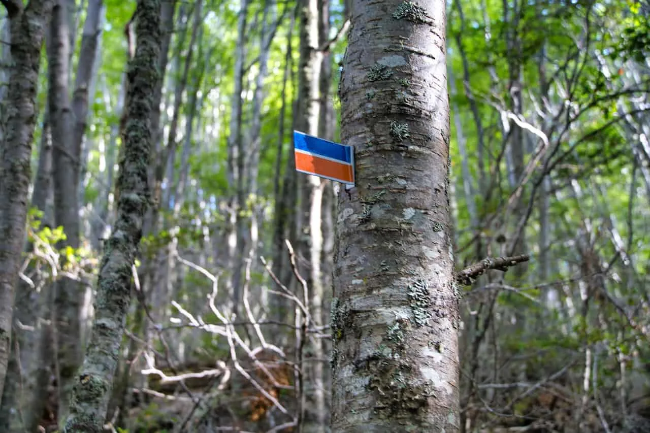
For the next 2.7 km / 1.7 miles, the trail heads up through the forest as you continuously gain elevation along the way. Throughout this portion of trail you will find orange and blue trail markers on the trees.
Be sure to always eye your next trail marker as you continue on up. While the path is mostly obvious here, there were a few times where you may question your route. As long as you see that next trail marker out in front, you should be good to go.
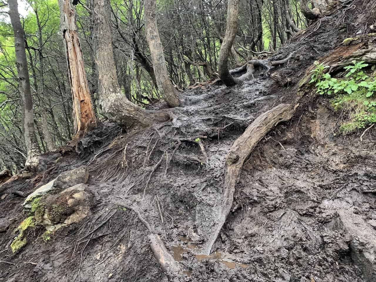
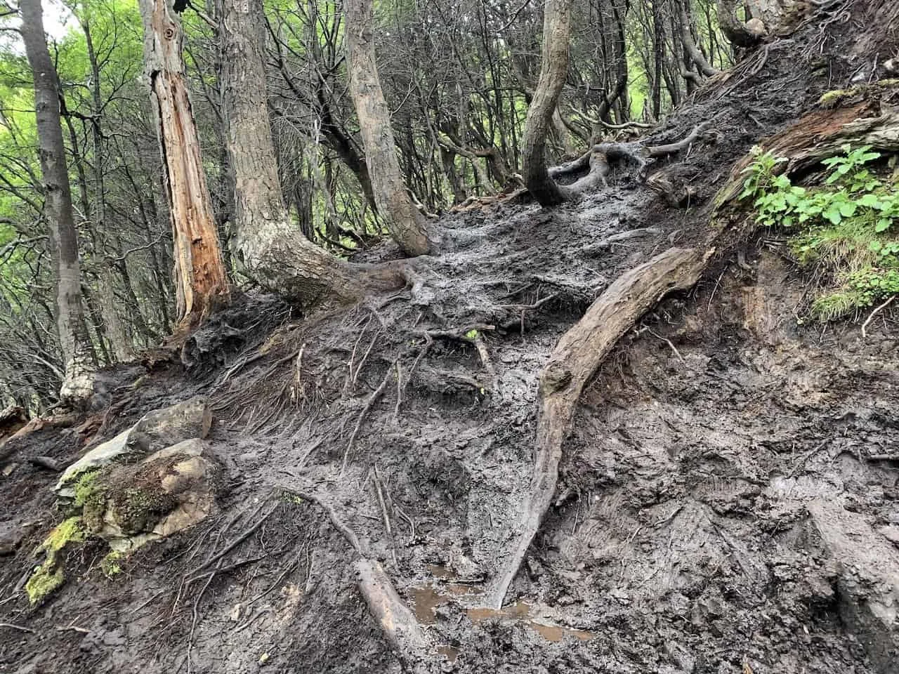
The route up through the forest will be muddy and can have some more annoying terrain to walk through at times. So, be sure to come prepared with that appropriate gear!

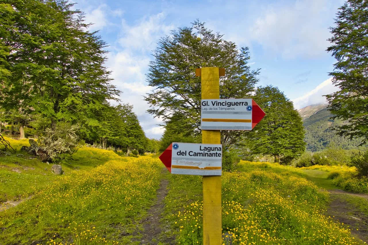
Also, in the forest you will come across an intersection. One route points towards Laguna Encantada and the other to Vinciguerra Glacier & Laguna de los Tempanos.
Follow the signs and trail to the left to keep on track. Note that you can add on Laguna Encantada on the way back (or on the way up), if you want to take part of a longer overall hike.
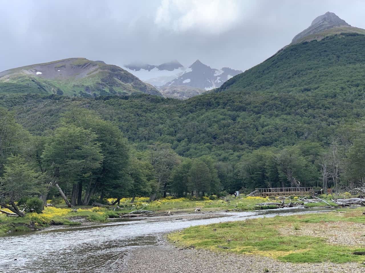
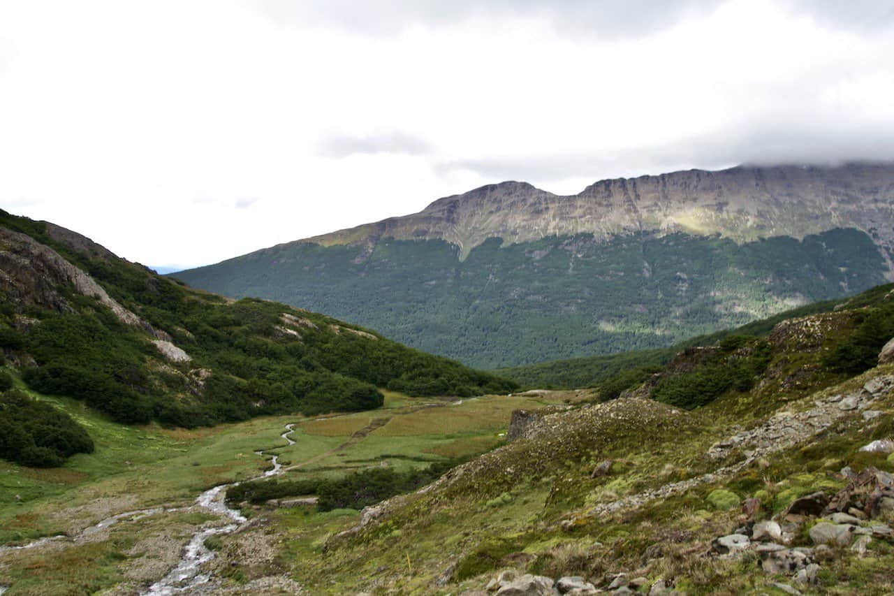
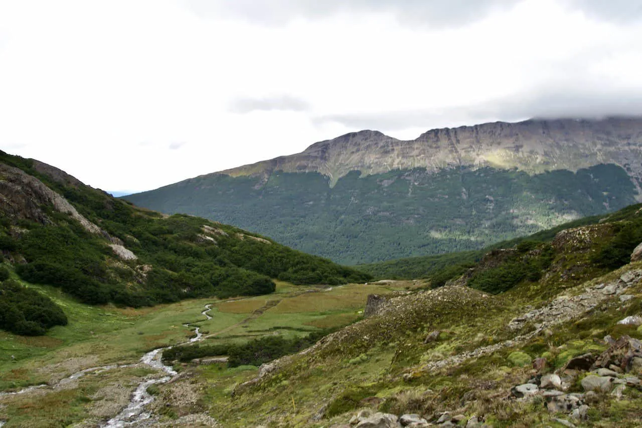
After continuing the hike up through the forest, you will soon reach a clearing and be welcomed to another river.
Final Push
The last portion of trail may only be around 0.6 km / 0.4 miles, but it is the steepest section of trail. As the forest opens up, you will hike alongside the stream and then up the hillside wall. The first portion of this section will be pretty muddy and soggy so do watch your step.
While this may be the steepest part of the climb, is it also one of the most beautiful parts. Be sure to turn around from time to time to enjoy the stream flowing down the mountainside, with the forest down below and mountains out in the distance.
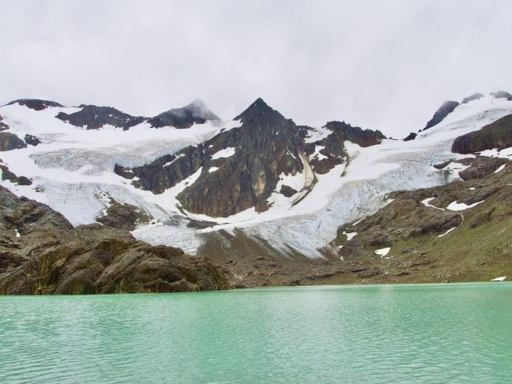
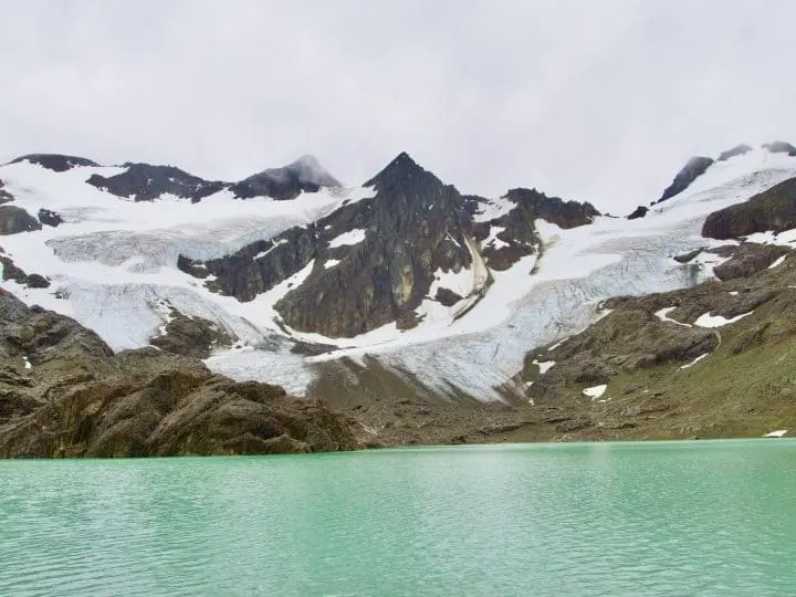
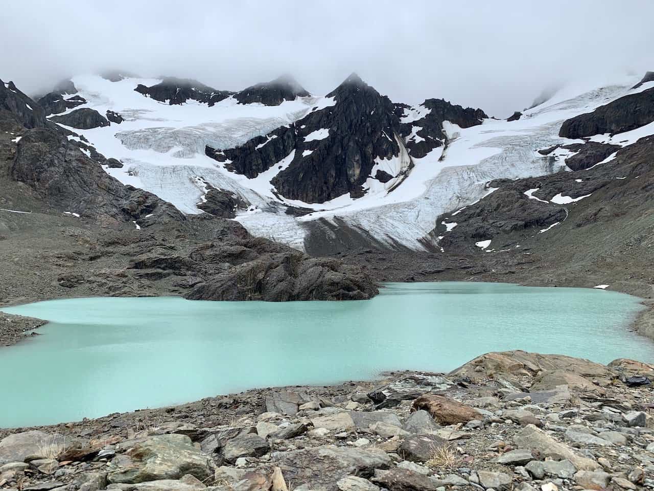
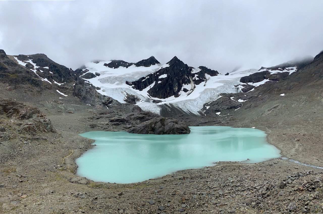
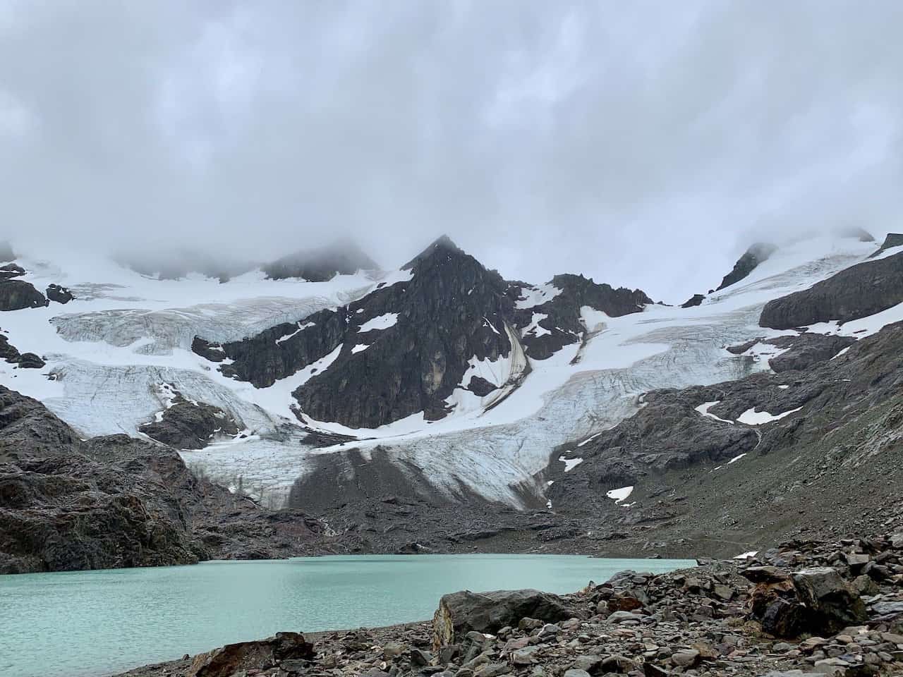
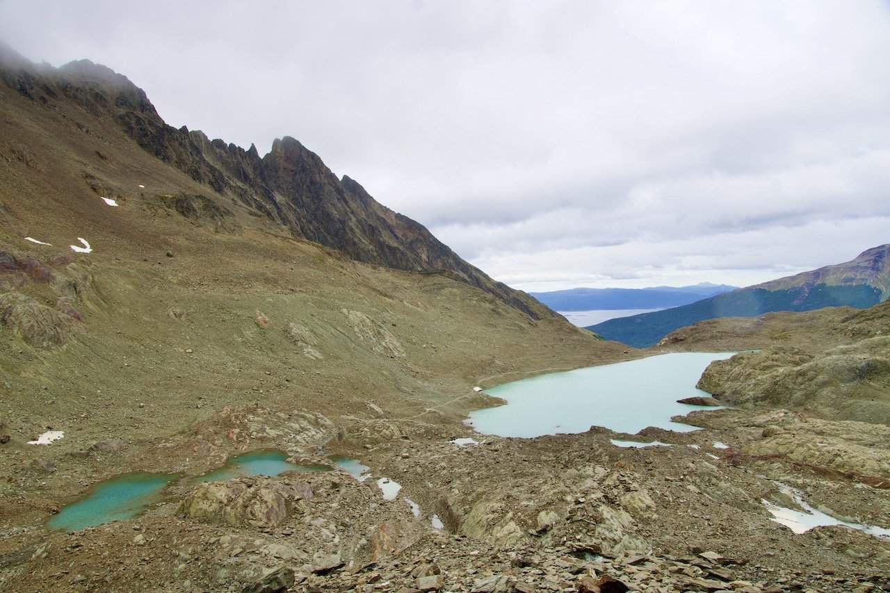
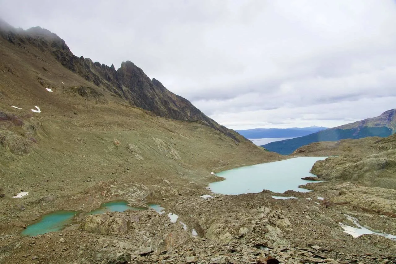
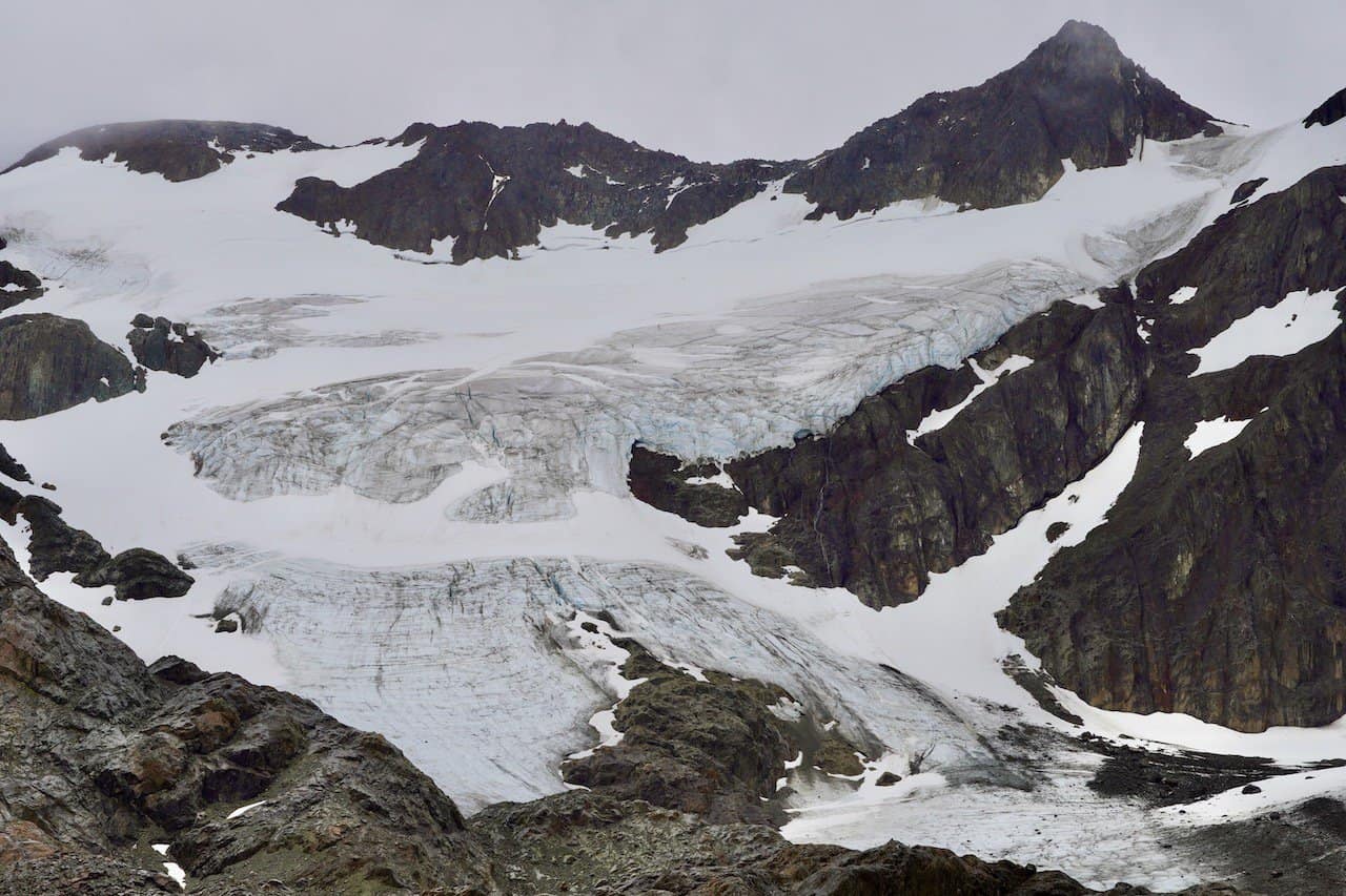
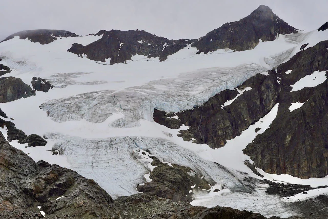
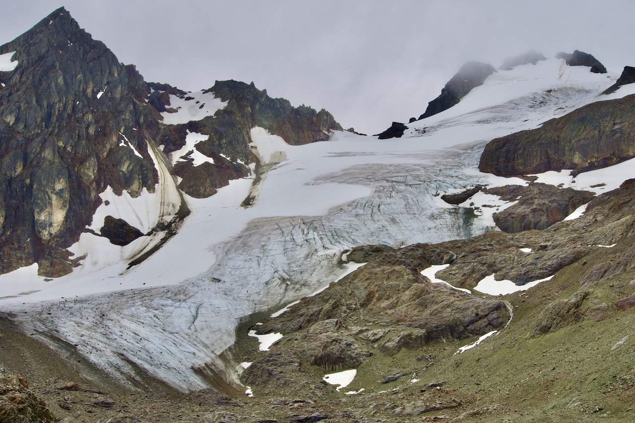
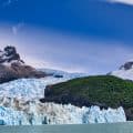
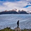
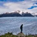
Soon enough, the climb will come to an end, and you will reach the base of Laguna de los Tempanos with the Vinciguerra Glacier out back.


Vinciguerra Glacier & Laguna de los Tempanos
Once you have reached the lagoon and glacier, it is up to you what to do next.
You can decide to just enjoy the views from the shore, or you can head along the right hand side of the lagoon up to the glacier itself.
If you are up for it, I would first recommend heading up the small hill located at the base of the the lagoon. From this elevated terrain, you will get some stunning views of the lagoon down below and the glacier in the background.
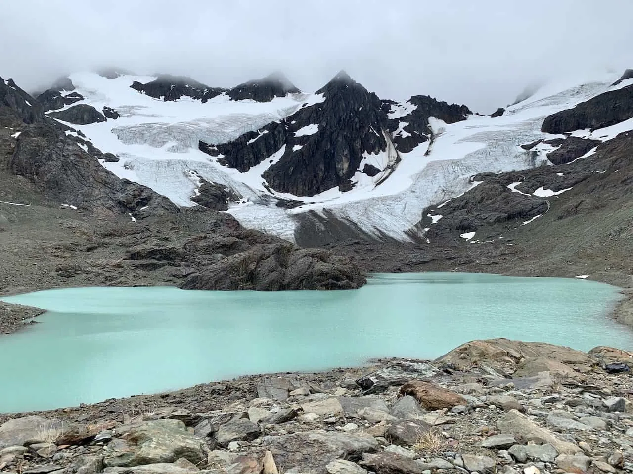

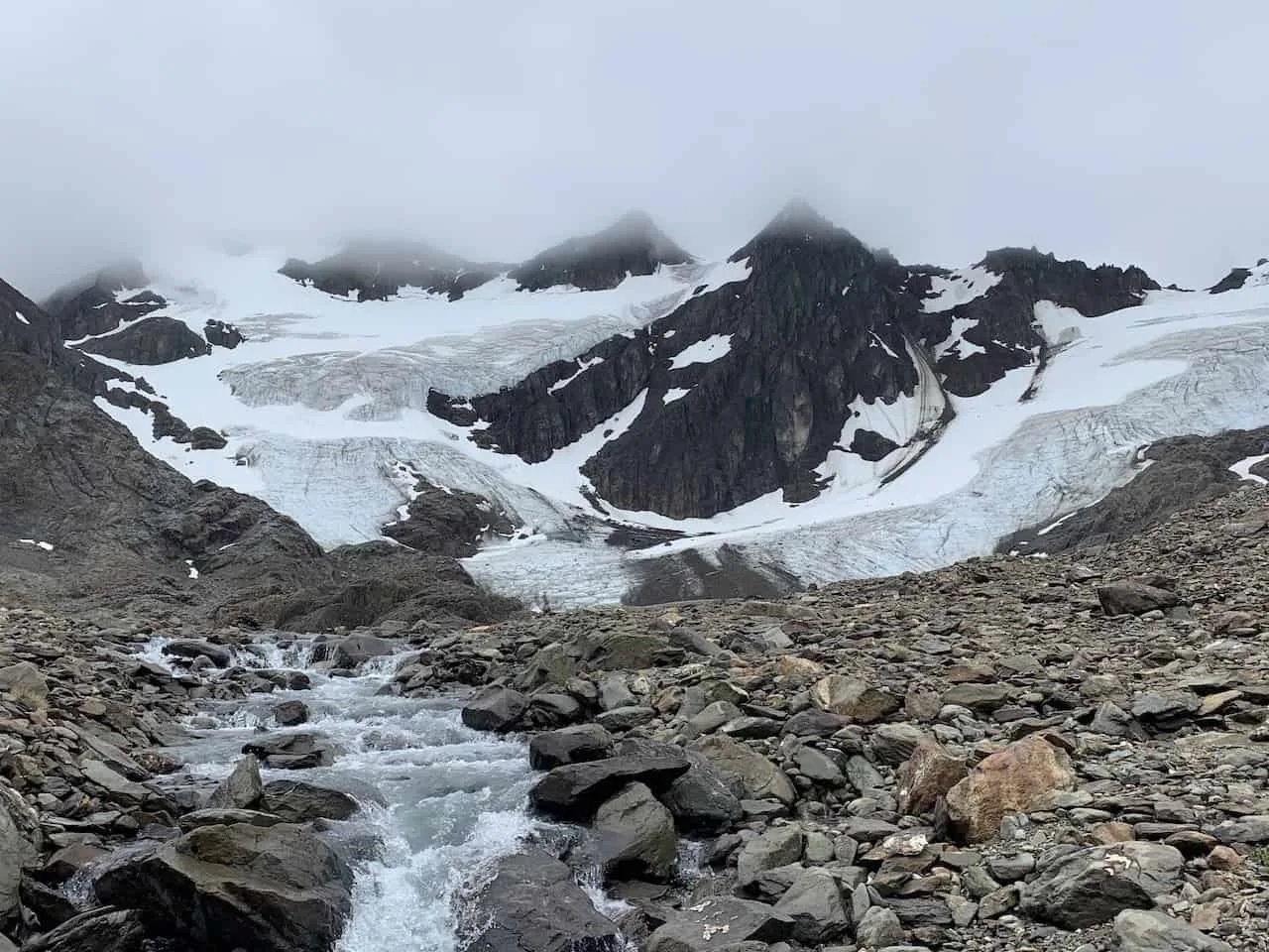
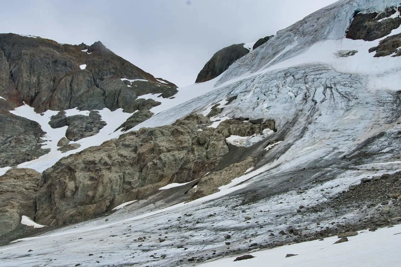
From there, continue on the trail on the right hand side of the lagoon. You will find yourself walking along some rockier and trickier terrain as you get closer to the glacier itself. Be very careful here!
The walk towards the glacier will have you seeing little ice caves, small glacier ponds, and more views of the surrounding area.

You will soon then reach the base of the white glacier ice. I would not recommend heading onto the ice as it can be dangerous. Simply enjoy the view from a close proximity before heading on back to the lagoon.
Once you have had enough time around the glacier and lagoon, it is time to head all the way back to the trailhead. Be sure to understand your timing here if you agreed to get picked up at a certain time!

The trail back will be a lot of elevation loss down to the tree line, through the forest, and back towards the river. Watch your step as you make your way down as the terrain is not the easiest to rush through (as you will find out on the way up).
From the trailhead, it is back to Ushuaia to end a successful day out on the trail. Rest up and get ready for your next adventure in Patagonia!
Learn More: Read up on some more of the top Ushuaia trekking options for your time around the area
6) Where to Stay in Ushuaia
Ushuaia is essentially the only place you are going to want to base yourself in as you explore Vinciguerra Glacier & Laguna de los Tempanos and the surrounding areas like Tierra del Fuego National Park. Below are just a few of my top recommendations when it comes to where to stay in the city.
These are all highly reviewed and recommended options so you really can’t go wrong with any of them.
Just note that during the high season (December- February), accommodation can get booked up. So, once you know your dates, you should book your hotels.
Hotel Tierra del Fuego: for a hotel located directly in the town center, Hotel Tierra del Fuego is a great option. Views of the town, mountains, and water will be right outside your window, and you will be minutes away from the action.
MIL810 Ushuaia Hotel: another centrally located hotel that is a great mid tier option is the MIL810 Hotel. It is a short walk from all the top spots in town to & offers everything you need from an accommodation standpoint.
Los Acebos Ushuaia Hotel: perched up above the town center, Los Acebos is a luxury option that offers guests some of the best views of the Beagle Channel. It is the perfect hotel for those that want a little more style & class.
Arakur Ushuaia Resort & Spa: if you are looking for the top option in Ushuaia, then the Arakur Resort & Spa is for you. While it is on the expensive side, there are few hotels that can compete with its luxurious offerings.


That wraps up a guide to the Vinciguerra Glacier & Laguna de los Tempanos trail. If you have any questions or comments, be sure to add them in below. Also, don’t forget to check out some of the other Patagonia itineraries and guides up on the site.
Have fun out there and safe travels!


Annet
Sunday 20th of August 2023
It would be much more helpful to put the GPX file here to download instead of referring to apps for it.
Nicolas
Sunday 21st of May 2023
How cold/doable is this trail in fall by the end of april?
Thanks for this great post btw!
Charles
Sunday 21st of May 2023
Hi Nicolas - you should expect temperatures around that time to be around 35F - 50F. From my knowledge, the trail is still doable - it may just be colder and there is a higher risk of rain or even snow. Enjoy the trip
Sophie
Wednesday 30th of November 2022
Can you do this hike unguided without a tour? (in summer)
Charles
Friday 2nd of December 2022
Hi Sophie - yes! Most people who do this trail do it without a tour. You just would need to get yourself to the starting point (by taxi or by rental car). Enjoy!