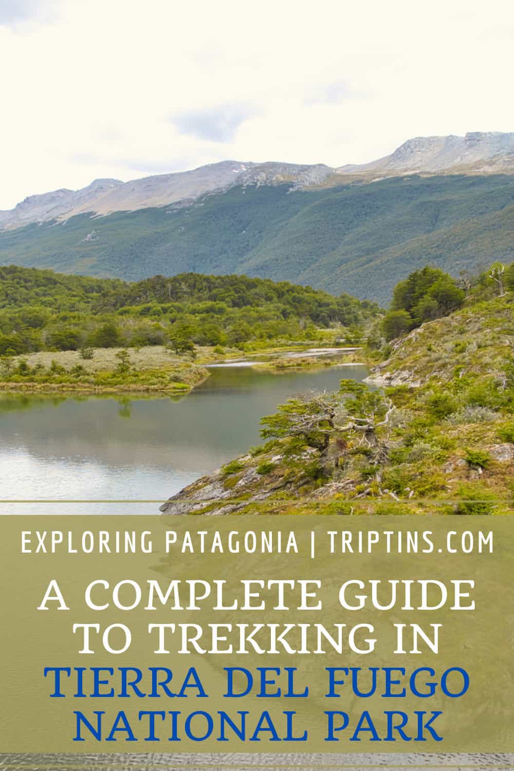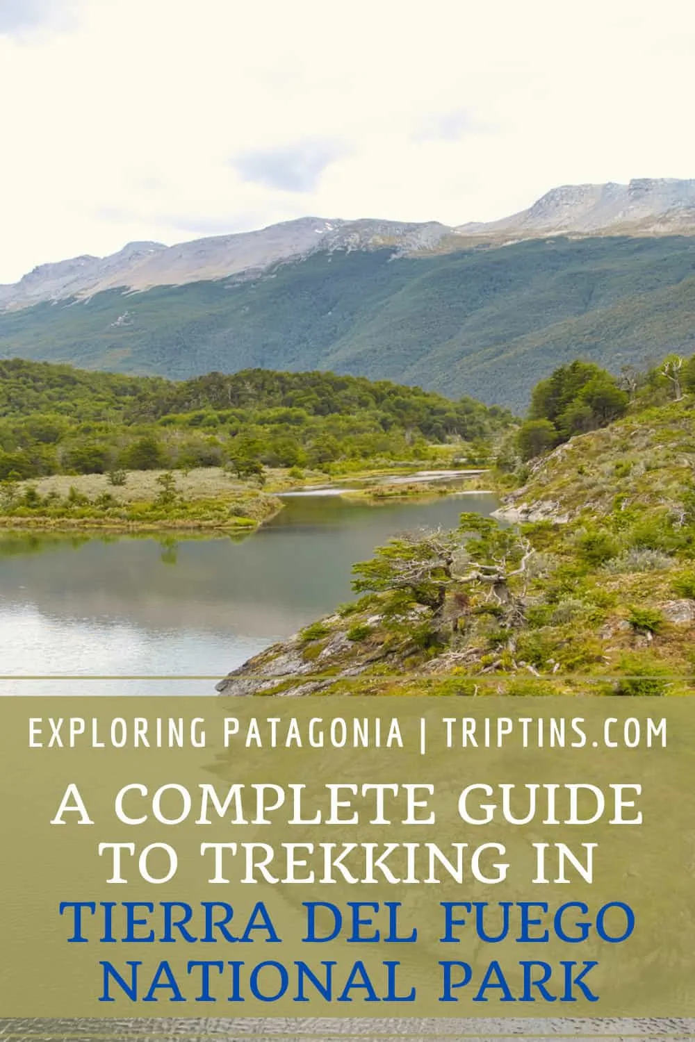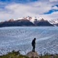
Patagonia is full of stunning landscapes and hiking trails to explore. One of the top places to take part of some hikes is in Tierra del Fuego National Park.
Tierra del Fuego, also known as the End of the World, offers a great variety of trails to enjoy. Whether it is hiking alongside lakes or heading up mountains, Tierra del Fuego trekking offers a little bit of everything.
This guide will talk through all the various hiking and trekking trails to take part of during a visit to Tierra del Fuego National Park. By the end of reading through, you should be all prepared to explore Tierra del Fuego for yourself!
* Affiliate Disclosure: This post may contain affiliate links, which means I may receive a commission if you make a purchase through the links provided, at no additional cost to you. Thanks for supporting the work I put into TripTins!
1) Background & Helpful Info
The Tierra del Fuego National Park is one of the top highlights when visiting the Patagonian town of Ushuaia. The National Park entrance is located just around 10 km / 6 miles from the town center, making it super easy to take part of a visit during your time in the area.
Below are just a few helpful things to know about the overall area & National Park, and what it entails:
Name: The name Tierra del Fuego translates to Land of Fire. When the Europeans first came across this land, they came across the local Yaghan people’s campfires, hence the name “Land of Fire”.
Size: The Tierra del Fuego National Park was formed in 1960 and makes up 63,000 hectares / 155,000 acres of land. While the area is quite large, there are just a few sections of the park that have been upgraded for tourists to visit. These include roads, visitor centers, and hiking trails.
Roads: There are just a handful of main roads within the park (most notably Route 3), that will take visitors to trailheads, viewpoints, and even a visitor center. Since only a small portion of the park is open for public use, you won’t need to drive or walk far to see the various highlights.
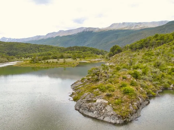
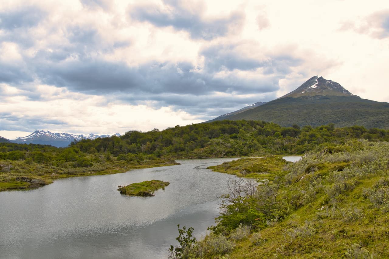
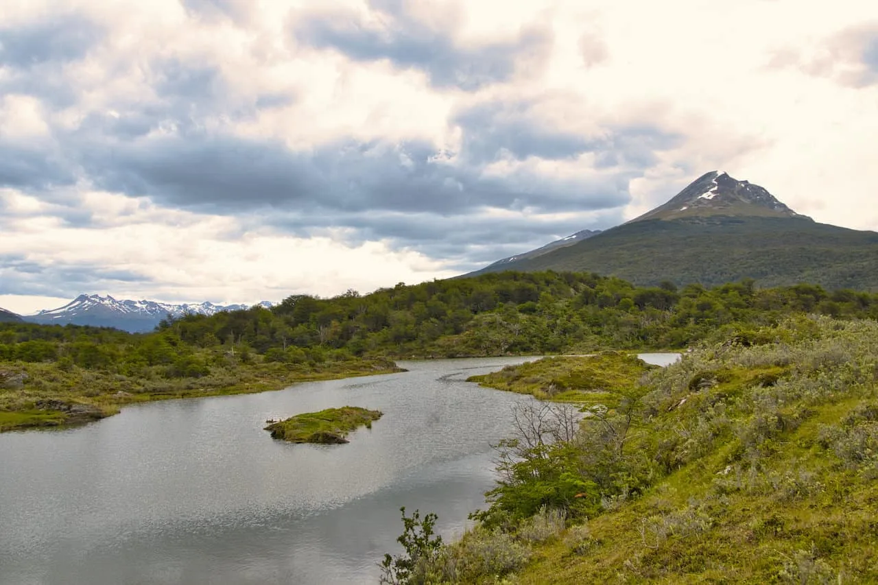
Landscape: Within the park you are going to find a variety of landscapes – forests, mountains, rivers, valleys, lakes, glaciers, and more. As you drive around the park and walk along the trails, you will be able to experience a little bit of everything.
Weather: The National Park also marks a spot where the Atlantic and Pacific Oceans meet. Due to this the weather of the area can get quite windy, rainy, and stormy. Always be prepared for the weather in Patagonia!
2) How to Get to Tierra del Fuego National Park
Before you actually take part of some Tierra del Fuego trekking, you first need to head to the entrance of the National Park. Thankfully, it is very easy to make your way back and forth from Ushuaia, which is the closest town.
There are four main ways to go about a visit: shuttle bus, taxi, rental car, or tour guide. Below I will go into a bit more detail on each:
Shuttle Bus
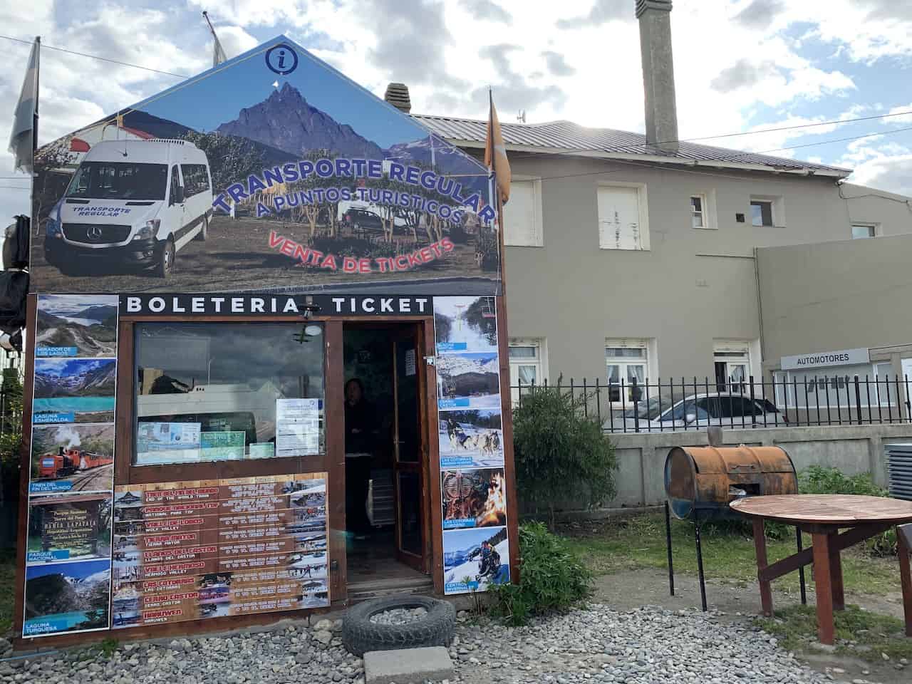
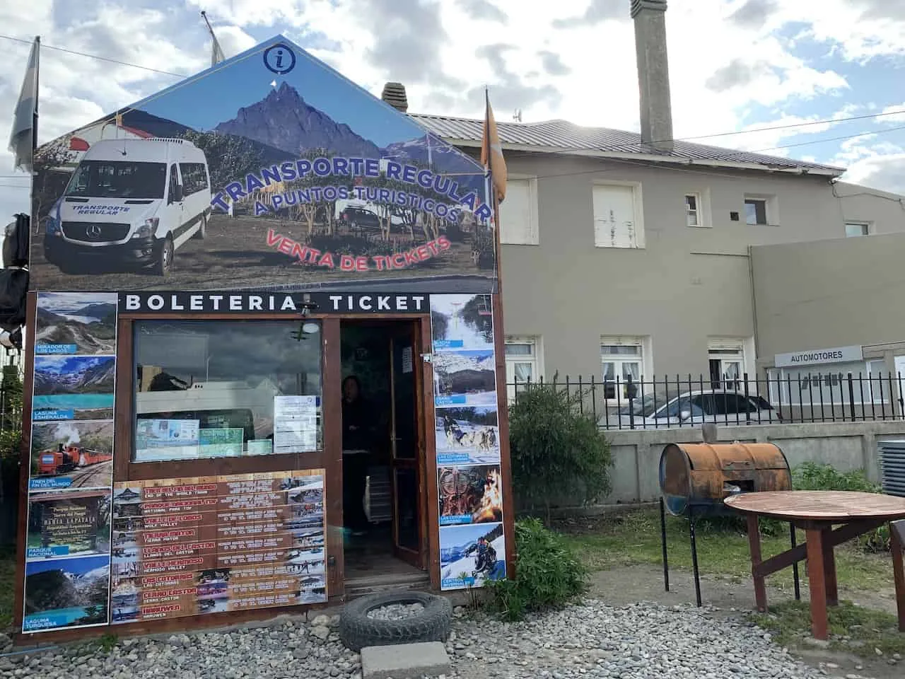
Right in the town center you will find a shuttle terminal. Here, each day, several different companies provide shuttle busses back and forth from Ushuaia to Tierra del Fuego National Park.
At the shuttle terminal, you will find a small hut, where you can purchase tickets. They will be super helpful with explaining the stops & timing for departures.
Since there are different shuttle companies operating here, each company will be on a slightly different schedule (but all tickets can be purchased from that one ticket booth).
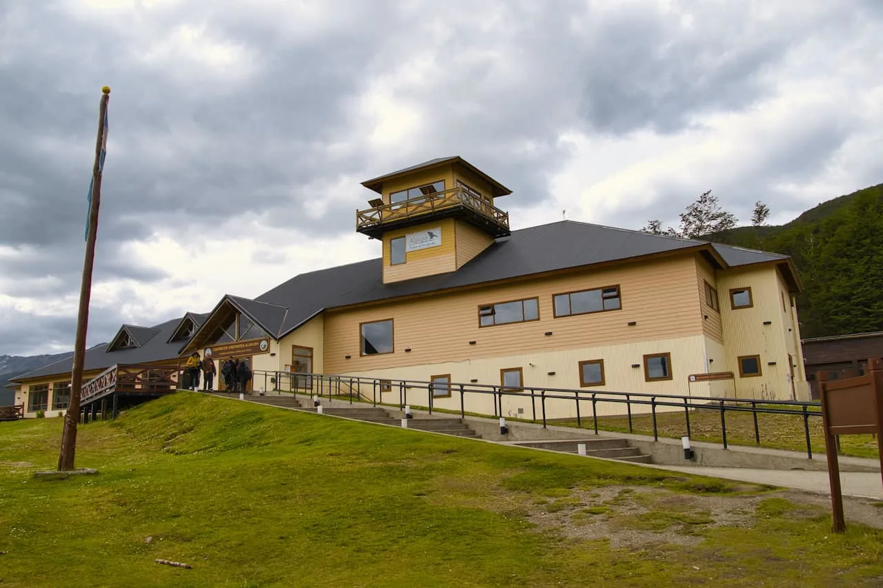
The shuttle busses will make a few main stops. These include at the National Park entrance to purchase tickets, and then at three main drop-off points: Ensenada Zaratiegui, Alakush Visitor Center, and Bahia Lapataia.
Depending on what hikes you want to take part of will dictate which shuttle bus stop you will get off at (and then back on at the end the day).
When I was visiting the park, the shuttle bus that I was set go back on only was picking up passengers at Alakush Visitor Center and Bahia Lapataia. That means I had to be sure to be at one of those two locations at the designated pickup times (which were given to me when I purchased tickets).
Note: there may be a few other drop off points along route 3 depending on shuttle company
The round-trip cost is just ~$8 USD with constant departures throughout the morning.
At the time I was there, the first departure was 9:00AM, but you can check with your hotel or the shuttle booking hut the day prior to be sure on timing. Show up just 30-60 minutes before departure to purchase your tickets and be on your way.
Taxi
If you are looking to be more on your own schedule and don’t want to worry about specific drop off an pick up locations, then having a taxi take you to the National Park could work for you.
If taking a taxi, you can decide to just have it drop you off somewhere in the park, and then pick you at the end of the day (be sure to get their phone number). Alternatively, you can hire a taxi for several hours and have them drive you to various spots around the park.
Rental Car
Another option here is to have your own rental car when visiting Tierra del Fuego.
This will give you the flexibility to come and go as you please on your own schedule. Not only will you be able to visit the National Park, but you can also drive to many other nearby hikes and points of interest during your time in the area.
Just be aware if you are taking part of one way hikes in the park, it may be a bit of a hassle to get back to your car at the end of the day.
If you want to rent a car, be sure to check out Rentalcars.com for a variety of options available.
Join a Tour
The last way to go about a day in Tierra del Fuego is to join a tour (whether that is a group tour or private tour).
There are several companies that run tours into the National Park, visiting some of the top highlights.
Usually, these tours are not going on any long hiking trails, but rather just points of interests and short trails. If you do join a private tour, you will have more flexibility with your itinerary.
Take a look at a few highly recommended options for your visit:
- Tierra del Fuego National Park Hike and Canoe Tour
- Tierra del Fuego National Park Tour with Lunch
- Private Excursion to Tierra del Fuego National Park
Learn More: Take a look at this Ushuaia itinerary to get a better idea on how to put together a comprehensive trip to the region.
3) How Much Does it Cost to Visit
While you may need to pay for the shuttle service, taxi, or tour to get yourself into the National Park, you also need to pay an entrance fee.
At the entrance of the National Park, you will need to get out of your car and purchase your ticket, before continuing onward into the park.
The fees can change frequently due to the change of value in the Argentinian Peso. Expect a ticket to cost $18 for a one day entry with a discount for a second day if you decide to head into the park multiple times.
4) Where to Stay in Ushuaia
Ushuaia is essentially the only place you are going to want to base yourself in as you explore Tierra del Fuego and the surrounding areas (including many other Ushuaia hikes). Below are just a few of my top recommendations when it comes to where to stay in the city.
These are all highly reviewed and recommended options so you really can’t go wrong with any of them.
Just note that during the high season (December- February), accommodation can get booked up. So, once you know your dates, you should book your hotels.
Hotel Tierra del Fuego: for a hotel located directly in the town center, Hotel Tierra del Fuego is a great option. Views of the town, mountains, and water will be right outside your window, and you will be minutes away from the action.
MIL810 Ushuaia Hotel: another centrally located hotel that is a great mid tier option is the MIL810 Hotel. It is a short walk from all the top spots in town to & offers everything you need from an accommodation standpoint.
Los Acebos Ushuaia Hotel: perched up above the town center, Los Acebos is a luxury option that offers guests some of the best views of the Beagle Channel. It is the perfect hotel for those that want a little more style & class.
Arakur Ushuaia Resort & Spa: if you are looking for the top option in Ushuaia, then the Arakur Resort & Spa is for you. While it is on the expensive side, there are few hotels that can compete with its luxurious offerings.
If you enjoy Tierra del Fuego you will also enjoy hiking in Torres del Paine National Park. Whether that be multi day hikes like the O Circuit or just a day hike to Mirador Las Torres.


5) What to Bring
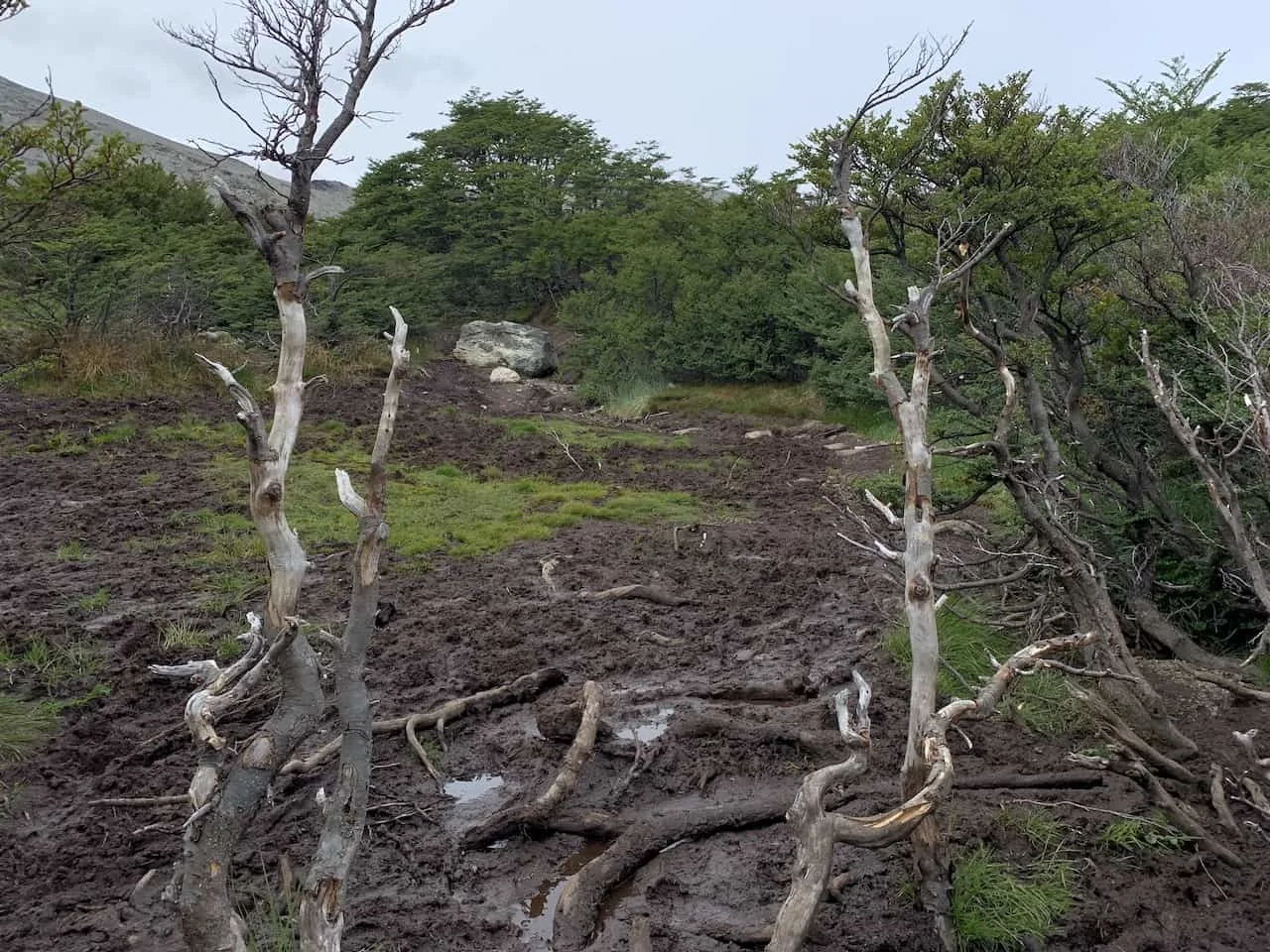
Hiking in Patagonia will require the right hiking gear for the trails. The weather can consistently change and so can the terrain. You will want to prepare yourself for all situations, so I would recommend you take a look at the day hike packing list I put together for the trails.
There are certain parts of Patagonia trails that can get very soggy and muddy, so having appropriate footwear and socks is a must (check out the photo below).

Hiking Resources & Checklist
Before heading out for the trails, be sure to read up on some of the hiking resources up on the site. These are here to better prepare you for all types of outdoor adventure.
- Gear: Hiking Packing List
- Weather: How to Prepare for Hiking Weather
- Navigation: Hiking GPS & Navigation
- Tips: 20+ Hiking Tips & Tricks for the Trail
- Accommodation: Book Your Hotel Today
- Rental Car: Book Your Car Rental Today
6) How Many Days Do You Need
For most people, one day is enough to explore Tierra del Fuego National Park. You have the chance to take part of one or more of the hiking trails as you spend a full day exploring the ins and outs of the park.
However, if you are keen on hiking additional trails, and you want to see even more of the park, then two days will be perfect for you. And thankfully, they do offer those two day tickets for those that want a bit more out of a visit.
Anything more than two days, would just be filled with more downtime and relaxing. I can imagine 3+ days makes sense if someone wants to camp and just enjoy longer times in nature.
But overall, I do think you will still get a lot out of one day in the park, especially if it is a full day.

7) Hiking Tierra del Fuego National Park Map
Let’s now get into the actual hiking trails of Tierra del Fuego National Park. I would consider there to be 6 main hiking routes, in addition to the Lapataia Sector.
Within the Lapataia Sector there are 6 shorter routes that all connect to one another. I will try my best to talk through all these intricacies during the course of this guide.
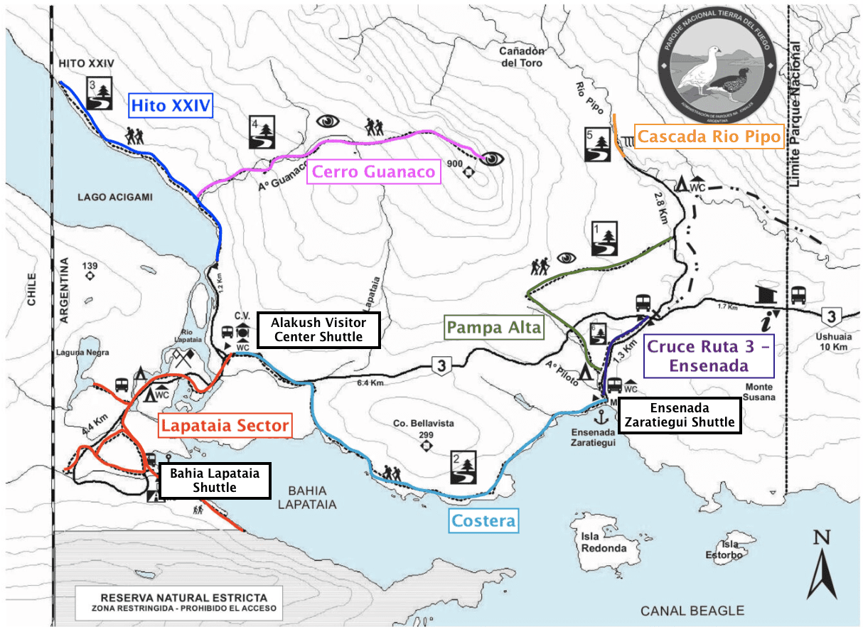
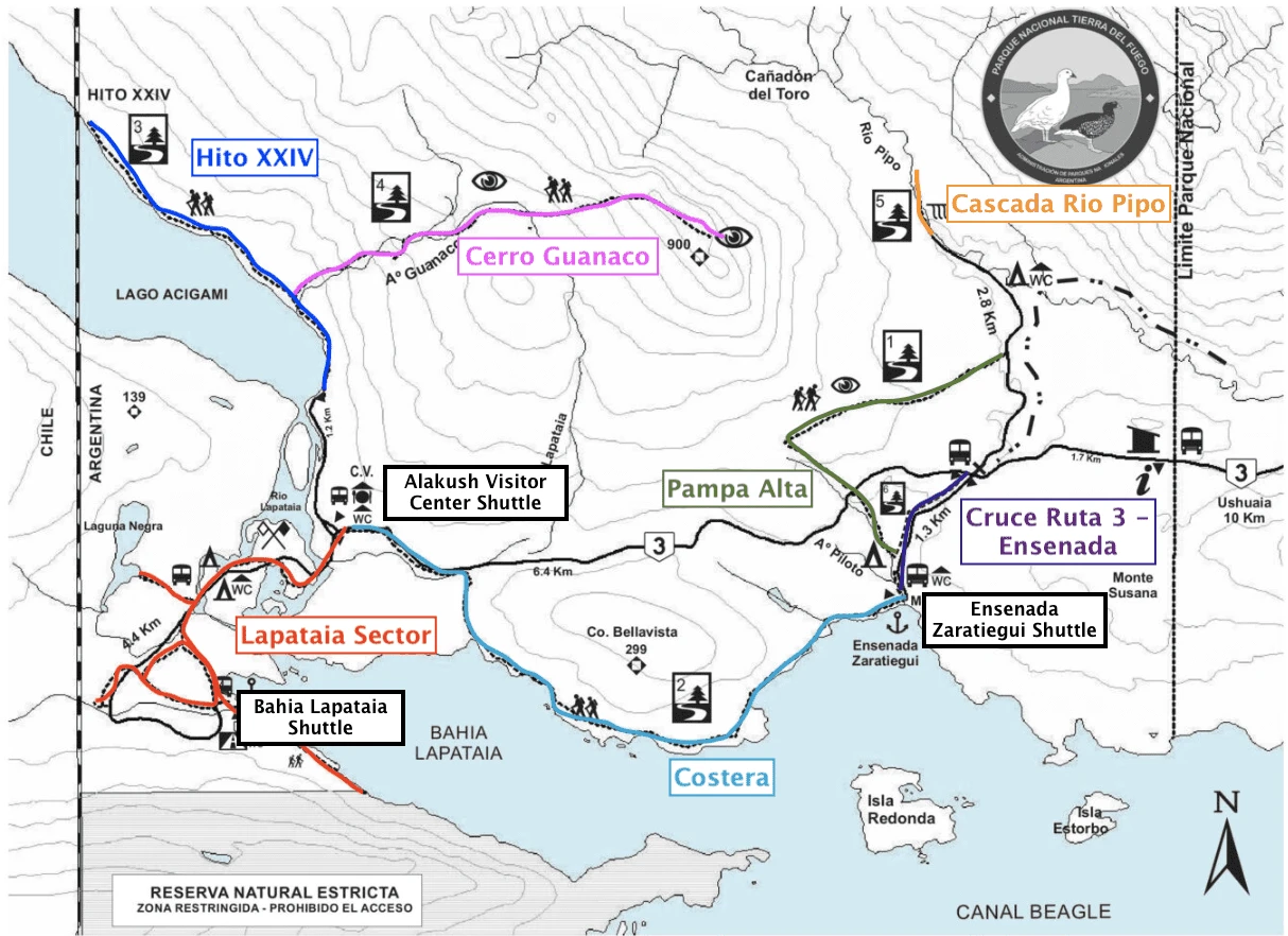
Below you can find the trail map with some notes tagging the individual hiking trails within the park (and the main shuttle bus stops).
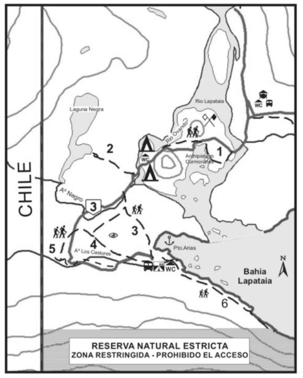
In the second map you can find a zoomed in view of the Lapataia trail, which technically has 6 shorter trails that make up the area. The rest of this guide will go over the hikes alongside some helpful trekking details.

8) National Park Hiking Tips
Here are just a few helpful hiking tips and things to know for your time hiking in Tierra del Fuego:
Drop Off Points: As mentioned earlier, there are a few main drop-off points for the shuttles – Ensenada Zaratiegui, Alakush Visitor Center, and Bahia Lapataia. These are where most of the hikes start and/or end.
Route: Whether you are taking the shuttle or driving in, you will want to think of your overall route for the day. The nice thing about the shuttles, is that you can start in one place and hike through to another shuttle bus stop to get picked up. You may not have that luxury with a car.
One Way Routes: Some of the routes are mentioned as one-way routes, so you may start in one spot and end up in another. You can alter some of the routes so you just head there and back in order to end at the starting point instead.
Weather: I will reiterate this again – be prepared for the weather! Bring the necessary gear to keep you comfortable in the rain and wind.
9) Best Hikes in Tierra del Fuego
Now that you have a good idea of the overall layout of the park, let’s get into some details for each of the hikes in Tierra del Fuego.
Senda Pampa Alta
Starting Point: Ensenada Zaratiegui
Ending Point: Rio Pipo Road
Length: 4.7 km
Duration: 2 hours
Difficulty: Medium
This is a hike that starts at Ensenada Zaratiegui, heads up to a viewpoint, and then heads down the other side to the road that connects to Rio Pipo waterfall.
You can also make this an out and back hike instead, by just heading up to the viewpoint and back down the same way you came (starting and ending at Ensenada Zaratiegui).
From the Zaratiegui Bay campsite / shuttle bus stop you can follow the trail upwards into the woods. About an hour into the hike you will be welcomed to views of the Beagle Channel, Bahia Lapataia, and the unique Patagonian landscape all around.
From the viewpoint you can decide to head back down the same way you came or continue onwards to the other side, which meets up with the road that leads to the Rio Pipo waterfall (more on that soon).
Senda Costera
Starting Point: Ensenada Zaratiegui
Ending Point: Alakush Visitor Center
Length: 8 km
Duration: 4 hours
Difficulty: Medium
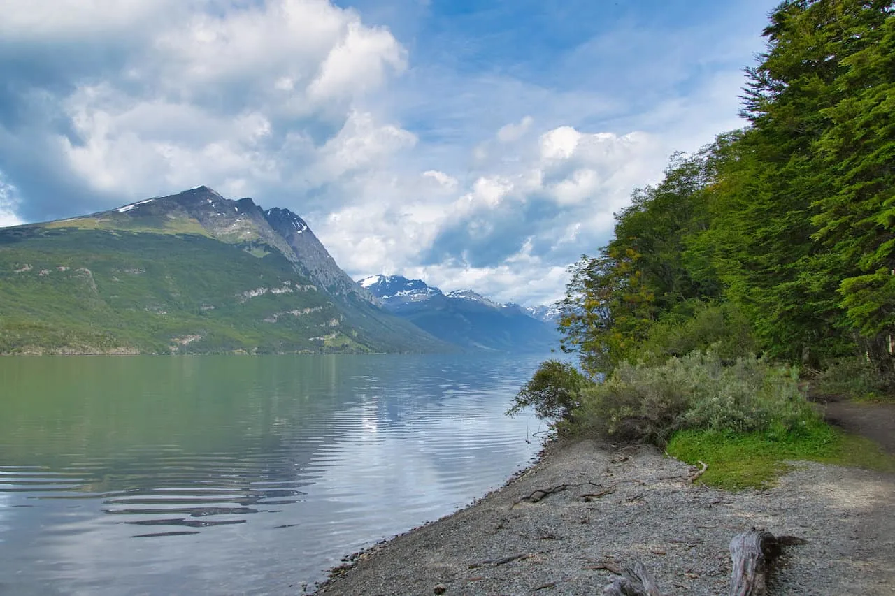
If you are looking for the best coastal track of the National Park, then head on the Senda Costera trail.
The route also begins at Zaratiegui Bay and then wraps its way alongside the waterside before heading inland towards the Alakush Visitor Center.
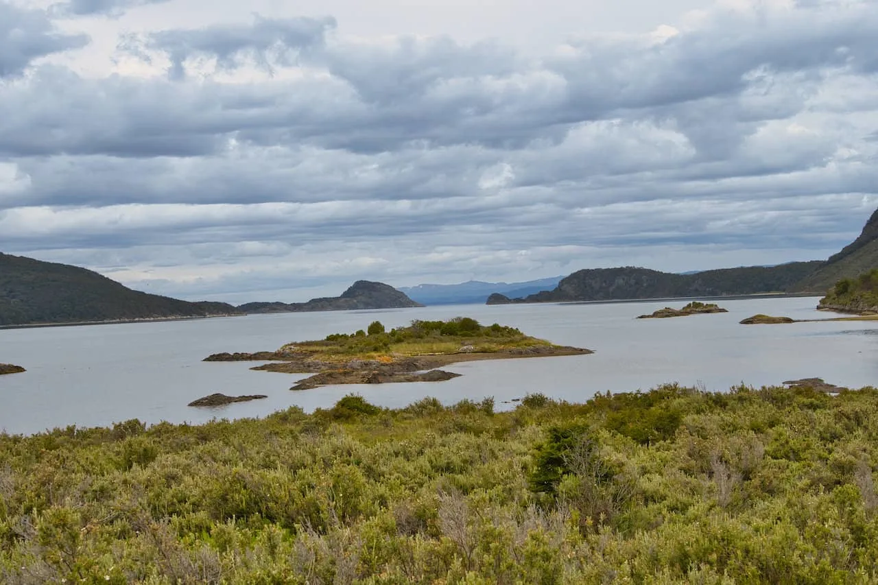
During the duration of the trail, you will come across small beaches and bays with views of Bahia Lapataia, the Beagle Channel and small islands that dot the water.
Note: you can also hike this trail in the opposite direction. However, as mentioned previously, during my time there shuttle busses were not picking up from Zaratiegui Bay at day’s end (only drop-offs).

Senda Hito XXIV
Starting Point: Alakush Visitor Center
Ending Point: Alakush Visitor Center
Length: 7 km (round trip)
Duration: 3 hours
Difficulty: Medium
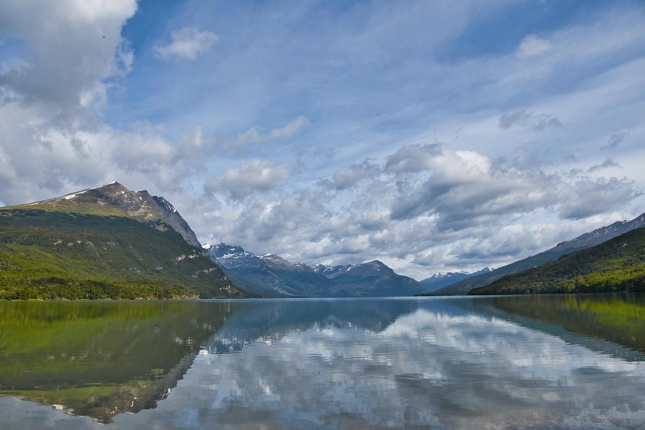
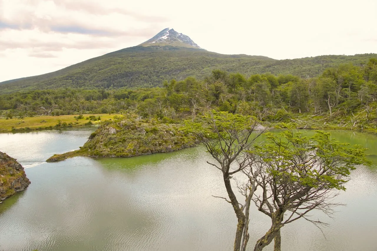
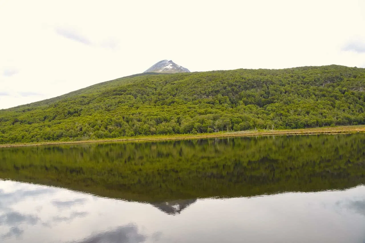
The Senda Hito XXIV trail begins at the Alakush Visitor Center and makes its way all along Lake Acigami.
Along the way you will see the turnoff for the Cerro Guanaco hike (more on that next). But unlike the hike up Guanaco, this hike is quite flat and peaceful to enjoy.
The interesting thing about the hike is at the end point (halfway point I should say), the trail meets up at the border of Chile and Argentina. If you want to quickly step foot in another country, here is your chance!

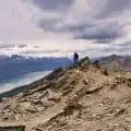
Cerro Guanaco
Starting Point: Alakush Visitor Center
Ending Point: Alakush Visitor Center
Length: 14 km (round trip)
Duration: 5-6 hours
Difficulty: High
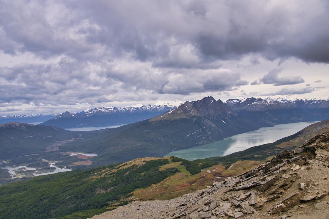
This is the only true mountain hike that you can easily take part of in Tierra del Fuego National Park. From the visitor center, the trail heads up into the forest and then above the tree line.
From there, the tricky terrain begins as you scale Cerro Guanaco, gaining 1,000 meters / 3,300 feet of elevation along the way.
This is by far the most difficult of hikes in the park, but it is also the most rewarding.
At the summit you will get some of the best views you can ask for of the National Park and even all the out to Ushuaia and beyond.
Learn more in the Cerro Guanaco guide up on the site

Cascada Rio Pipo
Starting Point: Rio Pipo Camp
Ending Point: Rio Pipo Camp
Length: 1.8 km (round trip)
Duration: 45 minutes
Difficulty: Easy
Between the entrance to the National Park and Zaratiegui Bay, is a turnoff from route 3 towards the Rio Pipo campsite.
From the campsite, you can walk 20 minutes to reach the Rio Pipo waterfall. After visiting the waterfall, it is just back the same way you came.
This will be difficult to reach unless you have your own car as the shuttle busses don’t go up to the campsite.
Cruce Ruta 3 – Ensenada
Starting Point: Route 3
Ending Point: Ensenada Zaratiegui
Length: 1.3 km (one way)
Duration: 30 minutes
Difficulty: Easy
I wouldn’t really consider this a hike, but it is just the path that connects Route 3 with Zaratiegui Bay. I figured I would include it here as the official Tierra del Fuego hiking map marks it down as one of the trails.

Lapataia Sector
Connecting the Alakush Visitor Center and the final shuttle bus stop at Bahia Lapataia is the Lapataia Sector.
The sector is made up of 6 various hiking trails. While you can simply just walk the route between the two connecting the trails, there are additional turnoff points to take part of too.
I would highly recommend walking this sector as there is just so much variety to enjoy during a hike here. Depending on your interest, you can head down just some of these extended routes or all of them.
Below is a breakout of the six trails as part of the Lapataia Sector:
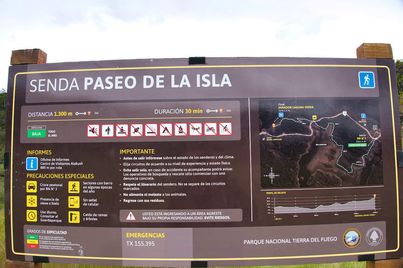
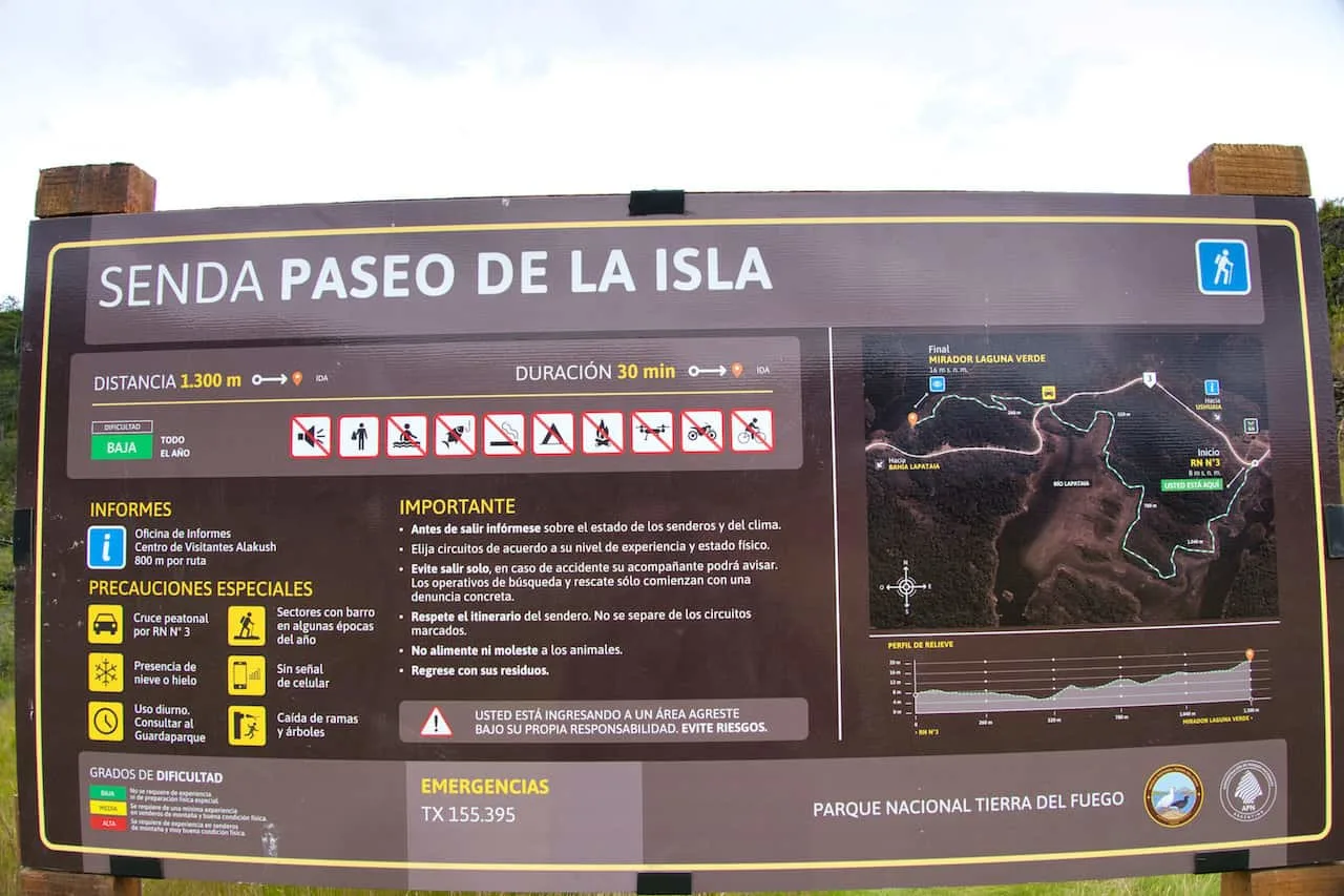
Paseo de la Isla
Length: 1.3 km
Duration: 30 minutes
The first portion of trail starts at the Alakush Visitor Center and makes its way over the Lapataia and Ovando Rivers. It is called the island trail because between the two rivers is the Cormoranes Archipaelego. The trail hugs the coastline, as you get to take in some great views of the National Park.

Laguna Negra
Length: 1 km
Duration: 30 minutes (round trip)
A short detour off of the end of the Paseo de la Isla is the Laguna Negra trail (translated to Black Lagoon). Here you will find a peat bog that is currently in formation.
From the lookout at the end of the trail, there will be some great views of the surrounding landscape.

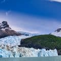
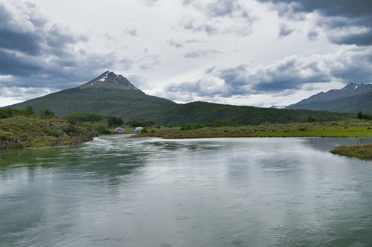
Mirador Lapataia
Length: 1 km
Duration: 30 minutes
As you continue along from the first two trails, you will then see a turnoff for the Lapataia Bay viewpoint. This is one of the top highlights of the Lapataia sector and I would highly recommend the detour. Be cautious on this trail as there is a bit of elevation gain but nothing too difficult here.
Another great thing about the viewpoint trail, is that instead of turning back after reaching the viewpoint, there is a trail that connects to the shuttle bus stop at Bahia Lapataia.
You also have the option to turn back around so you can take part of a couple other trails if interested.


Del Turbal
Length: 1.3 km
Duration: 40 minutes
Instead of taking the Mirador Lapataia trail to Bahia Lapataia, you can also take the Del Turbal trail. Here you will come across a peat bog and the chance to see some beaver lodges.
Castorera
Length: 0.5 km
Duration: 20 minutes
A pretty quick detour is the Castorera trail (translates to Beaver trail). Here is your chance to see some beavers and the lodges that they have built over time.
Senda de la Baliza
Length: 2.4 km
Duration: 40 minutes
Once you reach Bahia Lapataia, you can take part of one additional trail that follows the shoreline. Along the way you will get a few different viewpoints of Bahia Lapataia, as well as the opposite side of the park.
Depending on how you are feeling, you can decide to hike all the way to the end of the trail before turning back. Or you can just go down a portion of the trail before turning around.

After finishing up a day of hiking, either drive yourself back to Ushuaia or hop on your shuttle bus. Be sure to rest up as I am sure you will want to explore and hike more during your time there.
I hope this guide has helped you better understand all the various ins and outs of Tierra del Fuego trekking. If you do have any additional questions or comments, be sure to add them in below.
Also, don’t forget to check out the remaining Patagonia itineraries and guides up on the site.
Have fun out there and safe travels!