

The Catskills are full of amazing hiking opportunities all throughout its mountain ranges. However, Wittenberg Mountain just may be one of the top trails out there.
While the hike itself is a long, hard ascent along the Burroughs Range through the Slide Mountain Wilderness Area, the views from the summit are certainly some of the best you can ask for.
This overview will go through everything you need to know about the Wittenberg Mountain trail hike and how to take it on for yourself.
* Affiliate Disclosure: This post may contain affiliate links, which means I may receive a commission if you make a purchase through the links provided, at no additional cost to you. Thanks for supporting the work I put into TripTins!
1) Wittenberg Mountain Trail Stats
To start, below are some helpful round-trip trail stats for Wittenberg Mountain.
- Hike Name: Wittenberg Mountain
- Mountain Range: Burroughs Range
- Wilderness Area: Slide Mountain Wilderness
- Trailhead: Woodland Valley Campground
- Distance: 7.5 miles
- Elevation Gain: +2,500 feet
- Duration: 5 Hours
- Wittenberg Mountain Elevation: 3,780 feet
- Trail Type: Out & Back
The hike up Wittenberg Mountain begins near the Woodland Valley Campground, and is a near continuous ascent towards the summit. Along the way expect some technical scrambling up some rock faces, making this more than just a normal hike.
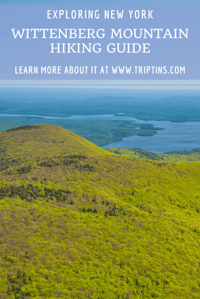
But once you have made it up the nearly 4 mile ascent, the views from Wittenberg Mountain will all be worth it. Out in front will be miles of beautiful natural landscape including the Ashokan Reservoir & many other nearby peaks.
Hiking Alternatives
The trail that I took part of was the standard trail from the Woodland Valley, up to the summit, and then right back down the same trail. However, there are alternatives to make this a longer hike too. Here are some of the most popular ways to extend:
- Wittenberg Mountain + Cornell Mountain (9 miles / +3,100 feet of gain): the summit of Cornell Mountain is just under a mile from the Wittenberg Mountain summit. You can continue along the ridge to Cornell before turning back around.
- Wittenberg + Cornell + Slide (12 miles / +4,700 feet of gain): another option is to head to Cornell & Slide mountain. Similarly, you can continue past Cornell for a couple of miles until you reach the Slide Mountain summit before turning around back to the trailhead.
- Note: this three peak trail can also be completed as an out & back hike from the Slide Mountain trailhead (12 miles / +3,850 feet of gain)
- Wittenberg + Cornell + Slide Loop (14.5 miles / +4,850 feet): also known as the Burroughs Range trail, the three peaks can also be completed as a loop trail starting & ending at the Woodland Valley Campground. This will be the most demanding of the trails, but can also be the most rewarding.
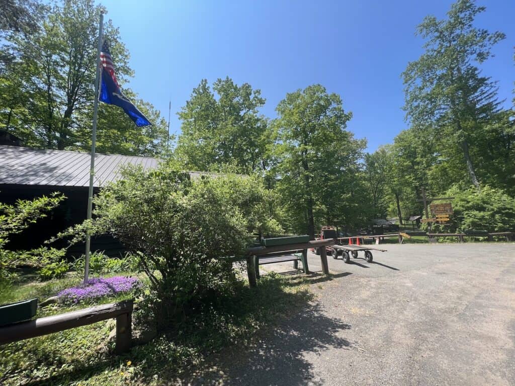
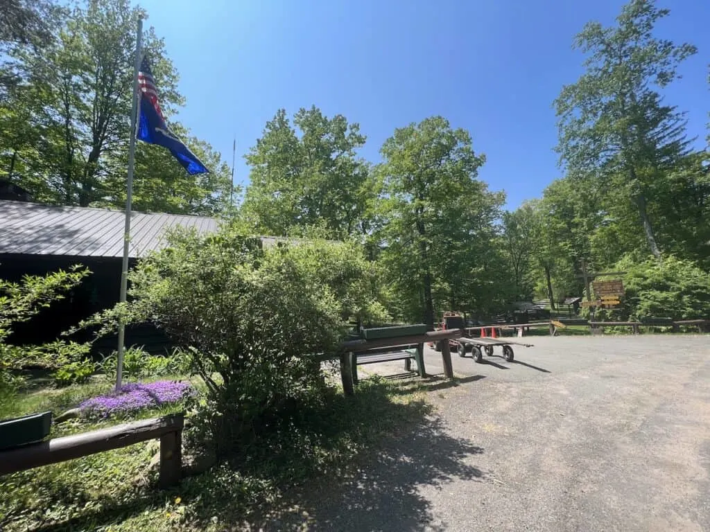
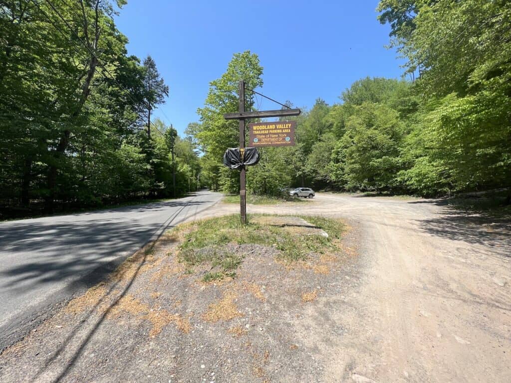
2) Wittenberg Mountain Trailhead
The main trailhead for Wittenberg Mountain is located at the Woodland Valley Campground.
If you are looking for an address to put into your GPS, you can use 1319 Woodland Valley Rd, Phoenicia, NY 12464. The address is not perfect, but you should see the large parking lot on your right-hand side as you make the final approach.
The lot is open year-round, but you do need to pay a $6 parking fee from mid-May to mid-October. To pay the fee, head further down the road a couple of minutes, where you will then see a ranger station on the left-hand side of the road.
If you arrive before the ranger station is open, just leave a note in your dashboard and pay the fee when you finish up the hike.
Need to rent a car? Check out Rentalcars.com, which gives you a whole array of car options to choose from for your trip.
Driving Advice: I would recommend downloading offline maps for your time in the area. There can be limited to no cellular service. So by having offline maps downloaded, you will be able to still receive driving directions when you depart.
In the area, there are multiple hiking trails that veer off in different directions.
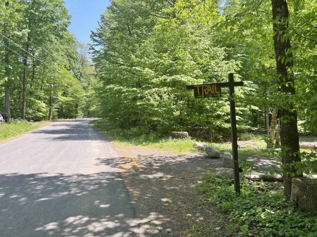
For the Wittenberg Mountain trail, you will exit the parking lot, make a left hand turn onto the road, and then a right hand turn to the other side of the road, where the large “Trail” sign is located.

3) Where to Stay
For many people, taking a day trip out to Wittenberg Mountain will just be too much driving back & forth. So, why not stay in the area, enjoy this trail & some other hikes in the region.
You can take part of some other top options like the Giant Ledge Hike, Kaaterskill Falls, and North South Lake.
Below are some great hotel options in some of the nearby towns:
- Phoenicia: Phoenicia Lodge (10 minutes)
- Shandaken: Catskill Seasons Inn (15 minutes)
- Big Indian: Urban Cowboy Lodge (25 minutes)
- Hunter: Bluebird by Lark (30 minutes)
- Saugerties: AutoCamp Catskills (40 minutes)
You can also browse through many more Catskills hotels if those don’t work for you!


Hiking Resources & Checklist
Before heading out for the trails, be sure to read up on some of the hiking resources up on the site. These are here to better prepare you for all types of outdoor adventure.
- Gear: Hiking Packing List
- Weather: How to Prepare for Hiking Weather
- Navigation: Hiking GPS & Navigation
- Tips: 20+ Hiking Tips & Tricks for the Trail
- Accommodation: Book Your Hotel Today
- Rental Car: Book Your Car Rental Today
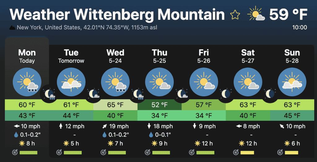
4) Wittenberg Mountain Weather
When it comes to hiking up Wittenberg Mountain, it is all about the views that you will get from the summit. Since the summit does offer one of (some say the best) view in the Catskills, you do not want to miss out on it!
Due to its elevation though at 3,780 feet, it is not uncommon for the peak to be surrounding by low lying clouds. This essentially will block those beautiful views and you will not be able to fully enjoy what the area has to offer.
Before setting out for the hike, I would recommend checking out the weather forecast. I have included two links below that are geared more towards mountain weather at elevation. You will want to try and avoid days with a low number of sun hours, and those days with low cloud cover.

5) Hiking Gear
If you were wondering what type of gear to take along with you on the trail, check out the hiking list overview below that can better help you out.
Hiking Packing List
In general when it comes to hiking, there are a few main aspects to consider. These includes clothing layers, hiking shoes, hydration & fuel, electronics, and other essentials.
Below in a breakdown of some of the top items, but be sure to check out the Hiking Packing List for a more comprehensive view.
Clothing Layers
Layering is going to be a top consideration when hiking. You will want to be prepared for all sorts of weather so you can be comfortable in different situations. Some items may include:
→ Hiking Shorts
→ Hiking Pants
→ Short Sleeve Shirt
→ Long Sleeve Shirt / Sun Hoodie
→ Mid Layer Fleece
→ Puff Jacket (not always needed)
→ Packable Rain Jacket (Columbia Watertight II)Note that your layers should be made of moisture wicking material as they are breathable and quick drying.
Footwear
Having appropriate footwear will also be very important. You will want to have shoes with the necessary grip and support to keep you safe on the trail.
→ Hiking Shoes (Keen Targhee)
→ Hiking Socks (Darn Tough)Other Essentials
Whether it is hiking gear, electronics, or just some miscellaneous items, here are some other essentials to bring along on hikes.
→ Hiking Backpack (Osprey Talon 22) & Rain Cover (Joy Walker Cover)
→ Hiking Poles (Black Diamond Trekking Poles)
→ Water Bottle (CamelBak Chute or Katadyn Filter Bottle)
→ Portable Charger (Anker PowerCore 5000mAh)
→ Action Camera (GoPro Hero)
→ Energy Bars & Snacks
→ Hat & Sunglasses
→ Sunscreen & Bug Spray
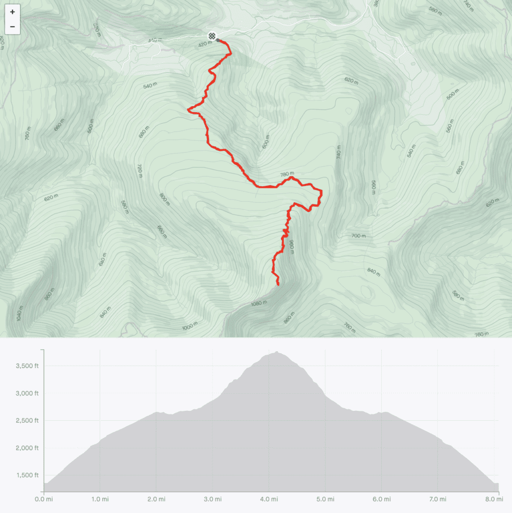
6) Wittenberg Mountain Trail Map
Before getting started with the overview of Wittenberg Mountain, you can check out the trail map that shows the route up.
Also included in the screenshot is the elevation gain profile of the hike. It is a relatively constant incline all the way through, with some steeper terrain during the last mile to the summit.
7) The Wittenberg Mountain Hike
Now that you have all the necessary background info, let’s dive into what to expect on the hike itself.
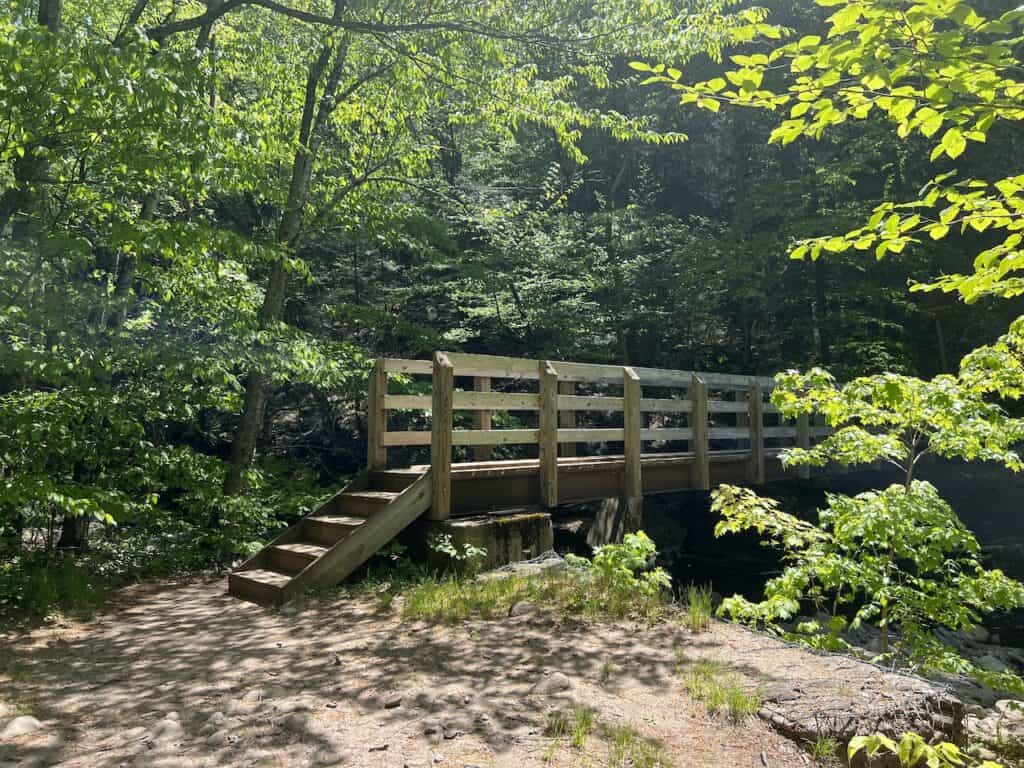
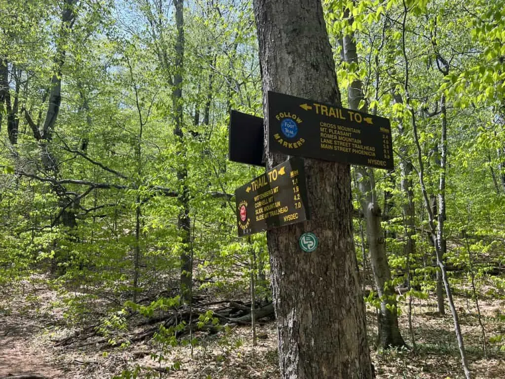
Once you park your car, and pay the fee, head on over to the trailhead just opposite the parking lot. From there you will see the “Trail” sign pointing you towards a small bridge over the river.
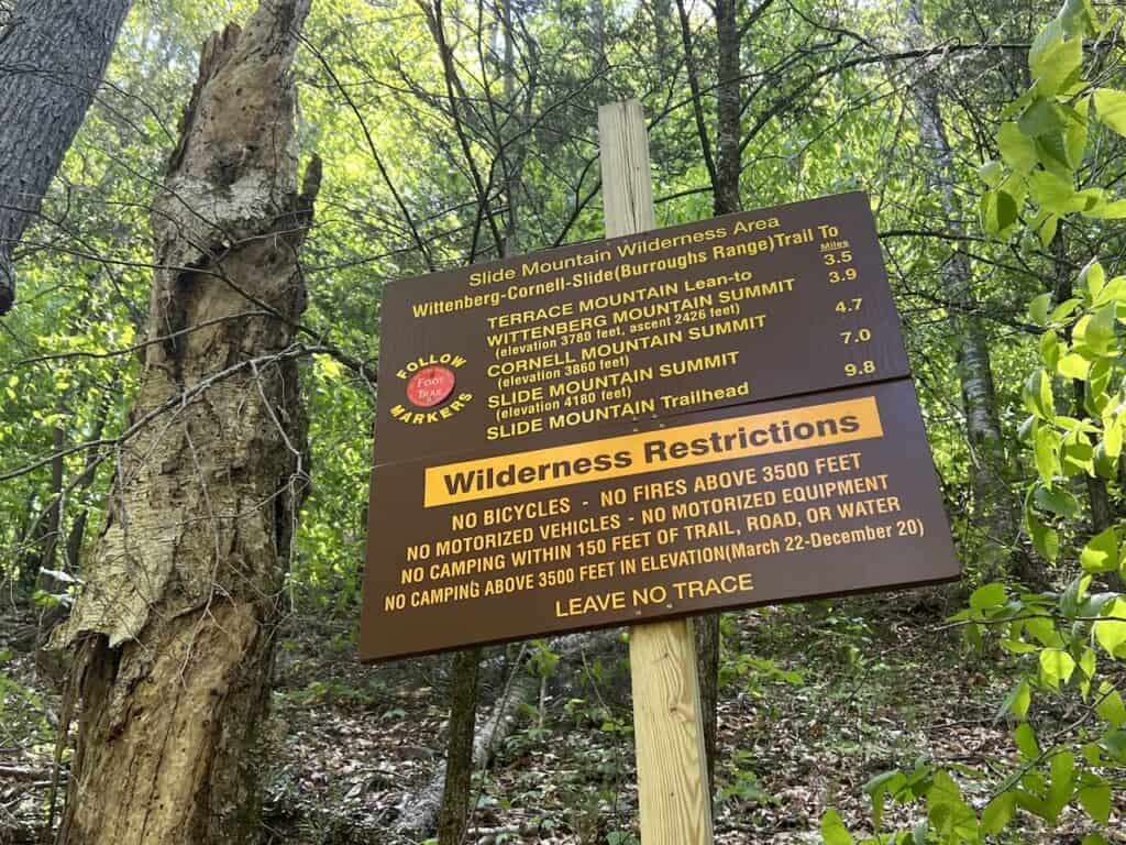
Cross over the bridge, where you will find a sign indicating trail lengths and elevation. From here you will want to follow the Red trail markers.


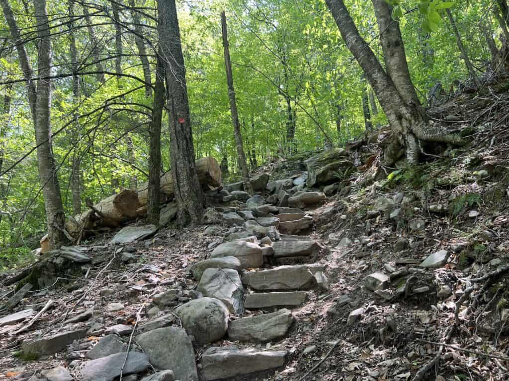
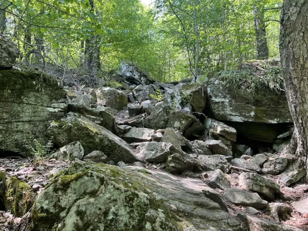
Right as the hike begins, the elevation gain begins with it. You will head up the stone staircase, which will then turn into a rocky technical ascent through the forest. Be very careful as you head on up as the trail is uneven and full of this rockier terrain.
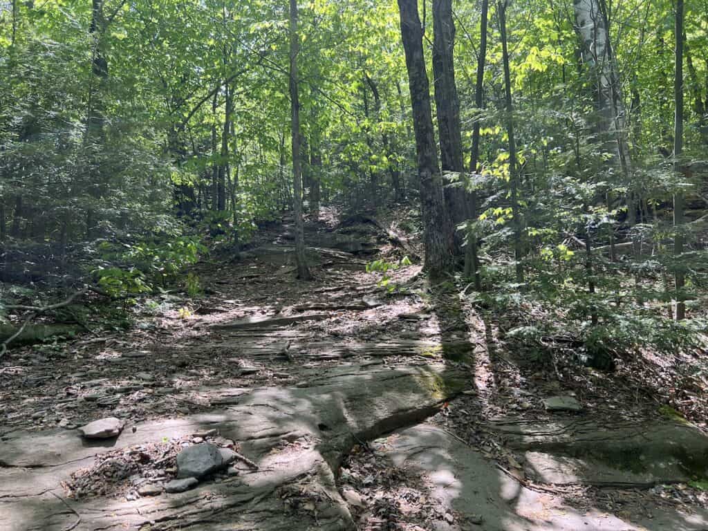
After some technical terrain, the trail does then become easier. While there is still some elevation gain here, it won’t be on a steep grade. Continue to make your way through the forest, enjoying the surrounding natural landscape and following those red trail markers.
Throughout the hike, I did not find much issue with following the trail. The trail markers were pretty consistent all the way through. At some points you may second guess yourself, so just be sure to pay attention and keep an eye out for them.
I would also recommend downloading the offline route on a navigation app such as AllTrails or Maps.me. This way, if there ever was a question of direction, your app will be able to answer those questions.


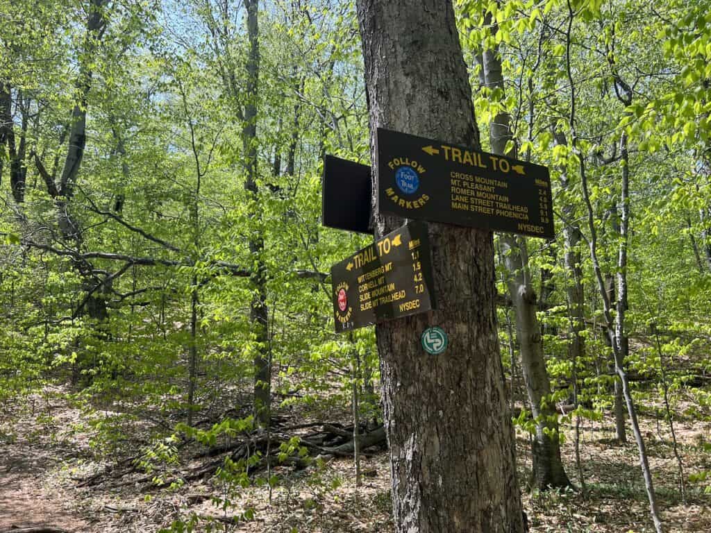
Around the 2.5 mile mark, you will reach the first of two intersections. You will want to make a right hand turn here as you continue to follow those Red trail markers.
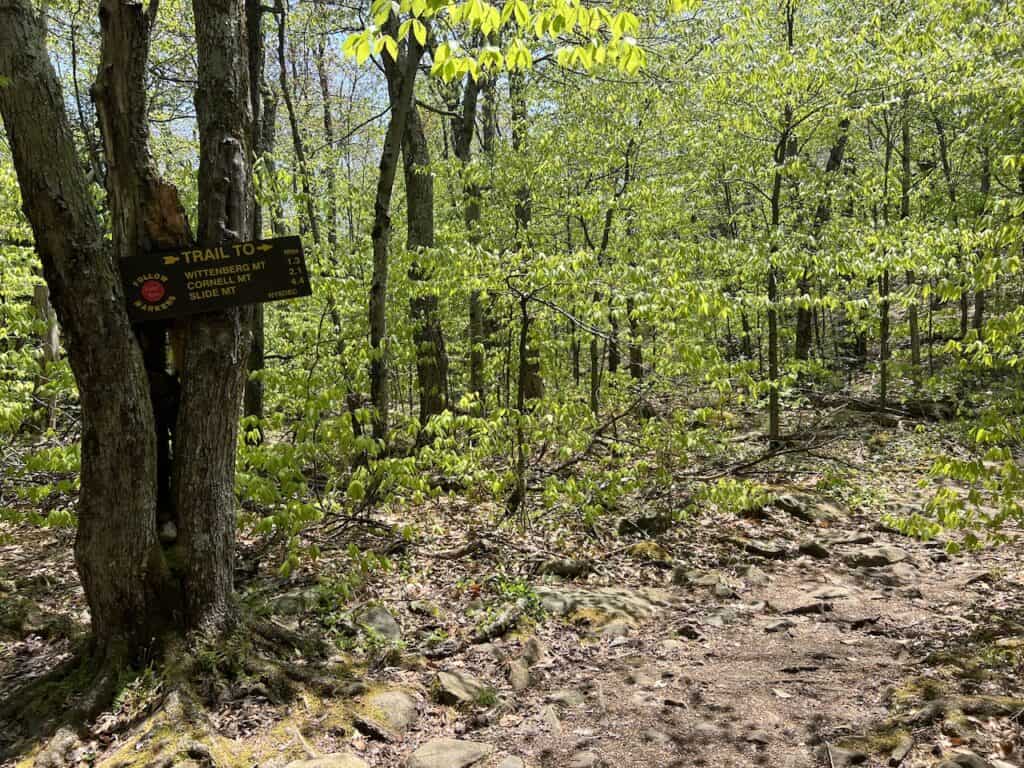

Just 0.2 miles after this intersection, there will be a second one. Once again, keep to those Red trail markers pointing you towards the Wittenberg Mountain summit.
At this point, you just have 1.1 miles to go to the top. And by now, you may feel like it hasn’t been that bad of a hike (just as I thought). However, the real fun is just about to begin.
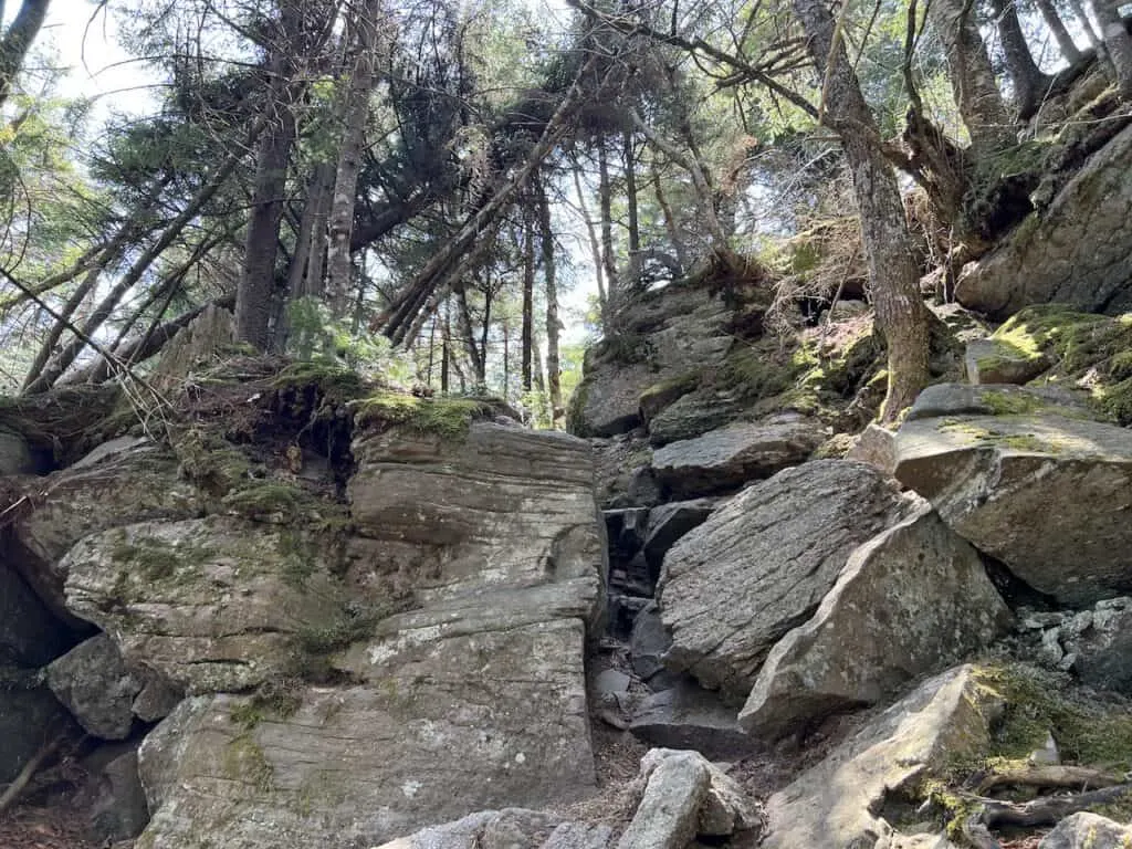
From this point, you will need to cover an additional +1,000 feet to the summit. Not only that but it is also some of the most technical terrain you will come across in the area.
The remainder of the trail is full of various rock ledges, which will require some climbing with your hands getting you up and over to the next section. Some of these will be harder or easier than others, but expect several of these more technical climbs during this final mile.
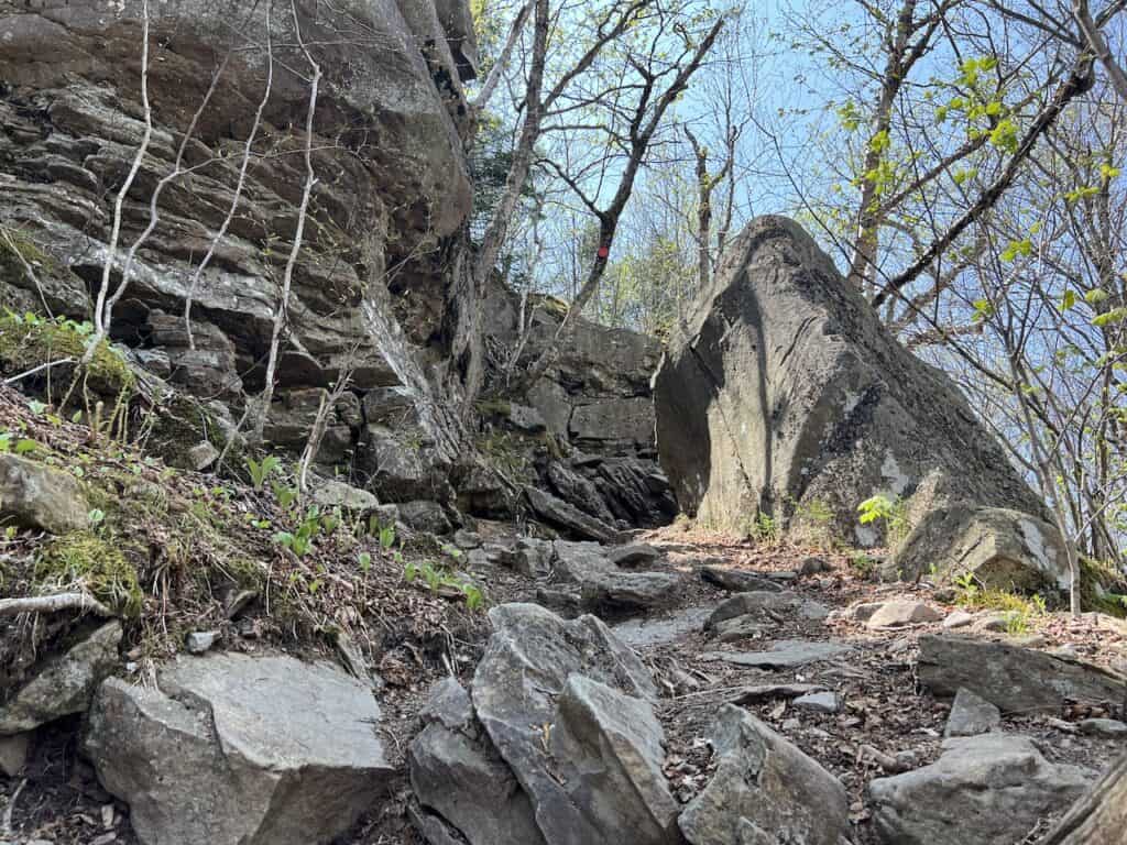
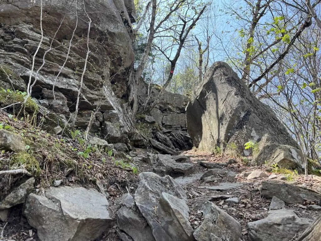
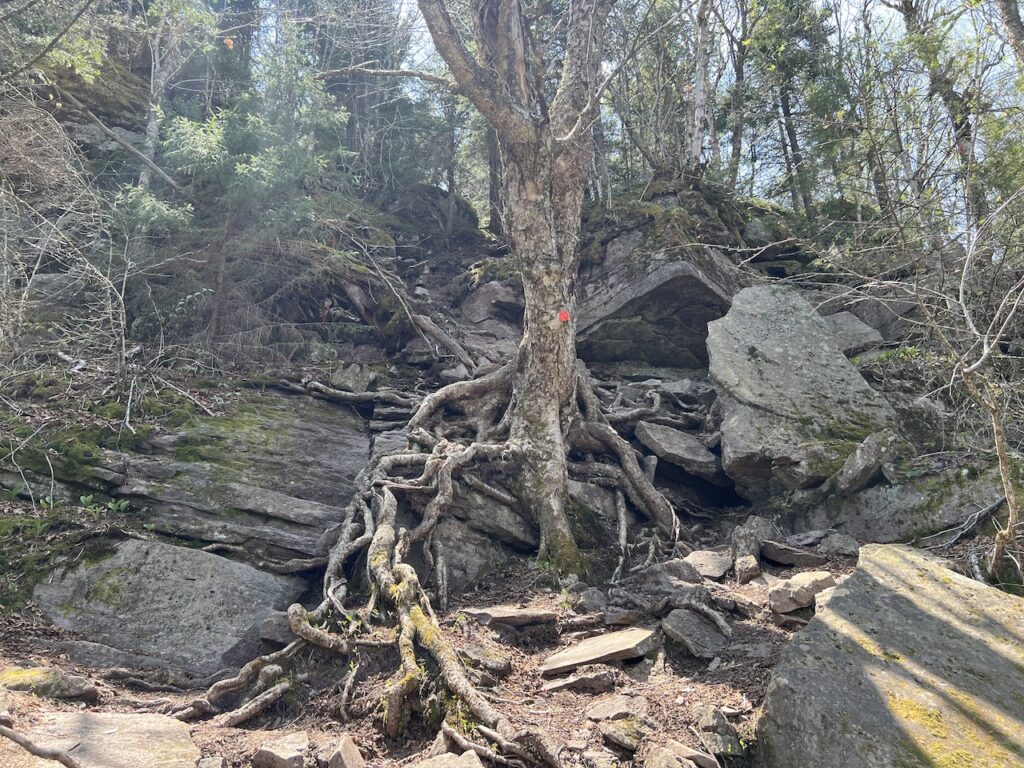
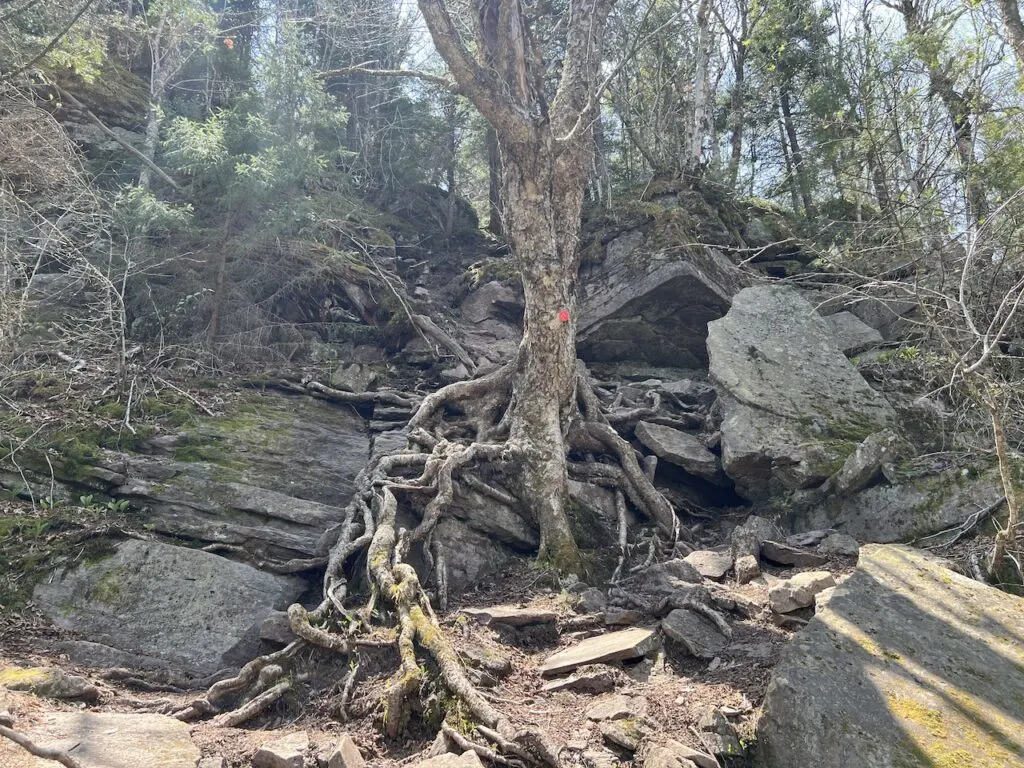


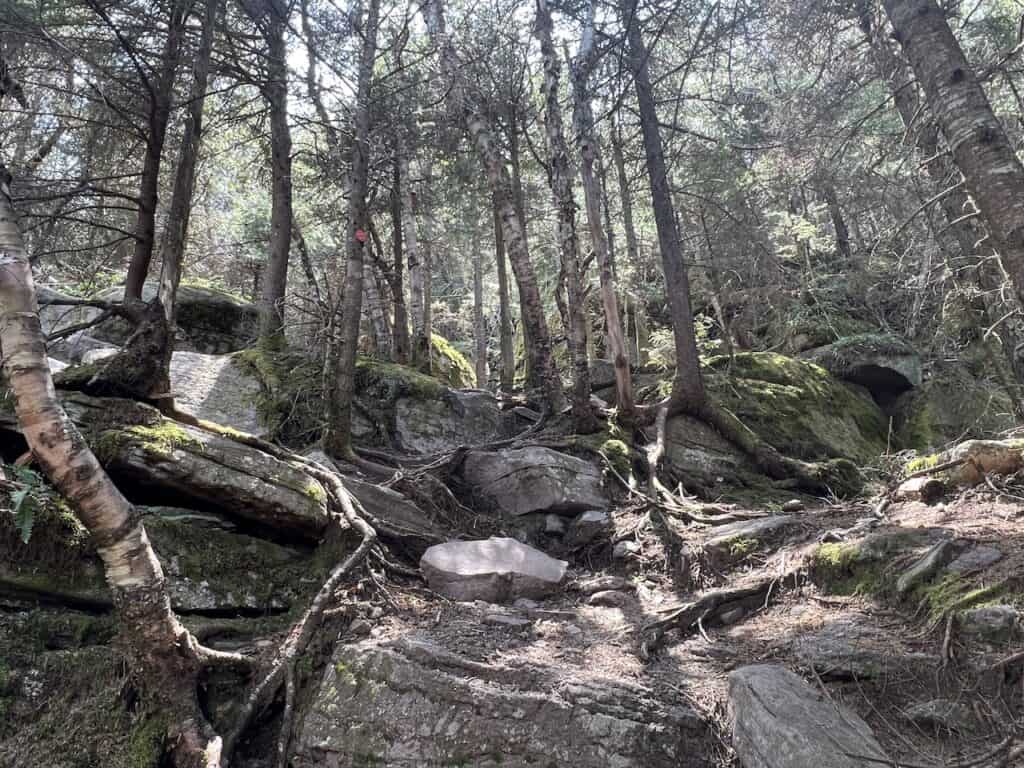
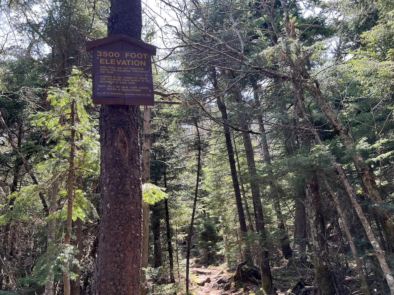
Besides for these climbs, the terrain is going to be rockier and more technical in general. Soon enough though, you will pass by the 3,500 foot elevation sign. From here it is just a few hundred more feet to the summit!
After the sign, there is one more ledge to climb up and over and then an easier trail that winds its way through the forest and onto the Wittenberg Mountain peak!


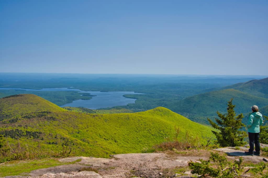
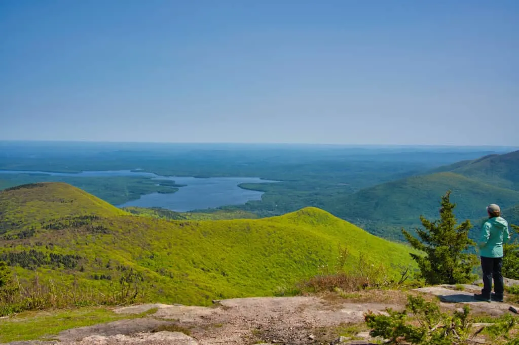
Wittenberg Mountain Summit
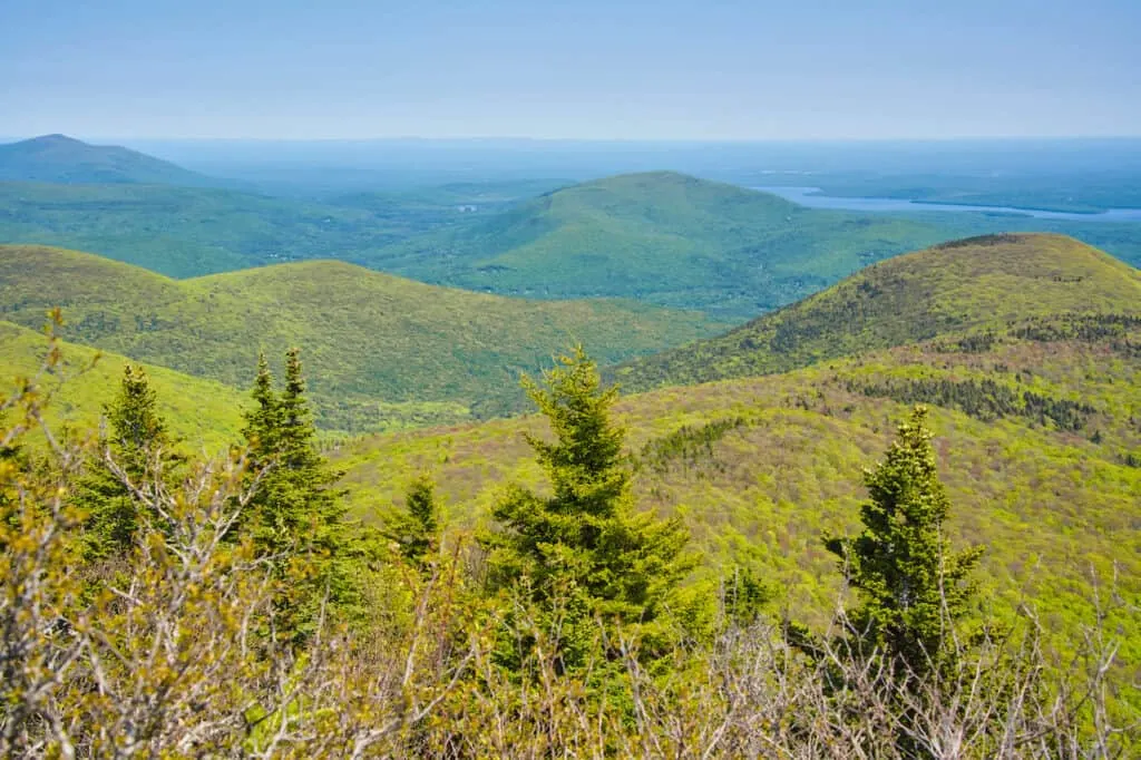
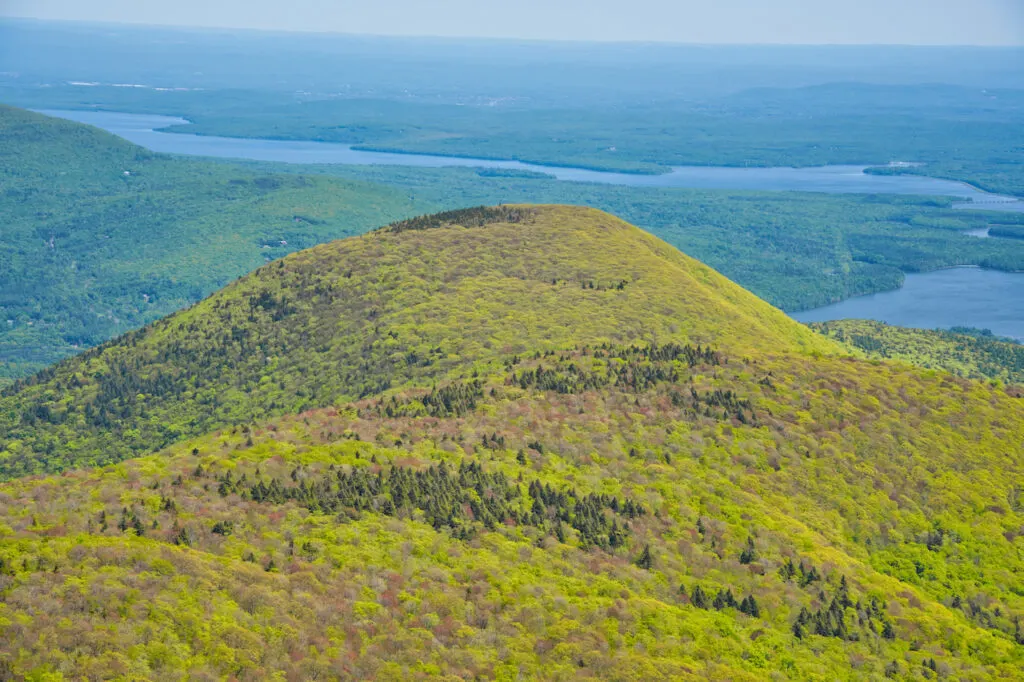
Once you reach the summit of Mount Wittenberg, you will be welcomed to a large open area that is full of viewpoints and seating areas. Out in front of you will the Ashokan Reservoir in addition to some nearby peaks, and a wide panorama of the Catskills landscape.

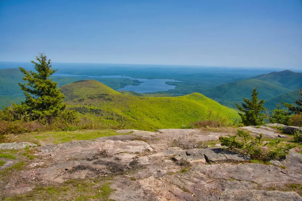
You can find a spot to sit down and enjoy the view, as you take some photos from one of the most beautiful locations in the area.
Below are some of my favorite shots I took during my time on the summit:


Hiking Down
Once you are all wrapped up at the peak, it is time to retrace your steps all the back down to the trailhead. The first mile back to the intersection is going to be the toughest part.
All of those technical ledges you had to climb up and over, will now need to be descended. I would argue it is more difficult to climb down these then climb up. Be very careful as you go down and wisely choose the safest route.
After getting those more technical sections taken care of, it is then following the trail markers all the way back down to the trailhead. Just be cautious of your step as you head down, and keep an eye out for the trail markers along the way.
Soon enough, you will arrive back down by the roadside, where you can cross over and head back to the parking lot.


That will end a hike up and down Wittenberg Mountain! If you have any questions or comments about the hike, be sure to add them in below.
Also, don’t forget to check out some of the other New York itineraries and guides up on the site.
Have fun out there and safe travels!


Chloe Wilson
Monday 1st of June 2026
I've read a dozen pieces on this and yours actually said something new. Appreciate the time you put in.