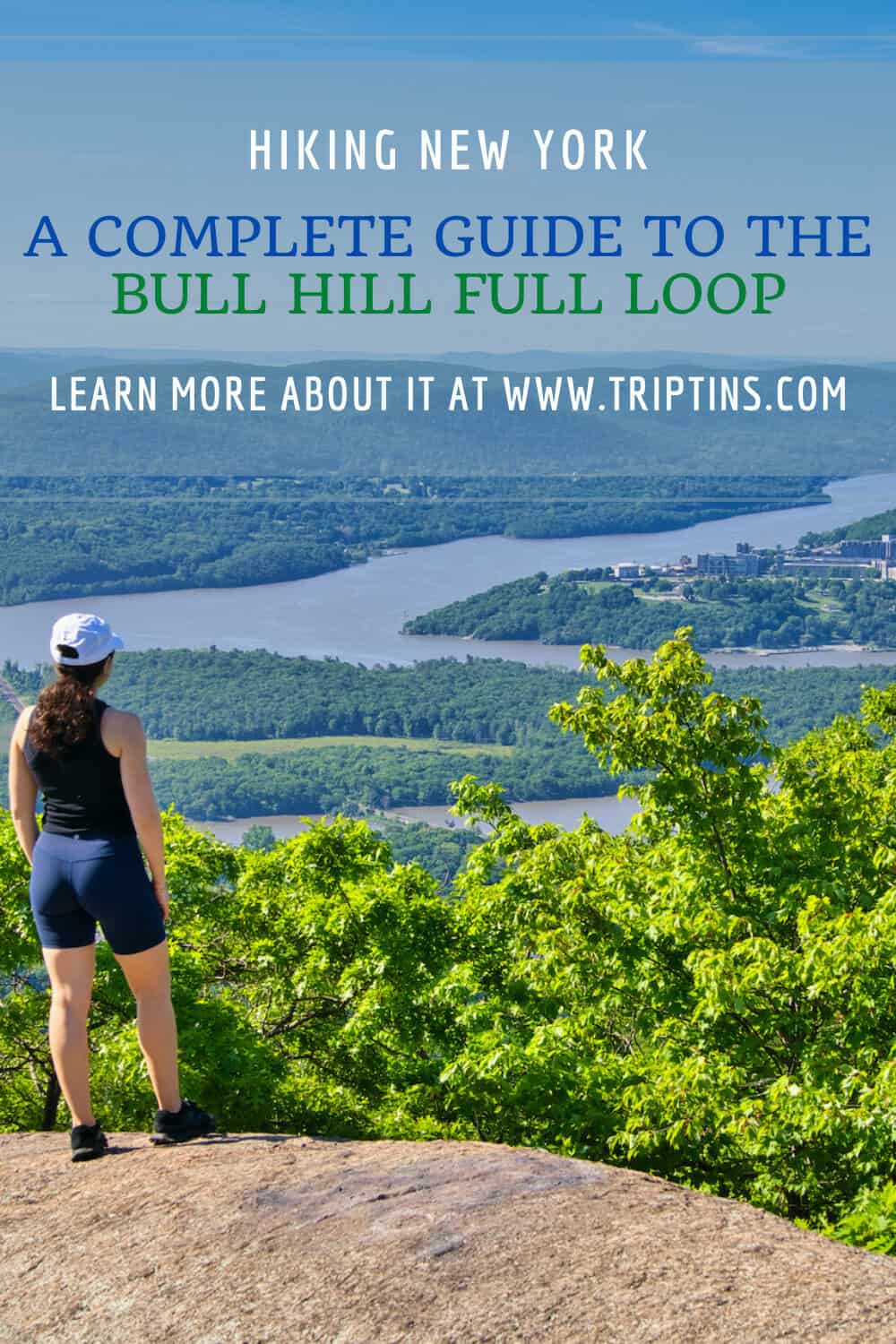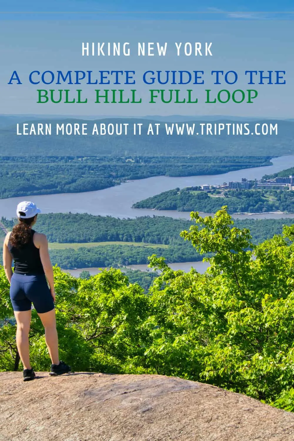

The Hudson Valley is full of some stunning hiking trails overlooking the Hudson River and surrounding nature. While there really are many to choose from, the Bull Hill hike (also known as Mount Taurus) has quickly become one of my favorite trails to take part of.
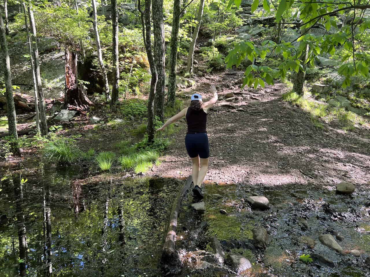
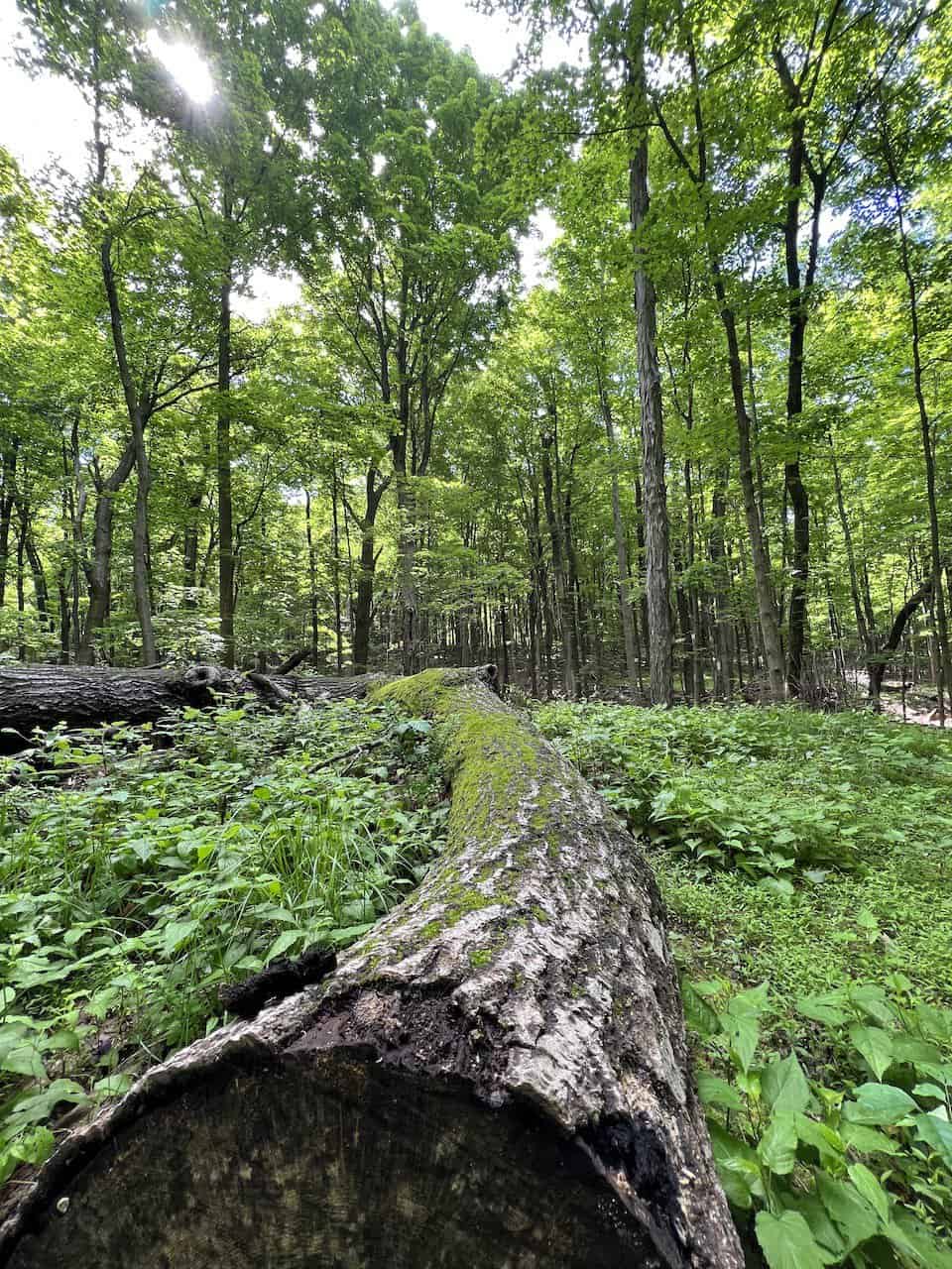
During the ascent of Bull Hill, you will come across several viewpoint areas to enjoy. On the way down, you will get to hike alongside a calming stream and even visit an abandoned estate.
When it comes to variety on the trail, it is tough to beat the hike up and down Bull Hill. This guide will go over everything you need to know about a visit and it will help prepare you for your time hiking the Hudson Valley.
* Affiliate Disclosure: This post may contain affiliate links, which means I may receive a commission if you make a purchase through the links provided, at no additional cost to you. Thanks for supporting the work I put into TripTins!
1) Hiking Details & Overview
To start, let’s talk about the important hiking details of the Bull Hill / Mount Taurus route. The rest of this guide will dive deeper in several important aspects of the trail and how to take part for yourself.
Trail Name: Bull Hill / Mount Taurus
State Park: Hudson Highlands State Park Park Reserve
Parking Location: 41°25’35.9″N 73°57’55.4″W
Trail Length: 5.5 miles
Elevation Gain: +1,468 Feet
Duration: 3-4 Hours
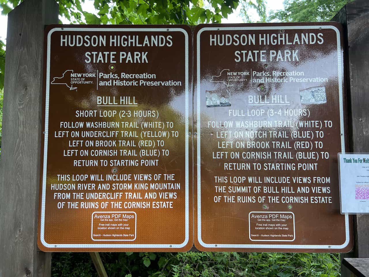
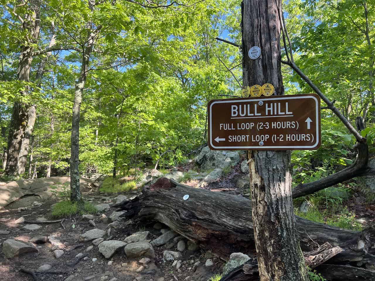
The above statistics are regarding the “Full Loop” route of Bull Hill. At the entrance, and along the route, you will also see signs for the “Short Loop” route. The short loop essentially cuts across the mountain, and removes around 1 mile of trail length.

Bull Hike Loop Difficulty
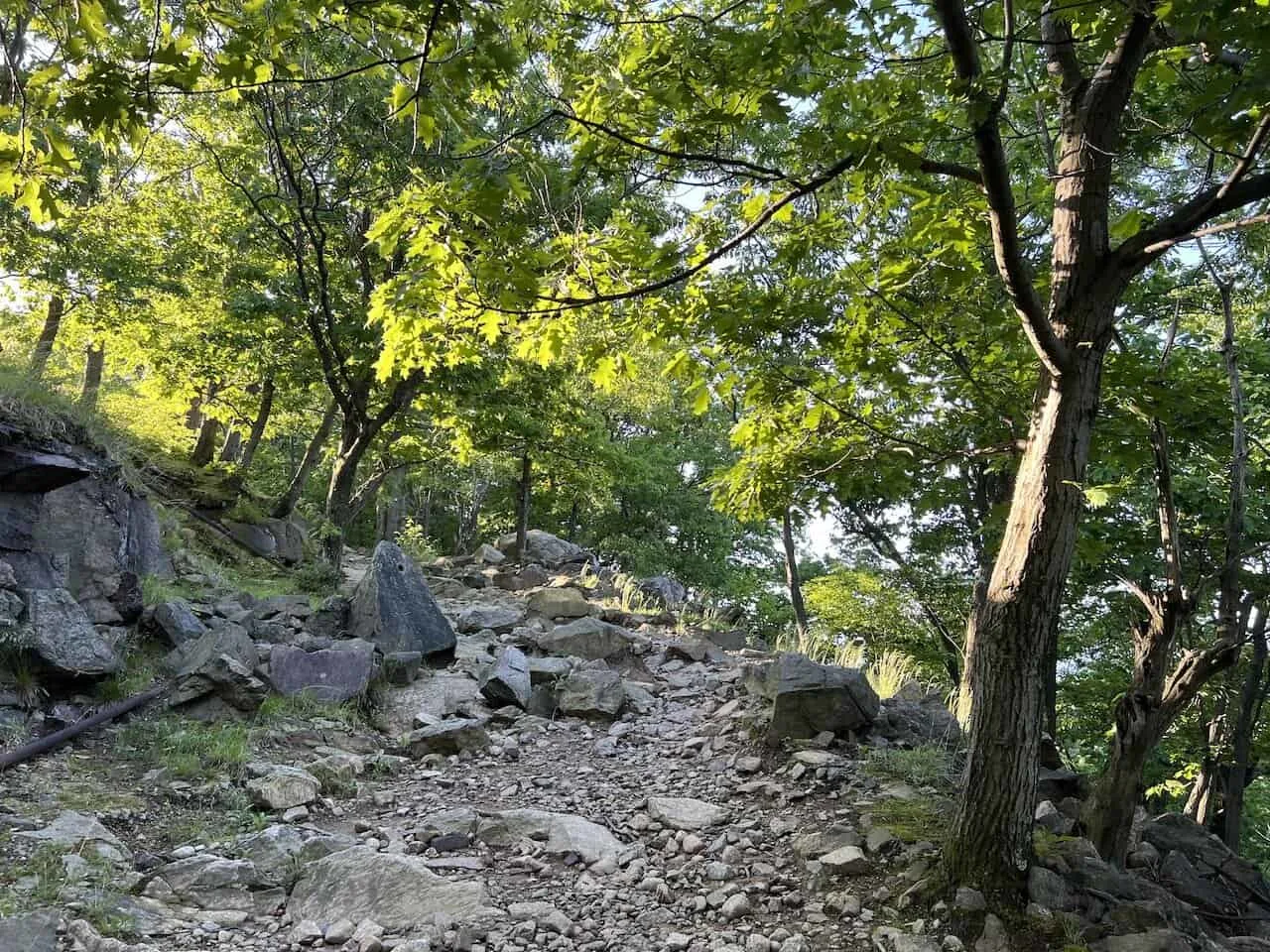
Overall, I would consider the Bull Hill hike as moderately difficult. The full loop gains nearly 1,500 feet of elevation over the course of 2 miles before descending down into the forest. There are some uneven and rocky portions of terrain throughout, making it a bit harder of a climb.
It is certainly the easier and less dangerous alternative to the nearby Breakneck Ridge hike (check out that guide to learn more).
I do believe though this is a perfect day hike to take part of in Hudson Valley that offers a little bit of everything. It has various viewpoints, historical ruins, and a beautiful river all in one hike.
2) Where is Bull Hill: Directions & Logistics
Bull Hill (Mount Taurus) is located just north of the village of Cold Spring. It is part of the greater Hudson Highlands State Park Preserve, which makes up 6,000+ acres of beautiful landscape.
The trailhead is just a mile north from the village on the right-hand side along Route 9D. On navigation apps, you may see this location named the Washburn Trail (a portion of the Washburn trail makes up a part of the overall Bull Hill hike), which is directly across from Little Stony Point.
There are two main ways to get yourself to the Bull Hill trailhead – either by car or by train.
By Car
You can easily drive yourself directly to the Bull Hill parking lot (more on that next).
The drive from Manhattan should take just around an hour without traffic as you make your way northbound following the Hudson River.
It is a beautiful drive as you are surrounded by the Hudson Valley greenery/foliage (depending on what season you visit in), and get peeks of the Hudson River along the way.
By Train
If you do not have your own car, then taking the train is also a great option. What makes this hike so accessible is that there is a train station in Cold Spring.
The Metro North Hudson line leaves 1-2 times an hour from Grand Central Station and takes around 80 minutes to arrive in Cold Spring.
The downside of the train, is that you will not be let off right at the starting point of the hike. Instead, you will need to walk the 20 minutes from the station to the trailhead. This will end up adding another 40 minutes / 2 miles to your overall day.
The round-trip ticket from Grand Central Station to Cold Spring will cost $30.
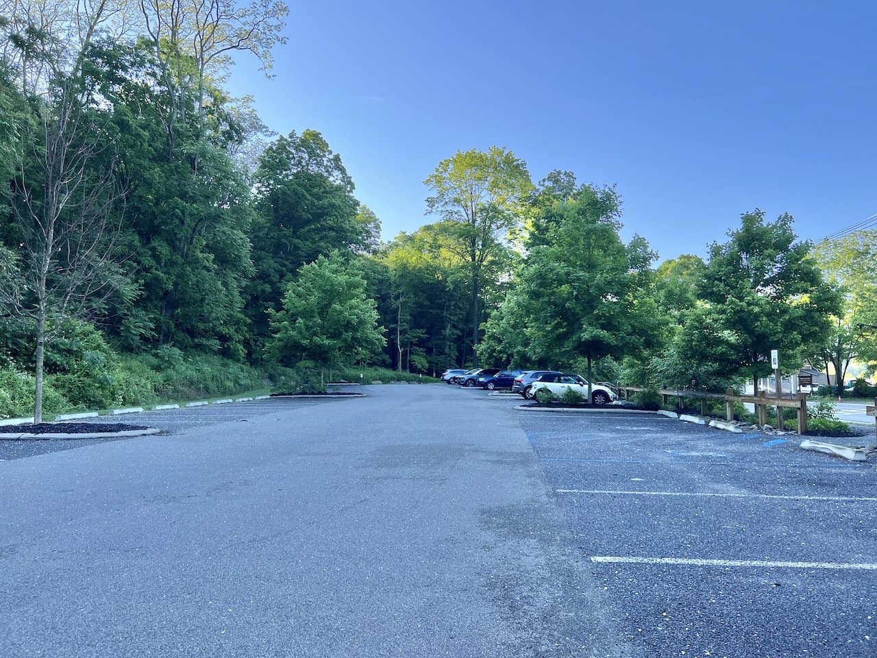
3) Bull Hill Hike Parking
By having your own car, you will get to drive up right into the Bull Hill parking lot. The parking lot is located on Route 9D, directly across from Little Stony Point.
If coming up from the south, you will pass through the village of Cold Spring before coming across the parking lot entrance on your right-hand side.
If you are looking for exact GPS coordinates, you can put in 41°25’35.9″N 73°57’55.4″W into your navigation app. Alternatively, you can just put in Little Stony Point or the Washburn Trail, and you should be getting to the same area.
The main parking lot holds around 30 or so cars. In addition to the main lot, parking is also allowed across the road just alongside the highway (maybe for another 30 cars).
If you can’t find parking in either location, you will need to backtrack closer to Cold Spring.
Between Cold Spring and the parking lot, you should find street parking pop up from time to time. The closer to Cold Spring you go though, the farther you will need to walk to the parking lot.
With all that said, you may be wondering what time to arrive to guarantee a spot in the main lot. If visiting during a spring/summer/fall weekend in nice weather, I would recommend arriving prior to 9:00AM. This is not only to get a spot, but to also enjoy the trail without the crowds.
Each viewpoint I reached during the trail, I had no other hikers alongside me. I just cannot imagine the viewpoints with the number of hikers that would be on the trail later on in the day.
If you are visiting during the weekday or an off-season weekend, I wouldn’t worry as much about the parking situation. During my time at Bull Hill, I arrived around 7:30 (first photo) and came back to the lot around 11:30 (second photo).
As I arrived back, the lot was closed off for new vehicles, the opposite side parking was full, and people were walking in from town.


4) Hudson Valley Weather
A hike like Bull Hill deserves a good weather day.
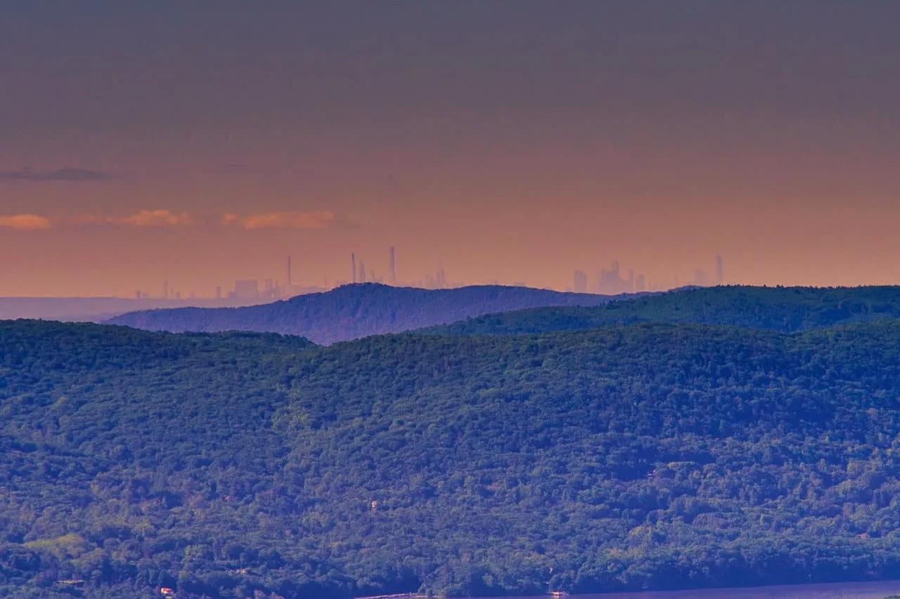
The views all along the Hudson are expansive, and I just don’t feel like it would be the same type of scenic experience if it was a very overcast day. In addition, you can see the NYC skyline on a clear day. While faint in the distance, it was still very cool seeing the skyline during the hike.
As you are deciding when to head on the hike, I would recommend checking out the Bull Hill weather and be on the lookout for the number of hours of sun in the forecast.
In addition to the weather itself, you may also want to think about what season to go in. Personally, I love hiking during the late spring and peak fall foliage times.
During the late spring, the temperatures are still moderate and the trees are full of greenery. As the leaves turn colors in the fall, you will get to see a very colorful canopy of trees all along those viewpoints.

Hiking Resources & Checklist
Before heading out for the trails, be sure to read up on some of the hiking resources up on the site. These are here to better prepare you for all types of outdoor adventure.
- Gear: Hiking Packing List
- Weather: How to Prepare for Hiking Weather
- Navigation: Hiking GPS & Navigation
- Tips: 20+ Hiking Tips & Tricks for the Trail
- Accommodation: Book Your Hotel Today
- Rental Car: Book Your Car Rental Today
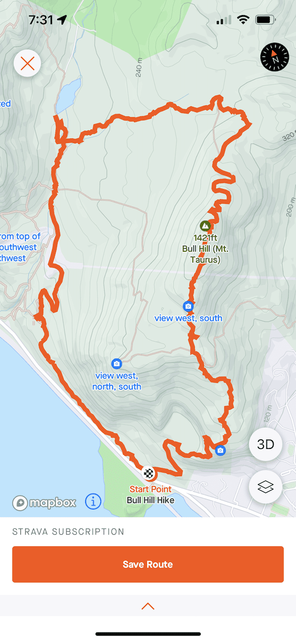
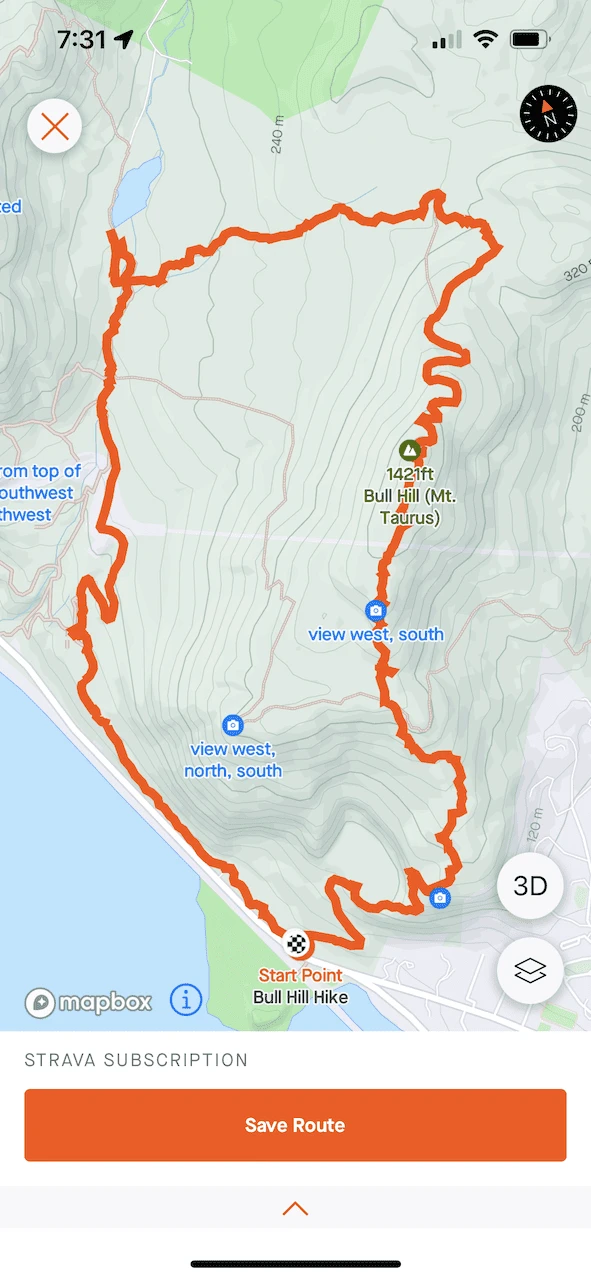
5) Bull Hill Map
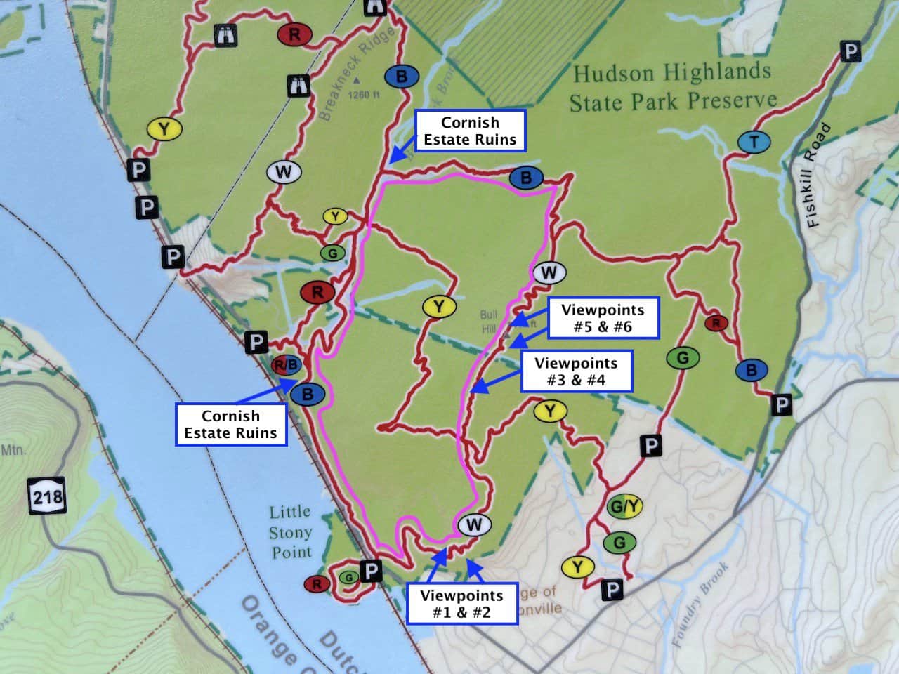
Below you can find two maps for the Bull Hill hike.
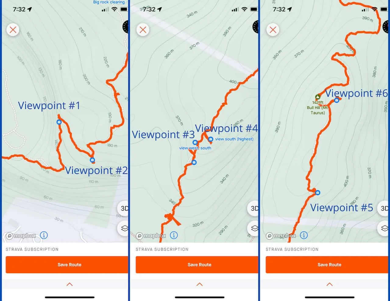
The first is the map that is shown at the trailhead. Here you can see all the various routes that exist in the immediate area. On the map, I have added a pink line that indicates the route to take. In addition to the map at the trailhead, I have also included a screenshot of my Strava app.
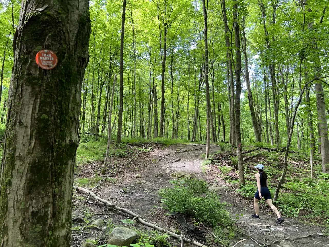
From the parking lot, the route follows the White Trail – Blue Trail – Red Trail – Blue Trail. It is all well marked on the trail itself, with markers indicating the trail color as well as signs pointing you on the Full Loop.

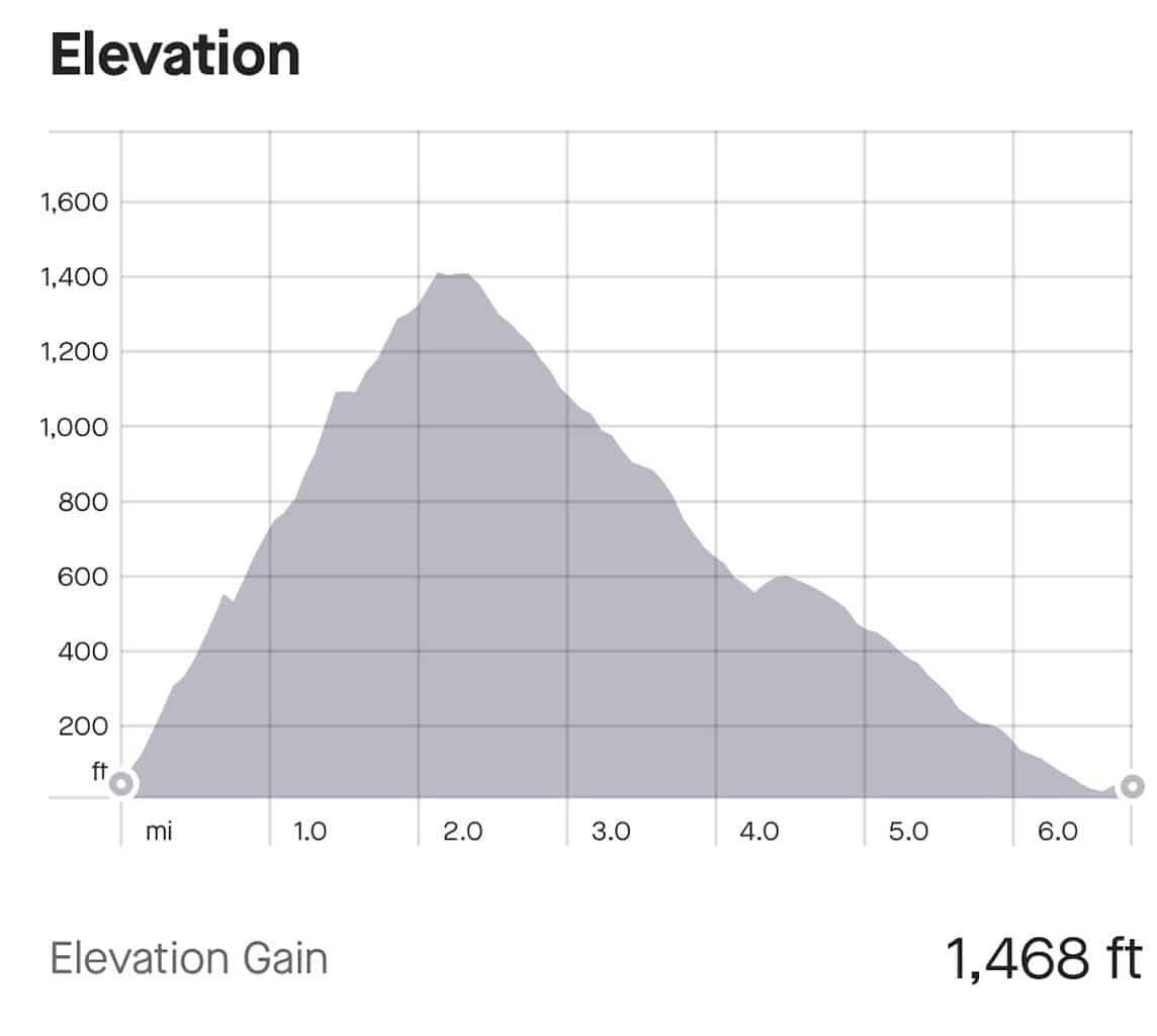
I also thought it may be helpful to include the elevation gain profile of the hike. Like most people, I opted to go in the counter clockwise direction. This left me with a steeper but shorter incline and a longer but gentle decline.
Overall, the route does gain essentially all the 1,468 feet during the first 2 miles of trail. Over the next 4 miles or so, the route is just a downhill walk to the parking lot.
Note: you can see on the screenshot that my hike came in closer to 7 miles (vs. the 5.5 miles it is marketed as). This is because I spent additional time walking around the Cornish Estate ruins.
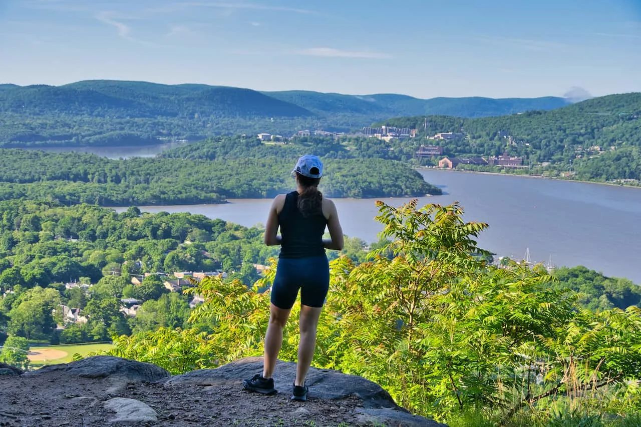
6) Viewpoints!
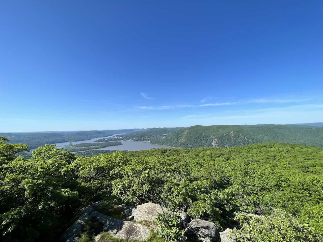
The highlights of the Bull Hill Mt Taurus hike are certainly the various viewpoints you will take in along the way.
These views go both north and south of the Hudson River, with the surrounding Hudson Highlands State Preserve in each direction.
A very important thing to note about the viewpoints is that not all of them are directly on the trail itself. It is VERY easy to walk right by the best viewpoints without even realizing it.
Here is where having a navigation app can be super helpful. The apps like Strava, Maps.me, AllTrails, etc., have the viewpoints marked down. If you are paying attention to the app as you get closer to a viewpoint, you will be in a much better position not to miss it.
I have marked down 6 main viewpoints on the map above, and the zoomed in Strava app below. These viewpoints are what I would consider the “main” viewpoints of the hike up Bull Hill. There are other views along the way, but you should try your best not to miss these 6.
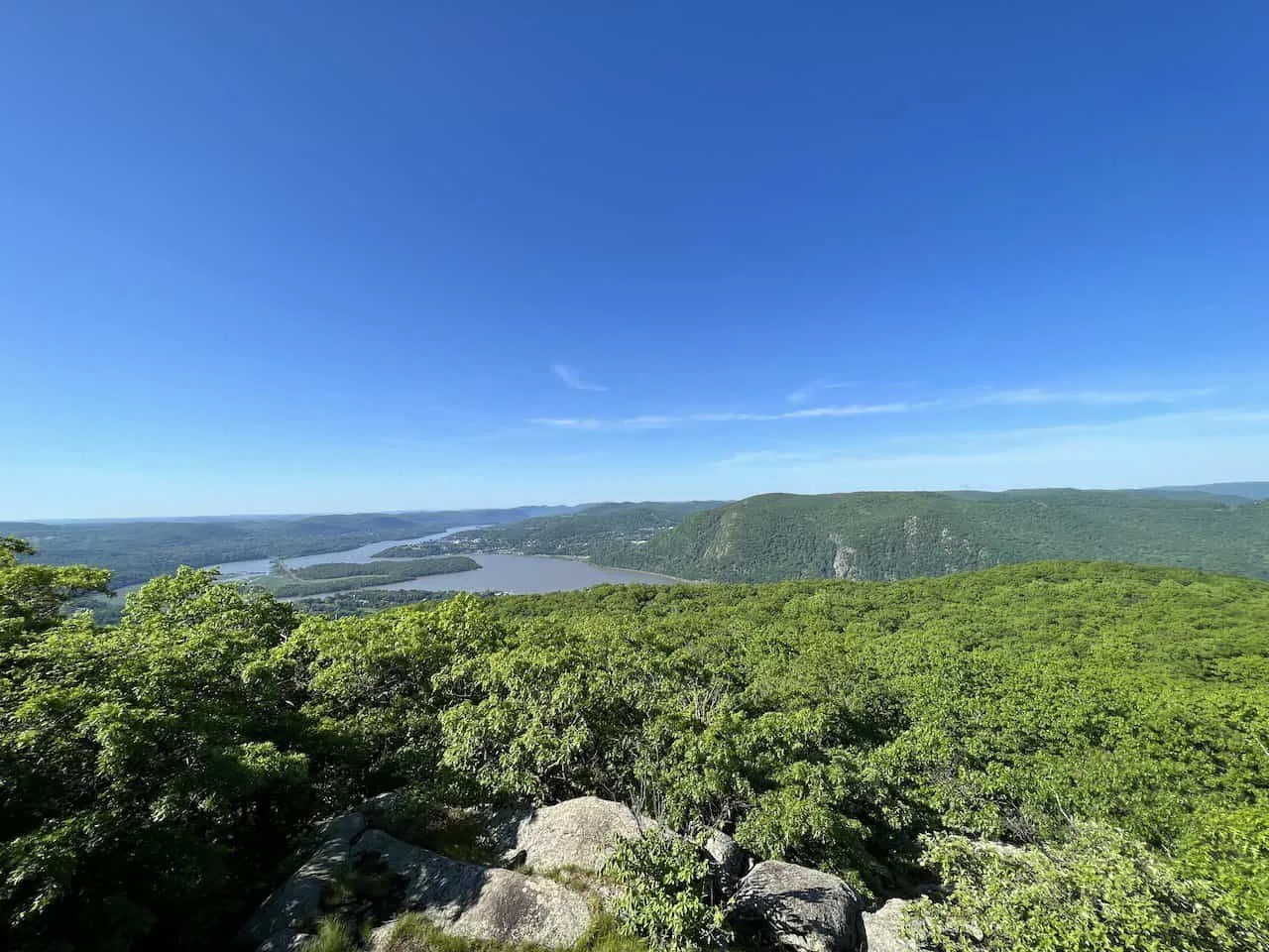
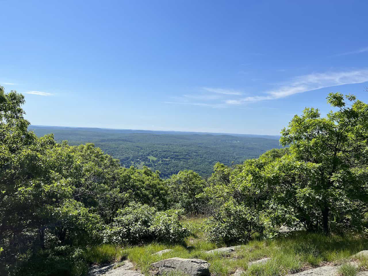
Viewpoint #1: the first viewpoint is located 0.6 miles into the trail overlooking the Hudson in the northbound direction. This viewpoint is on the trail itself and is very hard to miss.
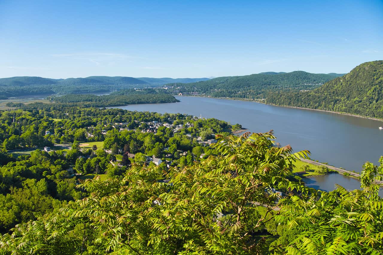
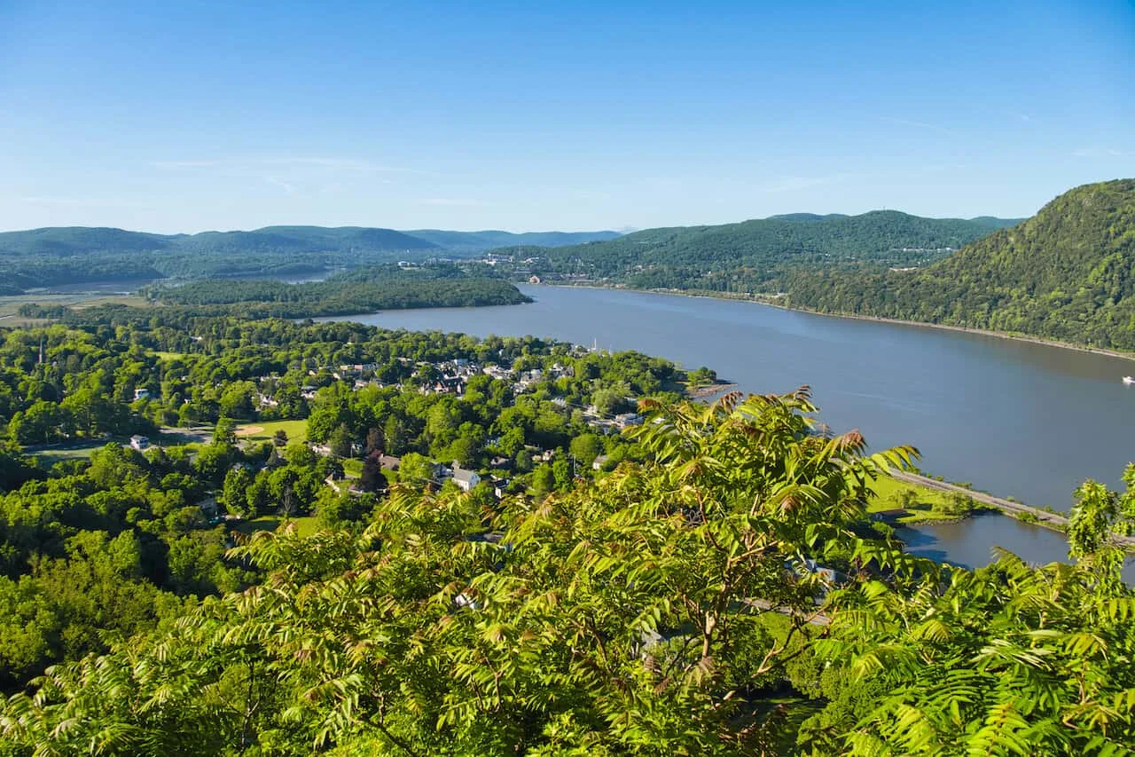
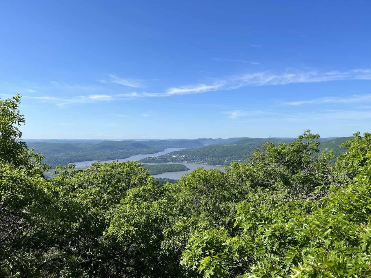
Viewpoint #2: the second viewpoint is located 0.7 miles into the trail. Here you will get a view overlooking the town of Cold Spring with the Hudson River out back. This viewpoint is also along the trail itself and you should have no issues taking in the view.
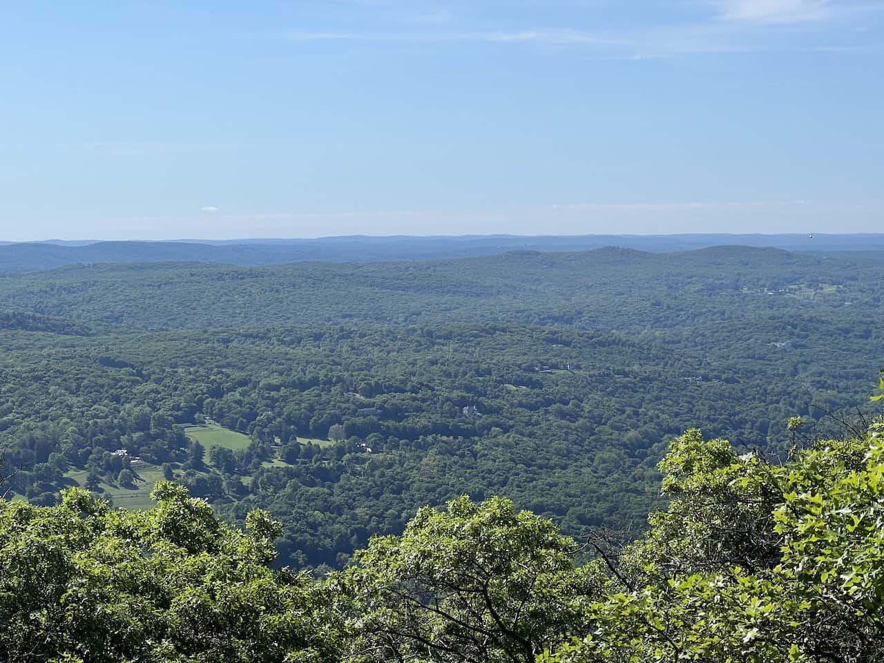
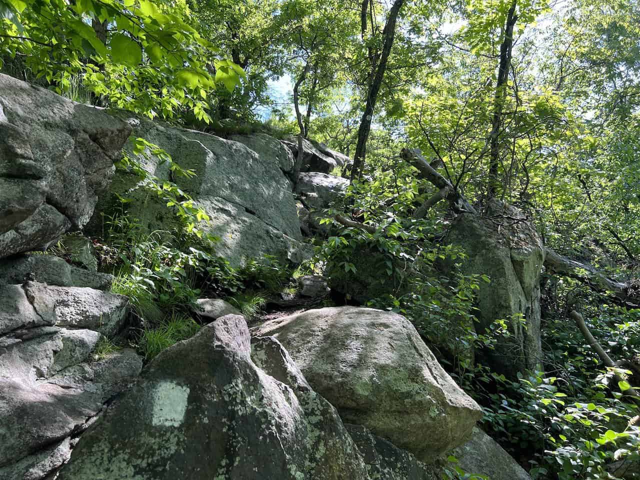
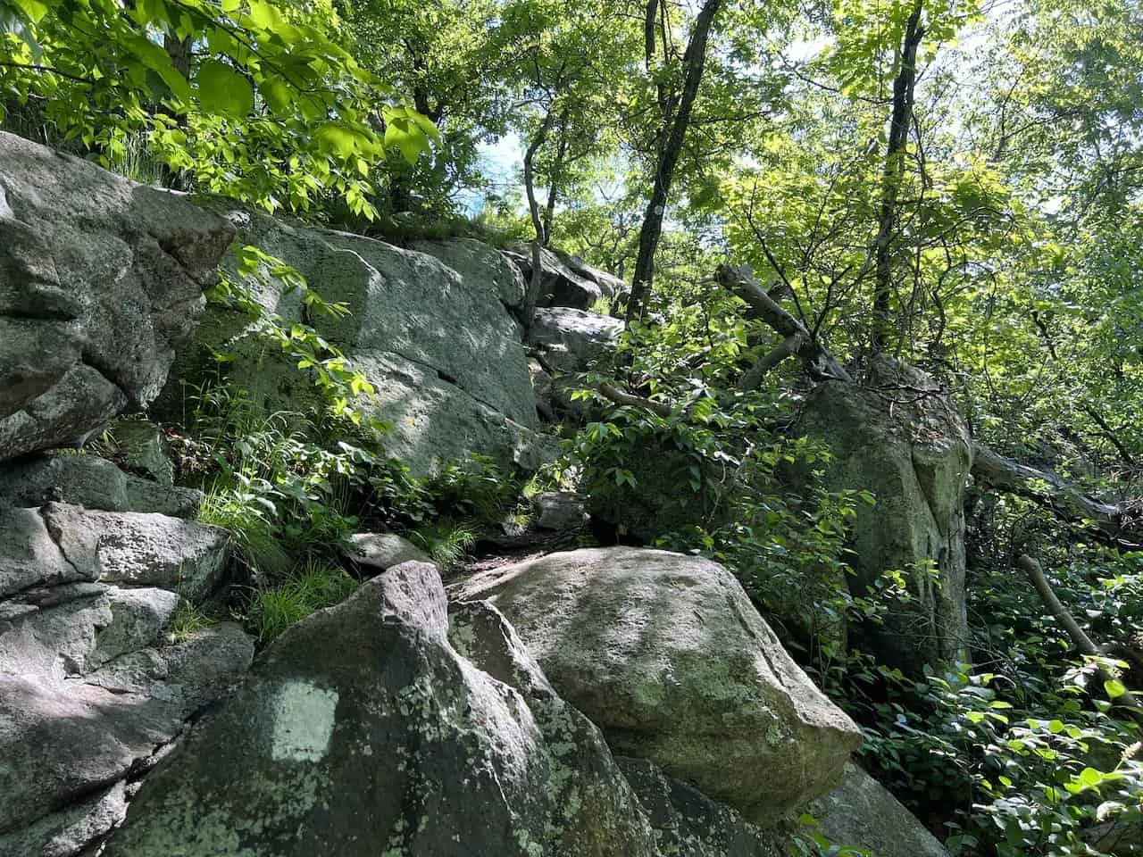
Viewpoint #3: the third viewpoint is 1.8 miles into the hike and is very easy to miss. The location is just off the trail on the left-hand side.
Here you will get some expansive views looking in various directions of the Hudson Valley. On the map this is named “view west, south”. If you have a navigation app, it will be much easier not to miss this spot.
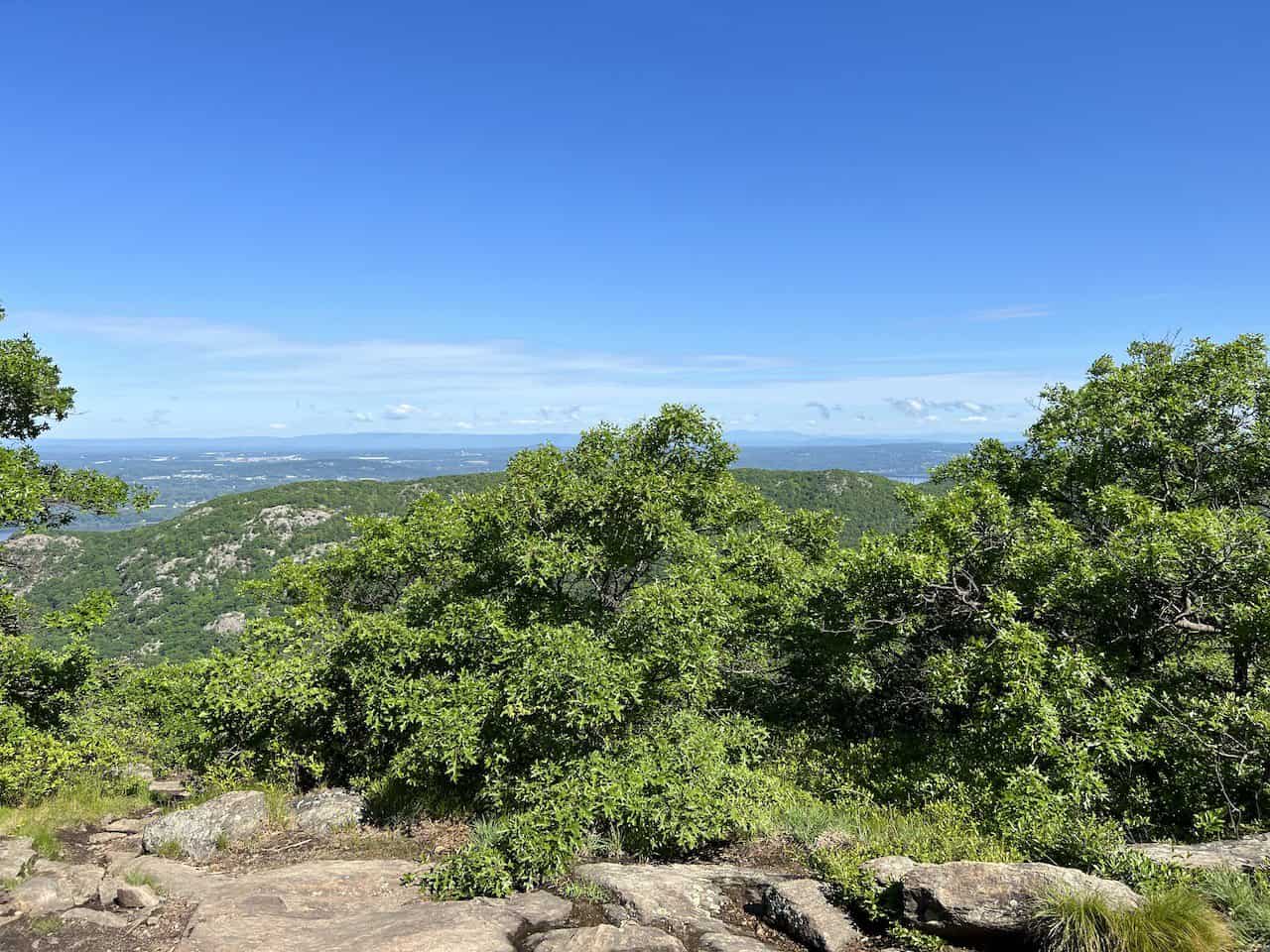
Viewpoint #4: the fourth viewpoint is nearly right across the way from the third viewpoint. Walk another minute or so along the trail and you will see a rock painted “view” on the right-hand side.
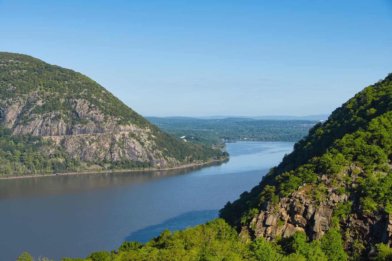
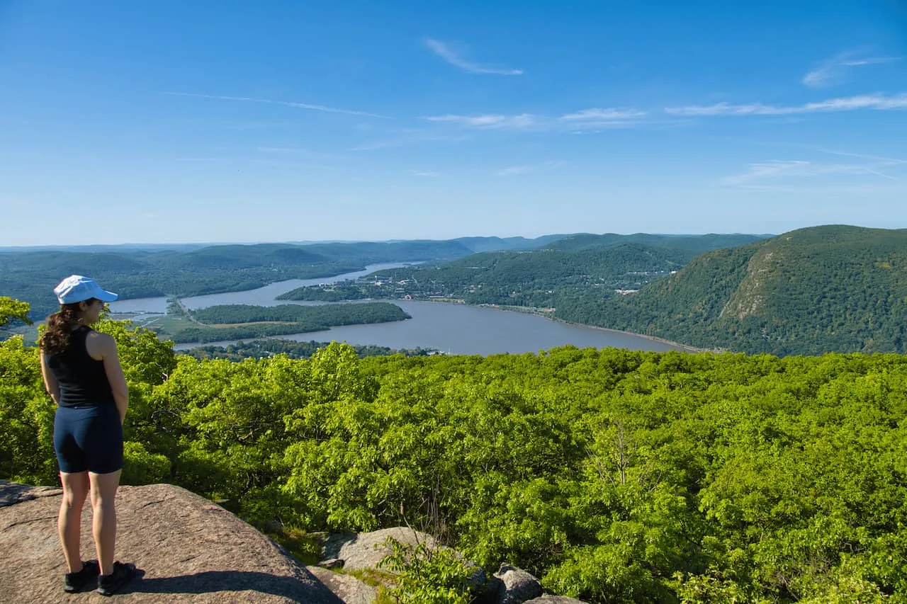
Head onto the rock for the best view of the hike, in my opinion. Views looking all the way south down the Hudson River in addition to the NYC skyline on a clear day can be seen from this spot.
You will see this marked as “view south (highest)” on the navigation apps.
Viewpoint #5: 2 miles into the trail you will find the 5th main viewpoint area. Here you will get similar but more obstructed views compared to the 4th viewpoint. This viewpoint is technically on the trail but can also be missed if accidentally circumventing it.
Viewpoint #6: 2.2 miles into the trail is the final viewpoint just prior to top of Bull Hill. This viewpoint also looks southbound but is not as expansive as some of the other views on the hike.
And of course, as you leave the last viewpoint, you will come across the highpoint of Bull Hill on the main trail. Here you will have views looking north and west, but it is a bit obstructed by the surrounding trees.

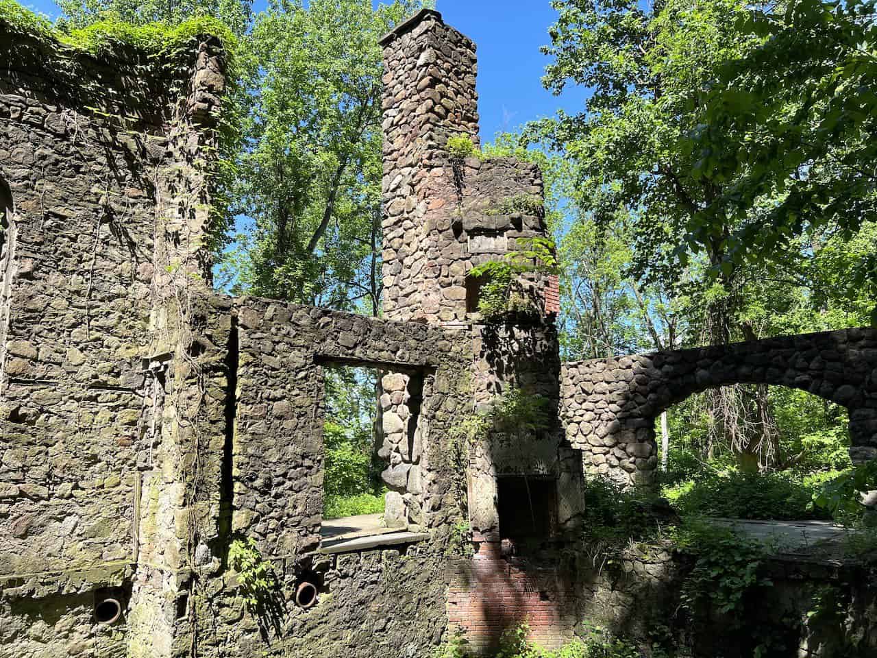
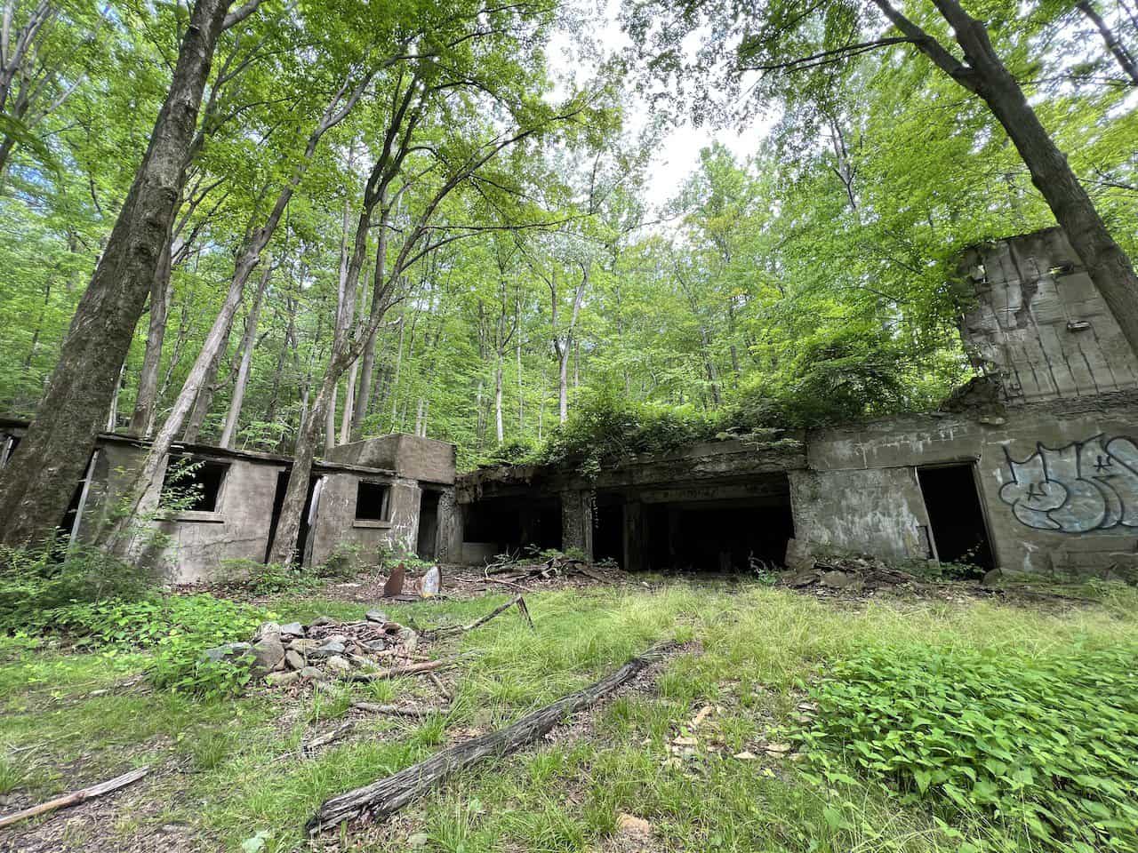
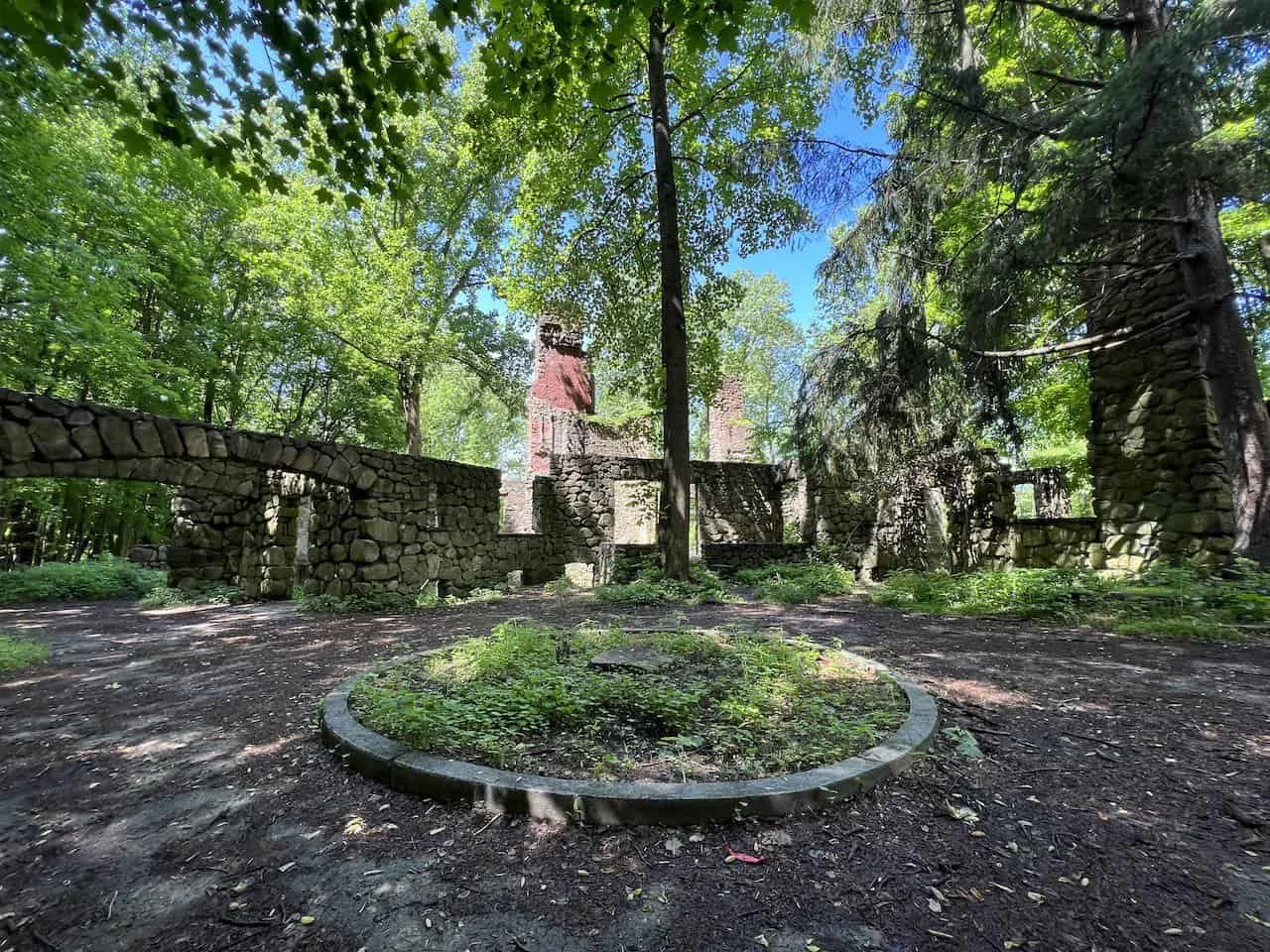
7) Cornish Estate / Northgate Project
Beyond the views, the other main highlights of the Mount Taurus hike are the ruins of the Northgate Project / Cornish Estate.
There are two main areas to see the ruins, both marked on the map above. Here is just a brief history of how these ruins came to be:
In 1904 Sigmund and Dove Stern started to purchase land to create a 650-acre estate in the Breakneck Valley. This would include a mansion, gardens, a swimming pool, and more.
In 1915, Dove Stern passed away and the property was soon sold to Edward and Selina Cornish. They then lived there for the next couple of decades. However, in 1958 a fire destroyed the main property.
In 1967, New York State purchased the property and it became part of the Hudson Highlands State Park.
Today, the Northgate Project is a way preserve the ruins of the Cornish Estate. The goal is to “create an interpretive experience, remove invasive plants, and preserve the ruins for future generations to enjoy.”
8) Bull Hill Hike
I think by now you should have all the information you need to know to fully enjoy the Bull Hill Full Loop. Here is an overview of the trail so you can get a better idea of the terrain, nature, views, and more along the way.
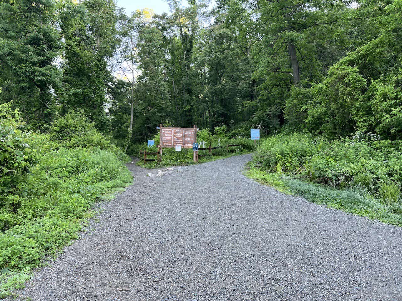
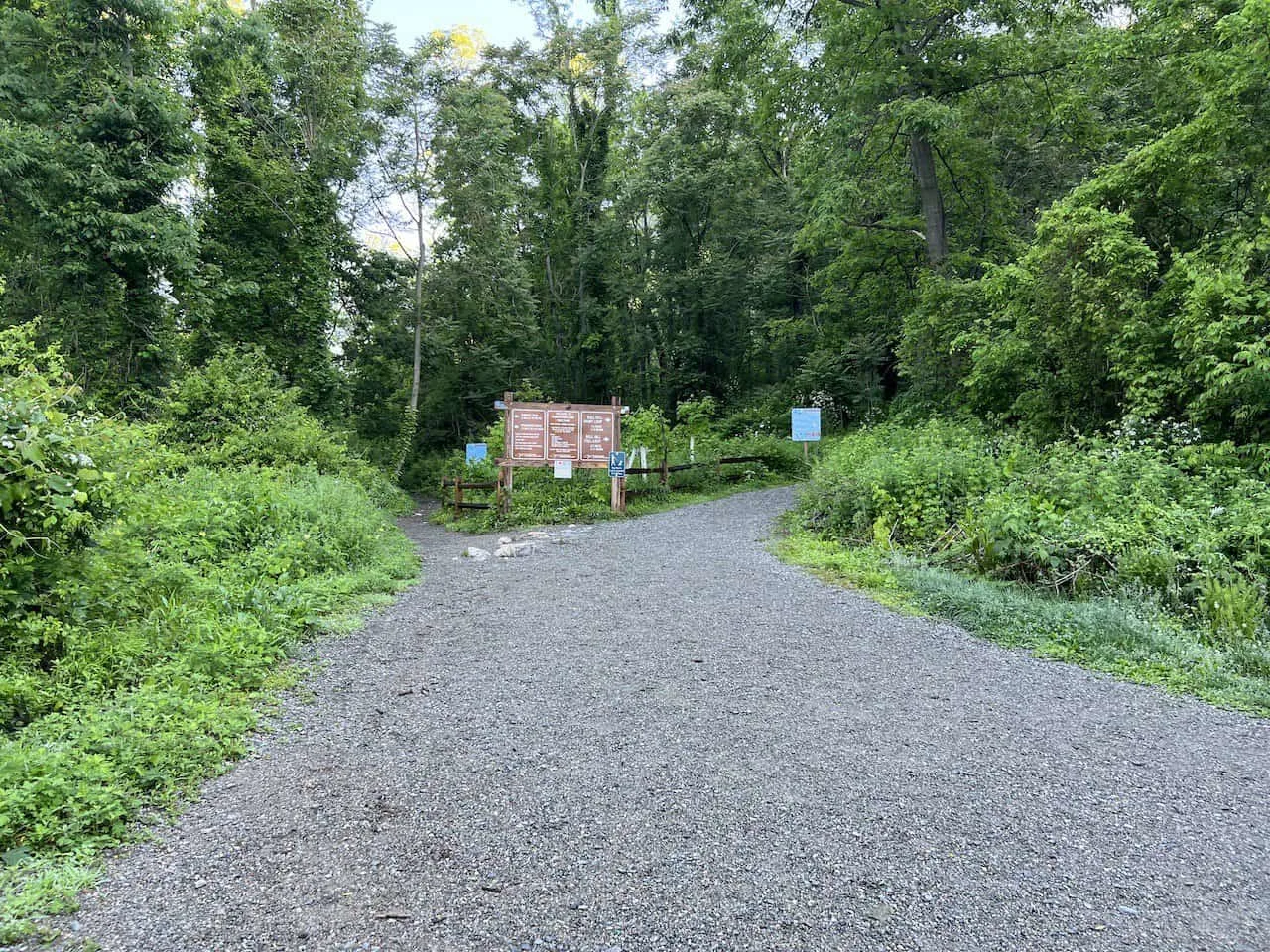
The start of the hike begins just at the end of the parking lot, where you will immediately be greeted to two routes.
Head to the right here on the White Trail, following signs for the Bull Hill Full Loop (the left-hand side is what you will be coming back on at the end of the hike).
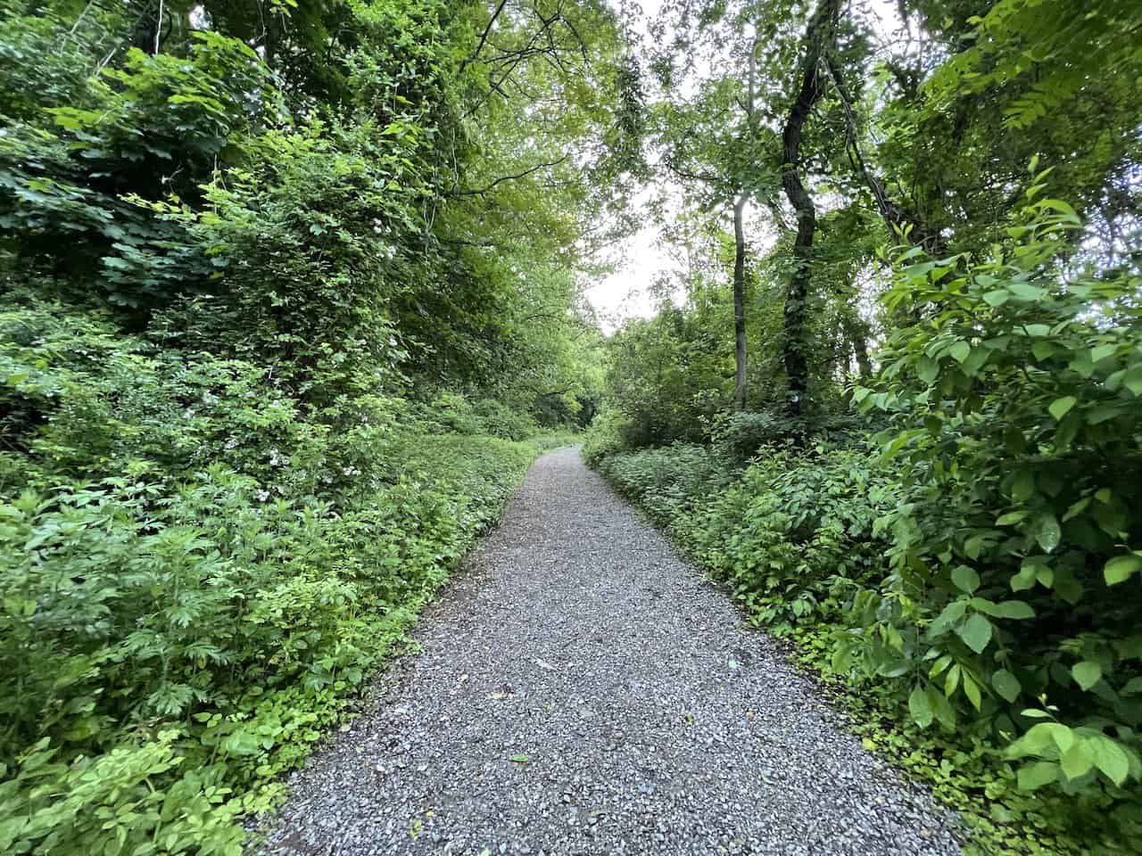
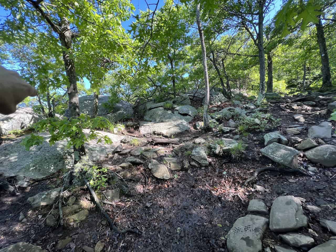
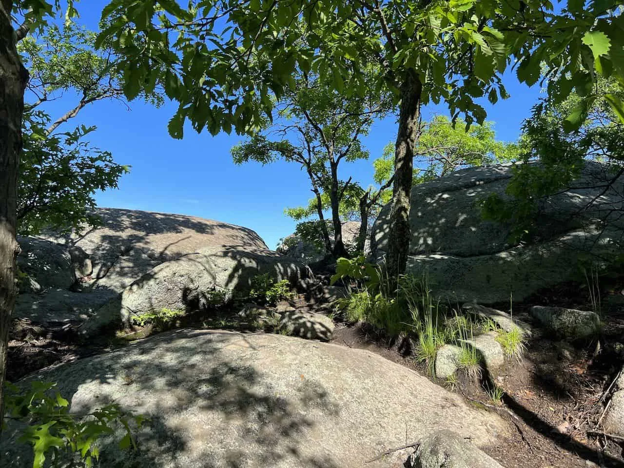
As you may remember from earlier, the first couple miles will just be a steady uphill climb. The first portion will be through trees along a rocky trail. You will then reach a point, where the trail points you up to the right. The trail then continues in a denser forest up along some more uneven terrain.
Just prior to the first two viewpoints, you will come across a trail sign letting you know you are just 0.1 miles away from the first viewpoint.


Viewpoint #1
The trail continues uphill until you reach viewpoint #1.
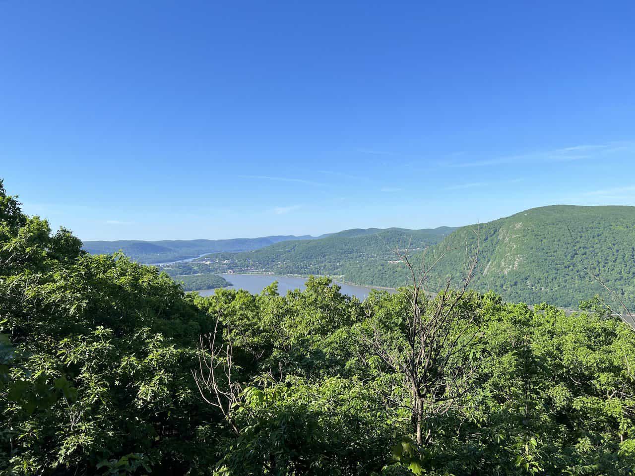
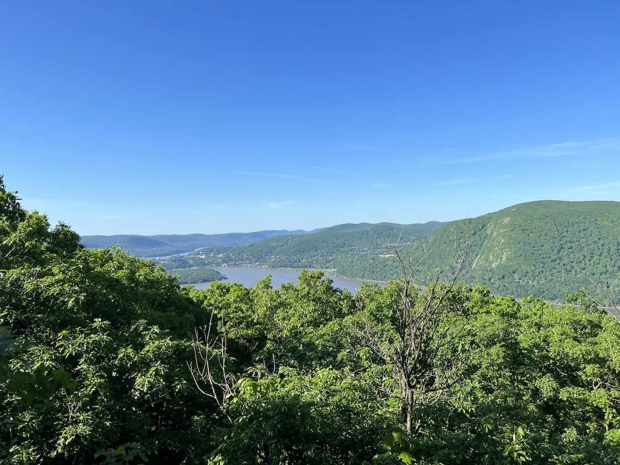
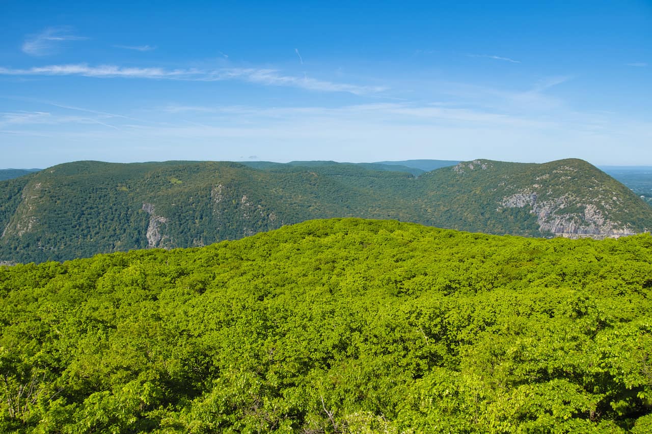
Here you will have views looking northbound up the Hudson River, with Breakneck right off to the side and Storm King Mountain across the way (check out the guide to learn more about the hike).


Viewpoint #2
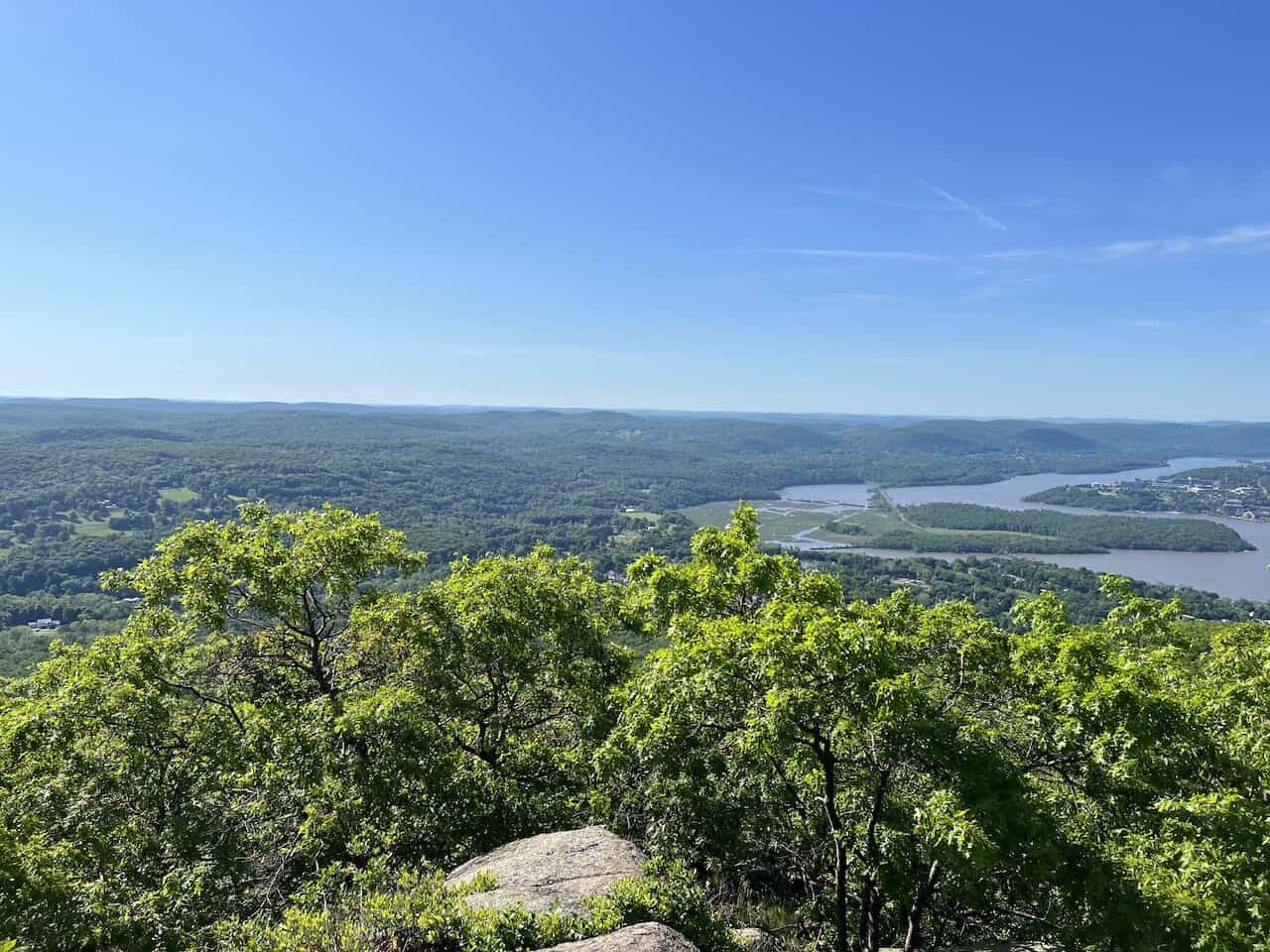
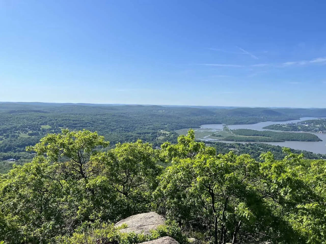
Follow the trail along for another couple of minutes and you will arrive at viewpoint #2. Here you will find views of Cold Spring down below with the Hudson River right alongside of it.
Further out in the distance you will also get to see West Point.

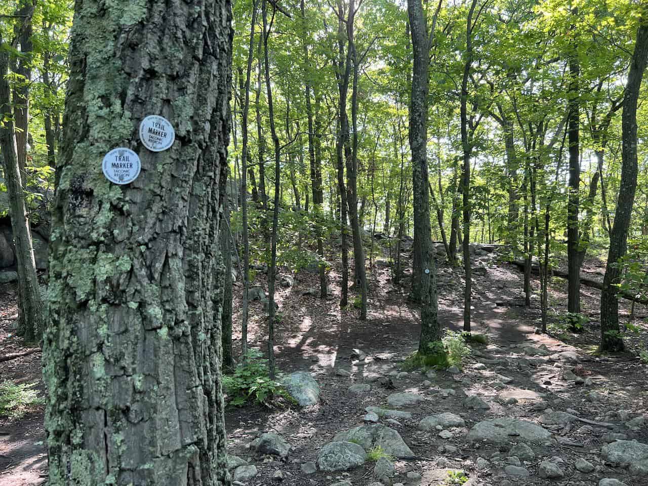
From here, the trail continues to climb. Be sure to look out for those white trail markers on the trees.
It is easy to get distracted in some places. But as long as you see the next white trail marker, you should be good to go.
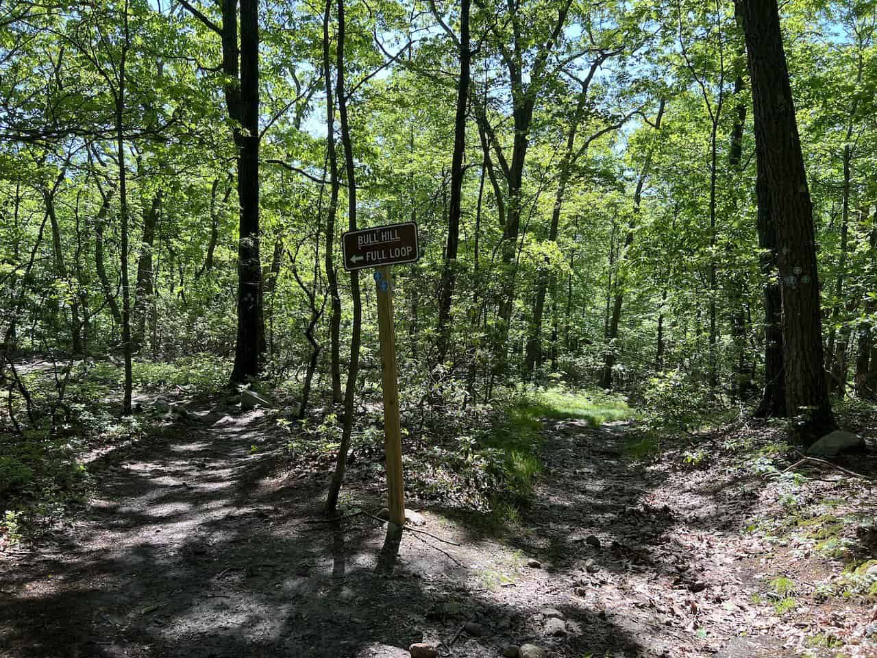
As you head on up, there may be some additional views to take in along the way. The trail then continues until you reach an intersection.
The short loop will be to your left and the full loop, straight ahead. Since this hiking guide is about the full loop, head straight on the trail.
Note: you could add on another mile or so of hiking if you want to see a couple viewpoints that are just on the short loop. Turn left here, take in the views, and then turn back around to the intersection. I did not do this, but I did see those views pop up on my navigation app.

The trail continues onwards, where you will soon need to hop across a small river and then up some rocks to the next portion of trail.

Viewpoint #3
It is approximately 10 minutes after passing over the river, where you will need to pay close attention to reach viewpoint #3. Below are a couple shots of the left hand turn I took up onto some larger rocks.


Once at the viewpoint, you will get some of the best views looking south, west, and north. While the viewpoint is certainly a bit trickier to get to, the views are worth it.


Viewpoint #4
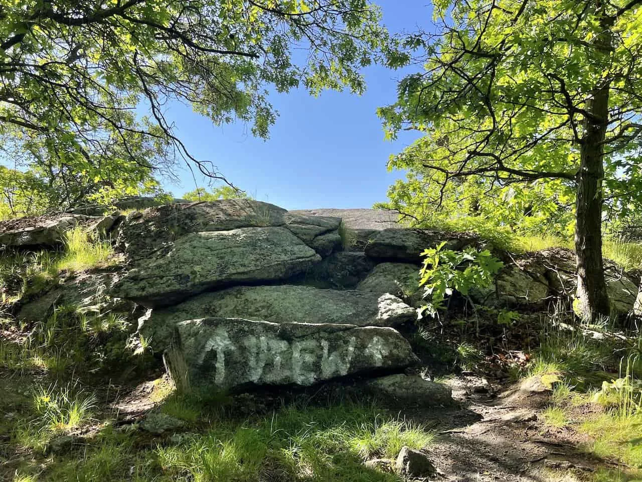
After enough time enjoying the view, backtrack onto the trail and pay very close attention to your right-hand side as you continue to walk.
There should be a rock painted “View” on it with two arrows pointing up. This is where you will find viewpoint #4.

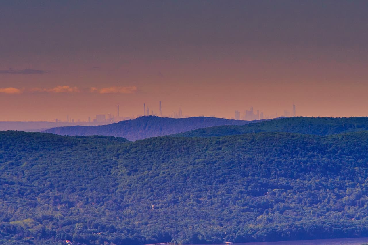
Here you will get never ending views of the forested tree canopy with the Hudson River just winding its way southbound.
On a clear day the Manhattan skyline will be in view all the way out in the distance. Below you can find a zoomed out and then zoomed in shot of the skyline.
You can clearly see some of the major buildings dotting the landscape. I had to do some de-hazing to really get the skyline to pop in the photos.


Viewpoint #5
The views don’t end there though! Continue back on the trail to reach the last couple of viewpoints for the day. Viewpoint #5 is on the route itself if you follow the white painted rock you should come across.
At the viewpoint, you will see the “NYC View *” painted on the rock.
This viewpoint area will also give you views of the skyline and south Hudson but it is more so blocked by trees than the previous viewpoint.

Viewpoint #6
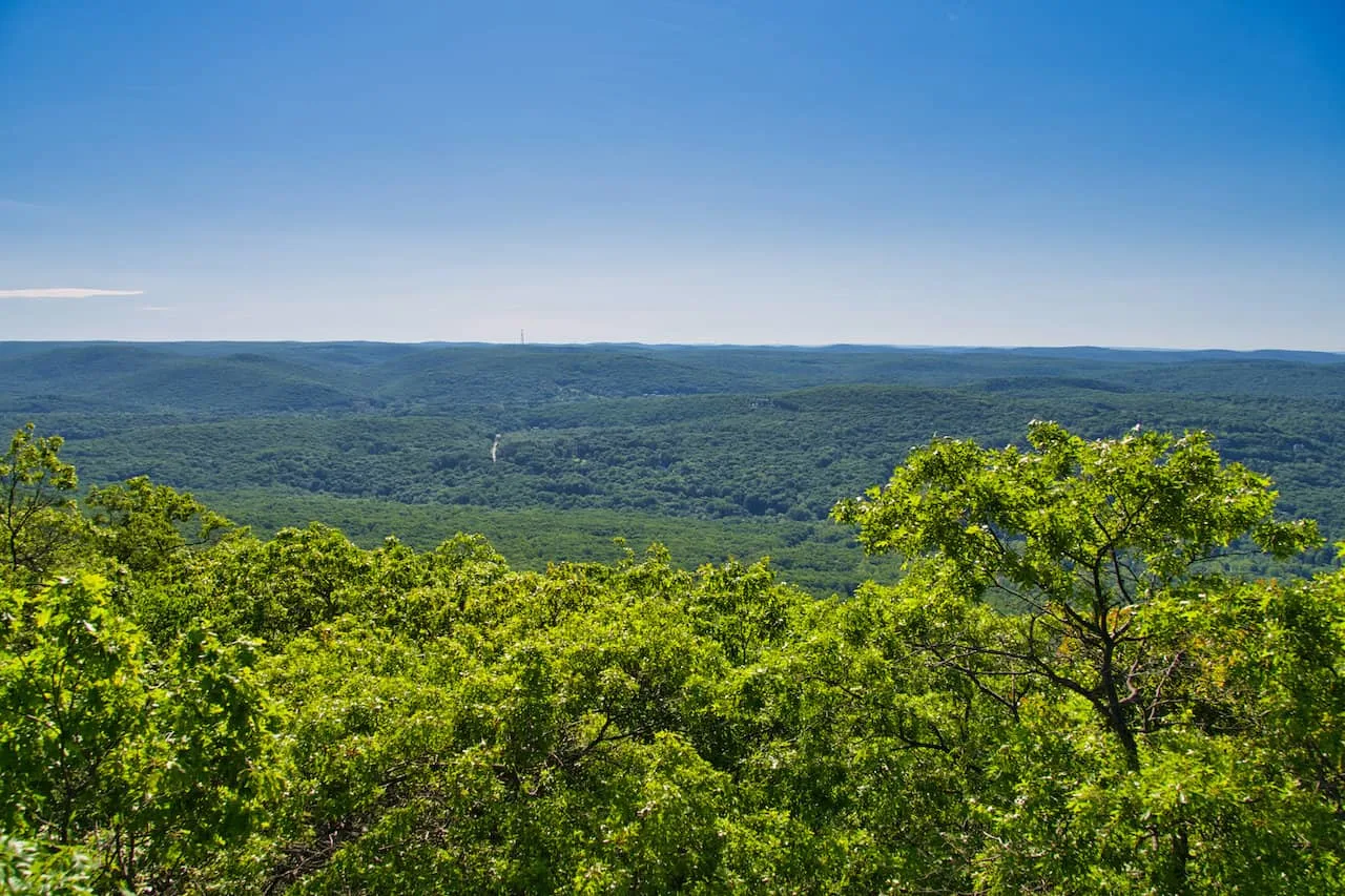
As you leave viewpoint #5, the trail will continue to the highest accessible point of Bull Hill. But right before that point, you will see a faint trail to the right-hand side that opens up to a grassy area.
Here you will get a straight view of the greenery for miles and miles (or colorful leaves during foliage).
This is viewpoint #6 and the last of the major views that you will get to enjoy on the hike before descending down.

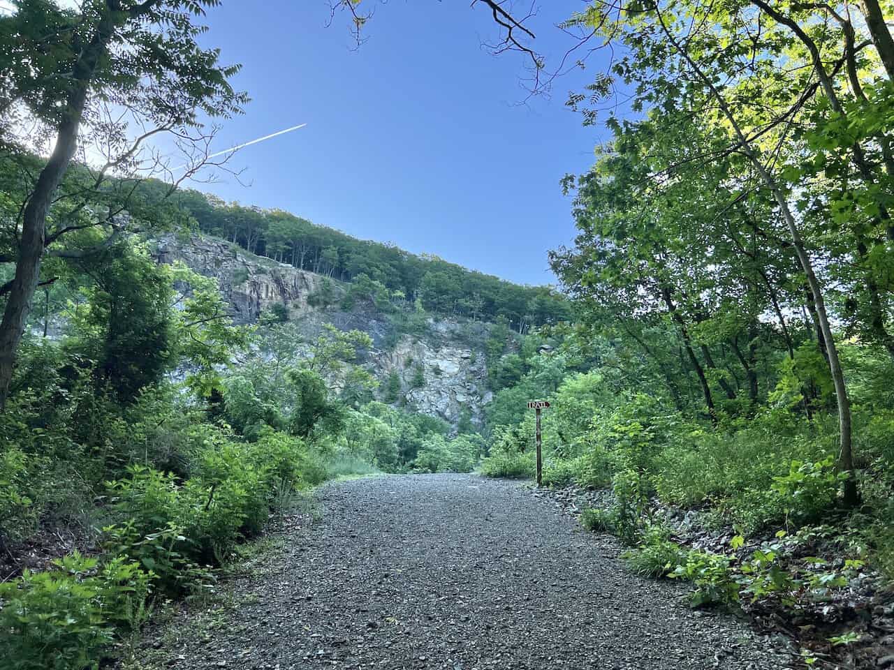
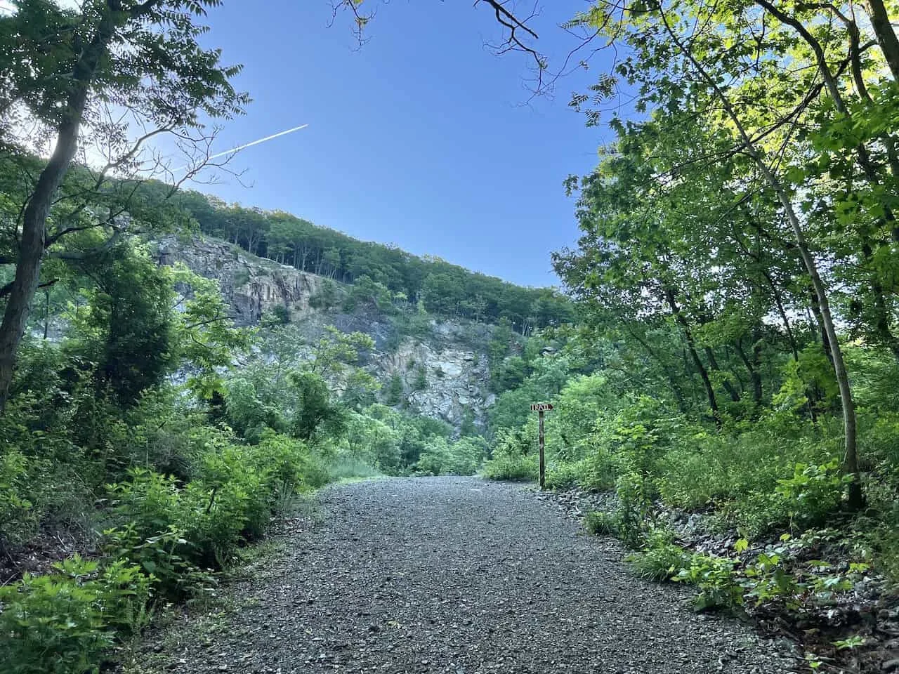
After leaving viewpoint #6, you will come across the Bull Hill highpoint of the trail, where you will have some views northbound (although a bit blocked by trees). From here, the descent begins.

The Descent
From the top of Bull Hill, follow the pathway into the forest as you slowly lose that elevation. The trail will make some twists and turns as it heads further down the mountainside.
As you are making your way down, be on the lookout for a hiking sign pointing to the full loop, as there are some alternative routes that pop up along the way. Here is where you will leave those White trail markers behind, and start following the Blue markers.

Cornish Estate #1
The trail continues through the forest until you reach another hiking sign pointing you on the full loop. Before you continue on the full loop here, you should see some of the ruins on your right-hand side.
You can follow a few different pathways to reach two main structures.
The first one is more of just a dilapidated building while the next one is a bit more scenic to enjoy. Be careful as you are making your way around as these are very old structures.


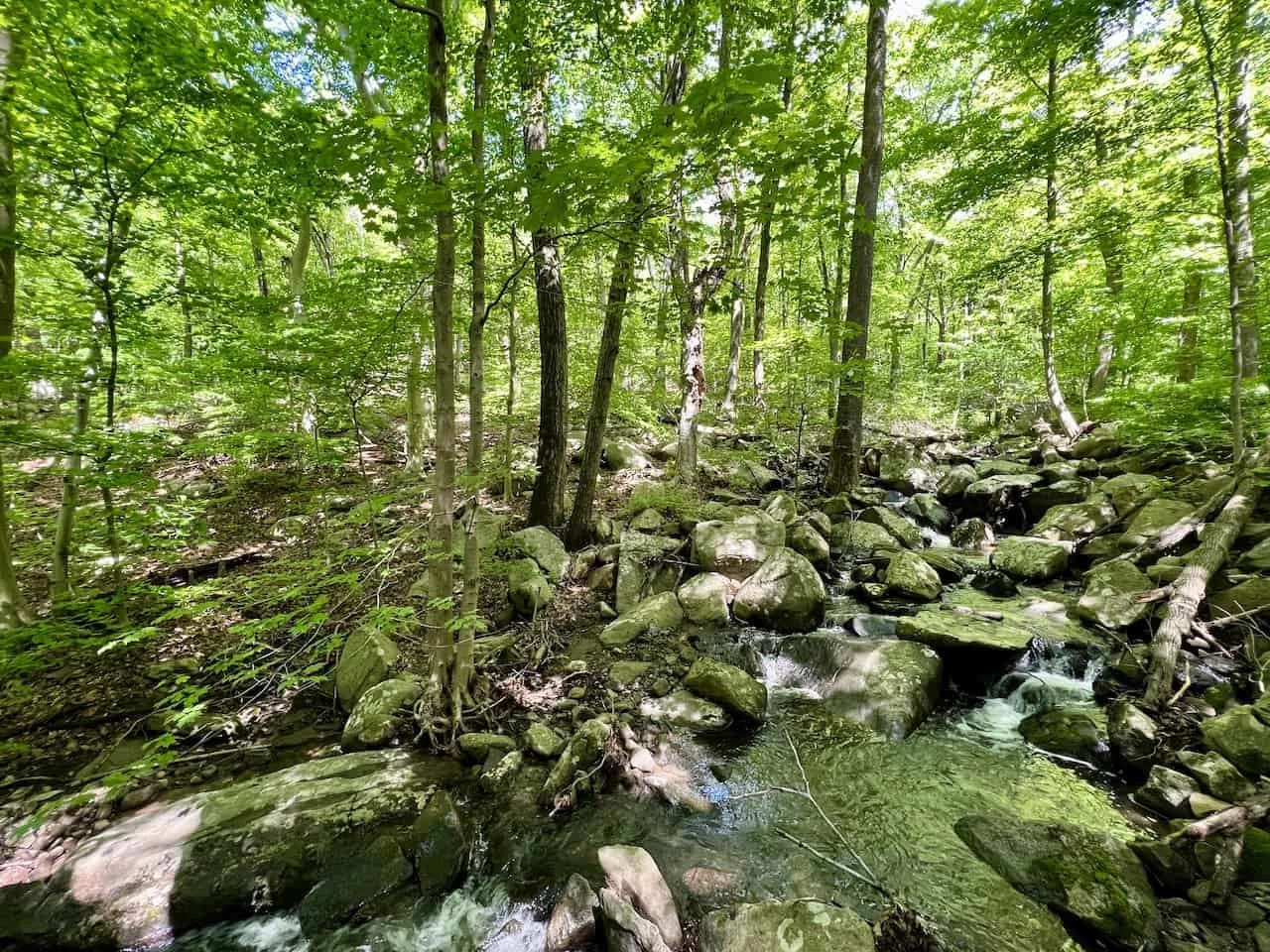
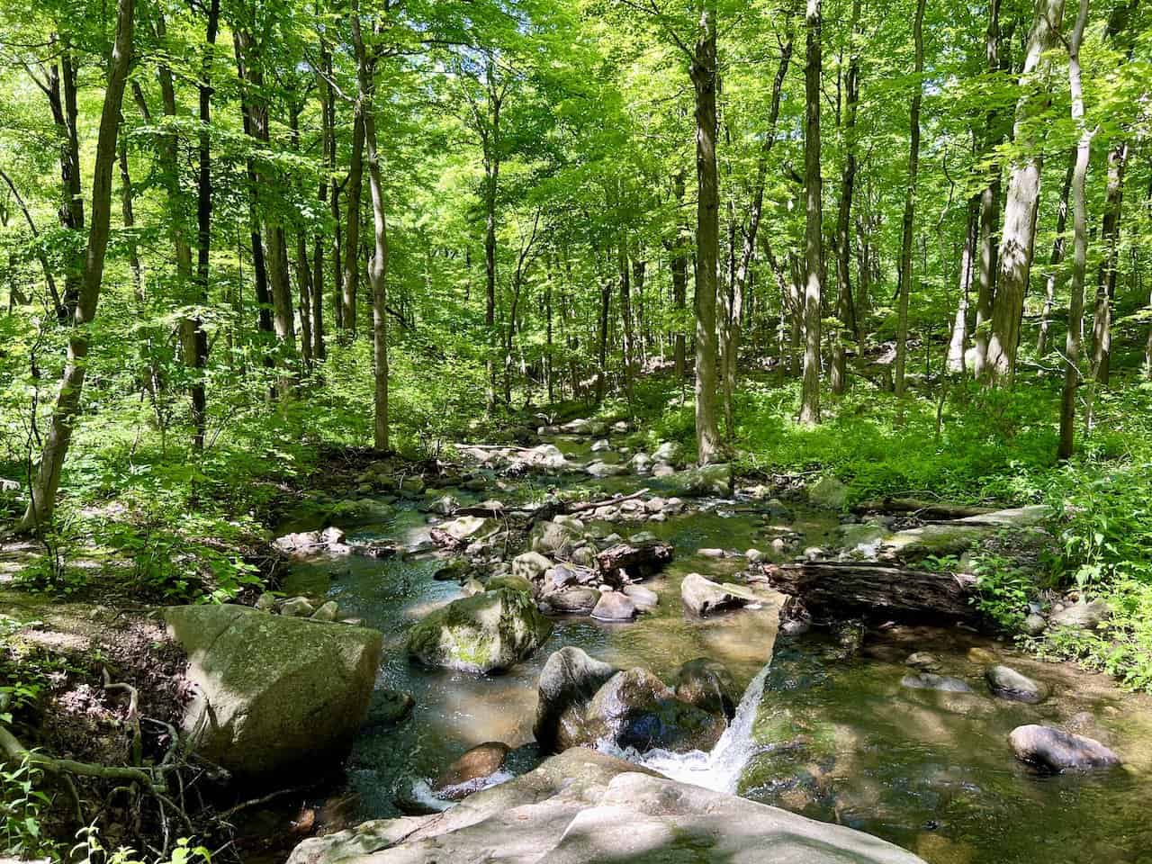
Following the River
Backtrack towards that hiking sign from before, where you will now begin to follow Red markers for a little while. This portion of trail is yet another highlight. While there will be some streams throughout the hike, here is where you will find a constant river flow next to the trail.
It is a very soothing and relaxing experience to take in as you walk along the river and take in the view along the way. The river portion of trail will then end, as you are directed to once again follow the Blue markers back to the parking lot.


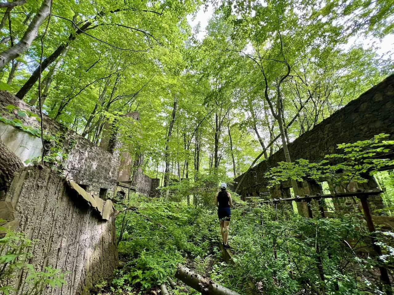
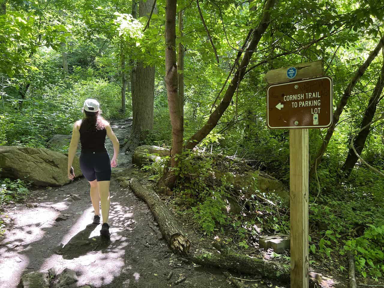
Cornish Estate #2
Before making it to the parking lot though, you will come across the main Cornish Estate ruins. You will find several structures alongside some informational signboards about the estate.
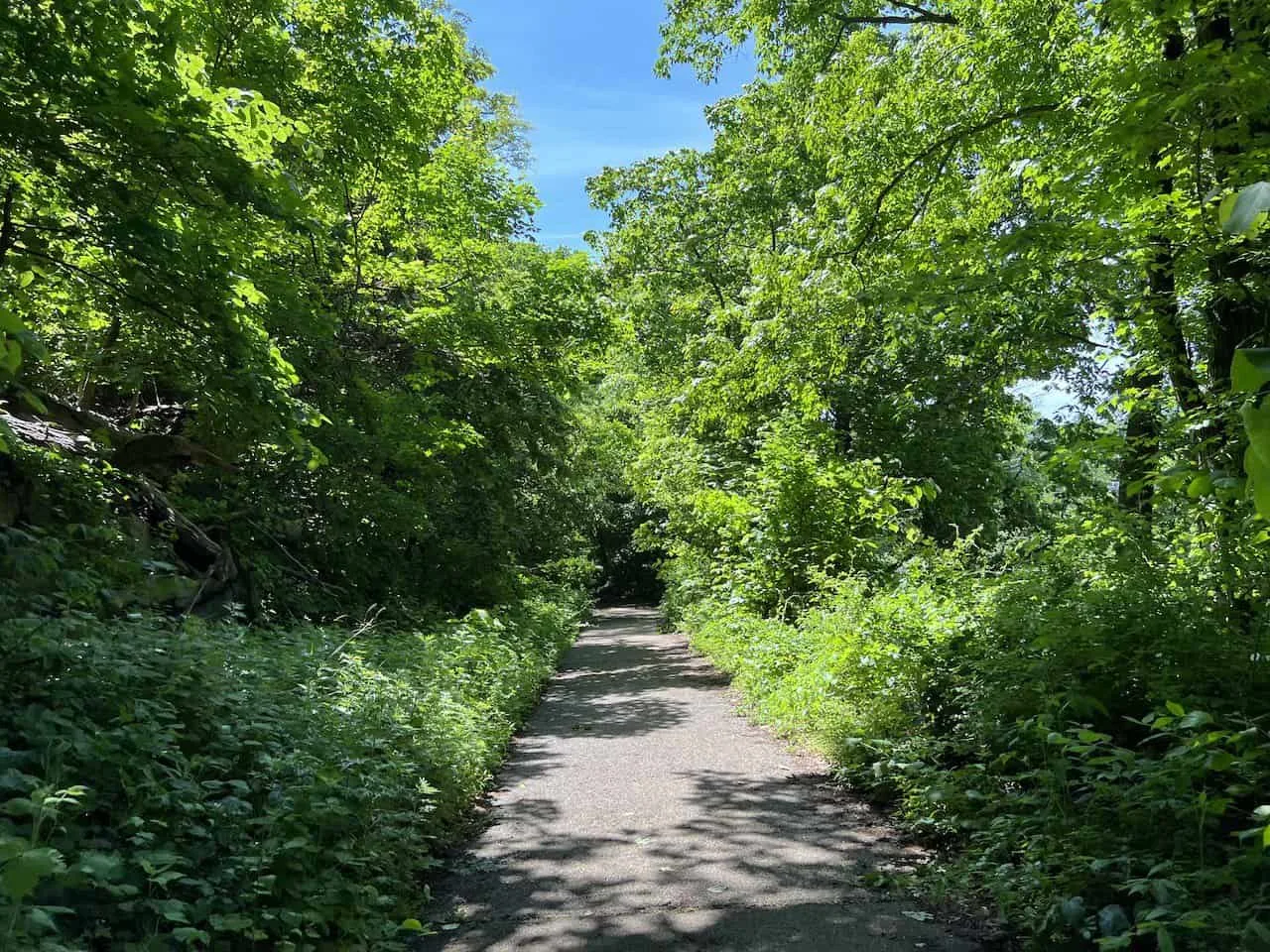
Feel free to walk around the ruins, learning a bit more about their history and taking some unique photos along the way. The trail from here turns to pavement for a little while before being directed on the Cornish Trail back to the parking lot.
It is then just another 5 minutes or so until you reach the trailhead and end a successful day out on Bull Hike.


I hope you enjoyed this extensive guide to the Bull Hill hike of the Hudson Valley. If you have any questions or comments, feel free to add them in below.
Also, don’t forget to check out some other New York itineraries and guides up on the site like the Bear Mountain hike, Popolopen Torne, Beacon Mountain & Anthony’s Nose.
Have fun out there and safe travels!