When it comes to Hudson Valley hiking opportunities, Mt Beacon (also known as Beacon Mountain), is one of the top options out there.
Mt Beacon offers a variety of hiking options for different skill levels. A hike up can be anything from a 2 mile out & back trail to a 7+ mile loop trail.
No matter what you choose though, you are sure to get some of the best views that the Hudson Valley has to offer. From up top you will get panoramas of the surrounding Hudson Highlands State Preserve, the Hudson River, and more beautiful scenery.
Read on to learn everything you need to know about the Mt Beacon hiking trail and what it entails.
* Affiliate Disclosure: This post may contain affiliate links, which means I may receive a commission if you make a purchase through the links provided, at no additional cost to you. Thanks for supporting the work I put into TripTins!
1) Mt Beacon Trail Routes
To start, I wanted to layout the various options to choose from when going about your time at Mount Beacon.
Unlike other trails in the area, Mt Beacon offers many different options along its route. This is great for everyone, as hikers can choose the perfect hike for themselves.
Below are the main Mt Beacon trail routes to consider. While there are additional ones out there, I would say that these are the main 4 routes that people decide between on Mt Beacon.
Out & Back to Casino Ruins
Length: 2.2 miles
Elevation Gain: +1,000 feet
Duration: 1.5 hours
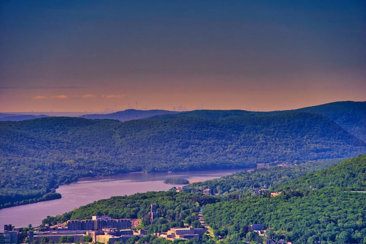
The simplest of routes just heads up from the trailhead to the casino ruins. Here you will find a beautiful viewpoint overlooking Beacon, the Newburgh Beacon Bridge and the Hudson River.
Out & Back to Fire Tower
Length: 3.7 miles
Elevation Gain: +1,400 feet
Duration: 2.5 hours
Continuing off of the first option, the trail then continues up to the Beacon Mountain summit. Here you will find a fire tower to climb, where you will have 360 degree views of the surrounding landscape.
Loop Trail without Lambs Hill
Length: 6.8 miles
Elevation Gain: +2,000 feet
Duration: 4 hours
Instead of doing an out and back route to the fire tower, you can also make it a loop trail. This is the easier of the two loop options as it avoids the ascent of Lambs Hill.
Loop Trail with Lambs Hill
Length: 7.3 miles
Elevation Gain: +2,400 feet
Duration: 4.5 hours
The final main option is the loop trail but adding in Lambs Hill. If you want to complete the full loop and hit every viewpoint, then this one is for you.
During my time on the trail I opted for the loop trail without Lambs Hill. Getting to experience the loop but not overdoing it with Lambs Hill felt like the perfect option.
For the majority of people out there, the out & back hike up to the fire tower is the trail route of choice. The tower gives you the best of the best views and you are sure to be come away satisfied with the hike. While the remainder of the loop does offer additional viewpoints, they won’t be as vast as the fire tower.
With that said though, I would still highly recommend doing the loop trail for a few reasons:
Descent: The trail up to the fire tower is the steepest portion of the trail. Heading back down in the same direction will offer a tougher descent.
Crowds: You are also going to be dealing with a lot more people on this section of trail going up & down. By looping around, the second portion of your hike will not bring the crowds.
Waterfall: There is a beautiful waterfall located on the loop trail, and that was certainly a highlight to see that the out & back trails don’t offer.
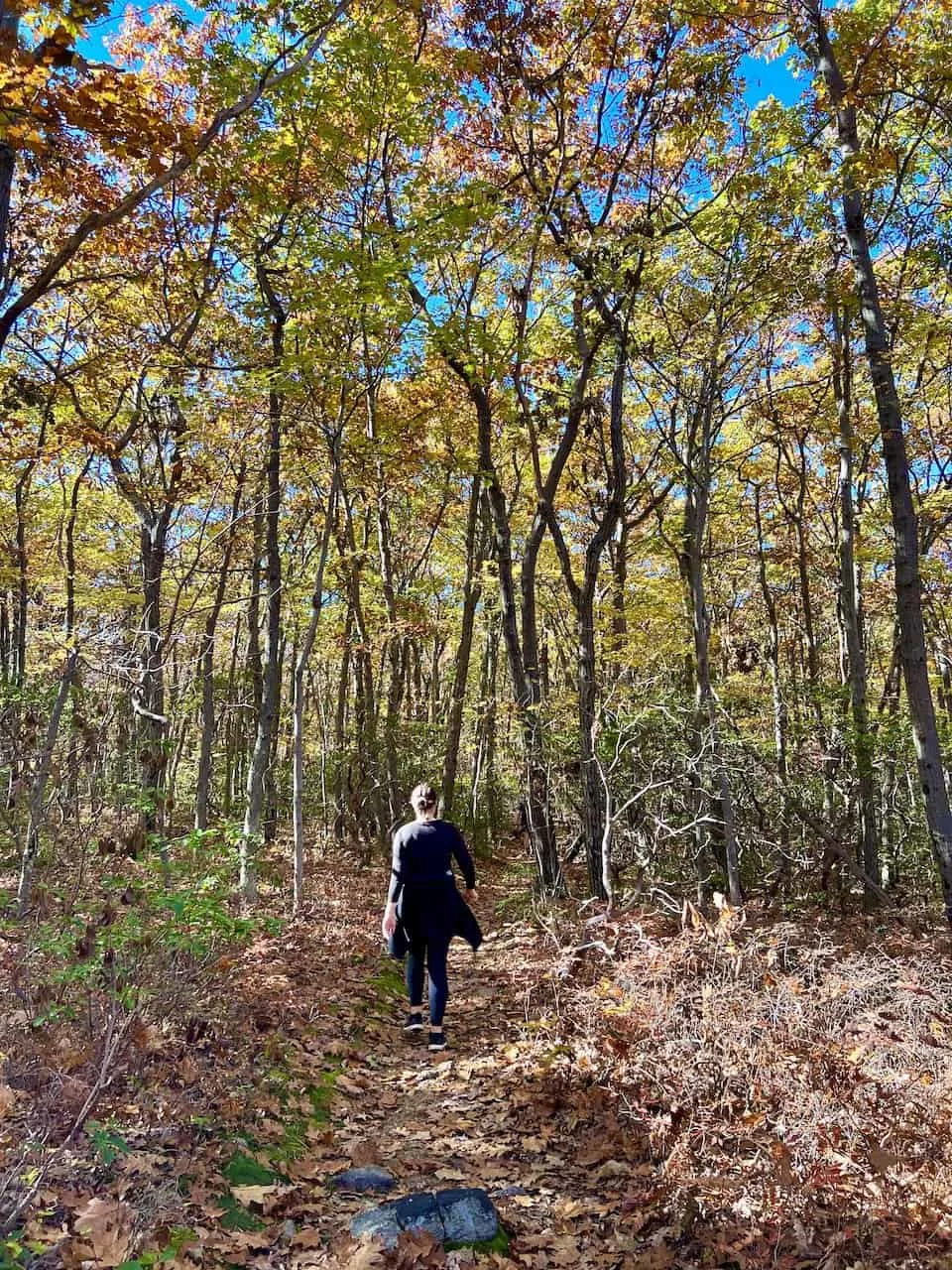
Foliage: During Fall foliage in particular, the second half of the trail is surreal to hike along. While the first portion of the hike does offer similar, I found the foliage on the second part of the loop to be even better (pictures later on).
In the next section I will lay out a map that shows all of the routes & highlights mentioned above.
2) Mount Beacon Trail Map
To get you familiarized with the various routes, below is the Mount Beacon trail map that shows the routes and pinpointed highlights.
You can download this route as a GPX/KML file and add it onto your phone for navigation purposes. Since there are various turnoffs to make, having the route on your phone will remove any uncertainty on the trail.
3) How to Get to the Trailhead
The great thing about Mt Beacon is that it is very accessible, even for those coming from NYC. At the trailhead you will find a larger than usual parking lot (at least compared to other nearby hikes). If the parking lot is full, you can opt for street parking or walk in from town (where you can find more parking opportunities).
If using Google Maps, you simply will want to type in “Mount Beacon Scenic Hudson Parking Lot” or the GPS coordinates “41.493765, -73.959727”.
There are really just two main ways to get yourself to the trailhead – by car or by train.
By Car
Getting to the trailhead by car will be the easiest option logistically as you can drive right up into the parking lot. I would imagine the parking lot can hold 50+ cars with overflow parking on nearby streets or in town.
If coming in from Manhattan, expect the drive to take just around 75 minutes with no traffic. Getting back into the city later on in the day, the drive can get closer to 2+ hours with traffic.
By Train
For those that do not have a car, taking a train up to Beacon Mountain is also an option. The Metro North Hudson Line leaves from Grand Central Station and takes around 90 minutes to reach Beacon. A round-trip off-peak ticket will cost $35.
The train station itself is located 2 miles (40 minute walk) from the trailhead parking lot. So, if you opt for the train, you could either walk, grab a Uber/taxi, or hop on a free shuttle that goes to the trailhead.
Be sure to check the latest hours and schedules of the free shuttle service before your hike.
This train line also can be an option for those trying to hike Breakneck Ridge, Bull Hill, or even Anthony’s Nose. Check out those hiking guides to learn more.
4) History & Things to Know
Before getting into the route, I did want to mention some interesting historical facts & some helpful tips to consider on the trail.
Historical Facts
Highest Point: Beacon Mountain is the highest point of Hudson Highlands State Preserve at 1,635 feet in elevation. There are actually two mountains – South Beacon Mountain & North Beacon Mountain. South Beacon is what you will be climbing and is what is considered to be “Beacon Mountain”.
Mountain Railway: During the first portion of trail you will come across the remains of a railway. This mountain railway was used from 1902 until the 1970’s before shutting down. At one point in time, it was the steepest mountain railway in the world!
Casino: The railway took people up to the Beaconcrest Hotel & Casino, where you will now find just a few ruins with views overlooking Beacon and the Hudson River.
Fire Tower: On top of Beacon Mountain, you will find a restored fire tower, where you can head up another 60 feet into the air. The views from up top will no doubt be the most wholistic 360-degree views in the region.
Helpful Tips
Navigation App: As mentioned earlier, do yourself a favor and download a navigation app onto your phone with the route. There is no need to second guess yourself at various intersections. Simply take a look at your GPS app and easily understand the route.
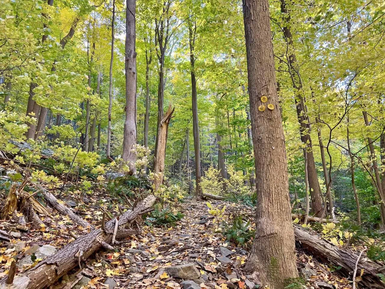
Other Trails: Throughout this hike you will come across various trails that make up the longer route. These are referred to by name and more notably by color. On the trail you will see colored trail markers pinned onto trees directing hikers. Paying attention to these + your navigation app, and you should be good to go.
Colors: If just heading to the ruins and/or fire tower, you will stick to the Red Casino Trail. On the other hand, if continuing the loop, the yellow, blue, and white trails will come into play too. The map above pinpoints the times when the route changes trail colors/names.
Crowds: Weekends will bring the crowds on this hike (and others in the region). Please start early to avoid the crowded route and to not be overwhelmed by others on the trail.
Arrival: I took part during a peak foliage weekend and arrived around 9:15AM (although I would advise to start even earlier). While the lot was relatively full, the trail itself was pretty quiet. Check out the zoomed in photo though taken at 12:15, looking back at the fire tower from further along the loop.
Hiking Resources & Checklist
Before heading out for the trails, be sure to read up on some of the hiking resources up on the site. These are here to better prepare you for all types of outdoor adventure.
- Gear: Hiking Packing List
- Weather: How to Prepare for Hiking Weather
- Navigation: Hiking GPS & Navigation
- Tips: 20+ Hiking Tips & Tricks for the Trail
- Accommodation: Book Your Hotel Today
- Rental Car: Book Your Car Rental Today
5) Mount Beacon Hike
Now, let’s talk through the hike itself and what to expect out on the trail. I will include plenty of photos along the way for you to get a better sense of the terrain & views on Beacon Mountain.
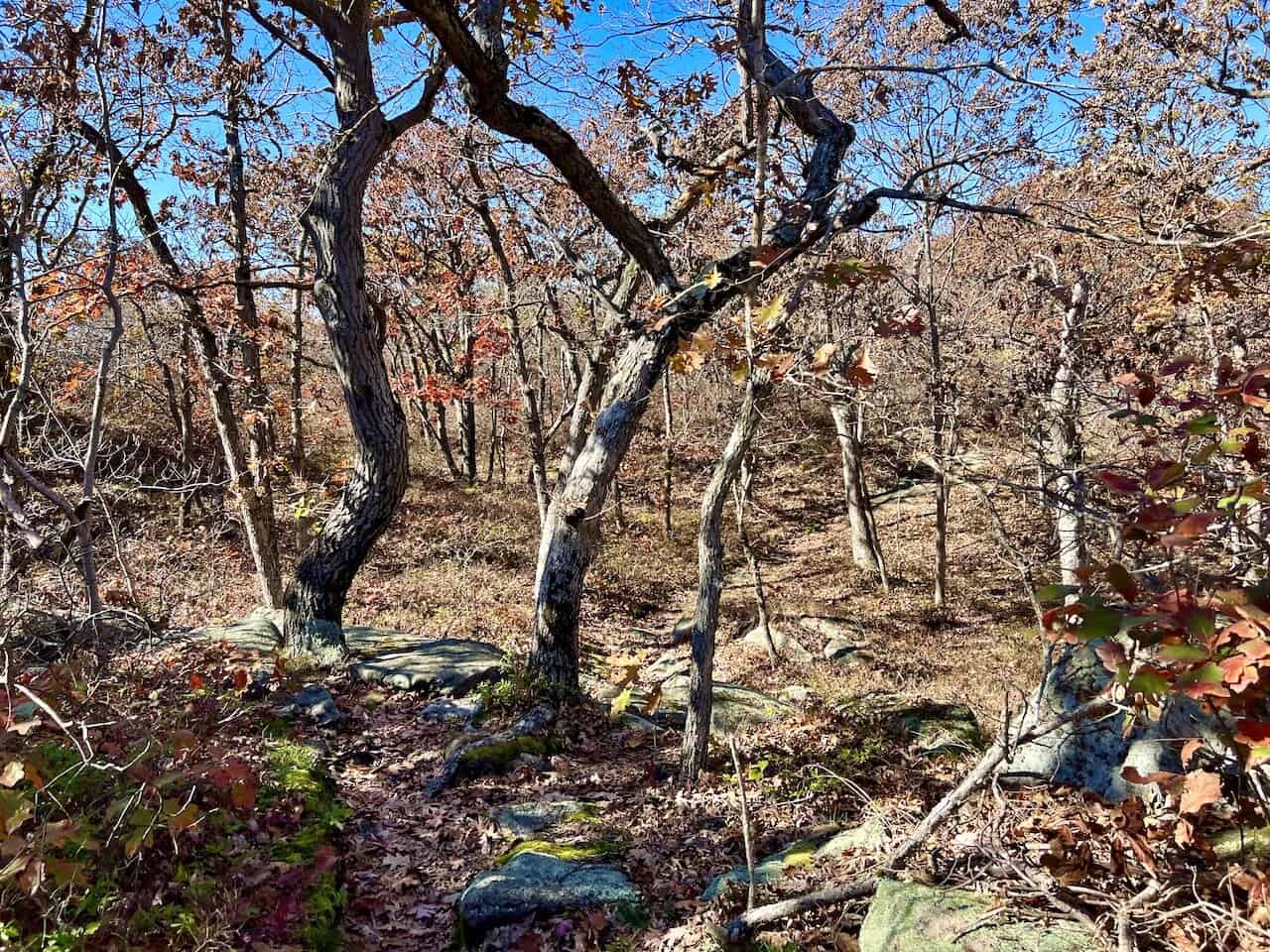
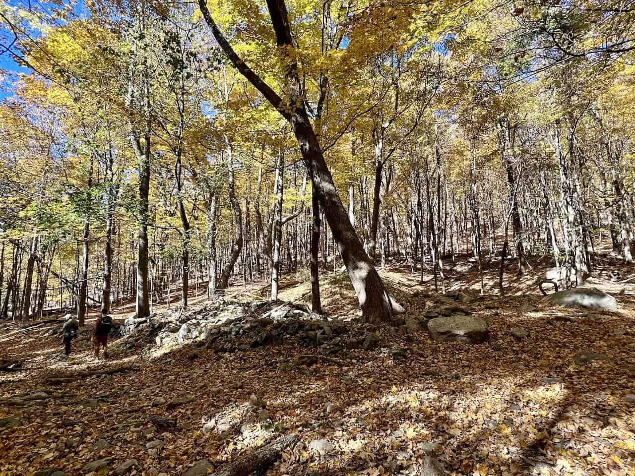
As mentioned before, I completed this hike during peak foliage so the colors were as vibrant as could be during my time on the trail.
Trailhead to Casino Ruins
From the parking lot, you will find the trailhead just beyond the gravel road and gates out in the middle of the lot.
A few minutes after starting, you will come across the railway tracks and a staircase that will bring you up to the next portion of trail.
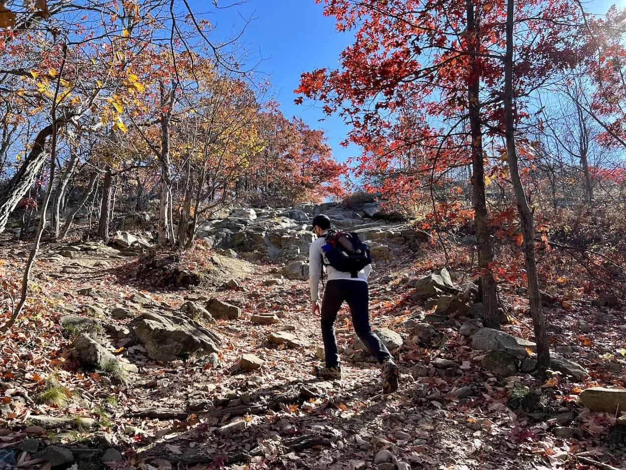
Soon after the staircase, you will find the first intersection of the trail. Here is where you will need to follow the Red Casino Trail markers to the right (third image below). To the left is the yellow trail, which you will be returning on if opting for a loop route.
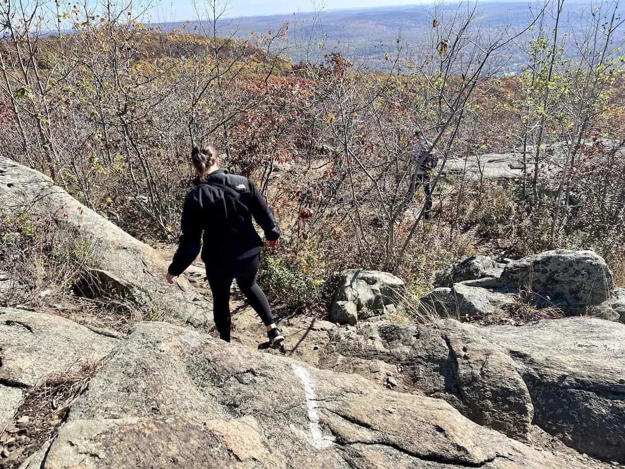
After the intersection, the trail heads up a series of switchbacks on some rocky terrain. This first portion of the hike up until the casino ruins will be the toughest of the trail. While it is only just a mile or so, you will be gaining around 1,000 feet in elevation during this section.
Be on the lookout for the red trail markers as those will help dictate that you are heading up in the correct direction.
While the trail for the most part will be on a dirt/rocky terrain, there will be some larger slabs of rock to maneuver around as well. Be sure to watch your step all the way through as it is easy to have a misstep.
After around 30-40 minutes of hiking, you will reach the brick facade of the mountain railway. You can take a peak inside to view the large mechanism still in place.
Continue just around the corner, where you will have a large open rocky/grassy field. This is the site of the old casino & hotel, and what is left of it (in this case, not much).
However, from this area, you will find plenty of places to take a seat and enjoy the view over the Hudson River, Newburgh Beacon bridge, and the surrounding natural beauty.
If this is good enough and you are just looking for a short hike, you can decide to turn back around here. If not, it is time to head up to the fire tower.
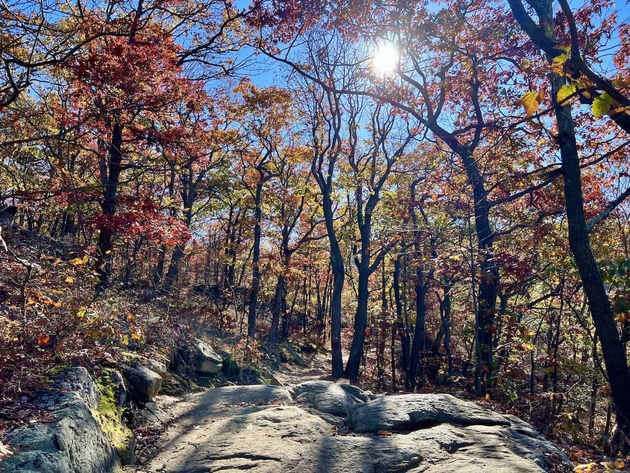
Casino Ruins to Fire Tower
Next up is the section of trail taking you from the casino ruins up to Mt Beacon peak & fire tower. While the terrain is still technical, the route isn’t on as much of an incline as before.


Take your time to enjoy the ascent as you soon reach the fire tower intersection. If paying close attention to the map and the route in front of you, you will come across an intersection with a trail off to the right.
While there aren’t trail markers up to the fire tower here, the trail is easy to follow as you make your way up above the treeline.
Soon enough, the views will start to come out with a never-ending canopy of trees out in front of you. On the map, I pinpointed a spot prior to the fire tower that is perfect to just take some time to hang out at.
Since the fire tower area itself can get more congested, I found this spot to be a better option to get away from the crowds.
After taking in the views, continue another couple minutes to the base of the fire tower. Be wary of people coming down, before making your way up to the top of the tower.
In every which direction, more and more views will be out in front of you. While the footprint of the fire tower platform isn’t so large, you should still be able to get some unbelievable 360-degree panoramas.
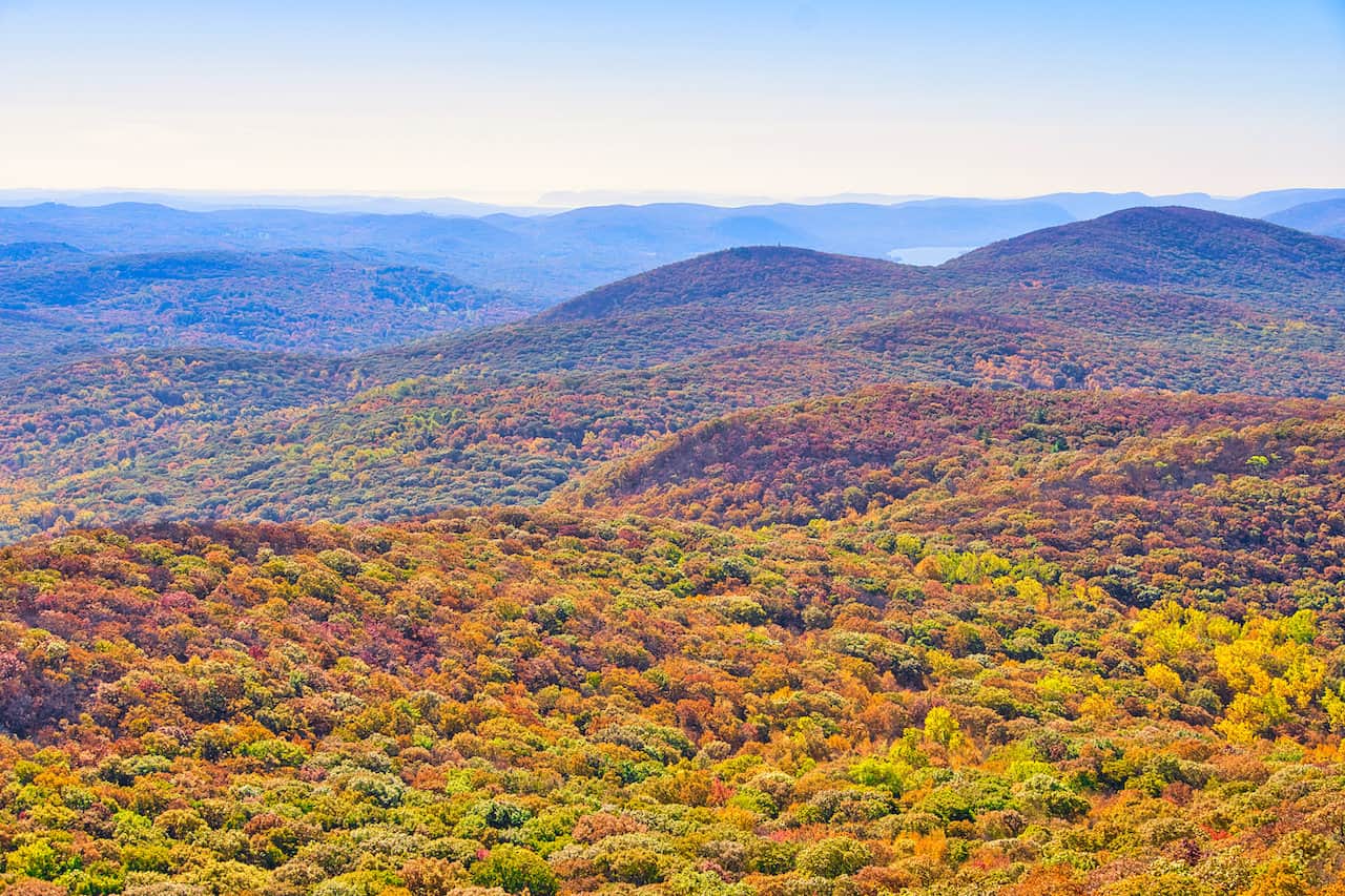

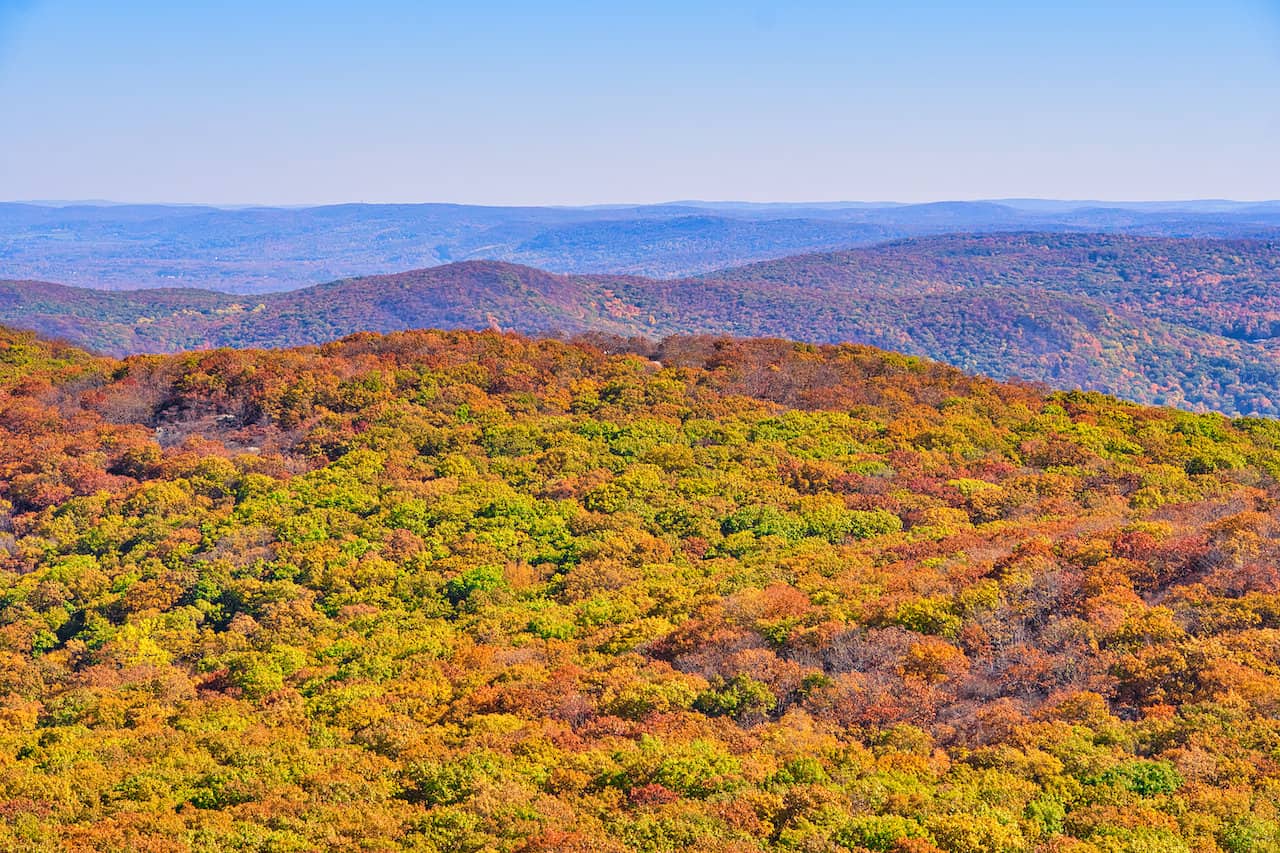

Once all finished up top, be careful as you make your way back down and back to the base of the tower. From here you can find a spot to sit down at overlooking the Hudson Valley before making your next move.
If you are content with the views & experience, you can head right back down the same way you came up. However, if you are looking to take on the full loop trail, then continue reading onwards.
Fire Tower to Lambs Hill
From the fire tower, you can either head back down the intersection the same way you came up or wrap around the white marked trail on the descent. The route on the map above shows the later option.

From here, you will then come across the red trail markers once again (image below), where you will head towards the right to continue on the route.
After about 5 minutes of hiking, you will come across a very important intersection not to be missed. The yellow Wilkinson Memorial Trail heads to the left (see below), while the red trail comes to end.
It is easy to miss this and just walk by (as some of my friends pictured did). But as long as you are aware of the turnoff and are navigating correctly, this shouldn’t be an issue.
The yellow trail markers will have you gaining a bit of elevation as you walk along the Fishkill Ridge gaining some additional views along the way. The route will then turn more inland and towards a lookout rock overlooking the Beacon Reservoir.
From here you will get some great views of the reservoir and its surrounding nature, along with the fire tower out in the distance.

It is then back down into the forest gaining and losing mild elevation along the way, where you will get a couple more beautiful viewpoints (marked on the map above).

From the last of these viewpoints, the trail continues its descent, where you will come across another intersection (pictured below). The blue trail is next up as you make a left off of the yellow route and onto the next portion of the hike.
Just 2 minutes or so after getting onto the blue marked trail, you will reach the Lambs Hill intersection. Heading up to the hill will have you gaining several hundred feet of elevation before getting to the top and looping around.
If you would like to avoid the ascent, take a left at the intersection below (where those two people are heading) and get ready for the final push back to the trailhead.

Lambs Hill Intersection to Trailhead
If avoiding Lambs Hill, the route continues downwards as you soon reach a dirt road. Take a left here followed by a quick right onto the White trail.
The trail continues into the forest, and after 10 minutes or so reaches a multi tiered waterfall. It is the perfect spot to take a break and enjoy the waterfall and river.
The trail makes its way along the river, crosses over to the other side and then onto the last portion of trail.
Be very cautious because soon after crossing the river, one more intersection awaits. Uphill to the left will be the yellow trail taking you back to the parking lot. If you miss this intersection, the trail reaches a different trailhead, where you will then need to walk the street back to the lot.

After making the left onto the yellow trail, you will gain just a bit of elevation and then pass by an abandoned car. Follow the trail markers up towards the initial loop intersection and then back down to the parking lot to end the day.
Now that you are all finished up with the hike, feel free to make the drive into town. You can find a place to eat and relax after a long day of hiking. It is then back home to end a successful Beacon Mountain trip.
6) Frequently Asked Questions
To wrap up, below are some of the most frequently asked questions when it comes to Beacon Mountain.
How Long Does it Take to Climb Beacon Mountain?
If opting for the classic out & back route up to the Beacon fire tower, it should take 2.5 hours to complete the round trip climb of Beacon Mountain.
With that said though, you can opt to make the hike longer or shorter depending on you interest level.
How Hard in the Mount Beacon Hike?
The initial mile up to the Casino Ruins is surely the toughest part of the hike as you gain 1,000 feet of elevation. While there is more elevation gain after that, it is on a milder incline.
The route itself is made up of small & large rocks, so the terrain itself can be a bit tricky to maneuver at times. Having solid hiking or trail shoes with some grip will help with your time out on the mountain.
Can You Drive to the Top of Mt Beacon?
No, you cannot drive to the top of Mt Beacon. However, if you are looking for another nearby option where driving to the summit is possible, take a look at Bear Mountain.
What Was at the Top of Mt Beacon?
At the top of Mt Beacon you can find a fire tower, and just below the fire tower will be the old casino ruins.
Today, while the casino is not in place any longer, there are still some great views from where it used to be. You will also find the old mountain railway station nearby the ruins.
Can You See NYC from Mount Beacon?
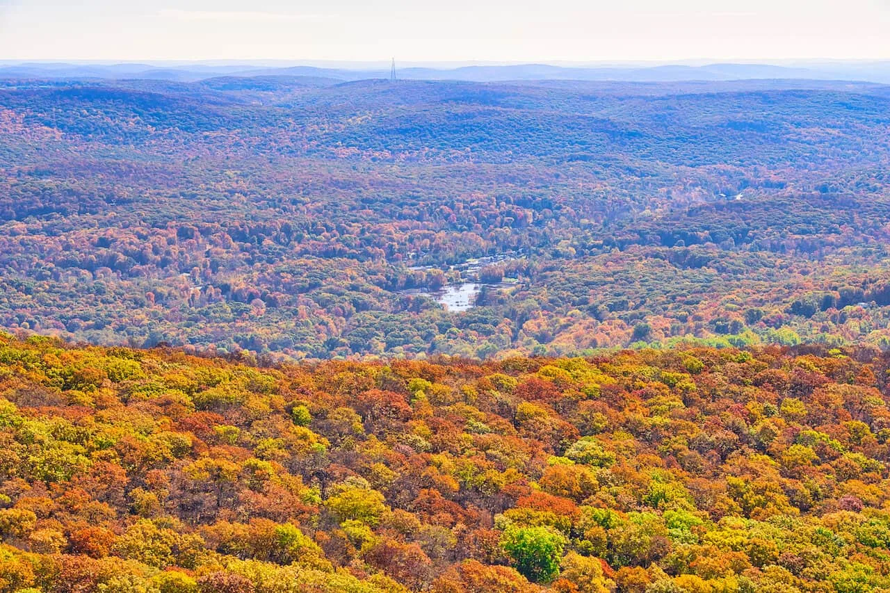
Apparently, you can see NYC from the top of Mt Beacon on a clear day. While I was not able to see the skyline during my visit, a did catch a glance of the skyline on nearby Bull Hill.
Check out the photo below of a zoomed in picture of what the NYC skyline looks like from a far.

Can You Swim in the Beacon Reservoir?
No, you cannot swim in the Beacon Reservoir. While there is a pathway down to the bottom, you are just allowed to view the reservoir and not actually swim in it.
How High is Mount Beacon?
Mount Beacon sits at 1,635 feet in elevation, making it the highest point of Hudson Highlands State Preserve.

That about wraps up a trail guide to the Mt Beacon hike of the Hudson Valley. If you have any questions or comments about the hike, feel free to add them in below.
Also, don’t forget to check out some of the other New York itineraries and guides up on the site like the hike up Popolopen Torne & Storm King Mountain.
Have fun out there and safe travels!