
Switzerland is one of the top hiking destinations in the world with so much variety to offer its visitors. The landscape is full of the Swiss Alps, green valleys, glaciers, waterfalls and much more.
However, Switzerland is also home to one of the world’s longest pedestrian suspension bridges and you will have the chance to hike to it for yourself.
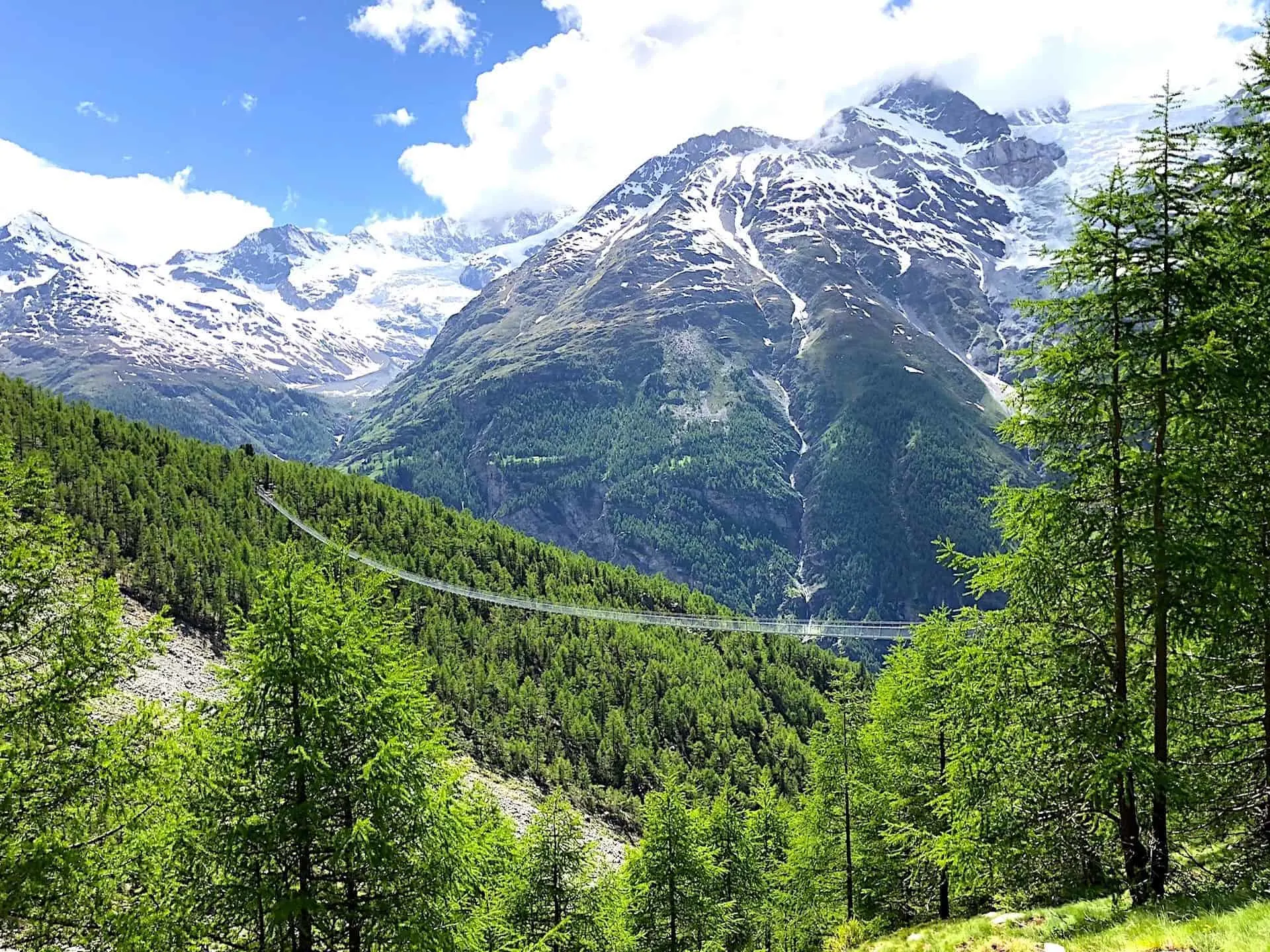
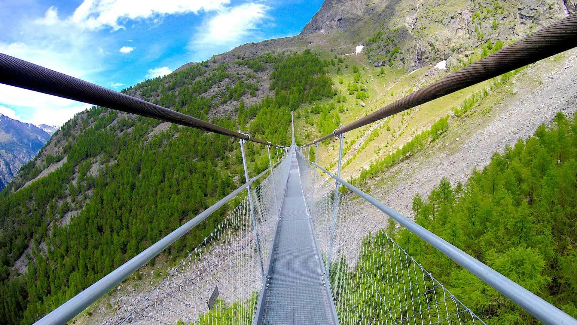
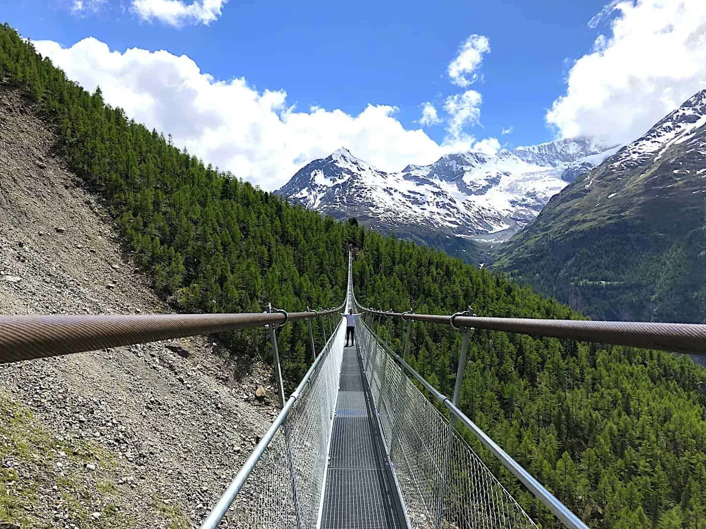
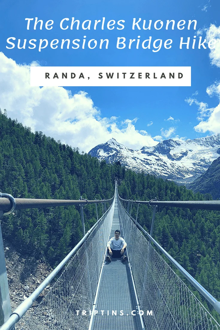
At 1,621 feet long and nearly 300 feet above the ground, the Charles Kuonen Suspension Bridge is one of the top hiking highlights during a trip to Switzerland. This guide will go over all you need to know about the hike and how to take part of it for yourself.
* Affiliate Disclosure: This post may contain affiliate links, which means I may receive a commission if you make a purchase through the links provided, at no additional cost to you. Thanks for supporting the work I put into TripTins!
1) Charles Kuonen Suspension Bridge Background
In July 2017, the Charles Kuonen Suspension Bridge was officially opened for hikers and adventurers to make the trek up and across it. The bridge itself is not located in Zermatt, rather it is a quick 15 minute train ride away above the town of Randa.
To get to the bridge from Randa there is a ~4 hour circular hiking trail that will take you up the mountain, across the bridge and back down to Randa.
Depending on fitness level you could finish it in nearly half the time. It just depends on what type of hiker you are and the amount of picture breaks you take along the way.
If you are looking for a multi day hike, then there is also an option for you. The bridge also happens to be a part of a much longer two day hike – the Europaweg, from Grachen to Zermatt.
Before you go make sure the trail and bridge is open. To do so check the Europaweg website and on the right hand side of the page it will say whether it is open or not. Also please be wary in poor weather – there are a lot of steep and rocky sections, which are not ideal in wet conditions.

2) Charles Kuonen Hike Facts
Before jumping into the hike, I thought it may be helpful to outline some of the facts about the Charles Kuonen Suspension Bridge hike, so you are better prepared for the trail.
- Trail Name: Charles Kuonen Suspension Bridge
- Starting & Ending Point: Randa Train Station
- Length: 5.3 Miles / 8.5 KM
- Duration: 4 Hours
- Elevation Gain: 3,215 Feet / 980 Meters
- Terrain: Packed Dirt / Rocks
- Difficulty: Hard
What makes the hike difficult is the large amount of elevation gain in a short distance along with some of the rocky terrain throughout.
Just be aware that to reach the bridge, you will need to hike up over 3,000 feet of elevation in just a couple miles. If you are prepared for that, you should be good to go to tackle the trail for yourself.

Hiking Resources & Checklist
Before heading out for the trails, be sure to read up on some of the hiking resources up on the site. These are here to better prepare you for all types of outdoor adventure.
- Gear: Hiking Packing List
- Weather: How to Prepare for Hiking Weather
- Navigation: Hiking GPS & Navigation
- Tips: 20+ Hiking Tips & Tricks for the Trail
- Accommodation: Book Your Hotel Today
- Rental Car: Book Your Car Rental Today
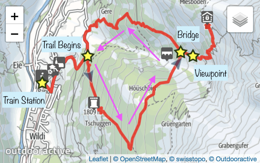
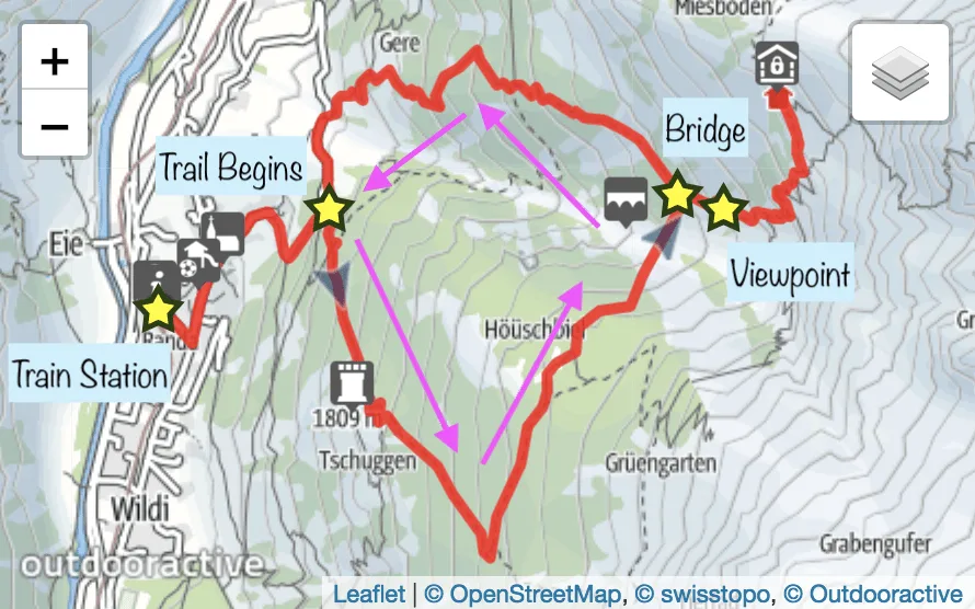
3) Charles Kuonen Hike Map
Here is a map of the hike courtesy of the Europaweg website (with some added text).
The counter clockwise trail starts in the town of Randa by the rain station, up to the edge of town, into the forest towards the bridge, and then back down the other side finishing up in Randa once more.
The trail also adds in the Europa Hut, which can be ignored if you do not want to add it to the hike. I would however, still head past the bridge to reach some better viewpoint spots of the bridge from above.
4) Recommended Hiking Gear
Before you head off to the Charles Kuonen Suspension Bridge you should make sure to pack up some essentials. Since the hike can take up to 4+ hours, you will want to be prepared.
Hiking Packing List
In general when it comes to hiking, there are a few main aspects to consider. These includes clothing layers, hiking shoes, hydration & fuel, electronics, and other essentials.
Below in a breakdown of some of the top items, but be sure to check out the Hiking Packing List for a more comprehensive view.
Clothing Layers
Layering is going to be a top consideration when hiking. You will want to be prepared for all sorts of weather so you can be comfortable in different situations. Some items may include:
→ Hiking Shorts
→ Hiking Pants
→ Short Sleeve Shirt
→ Long Sleeve Shirt / Sun Hoodie
→ Mid Layer Fleece
→ Puff Jacket (not always needed)
→ Packable Rain Jacket (Columbia Watertight II)Note that your layers should be made of moisture wicking material as they are breathable and quick drying.
Footwear
Having appropriate footwear will also be very important. You will want to have shoes with the necessary grip and support to keep you safe on the trail.
→ Hiking Shoes (Keen Targhee)
→ Hiking Socks (Darn Tough)Other Essentials
Whether it is hiking gear, electronics, or just some miscellaneous items, here are some other essentials to bring along on hikes.
→ Hiking Backpack (Osprey Talon 22) & Rain Cover (Joy Walker Cover)
→ Hiking Poles (Black Diamond Trekking Poles)
→ Water Bottle (CamelBak Chute or Katadyn Filter Bottle)
→ Portable Charger (Anker PowerCore 5000mAh)
→ Action Camera (GoPro Hero)
→ Energy Bars & Snacks
→ Hat & Sunglasses
→ Sunscreen & Bug Spray
5) How to Get To Randa
To start off the hike, you first need to get to the base of it located in the small charming town of Randa.
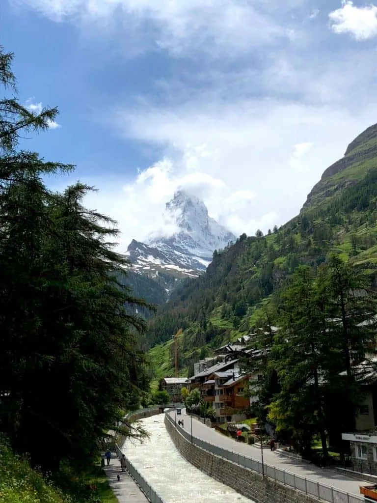
As mentioned, Randa is just a quick 15 minute train ride from Zermatt which makes this hike the perfect day trip.
There are plenty of trains throughout the day that leave from Zermatt (every 30 minutes or so). Since you must pass Randa when arriving and leaving Zermatt, basically every train will stop there.
A roundtrip ticket will cost around 28 CHF (with a half fare card it will be 14 CHF and travel pass holders will be free).
Once you get off the train, you can simply follow the trail markers pointing you up above town and into the mountainside.
» For more info regarding trains and travel passes, read the Train Travel in Switzerland Guide
Swiss Travel Pass: Are you planning on traveling frequently throughout Switzerland during your trip? Consider purchasing a Swiss Travel Pass to save some money!
6) How to Reach the Starting Point
Once you hop off the train, you will be at the base of Randa, a small town with picturesque houses located throughout.
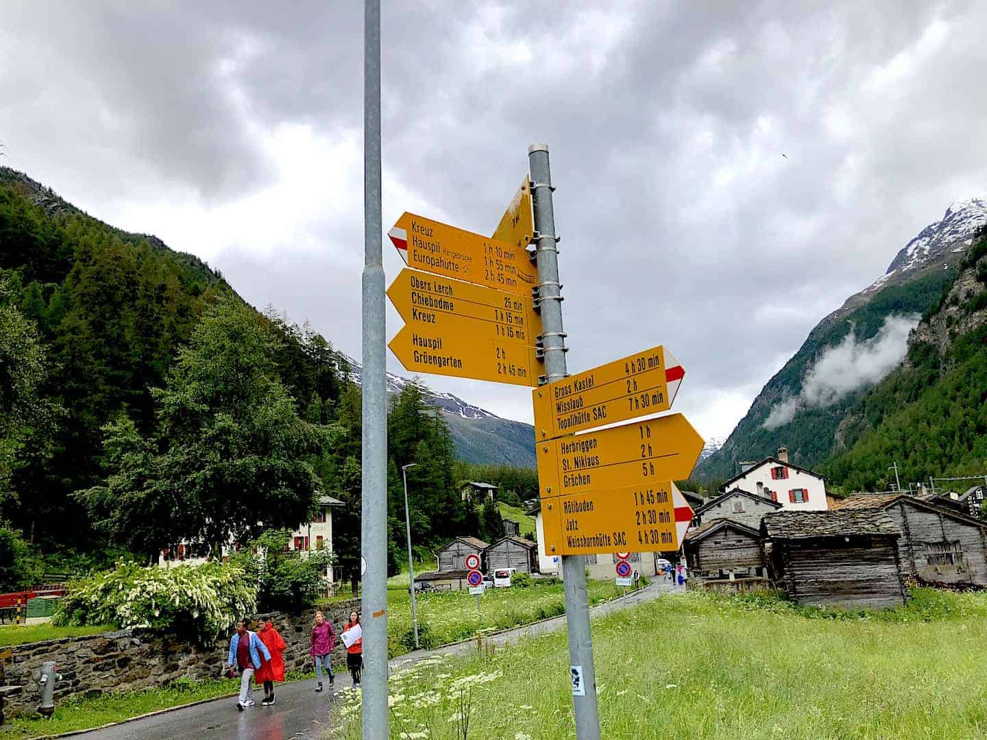
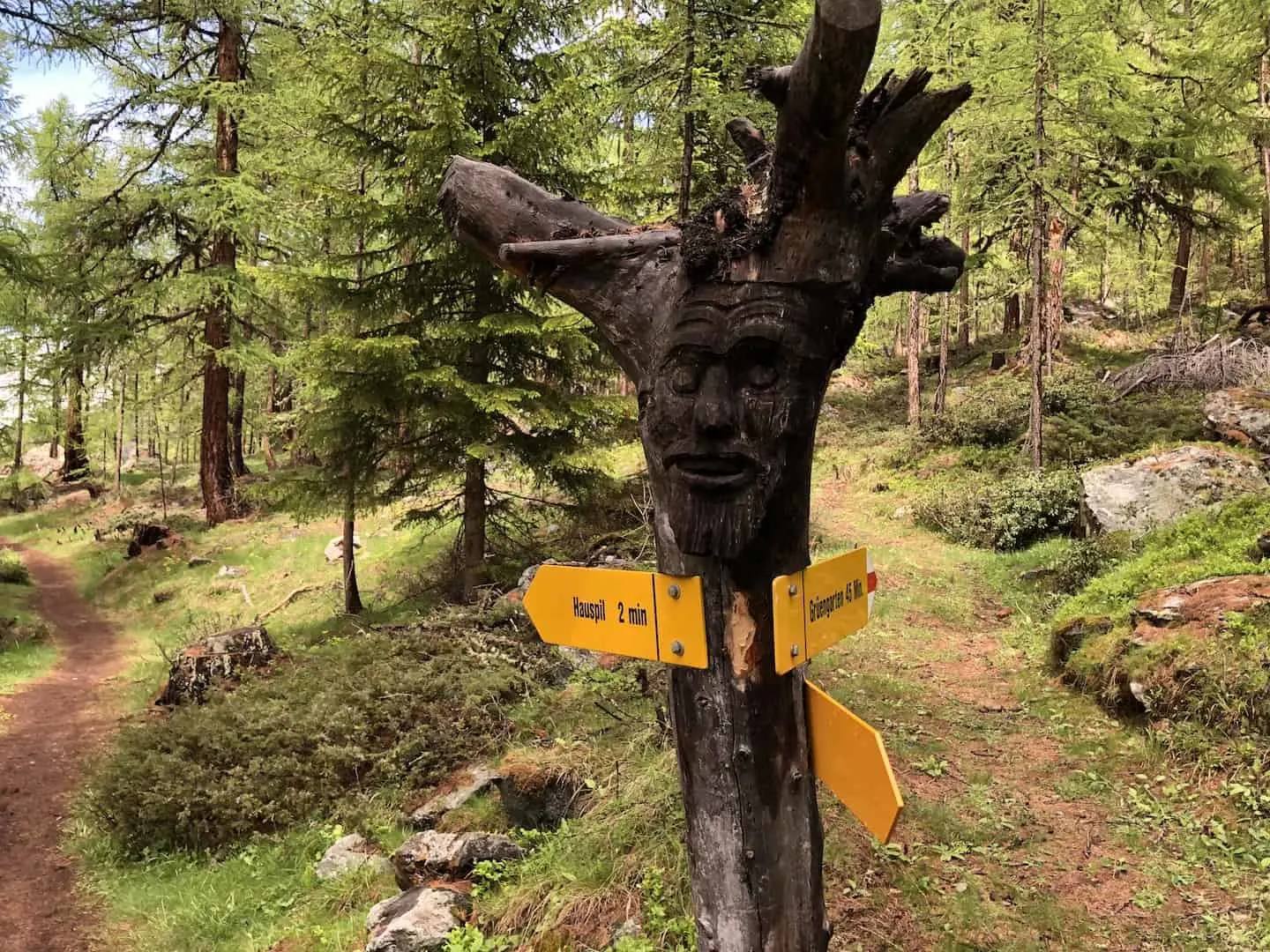
As you move away from the station and towards the town you will see your first yellow hiking marker sign pointing you in the direction of the hike.
For the duration of the hike you can follow these signs that will take you the Charles Kuonen Suspension Bridge – on the top of the sign you will see “Hauspil – Hangebrucke” with a small bride symbol next to it.
Continue to walk up the hill of Randa passing through the village and ultimately getting onto the trail towards the forested woods on top of the town.

7) Getting Up to Charles Kuonen Suspension Bridge
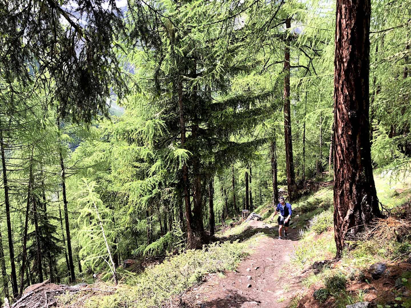
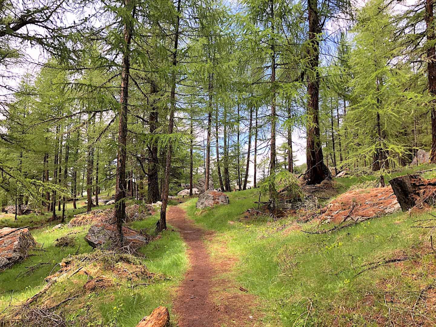
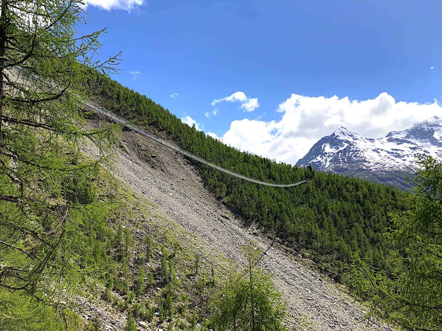
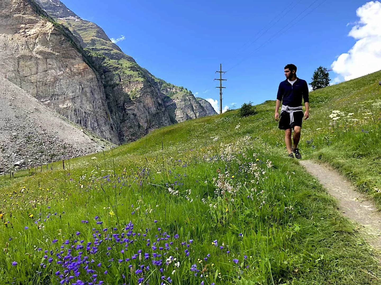
Once you are in the woods, you will now start the counter clockwise loop that will take you to the suspension bridge. This part of the hike is probably the most demanding as it zig zags up and across the mountainside.
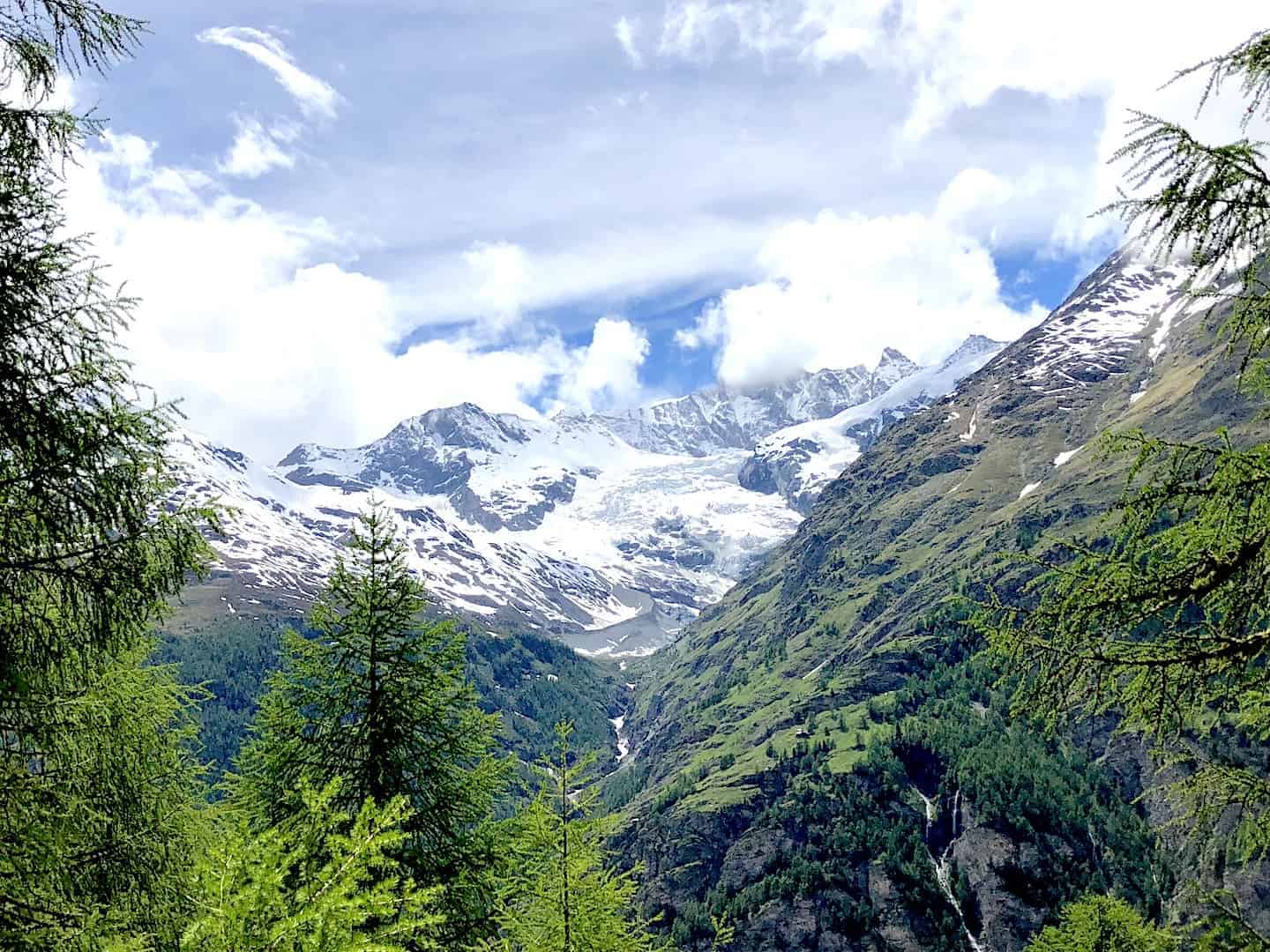
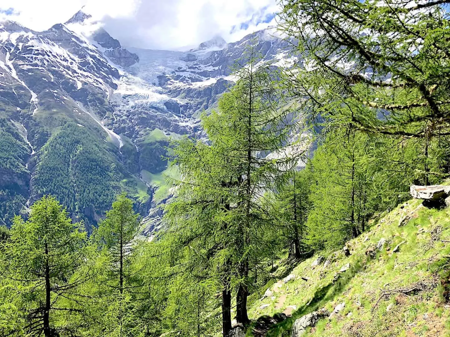
For the next 1.5 hours or so (depending on fitness level) you will follow the signs through the forest. To your right you will be able to see some of the snowcapped peaks of the Alps out in the distance, and all around you will be some incredible greenery.


8) The Charles Kuonen Suspension Bridge
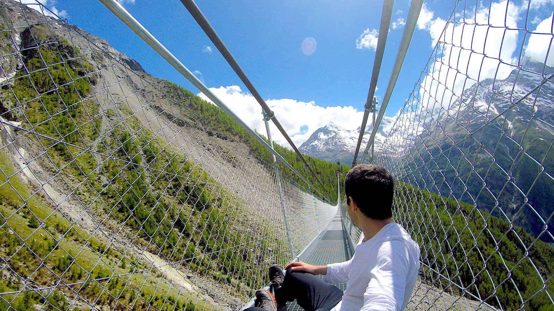
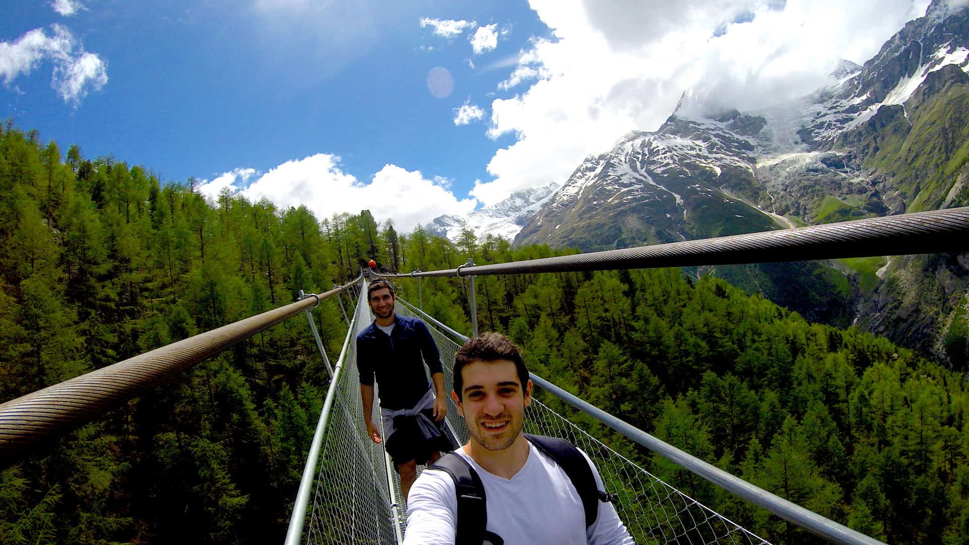
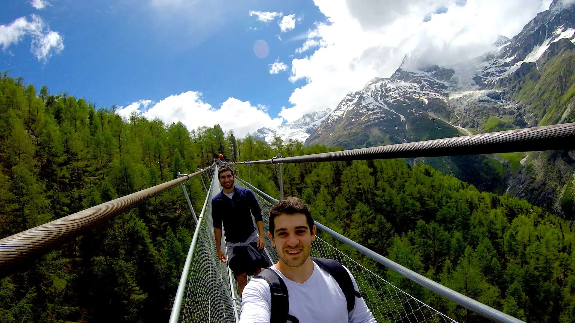
After hiking up for a little while, you will soon come across the bridge itself.
Hopefully for you it will not be that crowded (I only saw about 10 people throughout the hike the whole day) and you will be able to take your time crossing the bridge and snap all sorts of pictures along the way.
While crossing the bridge can take 10 minutes in itself, you should probably plan on staying closer to 30+ minutes around the area to really enjoy it and take in all the incredible views around you.

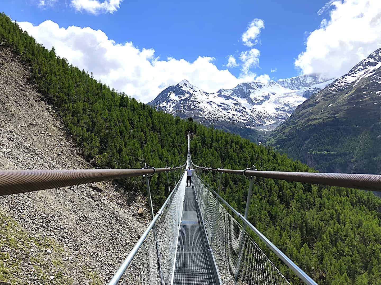
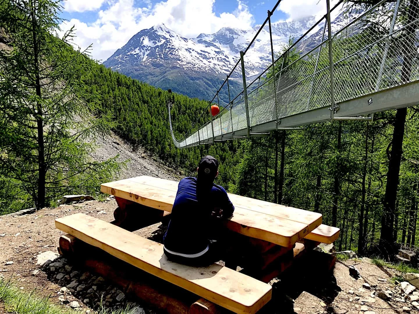
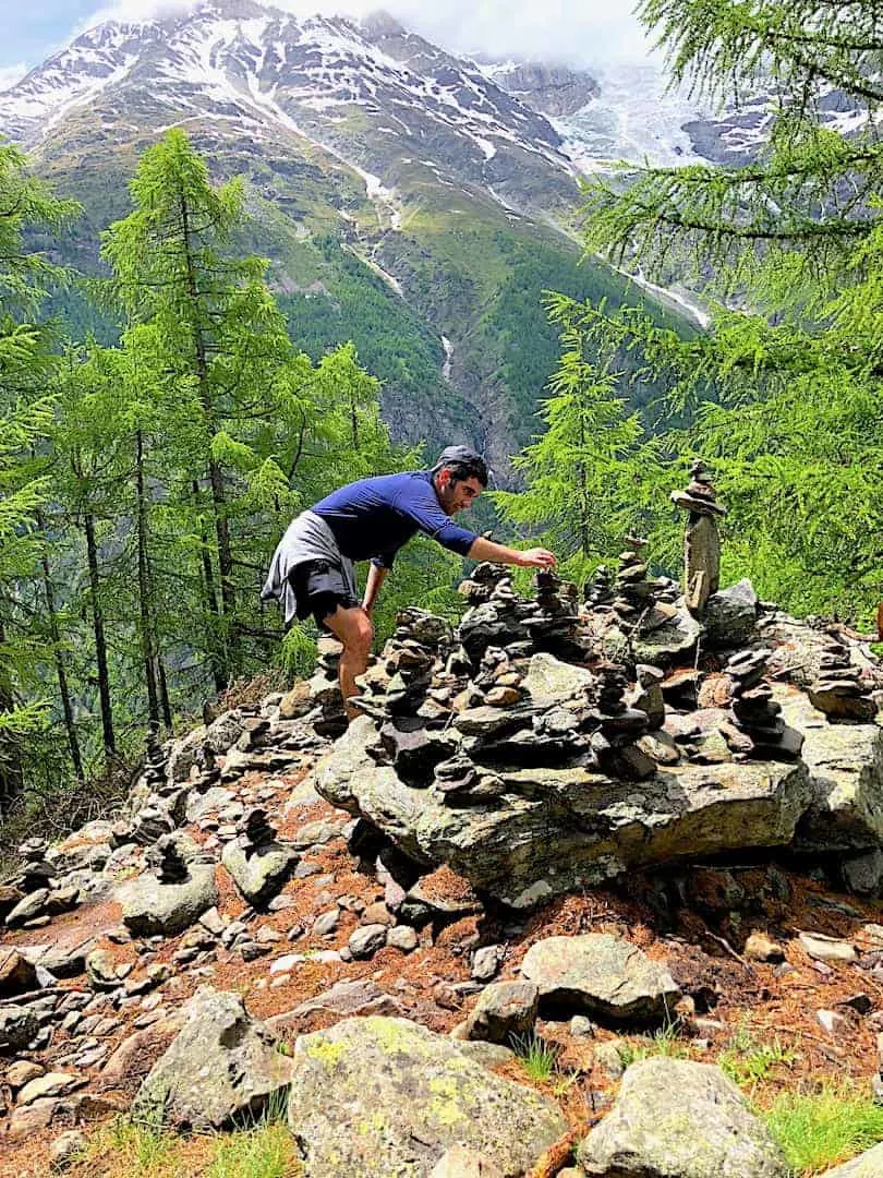
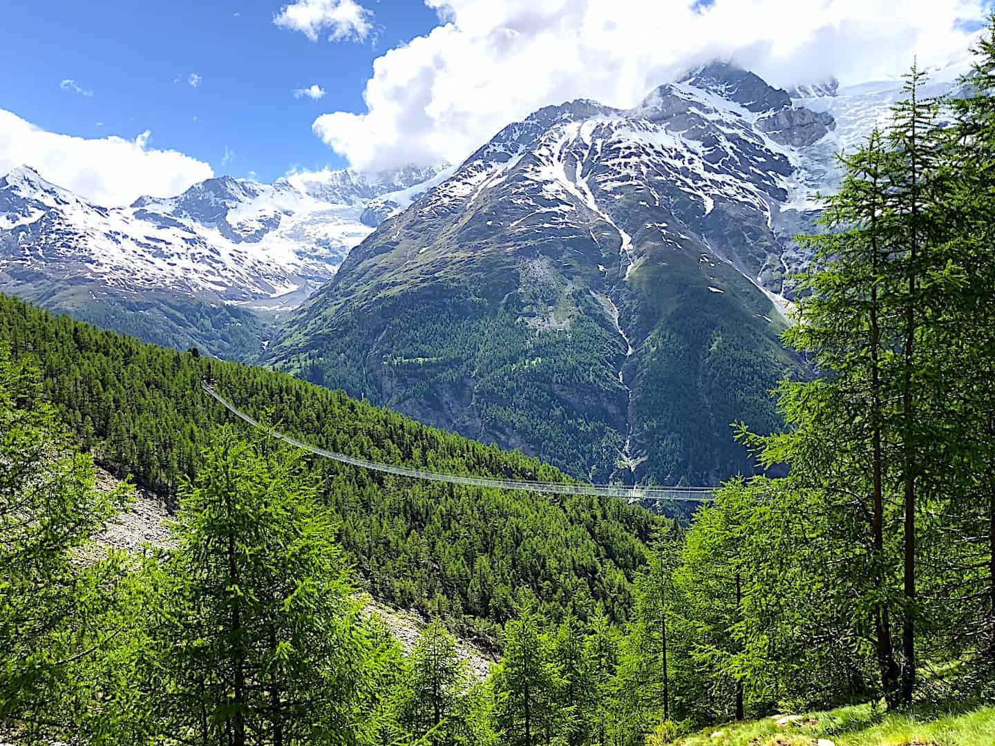
Once you cross the bridge you can get a great secondary viewpoint if you want just a few minutes to the right (instead of the left where the trail takes you back to Randa).
Here you will be able to really see the bridge in its entirety and how long it really is.
Once you get some good snaps from there you can head back down towards the bridge and continue on the path down to Randa by following the signs.
As mentioned earlier, you can also continue the trail towards the Europa Hut if that is something that interests you. If not, then just continue back downwards as you catch the trail back to Randa.

9) Heading Down to Randa
Now it’s time to head back down to the town of Randa and onto the station so you can hop on a train back to Zermatt. You will see the yellow signs pointing you the way down, so just continue to follow them until you hit the town again.
The way down is a bit more steeper than the way you came up so just be careful of your footing especially if it had recently rained.
Once you get out of the trees, you will walk through a nice field of flowers before making your way back down through the town.
Note that we did see a few people on our way up to the bridge who were coming down in the same direction. So instead of doing a circular loop, they just went there and back on the same path.
I would say that by doing so it would be a bit less steep (but not by much), however you will also be missing out on the other half of the loop.
Getting some new scenery in by completing the whole circle would be my recommendation.


Now that your day of hiking to the Charles Kuonen Suspension Bridge is complete, you can hop on the next train heading back to Zermatt and rest up those legs.
10) Where to Stay in Zermatt
If staying in the town of Zermatt check out some great hotel options on Booking.com using the search below, or check out some of my personal recommendations.
Zermatt also has its fair share of hiking options like the famous 5 Lakes Trail or the Gorner Gorge.
High Rated & Good Value Options
- Highly Rated: Hotel Bellerive
- Luxury: Hotel Firefly
- Value: Hotel Elite
→ Be sure to check out some hotels in Zermatt with views of the The Matterhorn

If you have any questions or comments about the Charles Kuonen Suspension Bridge feel free to write them in below.
Check out some of the other Switzerland guides and itineraries I have up on the site for more helpful info. Safe travels out there!


Tom
Monday 9th of October 2023
Hi
I want to do this hike my wife not so up for it could I get a train really early to Ronda so I can make the most of the day as only there for 2 nights
Charles
Tuesday 10th of October 2023
Hi Tom - yes, you should be able to find trains as early as 5:30AM or so. Feel free to check out Sbb.ch for the latest schedules. Enjoy!
Rachel
Monday 3rd of February 2020
Heading there in the summer. I am not in the best of shape, lol. Is there a way to get to the bridge minus the hike?
Charles
Friday 7th of February 2020
Hey Rachel - unfortunately the only way to reach the bridge is by foot. Although it is a tough hike to take part of, it is worth the effort!!
Mark
Thursday 18th of July 2019
Thanks for sharing. Great post. We will be visiting Switzerland in August. We are looking for several good hikes to do with our kids. Is the height to the suspension bridge doable with kids?
Charles
Friday 19th of July 2019
Hey Mark - I dont think the suspension bridge height is an issue with kids. I think the issue is more the elevation gain up to get to the bridge from Randa. The elevation gain for the hike is about 1,000 or so meters so it can be a bit tough depending on fitness level.