
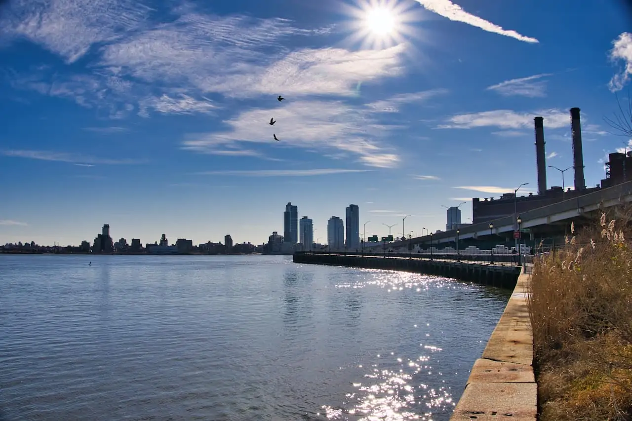
New York City is full of walking paths that wrap around rivers, parks, and city streets. One of the top options to choose from when visiting Manhattan has to be the East River Greenway. The running / walking / biking path runs between Battery Park in the south all the way up towards 120th Street in the north.
In between you will get some fantastic river, city and bridge views along the way. Read on to learn more about the southern end of the East River Greenway and what to expect along the way.
* Affiliate Disclosure: This post may contain affiliate links, which means I may receive a commission if you make a purchase through the links provided, at no additional cost to you. Thanks for supporting the work I put into TripTins!
1) Getting to Know the East River Promenade
The path that runs all along the East River of Manhattan can be broken down into two main sections. One section runs between Battery Park and 37th Street (what this guide will be focusing on), while the second section runs between 60th Street and 120th Street.
The reason there are two sections here is because the United Nations is located directly on the water near 42nd Street, so the path stops just prior to this on the south side.
On the north side, while there are a couple pedestrian sections on the water (between 42nd Street and 60th Street), they are not connected to the northern end of the East River Greenway.
Once you get to 60th Street though, the pathway will continue all the way towards 120th Street and you should be able be able to enjoy the river for another few miles.
If you are looking to walk, bike, or run the entirety of the East River Greenway from Battery Park to 120th Street, then you will need to make a quick 1+ mile detour onto 1st Avenue between 37th Street and 60th Street, circumventing the United Nations and catching the path on the other side.
Feel free to take a look at some of the other top things to do in New York during a visit.

Important Construction Note
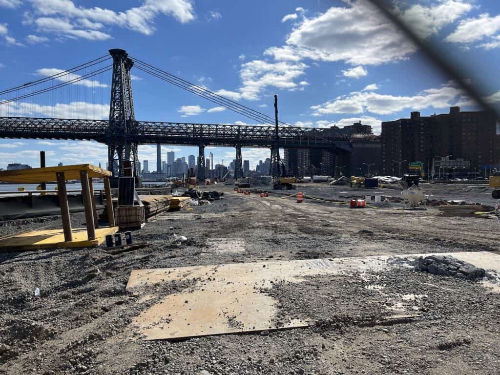
Before talking more about the East River Greenway, I want to point out some important construction notes.
There are several sections that are closed off due to the ongoing construction. Due to these closures, there are detours off of the greenway and into the city streets.
This has in turn made it impractical to walk along the whole greenway.
To give you an idea of the openings/closures (southern end of the greenway only):
- 37th Street to Stuyvesant Cove (20th Street): Open
- Stuyvesant Cove (20th Street) to 10th Street: Closed
- 10th Street to Houston Street: Open
- Houston Street to Corlears Hooks: Closed
- Corlears Hook to The Battery: Open
If you are thinking about heading along the greenway, you may want to stick to just one of the open sections to make things simple. Starting near Corlears Hook or nearby Pier 36 and heading down to the Battery is still going to be a beautiful walk to take part of.
2) East River Greenway Map
The below map shows the southern end of the East River Greenway between 37th Street and Battery Park. Note that the map also shows the Hudson River walking path as well on the left hand side.
This guide, however will just focus on the right hand side of the map – from just below the United Nations to Battery Park in the south.
This southern portion of the walkway is approximately 5 miles in length and should take around 3 hours with breaks if you are walking.
The entire greenway from Battery Park to 120th Street is about 9 miles long (includes the 1+ mile detour in between the southern and northern sections).
3) East River Greenway Entrance
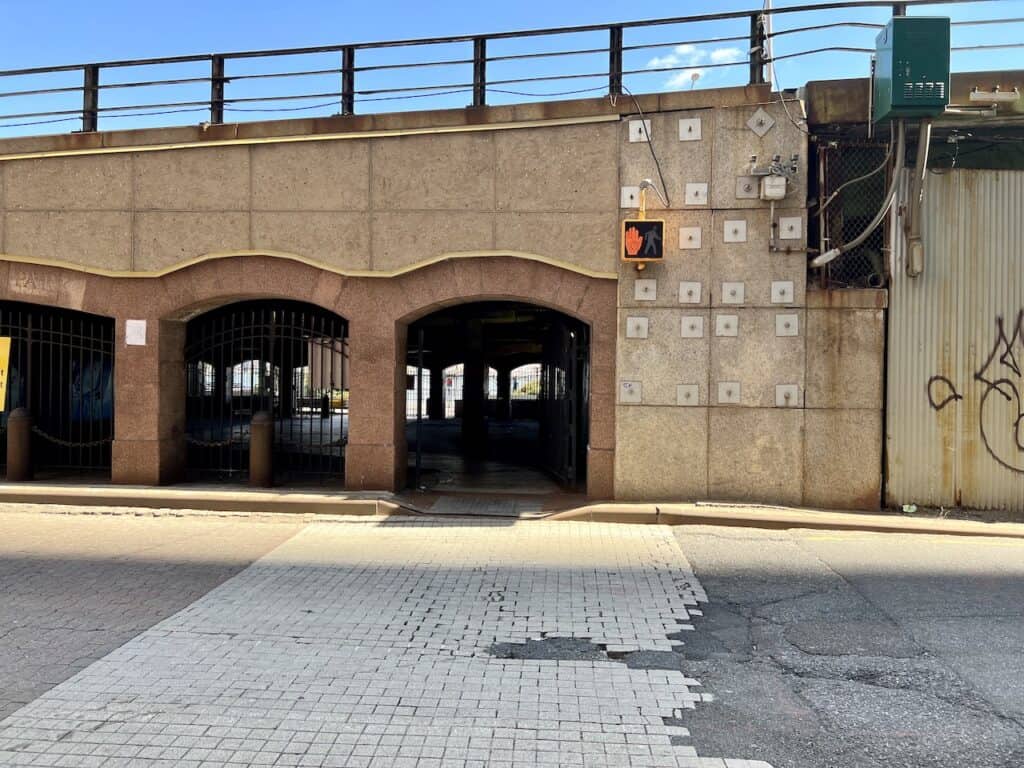
The starting point entrance of the southern end section of the Greenway can be found right on the most eastern part of 37th Street (or 34th Street as an alternative entrance).
You simply just need to get to 37th Street, walk all the way east, cross under the FDR underpass, and you will then be right on the water.
Below is a picture just as I was crossing the underpass at the 37th Street entrance and where I began my walk down towards Battery Park.

While I like taking part of the path from north to south, you can also opt to start downtown before heading up.
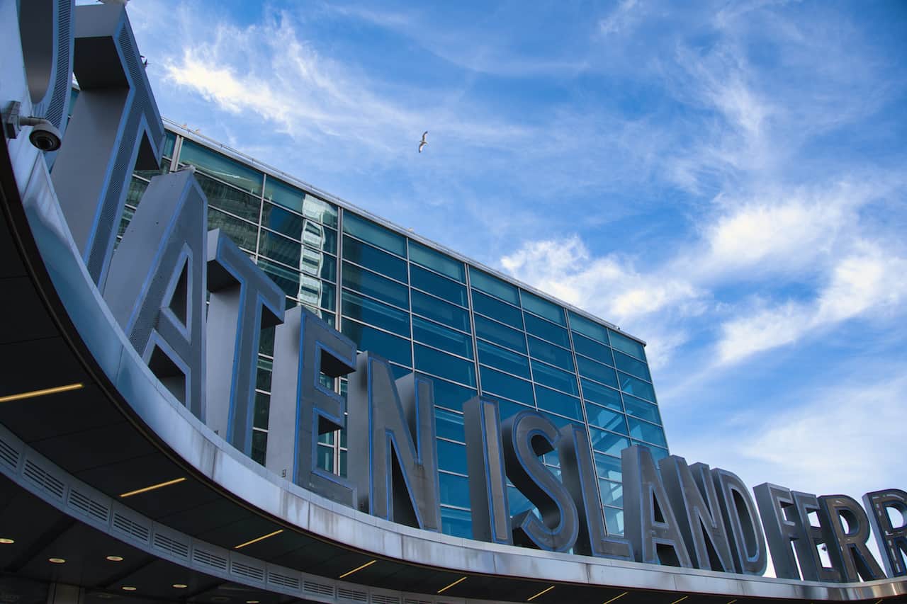
If doing so, just make your way to the Staten Island Ferry terminal directly next to Battery Park. From here simply follow the sidewalk up the East River and you should be on your way.

4) Navigating the Pathway
While it should not be too difficult to navigate the walkway once you are on it, I did want to point out some helpful things to know as you are making your way along.
Pathway: Most of the pathway is right along the waterfront, but you will find instances where there may be construction or just one-off instances that force the pathway away from the river. Sometimes you may be walking just feet away from the FDR highway and at other times you may be walking on the sidewalk. For the most part however you should be walking along the river.
Narrow: There is one portion of walkway that gets very narrow (somewhere right around 15th Street). If you are riding a bike here you will need to dismount and walk across in case there are others coming in the opposite direction. There may also be a time or two where signs tell you to dismount your bike, so do be aware as you are making your way along.
Lanes: Some portions will also split up between walking and biking lines. Be sure to pay attention here as you don’t want to put yourself in harm’s way and accidentally head into the bike lane.
Bathrooms: There are a few restrooms that you can use along the pathway that I know of. One is located around 6th Street near the running track that you will pass by. There are also restrooms further south around the South Street Seaport area.
Water: Along the way you should find plenty of water fountains, where you can hydrate. Note though that these water fountains usually do not operate in colder weather.
Exits: While you can take part of the entire southern end of the walkway, you can also exit the walkway and head back into the city streets at many different parts. I can’t list those out specifically because there are many of them, but at the end of the day if you are looking for an exit, you shouldn’t be too far from one.

5) Walking, Running & Biking the East River Greenway
As mentioned before, the southern end of the East River Greenway is located between 37th Street and Battery Park. You can go about your run, bike or walk in either direction but this guide will be heading from north to south.
To begin your time on the East River Greenway just make your way to 37th Street and walk east until you reach the river. You will simply cross under the underpass and you will be welcomed to the start of the pedestrian pathway.
I should note that while this is the northernmost entry point of the southern section, the pathway itself does head further north here for another few blocks until the promenade hits a dead end at 41st Street. This section of the riverfront (between 37th Street & 41st Street) is called the New Wave Pier.
You can make your way north to begin your walk and get right up and close to the United Nations building on the New Wave Pier. But right when you hit the end of the pier at 41st Street, you will need to turn back around and head southbound.
So, to recap the beginning section of the southern portion of the East River Greenway:
→ The northernmost entrance is at 37th Street, with an additional entrance at 34th Street.
→ You are able to walk northbound along the New Wave Pier to 41st Street. However, this is a dead end, so you will need to circle back once you reach the end of it.
→ You can then continue southbound all the way to Battery Park to enjoy the rest of the East River Greenway.

Whether or not you head a bit further north on the New Wave Pier, you can now begin your walk south all the way down the East River Greenway.
There will be a few portions of walkway where you will be right on the water while others just a bit more inland.
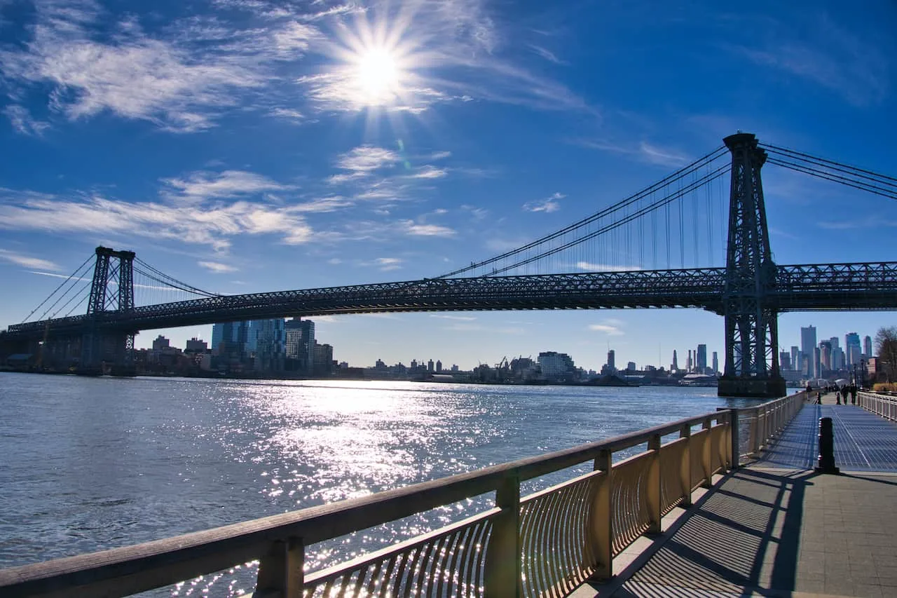
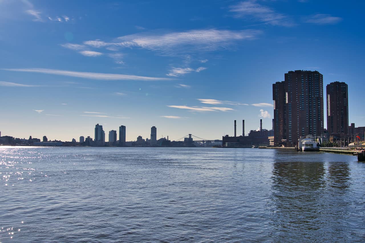
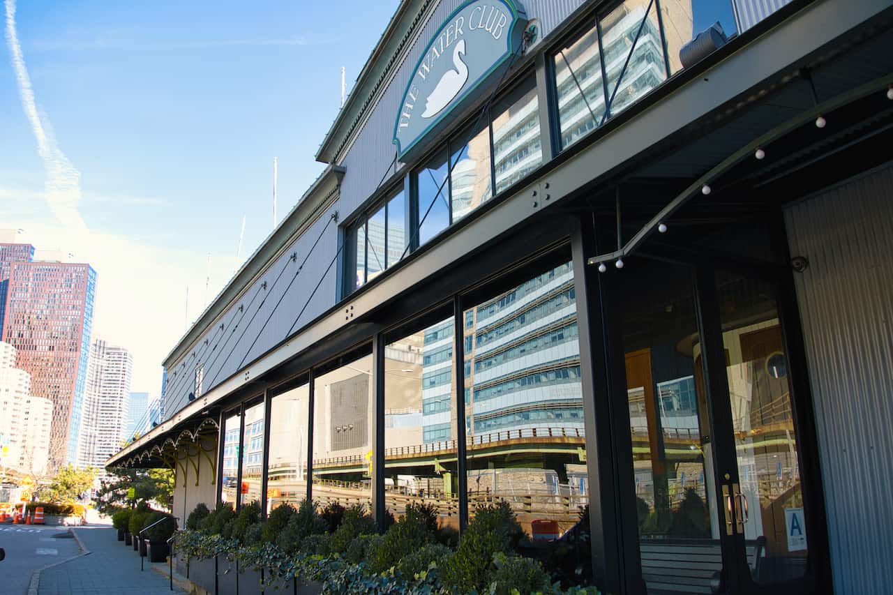
You will get some initial views of the Williamsburg Bridge out in the distance as you pass by the The Water Club restaurant and continue southbound.
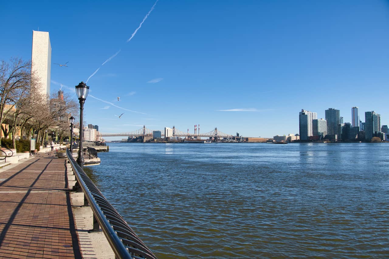
Be sure to look northbound as well, where you will see the United Nations and 59th Street bridge in that direction.


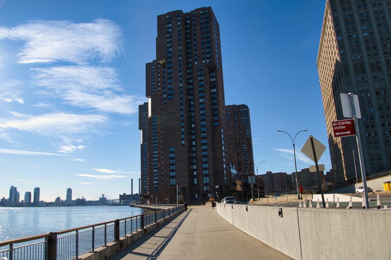
Soon you will approach some apartment buildings (Waterside Plaza) straight out ahead of you (pictured below).
Here you can decide to walk right alongside the river on a narrower pathway or head closer to the street side.

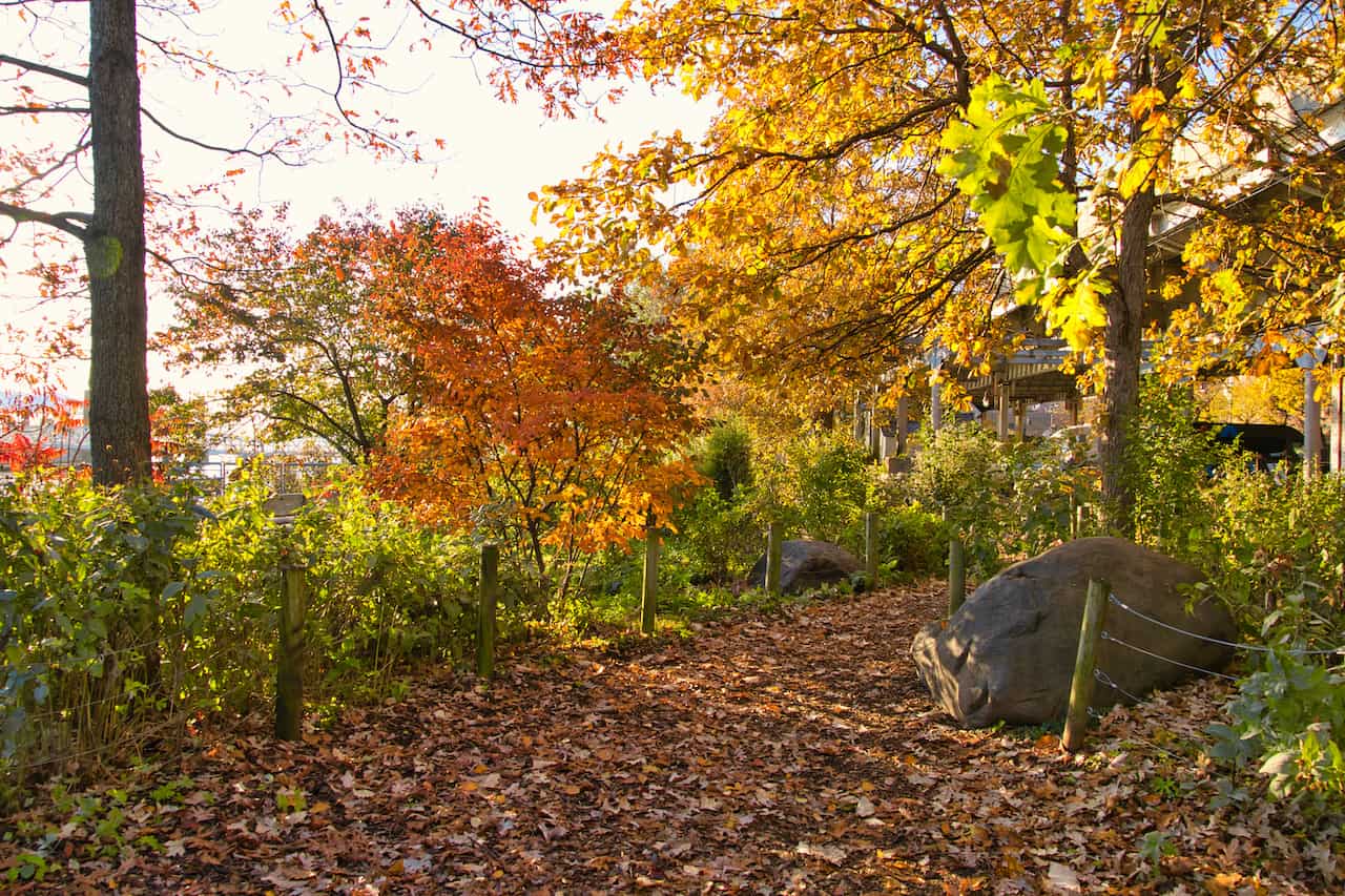
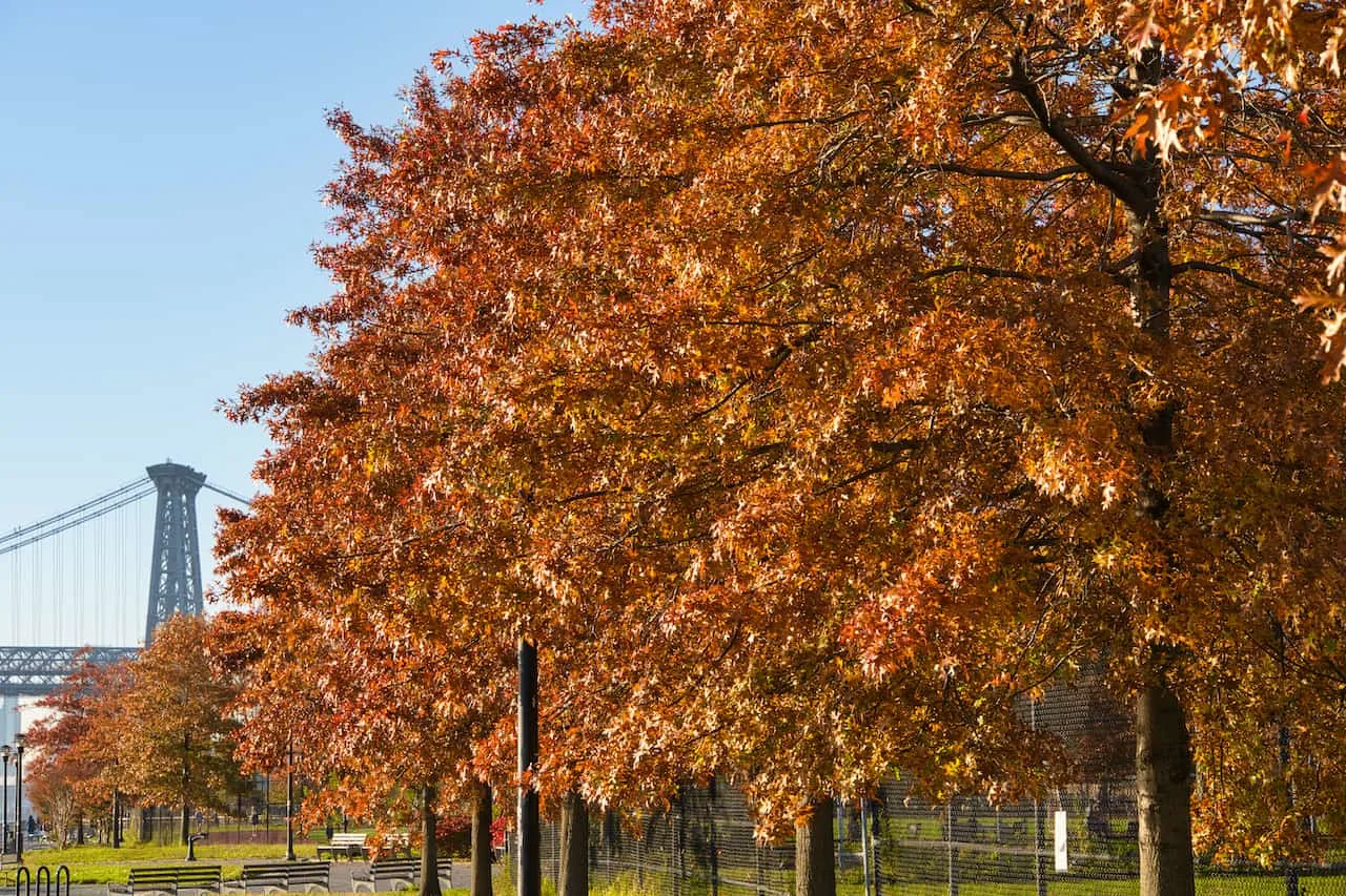
After this area you will begin to walk through Stuyvesant Cove Park. It is a short but scenic greenery filled area with a swerving pathway making its way through.
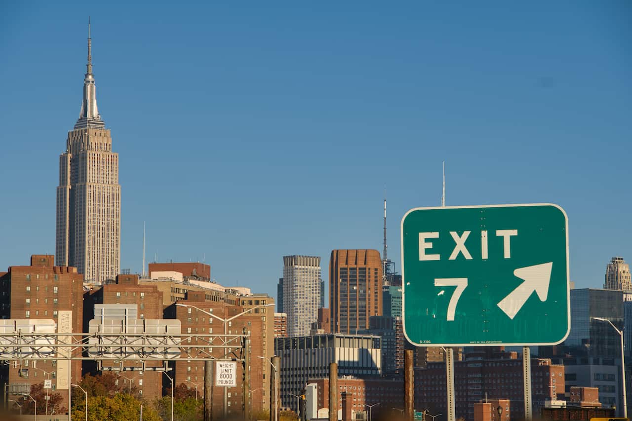
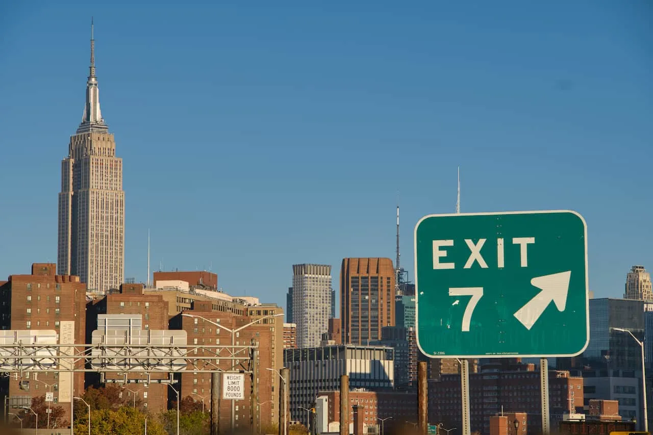
During / after walking through the park, be sure to take a look around in the opposite direction. You should see the top half of the Empire State Building as well as the Freedom Tower.


The path continues southbound as you make your way alongside the FDR drive. At some point the path gets very narrow for a few minutes and bikers will need to dismount and walk this short portion.
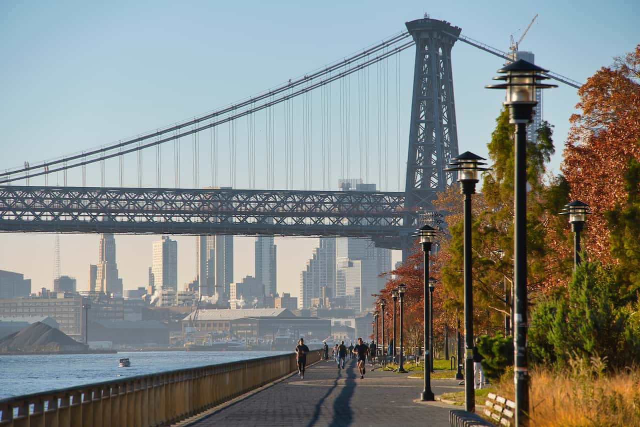
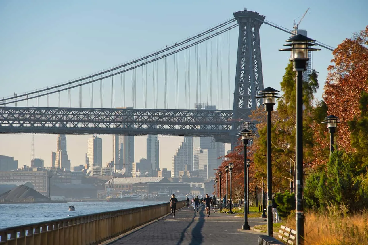
Once the narrow section ends, you will enter the East River Promenade area, which is full of parks, benches, fields, and more.
This section of pathway up until the amphitheater is the most popular section of the East River Greenway as the path widens, bridges come into better view, and there are plenty of places to sit down and enjoy.
I should note that there is also an inner pathway here closer to the street but I would definitely recommend the route closer to the East River as that is where all the views will be found.
Learn More: Check out some other viewpoints around the area in the guide to the best views of New York City

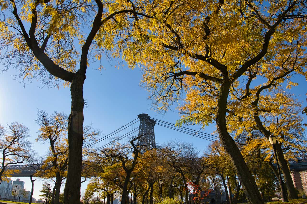

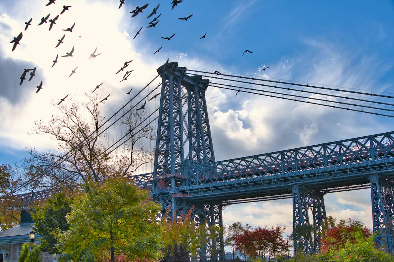
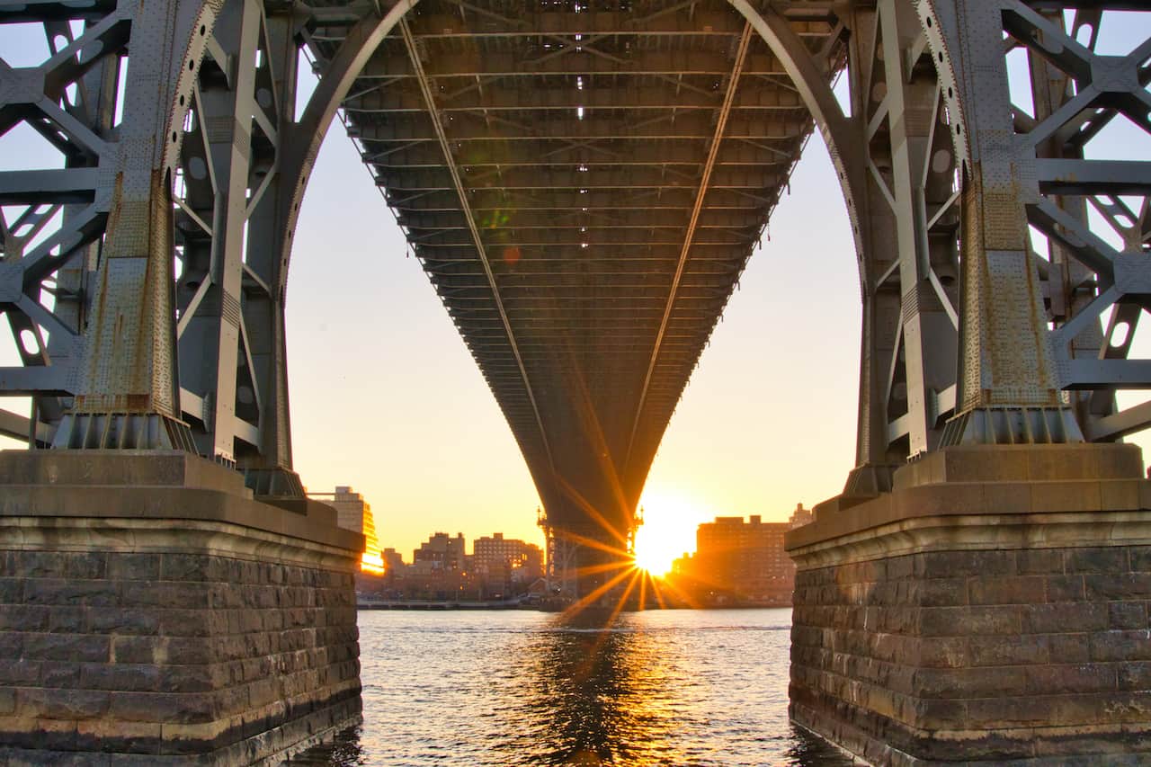
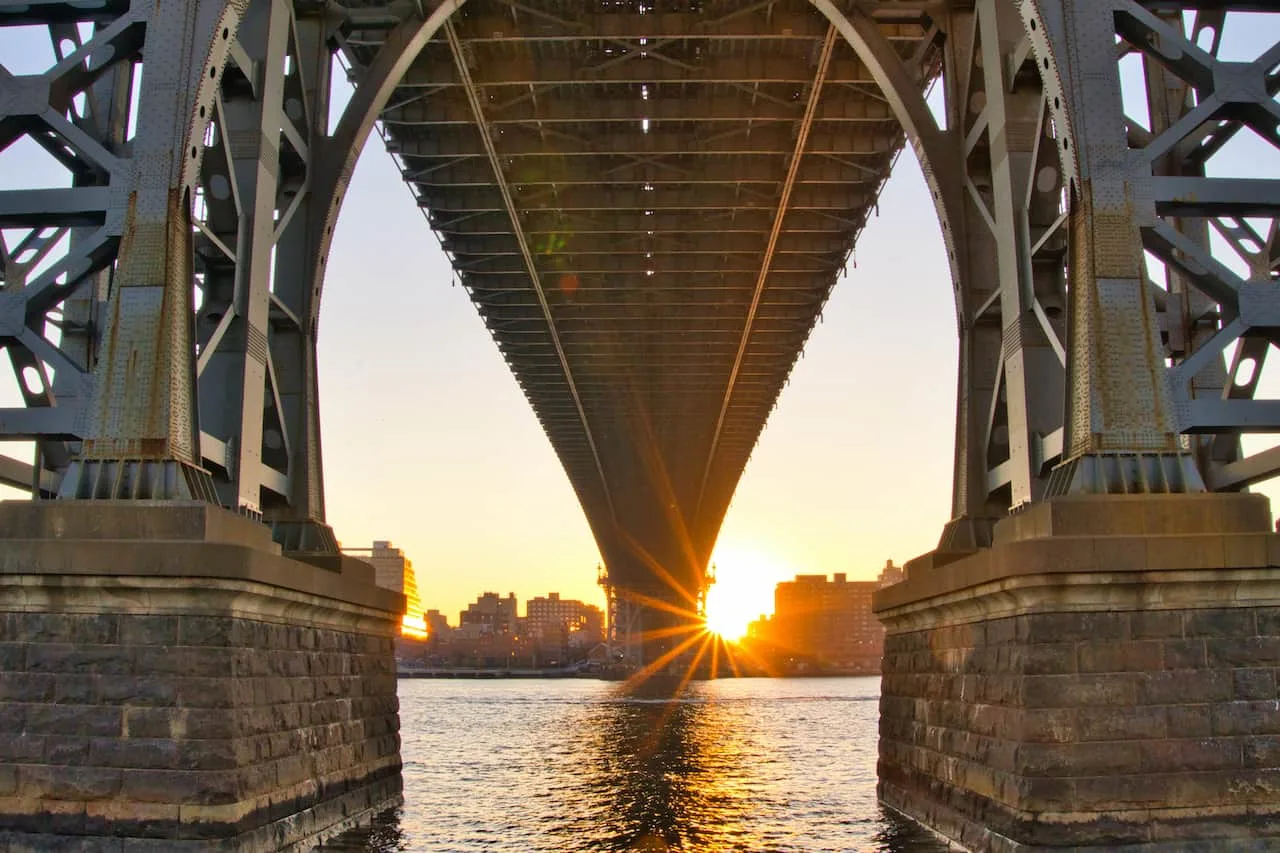
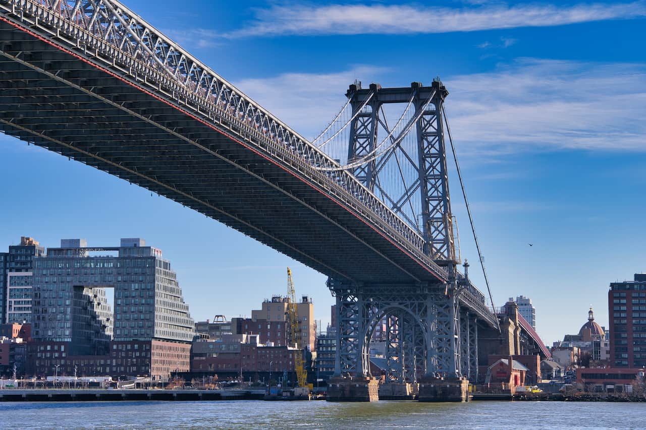
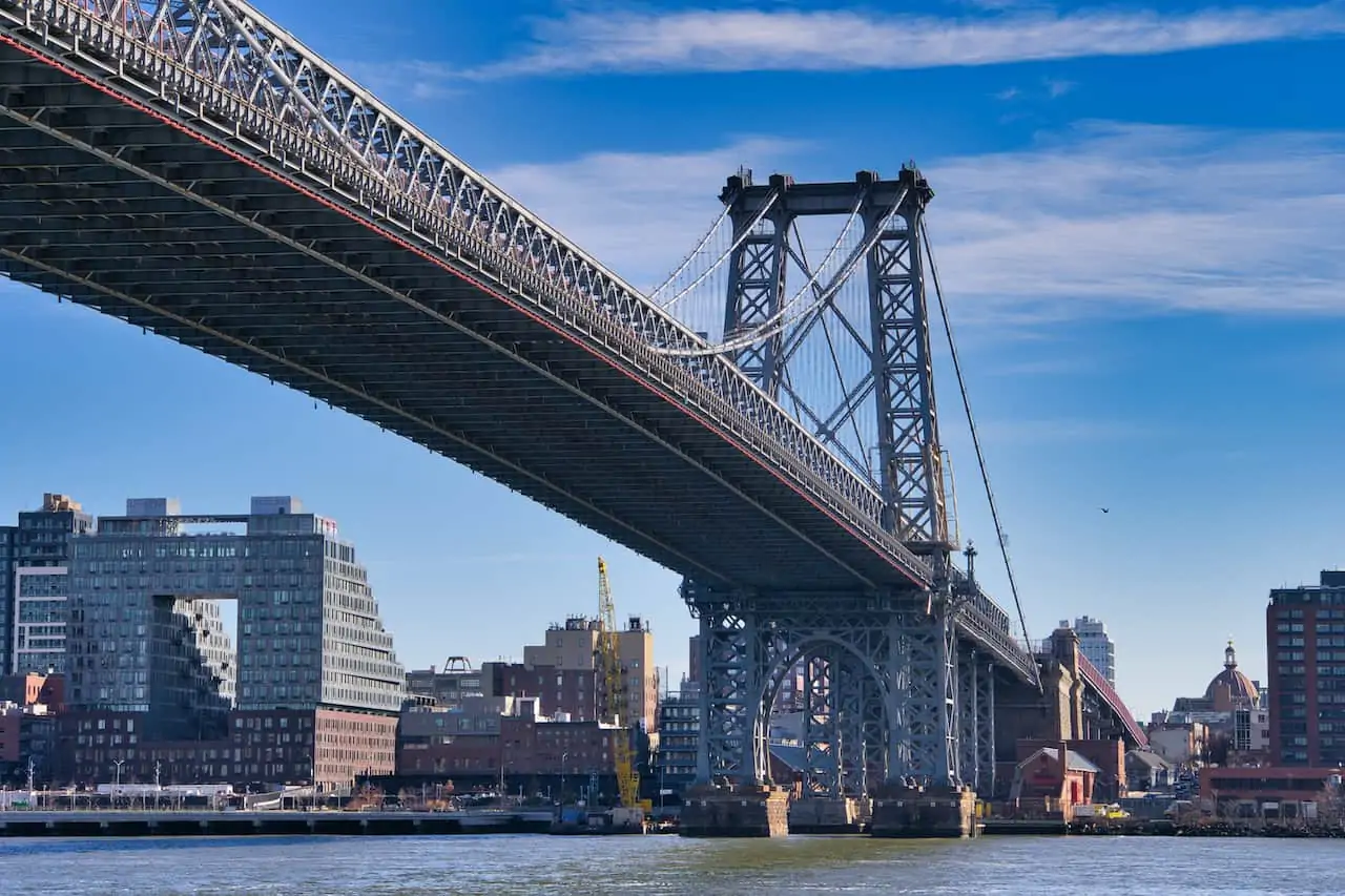
Continue alongside the various ball fields, tracks, and tennis courts as you slowly approach the first of three bridges – the Williamsburg Bridge.
Check out some of the close up shots that you can enjoy from down below before continuing onwards.
After passing by the Williamsburg Bridge you will see a couple more fields to your right followed by the East River Park Amphitheater. If you want to run some stairs, here is your opportunity.
Once past the amphitheater you will see that the foot and bike traffic goes down as many locals turn back around at this point. However, if you are looking to enjoy the East River Greenway, I highly recommend continuing onwards.
Around this area you should also get a peak of the Statue of Liberty way out in the distance. It is basically the only time between 34th Street and the Staten Island Ferry where you will get to see it.
This is also where the Corlears Hook Park and ferry terminal is located. If you are looking to take a ride out on the water, you can do so from here.

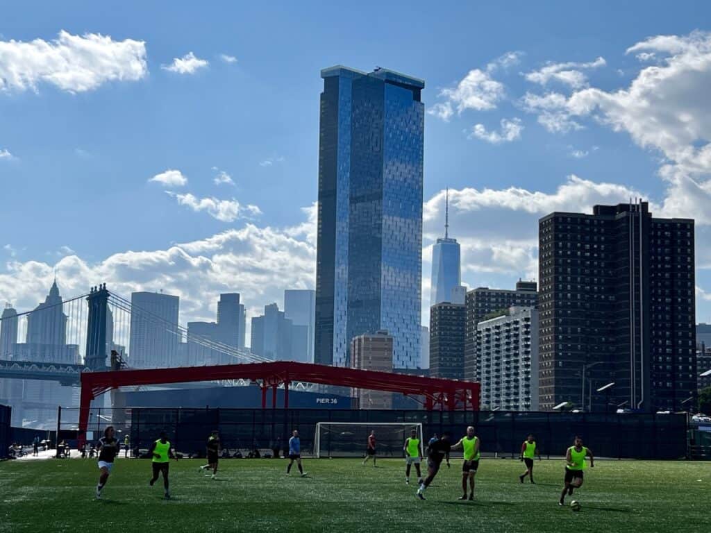
The path here will turn inland as you head away from the water before passing by some of the main pier areas. One of the newer piers along the waterfront here is Pier 42.
Pier 42 is full of various sports fields (such as soccer, basketball, and tennis) as well as several seating areas where you can sit back and enjoy the view. Getting that downtown NYC panorama, while taking in a game seems pretty good to me.

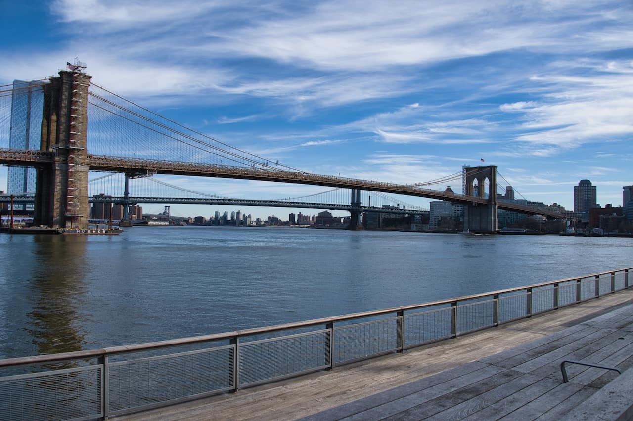
As you follow the waterfront southbound, be on the lookout to your left as you approach Pier 35, another great addition to the East River Greenway.
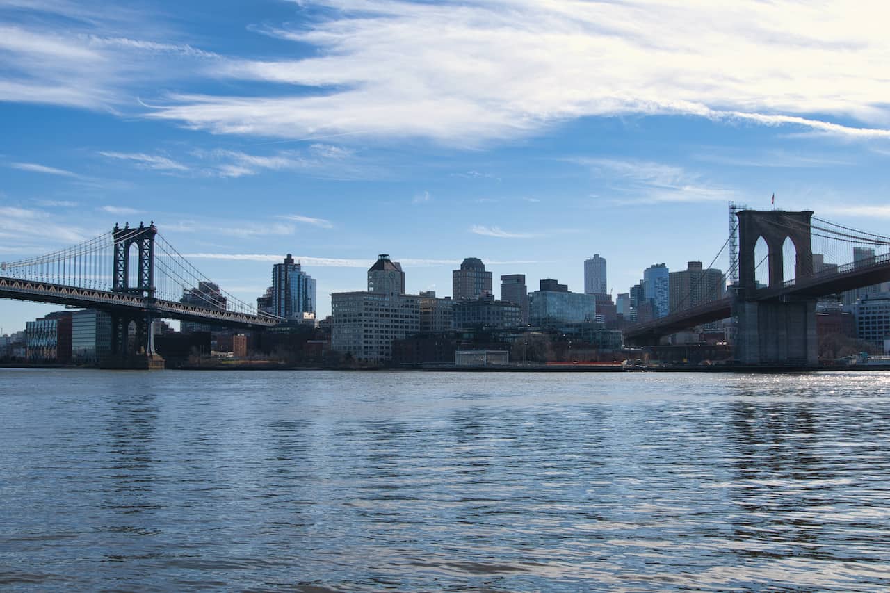
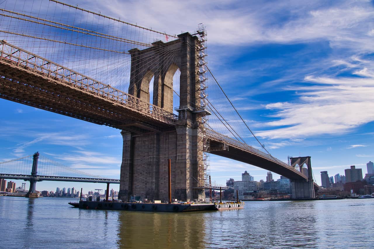
It is a relaxing little area to hang out at and enjoy the view of the Manhattan Bridge out in front of you and the Brooklyn Bridge just behind it.
Note that during much of this portion of pathway you will be walking somewhat underneath the purple FDR overpass. It may not feel as open as other parts of the walkway but you will still have some scenic views throughout.


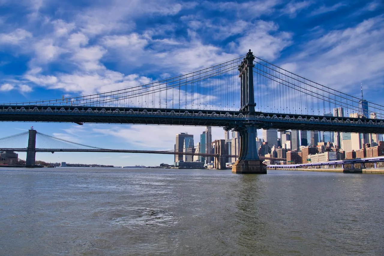
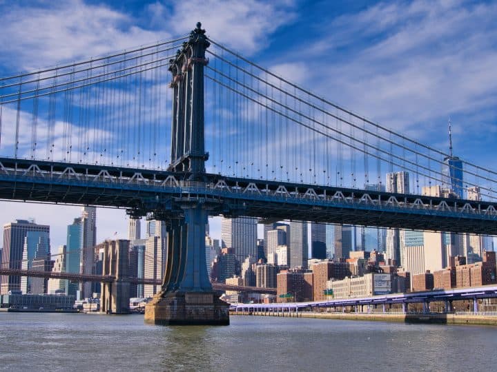
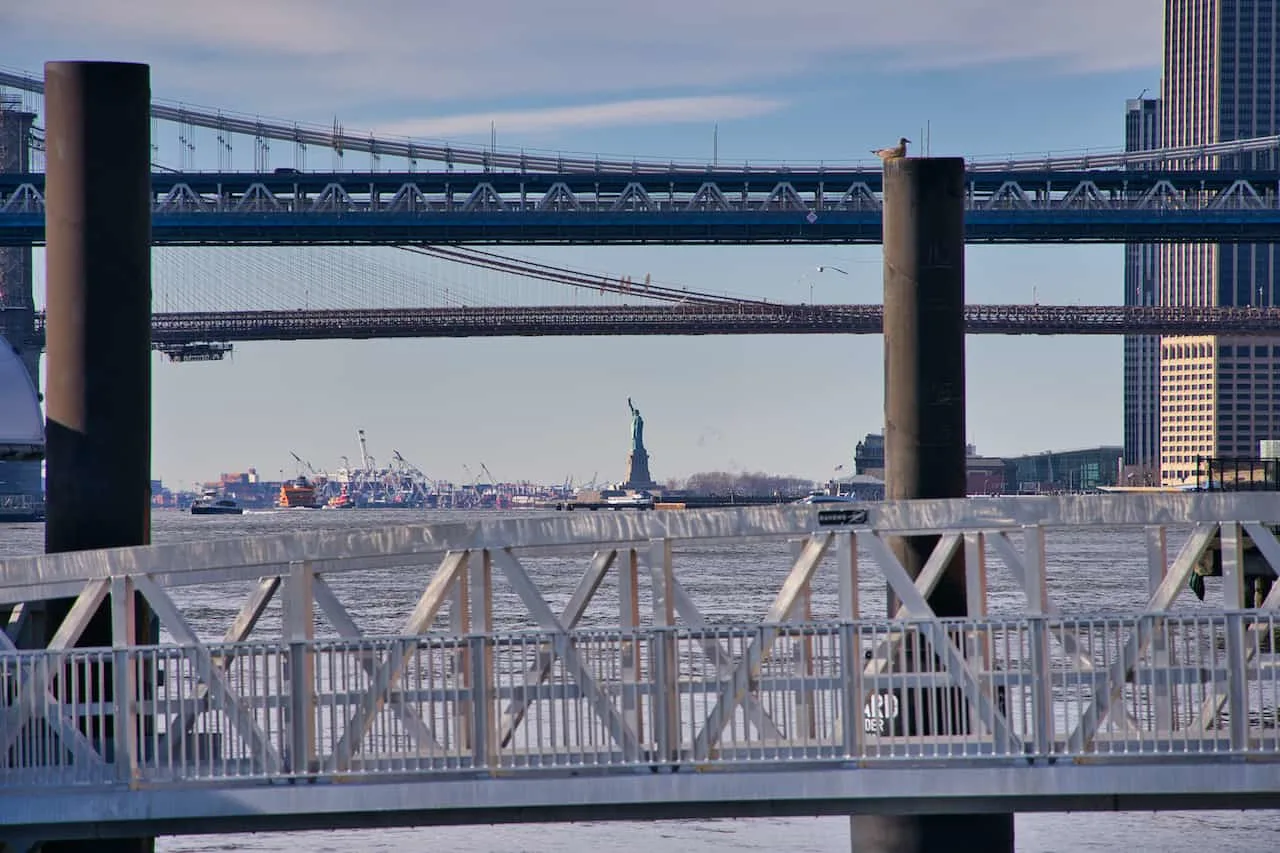
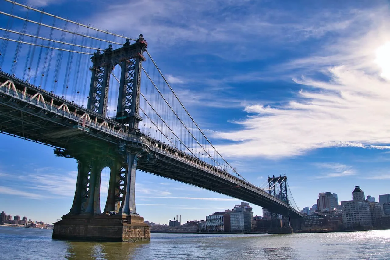
It is then further south as you pass under the second bridge of your journey, the Manhattan Bridge, and then right towards the most famous of NYC bridges, the Brooklyn Bridge.
If you would like to learn more about the bridge itself, check out the Brooklyn Bridge Walking guide up on the site.


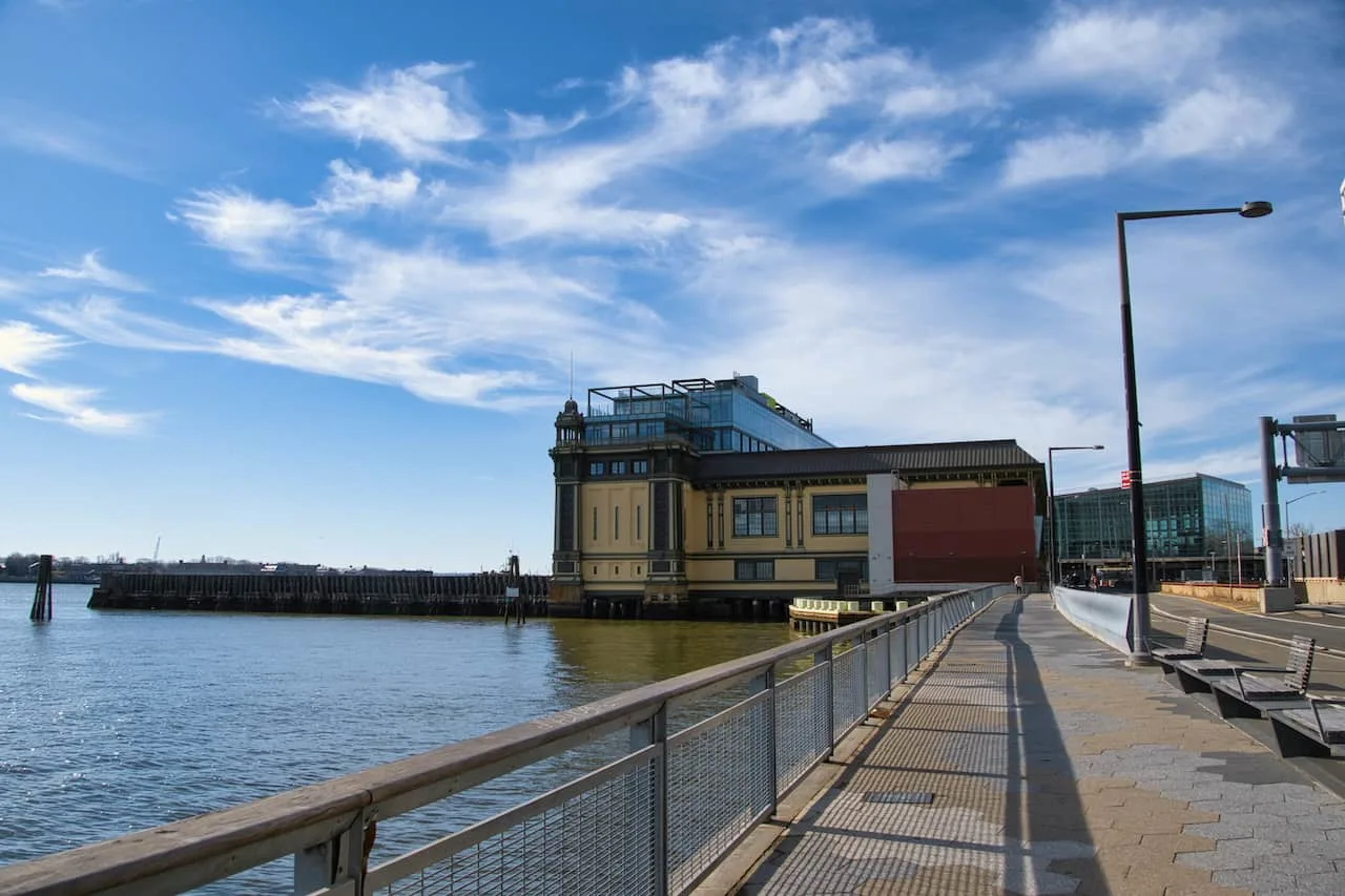
Right after passing underneath the Brooklyn Bridge you will come across the South Street Seaport area, around Piers 15,16, and 17.
One of my favorite spots of the East River Greenway is the outdoor deck area at Pier 17, where you will find several lounge area to sit back and enjoy the view of the Brooklyn Bridge.

The path then continues further southbound as you slowly approach the end of the greenway. You will come across a couple last piers and helicopter pads and then pass by the Governors Island Ferry terminal before ending your journey right outside the Staten Island Ferry.
From here you can continue further along to Battery Park, where you can get some great Statue of Liberty sunset and Governors Island views.
You can also choose to continue your walk around the tip of Manhattan and up the Hudson River Greenway on the west side of Manhattan.

6) Where to Stay in Manhattan
There are so many different neighborhoods to choose from when visiting NYC. Below are some articles to help you make the best choice for your trip.
Looking for the top hotels & neighborhoods in NYC? Check out some helpful accommodation resources when it comes to picking the best spot for you!
Neighborhood Overview: Best Places to Stay in NYC
Best Skyline Views: NYC Hotels with a View
Times Square: Top Times Square Hotels with a View
Theater District: Hotels in Broadway Theater District
Central Park: Best Hotels with Central Park Views
Tribeca: Best Tribeca Hotels
SoHo: Where to Stay in SoHo
Greenwich Village: Top Greenwich Village Hotels
Brooklyn Bridge: Hotels with Brooklyn Bridge Views
Best Panoramas: Hotels in NYC with Floor to Ceiling Windows
That wraps up a guide to the southern portion of the East River Greenway running, walking, and biking path. If you have any questions or comments about the route, feel free to add them in below.
Also be sure to check out the other New York travel guides up on the site such as. Have fun out there and safe travels!


Trini
Monday 13th of February 2023
You might want to update this. It's been close to a year since anyone can walk this path. There is a major storm surge protection project going on, and by major I mean it's scheduled to go on for 2-5 years. https://www.nyc.gov/site/ddc/about/press-releases/2021/pr-110121-ESCR-construction.page
Charles
Tuesday 14th of February 2023
Hi Trini - yes, I have a note right near the beginning noting the construction around the area.
Jacky
Monday 15th of August 2022
This is very confusing. You mentioned the path ends someone near United Nations. Where does it continue after that? Also, you went to uptown and downtown and not clear about the directions. Thank you
Charles
Monday 15th of August 2022
Hi Jacky - I tried to explain in the guide that there are two sections to the greenway - a southern section & a northern section. In the middle of the two is the United Nations. In order to connect the southern and northern ends of the Greenway, you must go inland onto 1st Avenue for around 1 mile.