

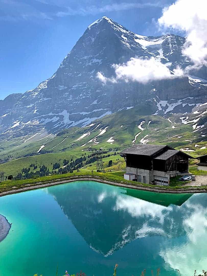
The Jungfrau Region of Switzerland is packed with various hiking opportunities, snowcapped mountain tops, and never ending valley views. One hike that will offer all of that is the Mannlichen Royal Walk above Wengen.
This short 25 minute stroll will take you to the top of Mannlichen, where you will have views of the famous Eiger, Monch, and Jungfrau mountains. Not only that but you also will have beautiful views down to the Lauterbrunnen Valley and Grindelwald.
Read on to learn more about the Royal Walk and how to go about your visit there.
* Affiliate Disclosure: This post may contain affiliate links, which means I may receive a commission if you make a purchase through the links provided, at no additional cost to you. Thanks for supporting the work I put into TripTins!
1) How to Get to Mannlichen
In order to take part of the Royal Walk, you first need to get up to the starting point of the walk near the Mannlichen cable car station.
From the cable car station, you will then be able to take part of the walk towards the Mannlichen summit at 7,687 feet (2,343 meters).
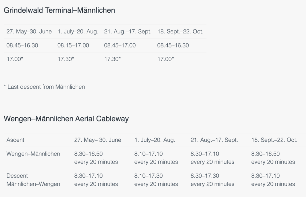
There are actually two cable cars that you can take up to Mannlichen – one from Wengen and one from Grindelwald:
- From Wengen: Take the Aerial Cableway (LWM), which departs every 20 minutes and just takes 5 minutes to get up to the top
- From Grindelwald: Take the Gondola Cableway (GGM), which departs constantly and takes 20 minutes. Note that the cableway departs from Grindelwald Terminal, which is not the same as Grindelwald Station.
Both the gondola and aerial cableway usually open end of May / beginning of June and close in mid October. They run from around 8:30AM to 5:00PM, depending on the time of year. Take a look below at the schedule and be sure to take a look at the Mannlichen website for the latest.
» Learn all about Train Travel in Switzerland and what you need to know about trains, cable cars, and more!

Swiss Travel Pass: Are you planning on traveling frequently throughout Switzerland during your trip? Consider purchasing a Swiss Travel Pass to save some money!
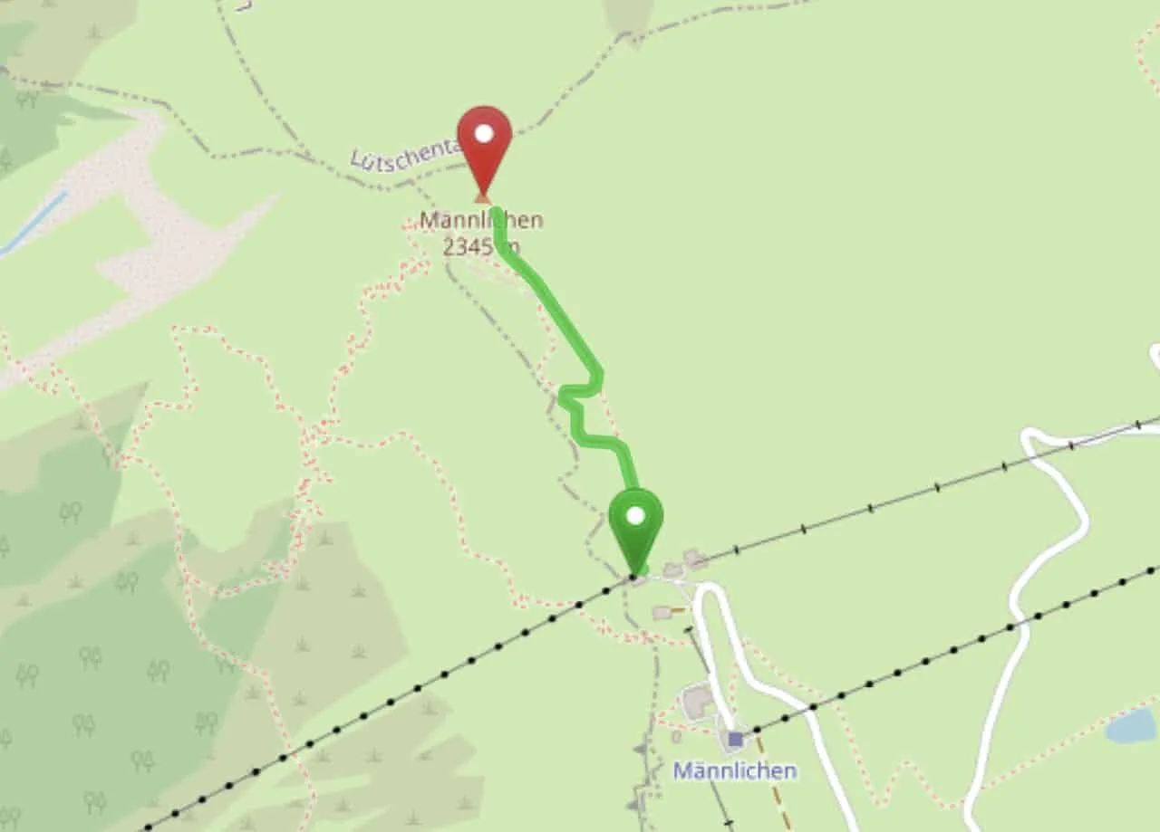
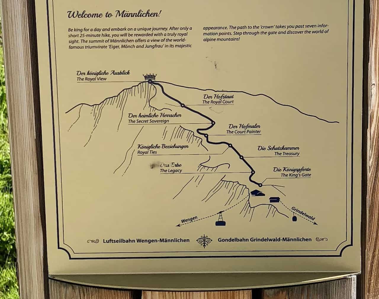
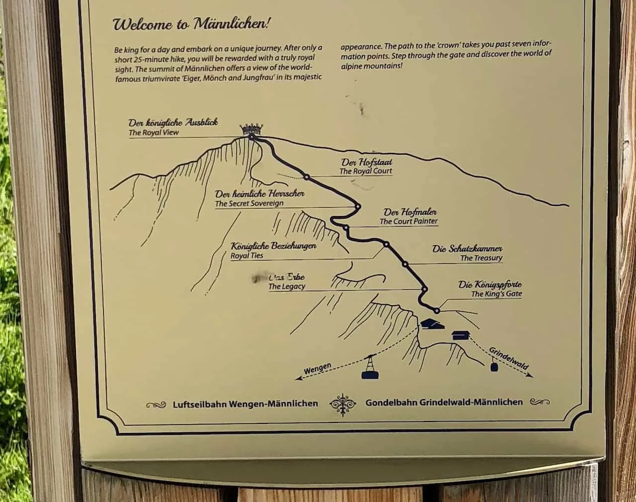
2) Mannlichen Royal Walk Map
Below you can find a screenshot of the Royal Walk hiking map that begins right near the cable car terminals and takes you up to the Mannlichen summit.
As you can see, the route is not too long at all and is easy to follow onwards to the top.

Hiking Resources & Checklist
Before heading out for the trails, be sure to read up on some of the hiking resources up on the site. These are here to better prepare you for all types of outdoor adventure.
- Gear: Hiking Packing List
- Weather: How to Prepare for Hiking Weather
- Navigation: Hiking GPS & Navigation
- Tips: 20+ Hiking Tips & Tricks for the Trail
- Accommodation: Book Your Hotel Today
- Rental Car: Book Your Car Rental Today
3) Where to Stay in the Jungfrau Region
When visiting the Jungfrau Region, one of the main questions that consistently arise is where you should base yourself.
There are many options out there such as Wengen, Murren, Grindelwald, Lauterbrunnen, Interlaken, among others.
Since there is so much to do on all ends of the region, you will find yourself constantly going from one town to the next on a daily basis.
Due to this, there really isn’t one “best” place to stay. However, for the purposes of the Royal Walk and nearby hikes, Wengen or Grindelwald will be your closest options.
Below are some of my top hotel recommendations to choose from for your trip to the Swiss Alps. Note that in the high season, hotels will sell out! Be sure to book your rooms today to guarantee your spot in one of the world’s most beautiful regions.
- Murren: Hotel Edelweiss Superior | Hotel Alpenruh
- Interlaken: Hotel Bellevue | Hotel Roessli | Balmers Hostel
- Wengen: Hotel Edelweiss | Hotel Baeren
- Grindelwald: Hotel Lauberhorn | Hotel Belvedere
If you would like to learn more, feel free to take a look at the guide I put together that talks through where to stay in the Jungfrau region, as well as the best Wengen hotels and Murren Hotels to choose from.
4) Royal Walk Details
Before diving into some images of the hike itself, I thought it may be helpful to breakdown a few helpful details of the Royal Walk (round trip numbers).
- Starting Point: Mannlichen Cable Car Station
- Ending Point: Top of Mannlichen
- Distance: 0.8 miles / 1.2 km
- Duration: 40 minutes
- Elevation Gain: +262 feet / +80 meters
As you can tell, this is definitely on the shorter and easier side of hiking options. The route should take about 25 minutes to get up and another 15 or so minutes to get down.
Although on the shorter side, it is the perfect add on to a day if you want to take in some spectacular views and just get a good feel for your surroundings.
Be sure to check out some of the other top things to do around Wengen during a visit

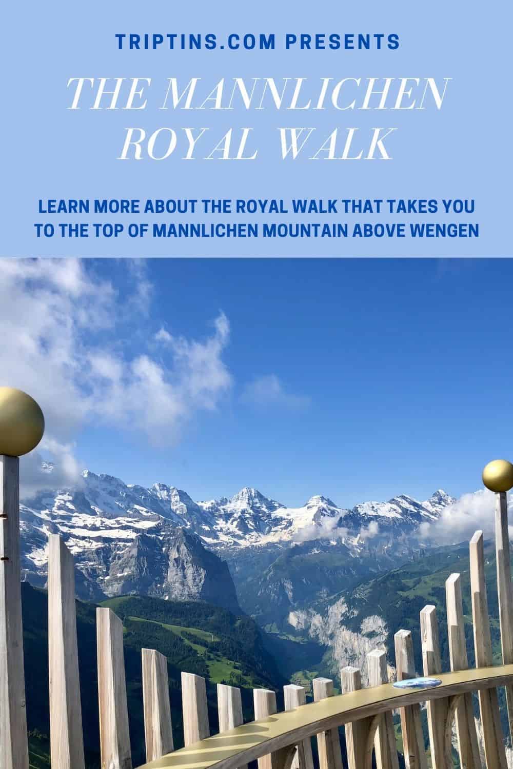
5) The Mannlichen Royal Walk
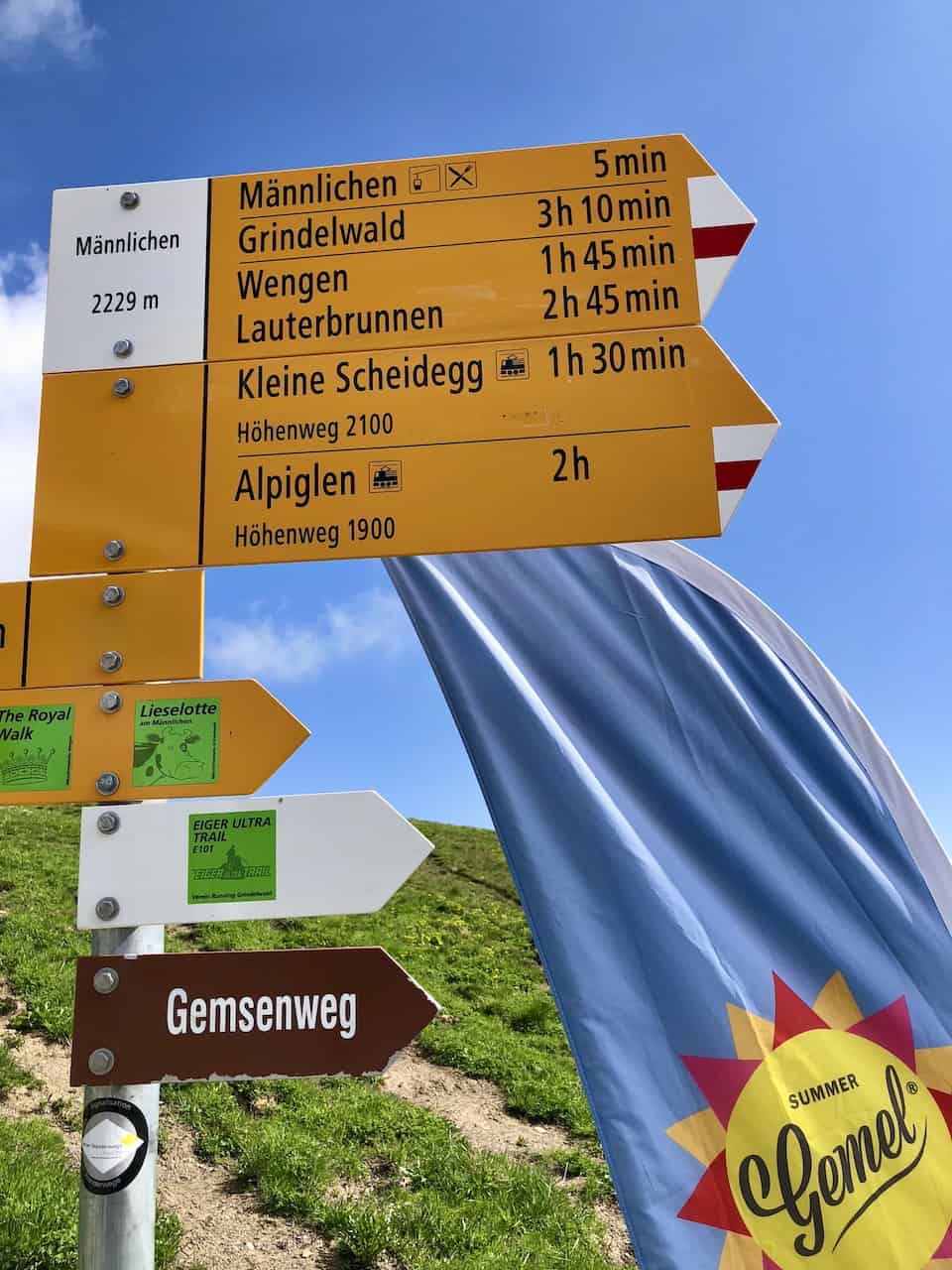
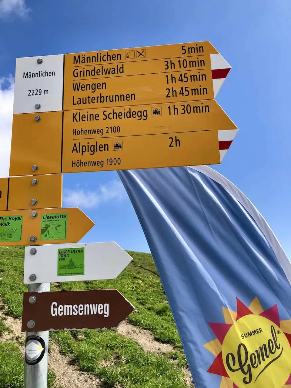
As you arrive from either Grindelwald or Wengen, the trek to the Mannlichen summit will begin.
You will be able to see the summit once you are off the cable car, and all you need to do is follow the well-marked path upwards.
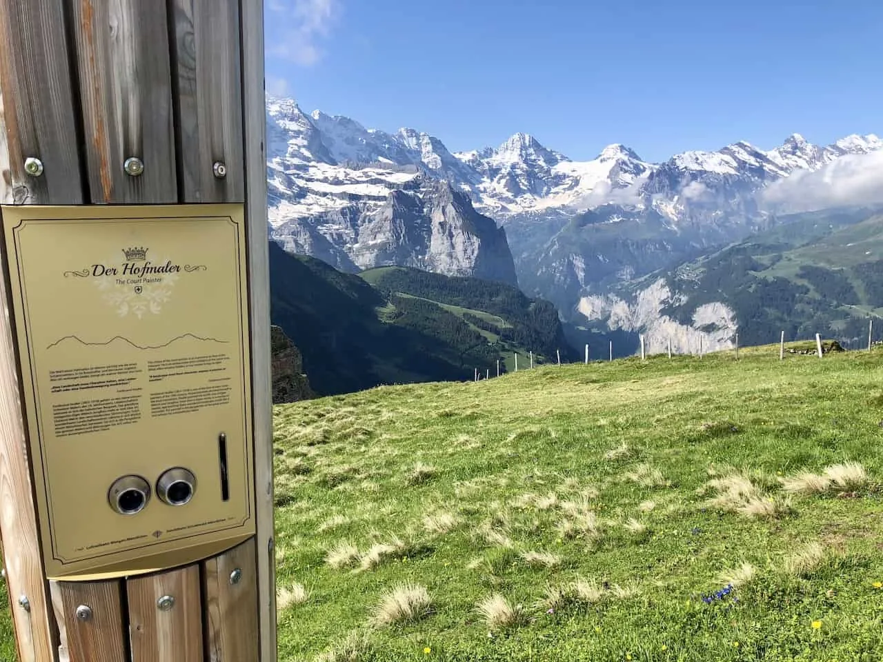
During the duration of the trail you will actually come across seven information points along the way, where you can stop for a moment and learn a bit more about Swiss history and the surrounding mountains.
On the map these waypoints are marked as: The King’s Gate, The Legacy, The Treasury, Royal Ties, The Court Painter, The Secret Sovereign, and The Royal Court. At the top you will be welcomed to The Royal View.
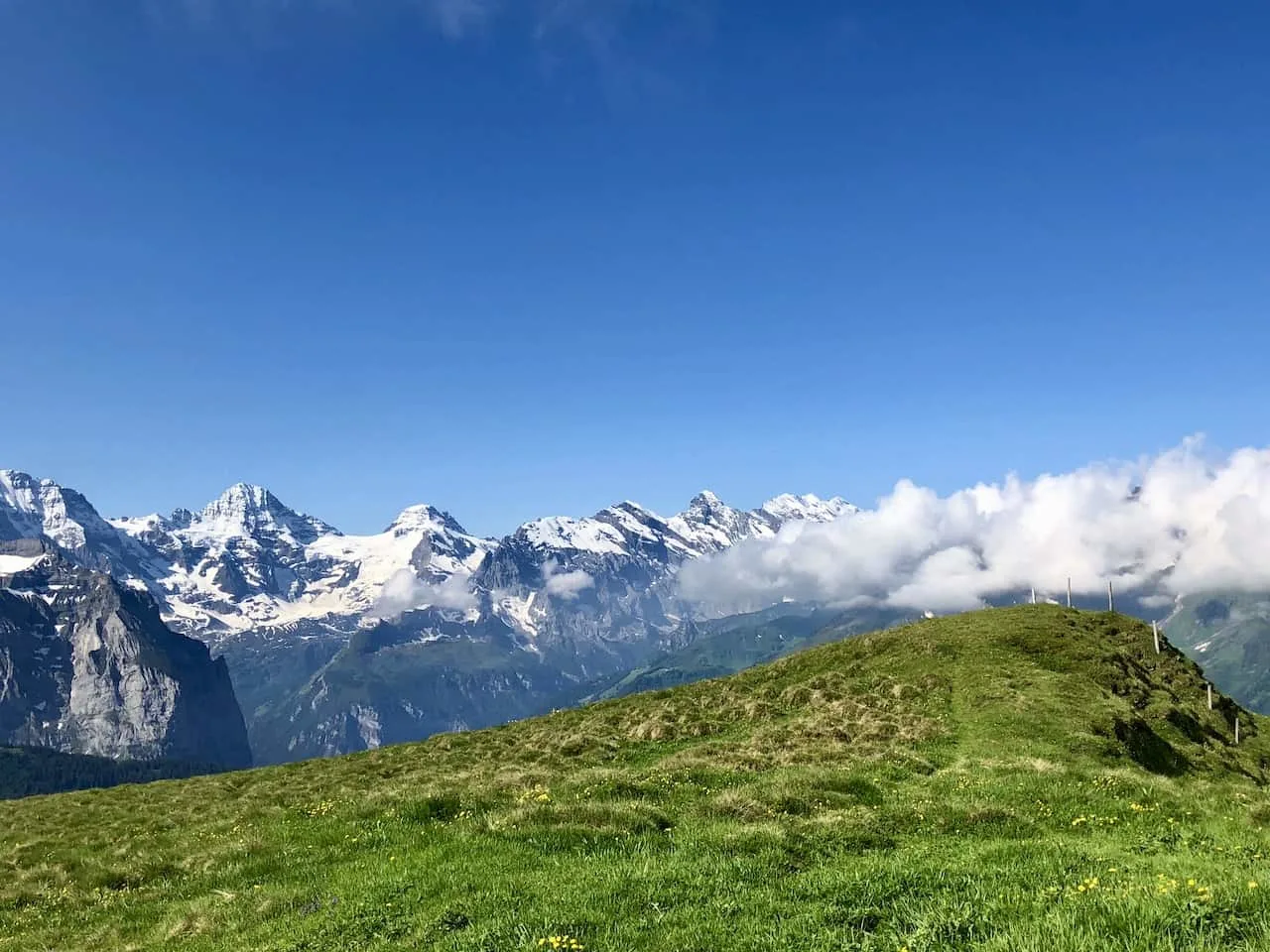
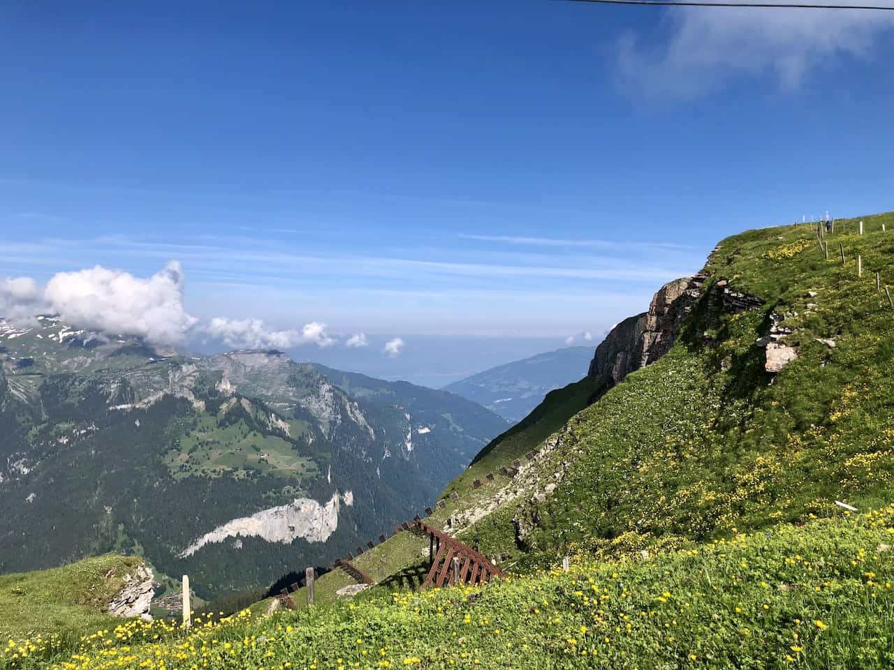
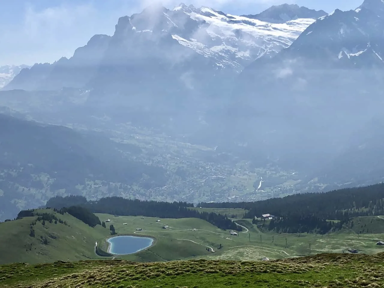
Continue the walk upwards to the summit as you begin to surround yourself with the mountain greenery and snow capped mountain views in all directions.
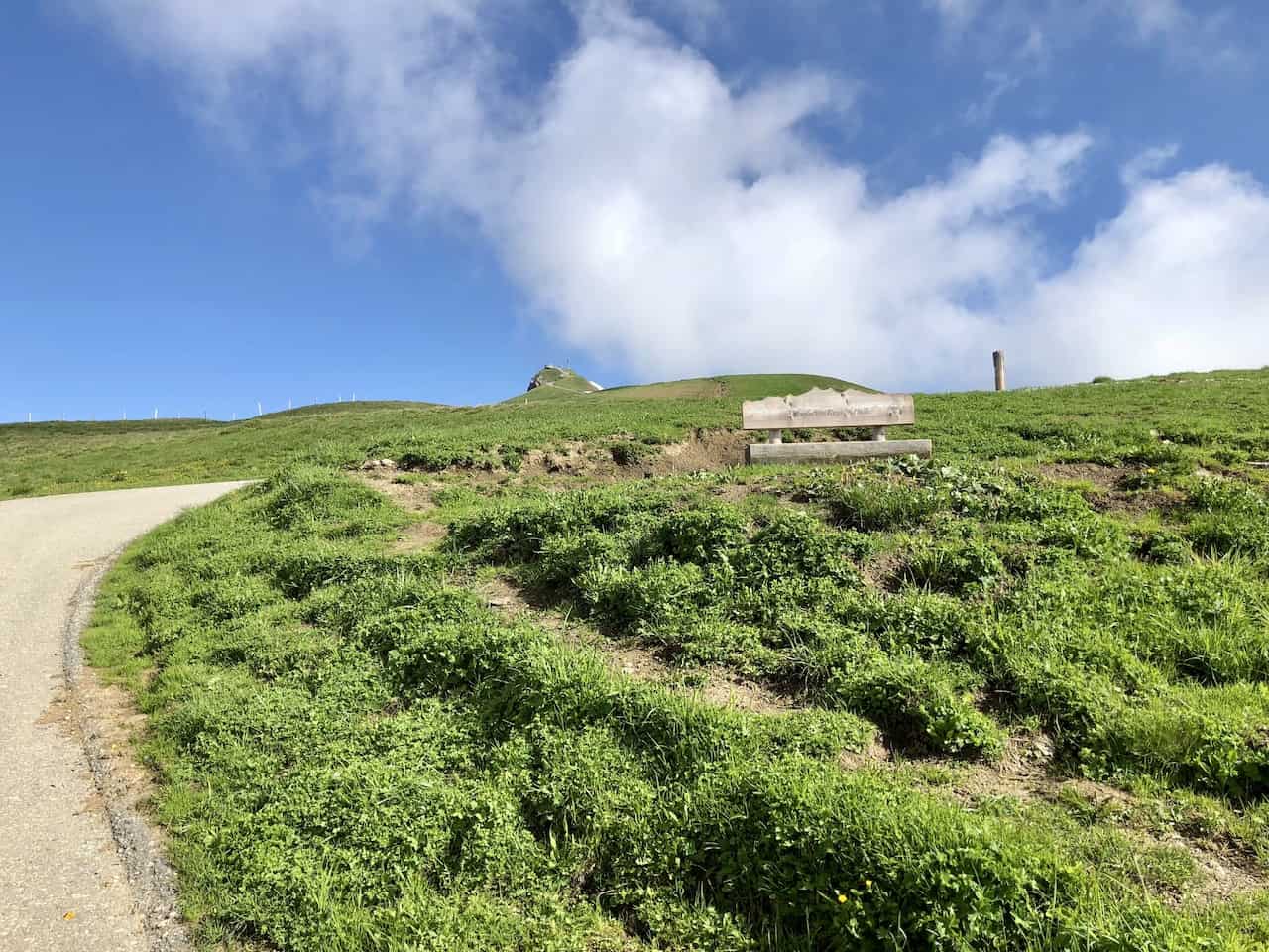
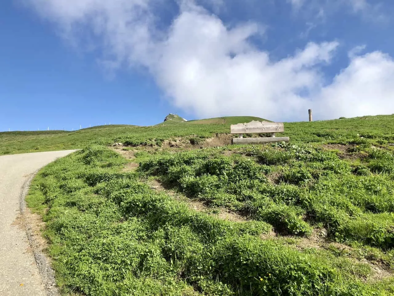
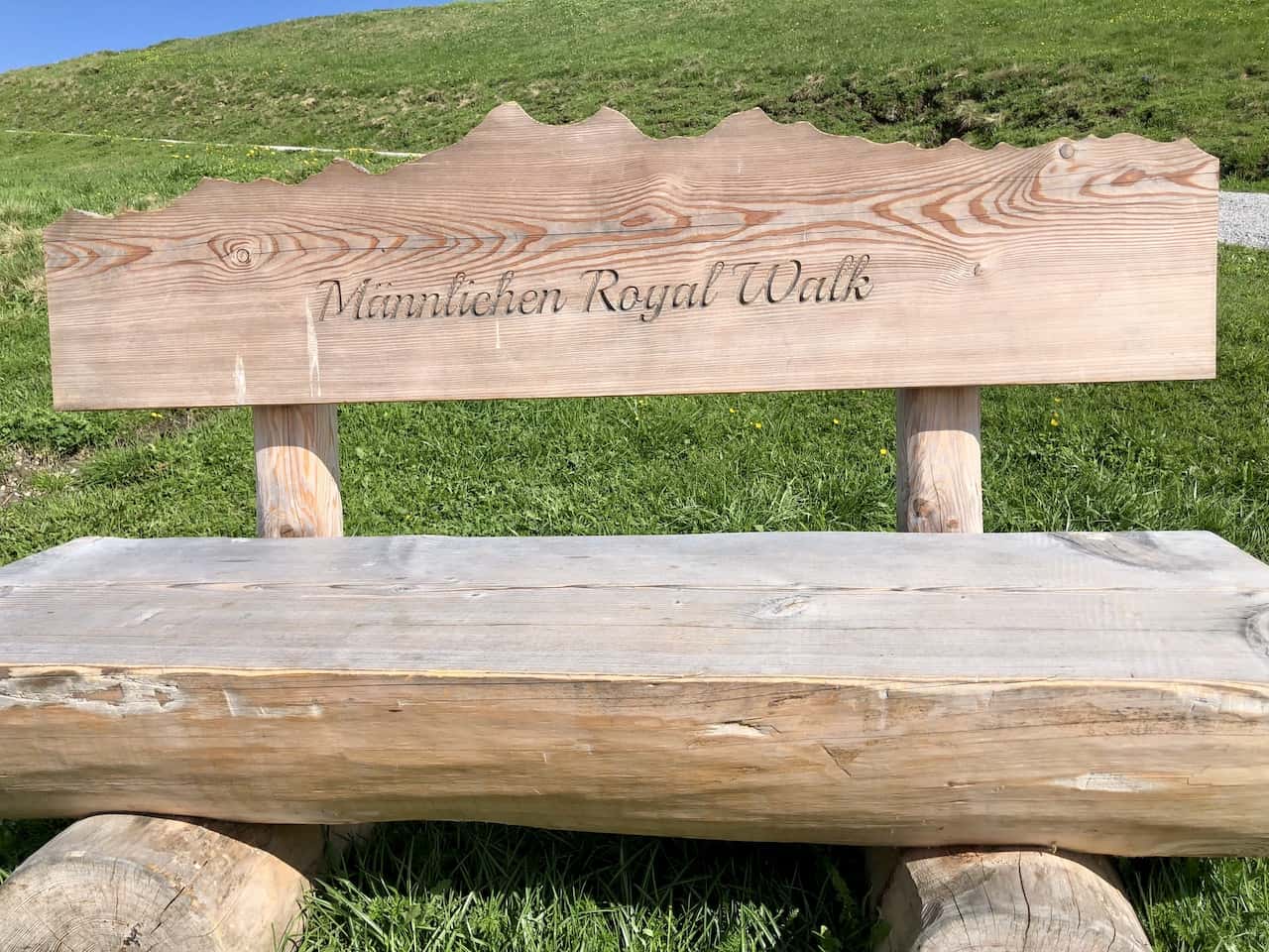
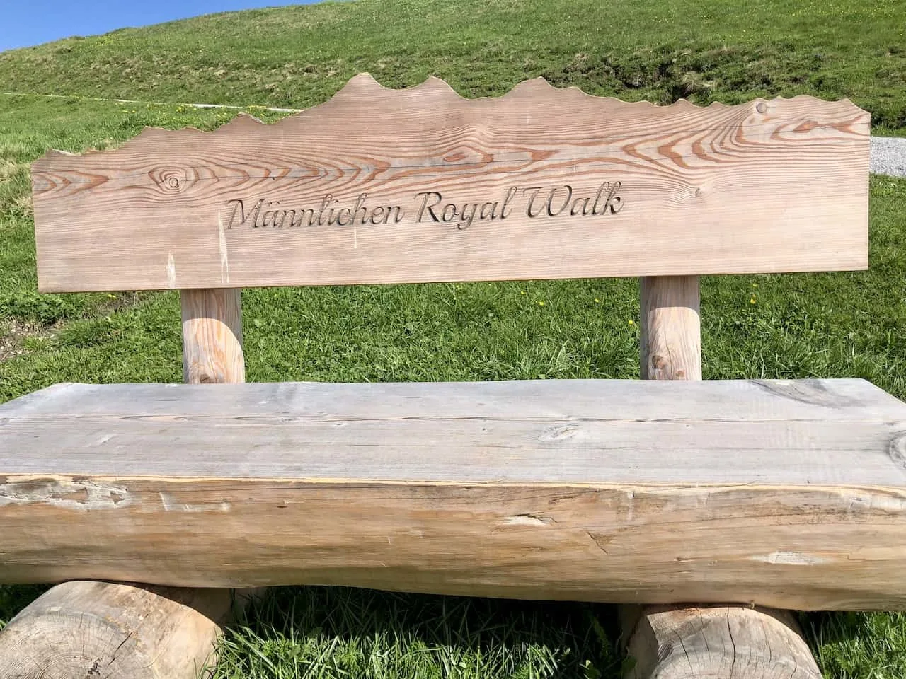
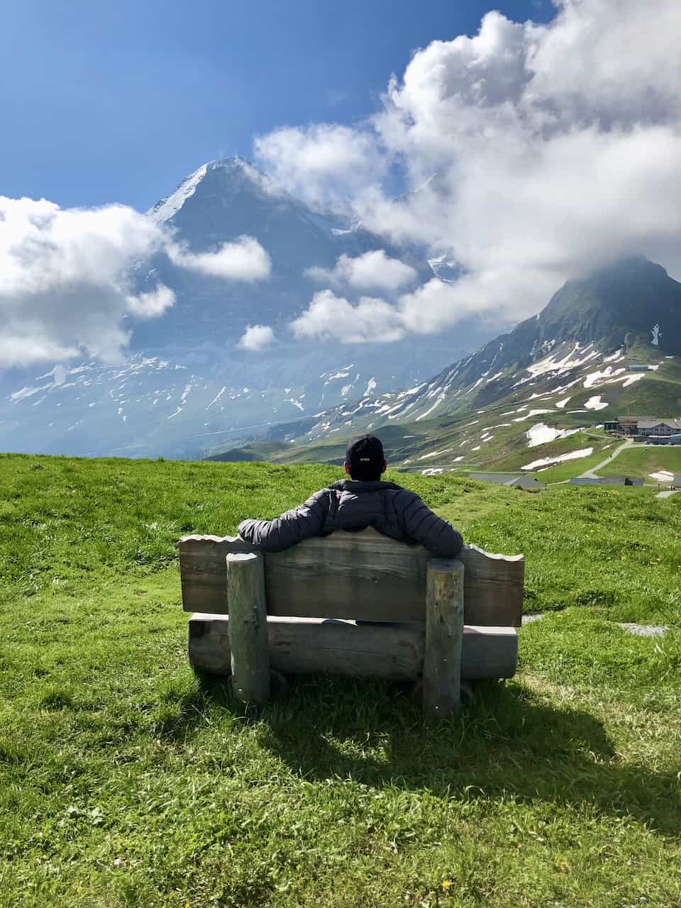
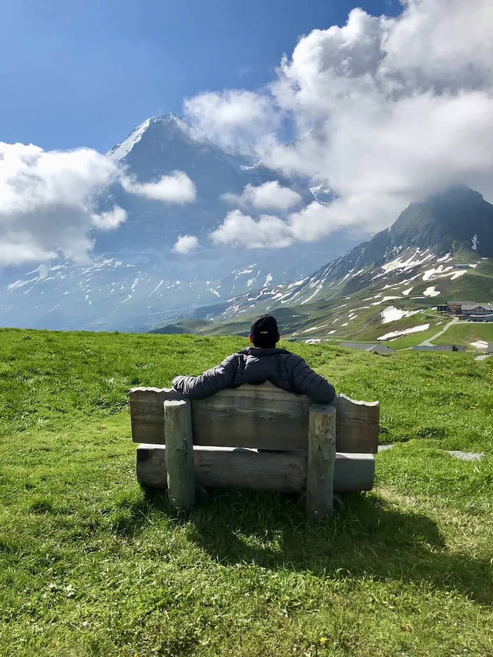
Along the way you will come across a couple bench areas, where you can sit back and enjoy the view of the Alps. The higher you get, the better the view!
As mentioned, you will also come across these sign posts along the way. At some of them, you will find some binoculars to look through to see even further out in the distance.

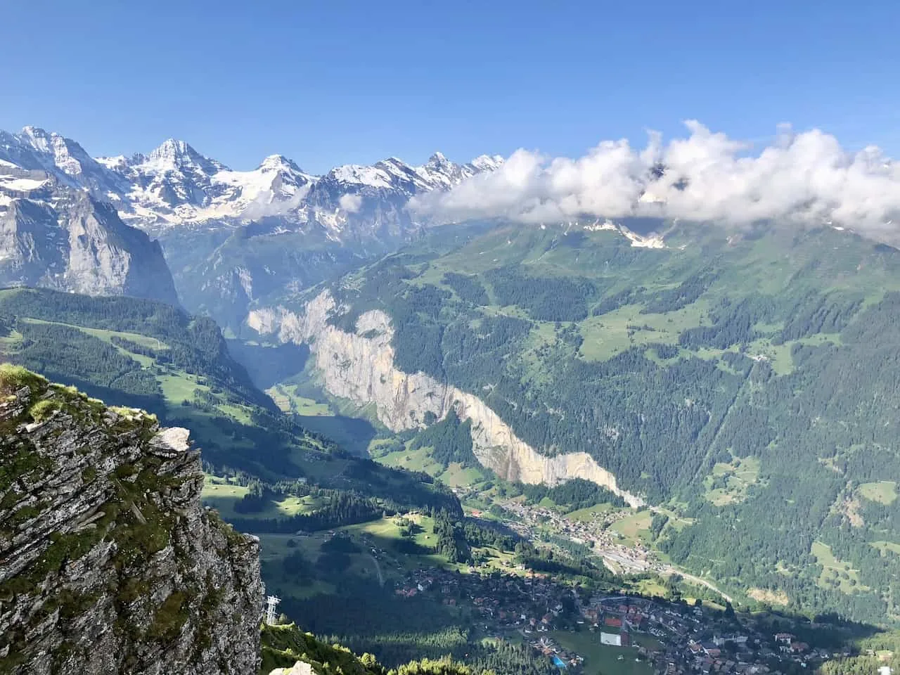
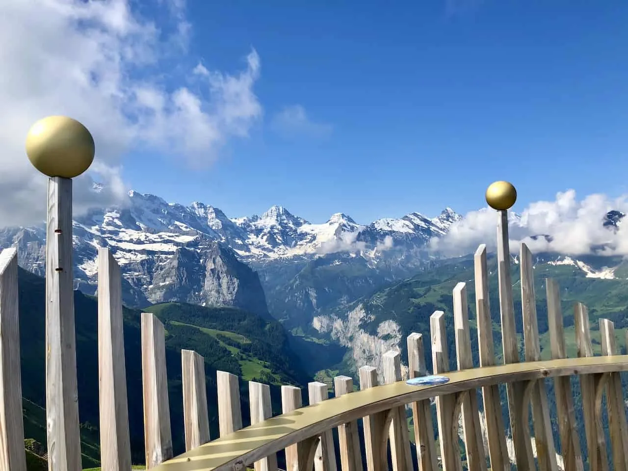
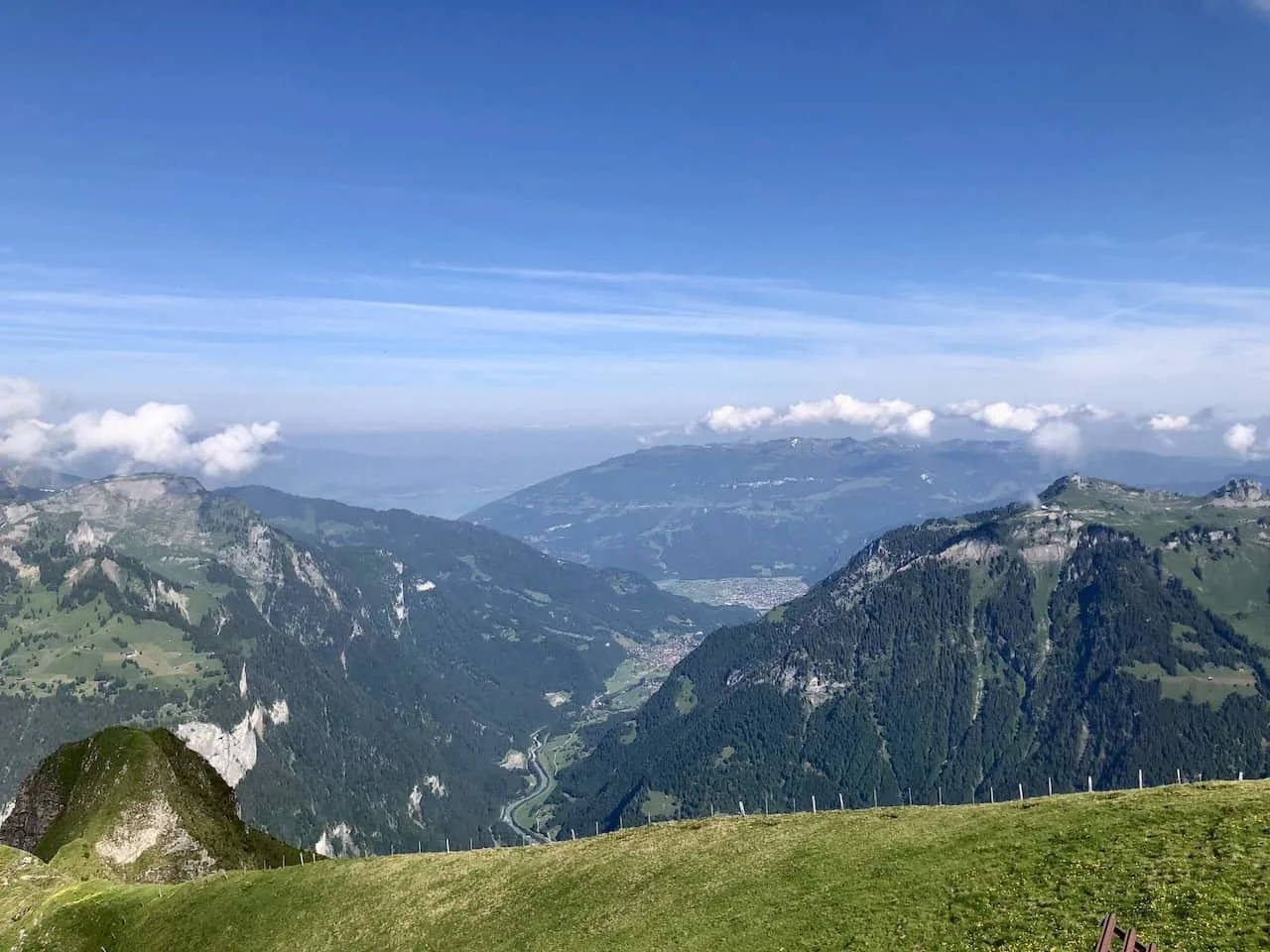
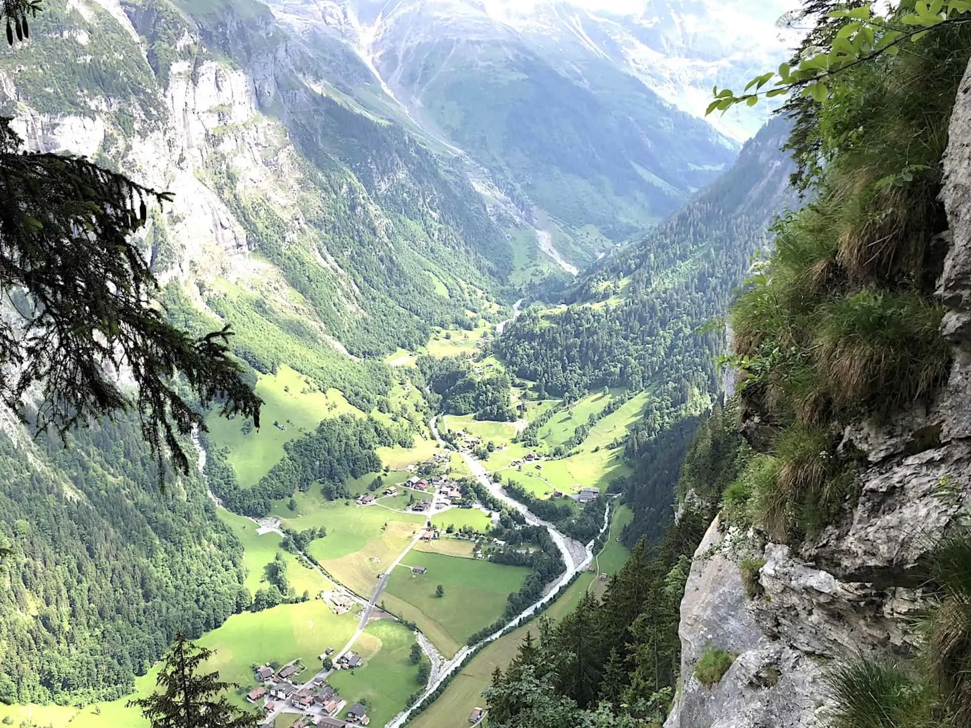
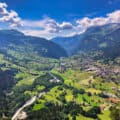
Once you continue to get further up the Royal Walk, you will also see the Lauterbrunnen Valley down below. It is one of the best views to see the entirety of the valley, including its cliffside waterfalls and glacial river.
Further out in the distance you should be able to see the mountainside town of Murren and the cable cars up to Schilthorn.

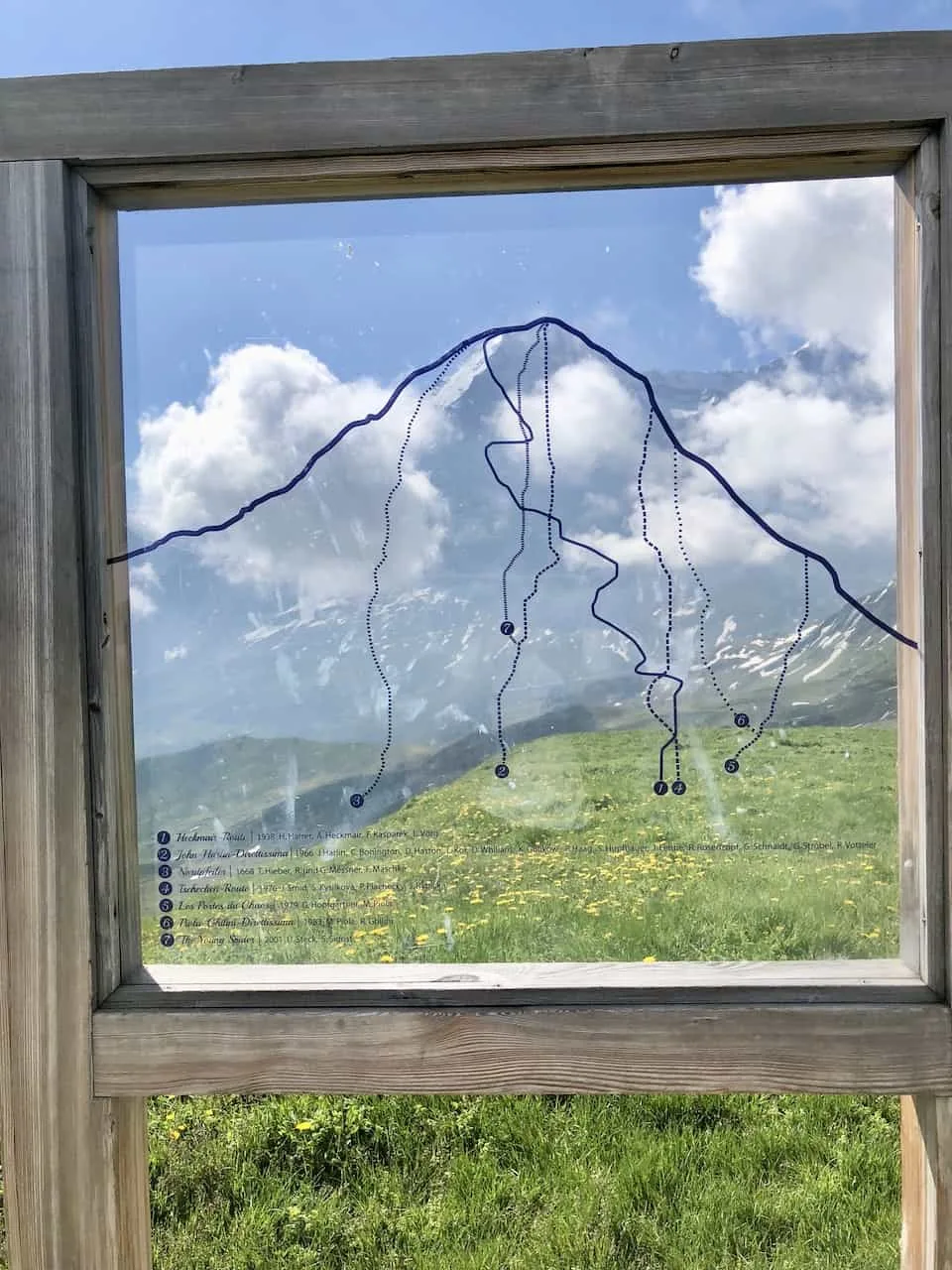
All throughout the journey up you will see the most famous of mountains in the region – The Eiger.
At another information board you will be able to see the various routes that skilled climbers take to make it up to the summit.

Soon enough though you will reach the Royal Walk Mannlichen summit. Here you will be welcomed to The Royal View on top of the crown.
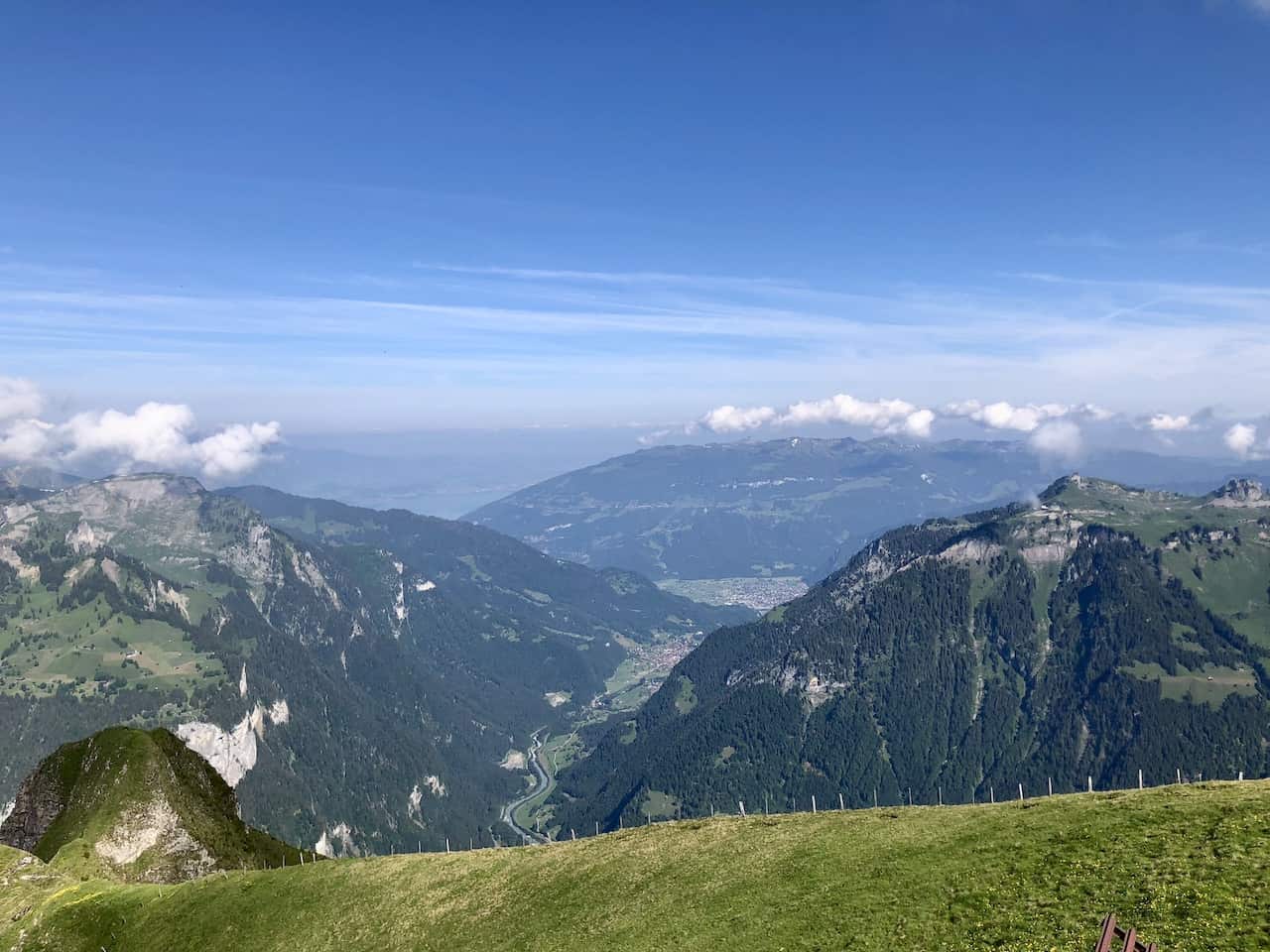
You will have great views in all directions of the Jungfrau region, and you can spend some time just relaxing up top and enjoying the scenery.

From up top it is just the same way down, which should take about half the time from the way up.
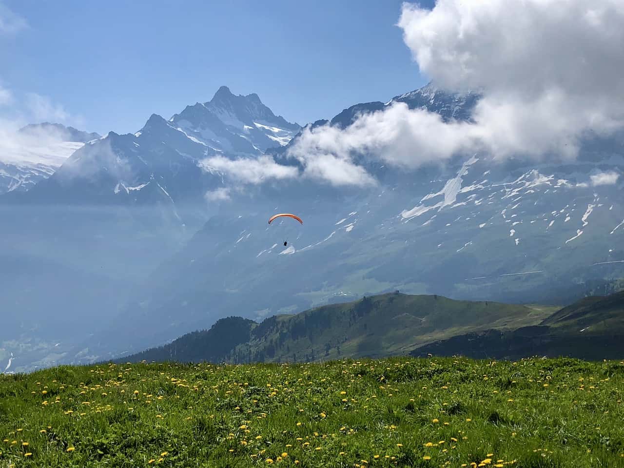
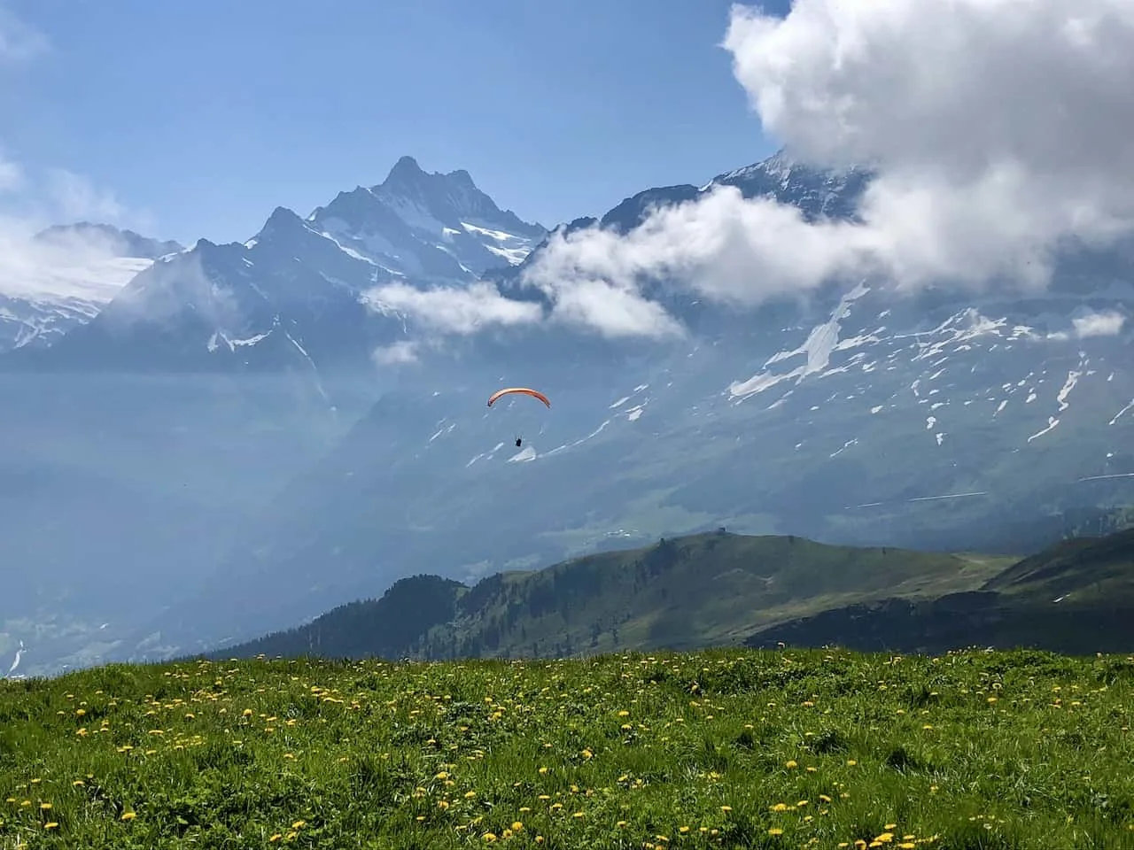
Be on the lookup for some paragliders who take off from around this area and fly towards the valley down below. It was quite the site to see!

6) The Panorama Trail
Once you get closer back down towards the cable cars, you will come across some yellow hiking signs.
One of the most famous hikes in the area is called the Panorama Trail that takes you from Mannlichen to Kleine Scheidegg.
This 90 minute trail is a must do in my opinion and I highly recommend you take part during a visit.
Throughout the hike you will be staring down the Eiger along with its surrounding mountains as you take in some beautiful views around you.
» Learn more in the Mannlichen to Kleine Scheidegg Panorama Trail guide up on the site.
That wraps up a guide to the Mannlichen Royal Walk. If you do have any additional questions feel free to add them in below.
Also be sure to check out the other Switzerland itineraries and guides up on the site like this 14 Day Switzerland itinerary.
Have fun out there and safe travels!


Dre
Tuesday 16th of August 2022
I am thinking of making the hike a little longer by starting it from the base in Wengen, instead of taking the cable cars. Have you ever done this or have any info to offer? Thank you!
Charles
Thursday 18th of August 2022
Hi Dre - while I havent done that particular hike, it certainly is possible to do it. However, it can be quite strenuous - looks like its about 3,000+ feet of elevation gain over the course of 3.5 miles. Note that you can also extend the hike by adding in the route from Mannlichen to Kleine Scheidegg along the Panorama Trail. Enjoy your time there!
sam
Saturday 18th of June 2022
Thank you for such a detailed plan. This is one of the best description that I can find through the net.
Anda
Wednesday 16th of February 2022
Thank you for taking the time and writing these suggestions. I have bought Lonely Planet Switzerland, I read various blogs, none of them were so clear as your instructions. The blogs I read were not selectable, so you could not copy their unbelievable (!) knowledge, were unclear (no selectable maps, too small), insisting mostly on how they "felt" when they saw all the amazingness, less practical info... Only after I read your blog, it all made sense (without ever having been to Switzerland, getting from Grindelwald to Bachalpsee via First and then back via Faulhorn is definitely not obvious). One more thing that still left me confused a bit is the pass we should buy. Regional-Pass Berner Oberland seemed to me the obvious choice (for once:-)) as we will drive to Grindelwald and stay mainly in Grindelwald/Zermatt, but no one seems to mention it... In any case, thank you!
Charles
Saturday 19th of February 2022
Hi Anda - thanks so much for the kind words. I am glad that the articles have helped you out better prepare for your trip to Switzerland. Hope you have a great time there!