
The town of Buena Vista is the perfect place to base yourself in Colorado if you are looking to take part of some hiking opportunities. Whether it is 14ers, 13ers, lakes, or just a quick trail, there are plenty of Buena Vista hikes to choose from.
This guide will go over some of the top hiking options around the Buena Vista area to take part of during your trip to Colorado. Read on to learn more about the trails and all that they entail.
* Affiliate Disclosure: This post may contain affiliate links, which means I may receive a commission if you make a purchase through the links provided, at no additional cost to you. Thanks for supporting the work I put into TripTins!
1) Where is Buena Vista
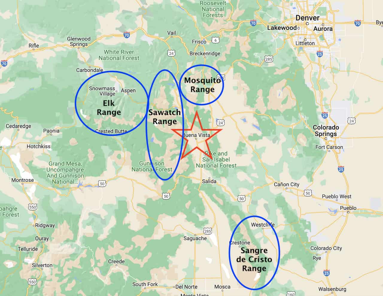
Buena Vista is small town located in Chaffee County right in the middle of the state. Due to its central location, the town makes for a great starting point to explore various nearby regions.
Not only can you take part of hikes just on the outskirts of Buena Vista itself, but you can also drive yourself 1-2 hours in various directions to take part of additional hikes.
The town is located right in the middle of the Sawatch Mountain Range, which is home to many 14ers.
In addition to being right alongside the Sawatch, you can find the Mosquito Range just an hour away, Elk Mountains 1.5 hours away, and the Sangre de Cristo just under 2 hours away.
Below is a map highlighting the location of Buena Vista alongside the various mountain ranges:

2) The Best Buena Vista Hikes
While there are certainly some hikes to take part of in Buena Vista itself, this guide will be more focused on some of the best hikes within a 1-2 hour drive from Buena Vista.
Some of the hikes mentioned will be just a 20 minute drive from town, while others will be closer to 1.5+ hours.
At the end of the day, Buena Vista makes for a great place to base yourself when hiking in Colorado. As long as you don’t mind a bit of driving to and from trailheads, I would highly recommend spending some time in Buena Vista during your trip.
Below is a list of 10 hikes that I will be going over in this guide:
1) Mount Yale
2) La Plata Peak
3) Huron Peak
4) Mount Elbert
5) The DeCaLiBron
6) Mount of the Holy Cross
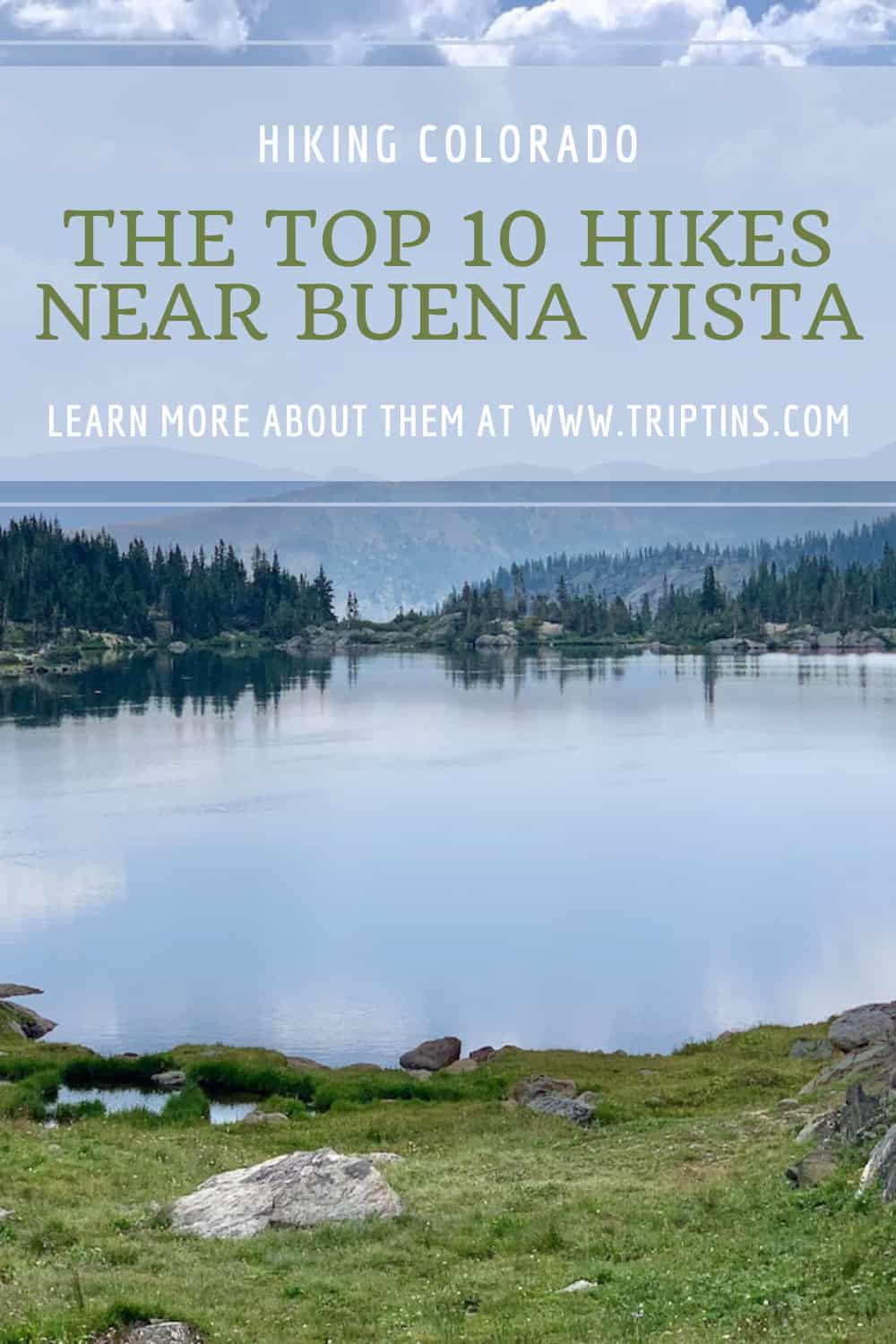
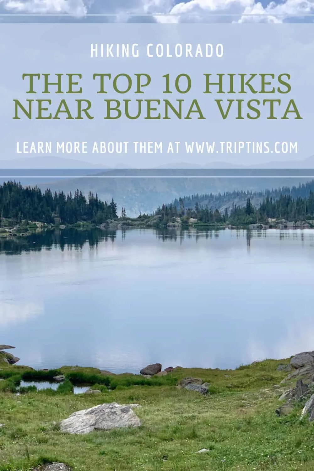
7) Ptarmigan Lake
8) Lost Lake
9) Missouri Lakes & Fancy Pass
10) Cottonwood Pass
You can see that there is some variety of on the list. Whether you just want to do an easy lake trail or head up a demanding 14er, there is plenty to choose from around Buena Vista.

3) Trailhead Map
To get yourself more oriented with where all these hikes are located, I have pinpointed down the location of each one of the trailheads on the map below.
Colorado Car Rental: Looking for a rental car in Colorado? Check out Rentalcars.com for a variety of options that can work well on your trip.
4) What to Bring on Hikes
During my time traveling and hiking all over the world, I have gained a better understanding of the key items and accessories to bring on hikes.
Especially when dealing with a place like Colorado, you never know when the weather can change and bring the rain. Due to this, it is essential to come prepared with all the necessary gear.
→ Take a look at this Hiking Packing List I put together that goes over everything I bring along on day hikes. This should help get you going in the right direction to be prepared for hiking in Colorado.
Hiking Resources & Checklist
Before heading out for the trails, be sure to read up on some of the hiking resources up on the site. These are here to better prepare you for all types of outdoor adventure.
- Gear: Hiking Packing List
- Weather: How to Prepare for Hiking Weather
- Navigation: Hiking GPS & Navigation
- Tips: 20+ Hiking Tips & Tricks for the Trail
- Accommodation: Book Your Hotel Today
- Rental Car: Book Your Car Rental Today

5) Where to Stay in Buena Vista
While there are many places you can choose to base yourself around the area, below are 3 of my top recommendations that are in/near town.
These are great places to stay if you are looking to not only take part of these hikes but also take part of many other activities around the area.
- Surf Hotel & Chateau
- Best Western Vista Inn
- Mount Princeton Hot Springs Resort (just outside town)
With that said, let’s now get into the 10 hikes mentioned above alongside some helpful details, photos, and additional hiking guides to look into.
6) Colorado Hiking Tips
Before getting into the hikes, feel free to read through some helpful tips when it comes to hitting the trails in Colorado.
Be aware of the elevation: hiking at altitude is no joke and you need to ease your way into the trails. Before taking on hikes from the start, give yourself a day or so to acclimatize.
Stay hydrated: to help with the altitude and the hiking itself, stay consistently hydrated. Take plenty of water and consider a Katadyn Filter Water Bottle for the trail.
Bring bug spray: the bugs can be out in full force on many trails. Put on some bug spray to keep yourself protected while hiking.
Apply sunscreen: the sun can be very strong in the mountains. Applying sunscreen (and wearing a hat / sunglasses), will be very important when it comes to protecting yourself.
Keep an eye on the forecast: the weather can turn suddenly out on the trails. Be sure to check the weather forecasts beforehand to avoid rain & thunderstorms. Afternoon storms can be more prominent in the summer months (so start early!).
Download offline maps: to keep yourself on track, download offline maps for the trail. This can be done by using navigation apps such as AllTrails, Maps.me, and Gaia. You should also download offline Google Maps, as cell service does not always work closer to the trailheads.
Check trail conditions: before committing to a trail, I would recommend looking at the latest trip reports on AllTrails (or 14ers.com for 14er hikes). This is more so important as the summer season starts & ends, as you can get a better idea of trail conditions & snow coverage.
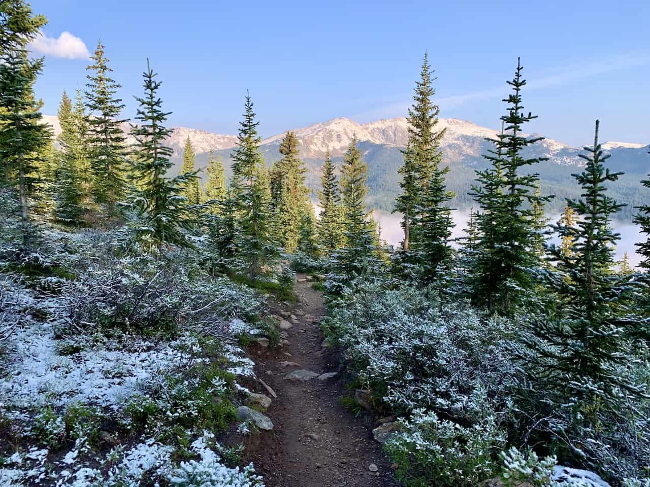
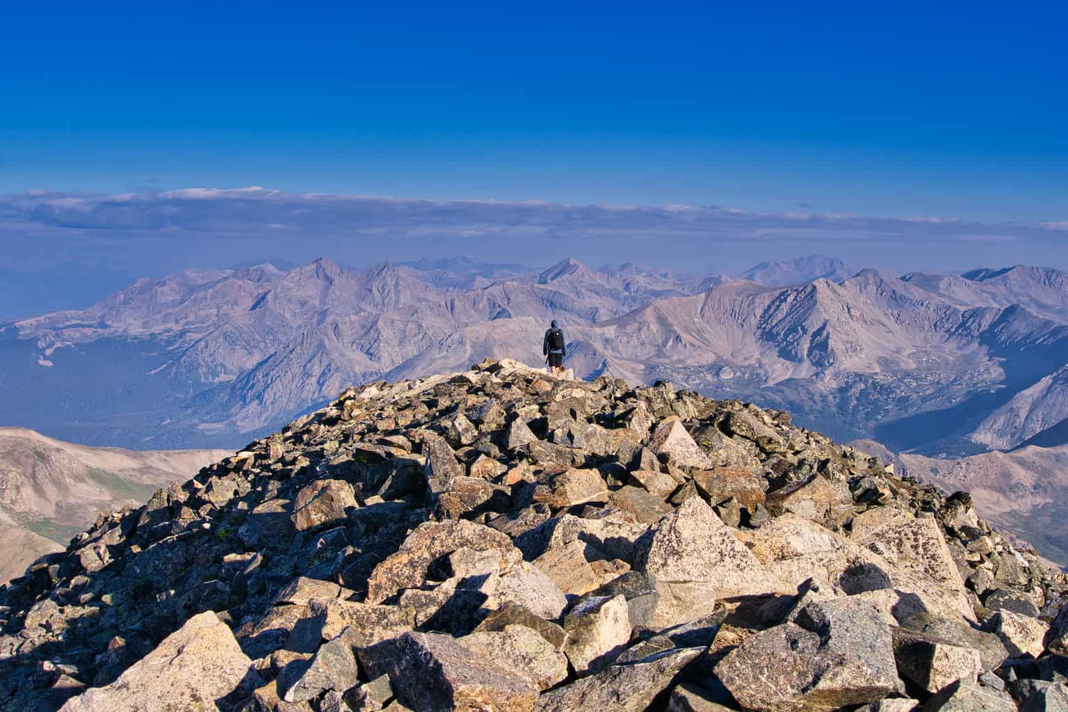
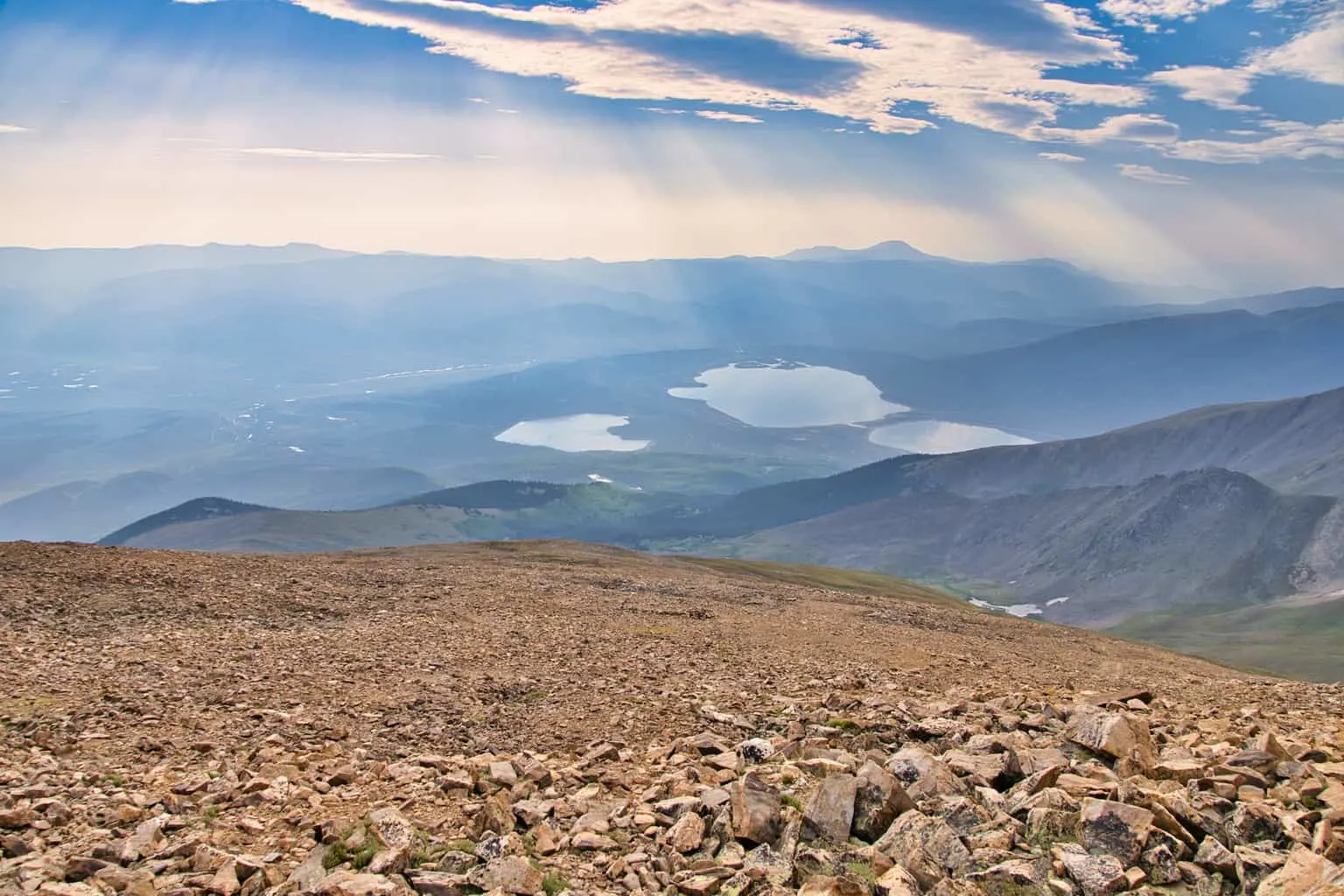
Mount Yale
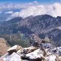
One of the closest 14er trails to Buena Vista is Mount Yale. The mountain is part of the Collegiate Peaks range that includes several other nearby 14ers such as Princeton, Harvard, and Columbia.
The trailhead is directly off the side of a main road just 20 minutes from town, making it super accessible to get to. Once you are all set from the parking lot, it is a 9.5 mile mile / 4,300 foot climb to the summit.
Like most mountain hikes you will come across in Colorado, the beginning portion of the hike will be through the trees. Once you clear the tree line, it is then following the zig zagging pathway further to the ridge of Mount Yale.
From here, the hike gets a bit more technical as you maneuver your way around some rocky terrain to reach the summit of the mountain. Once up top, enjoy the view of the surrounding landscape.
Trailhead: Denny Creek
Distance from Buena Vista: 12 miles / 20 minutes
Hiking Distance: 9.5 miles
Elevation Gain: +4,300 feet
Trail Class: Class 2
Hiking Guide: Mount Yale Trail Guide

La Plata Peak
Another trailhead that is close to Buena Vista is La Plata Peak. Similarly to Mount Yale, the La Plata trailhead is also located right on the side of a main road.
The trail begins in the forest slowly gaining elevation along the way. The route then reaches a never ending switchback section that will bring you closer to the La Plata Peak ridge line.
Once you get over the switchbacks and then further up the mountain, you will need to maneuver your way up the rocky terrain towards the summit.
This certainly has more of a Class 2 feel to it for a good duration of trail once you reach the ridge.
While it is a demanding hike up the rocky terrain towards the summit, you will be rewarded with some of the best views out there.
Trailhead: La Plata Gulch Trailhead
Distance from Buena Vista: 34 miles / 40 minutes
Hiking Distance: 9.5 miles
Elevation Gain: +4,500 feet
Trail Class: Class 2
Hiking Guide: La Plata Peak Trail Guide
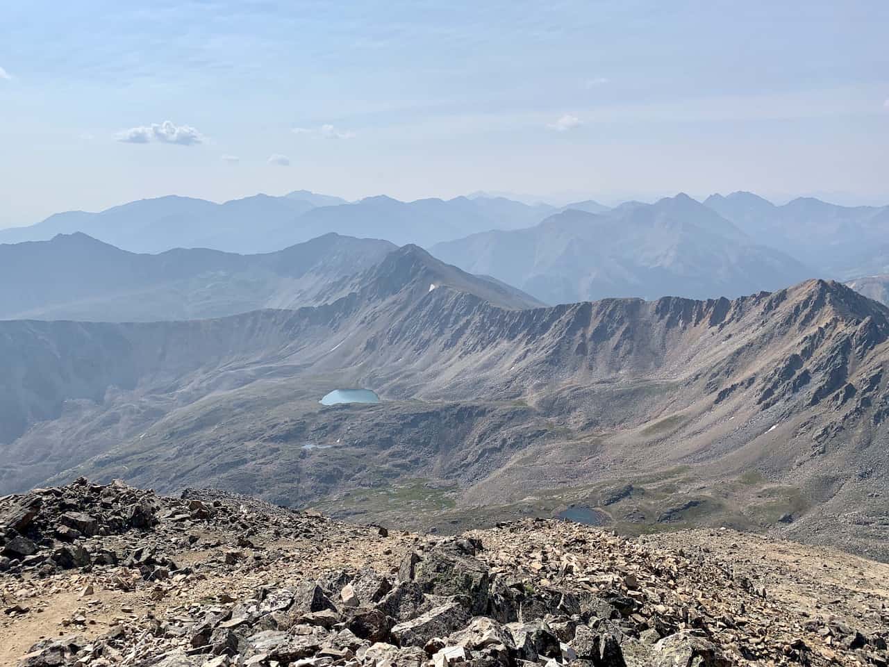
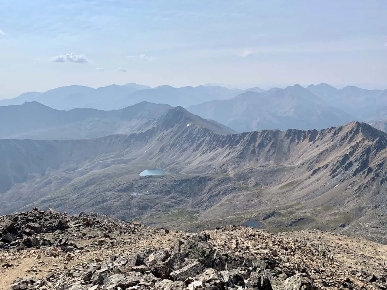
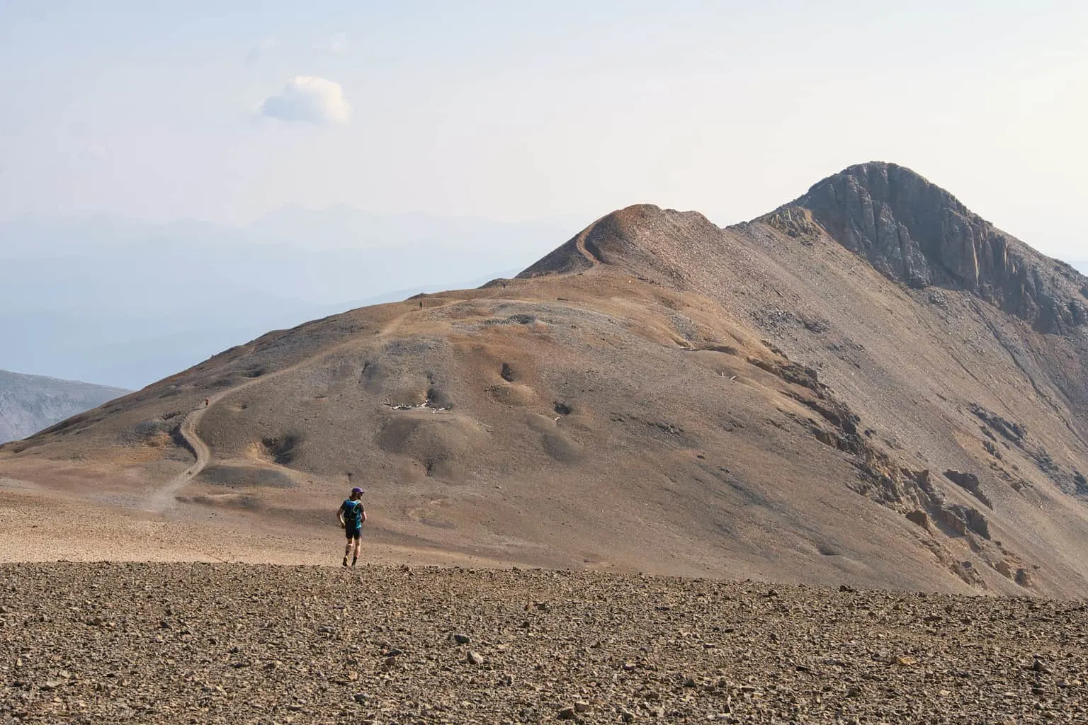
Huron Peak
One of the fan favorite hikes in the Sawatch Range is Huron Peak. From its summit you truly get some of the best 360 degree views that you can ask for.
Unlike the previous two trailheads, getting to the Huron Peak trailhead is a bit more difficult. There is a lower trailhead that you can get to with 2WD, albeit still a bumpy ride.
There is also an upper trailhead, a couple more miles up the road that will require 4WD to get to.
The hike up to the summit starts in the trees and zig zags its way up the mountainside. After a couple miles of hiking, the terrain starts to open up more as you reach the basin of the mountain.
Enjoy the flat path here, because soon enough the demanding summit push begins. Throughout the hike up you will be able to see the trail winding its way up this 14er with people dotting the trail throughout.
The trail itself is easy to follow all the way through to the top section of trail. Here is where the path gets rockier and a bit harder to maneuver around.
As long as you take your time and watch your step, you should soon reach the Huron Peak summit.
Trailhead: Clear Creek / South Winfield Trailhead
Distance from Buena Vista: 27 miles / 50 minutes
Hiking Distance: 7 miles (upper trailhead)
Elevation Gain: +3,500 feet (upper trailhead)
Trail Class: Class 2
Hiking Guide: Huron Peak Trail Guide

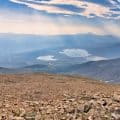
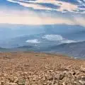
Mount Elbert
What better hike to take part of near Buena Vista, other than the highest peak in Colorado. Mount Elbert is one of the more popular hikes in the state for that reason (as well as being an easier hike to complete).
There are a few trailheads to choose from here, with the south trailhead being just 30 minutes from Buena Vista and the north trailhead 45 minutes. I ended up at the north trailhead and made my way towards the summit of Colorado from there.
The hike starts in the trees, before making its way above the tree line as the landscape opens up. The most frustrating part of the hike up Mt Elbert is that there are a couple of false summits along the way.
While you may think you see the summit from the trail, odds are that you aren’t looking up at the true summit (just yet). But the overall trail is pretty easy to follow all the way through, as you head up and over the false summits and then towards the true summit.
Once up top, you will officially be at the highest point in Colorado and get some fantastic views to take in.
Trailhead: Mount Elbert North / Halfmoon Trailhead
Distance from Buena Vista: 37 miles / 45 minutes
Hiking Distance: 9.5 miles
Elevation Gain: +4,700 feet
Trail Class: Class 1
Hiking Guide: Mount Elbert Trail Guide

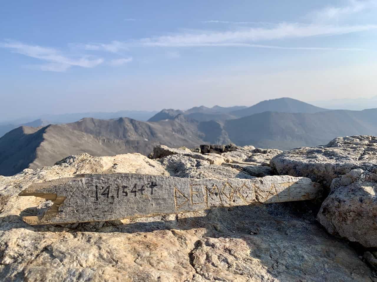
The DeCaLiBron
If you are looking to reach the summit of 4 14ers in one day, then the DeCaLiBron is for you. The trailhead at Kite Lake is just 1 hour away from Buena Vista, making it an easy drive to get to.
Note that the last mile or so of road is more geared for 4WD but you can park on the side of the road here if your car can’t make it.
It is called the DeCaLiBron due to the name of the four summits it reaches – Democrat, Cameron, Lincoln, and Bross.
This loop trail can be done in the either direction, but if you want the best views in front of you, I would probably recommend going counter clockwise.
This is actually one trail that doesn’t have a tree portion to hike through. Instead you will immediately head up the mountainside, and have some great views throughout the duration of the hike.
If going counter clockwise, the first summit you will reach is Mount Bross (the summit itself is closed for hikers but you can walk right below it).
This is also the toughest portion of the trail as it can be pretty steep and rocky as you head from the trailhead up to Bross.
After visiting Bross, the trail flattens out a bit and continues around towards Mount Lincoln. I loved the views during this portion of the trail approaching the Lincoln summit.

Once you have summited the second peak of the day, it is then retracing your steps and then heading up to the Mount Cameron summit. Note that Cameron is not a true 14er due to it being too close in elevation to Lincoln, but nonetheless a great addition to the trail.
From Cameron, the trail continues downwards to the Democrat saddle. The views during this portion of trail will be fantastic all the way through, but do watch your step as you head down the mountainside.
From the saddle though, you will now need to head up in elevation towards the Mount Democrat summit. It is a tough rocky trail up to the top but it sure will be a rewarding one. Once you reach the summit, retrace your steps back to the saddle and then down the mountain to the trailhead.
Overall, the DeCaLiBron is a great hike near Buena Vista to take part of that offers a little bit of everything.
Trailhead: Kite Lake
Distance from Buena Vista: 49 miles / 1 hour
Hiking Distance: 7.7 miles
Elevation Gain: +3,500 feet
Trail Class: Class 2
Hiking Guide: DeCaLiBron Trail Guide

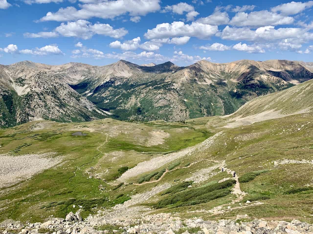
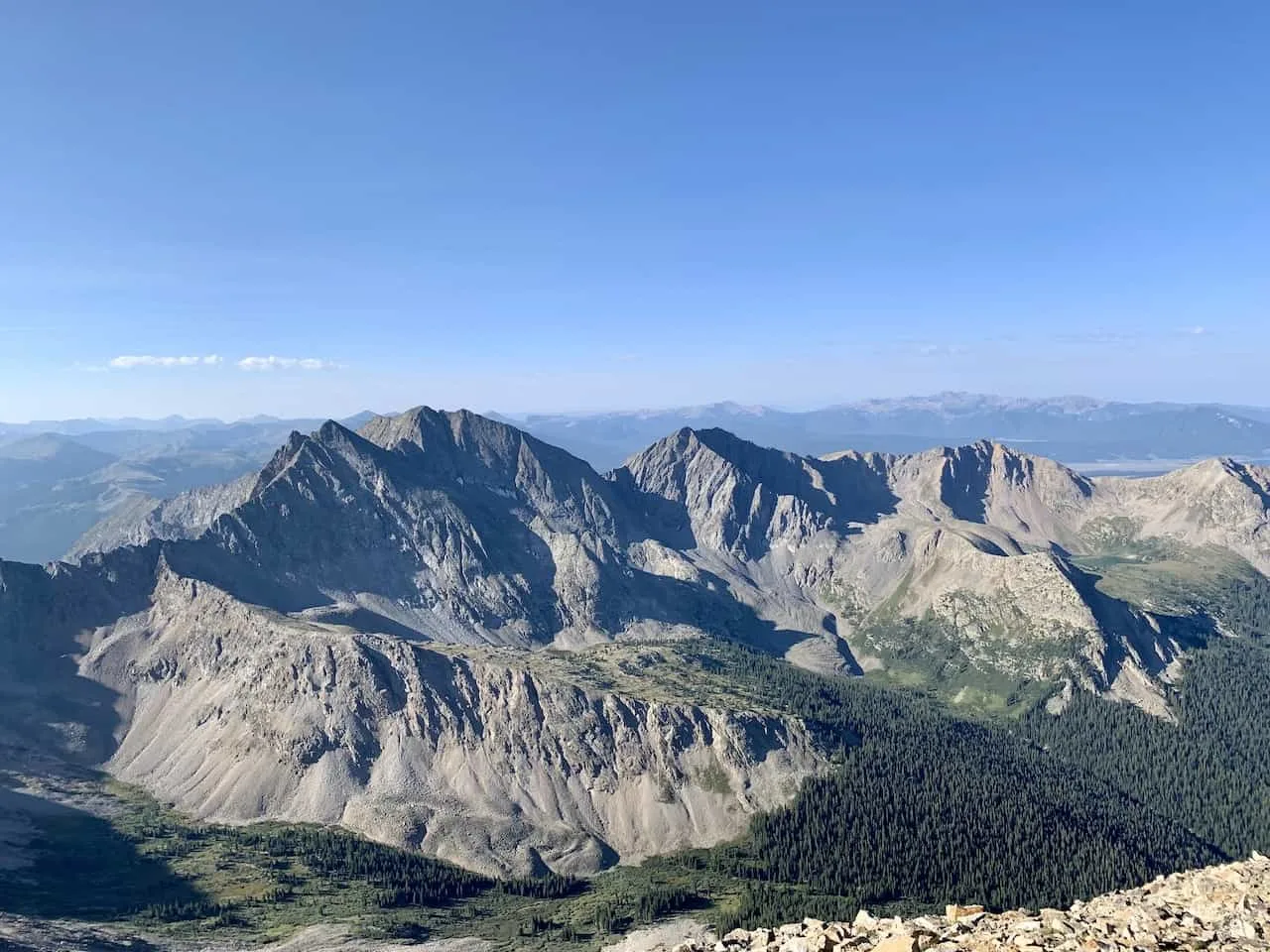
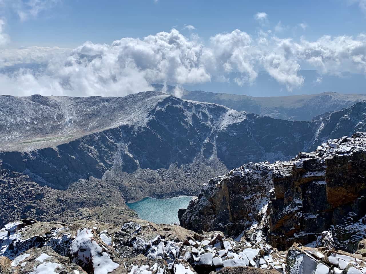
Mount of the Holy Cross
The last 14er I will talk about on this list is Mount of the Holy Cross. Out of all of the hikes mentioned, this trailhead is the farthest out from Buena Vista.
Although it is a bit farther away, it is still a top trail that I would recommend taking part of due to its different views and landscape that you will find versus the rest of the hikes mentioned.
This is also probably the toughest out of any of the hikes on the list as the hike does come in at 12 miles with 5,600 feet of elevation gain.
But at the end of the day, the hike offers some of the best views that you can ask for. While the trail starts out in the forest, it isn’t as dense of a forest compared to other hikes. You will consistently have views of the surrounding landscape throughout.
One of the tough parts of the trail is that is actually loses around 1,000 feet of elevation on the way up, meaning you will need to gain that elevation on the way down.
The route up to the summit along the ridge, is certainly Class 2 climbing as the trail is mostly made up of a rocky pathway up to the peak. You will find plenty of rock cairns to help guide you along the way, so be sure to follow them. It is easy to head off trail if you aren’t paying attention here.
Once you reach the summit though, you will have some fantastic views of the surrounding landscape with plenty of mountains further out in the distance.
Trailhead: Half Moon Tigiwon
Distance from Buena Vista: 68 miles / 2 hours
Hiking Distance: 12 miles
Elevation Gain: +5,600 feet
Trail Class: Class 2
Hiking Guide: Mount of the Holy Cross Trail Guide

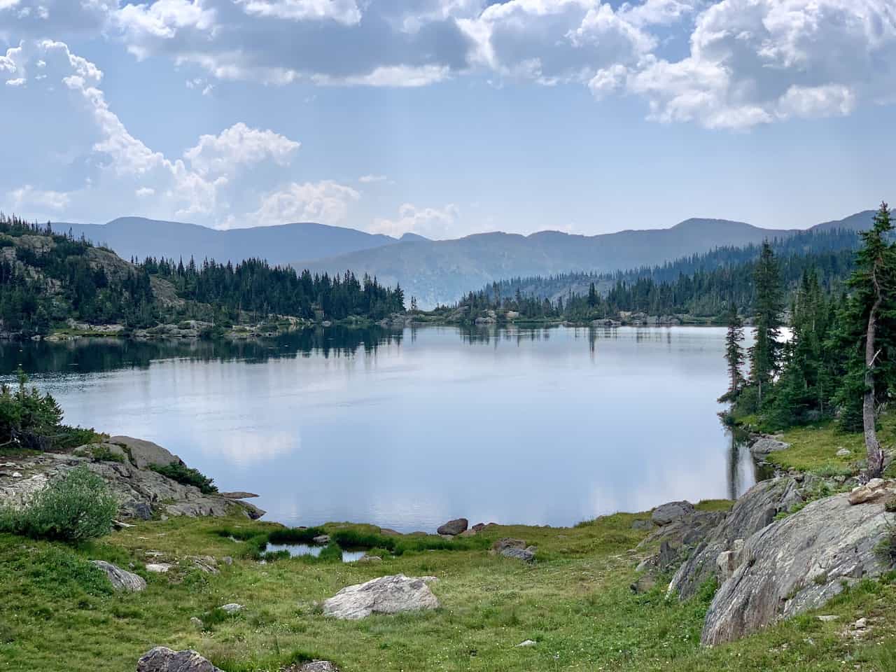
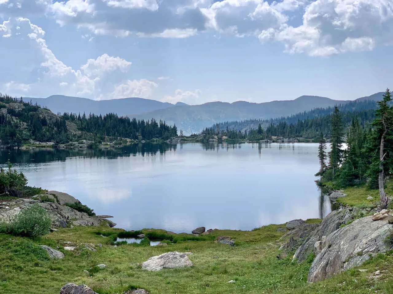
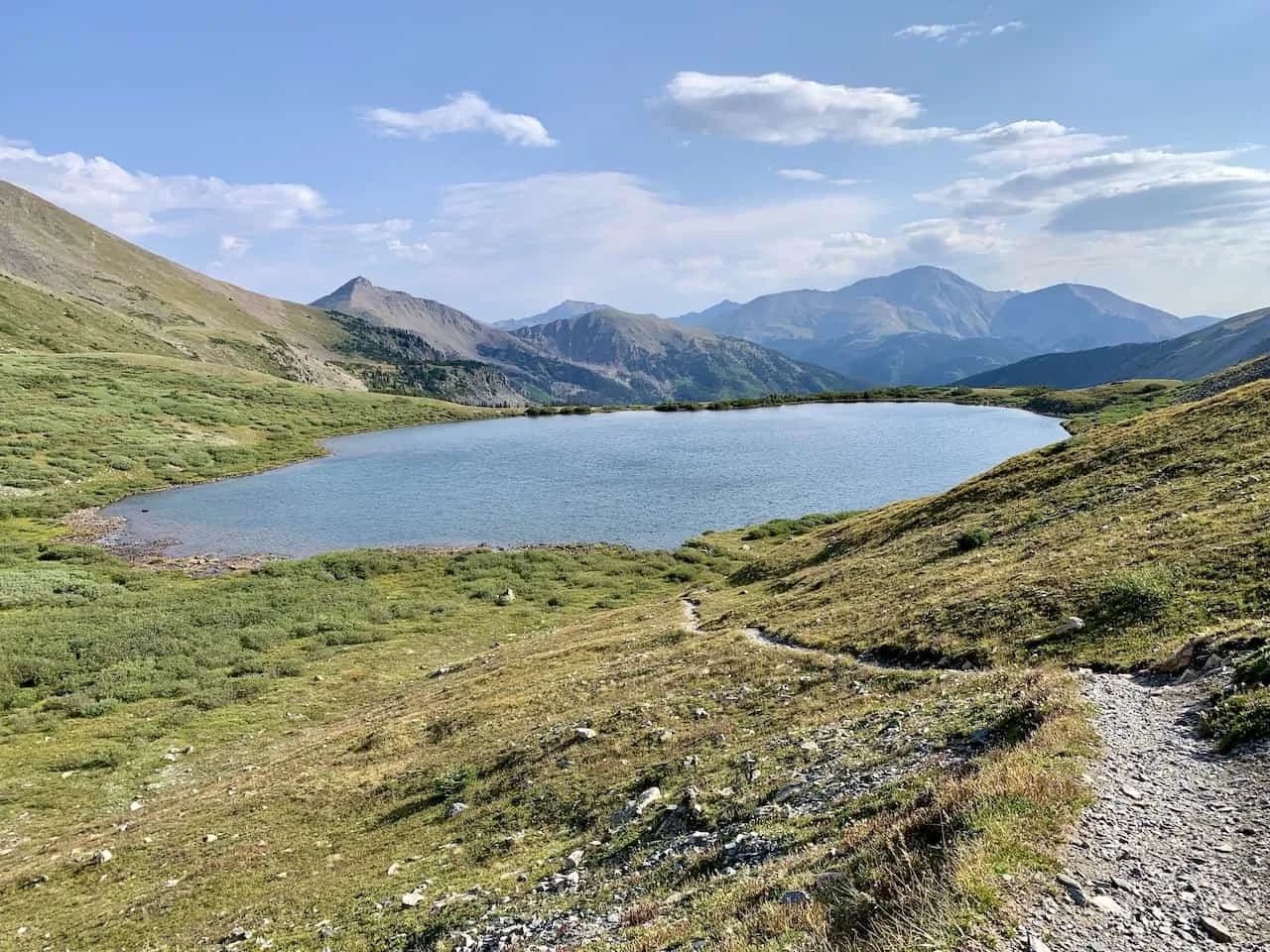
Ptarmigan Lake
While 14ers are great hikes to take part of near Buena Vista, there are certainly other options out there as well.
One of my favorite types of hikes are trails that head to lakes. Being able to head out on a trail and then relax by a lake is the perfect way to go about a day in Colorado.
The Ptarmigan Lake trail is one of the best lake hikes in Buena Vista. The trailhead is located just 20 minutes from town, off of the Cottonwood Pass road.
Here you will find a small parking lot, where you can park and start the hike from.
Most of the hike to Ptarmigan is through forest, however once past the tree line, things really start opening up. You will pass by several smaller lakes along the way with the surrounding nature all around.
It is then a short incline push to get to the main Ptarmigan lake itself, where you can have a seat and enjoy an afternoon. If you are up for it, you can even hike around the lake and head up to a viewpoint on the far side to see Ptarmigan from above.
Trailhead: Ptarmigan Lake Trailhead
Distance from Buena Vista: 14 miles / 23 minutes
Hiking Distance: 6.5 miles
Elevation Gain: +1,430 feet
Trail Class: Class 1
Hiking Guide: Ptarmigan Lake Trail Guide

Lost Lake
Just near the Ptarmigan Lake trailhead you will find the Lost Lake trailhead. There is not a set parking lot here. Rather, just find a safe spot on the side of the road to pull into.
The hike to the lake is quite short and flat as you make the 1.25 mile trek towards the lake itself.
What makes this lake even more so unique though is that there is a small island in the center of it. This certainly is something different that you won’t find in too many other places around Colorado.
Trailhead: Lost Lake Trailhead
Distance from Buena Vista: 16 miles / 28 minutes
Hiking Distance: 2.5 miles
Elevation Gain: +450 feet
Trail Class: Class 1
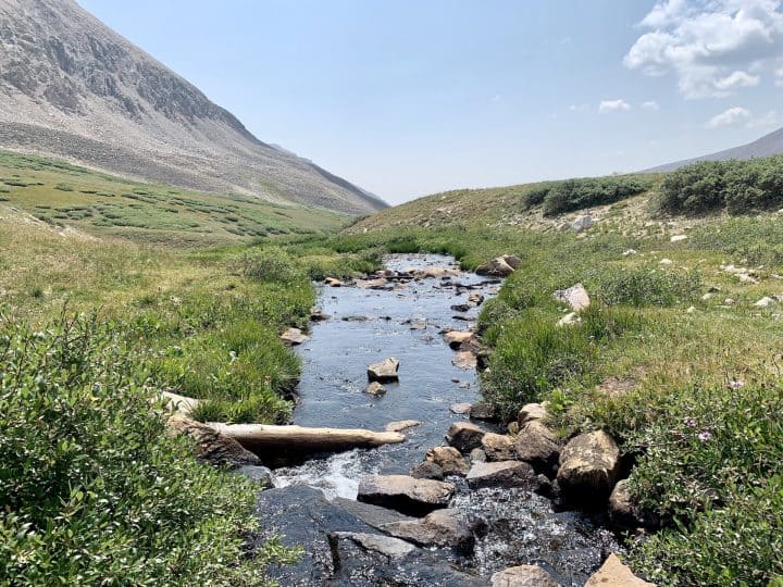
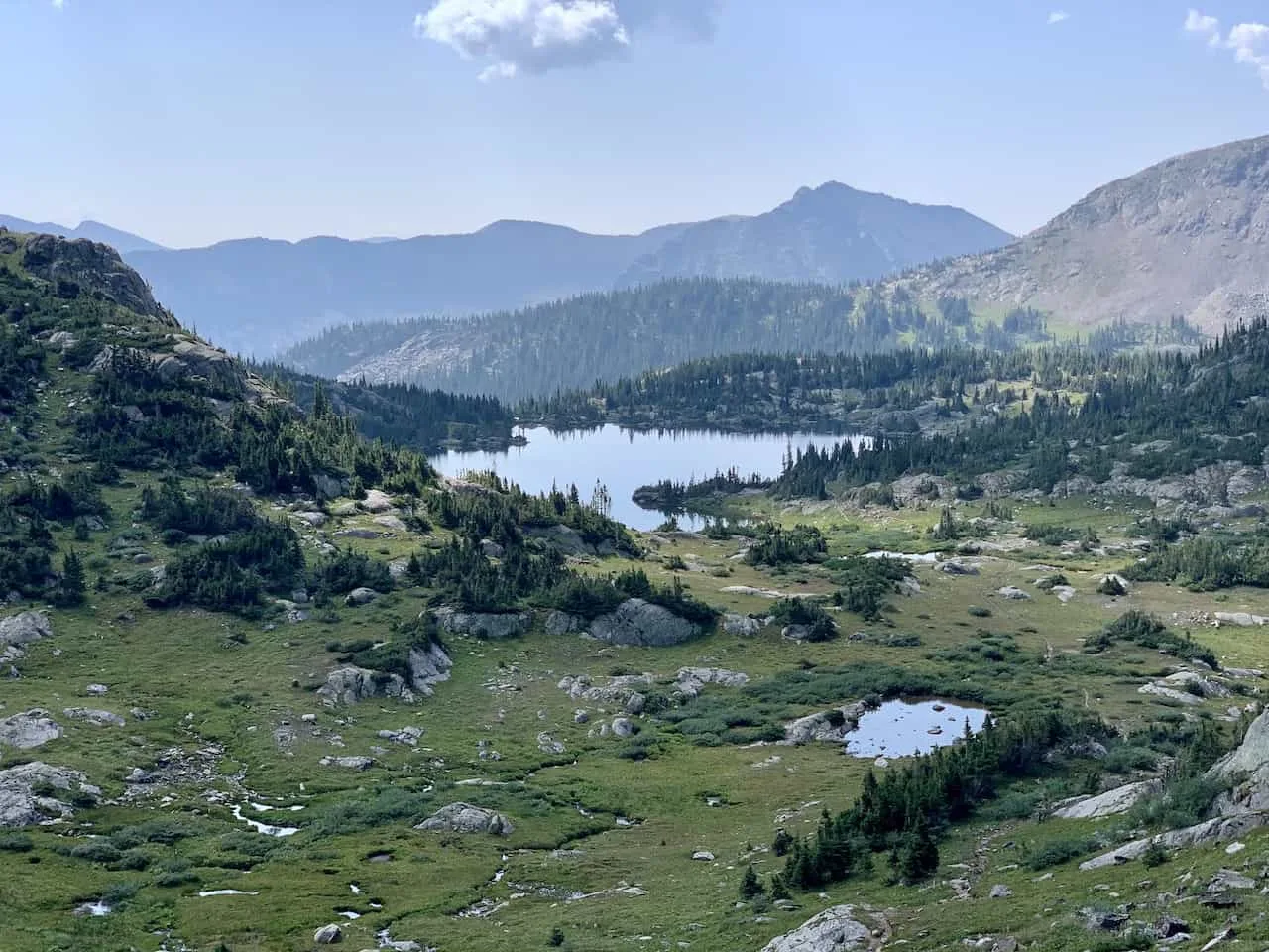
Missouri Lakes & Fancy Pass
The Missouri Lakes & Fancy Pass loop hike is also a bit further away from Buena Vista. However, it is the perfect hike that gives you a little bit of everything.
You will hike through forests, along rivers, up two passes, and towards several lakes including Fancy Lake and the various Missouri Lakes.
The loop trail is just around 10 miles in length gaining 2,625 feet along the way. It is also a popular hike to split up into 2 days but you can certainly get it done in one.
If heading in the counter clockwise direction, the first highlight will be Fancy Lake. On a calm day, you should get some of the most beautiful reflections you can ask for. From there it is up and over the Fancy Pass, which is the most technical portion of trail.
On the other side of the pass, you will be welcomed to a new landscape with greenery, mountains and lakes all in view. The trail then wraps up towards the Missouri Pass, where you will get views of the Missouri Lakes down below.
When it comes to viewpoints in Colorado, this one is tough to beat! From the pass, it is then down towards the lakes themselves, and then finishing the loop through the forest.
Trailhead: Missouri Lakes or Fancy Lake Trailhead
Distance from Buena Vista: 62 miles / 1:20 hours
Hiking Distance: 10 miles
Elevation Gain: +2,625
Trail Class: Class 2
Hiking Guide: Missouri Lakes & Fancy Pass Trail Guide

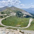
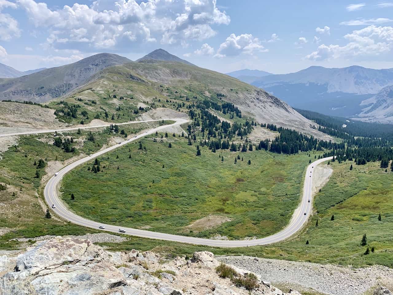
Cottonwood Pass Peak
A very short but memorable hike is the one up to the Cottonwood Pass viewpoint at the Continental Divide. The Cottonwood Pass is located just on the outskirts of Buena Vista, and makes for a great scenic drive.
Along the way, you can stop at the Continental Divide viewpoint parking lot and make the short 0.4 mile round trip hike towards the viewpoint area. From up top you will get to see the winding road in either direction surrounded by the mountains.
If you would like to get a bit more hiking in, you can also continue along to Cottonwood Pass Peak, just a 1.2 mile round trip hike up from the trailhead.
Trailhead: Cottonwood Pass
Distance from Buena Vista: 17 miles / 30 minutes
Hiking Distance: 1.2 miles
Elevation Gain: +425 feet
Trail Class: Class 1
Hiking Guide: Cottonwood Pass Trail Guide

To wrap up this hiking guide, I have to say that Buena Vista really is an ideal place to stay in when exploring Colorado.
There are plenty of Buena Vista hikes to choose from, whether you are looking to just drive 20 minutes or if you want to head further out of town.
If you have any questions or comments, be sure to add them in below. Also, don’t forget to check out some of the other Colorado itineraries and guides up on the site.
Have fun out there and safe travels!